

On our journey, from Delhi to Deoria Tal & Chandrashila. We reached Rishikesh on the first day and had an amazing time. You can read about the journey so far in Deoria Tal - Trek & Travelogue Part 1.
In, this blog we travel from Rishikesh to Sari Village, the starting point of Deoria Tal Trek. So, let’s continue our trip to Chopta in Deoria Tal - Trek & Travelogue Part 2.
Before we proceed with our travel, let me share some important things about Delhi to Chopta route which we missed in the Deoria Tal - Trek & Travelogue Part 1 .
Chopta is the starting point for Tungnath & Chandrashila Trek. Deoria Tal trek starts from Sari Village. Chopta is located on Ukhimath-Gopeshwar road in Rudraprayag district. Sari village can also be reached from Ukhimath-Gopeshwar route via a 3 km connecting road. Please refer to the below map.

You can easily cover Delhi to Chopta distance as it is well connected with roads. There are no direct bus, train or airplane route from Delhi to Chopta.
Buses: You can take direct buses from Delhi to places like Haridwar, Rishikesh or Rudraprayag. From there, you would easily get connecting buses and shared jeep to Sari, Chopta.
Trains: Nearest train Stations are at Haridwar and Rishikesh. The rest of the travel has to be done by road.
Flight: The Nearest airport is Jolly Grant Airport in Dehradun. Then, reach Chopta by road.
Buses, Shared Jeeps and Private Cabs ply from all the above locations. They run from early morning till evening. Public transport stops once the sun goes down. Private cabs or self- transport remains the only option thereafter.
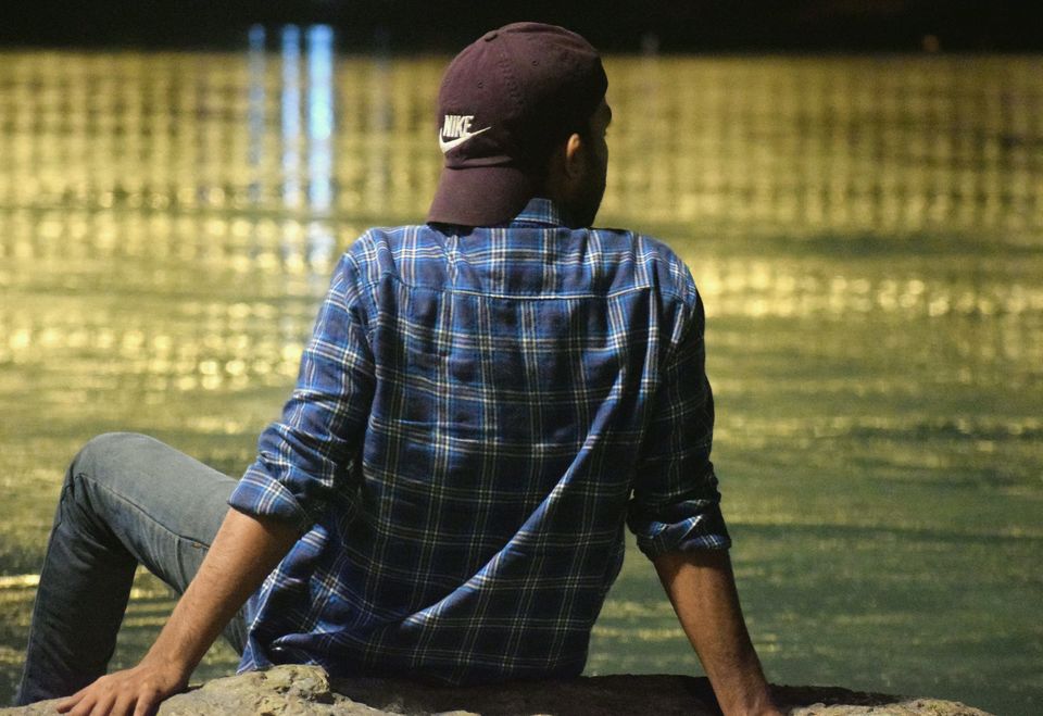
Rishikesh to Deoria Tal - Day 2
Rising Sun was peeking behind the lush hills when we left our hotel. The morning was chilly with a cold breeze. We just missed our 7 'o clock bus by a few minutes. We waited for the next bus while sipping hot tea and watched the sky change color. Finally, our Bus left for Rudraprayag at 8'o clock since there was no direct bus for Sari village or Chopta.
After leaving Rishikesh, the bus rode along the Ganga valley. There were few rafts in the river valley, slowly ending their adventure. The rapids looked weak from the top but the roaring sound made us realize otherwise. We shared our vivid river rafting experience with Manish. The bus passed through Shivpuri. The hills kept increasing vertically making the valley deeper.
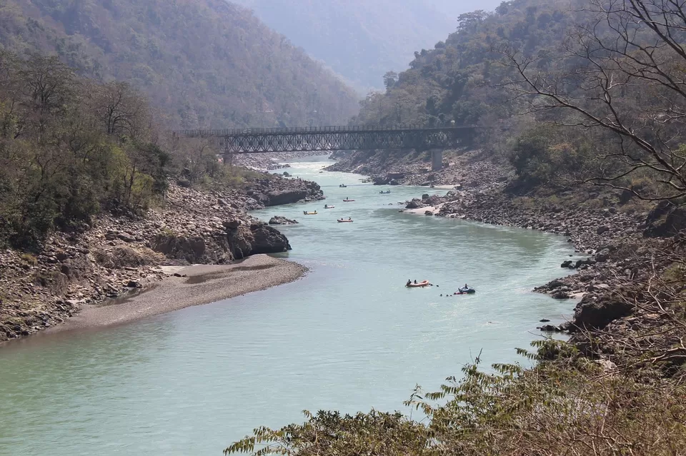
The bus kept moving through winding roads.After a while, the bus started the long steep climb from one hill to another. Now, Emerald green Ganga was lazily flowing at the enormously deep gorge and distant faint peaks were visible. The bus halted at Teen Dhara with few dhaba on the roadside. We had Maggi and Paranthe in one of the dhaba. A faded snowy mountain was visible from the dhaba window. We were thrilled to see it and made failed attempts to identify the mountain using phone apps.
DevPrayag
Then the bus headed for Devprayag, the road was slightly downhill now. The valley was less deep and the river was silently flowing with us. This was when I informed Shaan and Manish, that we were about to see the birth of a river, The Great Ganges. I explained about the geographical phenomena of two mighty rivers Bhagirathi and Alaknanda confluence at DevPrayag.
Bhagirathi river rises at Gaumukh at the foot of Gangotri Glacier. In mythology and culture, it is considered the source stream of Ganga. Alaknanda river is formed at the foot of Satopanth and Bhagirathi Kharak glacier. In Hydrology, it is the main source stream of Ganga. The Panch Prayag are confluences of five different rivers with Alaknanda. Finally, Bhagirathi joins Alaknanda to form the Ganges at Devprayag. (I know I cannot help the Geek in me)

Now, we held our breath and waited to see the spectacle. We kept looking down and out of the Bus window. Then, we saw the turbulent Bhagirathi meeting tranquil Alaknanda and become the longest river in India, Ganga. The rivers were strikingly different, Turquoise Bhagirathi was forceful and bubbly while Alaknanda was deep and calm. No words were spoken, nature had left us stupefied. We kept watching the confluence until it was visible. The bus went ahead, crossed Bhagirathi and took a hairpin bend giving us one last glimpse of the Holy confluence.
Rudraprayag
The bus continued towards Rudraprayag. At one point, the traffic was stopped due to small landslide clearance. We got off the bus and watched Aquamarine Alaknanda quietly flowing, deep in the river valley. We kept discussing the geology and watched the river passing through small villages and towns in our journey forward.

We reached Rudraprayag around 1:30 pm and looked for transport options towards Chopta. A bus was leaving soon for Ukhimath, we placed our luggage in it and went for lunch. After lunch, we considered going down to Rudraprayag Sangam but our bus was leaving. So, we boarded the bus and started the last lap towards Sari.
Rudraprayag to Ukhimath Shaan noticed that the river was darker, clear with a tinge of green now. I told him that it is the Mandakini river, which caused havoc in the entire Kedarnath valley in 2013. It flowed briskly, bouncing and splashing on the rocky river bed, making deafening noise in the process. Several villages and small towns were adjacent to or overlooking the river valley on the way.

About 45 minutes later, a gigantic white wall behind the hills caught my eyes. I looked at Shaan, he was already staring at it and I nudged Manish to watch the Grand view. We were actually looking right at Kedar range, 6990 meters of sheer rock and ice. This was it; this was exactly what we came here for. The imposing Mountain range, untouched nature of the valley and boisterous river engulfed us in its splendor.
We reached Kund, it was the juncture from where the road forked. The left fork had a bridge to cross the river and continued towards Kedarnath. The right fork was a steep climb, our bus turned right and kept climbing. We gained significant elevation in a few minutes. The valley now seemed bottomless and Kedarnath peak within the arm's reach. We reached Ukhimath at 4:30 pm and weighed our options. I suggested that we could try trekking up to Deoria Tal since we had quite a daylight left.
We hired a cab to Sari Village and left immediately. It was a pleasant 35 minutes drive to Sari, overlooking the deep scenic valley and distant hills. The hills on the other side kept the High Mountains out of the view, though.
Trek to Deoria Tal from Sari
Deoria Tal is located at the top of the hill overlooking Sari village. The trail starts on your right, just after entering the village. We found Mr. Mahendra right there, who had accommodation in the village as well as the hilltop. We chose to stay overnight at Deoria Tal since trekking down in dark was insensible. Mahendra went back to fetch a few things he needed. While we were waiting for Mahendra, a simple old man offered us Kinnu juice. We declined the offer politely but purchased bottled water from him. He had a tiny shop right in front of the small board indicating trek start point.

We started the trek at 5:15 pm along with Mahendra. The zigzagging trail was rocky with a steady climb. After hiking for 15 minutes, we saw a Shiva temple with Kedarnath style architecture. The sun was setting, leaving behind a golden glow to the mountains, including Chandrashila peak. Sky had rainbow hues from Blue to Purple. Sari was far below and the distant hamlets in the valley looked like miniatures. The view could make you sit there and watch the valley for hours.
There were few resting points with gazebos & benches on the trail. The hike had become steeper and we were now surrounded by thick forest. The light was fading making the path darker. We sped up to avoid trekking in dark. We made it to the top in almost dark surroundings. Manish fell ill during the trek so it took us around 50-60 minutes to reach the top (2.5 km trek).

The temperature was predicted to go sub-zero and Manish had a fever. So, we chose to spend the night in a hutment instead of tents. It was pitch dark and nobody else was on the mountain top apart from us. We freshened up, Manish took some pills and rested in the hutment. We had our dinner in the dhaba while chatting with Mahendra and his uncle (owner of the dhaba). The food was served hot; it was simple but tasty with pahadi flavors. I spent some time under the magnificently starry sky, locating different constellation within the million stars. We retired to the bed for an early morning start.

I woke up early and went outside in freezing conditions. The sky turned from blue to pink and mountains were floating in the mist. When I turned, I met with Choukhamba face on. The tallest of the Gangotri group of peaks was towering over our hutment. Manish was feeling better now so I quickly got inside and asked them to come out. All of us were stunned and we could not wait to see the complete range. We got ready and walked to the lake.

The lake is located on a small meadow and has foliage around it. The pristine lake looked absolutely still. The Great Central Himalayan peaks were in front of us, just like we expected in Deoria Tal - Trek & Travelogue Part 1.The first ray of the Sun christened the peaks with fiery hues. The emerald lake now sparkled with a mountain reflection.The entire Garhwal rangewith mountains like Kedardome, Thalaysagar, Neelkantha, Kharchakund, Janhukut along with Kedarnath and Chaukhamba provided a gorgeous panoramic view.

This lake has a mention in “Mahabharata” where Yudhishthira answered Yaksha’s 16 questions to revive the Pandav brothers. Fresh cold air, clear green water, chirping of birds, glowing mountains ever so close and solitary settings, all the ingredients needed for a mystical lake. It was indeed Magical.

We kept strolling lazily, taking pictures, identifying and discussing different peaks. After spending much time, we realized that we got to leave for Chopta. We reluctantly got back, had some tea and "biskut" at the Dhaba. Then, we started our trek down to sari Village.


Sari
There was mist in the valley, with a slight cold breeze. Faraway villages, steps farms on the lush mountains were basking in the early winter morning. Bhajan echoed from the temple and the tiny village looked surreal from above. We kept trekking down the rocky trail, soaking the scene in front.

Sari was a small remote village, almost unaffected by the modernization. There were trees laden with flowers and fruits. People in the village were friendly and went about their lives in the simplest manner. The village had a laidback feeling, in contrast to the chaotic city life.

The Abrupt end
We reached Sari and took some rest. Manish was apprehensive of the trek ahead considering his illness. He did not look fit and the trek could further affect his illness. So, we decided to leave for Delhi right away. Despite the sudden end of our trip, we were overwhelmed. We made promises to return next year and complete our trip to Chopta and trek Chandrashila peak.
Our journey ends here with Deoria Tal - Trek & Travelogue Part 2. Read the Part 1 of our journey here.
Photo Credit
Vvnataraj [CC BY-SA 3.0 (https://creativecommons.org/licenses/by-sa/3.0)] photo 1 & photo 2.
My photos are available at Flickr
The Blog is originally posted at https://sunomeriaawaaz.blogspot.com