
I was watching some documentaries about the great Indian war and wondered why the south of India is less glamorous about the forts and big canons as we see in the majestic Rajasthan.My mind was in a mood to visit an ancient fort,for a long time but my short holidays is not suitable for a trip to a far place like Rajasthan, really I wanted to visit a fort which is really massive and beautiful.I came across lots of forts like golconda, vellore, gandikota etc.But I needed a less famous one, compared to all those famed options in those pretty big towns.The answer to that was the town of Gingee, now a panchayat town in the district of Villupuram in Tamil Nadu.Gingeefort is so fortified, that Shivaji Maharaj the king of the valiant Marathas, ranked it as the "most impregnable fortress in India" and it was called the "Troy of the East" by the British.
The fort with such honours,is still insignificant for many people.The fort of gingee is eccentric compared to other forts and its complexes, because it offers you wide variety of architectural styles across India.It features Bijapur architecture to Pure Dravidian.
11:50 AM
We started our journey from Thiruvananthapuram Central Bus stand.Our plan was to catch the Antodaya Express from Tirunelveli Railway Station.
3:30 pm
The largest Bus Station in the area of Nagercoil l,one of the two bus terminals, Long route buses to other districts in Tamil Nadu and parts of Kerala starts here.
We got a nonstop bus to Nellai New Bus Station.
4:25 pm
The Tirunelveli railway Junction is a bit far from the place, need to take another bus to reach there. It was around 20mins journey to the station.we were bit tensed about getting the train and the rush on holidays. The surroundings of the bus stand was almost deserted, no buildings or any commercial establishments. The bus crossed the Thamiraparani river and dropped at a junction, and told us to ask for walking directions. Finally, we saw the station entrance from a distance.
5:00pm
The 16191 Tirunelveli - Tambaram Antyodaya Express, was ready for departure in 15 minutes.We bought our food packets and water bottles for the night.Luckily,the train was not congested.
5:20 Am
The train was punctual at Villupuram,a prominent railway station, it serves as the distribution point of rail traffic from Chennai, towards the southern parts of the state. It is the second largest junction by number of branch lines.A station with decent facilities and transport services.
5:45 Am
We asked them for a double room, but they gave us a single room. It may be due to the rush in Tiruvannamalai pilgrimage, the availability was less in Balaji lodge.
6:15 Am
Started our journey in Tiruvannamalai chain service public transport bus.
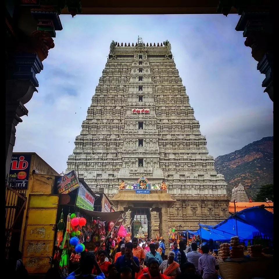
Located on the of Annamalai hills , Tiruvannamalai has been ruled by the Pallavas, the Cholas, the Later Cholas, Hoysalas, the Vijayanagar Empire, the Carnatic kingdom, Tipu Sultan, and the British. It served as the capital of the Hoysalas. The town is built around the Annamalaiyar Temple like other Nayak capitals.The Bus took almost 1 hour 10 minutes to reach the Town of Annamalai.Tiruvannamalai is one of the
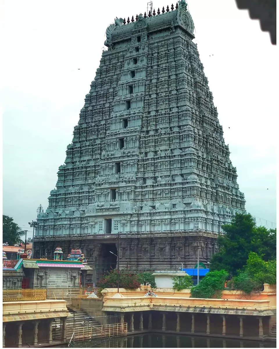
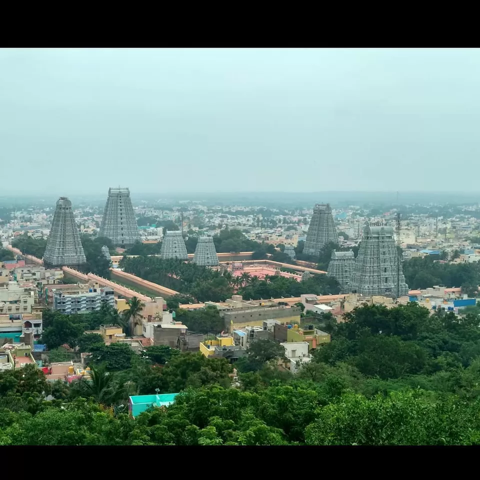
greatest Shaivaite Temples in India, on a sprawling 24 acre temple campus, drawing hundreds of thousands of pilgrims every full moon. The hill here is considered to be a manifestation of Shiva. Tiruvannamalai is one of the Panchabhoota Stalams signifying the 5 elements of wind (Kalahasti), water (Tiruvanaikka), fire (Tiruvannamalai), earth (Kanchipuram) and space (Chidambaram). Kartikai Deepam festival here is of great significance.Deepam will be lit at around 6 pm at the top of 2668 ft high holy mountain. The entire Mountain is Shiva Linga. Maha Deepam will be lit using nearly 3500 kg of Ghee. Sri Arthanareeshwara will bless devotees in the Temple at the time of lighting the Maha Deepam. The Maha Deepam will be visible around the Holy Mountain in a radius of 35 km. Lakhs of devotees will perform 16 km Girivalam (circumambulation of the holy mountain). The Moist Black Ash (what they call as 'Mai' in Tamil) that remains after the lighting of the Ghee & Cotton Wick will be distributed as Prasadam to devotees on the Marghazhi Arudra Darisanam day.
Lakhs of people completed there Girivalam in the morning and standing in a queue to reach the darshan, It will almost take 4 to 5 hours to reach the main shrine.
The Hoysala kings used Tiruvannamalai as their capital beginning in 1328. There are 48 inscriptions from the Sangama Dynasty(1336–1485), two inscriptions from Saluva Dynasty, and 55 inscriptions from Tuluva Dynasty (1491–1570) of the Vijayanagara Empire, reflecting gifts to the temple from their rulers. There are also inscriptions from the rule of Krishnadeva Raya (1509–1529), the most powerful Vijayanagara king, indicating further patronage. Most of the Vijayanagara inscriptions were written in Tamil, with some in Kannada and Sanskrit. The inscriptions in the temple from the Vijayanagara kings indicate emphasis on administrative matters and local concerns, which contrasts the inscriptions of the same rulers in other temples like Tirupathi. The majority of the gift related inscriptions are for land endowments, followed by goods, cash endowments, cows and oil for lighting lamps. The town of Tiruvannamalai was at a strategic crossroads during the Vijayanagara Empire, connecting sacred centers of pilgrimage and military routes. There are inscriptions that show the area as an urban center before the precolonial period, with the town developing around the temple, similar to the Nayak ruled cities like Madurai.
During the 17th century, Tiruvannamalai came under the dominion of the Nawab of the Carnatic. As the Mughal empire came to an end, the Nawab lost control of the town, with confusion and chaos ensuing after 1753. Subsequently, there were periods of both Hindu and Muslim stewardship of the temple, with Muraru Raya, Krishna Raya, Mrithis Ali Khan, and Burkat Ullakhan besieging the temple in succession. As European incursions progressed, Tiruvannamalai was attacked by French Soupries, Sambrinet, and the English Captain Stephen Smith. While some were repelled, others were victorious. The French occupied the town in 1757 and it came under the control of the British in 1760. In 1790, Tiruvannamalai town was captured by Tippu Sultan, who ruled from 1750–99. During the first half of the 19th century, the town came under British rule.
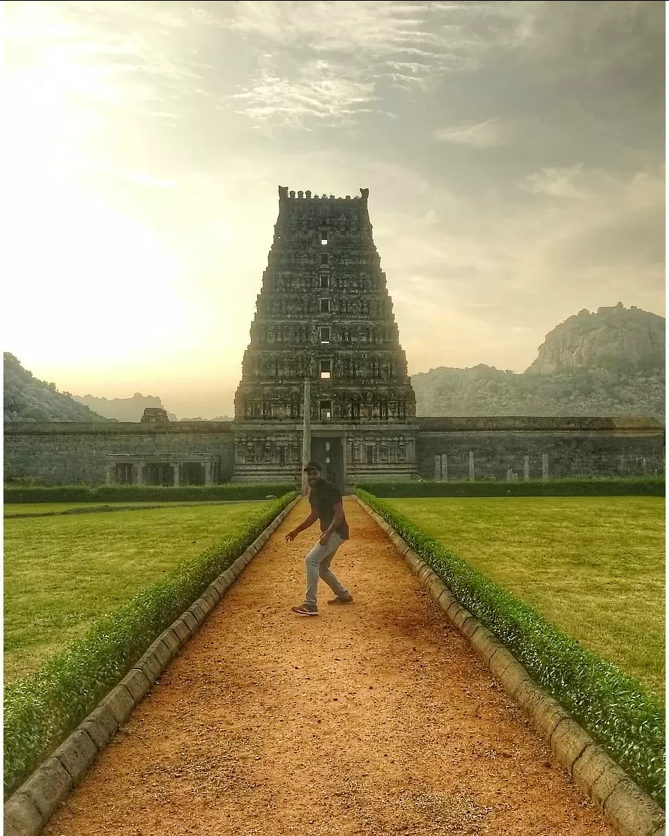
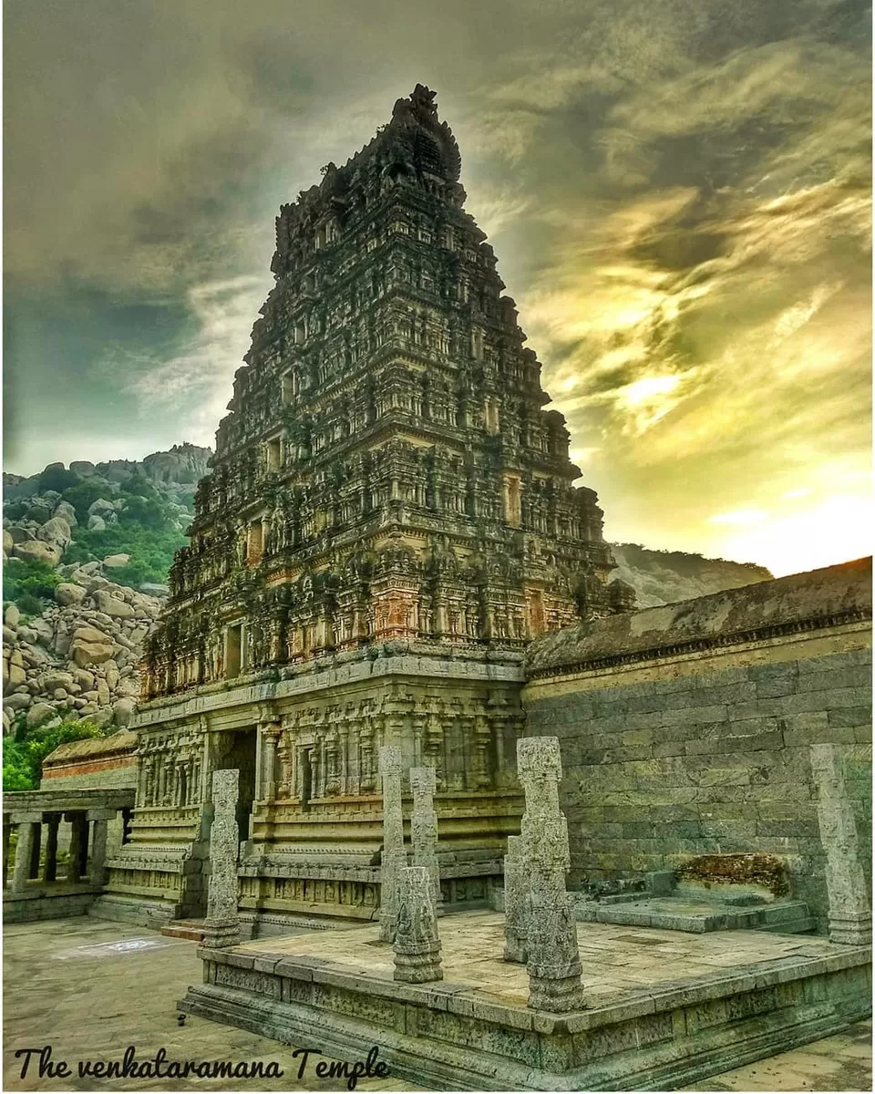
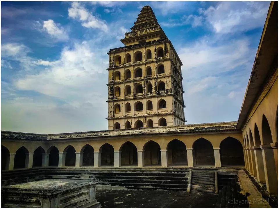
The temple complex covers an area of 10 ha (24acres), and is one of the largest temples in India. It houses four gateway towers known as gopurams. The tallest is the eastern tower, with 11 stories and a height of 66 m (217 ft), making it one of the tallest temple towers in India. The temple has numerous shrines, with those of Annamalaiyar and Unnamulai Amman being the most prominent. The temple complex houses many halls; the most notable is the thousand-pillared hall built during the Vijayanagar period.
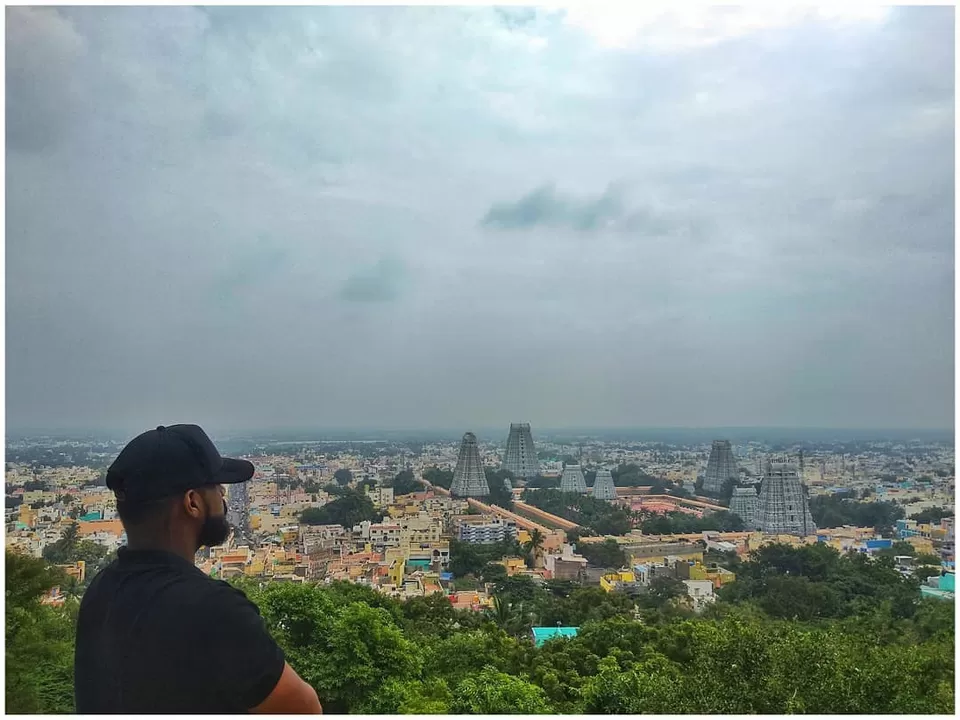
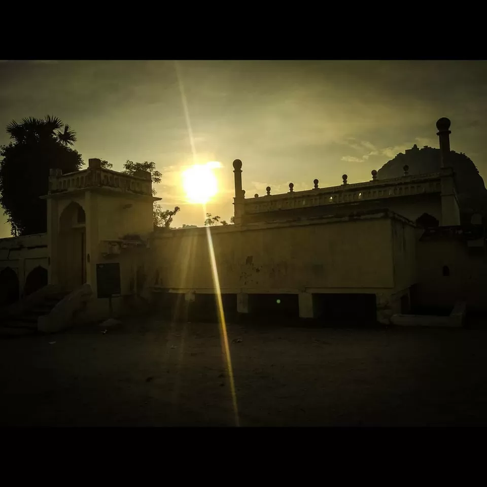
The view from the foothills filled me with awe,the foothills consists of some ashrams ,and residential localities.One of the swami offered us lunch we rejected it politely because we were running out of time to reach the next place.The pilgrim rush almost ruined our plan to visit the battlefield of South Arcot.We walked towards the bus stand,and asked for directions to Gingee .If we ask about Gingee they reciprocate with Senji, sometimes local Tamil slang is too difficult to assume,by end of the trip I've started pronouncing it Senji.We started our journey in an inadequate trash can which was around 30 yrs old. The bus driver stopped only for us to get down,at a distance the view of Krishnagiri fort was visible.The hamlet of Senji was peaceful, remembering it's pugnacious battlefield stories.
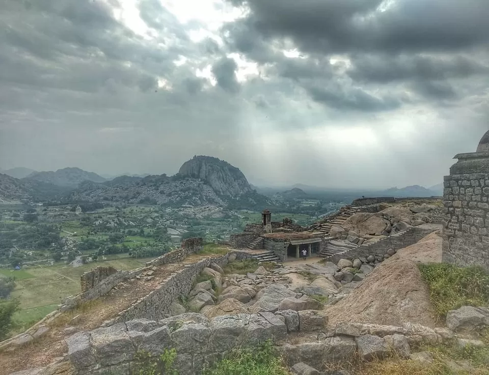
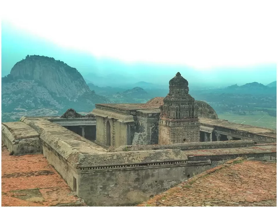
The Gingee Fort complex is on three hillocks: Krishnagiri to the north, Rajagiri to the west and Chandrayandurg to the southeast. The three hills together constitute a fort complex, each having a separate and self-contained citadel. The fort walls are 13 km (8.1 mi) and the three hills are connected by walls enclosing an area of 11 square kilometres (4.2 sq mi). It was built at a height of 800 feet (240 m) and protected by a 80 feet (24 m) wide moat.The fort is managed by ASI with a liberal ticket for Indian citizens,the gingee fort is stony and not too easy to climb.The path is broken in some areas,According to historian Narayan, a small village called Melacerri, located 3 mi (4.8 km) away from Gingee is called "Old Gingee" has traces of fortifications from about 1200 AD. The earliest mention of the hill fort of Gingee is found in an Inscription of Vikrama Chola (1120–63) dated in his 10th Year and a Kadava feudatory calls himself the Lord of Senjiyar of the strong embattled fort.
The presence of conch symbol represent a link to lunar dynasty who ruled the region,the fort was built during the 15–16th century by the Gingee Nayaks, the lietunants of the Vijayanagara Empire and who later became independent kings.The fort was built at a strategic place to fend off any invading armies. It was further strengthened by the Marathas under the leadership of Shivaji in 1677 AD. He recaptured it from the Bijapur sultans who had originally taken control of the fort from the Marathas. In 1691, it was besieged by Mghal generals Zul Fikar Khan, Asad Khan & Kam Baksha but was successfully defended by Santaji Ghorpade. During Aurangzeb's campaign in the Deccan, Shivaji's second son who had assumed the throne, Chhatrapati Rajaram, escaped to Ginjee and continued the fight with Moghuls from Ginjee. The fort was the seat of the Maratha Empire for a few months. The Moghuls could not capture the fort for seven years in spite of laying siege. The fort was finally captured in 1698, but not before Chhatrapati Rajaram escaped. It was later passed on to the Carnatic Nawabs who lost it to the French in 1750 before the British finally took control in 1761 despite losing it to Hyder Ali for a brief period. Raja Desingh ruled Gingee during the 18th century.hillock with an imposing citadel is known as Krishnagiri. It is also known as the English Mountain, perhaps because the British residents occupied the fort here, for some time. The Krishnagiri fort lies to the North , It is smaller in size and height compared to the Rajagiri fort. A flight of steps of granite stones leads to its top. It is really hidden gem that needs a great attention still it considered as one of the greatest by Archaeologists. We failed to complete, The Rajagiri because its almost 5 pm. The place was amazing with illustrious history, we planned to visit it again tommorow. We took a bus to Villupuram, back to BalJi Lodge.