

Northeast India
Northeast India is the easternmost region of India representing both a geographic and political administrative division of the country. It comprises eight states – Arunachal Pradesh, Assam, Manipur, Meghalaya, Mizoram, Nagaland, Sikkim and Tripura.
ARUNACHAL
The Land of Dawnlit Mountains
Arunachal Pradesh is one of the 29 states of India holding the most north-eastern position among the other states in the north-east region of India. Arunachal Pradesh borders the states of Assam and Nagaland to the south, and shares international borders with Bhutan in the west, Myanmar in the east and China in the north. Itanagar is the capital of the state.Arunachal Pradesh, which translates to "land of the dawn-lit mountains", is also known as the Orchid State of India or the Paradise of the Botanists. Geographically, it is the largest among the North-east Indian states. As in other parts of Northeast India, the people native to the state trace their origins from the Tibeto-Burman people. Arunachal Pradesh finds its mention in the literature of Kalika Purana and the great Hindu Epic Mahabharata. It is believed to be the Prabhu Mountains of the Puranas. According to a Hindu mythological legend, Arunachal Pradesh was the place where sage Parshuram washed away his sin, sage Vyasa meditated, King Bhishmaka founded his kingdom and Lord Krishna married his consort Rukmini. Ruled by many powerful dynasties and kingdoms, Arunachal Pradesh India is dotted with innumerable historical monuments and archeological remains, which bear testimony to its rich cultural heritage.
ASSAM
The Land of Red Rivers & Blue Hills
Located south of the eastern Himalayas, Assam (Asom, Axom) comprises the Brahmaputra Valley and the Barak river valleys along with the Karbi Anglong and the North Cachar Hills with an area of 78,438 km². Assam is surrounded by six of the other: Arunachal Pradesh, Nagaland, Manipur, Mizoram, Tripura, and Meghalaya. Geographically Assam and these states are connected to the rest of India via a strip of land in West Bengal called the Siliguri Corridor or "Chicken's Neck". Assam shares international borders with Bhutan and Bangladesh; and cultures, peoples and climate with South-East Asia. Assam became a part of the British India after the British occupied the region following the First Anglo-Burmese War of 1824–1826.
Dominated by the mighty Brahmaputra River, the state of Assam is the gateway to the northeastern part of India. This beautiful land finds its reference in the great Hindu epic Mahabharata as "Pragiyotisha" and "Kamarupa" in the first millennium. Endowed with lush greenery, Assam is also renowned for Assam tea, silk, petroleum resources and rich flora and fauna.
Assam has enjoyed a reputation for unspoiled natural beauty, substantial biodiversity, tea plantations, and friendly people. The Brahmaputra, the lifeline of the valley which shares its name, floods the nearby land with fertile silt every year to ensure a rich harvest. It is bound on either side by marshy land covered with thick jungle grass, interspersed with patches of rice fields and terraced tea gardens. There is little to interrupt the vast panorama except the occasional lone hillock. Only in the south of the valley is the even horizon broken by the hills of Karbi Anglong. Further south are the North Cachar Hills. Located here, amid orchards is Assam's only hill station, Haflong. The southern part of Assam is the Barak Valley, this region hosts untouched natural beauty. Green is the dominant colour of the state, with an impressive 35% forest cover and thousands of hectares under tea cultivation. Assam has five national parks including the World Heritage Sites of Kaziranga and Manas, and 20 Wildlife and Bird Sanctuaries. The great Indian one-horned rhinoceros is one of Assam's most noteworthy fauna.
Over the centuries, people of various ethnic, religious and linguistic backgrounds have been attracted by the fertile river valleys of Assam, and adopted them as their home. The people of Assam are mosaic of various cultures. They are from a range of racial backgrounds including Austro-Asiatic, Indo-Aryan and Tibeto-Burman.
MANIPUR
The Jewel of India
Manipur, located in a lush green corner of North East India, is an oval shaped valley surrounded by nine ranges of bluish green hills intertwined with cascading rapids, carpets of flowers and lazy lakes. A little paradise on Earth with her rich cultural heritage and sublime natural beauty, Manipur promises to be a favourite new Tourism Destination. The people and tribes of Manipur include Meiteis, Nagas, KukiChinMizo groups, Gorkhas, MeiteiPangals and many other colourful communities who have coexisted in complete harmony for centuries. These are people whose folklore, myths and legends, dances, indigenous games and martial arts, exotic handlooms, handicrafts and fine arts are invested with the mystique of nature
Manipur is a mosaic of ancient traditions and rich cultural patterns. In the field of arts and culture, the State is best represented by its classical and folk dance forms. Raas Leelas depict the Leelas of Lord Krishna as a child with Gopies of Brindavan and express their yearning for communion with the Lord. The Raas Dance is perfectly lyrical and has extremely graceful movements. The spring festival, the “LaiHaraoba” held in April – May is symbolized by a traditional stylized and ritualistic dance performed for peace and prosperity. The tribal folk dances are an expression of nature, creativity and aestheticism of the tribal way of life. One can be charmed by the colourful costumes, dances and unique rituals in festivals such as LuiNgaiNi (seed sowing festival of the Nagas of Manipur) and Kut, the largest festival of KukiChinMizo communities.
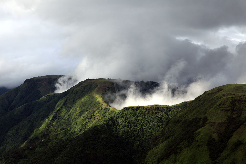
MEGHALAYA
The abode of clouds
Endowed with incredible natural beauty, Meghalaya is one of the most beautiful states in Northeast India. Meghalaya has great tourism potential, which is still untapped and unexplored. Meghalaya Tourism Department has formulated many plans and tourism policies, to attract more domestic and international tourists, which would lead to the economic development and generation of ample employment opportunities in the state. Meghalaya tourism is focused on developing infrastructure and public facilities at all tourist spots, along with the development of various areas of tourism in the state such as Nature based tourism, Cultural tourism, Health resort tourism, and Art and Craft tourism. Meghalaya tourism is also emphasizing on adventure tourism in Meghalaya that include trekking, caving, and water sports. Rock climbing and Hand gliding will be promoted with recognized adventure and sports associations.
This state is bounded to the south and the west by the People's Republic of Bangladesh and the north and the east by India's Assam state. The capital is Shillong, known as the "Scotland of the East". Meghalaya was previously part of Assam, but on 21 January 1972, the districts of Khasi, Garo and Jaintia hills became the new state of Meghalaya. English is the official language of Meghalaya. The other principal languages spoken include Khasi, Pnar and Garo. Unlike many Indian states, Meghalaya has historically followed a matrilineal system where the lineage and inheritance are traced through women; the youngest daughter inherits all wealth and she also takes care of her parents.
The state is the wettest region of India, recording an average of 1200 cm of rains a year. About 70% of the state is forested. The Meghalaya subtropical forests ecoregion encompasses the state; its mountain forests are distinct from the lowland tropical forests to the north and south. The forests are notable for their biodiversity of mammals, birds, and plants.
Meghalaya has predominantly an agrarian economy with a significant commercial forestry industry. The important crops are potatoes, rice, maize, pineapples, bananas, papayas, spices, etc. The service sector is made up of real estate and insurance companies. Meghalaya's gross state domestic product for 2012 was estimated at 16173 crore (US$2.6 billion) in current prices. The state is geologically rich in minerals, but it has no significant industries. The state has about 1,170 kilometers of national highways. It is also a major logistical center for trade with Bangladesh.
MIZORAM
The Jewel of India
Mizoram is one of the states of Northeast India, with Aizawl as its capital. The name is derived from Mi (people), Zo (hill) and Ram (land), and thus Mizoram implies "land of the hill people". In the northeast, it is the southern most landlocked state sharing borders with three of the seven sister states, namelyTripura, Assam, Manipur. The state also shares a 722 kilometer border with the neighbouring countries ofBangladesh and Myanmar.
Like several other northeastern states of India, Mizoram was previously part of Assam until 1972, when it was carved out as a Union Territory. It became the 23rd state of India, a step above Union Territory, on 20 February 1987.
About 95% of current Mizoram population is of diverse tribal origins who settled in the state, mostly from southeast Asia, over waves of migration starting about 16th century but mainly in 18th century. This is the highest concentration of tribal people among all states of India, and they are currently protected under Indian constitution as Scheduled Tribe. The tribes converted from Animist religions to Christianity over the first half of 20th century. Mizoram is one of three states of India with a Christian majority (87%). Mizoram is a highly literate agrarian economy, but suffers from slash-and-burn jhum or shifting cultivation, and poor crop yields. In recent years, the jhum farming practices are steadily being replaced with a significant horticulture and bamboo products industry. The state's gross state domestic product for 2012 was estimated at 6991 crore (US$1.1 billion). About 20% of Mizoram's population lives below poverty line, with 35% rural poverty.The state has about 871 kilometers of national highways, with NH-54 and NH-150 connecting it to Assam and Manipur respectively. It is also a growing transit point for trade with Myanmar and Bangladesh.
NAGALAND
The land of festivals
Nagaland is a state in the far north-eastern part of India. It borders the state of Assam to the west,Arunachal Pradesh and part of Assam to the north, Myanmar to the east and Manipur to the south. The state capital is Kohima, and the largest city is Dimapur. It has an area of 16,579 km2 with a population of 1,980,602 as per the2011 census, making it one of the smallest states of India.
The state is inhabited by 16 major tribes - Ao, Angami, Chang, Konyak, Lotha, Sumi, Chakhesang, Khiamniungan, Kachari, Phom, Rengma, Sangtam, Yimchungrü, Kuki, Zeliang and Pochury as well as a number of sub-tribes.Each tribe is unique in character with its own distinct customs, language and dress. Two threads common to all, is language and religion - English is in predominant use and Nagaland is one of three states in India where the population is predominantly Christian, with conversions starting in the British Raj era.
Nagaland became the 16th state of the Indian Union on 1 December 1963. Agriculture is the most important economic activity and the principal crops include rice, corn, millets, pulses, tobacco, oilseeds, sugarcane, potatoes, and fibres. Other significant economic activity includes forestry, tourism, insurance, real estate, and miscellaneouscottage industries. The state has experienced insurgency as well as inter-ethnic conflict, since the 1950s. This violence and insecurity has long limited Nagaland's economic development, where it had to commit its scarce resources on law, order and security. In last 15 years, the state has seen less violence and annual economic growth rates nearing 10% on a compounded basis, one of the fastest in the region.
The state is mostly mountainous except those areas bordering Assam valley. Mount Saramati is the highest peak with a height of 3,840 metres and its range forms a natural barrier between Nagaland and Burma. It lies between the parallels of 98-degree and 96-degree East Longitude and 26.6-degree and 27.4-degree latitude north of the equator. The state is home to a rich variety of flora and fauna; it has been suggested as the "falcon capital of the world".
SIKKIM
Small but Beautiful
Sikkim is a landlocked Indian statelocated in the Himalayan mountains. The state is bordered by Nepal to the west, China's Tibet Autonomous Regionto the north and east, and Bhutan to the east. The Indian state of West Bengal lies to the south.
Assembly of Sikkim abolished monarchy and resolved to be a constituent unit of India. A referendum was held on these issues and majority of the voters voted yes. On May 15, 1975 the President of India ratified a constitutional amendment that made Sikkim the 22nd state of India.
According to legend, the Buddhist guru Padmasambhava visited Sikkim in the 8th century AD, introduced Buddhism and foretold the era of the Sikkimese monarchy. Sikkim's Namgyal dynasty was established in 1642. Over the next 150 years, the kingdom witnessed frequent raids and territorial losses to Nepalese invaders. In the 19th century, it allied itself with British India, eventually becoming a British protectorate.
TRIPURA
A place of satiety
Tripura a state in Northeast India. The third-smallest state in the country and is bordered by Bangladesh(East Bengal) to the north, south, and west, and the Indian states of Assam and Mizoram to the east. The Kokborok speaking Tripuri people are the major group among 19 tribes and many subtribes. The Bengali people form the ethno-linguistic majority in Tripura.
The area of modern Tripura was ruled for several centuries by the Tripuri dynasty. It was the independent princely state of the Tripuri Kingdom under the protectorate of the British Empire which was known as Hill Tippera while the area annexed and ruled directly by British India was known as Tippera District (present Comilla District). The independent Tripuri Kingdom (or Hill Tippera) joined the newly independent India in 1949.
Forests cover more than half of the state, in which bamboo and cane tracts are common. Tripura has the highest number of primate species found in any Indian state. Due to its geographical isolation, economic progress in the state is hindered. Poverty and unemployment continue to plague Tripura, which has a limited infrastructure. Most residents are involved in agriculture and allied activities, although the service sector is the largest contributor to the state's gross domestic product.