

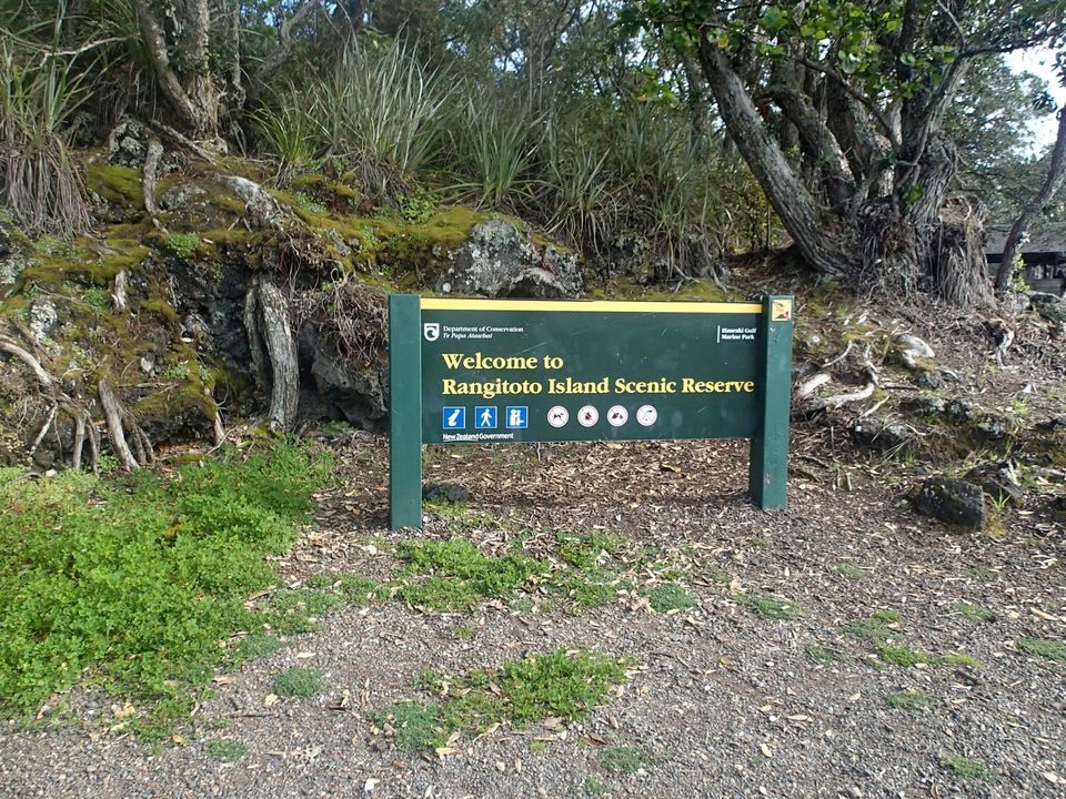
Rangitoto Island is a young volcano just off the coast of Auckland. It last erupted approximately 600 years ago and has been dormant since. It can be reached by kayak, private boat, or by the Fullers Ferry from the Britomart ferry terminal.
My husband and I thought the idea of hiking a volcano was so completely foreign that it was something we just had to experience when we were in New Zealand. We had been told that Rangitoto was the place to go, so we went! The ferry was easy to use and was a quite pleasant ride. It only took about 15 minutes and we were stepping off the boat onto the island.There are dozens of different paths possible, including guided tours, but we opted for the simple route of walking ourselves and doing the summit trek. The paths are all quite well signed and it is difficult to get lost. The path is rocky and at times quite loose; I was glad I wore my sturdy hiking shoes instead of the barefoot shoes today!
There are no shops or facilities on the island (with the exception of washrooms) so it is important to bring what you need with you. A small day pack is more than sufficient. We brought:
- Packed lunch
- Water (about 2 L per person
- Sunscreen
- Hat
- Camera
- Torch/headlamps (necessary for the lava caves)
- Umbrella (just in case...it is Auckland!)
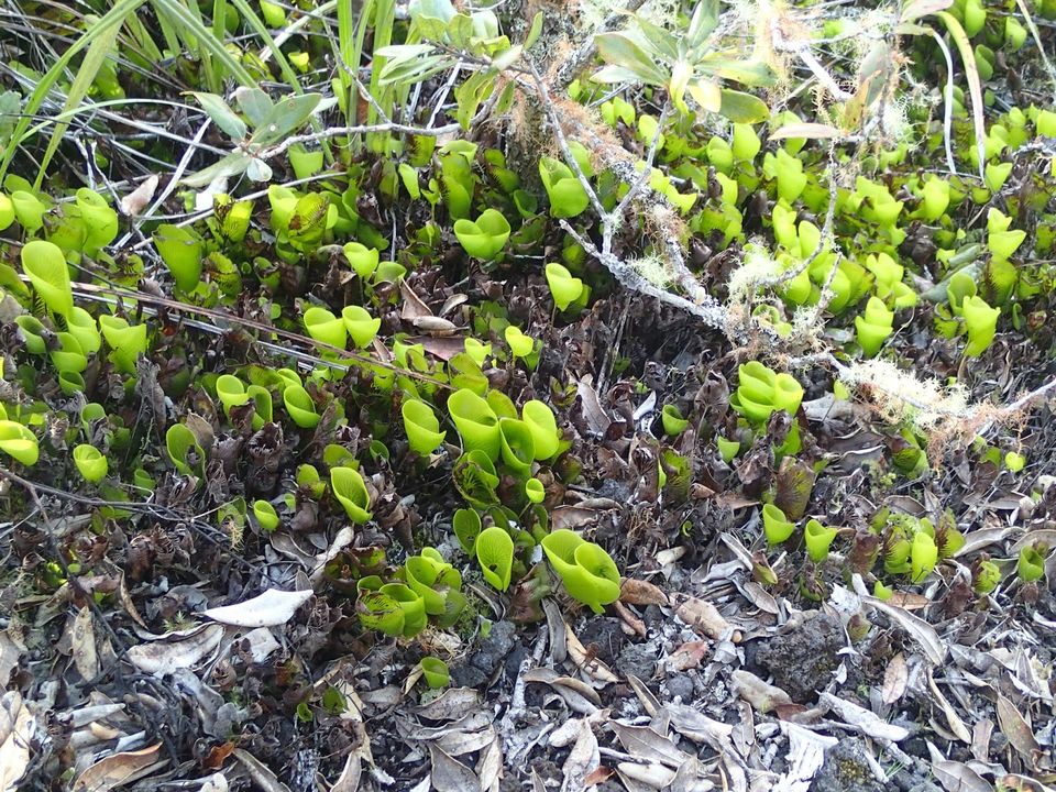
We followed the path up to the summit and saw a wide assortment of different trees, ferns, and flowers. Most notable is the kidney fern, which we were told is actually very rare. I was quite surprised with how rocky the terrain was to see any vegetation growing at all, but the plants don't seem to mind!
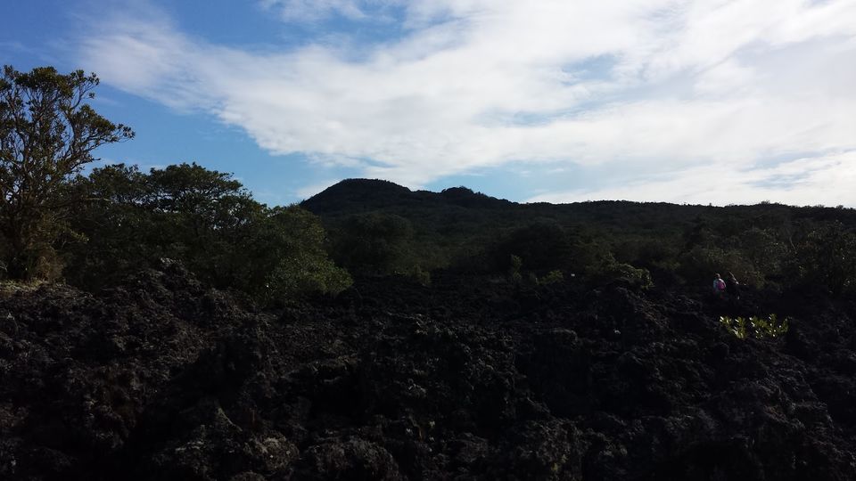
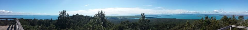
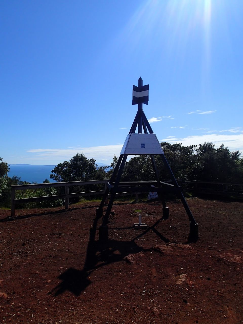
The path was well worn and gravel, or boardwalk where it was necessary. There were quite a few informational signs as well, talking about how the vegetation grew, how the volcano formed, and the history of the area. Rangitoto Island was used as a military base in WWII; it is still possible to see some of the deactivated mines in the water while scuba diving. There are also remnants of some of the buildings that were built in that time.The path climbed to an elevation of about 260m and it was a lot more humid than we are accustomed to so we definitely felt the effort. There were families hiking with fairly little kids though, so it is definitely a do-able family outing. The view from the top was absolutely spectacular!
We hiked the crater rim and I was surprised by the amount of vegetation growing in the crater. It was almost difficult to tell that we were even standing on a volcano. There were quite a few points where the trees opened up to allow incredible views of the surrounding island, the Auckland city skyline, and Rangitoto itself.There were a large number of people having their picnic lunches at the top, but we found it to be quite windy and rather cool today. We opted to hike back down to the split in the path that leads towards the lava caves. There were several fallen logs that we used as seats and tables. There were a few other groups around also using the place for a rest or picnic so apparently it was rather popular.
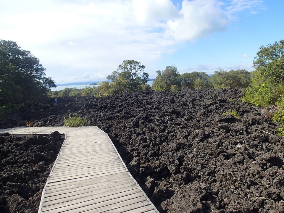
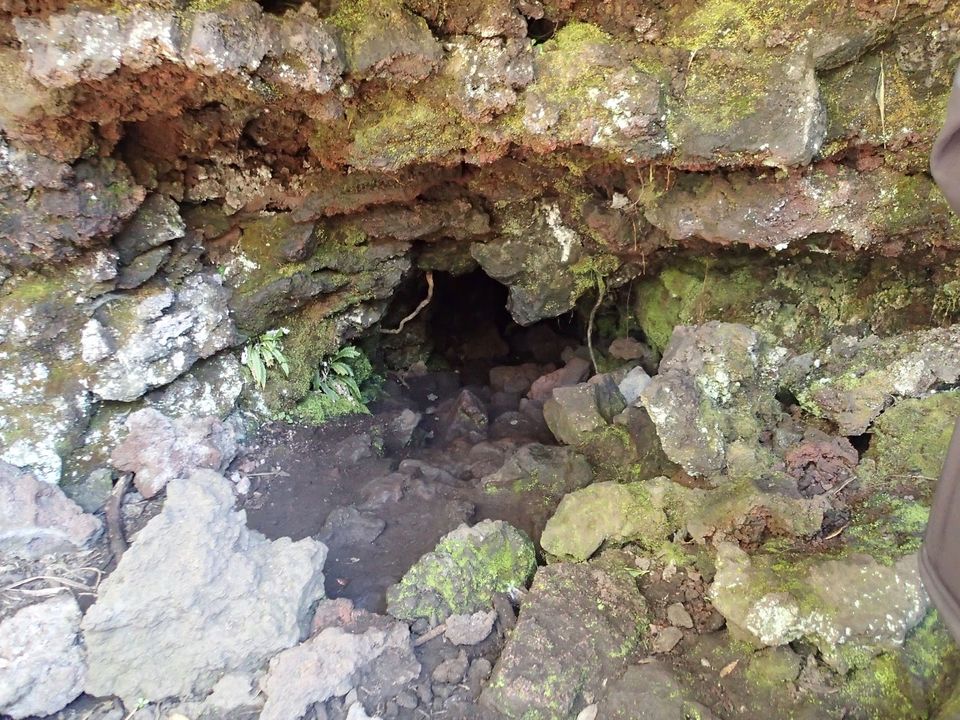
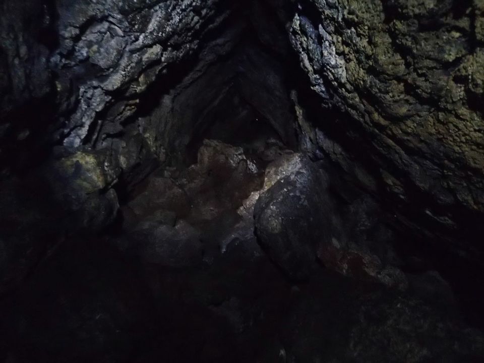
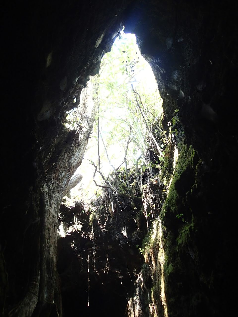
I've never been caving and going through caves created by lava seemed like something that just had to be done. We followed the trail to the lava caves, which was a little bit more difficult of a trail than the hike to the summit. There were a lot of loose rocks and slightly more difficult terrain. There were a few points along the trail that there were gaps in the rock that looked like they went a long ways down. We discovered that one that we had been admiring was actually the exit to one of the caves!There were a couple of different entrances to the caves. One set had really low ceilings and 2 of the paths led to dead ends. The middle path was quite low and downhill to start, but then opened up to about 6 foot ceilings. A headlamp is definitely required though as it is long enough that no light penetrates the middle. Inside the cave was extremely damp, but it was fun walking through it. The climb out the far side was a little bit difficult for those of us who are a bit short, but still manageable. The second set of caves had an open ceiling in the middle and was walking height nearly the entire way from start to finish.
We then walked the rest of the way down the summit track and then caught a ferry back to Auckland City. Make sure you pay attention to the last ferry departure so you don't get stranded! I think Rangitoto was definitely a neat experience and a nice hike, especially in nicer weather.
This trip was originally published on Adventure...Because It's There!
Frequent Searches Leading To This Page:-
New Zealand Tour Packages From India Price, Best New Zealand Tour Package, New Zealand Cheap Holiday Packages, New Zealand South Island Holiday Packages, Top New Zealand Tour Packages With Price, Best New Zealand Itinerary, New Zealand Vacation Packages