

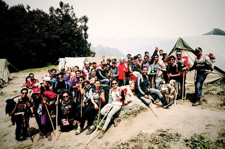
44 unknown people reported to base camp on 23th May, 2015(okay 3 reported bit late :P), destined to create a memory for life time; destined to be friends.First three days were all about knowing each other, making friends, discovering your actual stamina during dummy trek (phew! With all the weight), EAGERLY WAITING for trek to start and of course acclimatizing!
And then finally the day arrived when we left for Saar Pass and the way YHAI bid farewell, I felt no less than astronaut leaving for Mission Mars, just replace rug sack with oxygen cylinder(+weight *20)!
KASOL BASE CAMP to GRAHAN (alt: 7700 ft.): 9 km
High on energy, high on spirits and the dog who accompanied us was high on weed! (He slept all the while during our break periods!!). Grahan was the last inhabited location on the trek route. This part of trek was pretty simple and really beautiful. Wilderness of the streams, stillness of the forest and the stupefaction of komorebi (Japanese word for sunlight filters through the trees) perfectly describes the trek from Kasol to Grahan. The only tormenting time was when it started raining during the last stretch of trek and we were struggling with our ponchos because we all had just one extra pair of clothes saved for the last day!
GRAHAN TO PADRI (alt: 8900 ft.): 10 km
One of the best and sp23’s favorite camp site (especially for girls ;)). Trek was bit steep but otherwise decent enough. Everything was at ease at this camp. There was a stream flowing nearby so we didn’t had to stand in queue for water, nature’s call was always in the open with the round of 1-2-3 and poop; scenic beauty was epic; it was kind of grassland locked between mountains. Just 200 m from our camp site there was a cow fallen prey to a bear two days back which served as a feast for our doggie. Perhaps this was the camp where we enjoyed the most along with discovering mafia’s in our batch. Had a fun time playing “Mafia” with whole batch and of Course the camp leader!
PADRI to MIN THATCH (alt: 11200ft.): 11.5 km
If you have a rock climbing in your bucket list; don’t worry you will strike it off after this camp.Gradient was steep throughout but our slogan ’looo free 23’, was quite inspiring (:P that’s my sarcastic tongue). We were told that our batch was the first one to arrive in a single group ( yaayyy). Camp leaders definitely know how to cheer us up ;). Mountain sickness showed it effects on me and my friend. Fidgeting with headache, upset tummy and cherry on the top, the girl’s washroom was one hell of a trek. The times I trekked to go washroom; I would have reached Nagaru; no seriously!!
Was too consumed to gather my strength that didn’t notice much around.. ummm I guess the campsite was good! (It was beautiful :), and food was yummy … my upset tummy told me that :/)
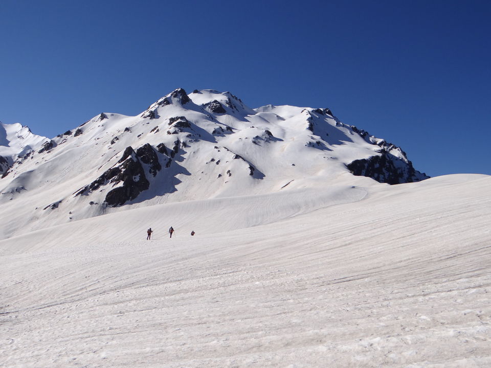
MIN THATCH to NAGARU (alt: 12500 ft.): 9 km
Tighten up your buckles and keep climbing! Gradient was steep but better than to MIN THATCH. Half of our luggage was shifted to our fellow mates (thanks a ton! may you get to eat all the grass on earth veggie and others: prey upon Ayam Cemani \m/).This trek was pretty much about …climbing…and climbing but no sooner did we reach the camp site, we were awestruck at the beauty bestowed on this planet and we lucky Passel were going to make it to Sar Pas.We experienced almost every weather condition at this site from sunshine to windstorm to hailstorm and finally to snow fall as if… we were welcomed; Royally. We enjoyed the conversation with our camp leader, hub of knowledge, tapped our feet to the beat from JBL speakers (Aakash, you are a pro) and swayed our heads to the symphony of dholak and songs our Sherpas were singing. Mountain top, embracing sun rays, musical evening and massive snow clad mountain in front; that was about NAGARU
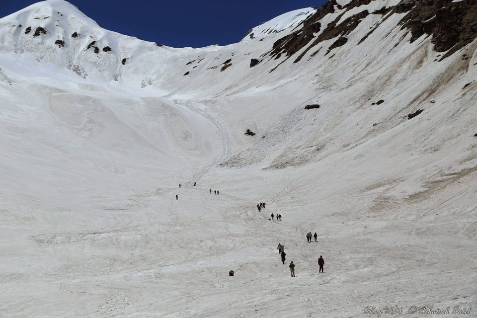
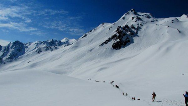
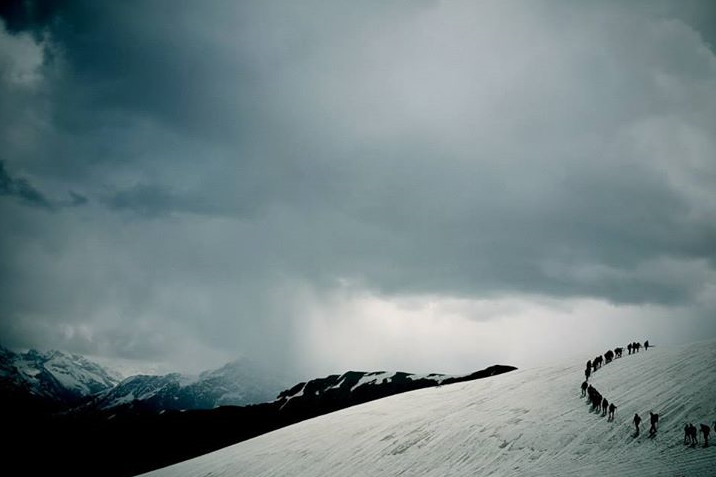
NAGARU to SAR PASS (alt: 13800 ft.) to BISKERI THATCH (alt: 11000 ft.): 14 km
Somehow tried to keep our eyes shut during freezing night just to see the morning sunrise and with that the Sar Pass. Woke up at three and left for Sar Pass at around 4!Freezing cold and getting tired at every 4th step. Walking in a line ensuring firm grip on snow with every step we took and when we made it to the top, WE WERE IN HEAVEN. Untouched beauty, sparkling snow and… snow only nothing else. It was like crossing a desert of snow. I wanted to capture as much as I can in my cam and in my memory. Coldplay’s “Magic” was going so well with the view that I couldn’t help it but played the song with all the teeny tiny battery left in my phone, truly “call it magic, call it true”.
It was not less than any magic:)
Few were sliding; sitting on their ponchos, few were busy clicking shirt less pics with the mountain in back ground and our GL was pain in the ass throwing snowballs at us, kidding GL it was fun :)
How can I forget to mention; getting hot cup of tea and Maggie at Sar Pass was a bliss.Slides were the most amazing part of Sar Pass crossing. We covered almost 3 km sliding down the mountain.From lunch point to Biskhari was a steep decent, with a varied species of flora throughout the terrain.
BISKERI THATCH to BHANDAK THATCH (alt: 8000 feet): 12 km
After Sar Pass if there was something we were excited about; it was Bandak Thatch. Grassland surrounded with mountains from all the sides. Apt to call it Switzerland of India. There was no camp leader so we were our own bosses, except that little kiddo who was … anyway, at least no official camp leader. Yes, like every batch we also played cricket and if ball enters into girl’s tent; its 4 and if it hits a girl; it’s a sixer!
I cannot forget that night; it was crazy, it was fun! Best sight for photographers, best sight for cricketers, best sight for nature lovers and best sight for … its Kasol baby:).I was going round and round as if I was sitting on a merry-go-round because I wanted to capture the complete scene in my memory and one glance was just not enough! It was a perfect landscape… sparkling snow under full moon, cool breeze, amazing friends, so many memories and most importantly … camp FIRE! I mean literally the fire unlike the ‘fire fire camp fire’ of base camp, where they’ll just switch on the lamps!
BHANDAK THATCH to BARSHANI to KASOL (alt: 6600 ft.): 10 km on foot, 22 km by bus
We made our way down to the hill without any guide, following the yhai marked red arrows. From Bershani, took bus to Manikaran and from Manikaran another bus to Kasol base camp. Finally we did it, sp23 crossed the Sar Pass. Though we were tanned like coal, tired like hell, got bruises and burns but it was worth it. These 10 days of trek taught us lot of things that are long lasting and will certainly make a difference in our lives. We collected our certificates, few planned to stay in camp rest of us left for their destinations biding adieu to a wonderful place, taking lot of memories and making many new friends These kinds of treks are contagious, we wish them to start but never to end but anyway they end with the long list of other treks for coming months.:).Rhapsodic when it starts and Nostalgic when it ends