
Dekho toh yeh nazara kudrat ka,Nigaho se hatthi nahi.
Saamne hain meri yeh Jannat,Kyon na waqt tham jaaye yahi.
Seven frozen lakes of Chandernahan iss ko dekhne ke liyeh trek karna hai yeh.
Idhar Mountains hai ,River hai ,Snow hai,..bas Aur kar chaiyeh bhai.
Video Link is here:
So, the Story of this trek begins with hunger, for the adventure, for the traveling,from reservations of the tickets to carry own backpacks.
without wasting timing, I will share the details about this trek:
How to plan this trek by own or by the help of a local villager,
who are native of this place. At the end of this blog, I will share the contact number of a local guide.
Lets Begin, I started my journey from the Pune, Maharashtra To Shimla,Himachal pardesh.
You can also do the same, Jab Bhi Mauka mile Nikal lo, Kyu ki Kal Ho Na Ho.
after catching my flight. I landed in the capital of India, Yes at Delhi Dil Walo ke, Waise Ab toh bechare pollution Se fight Karne valo ke jayda.
I suggest you break your journey into the part don't book a direct flight, if you plan for the north side treks, always booked flight till New Delhi. The Major Reasons are these: Flight rates are cheap and weather, weather can be unpredictable in the mountains, So you always will be in the safe zone. From Delhi, you have options of Cab, Bus and Train.
Chandranahan, constituting of 7 glacial ponds, is the point of origin of Pabbar River.
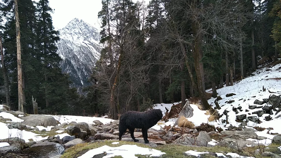
If you like to feel Switerzland in the india or Amazing winter trek and experience snow, nothing is better than the Chandernahan trek. The snowy scenery is amazing and camp sites are approachable. No risk of the running glacier. Chandernahan Winter Trek is a very exciting trek which will definitely fill your hunger for the ice,yes lots of ice,I have seen there.Sachi Mai Baat Mano Mere,Maine Dekhe Udhar,Tum Bhi Dekho.
I will not cover Shimla itinerary here, Aap khud Ghum Lo or I will share another detailed blog of Shimla.
Trek Details:
Difficulty Level :Moderate
Maximum Altitude :13,900 ft
Base Camp:Janglik, Himachal Pradesh
Best time to visit:Oct-Nov
It's suitable for most people aged between 15 to 60 years and depends on your fitness too.
Smart tip:
Book your hotel near to Shimla old stand.
How to Reach base camp Janglik:
Your whole journey to Janglik be totally different experience.
Rohru is the biggest town closest to Janglik and it is well connected with other cities of Himachal.
DAY 1:
Reach to Janglik by Cab or By Local bus:
We have started our trek from Shimla(Himachal Pradesh) early morning around 07:00 Am. We have arranged cab from Shimla Station to Janglik Village (Takes 06 – 08 Hour) post-Rohru and Chirgaon riding gracefully through the blue water of Pabbar river.
Cab will charge you in between 5000 Rs T0 6500 Rs from shimla old bus.
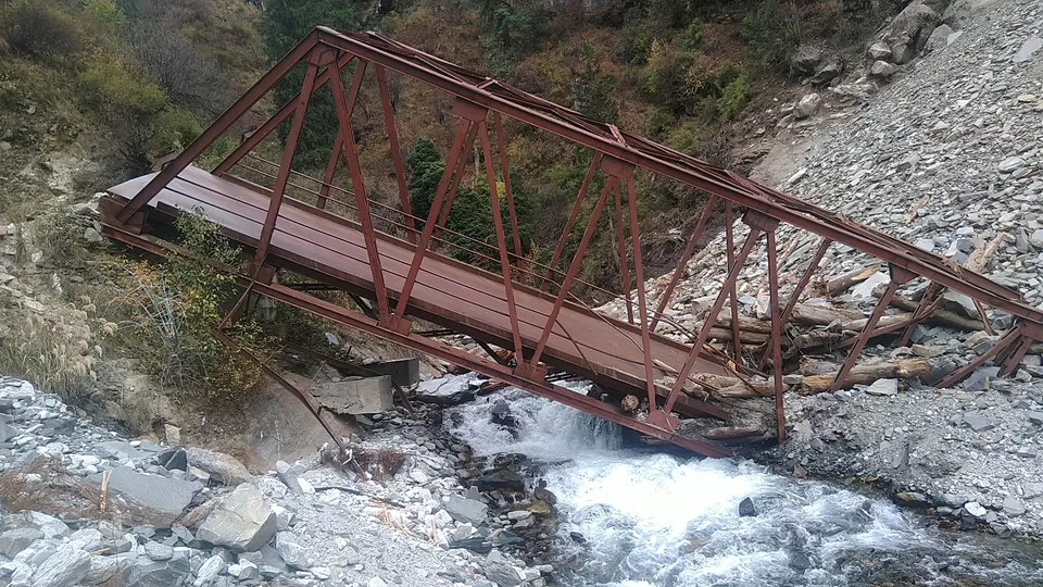
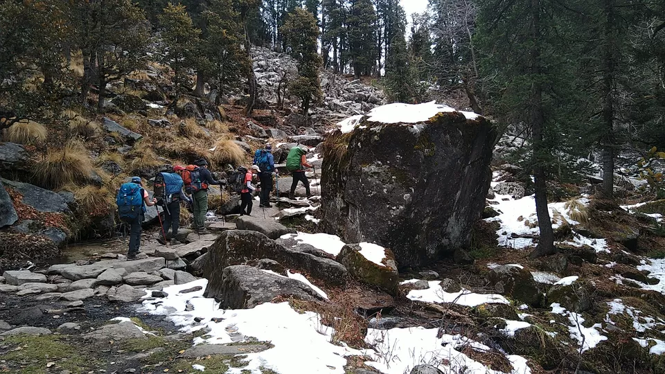
A short trek to Janglik village crossing through Pabbar by the bridge A broken bridge.
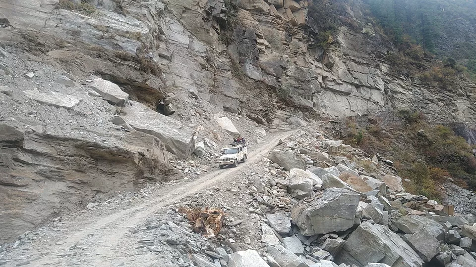
The motorable road at Tikri, just after Chirgaon, turns left and becomes an absolute dirt track for the rest of the way. It takes two hours along the dirt track to get to Tonglu. At Tonglu, the dirt track drops down to the river, crosses the Pabbar and climbs to Diude Janglik is a short walk from Diude.
From Shimla to Rohru is about 4-5 hours distance and buses are available from Shimla to Rohru.
By Local Bus:
Shimla to Rohru Bus – 07:00 AM
Bus operator :HRTC
Bus Fare:217 Rs
If you want to come from Chandigarh to Rohru Bus – 1.15 AM
and Delhi to Rohru Bus – 4.00 AM
Buses are less available ,jeeps are the best choice.
Route Hubs: Shimla - Theog - Kharapatthar - Hatkoti - Rohru - Chirgaon - Dhambhari -Tonglu.
Shimla - Rohru: 115 Km
Rohru to Chirgaon: 15 Km
Chirgaon to Tangnu: 22 Km
Tonglu to Janglik: 10 Km
Smart Tip:
Bus + Cab : from shimla 217+500= 717 rs you can reach janglik smartly.
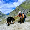
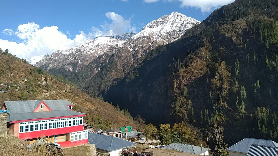
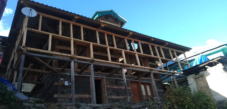
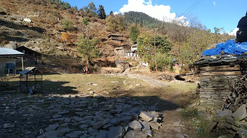
The population of the village is around 120 people comes under the tehsil of Chirgaon 29km from Janglik. Main Occupation of the villager is farming some are involved in tourism activities (On the evolution stage) .
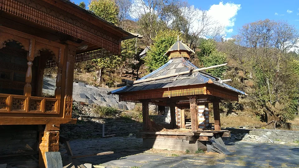
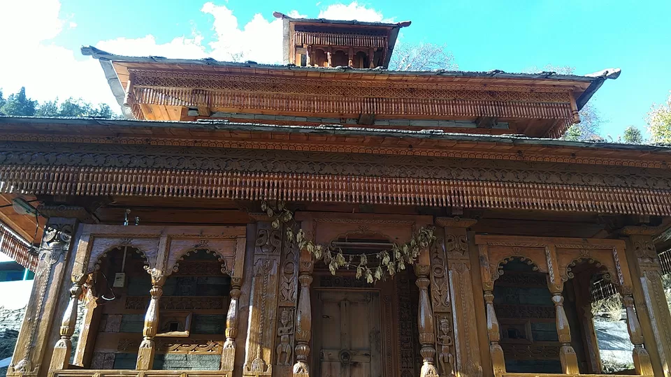
Devta Jakh Sahib is famous among the villager as you will find a big temple in the middle of the village where every villager pay tribute every day. We got to know from our Guide that villager gifts some part of their first crop and first income to devta Jakh sahib. There is tribute once in a year that is paid by the villager to Devta Jakh sahib.
The village is rich in heritage and has immense picturesque views.
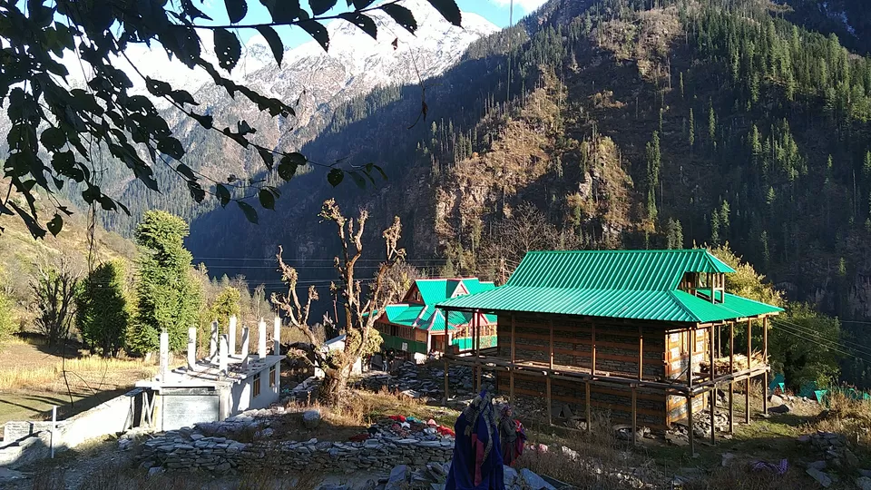
We have our base camp at Janglik village have the awesome views of Mountain have good traditional dinner in the camp.
Trek route
Janglik - Dayara Thach - Litham Thach - Chandranahan - Litham Thach - Simir Thach - Janglik.
Day 2: Janglik to Dayara
You will be at the Altitude of: 9,200 ft to 11,075 ft
Time taken: 5 -6 hrs with rest.
Trek gradient: Moderate,You will find little hectic due to Ascent.
Smart Tip:
Carry 2 litre of water mixed with ORS or Gulcose from Janglik. There are sources along the trail to refill your water bottles.
The word "thach" in the pahadi language of Himachal means a meadow- a large plane area in hilly areas where goats and other animals use it for grazing. Similarly, the word "bugyal" is used for meadows in Uttarakhand.
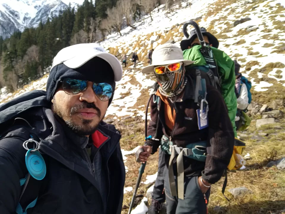
Lets start the adventure...
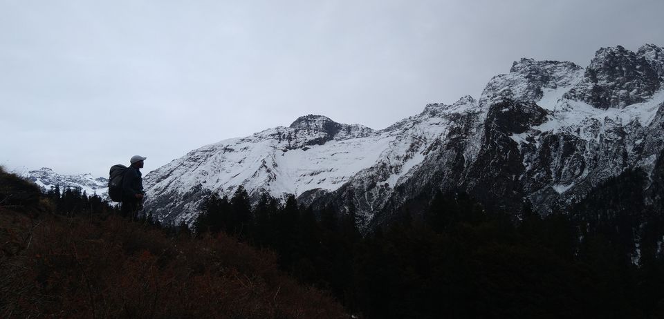
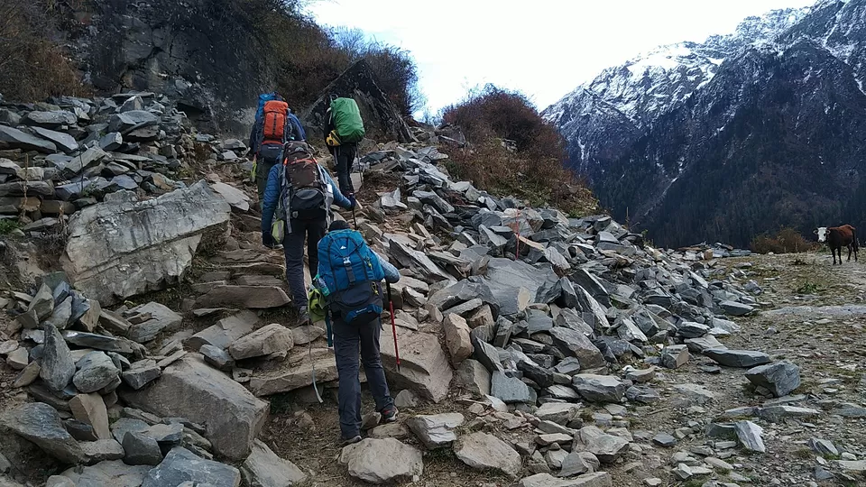
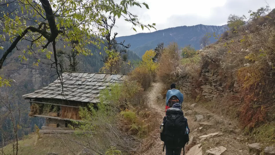
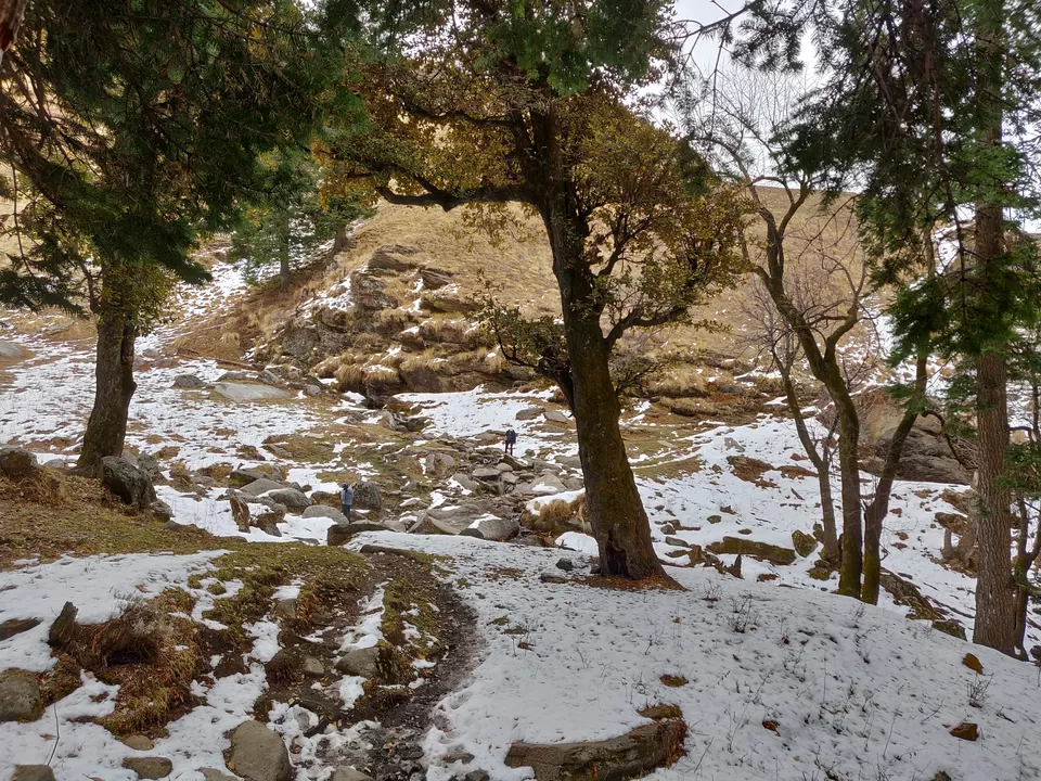
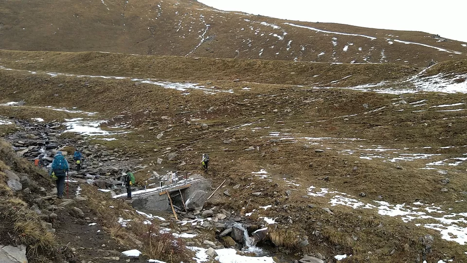
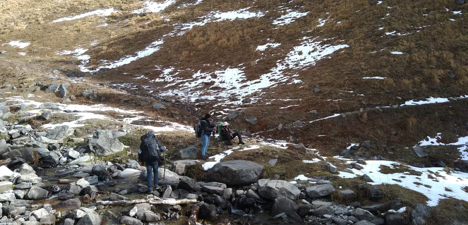
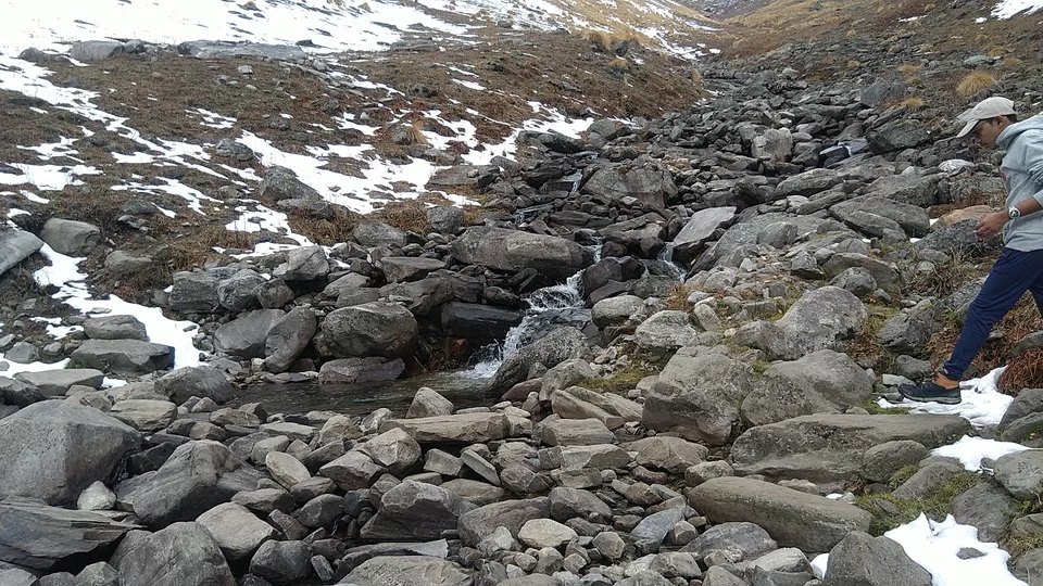
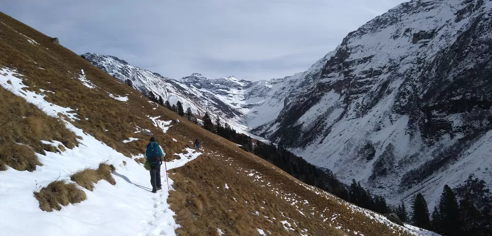
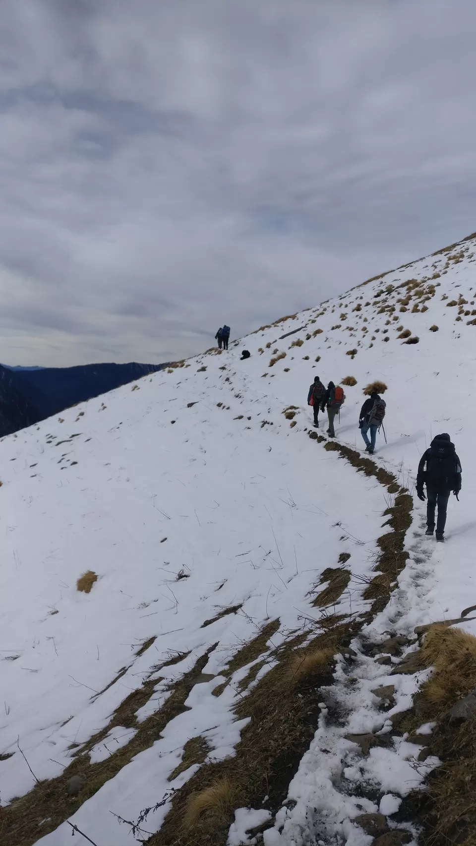
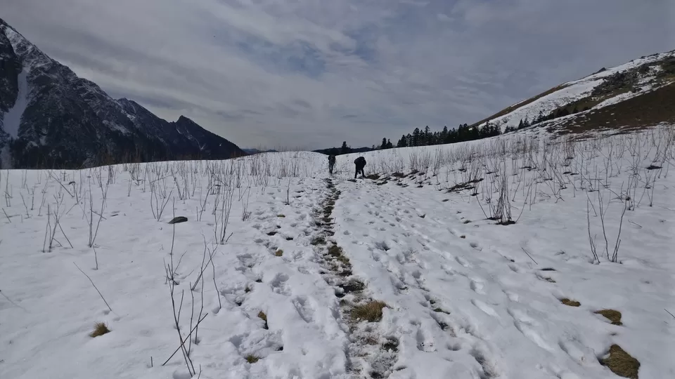
The trek begins from the trail going up the village and goes through the pine forest. After few hours of trekking you will reach beautiful meadows with view of majestic peaks. The trek till Dayara Thach takes 5-6 hours .We have started at 8:00 am from Janglik you can reach Dayra Thach by 2:00pm.
Phela Din Trekking ka: Thakna Maat
Today’s trek is perhaps the most beautiful first day of any trek that you will walk on. On the way to Dayra you will be witness of the superbly crafted wheat fields – lined by beautiful wooden farm houses on their edges.The climb, though beautiful, gains altitude rapidly. In an hour, step on a ledge and look behind you for a commanding view of Diude, Tonglu and other villages.
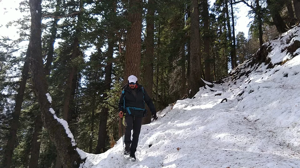
The trail climbs into a oak and pine forest. Getting deeper into the forest, the steep trail levels off to remain a gradual pleasant climb. The trail through the forest is just the treat that you needed after the long climb. Under the shady trees of the forest, streams running across the trail, brings a bounce to your step.
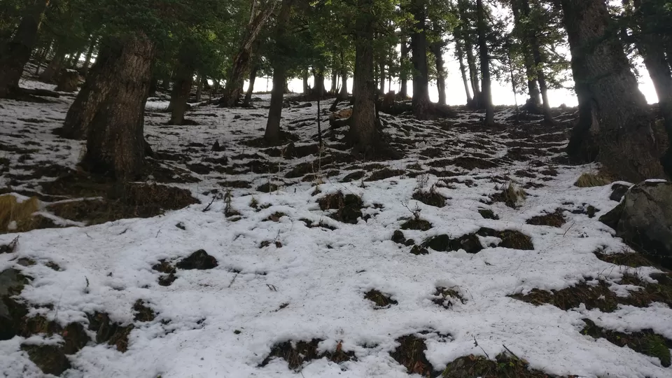
The trail is well defined and broad. Almost an hour later, the trail enters another magnificent forest of pine and oak — this time thicker and denser. The walk on the dark moist earth and the white carpet of snow is a moment to be cherished.
Abhi Hum Dayara nai phuche(we havn't reached Dayara till now),Take Rest and Walk.
Follow Me....Idhar se 30 Minutes Aur sirf..Aa gaya hai bas.
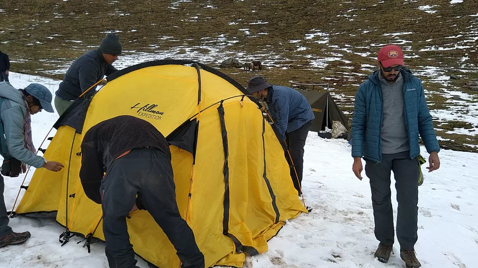
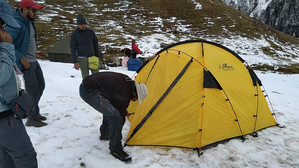
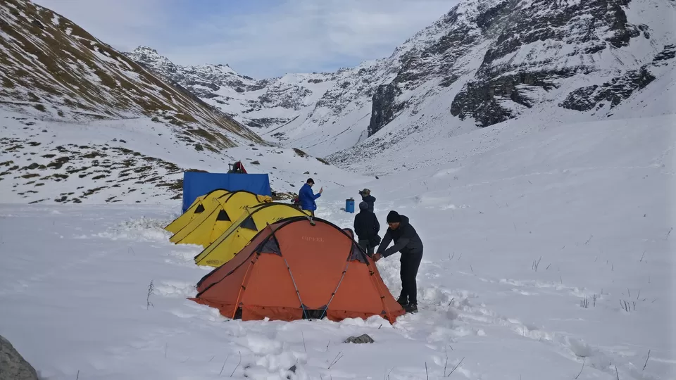
This is Dayara Thatch Finally ,So Aaj ke Raat Idhar Ruke ge.
After The Long Walk, we Did some stretching Exercise before pitching the tent.
Smart Tip: Do Some stretching before lying down.
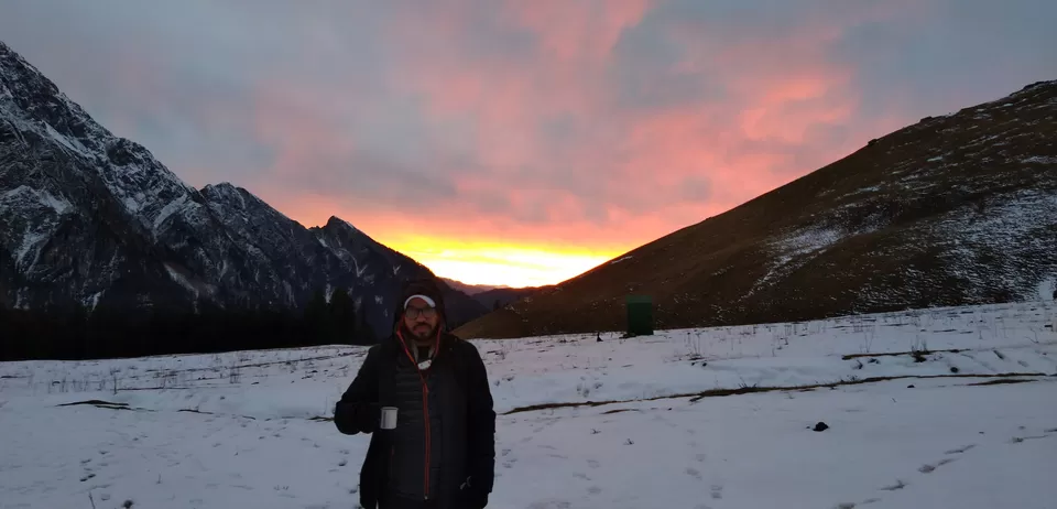
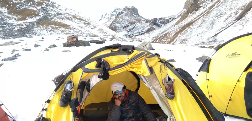
Days were cold as Good as Night.
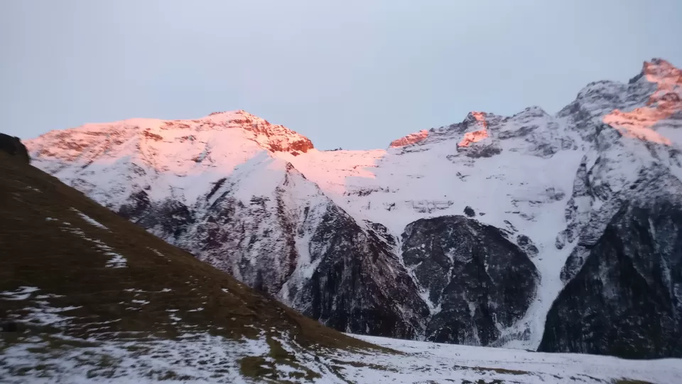
After setting Down there, we had a great evening. View of mountains Around us was Speechless.
Camera Can't capture that beauty, what we see through eyes.
Words can not describe that moment,what we feel there.
Aab Khush ho Na?
Soo Jao Aab.Kal Nikal na hai to Litham.
Smart Tip: If you feel a headache, take a cup of tea or water, still, headache remains so in this case, take half the Diamox tablet in the evening and the morning.
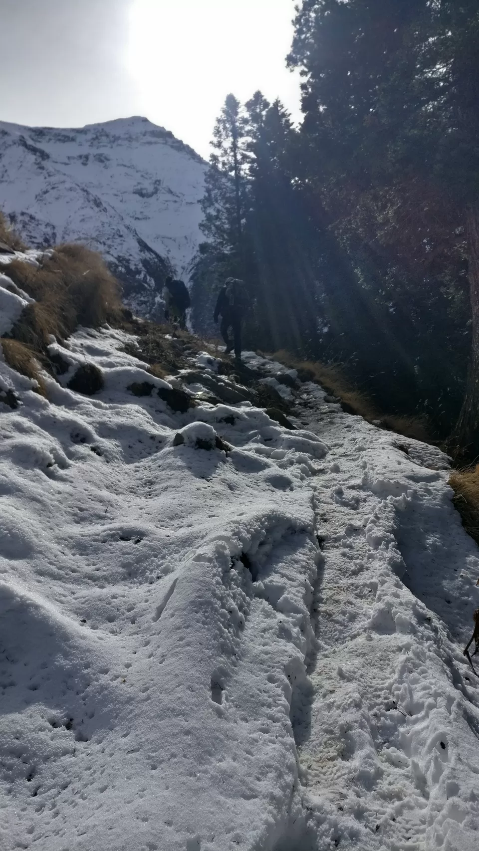
Day 3: Dayara to Litham
forget to wear your gloves and shoes.
Altitude: 11,075 ft to 11,737 ft
Time taken: 3 hours
Trek gradient: Easy.
Water sources: Carry 1 litre of water from Dayara. There are sources along the trail to refill your water bottles
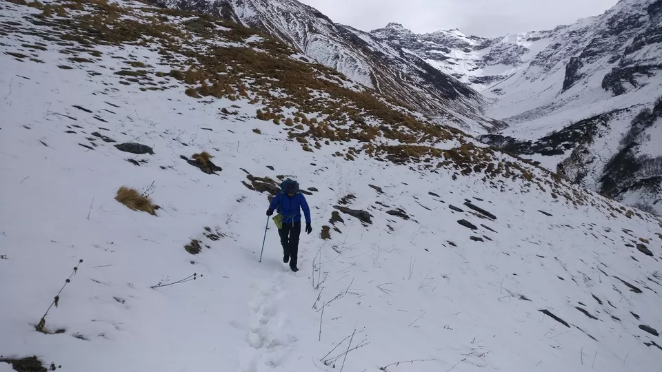
Start your day exploring the Dayara meadows. It looks most glamorous as it soaks up the golden glow of the morning sun. A walk on the snow early in the morning needs to be savoured by every trekker.
But its painful too if you forget to wear your gloves and shoes.
The trail from Dayara to Litham will take you through dense forests, wide snow fill meadows, gushing streams, and in little time as you gain an altitude of 737 feet in 3 hours.
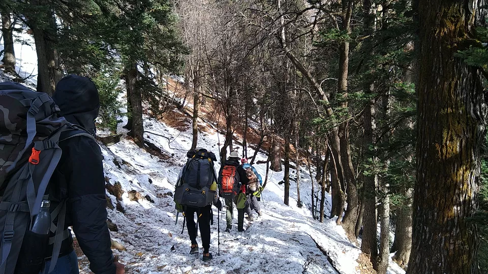
The trail traverses across the meadows towards the Gunas Pass. A gently ascending trail enters another clump of pine forest fifteen minutes out of the Dayara camp site. Then you get to a stream that needs to be leaped over.
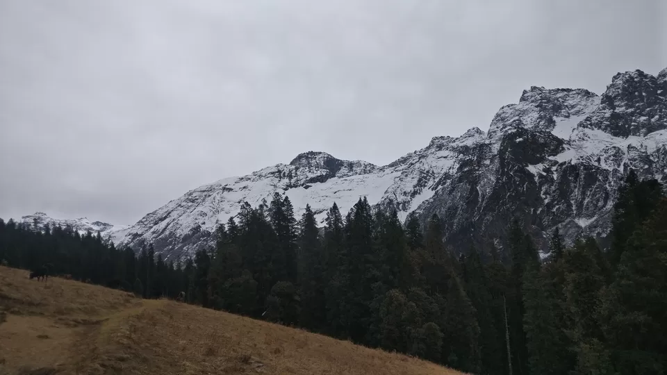
Across the stream, the trail climbs out of the forest and rounds a wide curve to regain the views of the snow capped mountains of the Dhauladhar range and Gunas Pass.
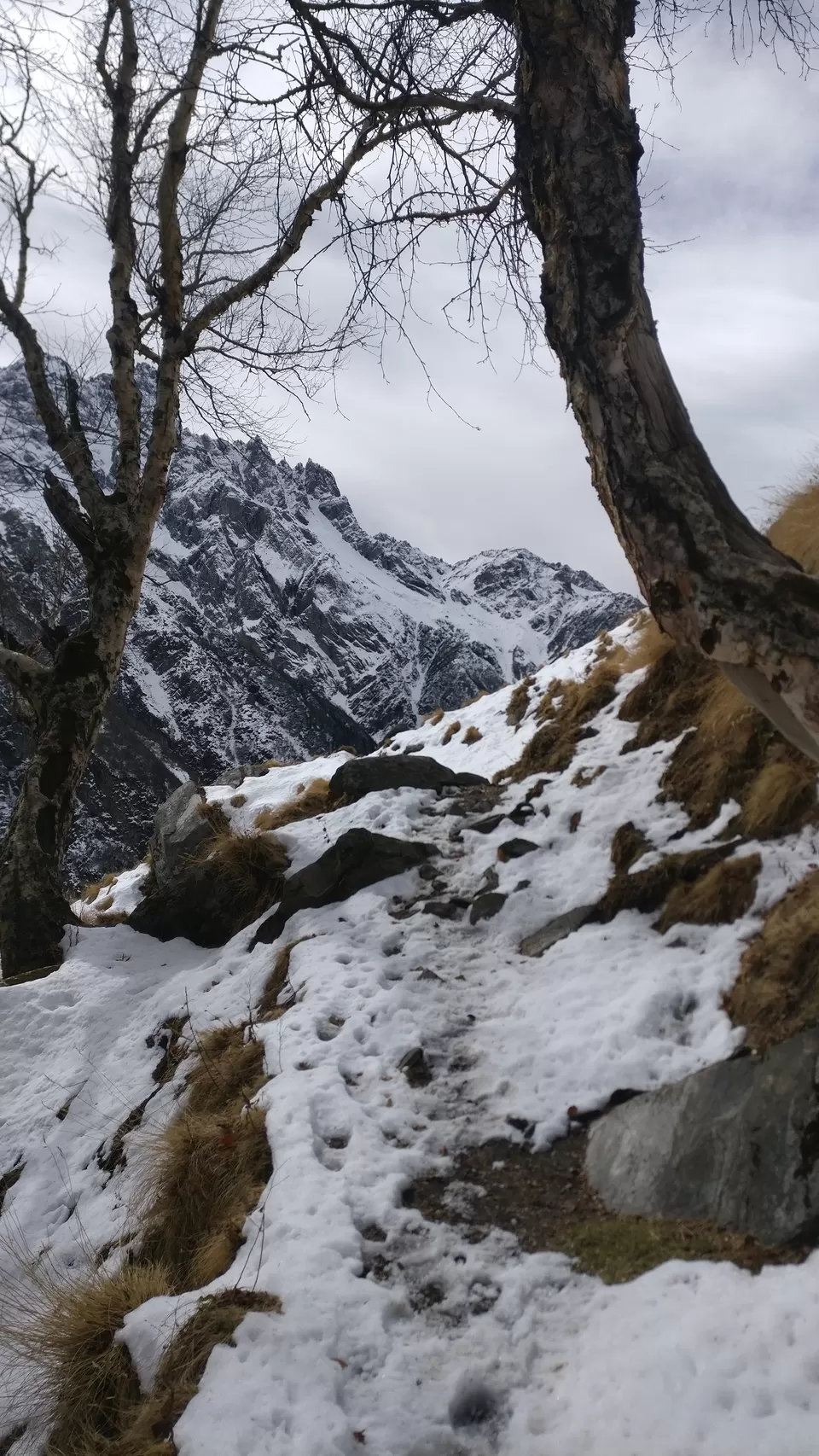
Just as the trail takes the curve is a superb scenery of the grasslands leading down from the trail and into the dark depths of pine forests about 300 feet below. Behind the pine forests are snow lined towering cliffs completing a scenery that is perfect in its harmony.
Half hour later the trail dives into another beautiful forest — this time of Silver Birch (Bhoj). The forest is old and the silver birches gnarled with age. Descending gently through the forest leads to another perennial stream in the fold of the mountain. Refresh here and climb out of the fold to your first clear view of Litham.
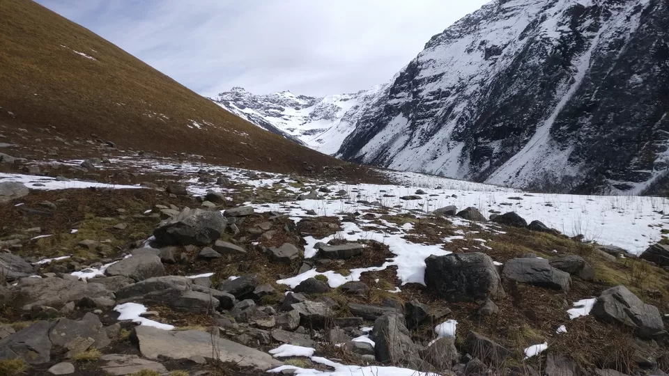
Across the meadows the trail dips to the Chandranahan stream that you need to cross before throwing down your backpacks at the Litham campsite. There are plenty of brooks running across Litham, choose a flat spot and good views to settle down for the day.
Aa Gaye Litham.
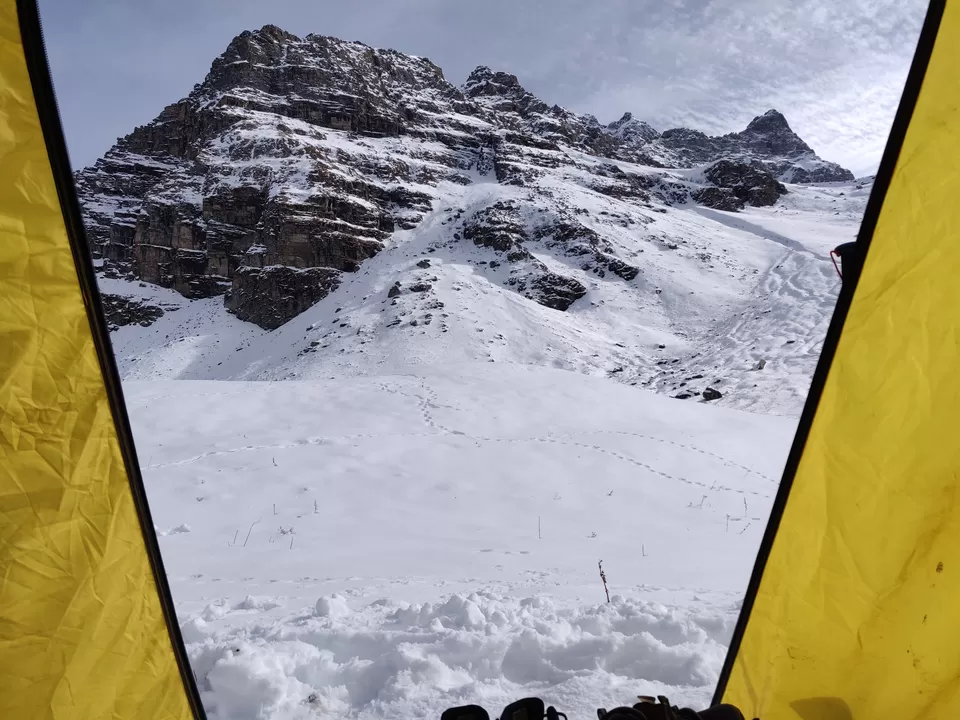
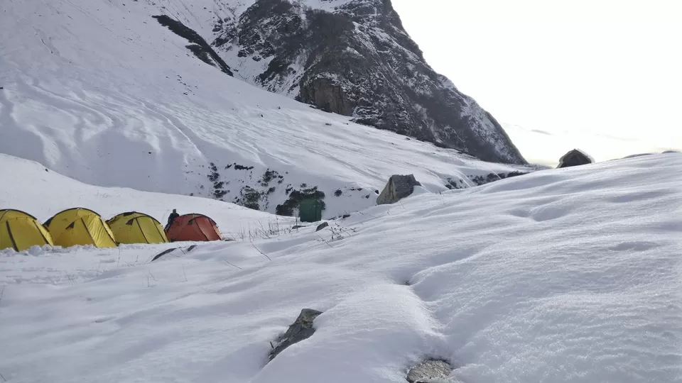
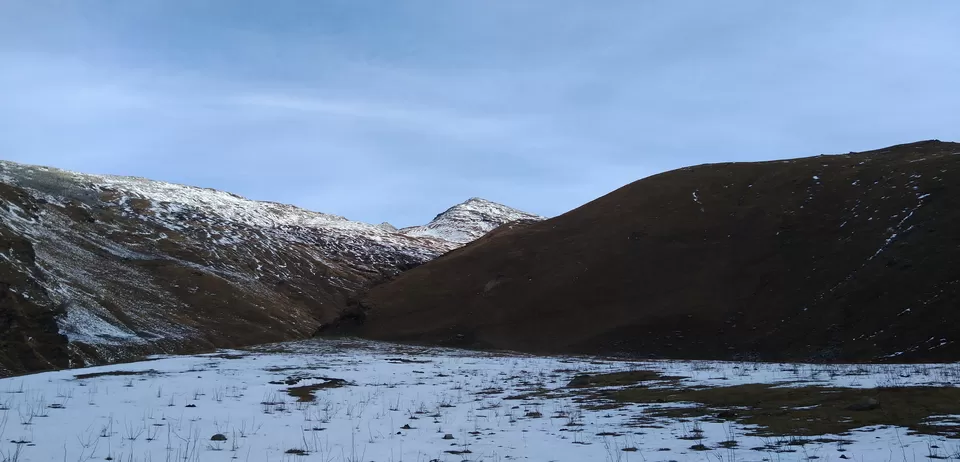
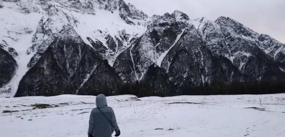
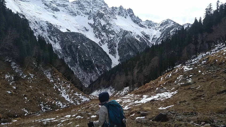
Litham has gorgeous views on three sides. On your left is is the Chandranahan waterfall, beyond which is the Chandranahan lake. In front are the towering snow clad mountains that hide Buran Ghati. On the right are the snow patched cliffs that hide the Rupin valley. The Litham campsite is a dramatic nest, the last of the great meadows of the trek.
Morning to night tak tujhe yaad karoo,I am talking about the views around me.
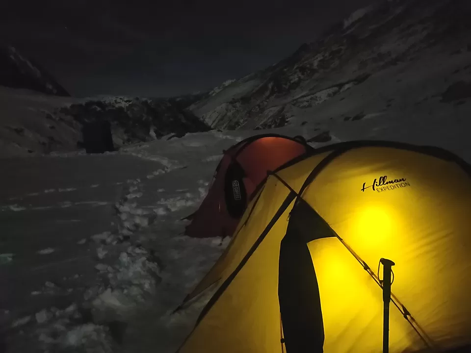
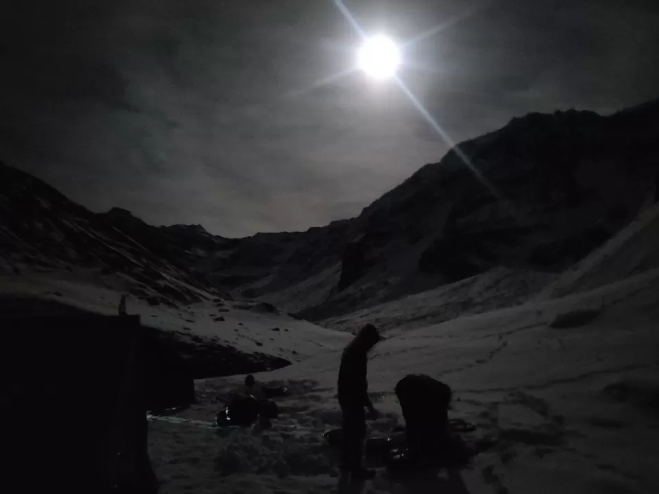
Aise chandani raat nai dekhe thi tab tak.
Hey Bhagwan..Fir se itna chal na Padega...
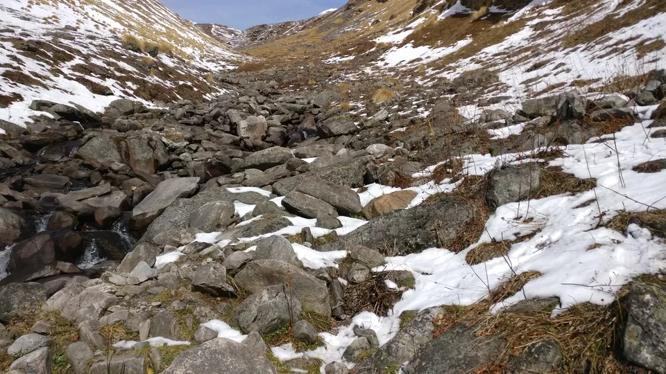
Day 4: Trek to Chandranahan lake and back to Litham
Altitude: 11,737 ft to 13,900 ft and back
Time taken: 6-7 hours
Trek gradient: Difficult. 90 minutes of gradual ascent to the snout of the waterfall followed by a steep climb for about an hour. Steep descent on the way back to Litham.
Water sources: Carry 1-1.5 of water from the campsite. There are water sources along the trail.
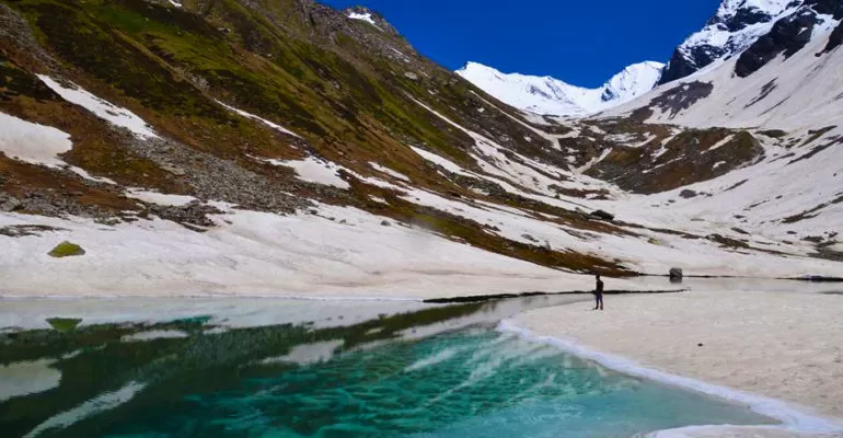
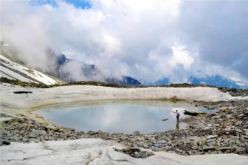
Today is the day when we finally move forward towards the seven Glacial Ponds, the Chandernahan Lake. These seven Glacial Ponds are the very source of Pabbar River. After exploring the lake and its surrounding area, we head back to Litham Thach followed by dinner, bonfire and night stay at Litham.
Trekkers usually assume that Chandranahan lake is close to the snout of the waterfall but it is another hour of trek into the glacial valley. The journey to the lake takes a difficult turn the moment you get to the flat at the snout of the waterfall. The closed alpine valley with snow patches all round is a treat.
Day 5:Litham to Dayara to Janglik and back to Shimla.
our last day, we rise early morning and start our descend from Litham Thach towards Jhanglik with a halt at Simbar Thach for snacks and refreshments Simbar Thach is a beautiful location on the way. After reaching Jhanglik, we make the short 2 km drive towards Tangnu village and finally depart from Tangnu to Shimla in the evening.
Buses from Shimla to Chandigarh are available from 5.00 am. Many of our trekkers wait at the bus stand itself to board one of these instead of booking a hotel in Shimla for a few hours. It is safe to wait in the bus stand.
Bonus.
As i said:Local Guide Mobile No:
08894985722
07807339354
09805227769
09418305669
Warm Regards,
Walking Sherpa
follow us on :Instagram and YouTube.
Write us: walkingsherpa@gmail.com
Feel free to connect for trek related information,we love to help you.