
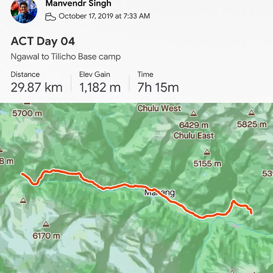
Starting point Ngawal (3680 m)
Ending point: Tilicho base camp (4150 m)
Date: 17th Oct
Distance covered: 30 km
Day 04 on the Annapurna circuit was all about taking on to the famous side trail for the 'Tilicho lake' (4919 m) sometimes called the highest lake for its size in the world.
Picture 1/10
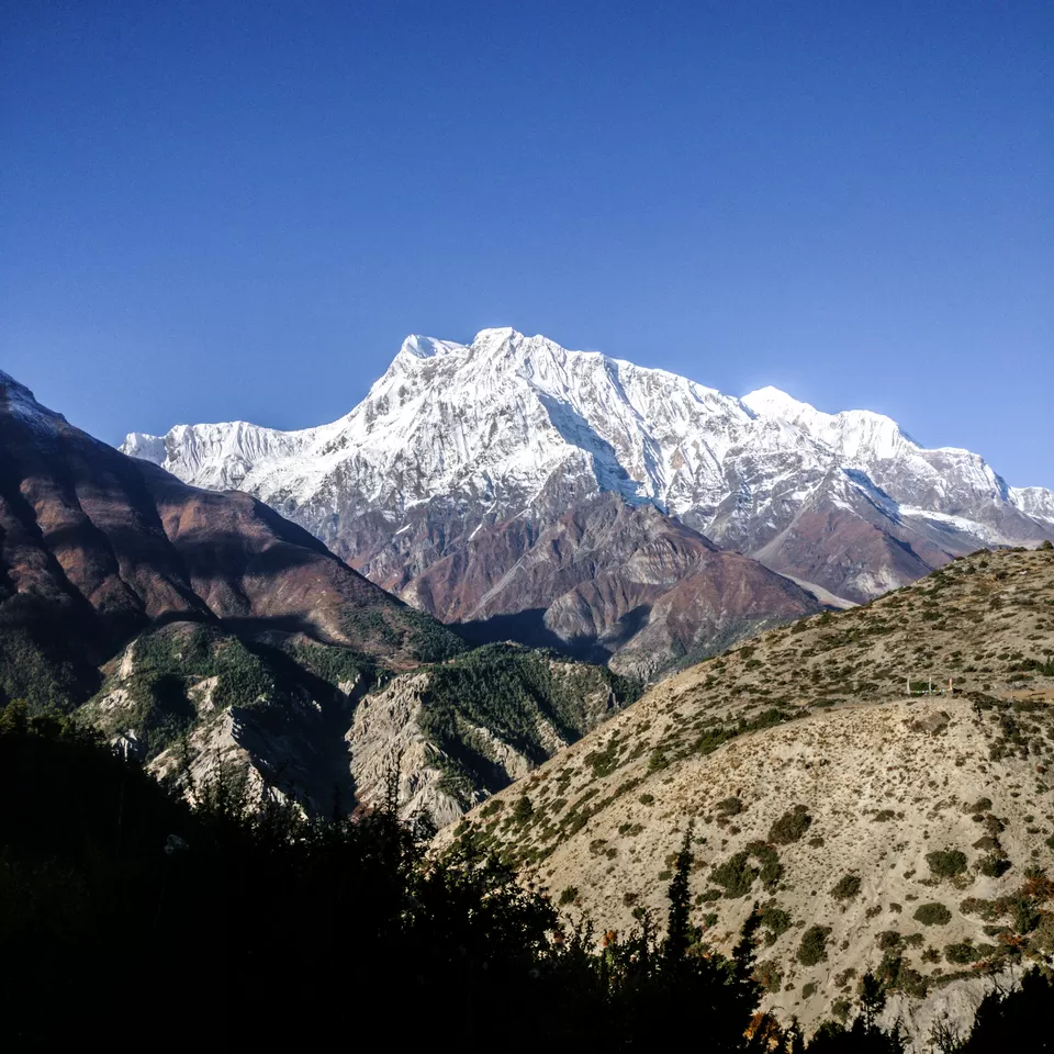
The trek on this day was a steep descend from Ngawal (3680 m) to Humde (3330 m) and as you walk you get to see the mighty Gangapurna peak (7455 m). The next ACAP check post is in the Bhraga village (3450 m). There are no check posts after this point till Jomshom (2720) which comes after crossing Thorang La (5416 m). If it is possible for you then stay in Bhraga because you get to see one of the best sunset over Annapurna massif and Gangapurna from this village. Further, you can also go for an acclimatization hike to the Ice lake from Bhraga if you want but it would definitely add one more day to your plan.
Picture 2/10
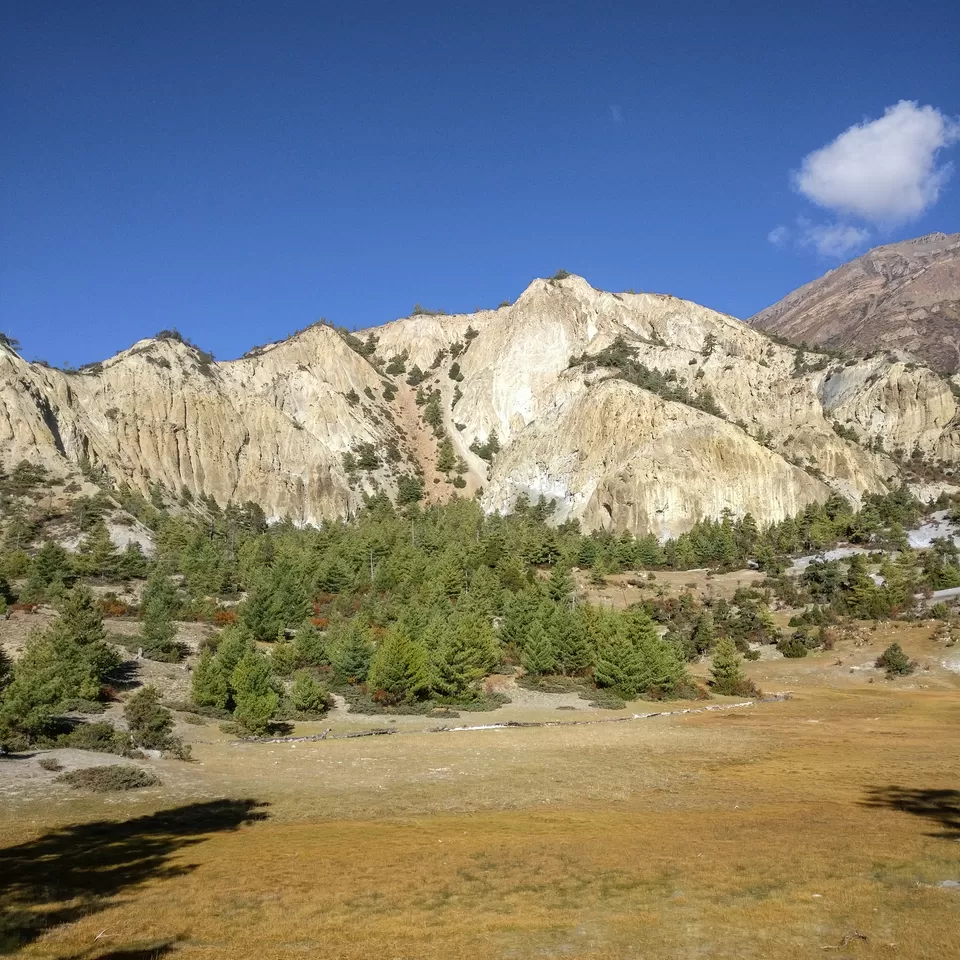
It was the very first time when I could see sand and gravel formations on the circuit. They were there near Bhratang (2850 m) but the ones near Moongi village were up close and they reminded me of the similar relief features present in the Spiti valley of Himachal Pradesh in India.
Picture 3/10
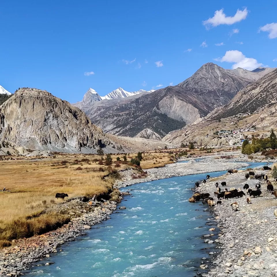
The Marsyangdi river still accompanies you once you leave Bhraga. Here, you could see Yak's grazing and you could even take a small side trail to go close to the foothills of the Annapurna massif. However, this trail is marked only on Maps.Me, you won't see any information boards regarding this small hike.
Picture 4/10
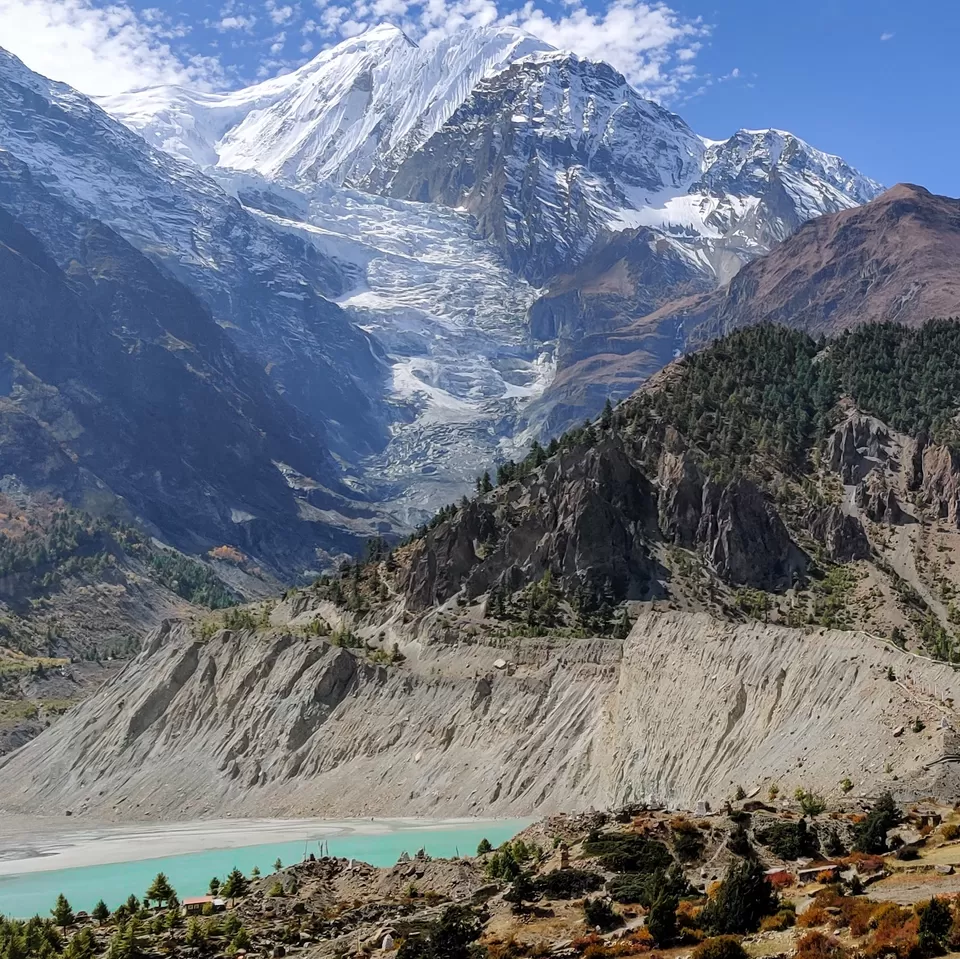
Another small side trail (a one hour hike from Manang) takes you to the famous Gangapurna lake which derives its name from the mighty Gangapurna mountain standing tall beside the lake. If you are planning to stay in Manang (3540 m) then you should definitely visit this lake. The road on this side of the Thorang pass ends at Manang. Therefore, be ready to face a lot of people on the trail as every person from here either walks or ride a mule. There are no roads for the vehicles to run. For me, witnessing the icefall region of Gangapurna was the most beautiful moment of the day.
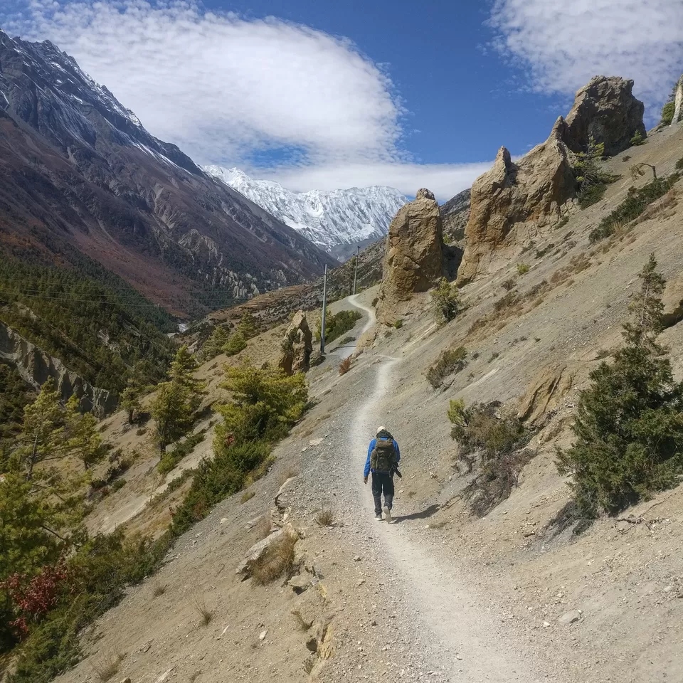
Picture 5/10
There are two trails now from the Manang village, one going to the Thorang pass and the other one going to the Tilicho lake. There are many sign boards on the trail and if you stay aware of your surroundings you can easily spot them. The trail to Tilicho lake is a dusty road till the next prominent village called Khangsar (3734 m). There is a primary medical post in Khangsar run by the Nepali government. Make sure that you check your blood pressure before going ahead. You can also get free medicines and electrolyte from the store. The staff is super cordial and helpful.
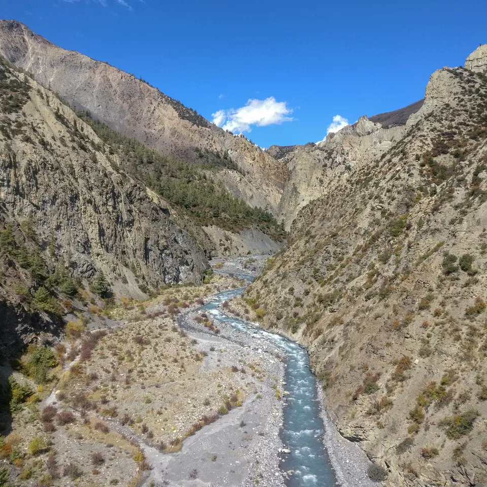
Picture 6/10
The trail to the Tilicho base camp from Khangsar is pretty long but indeed beautiful. You cross a couple of suspension bridges and the gain is pretty good. Make sure that your body is well acclimatized as the altitude is going to spike up a lot from Khangsar onwards.
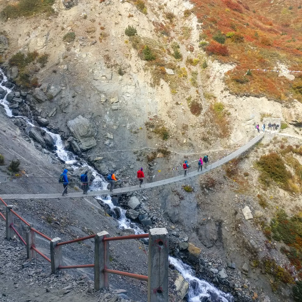
Picture 7/10
Suspension bridge close to the lower Shree Kharka village. People who start hiking from Manang early morning generally reach by evening 4 pm to the Tilicho base camp.
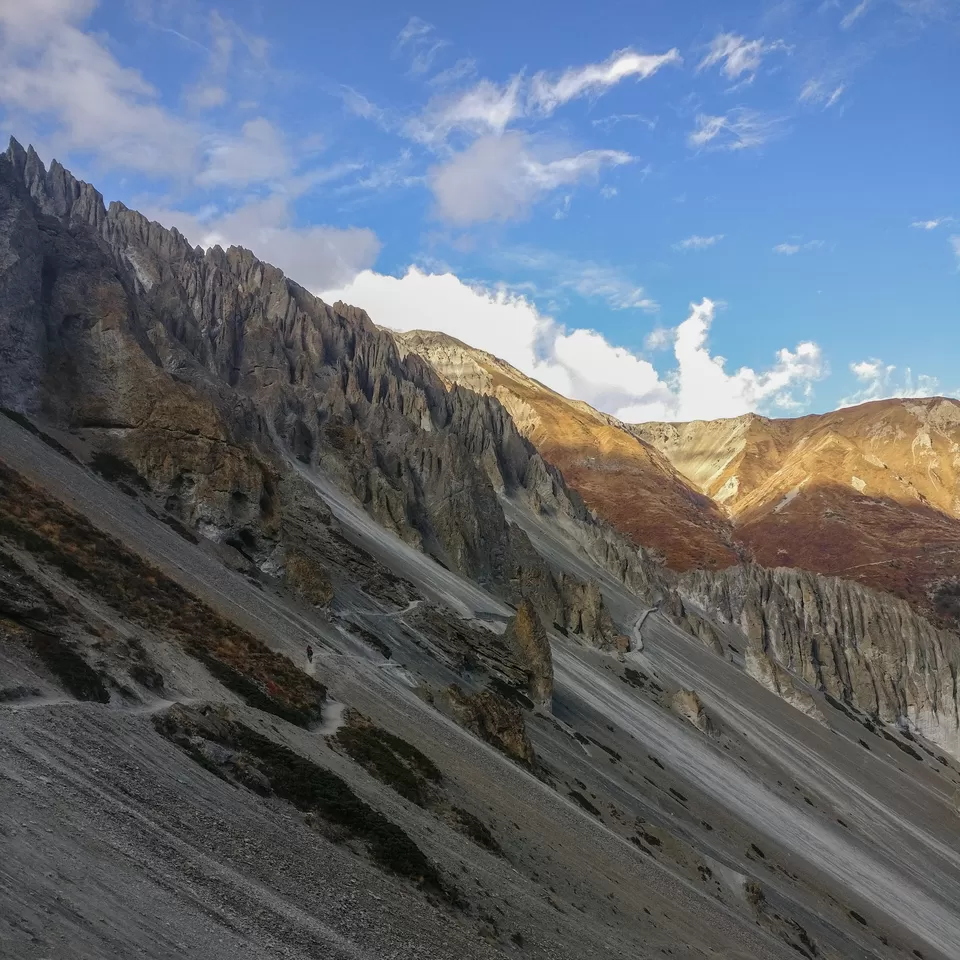
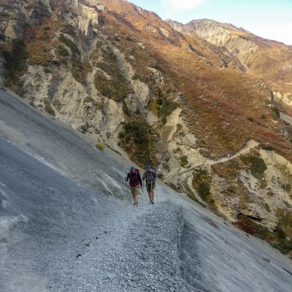
Picture 8/10
The trail from the upper Shree Kharka village to Tilicho base camp is the most challenging one. The whole trail is landslide phone and you could hear people losing their phones and cameras in this section. Please make sure that you are very careful in this section (4 kms before the Tilicho base camp). There is enough space to walk and if you walk cautiously it will be easy, just don't try those selfies at the edge of the rock.
Picture 9/10
After hiking for almost 12 hours I finally reached the Tilicho base camp at 05:30 pm. The whole region was covered with clouds and I had very less hopes of a clear weather window to go to the lake the very next day.
Picture 10/10
Aah! Strava disappoints me again. The total duration of the hike was easily above 10 hours. I feel though that the elevation gain and the distance covered are to the point. I think I will still keep loving the app until I find a better one. Any suggestions?
Do you think I made it to the lake the next morning?
Do read the next post to know.
Frequent Searches Leading To This Page:-
Annapurna circuit trek day wise, annapurna circuit itinerary 14 days, annapurna circuit trek cost for indian, annapurna circuit trek kimkim