Bali Pass Trek is related to a mountain pass that peaks slightly short of the 5000-meter mark and connects the Har Ki Dun - Ruinsara Valley to Yamunotri and vice-versa. The Bali Pass trek runs through numerous heritage Villages of Har Ki Dun Valley such as Osla, Gangaad, and Taluka, and ascends deep into the Govind National Park. On the route, we come across the beautiful Ruinsara Lake. Multiple Waterfalls lie on the way to the pass. The Bali Pass trek distance is 66 KM from Taluka to Janki Chatti. The trek is on the difficult end as the Bali Pass trek altitude is more than 16000 feet and has long walking days, with steep ascents and descents. If one plans to attempt the Bali Pass trek solo, it is highly advised to trek along a route guide as it is easy to misjudge the trail while descending or ascending the pass, with steep sections that can cause mishaps.
![Photo of Bali Pass Trek - 2024, Best Time, Itinerary, Dates [9 Day Trek] 1/18 by Mountains Curve](https://himalayashelter.com/wp-content/uploads/2022/02/Camp-at-Bali-Pass-Base-Camp-1024x461.webp)
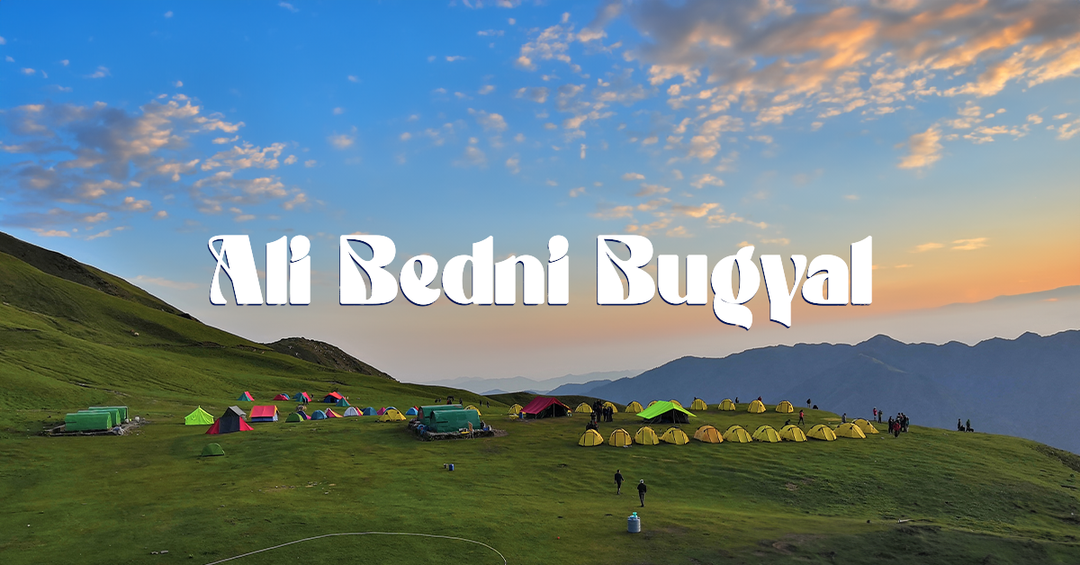
Bali Pass Base Camp
Highlights of the Bali Pass Trek:
Exploration of the Govind Wildlife Sanctuary and National Park-
Flora: Deodar cedar, Chir pine, Oak, and conifers like Spruce, Blue pine, and Silver fir. Fauna: Himalayan snow leopard, Himalayan black bear, Brown bear, Monal pheasant, Bearded vulture, Golden eagle, Western tragopan, Steppe eagle, and Black eagle.
High altitude and challenging terrain-
This trek is situated at an impressive altitude of 16,240 feet (4,950 meters). In the initial days of trekking to the Bali Pass, terrains are not very steep until the Ruinsara Lake, but you will cover a considerable distance of approximately 10-12 kilometers on an average day. Subsequently, the altitude will increase until the base camp, with an ascent of around 3,000 feet in a single day, followed by an additional 1,000 feet the next day. Descending from Bali Pass to Yamunotri is steep, and the altitude decreases by approximately 8,000 feet in just two days.
Villages Exploration-
Explore the villages of both the Har Ki Dun valley (Datmir, Gangad, Puani, and Osla) and the Yamunotri Valley (Kharsali, Hanumanchatti, and Jankichatti). Witness diverse architectures and delve into the local culture and farming practices of both valleys.
Thanga & Devsu Thatch/Meadow-
Thanga Bugyal, located 1 km from Ruinsar Lake, is an alpine meadow. It offers a beautiful view of Kyarkoti Bugyal along with a scenic 2 km ridge walk adorned with white rhododendron flowers. Devsu Thatch, at an elevation of 10,032 feet, is a sprawling meadow above the Supin River along the route from Puani Garat to the Waterfall on day 3, surrounded by dense forests. Graced with beautifully landscaped grassy mounds and an array of flowers, including orchids, poppies, anemones, primulas, daisies, and marigold, it offers a mesmerizing experience. Barefoot strolls on soft grass become a sensory dance with nature, inspiring a day of camping to savor beauty.
Camping at the pristine lake Ruinsara-
Ruinsara Lake, standing at 11,483 feet (3,500 meters), is a pivotal stop on the Bali Pass route, revealing Govind National Park's beauty with vibrant wildflowers, especially orchids. The trail meanders along the Tons River through charming villages like Gangad, Seema, and Osla. A day at Ruinsara Lake allows exploration near Banderpoonch glacier and the Black Peak base camp.
Kyarkoti Glacier-
Approximately 8 km from Ruinsara Bugyal, this is the base camp for the Kalanag, Swargarohini, and Dumdar Kandi Pass expedition. Situated at an elevation of 12,795 feet (3,900 meters) above sea level, it serves as the starting point for the Tons River, originating from the Kyarkoti Glacier.
Waterfalls on the trek-
In the 66 km Bali Pass trek, you come across numerous waterfalls, amplifying the trek's allure. Notably, the third day's journey through Seema and Swarn Dhara features some beautiful waterfalls, genuinely elevating the enchantment of the entire trek.
Yamunotri Dham-
Coming down from Lower Dhamini to Yamunotri, you'll find the sacred Yamunotri temple, one of Uttarakhand's Chota Char Dham. Nestled in the heart of the Himalayas, it's a special place for both pilgrims and trekkers. The peaceful surroundings provide a calm retreat, with the air filled with respect and tranquility for everyone who comes here.
Saprishi kund-
Towards the end of the Bali Pass trek, the majestic Bandarpunch Glacier and Saptrishi Kund come into view, representing the authentic source of the Yamuna River. Situated at an elevation of 4,421 meters, Saptrishi Kund is a high-altitude lake and the primary origin of the Yamuna. Formed by the imposing Bandarpunch Mountain, this lake is embraced by rocky glaciers, contributing to the grandeur of the landscape.
How to Plan Bali Pass trek?
The pass is more approachable from the Har Ki Dun Valley as the gradient is less steep and gives good time for the trekkers to acclimatize to the altitude. Although a few trekkers start the trek from Yamunotri too, which is not generally recommended. This is because the altitude gain from Yamunotri is very quick and the steep trail can quickly tire trekkers. It can even lead to acute mountain sickness as there is barely any acclimatization to the high altitude. The route from Sankri has multiple campsites on the route and the itinerary can be easily changed for the convenience of trekkers. Generally, the pass is attempted from Thanga, situated at 4100 meters. However, we can push to camp further at the base camp at a whopping 4,600 meters of altitude. This reduces the strain for the pass crossing day and further gives a unique experience of camping at a very high altitude. The Swargarohini has astounding views from the Bali Pass basecamp.
How to Reach the Bali Pass Trek
Reaching the Basecamp of Bali Pass Trek- Sankri Sankri is the Basecamp of Bali Pass Trek. Located in Uttarakhand, India, Sankri is the starting point for lots of treks like Har ki Dun, Ruinsara, Fachu Kandi Pass, Borasu Pass, Phulara Ridge, etc. To reach Sankri from Dehradun, you can use regular buses, shared jeeps, or taxis that are shared with others, these transport services are available from near Dehradun Railway Station.
How to Reach Dehradun from Delhi-
By Road:- Overnight UKRTC buses and Volvos, ranging from Rs 600 to Rs 900, operate from ISBT Delhi to ISBT Dehradun By Train:- It's recommended to opt for the overnight Kota Express, also known as Nanda Devi/Kota Express, departing at 11:50 PM, and arriving in Dehradun at 5:45 AM, aligning with our morning pickup schedule. By Air:- IndiGo and Vistara , are some regular flights from Indira Gandhi Airport, Delhi to Jolly Grant Airport, Dehradun. The schedules for these flights can be easily checked online. The Dehradun railway station, a hub for private and shared cabs heading to Sankri, is situated 30 km from the airport. Private taxis are easily accessible within the airport premises, with booking charges of Rs 1200 - 1500 for a Dzire or similar and Rs 1800 - 2200 for an Innova or similar vehicles.
How to Reach Sankri from Dehradun:-
Every morning, a limited number of shared cabs and buses depart for Sankri from the vicinity of Dehradun Railway Station. Govt. Buses and Private Buses- Only one government bus departs from Dehradun Railway Station to Sankri at 8:00 am. Additionally, two private buses leave around 7:00 am from just outside the Dehradun Railway Station heading to Sankri town. The fare for this journey is approximately Rs. 400-500 per person, which is roughly the same for both the government and private buses. Private Cab or Taxies- You can easily locate shared taxis near Hotel Milan or Hotel Grand, merely a 2-3 minute walk from Dehradun Railway Station. These taxis operate up to Purola, which is 54 kilometers away from Sankri. The journey lasts approximately 5 to 6 hours, with a fare of Rs. 400-500. Take shared cabs from Purola to Sankri in the morning before noon. Fare is 200-300 rupees per passenger when the cab is full. Plan your arrival in Purola accordingly. If you miss Dehradun buses or taxis, opt for a private taxi near Prince Chowk, around 100 meters from the Railway Station. Expect to pay Rs. 6,000 to Rs. 7,000 for a Maxx or Bolero booking.
Getting back from Janki Chatti (Yamunotri) to Delhi
The trek concludes at Janki Chatti, and then you'll travel by car/bus to Dehradun, which takes about 8-9 hours. There's a single government bus departing from Jankichatti to Dehradun at 6:00 am. In case you miss the bus, you can choose a local taxi to Barkot. From Barkot, another taxi or the government bus departing at 11:00 am can take you to Dehradun, with a fare of approximately Rs. 300-350 per person. For a more comfortable journey, you can book a separate cab for travel for Rs. 5000-6000 per cab. This will take you from Janki Chatti to Dehradun, and you'll reach Dehradun around 8:00 pm. If your next destination is Delhi, you can return by either the Mussoorie Express (departing at 9:20 pm) or the Nanda Devi Express (departing at 11:30 pm) from Dehradun.
The best time to Visit Bali Pass Trek
The best times for the Bali Pass trek are during the pre and post-monsoon seasons, offering two distinct opportunities - one in summer and the other in autumn. Summer begins around mid-May, depending on the snowfall from the previous winter, and lasts until the end of June, coinciding with the onset of the monsoon. Subsequently, the enchanting period of autumn starts in September, extending its allure until the latter half of October. These specific time frames not only ensure favorable weather conditions but also provide trekkers with a splendid canvas of nature, adorned with vibrant hues and diverse landscapes.
Bali Pass Trek in May and June-
Flora: In summer, the forests and meadows transform into vibrant shades of green, adorned with blossoming flowers, creating a picturesque and refreshing landscape. Snow condition- As summer progresses, the accumulated snow and glaciers melt, revealing a vast expanse of icy snow. Weather & Temperature- The daytime warms up to 10°C to 20°C in Bali Pass, especially in sunny conditions. At night or early morning, the base temperatures range from 5°C to 10°C.
Bali Pass Trek in September and October (Autumn)
Flora- In September and October, the scenery changes with colorful autumn leaves. Trees and grasses paint the surroundings in yellow, orange, and brown, offering a delightful sight. Snow- In September, there is less snow, and by October, the likelihood of fresh snowfall increases. Weather & Temperature- As you advance toward the Ruinsara Lake campsite and beyond, the weather significantly becomes colder. Daytime temperatures range from 5°C to 15°C in September and during nights or early mornings, temperatures range from 2°C to 8°C. In October, temperatures decrease noticeably, ranging from 5°C to 10°C. Be prepared for temperatures in the higher camps to drop below 0°C at night.
What makes the Bali Pass Trek a fantastic option?
Up Close with Kalanag and Swargarohini Peaks
Bali Pass trek has a lot to offer apart from its virgin trails and a challenging pass climb. We are surrounded either by the mighty Swargarohini or Bandarpunch ranges at almost all times. We get to see Kalanag (Black Peak) & Swargarohini Peak up close. At 6,387 meters, the Kalanag peak is the highest in this region. This peak was first summited by Jack Gibson in 1955 and the students of Doon School. We spent a day beside Ruinsara Lake. The walk across the two meadows of Devsu Thatch and Thanga is breathtaking. One of our camps will be beside a waterfall and another one lies above 4,000 m.
Wild Encounters and Summit-like Adventures
Wild animals such as Himalayan Ibex and Blue Sheep, Black Bears, and Brown bears can be spotted occasionally on this trail! Our teams sighted the Black bear on this trail ahead of Seema and near the waterfall camp, while the Brown bear was spotted near Thanga Campsite, and during an exploration towards Dhumdhar Kandi pass during the rest day at Ruinsara Lake. While the trail to Bali passes turns southward towards Yamunotri ahead of Ruinsara Lake, the eastward route continues to the challenging Dhumdhar Kandi. It's a daunting pass sharing its base camp with Black Peak and goes to Harsil. The Bali Pass unlike a conventional pass, which means a saddle-like opening between neighboring rising ridges, rises like a peak and gives a summit-like adventure when you reach the top. The same can be visually seen in the summit stretch picture of the Bali pass below. Towards the end of the Bali Pass trek, we see the Bandarpunch Glacier & Saptrishi Kund. They are the true source of the river Yamuna. We also get an opportunity to visit the holy temple of Yamunotri. All in all, Bali Pass is a wholesome adventure that provides trekkers with every element of a Himalayan trek.
![Photo of Bali Pass Trek - 2024, Best Time, Itinerary, Dates [9 Day Trek] 2/18 by Mountains Curve](https://himalayashelter.com/wp-content/uploads/2021/08/bali-pass-top-1024x576.webp)
The top of Bali Pass is more summit-like than a Mountain Pass
How difficult is the Bali Pass trek?
Bali pass trek difficulty is based on the following factors - the Bali pass trek height is an altitude of 16,240 feet or 4,950 meters. The trek has a distance of 66 km, starting from Taluka to the endpoint at Janki Chatti. It takes 6 to 7 days to complete the trek on foot. Thus we will walk around 10 KM on average every day. The altitude of Taluka, where the trek starts, is 6,825 feet (2080 meters). We thus have a net altitude gain of 9,250 feet (2,820 meters) over a duration of 5 days, thus climbing an average of 550 meters a day or 1800 feet. That is a considerable altitude gain. The distance, altitude gain, and finally the technical pass crossing make Bali Pass fall in the category of a Moderate-Difficult trek. It requires physical preparation and regular exercises that must be started at least 1 month prior to trekking to the Bali Pass. Content Credit: Abhishek Sohu
Bali Pass Trek Route Map:-
The Bali Pass Trek Map guides you through the beautiful path in the Garhwal Himalayas. It takes you past the charming Devsu Bugyal and Ruinsara Lake to reach the stunning Bali Pass at an impressive altitude of 16,200 ft. Following the scenic route along the Supin River, the map points out the awe-inspiring sights of snow-capped peaks and lush meadows. It promises an exciting adventure for both trekkers and nature lovers
![Photo of Bali Pass Trek - 2024, Best Time, Itinerary, Dates [9 Day Trek] 3/18 by Mountains Curve](https://himalayashelter.com/wp-content/uploads/2022/02/bali_pass_trek_route_map_himalaya_shelter-819x1024.webp)
Credits: Shivam Chand
A Glimpse of the Bali Pass Trek:-
Bali Pass Trek Itinerary
![Photo of Bali Pass Trek - 2024, Best Time, Itinerary, Dates [9 Day Trek] 4/18 by Mountains Curve](https://himalayashelter.com/wp-content/uploads/2022/02/WhatsApp-Image-2024-02-04-at-3.24.46-PM-768x1024.jpeg)
![Photo of Bali Pass Trek - 2024, Best Time, Itinerary, Dates [9 Day Trek] 5/18 by Mountains Curve](https://himalayashelter.com/wp-content/uploads/2022/02/Bali-Pass-Day-2-768x1024.jpeg)
![Photo of Bali Pass Trek - 2024, Best Time, Itinerary, Dates [9 Day Trek] 6/18 by Mountains Curve](https://himalayashelter.com/wp-content/uploads/2022/02/Bali-Pass-Day-2-Final-1024x768.jpeg)
![Photo of Bali Pass Trek - 2024, Best Time, Itinerary, Dates [9 Day Trek] 7/18 by Mountains Curve](https://himalayashelter.com/wp-content/uploads/2022/02/Bali-Pass-Rain-Basera-1024x768.jpeg)
![Photo of Bali Pass Trek - 2024, Best Time, Itinerary, Dates [9 Day Trek] 8/18 by Mountains Curve](https://himalayashelter.com/wp-content/uploads/2022/02/Bali-Pass-Day-3-Waterfall-Camp-1024x768.jpeg)
![Photo of Bali Pass Trek - 2024, Best Time, Itinerary, Dates [9 Day Trek] 9/18 by Mountains Curve](https://himalayashelter.com/wp-content/uploads/2022/02/Bali-Pass-Day-4-Waterfall-camp-to-Ruinsara-1024x768.jpeg)
![Photo of Bali Pass Trek - 2024, Best Time, Itinerary, Dates [9 Day Trek] 10/18 by Mountains Curve](https://himalayashelter.com/wp-content/uploads/2022/02/Ruinsara-Bali-Pass-1024x576.jpg)
![Photo of Bali Pass Trek - 2024, Best Time, Itinerary, Dates [9 Day Trek] 11/18 by Mountains Curve](https://himalayashelter.com/wp-content/uploads/2022/02/Bali-Pass-Day-5-Ruinsara-to-Odari-1024x768.jpeg)
![Photo of Bali Pass Trek - 2024, Best Time, Itinerary, Dates [9 Day Trek] 12/18 by Mountains Curve](https://himalayashelter.com/wp-content/uploads/2022/02/Bali-Pass-Thanga-1024x768.jpeg)
![Photo of Bali Pass Trek - 2024, Best Time, Itinerary, Dates [9 Day Trek] 13/18 by Mountains Curve](https://himalayashelter.com/wp-content/uploads/2022/02/Bali-Pass-Odari-to-bali-Pass-Base-camp-1024x768.jpeg)
![Photo of Bali Pass Trek - 2024, Best Time, Itinerary, Dates [9 Day Trek] 14/18 by Mountains Curve](https://himalayashelter.com/wp-content/uploads/2022/02/Bali-Pass-Base-Camp-1024x768.jpeg)
![Photo of Bali Pass Trek - 2024, Best Time, Itinerary, Dates [9 Day Trek] 15/18 by Mountains Curve](https://himalayashelter.com/wp-content/uploads/2022/02/Bali-Pass-summit-achievement-1024x768.jpeg)
![Photo of Bali Pass Trek - 2024, Best Time, Itinerary, Dates [9 Day Trek] 16/18 by Mountains Curve](https://himalayashelter.com/wp-content/uploads/2022/02/Bali-Pass-Summit-Day-Colours-1024x768.jpeg)
![Photo of Bali Pass Trek - 2024, Best Time, Itinerary, Dates [9 Day Trek] 17/18 by Mountains Curve](https://himalayashelter.com/wp-content/uploads/2022/02/Bali-Pass-to-Yamunotri-1024x575.jpg)
![Photo of Bali Pass Trek - 2024, Best Time, Itinerary, Dates [9 Day Trek] 18/18 by Mountains Curve](https://himalayashelter.com/wp-content/uploads/2023/08/Tons-1024x768.jpg)
Bali Pass Trek FAQ's
Reviews
Only logged in customers who have purchased this product may leave a review.
Inclusions
Transport support from Dehradun to Dehradun Pick-up location: Prince Chowk, near Dehradun Railway StationPick-up Time: Around 7:30 am All vegetarian meals starting from dinner on day 1 to breakfast on the last day Professional Guide, Cook and Support staff First-Aid kit with Oximeter and Portable Oxygen Cylinder Kitchen tents, common tents, toilet tents with portable toilet seats Rent for camping equipment like Clean sleeping bags and foam mattresses, Good quality 'A' shaped or dome tents, Camping stools, Table and Crampons and gaiters if required Forest entry charges for Indian nationals (Additional charges will be applicable for international tourists) Porter and mule support to carry camping equipment and personal luggage Accommodation throughout the trek on a triple-sharing basis Guesthouse accommodation on the first and second last day on a triple-sharing basis All applicable taxesExclusions
Personal expenses like tips, personal medicines, phone calls etc. Any transport support during the trek apart from what is included above Any cost or services not mentioned in the Inclusions Accommodation in Dehradun Adventure Insurance Cost arising due to unforeseen incidents like bad weather, medical evacuation, roadblocks etc Porter and mule support to carry personal Luggage can be arranged at an additional cost of INR 500 per bag per day (weighing up to 12 kg) Please carry a lunch box for packed lunch/breakfast to avoid using polythenes and Aluminium foils. Keeping the Himalayas clean is our own responsibility. Reduce the use of Plastic when you are in the abode of the Sacred Himalaya. 🌱


' fill='%23359391'%3e %3cpath d='M46.1538462%2c43.5714286 L41.5%2c50 L36.8461538%2c43.5714286 L36.8670256%2c43.5714286 C36.3173077%2c42.7142857 36%2c41.6851429 36%2c40.5714286 C36%2c37.4854286 38.4535641%2c35 41.5%2c35 C44.5464359%2c35 47%2c37.4854286 47%2c40.5714286 C47%2c41.6851429 46.6826923%2c42.7142857 46.1329744%2c43.5714286 L46.1538462%2c43.5714286 Z M41.4294872%2c39 C40.6150641%2c39 39.9487179%2c39.675 39.9487179%2c40.5 C39.9487179%2c41.325 40.6150641%2c42 41.4294872%2c42 C42.2439103%2c42 42.9102564%2c41.325 42.9102564%2c40.5 C42.9102564%2c39.675 42.2439103%2c39 41.4294872%2c39 L41.4294872%2c39 Z' id='Location-white'%3e%3c/path%3e %3c/g%3e %3c/svg%3e)