4.2 / 5

Changla Pass

📍 Chang La PassView map ›

🗓 Best Time To Visit:May to October, as the pass remains open and the weather is bearable.

⏰ Open Hours:24 hours, but travel is advised only during daylight hours due to the rough terrain.

🎒 Things To Do:Photography, sightseeing, adventure sports like trekking and mountain biking.

💰 Budget:N/A, no entry fees but costs will include transportation and food.

🧳 Traveller Types:Adventure enthusiasts, nature lovers, photographers.

📌 Known For:Being one of the highest motorable passes in the world, with stunning panoramic views of the snow-capped Himalayas.

📍 Distances:75 km from Leh, 464 km from Srinagar airport, and 630 km from the nearest railway station in Jammu.

⚠️ Important Tip:Carry warm clothing regardless of the season, as temperatures drop below freezing at night. Oxygen levels are low, so it's essential to acclimatize before visiting.

🌡️ Weather:Cold throughout the year, with temperatures ranging from -30°C to 15°C.

🍽️ Nearby Eateries:Limited options. Carry your own food and water.

🏥 Medical Facilities:Limited. Carry necessary medicines and first aid. The nearest medical center is in Leh.

Have questions about Changla Pass?Ask the Tripoto Community ›
Changla Pass: A Complete Guide To The World’s Third Highest Motorable Road

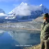
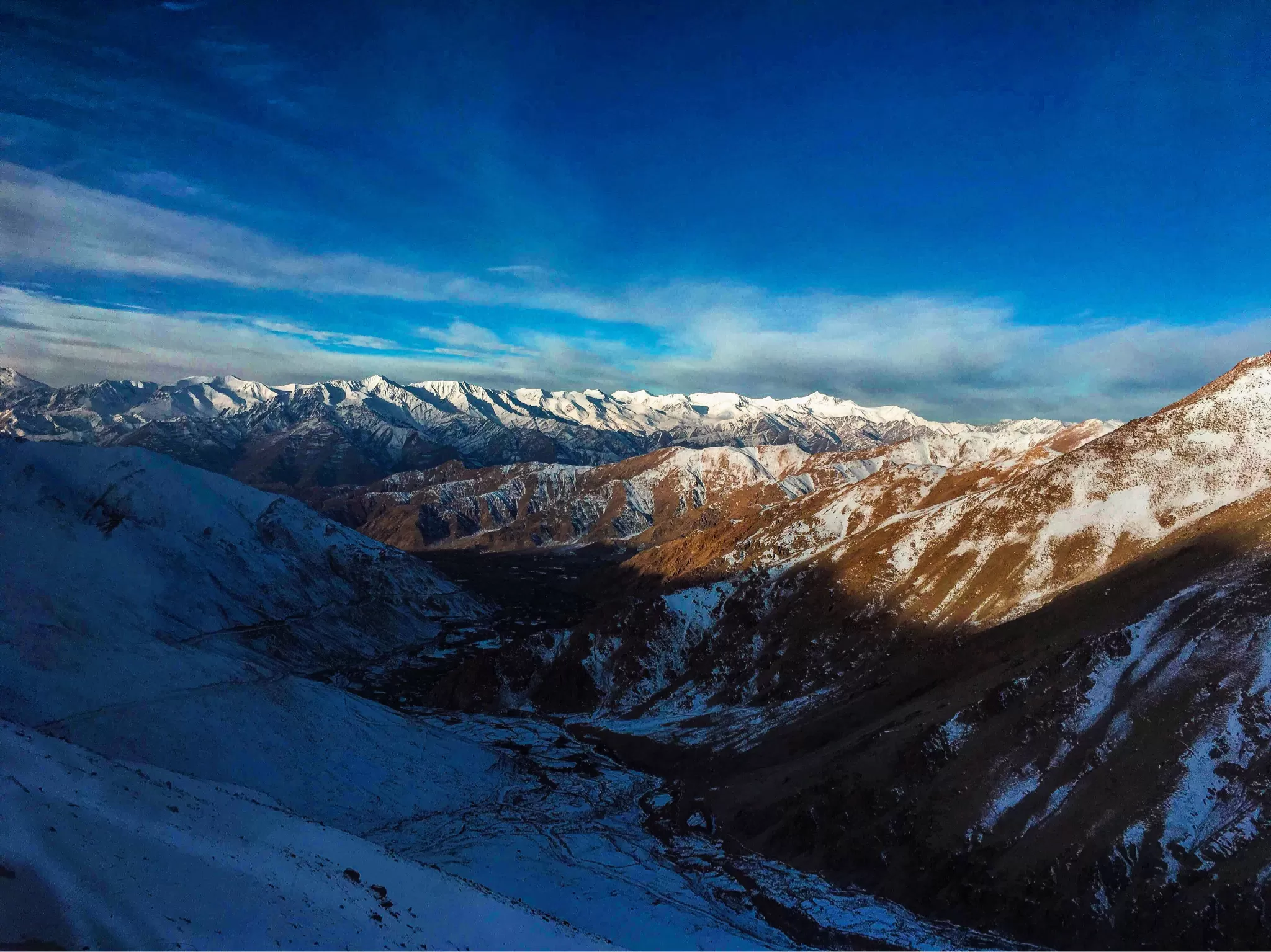
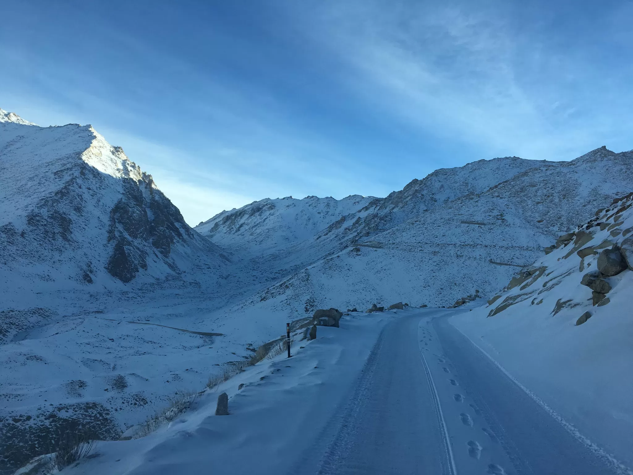
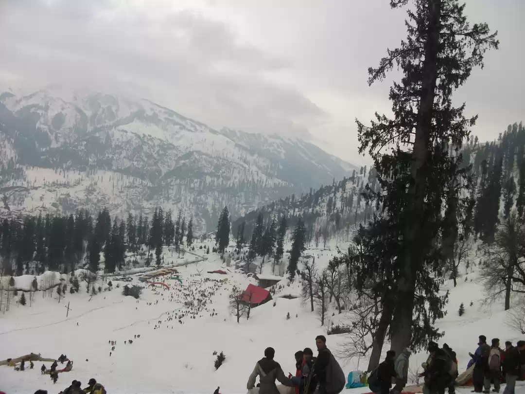
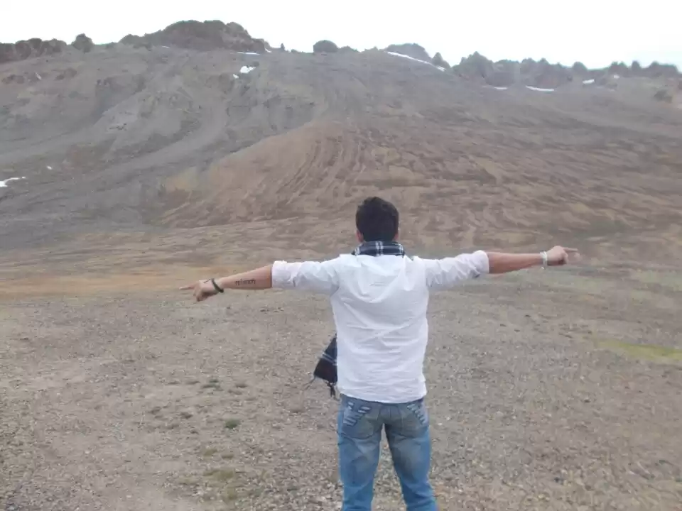
Imagine driving on a road that is higher than Mount Everest’s base camp, surrounded by snow-capped peaks, glaciers, and valleys. That’s what Changla Pass offers to the adventurous travelers who dare to explore it.

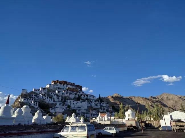
Changla Pass is a high-altitude mountain pass in the Himalayas, located in the Ladakh region of India. It is the world’s third highest motorable road, after Khardung La and Umling La, and connects Leh to Pangong Lake and Nubra Valley. It is also a popular destination for bikers, trekkers, and nature lovers, who come to witness its breathtaking scenery, challenging terrain, and unique culture.

In this article, we will tell you everything you need to know about Changla Pass, from its history and geography to its attractions and tips. We will also help you plan your trip to this amazing destination, and share some of the best experiences you can have there.

About Changla Pass

Photo of Changla Pass 1/1 by

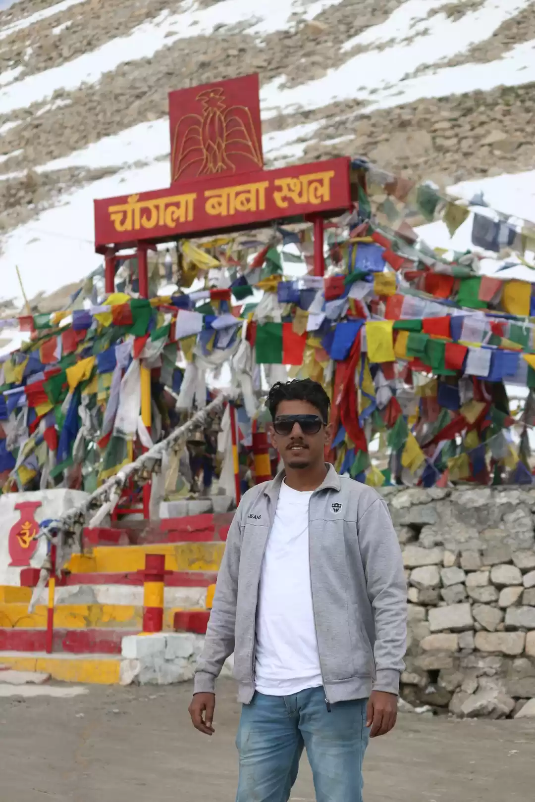
The name Changla means ‘pass towards the south’ or ‘pass in the south’ in Tibetan. It is believed that the pass was named after a sadhu named Changla Baba, who lived at the pass and meditated there. According to legend, he blessed the pass and the travelers who crossed it, and his temple still stands at the pass as a tribute. The pass is also considered sacred by the locals, who offer prayers and flags at the pass for protection and prosperity.

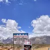
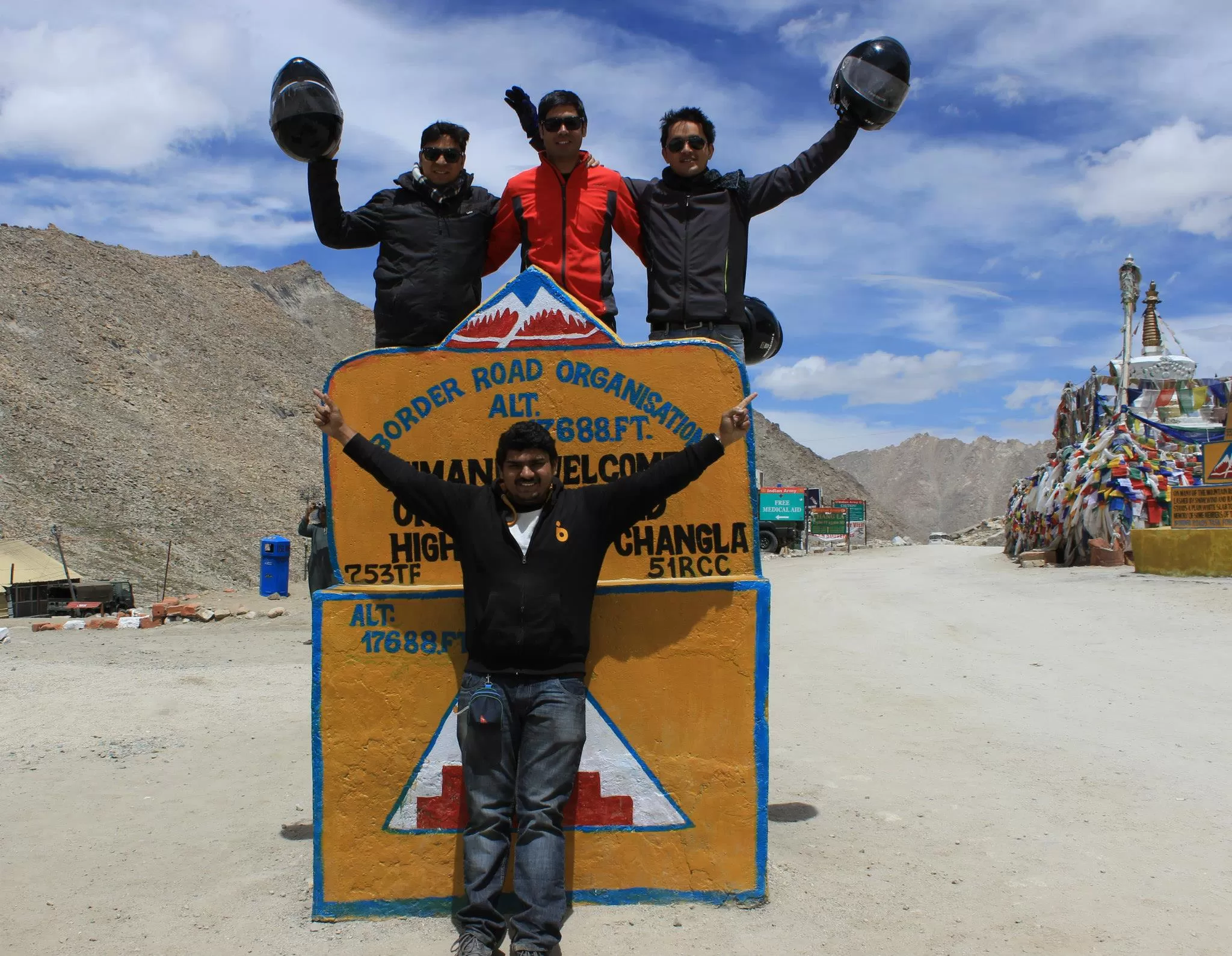
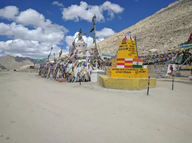
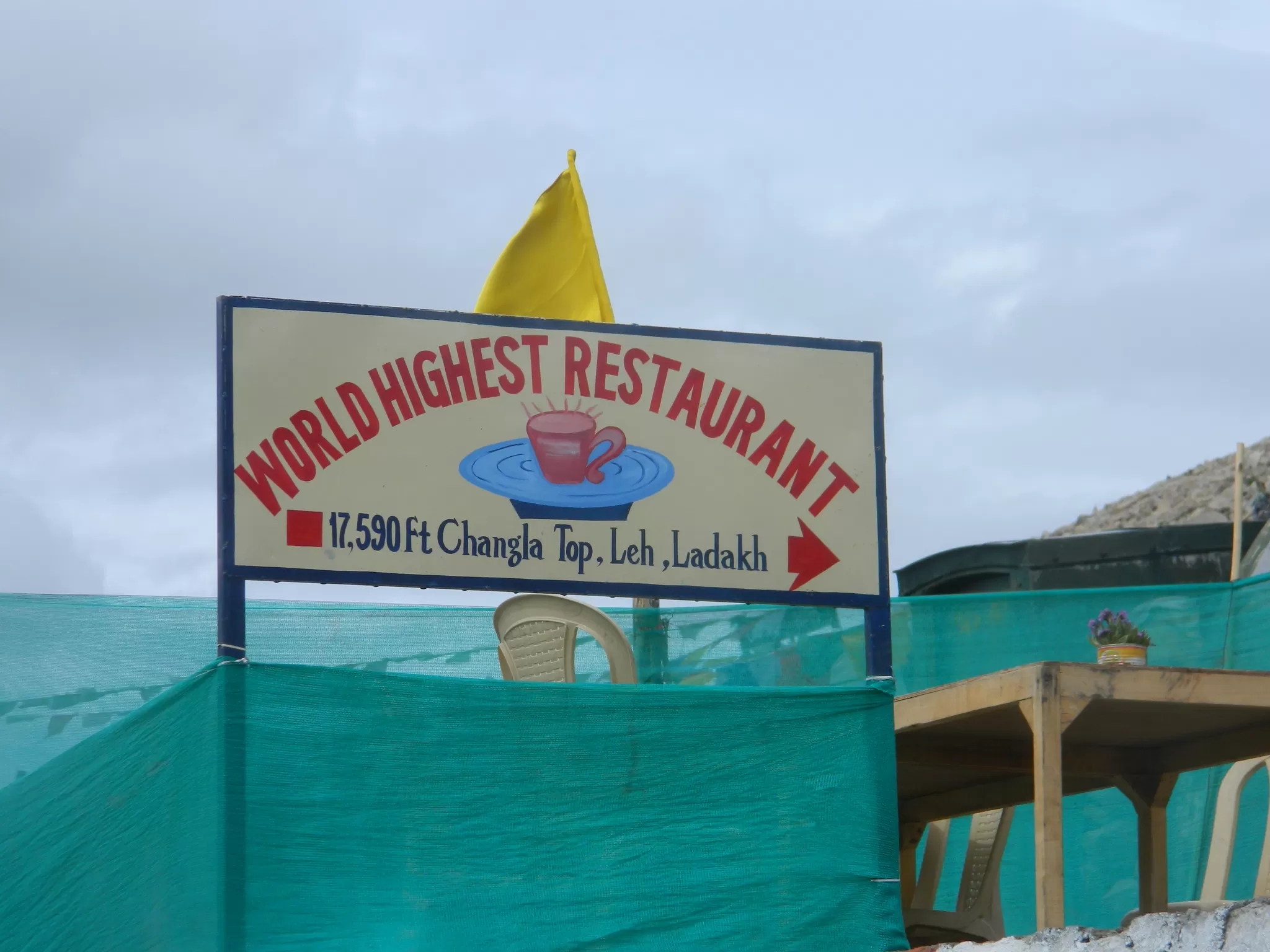
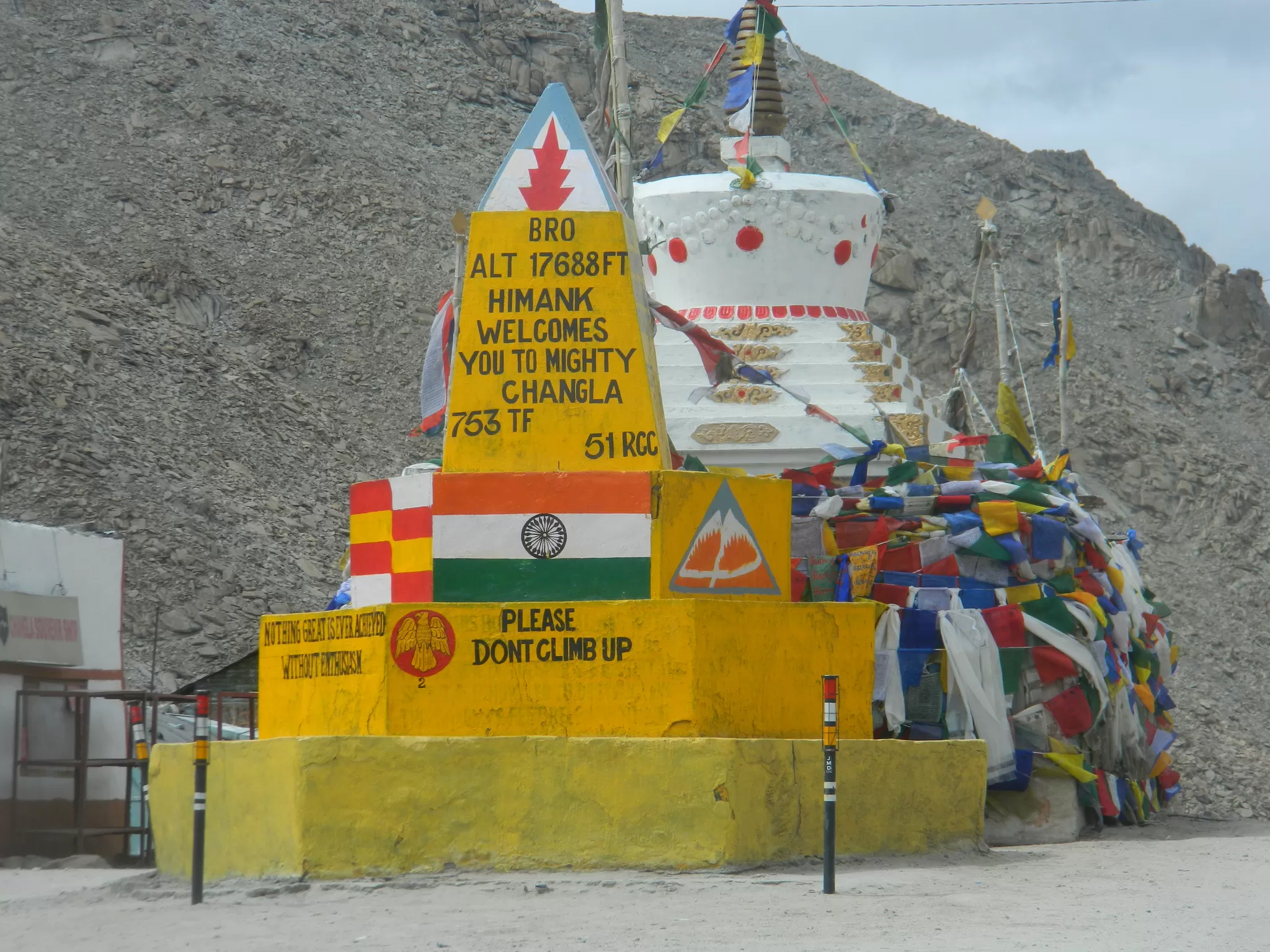
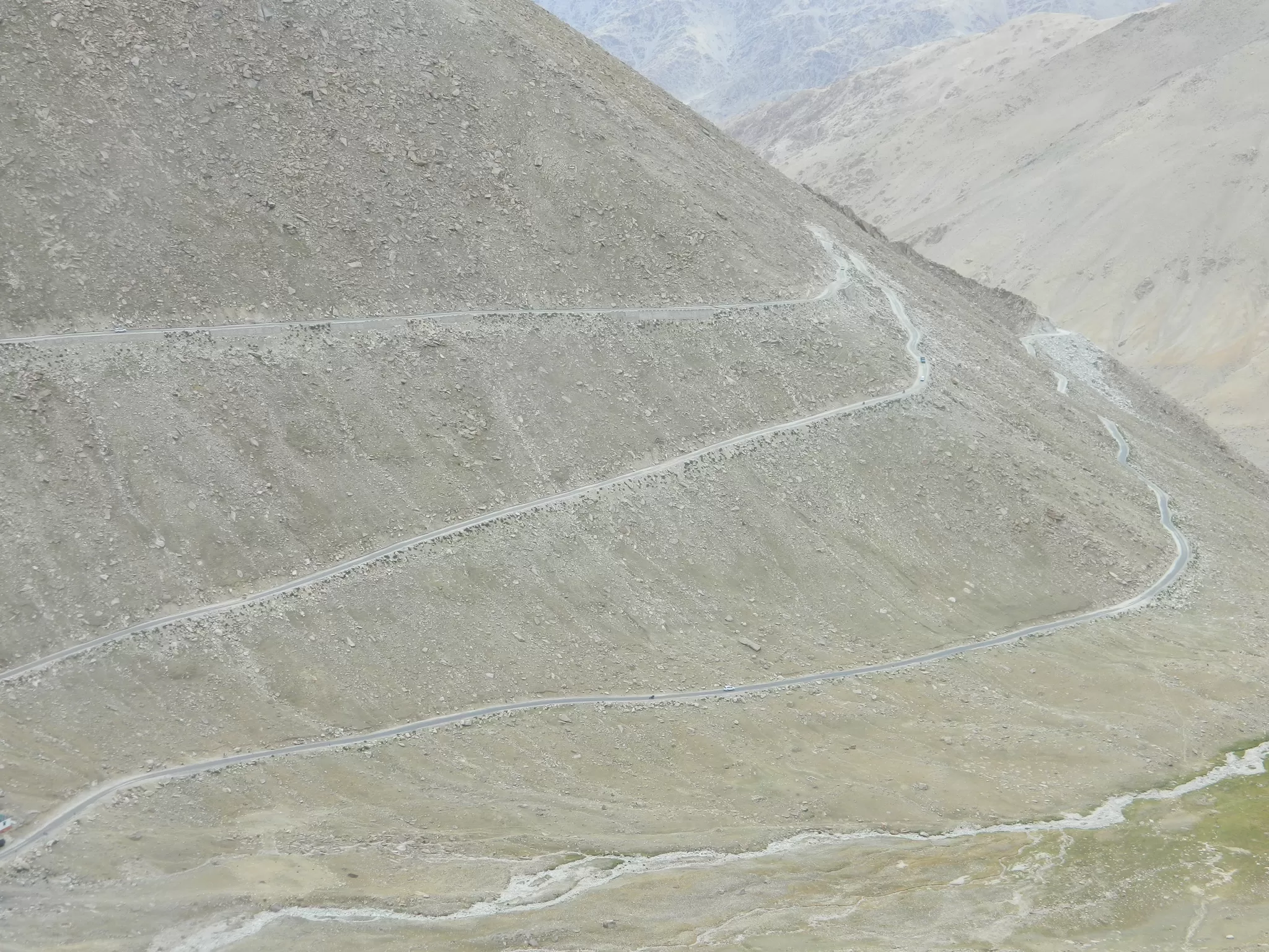
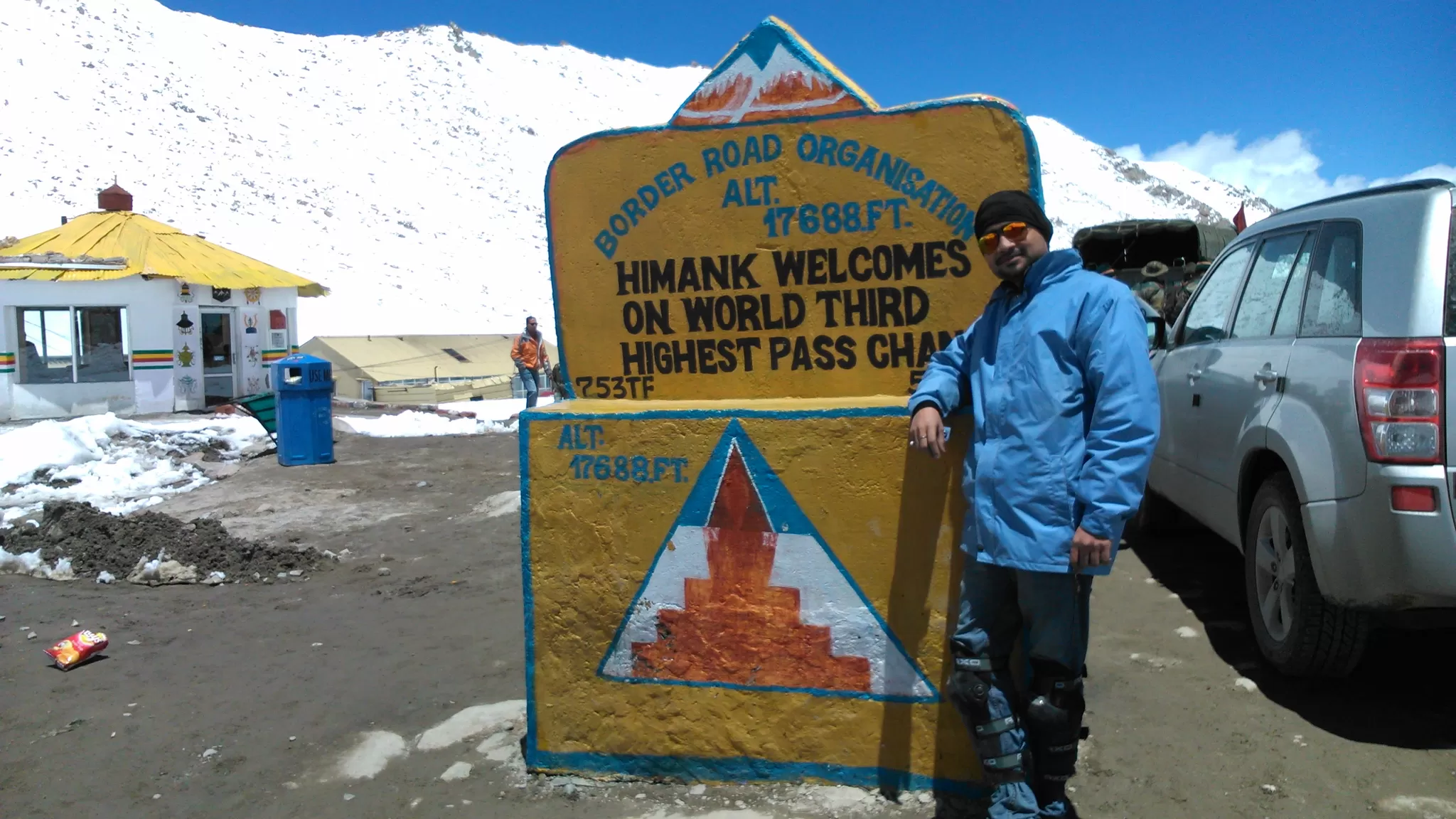
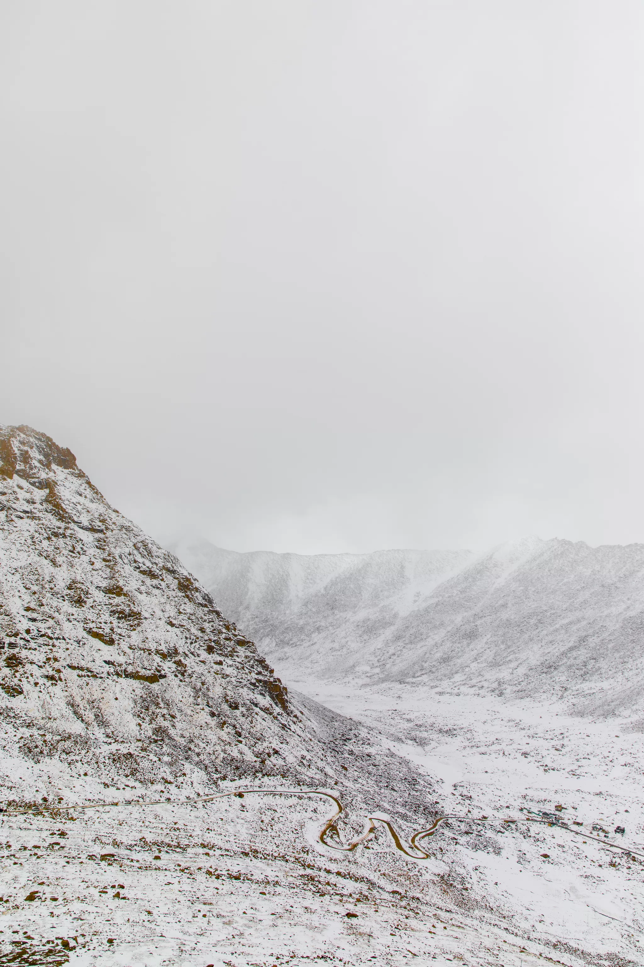
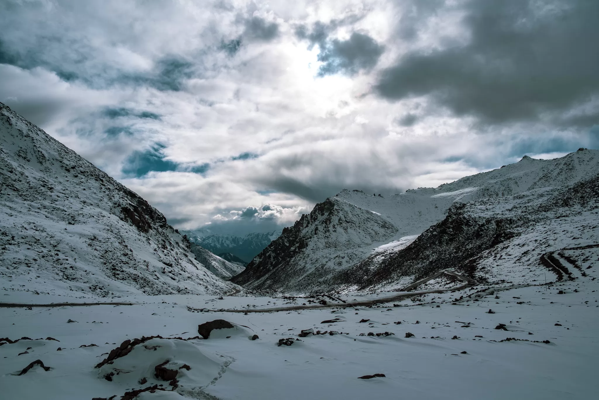
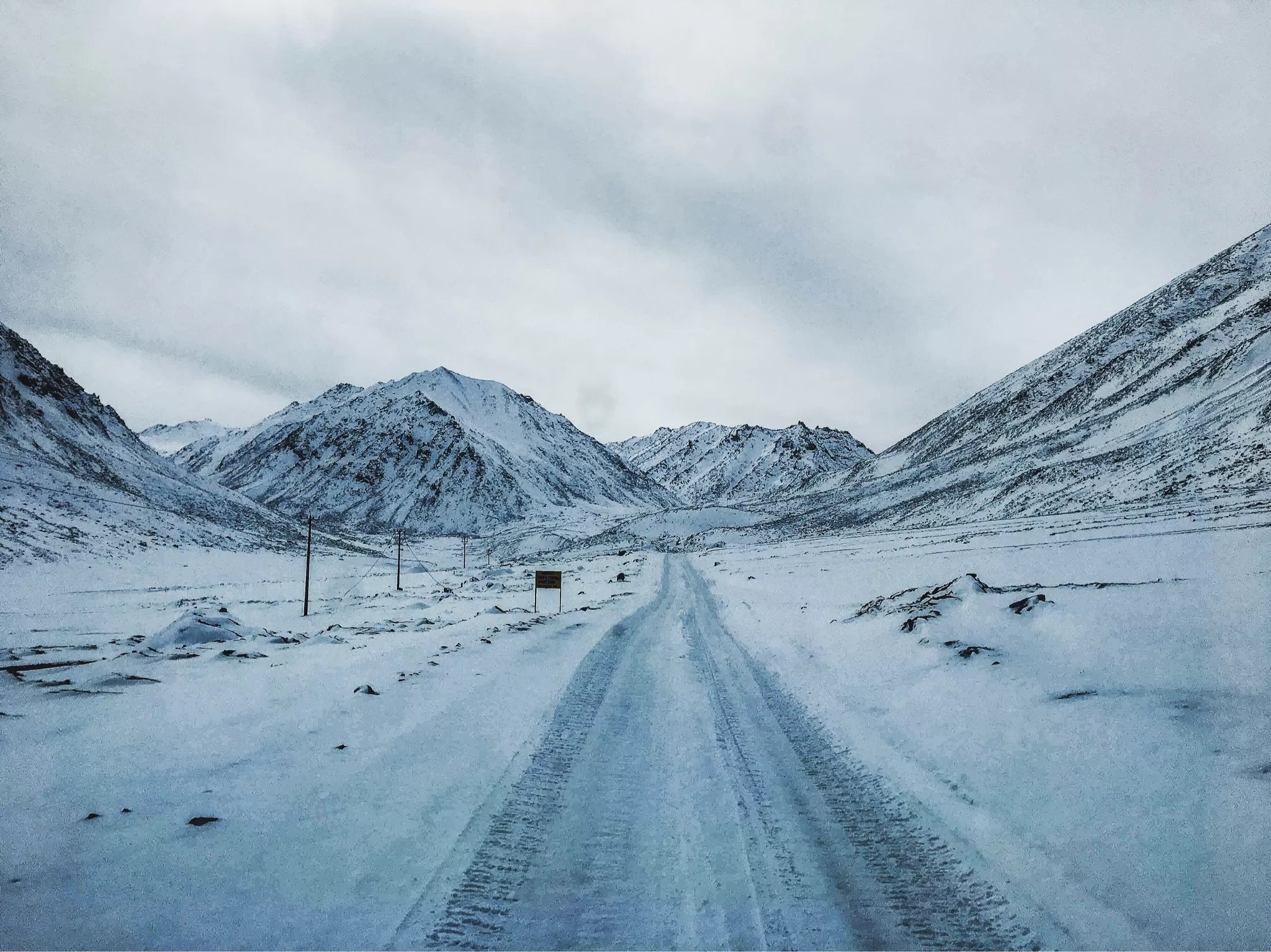
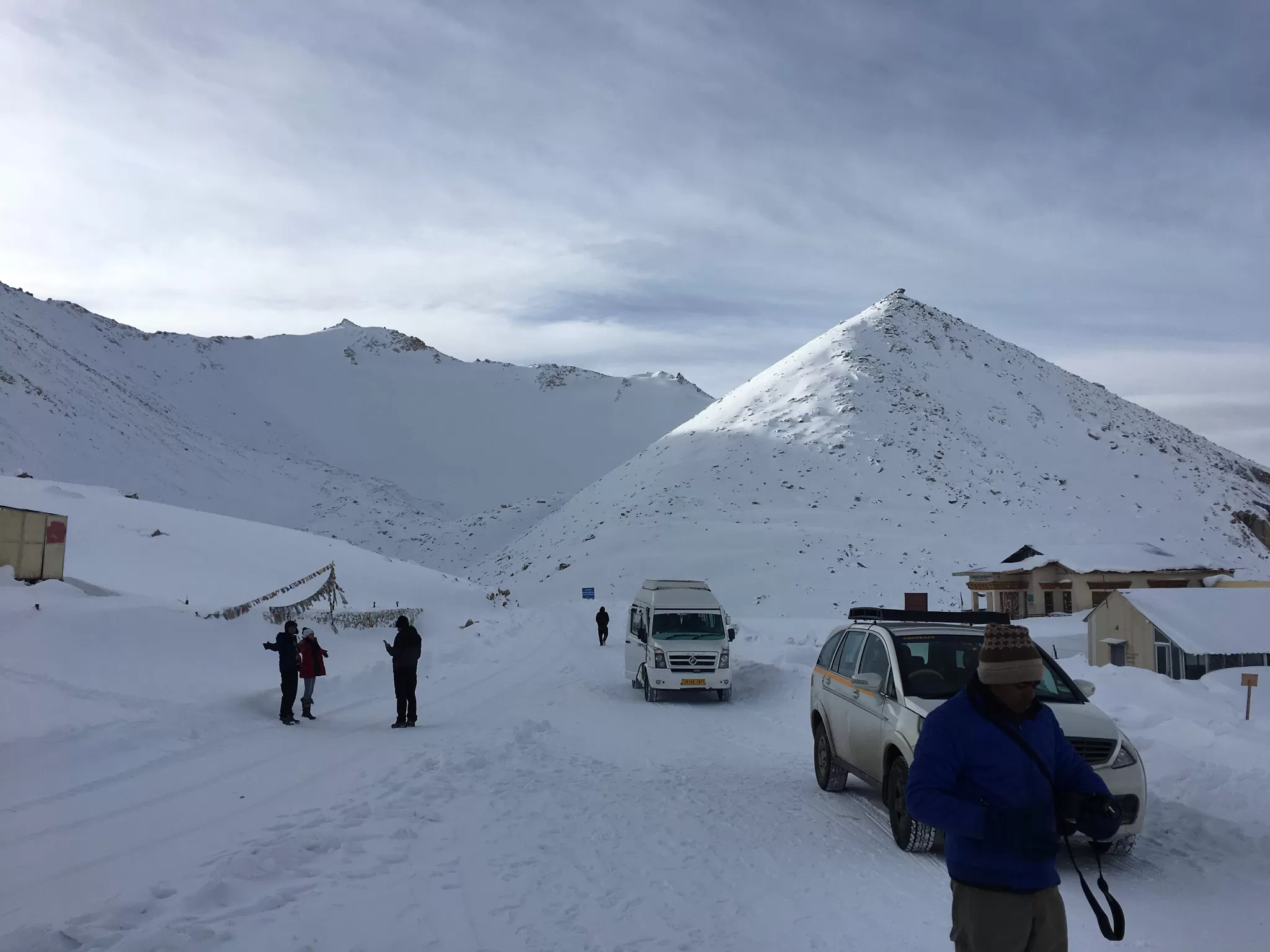
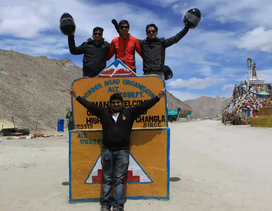
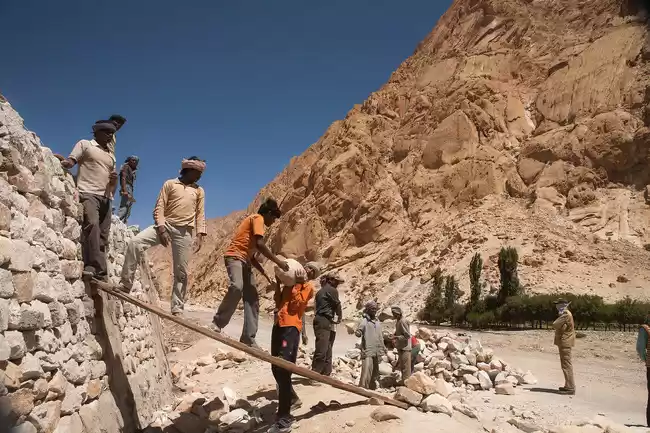
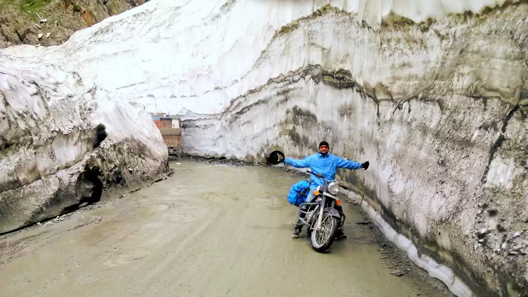
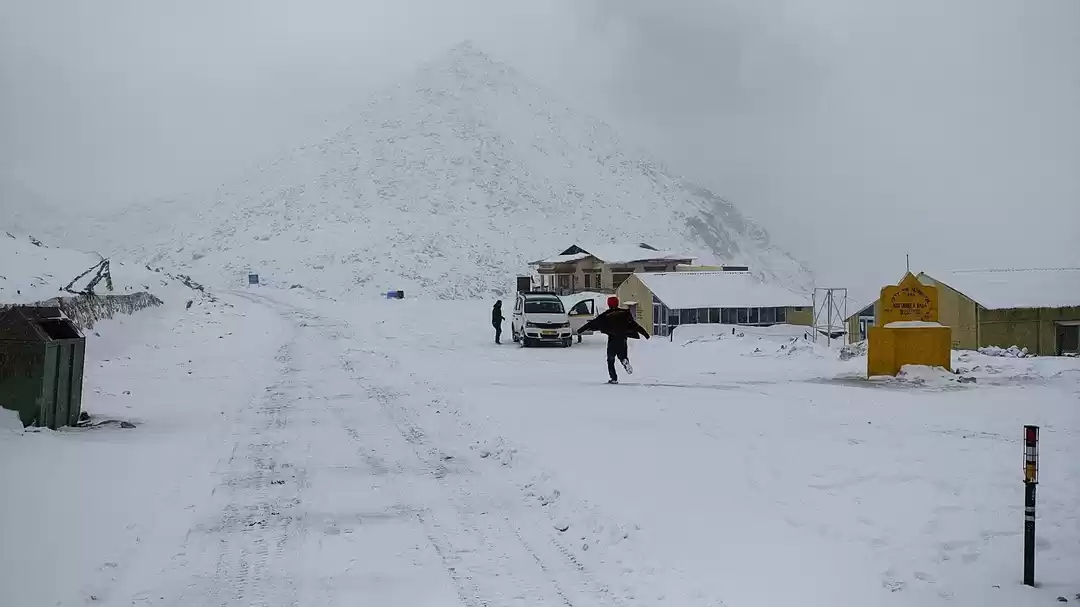
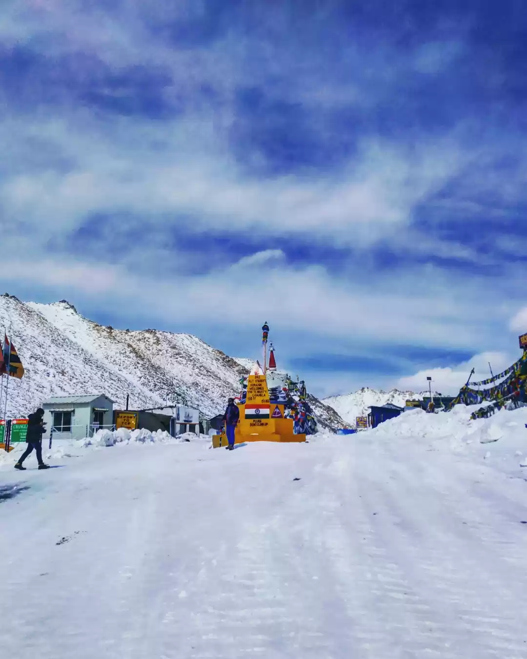
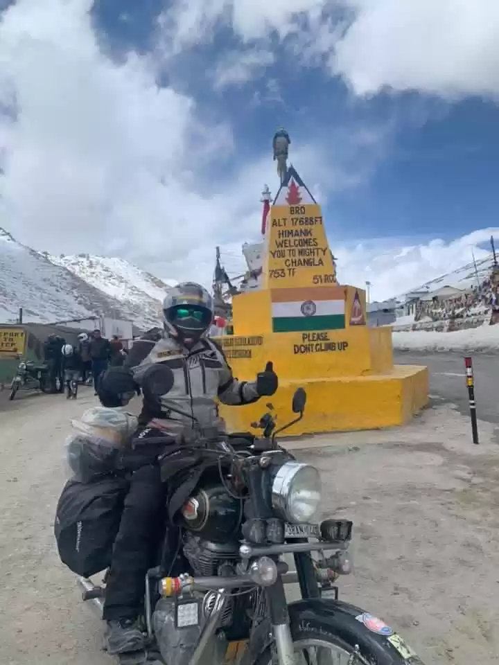
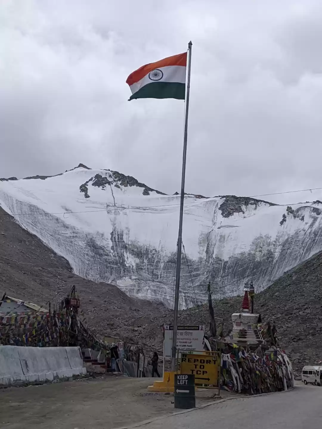
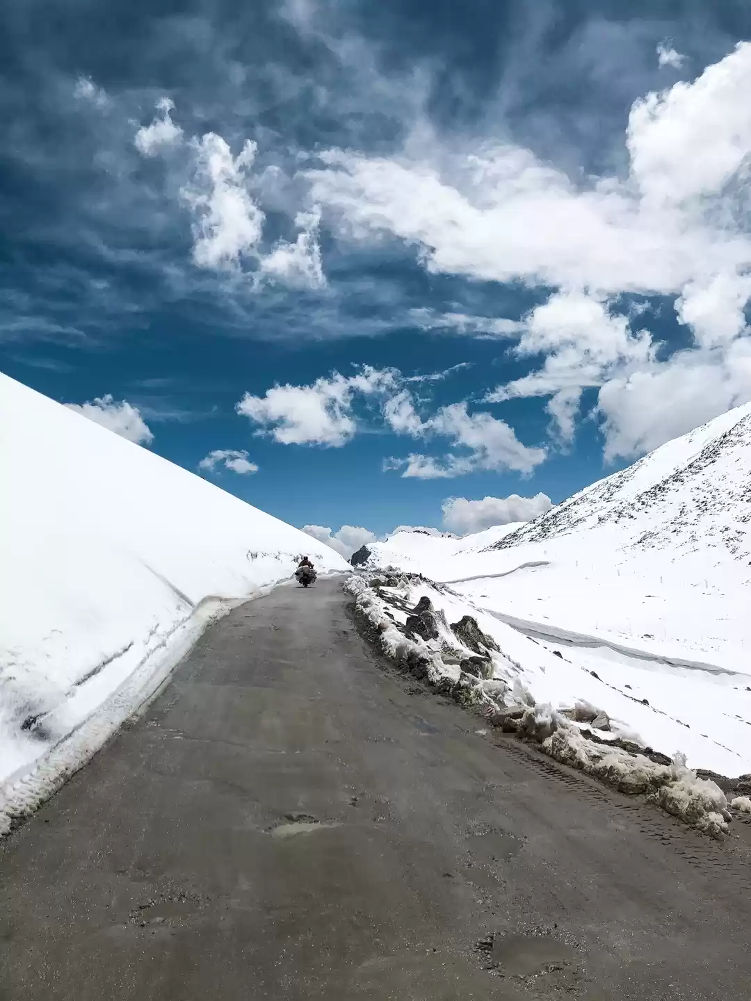
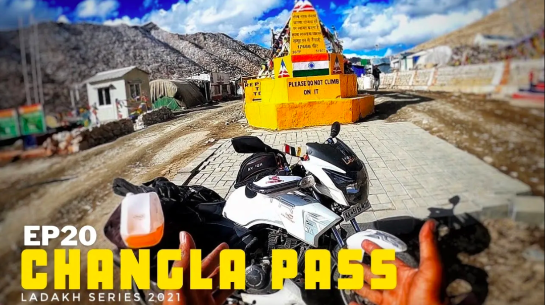
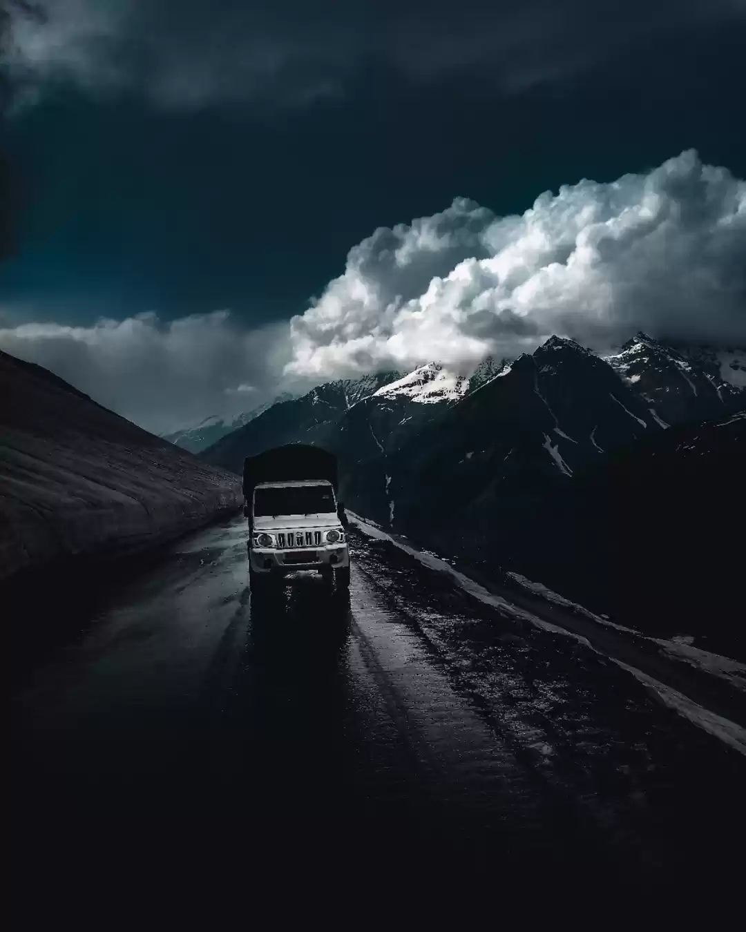
Changla Pass is located at an altitude of 5,360 meters (17,590 feet) above sea level, making it the world’s third highest motorable road. The pass is situated on the Ladakh Range, which separates the Indus and Shyok valleys. The road to the pass is narrow, steep, and winding, and often covered with snow and ice. The pass is maintained by the Indian Army, which operates a medical camp and a cafeteria at the pass for the travelers.

Things To Do At Changla Pass

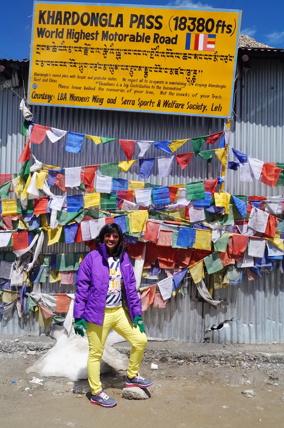
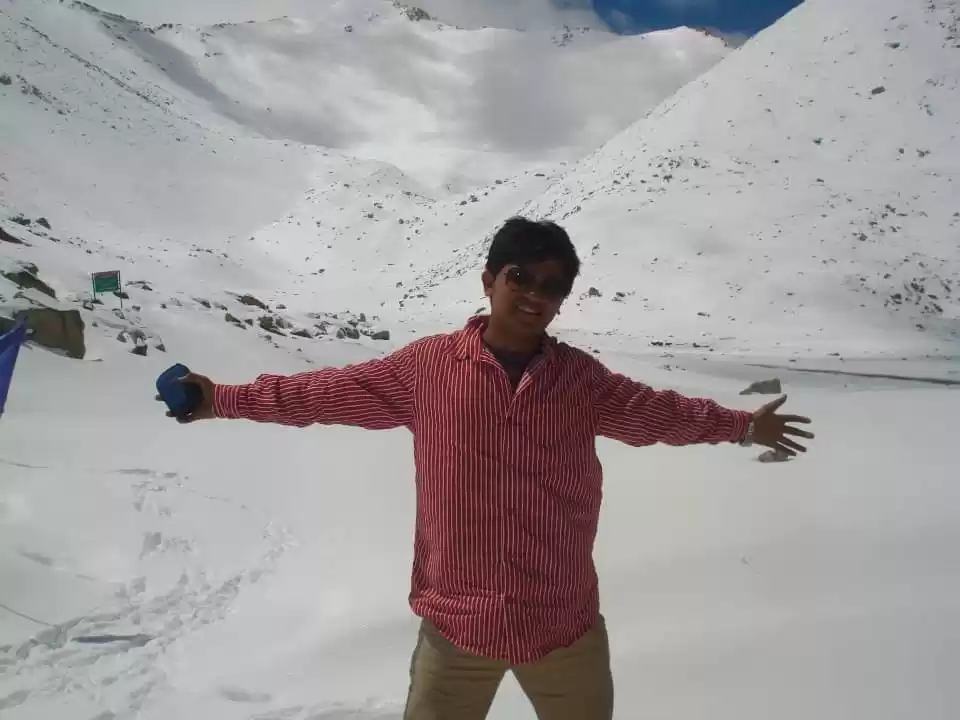
1. One of the most popular things to do at Changla Pass is to take pictures of the stunning views of the mountains, glaciers, and valleys. You can also pose with the signboard that marks the altitude of the pass, and get a certificate from the army camp that proves you have visited the pass. The photo session will take about 15 minutes, and is free of charge.

2. Another thing to do at Changla Pass is to visit the temple of Changla Baba, which is located near the army camp. The temple is a small and colorful structure, decorated with flags and offerings. You can enter the temple and pay your respects to the saint, who is believed to protect the travelers and the pass. You can also get a blessing from the army personnel, who act as the priests of the temple. The temple visit will take about 10 minutes, and is free of charge.

3. A third thing to do at Changla Pass is to have a cup of tea or coffee at the army cafeteria, which is located next to the temple. The cafeteria is a cozy and warm place, where you can relax and enjoy the hospitality of the army personnel. You can also chat with them and learn more about their life and work at the pass. The cafeteria offers hot and cold beverages, snacks, and souvenirs, at a nominal price. The cafeteria visit will take about 20 minutes, and will cost you around 50 rupees (0.7 USD).

How To Reach Changla Pass

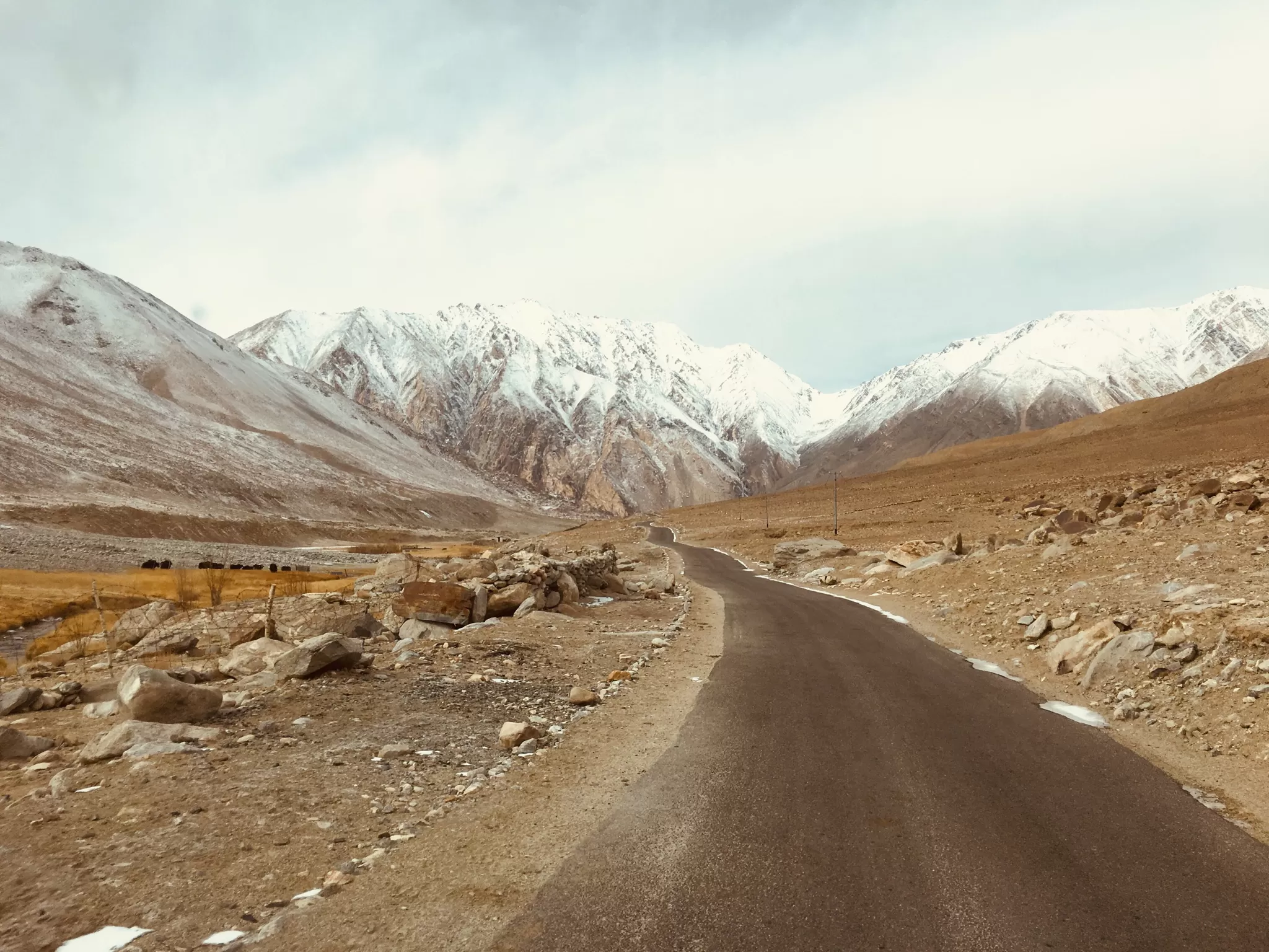
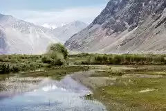
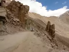
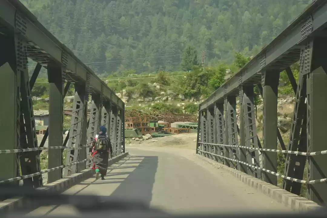
The distance from Leh to Changla Pass is about 75 kilometers (47 miles), and it takes about 3 hours to drive. The road is mostly paved, except for some patches of gravel and dirt. The road passes through some scenic villages, such as Karu, Shakti, and Zingral, where you can stop for refreshments and fuel. The road also crosses some streams and bridges, such as the Pagal Nala, which can be tricky to cross during the rainy season.

To visit Changla Pass, you need to obtain an Inner Line Permit (ILP) from the District Magistrate’s office in Leh, or online from the official website. The ILP allows you to enter the restricted areas of Ladakh, such as Pangong Lake and Nubra Valley. The ILP costs 400 rupees (5.4 USD) per person, and is valid for 15 days. You also need to carry a copy of your vehicle registration, driver’s license, and passport or identity proof, as you will have to show them at the checkpoints along the way.

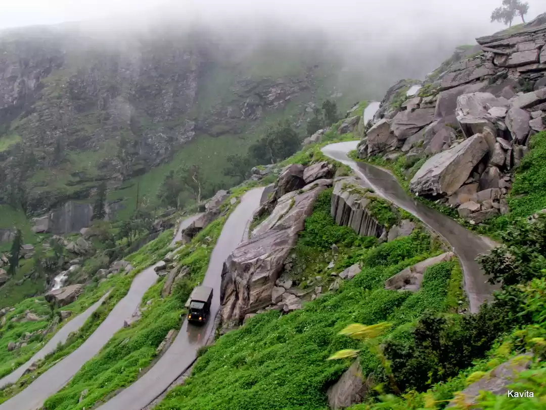
The best time to drive to Changla Pass is in the morning, when the traffic is less and the visibility is better. You should drive slowly and carefully, as the road is narrow, steep, and winding, and can be slippery and bumpy. You should also use low gear and high torque, as the engine can lose power at high altitudes. You should stop and rest at regular intervals, and drink plenty of water and fluids, to avoid altitude sickness and dehydration. You should also carry some spare tires, tools, and emergency kits, and check your vehicle’s condition and fuel level before you start.

Best Time To Visit Changla Pass

The best time to visit Changla Pass is from May to October, when the weather is pleasant and the road is clear. The average temperature at the pass during this period ranges from 5°C to 15°C (41°F to 59°F), and the snow melts away, revealing the greenery and the flowers. The road is also well-maintained and accessible, and the army camp and the cafeteria are open for the travelers.

Changla Pass is a high-altitude mountain pass in Ladakh that offers stunning views, thrilling adventure, and rich culture. It is the world’s third highest motorable road, and connects Leh to Pangong Lake and Nubra Valley. It is also a popular destination for bikers, trekkers, and nature lovers, who come to witness its breathtaking scenery, challenging terrain, and unique culture. In this article, we have told you everything you need to know about Changla Pass, from its history and geography to its attractions and tips. We have also helped you plan your trip to this amazing destination, and shared some of the best experiences you can have there. If you are looking for an unforgettable and exhilarating experience, Changla Pass is the place for you.

Changla Pass Reviews

Day 8: Pangong Tso- Changla Pass- Leh: 180kms (9am- 6pm) It was tough next morning to get out of the blanket and proceed with the daily routine. But then there was ‘sunrise’ which made jump out of my bed. What I witnessed was speechless. One has to be there to see the sunrise. It was the best sunrise I had seen till date. I have taken videos and pictures of the sunrise doing just a bit justice to it and as a memory for me. Next was freshening up with the cold water. I was ready, lubed my bike’s chain and was ready to go to the lake again. I enjoyed my ride along the shores of the Pangong. I spent some quiet time near the shore and just enjoyed the moment. Captured some final shots of the place from every possible angle and decided to proceed further to Changla pass with different shades of alluring Pangong Lake in mind. Next was the Thiskey Monastery before Changla pass. From a distant only one can see the huge statue of Buddha. Parked down the bike and then I climbed up to see it more closely from inside. Peace was in the serenity and I could feel it. Went through some of the preaching’s of Buddhism, prayed for some best wishes and enjoyed the view from the top and finally heading for the Mighty Changla. Actually while in the monastery I met a group of ladies of 6, who must have been in there 40’s and were on a road trip. They were from Mumbai and were glad to know me when I said them that I was riding from Pune. They warned me of the biting cold at Changla that they had encountered. I actually underestimated their advice as I had been to Khardungla. Though Changla pass is at a less height than Khardungla and is the 3rd highest pass, but the cold here is biting one. The roads were wet and slippery. Except the road, surrounding mountains were covered with ice and gradually at the bottom were patches of brown and white. Snow was in plenty here. I opened the helmet and within seconds my eyelids, nostrils were covered with tiny bits of ice. The cold here was something I had underestimated. So before it could get me I clicked few pictures and was ready to get down. After descending a few kilometres I could finally feel my fingers. After that the roads were good till Leh. It was around 6pm I reached Leh and went to the same hotel where I had checked in previously. Again there was this satisfaction having encountered these places which I had accomplished after riding continuously for 8 days. Though it was 2-3 degrees C at night, the weather at Leh now was quiet manageable having spent some time in the harshest conditions that I will ever encounter.
Well moving on, we hit the road again as we bid goodbye to this beautiful lake. We were headed back to Tangste where again tokens were checked. Soon after that we started our climb to the Mighty Chang La, the roads are not in best of shapes but one thing for certain BRO is like a real brother to everyone who travels on these roads they do an exceptional job of keeping roads in shape from military and civilian population alike. It was soon when we reached the top of Chang La, the second highest pass in the itinerary we were following. Although, there is not much of a difference in the height as that of the Khardung La, when we reached the top we did not feel as bad as we did in Khardung La. Probably we were acclimatized better. We took a lengthy break there for lunch around 1:30 p.m. Yippee noodles, Lays, Kurkure and a nice cup of coffee and we wear set until the evening. Roads after descending Chang La were in a better shape and we reached Karu around 5:15 p.m. and headed straight to Hemis monastery. This monastery is located surrounded by mountains on every side. It's a beautiful place to spend some time. There is also a Hemis museum which is a must visit. It walks you through the stages of Buddhism, how it evolved and spread in Ladakh region. Later we moved towards Thiksey monastery. His Holiness Dalai Lama was scheduled to visit the Monastery on 9th of August 2016. Every Monastery official was busy doing the beautification work around the area. This monastery has a similar statue of Maitreya Buddha as the one in Deskit monastery. A monk here explained the whole story of the Monastery, also gave us some insights into Buddhism. With that knowledge we left the monastery and started towards our newly found home, YES I say home cause the feeling of going home has started creeping in everyone's mind. As promised we headed back to our Green View. Got our bags, freshened up a little and went out in search of some good food. On this day as I said in my earlier post, we went to this place called Bon Appetit, a Continental delight. Good food, drinks, awesome climate and friend for life, what more you require man !! We ended the day there and went to sleep.
The excruciating troubles to mind and body on the climbing roads seemed worthwhile once we reached the top of the pass.The landmark on the top of Changla pass reads that at 17,600 feet it is the world’s 3rd highest motor able road which is as disputable as many such claims on many such passes in Ladakh. As we stepped out of the vehicle on the pass it dawned on us as to what it feels like standing at 5300 meters above sea level,more than 5 km high up. Brazen icy winds lash your face and it takes quite a bit of time to reorient your mind to these highly inhospitable environs. After the quick acclimatization drill at the top ,your eyes are set on one of the most beautiful mountain passes in Himalayas.The world of white peaks all around you and a constant breeze blowing across your face.The air is thin and devoid of adequate oxygen,the side effects of which can be very demanding.There is an Army camp at the top who provide assistance to victims of altitude sickness by providing oxygen breathers in their camp site. Chang La translates to (Chang-south,La-pass) The pass in the south which is the gateway to the exceedingly charming valleys and highlands of the Changthang. There is a small temple dedicated to some mythical Changla baba at the top of the pass and many claim the place to be named after him,but it is not so. The name clearly suggests a pass to the lands lying south of Leh. Apart from the military camps and the temple of Chang la baba, there is a much needed Cafeteria located which provides you among many other things –delicious black tea. And seeping a cup of tea at 5300 meters will put many things into perspective. he frozen world of Changthang lies beyond the pass of Chang La. As we slowly descended down the pass into the other side,a heavy cloud of mist hung over the valley. The dark clouds soon gave way to light snowfall further down and when the visibility drew to a naught at a point,we stopped to take a look at the mist-shrouded surrounding.The white sheets of ice were cracking open in spring time to reveal green pastures beneath and several water streams sparkled in the creeks of the
Today was the day when we were suppose to say goodbye to the picturesque Pangong Tso lake and head towards our next destination which was Karu 35 kms before Leh. Had our breakfast which consisted of paranthas, bread n omlette, milk, coffee or tea. So after having our breakfast started for Karu but hardly going ahead for 10kms we were stuck as Border Roads Organization ( BRO) was overtaking the road relaying work. So after a delay of approximately 40mins once again started for Karu and reached Durbuk from where we take a left turn from the Trijunction to mighty Changla Pass which is not the highest motorable road but this pass is even tougher than it's big brother and highest motorable road in the world Khardungla pass as the terrain to reach the summit is far more tough than the Khardungla pass. So reached Changla after going thru the rough terrain which took us an estimated time frame of an hour and a half and than it was time for some photo session as usual. After a quick photo session op we again started for our destination of the day Karu. The initial patch post leaving Changla pass was good but than happiness was short lived as after that there is road laying work been carried by the BRO. After Cross the off-roading patch of approximately 10kms reached the flats area which consisted of tarred roads on which we were easily able to do 80-90kmph or more sometimes but with all the safety gears and caution. We reached Karu at around 2pm ahead of our schedule so instead of going directly to our hotels in suggested my riding group of going to Thiksey monastery which was hardly 17kms from our hotel so we went there spent some quality time at the monastery had our lunch and than went to our hotel in Karu finally at 5pm.
Changla is again avalanche prone area and it was really cold, probably because it was early morning. They have a decent shop there, you can use the restroom and the tea is really nice. You can also purchase woolen gloves for Rs 300/- made up of pure wool and really warm. After few minutes we left from changla and drove ahead. Your driver will halt at one of the check post to show your permit, here there are some pretty café’s, you can spend some time here as well or use the restroom for 10rs. Nubra valley is connected to Pangong through a road used by army officials mainly. This road isn’t for tourist and not maintained well also. But some people directly go to Pangong from Nubra for it will not only save time, but also you won’t have to travel all the way to leh and come back for pangong on a different day. This road doesn’t have any check post and is really rough so our driver didn’t take a chance. The drive after Changla to Pangong is spectacular, amazing scenery with breathtaking views of the barren mountains which keeps on changing colors with every turn. You could see the frozen grassland, green pastures, the lovely Pashmina goats a.k.a Changthangi (is a breed of goats inhabiting the plateaus), himalayan marmots (so adorable), himalyan hybrid cattle as well. If you have an option, go for camping in Pangong instead in Nubra. I wish I could do so in the future. Zero mobile networks again. The roads will further get narrow and you have to cross through the roads with huge pile of stones on both the sides. You will feel lost in the valley if you are traveling alone. It will be hard to spot any human or shop for long distances.
Photos of Changla Pass
Planning a trip soon?
Unlock the Perfect Getaway with us
See Packages for Leh Ladakh