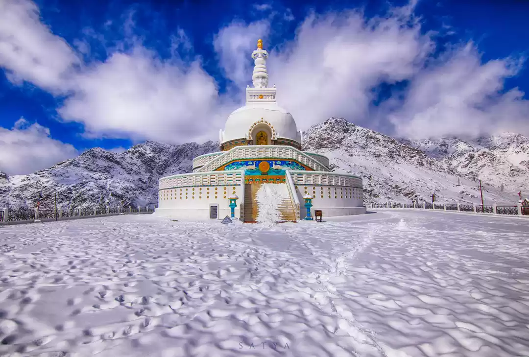


It was the 10th of June and there were still possibilities of heavy snowfall in the upper passes of the Himalayas.The winter of 2014 had been a harsh one with record ice and snow on the mountains with many passes yet to open.But the day looked cheerful for a trip down to the wonder called Pangong Tso.
We started from Leh early in the morning for the lake which is around 150 km from the district headquarters of Ladakh. Passing through green valleys and fields near Shey we began a very steep climb again further up the Ladakhi plateau. Leh is at 11,600 feet above sea level and we were still gaining height on the road. The stunning landscape stood in beautiful contrast to the blue sky and the road was taking us beyond earth itself.The colors of land below changed in the distance and many monasteries stood on stiff mountain faces as if hand painted by someone.As we left behind the settlements at Tangste village were climbing towards the Changthang plateau which is a part of the proper Tibetan highland.The plateau extends from Western Tibet into Ladakh in India.
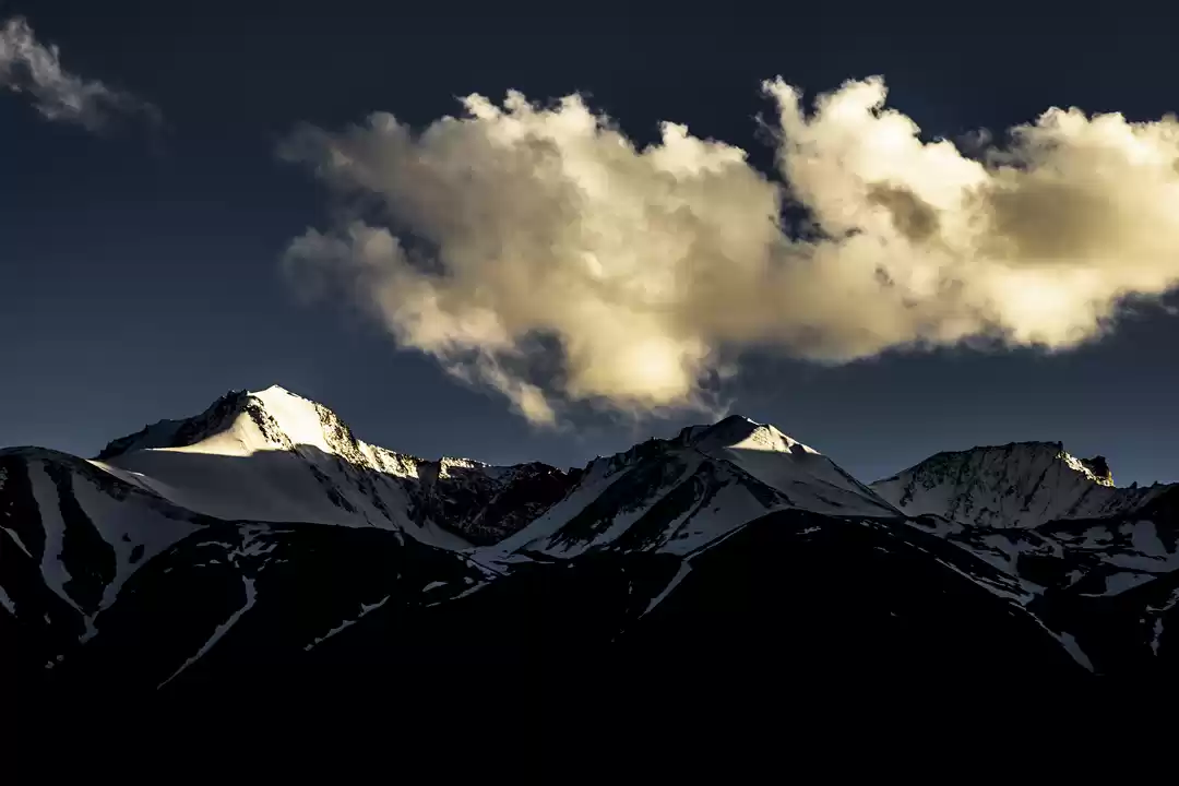
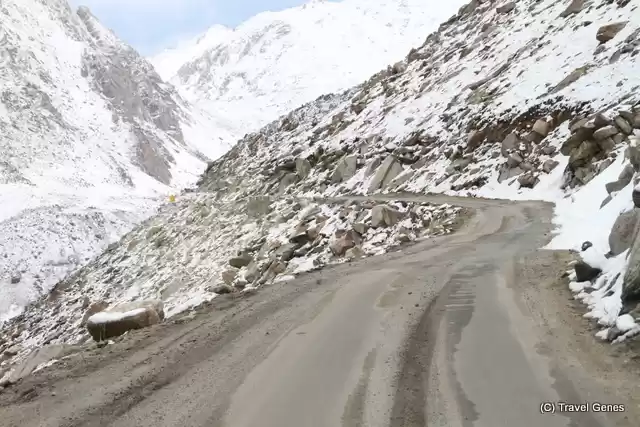
The vehicle was moving into the cold mist and cloud and slowly the green valleys down below started to disappear.Even after spending a few days at Leh,the occupants in the vehicles were starting to realize what less oxygen was doing to the body.A moment of nausea and dizziness had gripped many in the group.But we tried to distract the mind towards the snow peaked mountains and the changing colors in them due to unpredictable sunlight.The floating clouds cast moving shadows on the mammoth peaks.The nerves in the mind and body settled down as a hint of rainbow showed up in the horizon…..and there were small snow flakes landing on the vehicle as we neared the top of the mountain pass.
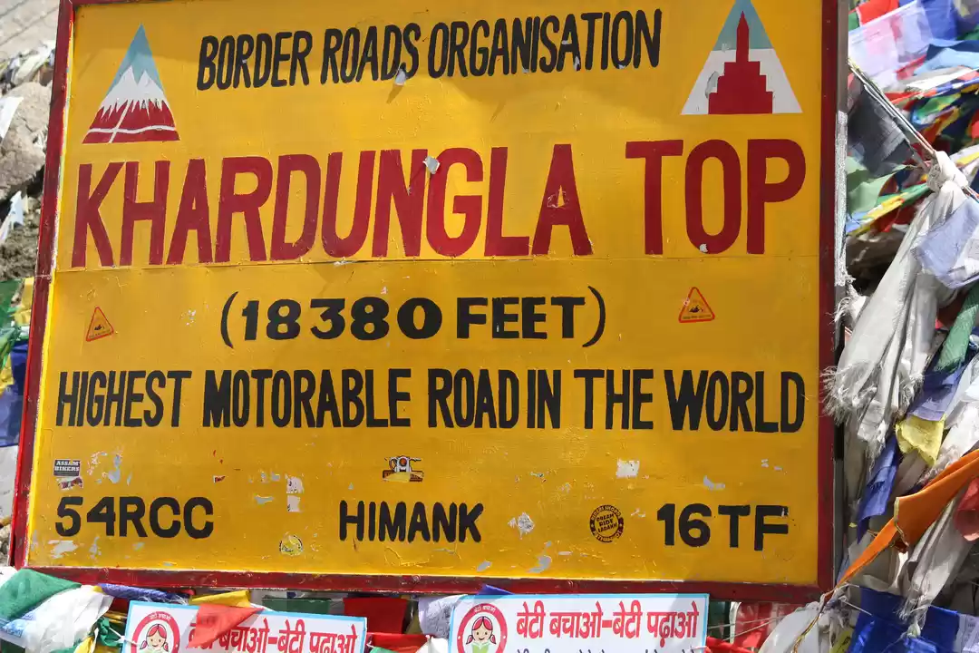
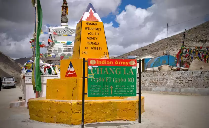
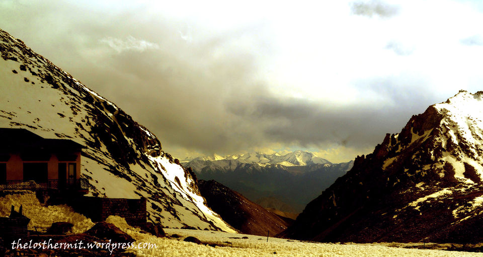
The excruciating troubles to mind and body on the climbing roads seemed worthwhile once we reached the top of the pass.The landmark on the top of Changla pass reads that at 17,600 feet it is the world’s 3rd highest motor able road which is as disputable as many such claims on many such passes in Ladakh. As we stepped out of the vehicle on the pass it dawned on us as to what it feels like standing at 5300 meters above sea level,more than 5 km high up. Brazen icy winds lash your face and it takes quite a bit of time to reorient your mind to these highly inhospitable environs. After the quick acclimatization drill at the top ,your eyes are set on one of the most beautiful mountain passes in Himalayas.The world of white peaks all around you and a constant breeze blowing across your face.The air is thin and devoid of adequate oxygen,the side effects of which can be very demanding.There is an Army camp at the top who provide assistance to victims of altitude sickness by providing oxygen breathers in their camp site.
Chang La translates to (Chang-south,La-pass) The pass in the south which is the gateway to the exceedingly charming valleys and highlands of the Changthang. There is a small temple dedicated to some mythical Changla baba at the top of the pass and many claim the place to be named after him,but it is not so. The name clearly suggests a pass to the lands lying south of Leh.
Apart from the military camps and the temple of Chang la baba, there is a much needed Cafeteria located which provides you among many other things –delicious black tea. And seeping a cup of tea at 5300 meters will put many things into perspective.
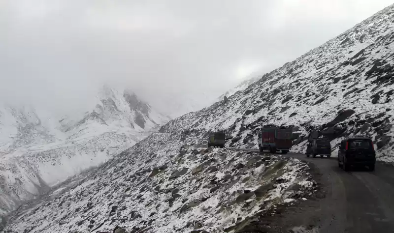
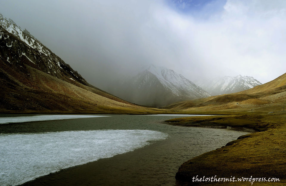
he frozen world of Changthang lies beyond the pass of Chang La. As we slowly descended down the pass into the other side,a heavy cloud of mist hung over the valley. The dark clouds soon gave way to light snowfall further down and when the visibility drew to a naught at a point,we stopped to take a look at the mist-shrouded surrounding.The white sheets of ice were cracking open in spring time to reveal green pastures beneath and several water streams sparkled in the creeks of the
We trekked down to a lake which was half frozen and with the mist hanging over it,the place looked straight out of someone’s dream.The harsh winter in Changthang valley was gradually giving way to mildness of the spring.White ice giving way to pastures of green and yellow and hints of wildlife like the Marmots peeping from behind large rocks,the landscape is awe inspiring and magical in the early morning climate.Much of the Changthang plateau lies in Tibet and a very substantive area extends to eastern Ladakh.The Changthang Wildlife Sanctuary is demarcated by the two famous lakes in the area-the Tso Moriri and the Pangong Tso.
Though stunningly beautiful to look at,the meadows and valleys of Changthang are very inhospitable due to the harsh climatic conditions.The highlands of the plateau are inhabited by a nomadic tribe called Changpa who are Tibetan in origin.Around small hamlets in the valley,the Changpa people can be seen taking their livestock topastures.The sanctuary is home to many indigenous Himalayan wildlife as the black necked crane,ruddy shelducks,many rare species of gulls and animals as the marmot,the Tibetan gazelle,the blue sheep and the kyang(Tibetan wild ass).A bright sunlight can give way to a sudden hailstorm of rain and snow within minutes here.Sudden change in climate forced us to abandon our romantic hallucinations in the valley and move on.Changthang is a harsh but soothing place,may be we are saying this from a traveler’s point of view without facing the fury of nature as the natives have done over theyears.In a manner of saying,we admire the strong and hardy nomadic tribes who live in these lands and have done so over generations.The valleys in places like Kashmir or Manali are easy on the eye to behold,but these parts of Ladakh have a very rugged beauty to them and it stays with you for a log time.May be because these places are rare and difficult to travel to,may be because the place just overwhelms you while you stand there.
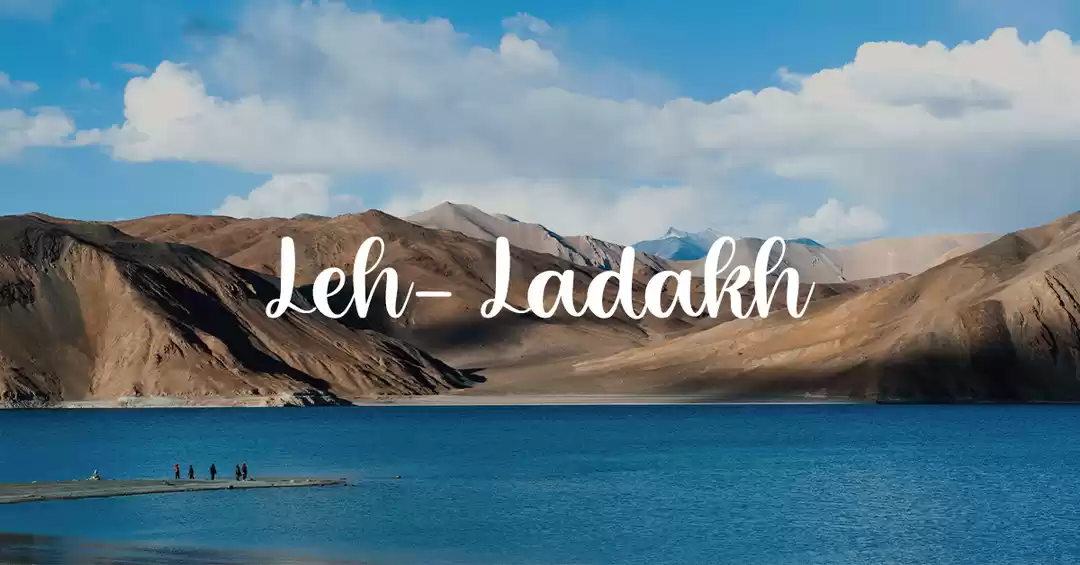
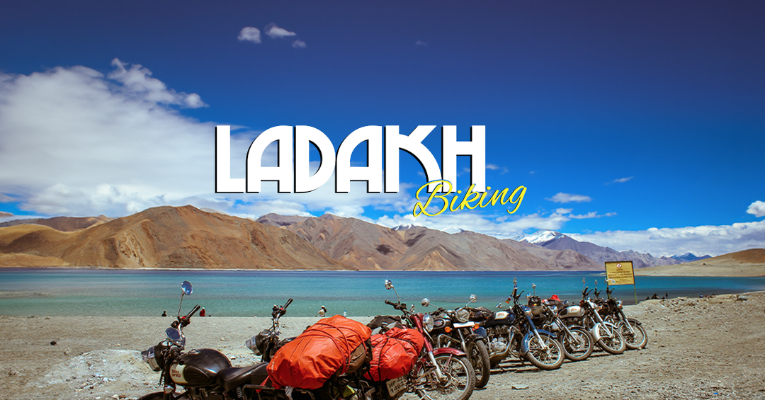
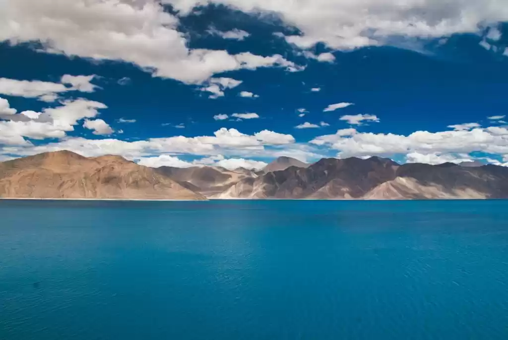
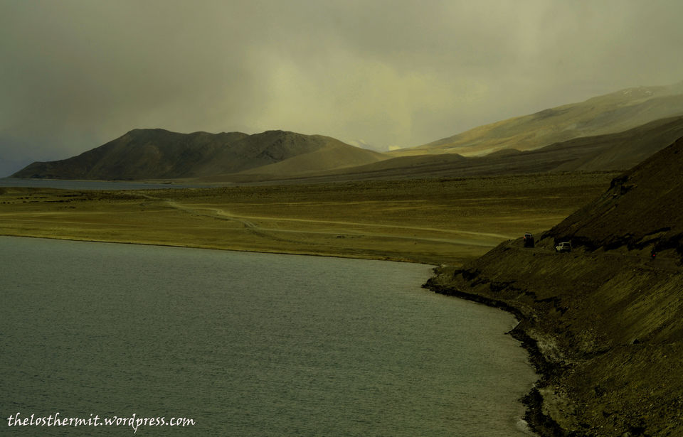
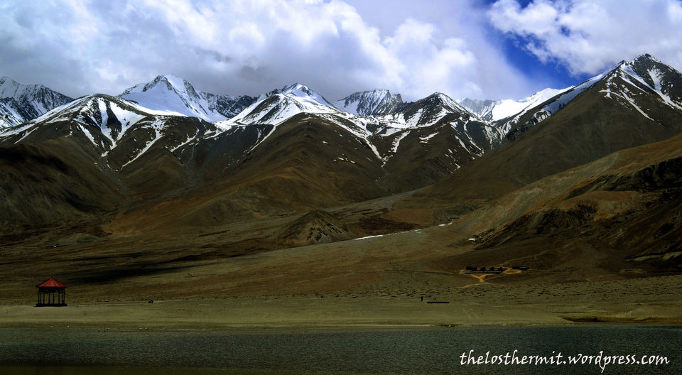
Biker gangs whiz past the stark and barren valleys on the road and the steep mountain roads in Ladakh have some very interesting road signs put up by BRO(Border Roads Organization) which can keep you amused on the road.There are entire books dedicated to these “Road Signs” in Ladakh and elsewhere,where travelers have tried to compile all of them at one place.And suddenly among the rock faces you notice a tinge of blue water,the first view of the world famous Pangong Tso.(Tso-means lake in Tibetan)
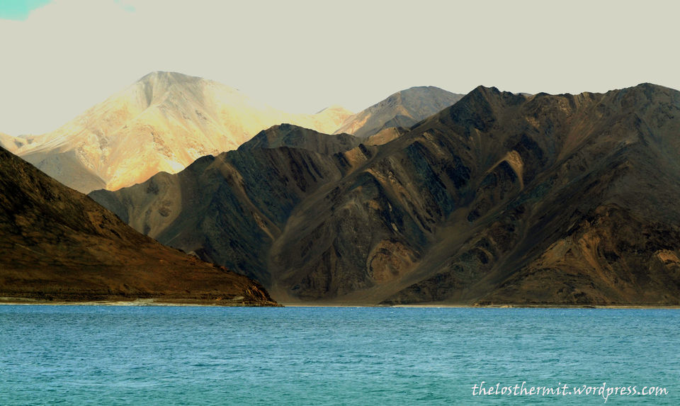
As we arrived at the lake around mid-day,a huge storm of a cloud followed us down into the lake and lashed cold rains in the valley.Once the weather cleared again and sun shone through the clouds the lake of Pangong stood like a beauty.The crystall blue waters of the lake changes it’s colours as per sun’s angle on it and that’s spellbinding to watch.An oasis of blue stands tranquil in the valley surrounded by massive peaks of brown and white.The Pangong Tso is around 110 kms long and only a stretch of 40 kms lies inside Indian territory.The rest two thirds lie in Chinese territory of Tibet. Thesnow on the peaks surrounding the lake melts in months of summer and the water pours down into the lake and though the water is salty,the lake freezes completely in winter months.
Even to the avid traveler and the much-experienced eyes,Pangong Tso will come as a pleasant surprise because lakes as these in the high mountains are a rarity anywhere in the world.And Pangong can claim to be one of the highest lakes in the world at 4500meters.The water is biting cold and only the military are allowed to cruise the lake on boats for patrolling. There have been many instances of Chinese incursions through the Pangong lake route recently.The drive along the lake’s boundary is spectacular and you arrive at a lowland where the land enters the lake in a bend.This is possible only some parts of the year as melted snow rises the water level and the route inside the lake is submerged again.In June it was luckily possible to walk within the lake through the narrow route of land available.Sitting in a small shed by the lake,we looked at the massive white peaks behind us and the pure blue lake in front,and introspected as to how blessed we were for that moment.Nothing else mattered right there,nothing else existed for us.
The charming spell of the lake was broken when hunger pangs attacked.In search of a place to eat,we landed up at the few shops lining the lake and not surprisingly,saw the restaurant named “3-idiots”.When Amir Khan shot the climax of the 2009 movie on the shores of Pangong lake,he changed the demographics forever as swarms of Indians yearned to be at this place.The lake was known to travelers and foreign tourists but very few Indians knew of this place.It’s magical what a movie can do for a place inIndia.So after eating maggi at 3-idiots and having tea at Rancho’s we sat by the lake to watch some more changing hues of blue.
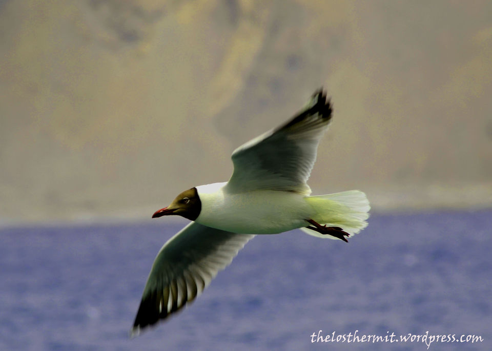
At mid day as the rays of the sun penetrated the waters of the lake perpendicularly,the dark shade of blue stood in stark contrast to the purple and brown of the surrounding mountain scape.The beautiful ranges of brown peaks stretched all the way to Tibet and snow sat prettily on those summits.Sea Gulls floated around in groups on the lake….and our only attempt to enter the waters of the lake was thwarted by the numbing low temperature of the high altitude lake.The clear blue waters of the lake makes beautiful ripples and waves on the smooth stone pebbles on the shore.A vision for eternity.In Tibetan the name Pangong means the narrow and beautiful lake.
SoumyaDJena/theLostHermit
This trip was first published on https://thelosthermit.wordpress.com/.

' fill='%23359391'%3e %3cpath d='M46.1538462%2c43.5714286 L41.5%2c50 L36.8461538%2c43.5714286 L36.8670256%2c43.5714286 C36.3173077%2c42.7142857 36%2c41.6851429 36%2c40.5714286 C36%2c37.4854286 38.4535641%2c35 41.5%2c35 C44.5464359%2c35 47%2c37.4854286 47%2c40.5714286 C47%2c41.6851429 46.6826923%2c42.7142857 46.1329744%2c43.5714286 L46.1538462%2c43.5714286 Z M41.4294872%2c39 C40.6150641%2c39 39.9487179%2c39.675 39.9487179%2c40.5 C39.9487179%2c41.325 40.6150641%2c42 41.4294872%2c42 C42.2439103%2c42 42.9102564%2c41.325 42.9102564%2c40.5 C42.9102564%2c39.675 42.2439103%2c39 41.4294872%2c39 L41.4294872%2c39 Z' id='Location-white'%3e%3c/path%3e %3c/g%3e %3c/svg%3e)