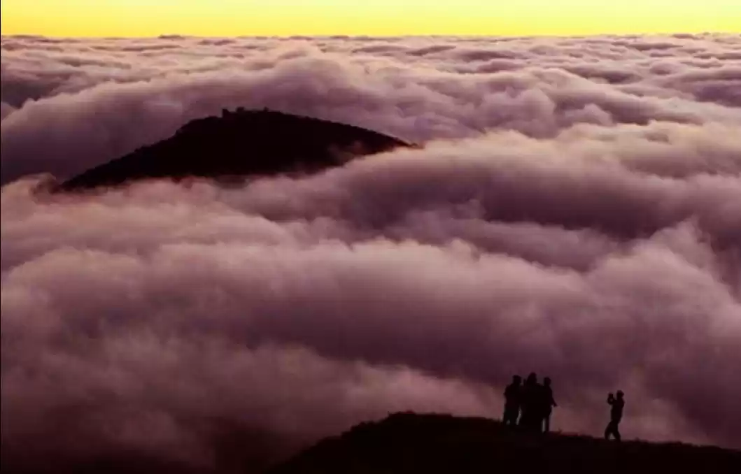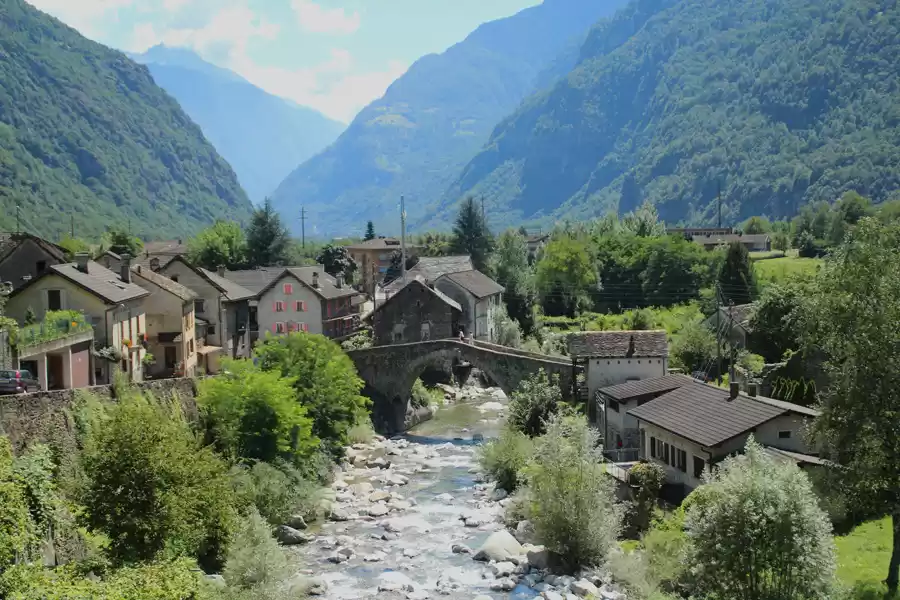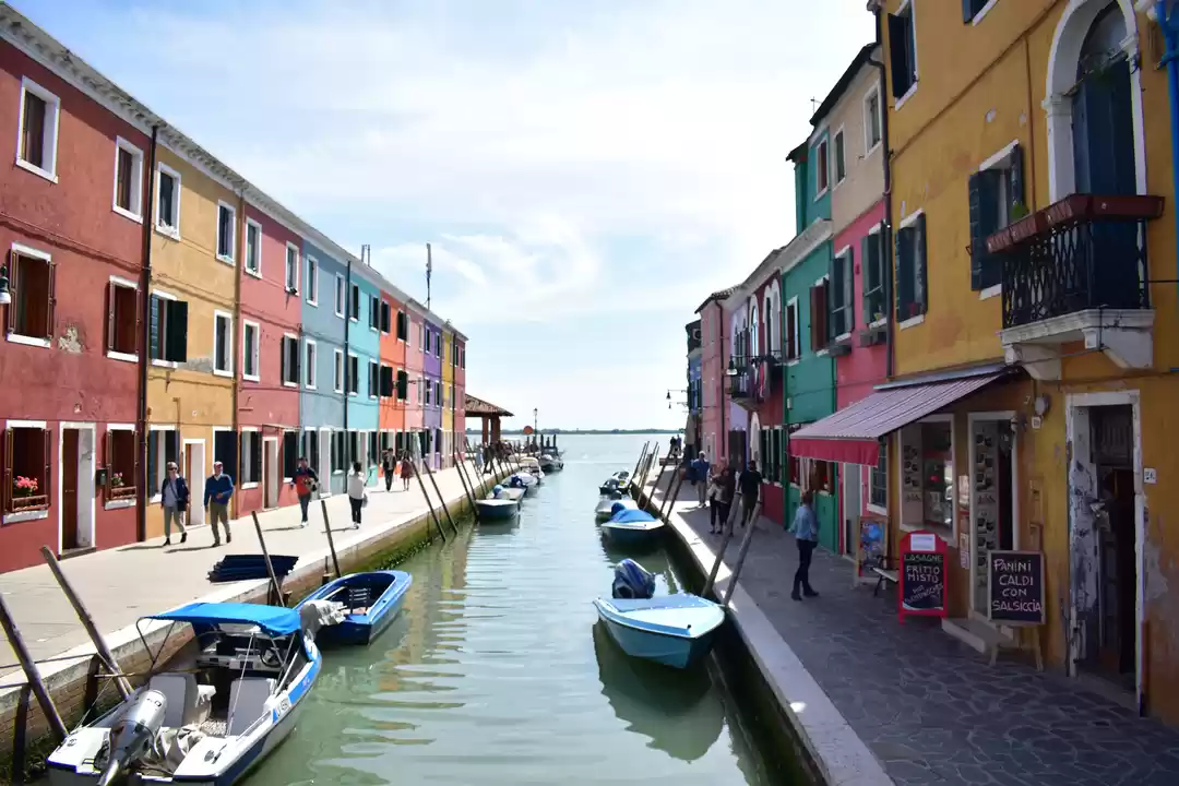


The province of Batanes is located in the northernmost of the Philippines, and its smallest province, both in terms of population and land area. Batanes is a group of inhabitant, namely, Batan, Itbayat, and Sabtang Islands. With the uniqueness beauty of the Province, it is known as the Last Frontier of the north. Geographically, it is on the channel where Pacific Ocean meets South China Sea, looking into the globe / map its situated south of Taiwan and north of Luzon. All flight lands in Batan island, city Basco. Before landing, this is a peek into the plane windows to spot the natural beauty of one of the islands of Batanes. We took SkyJet airline from Manila to Basco.
Upon arrival at around 8 am, we checked in at DDD Habitat Pension House, its a typical hometel in Basco, nothing fancy basic facilities. Only good point is its cheap price (as low as 600 php per pax per night), and its location which is walking distance to the market.
While waiting for the start of our tour (11 am), we had a walk along Abad Street, where the wet and dry markets are situated. The only fresh fish available during this season (February) are these Flying Fishes. Some dried fish hanging in the market, with some local produce: fruits and vegetables.
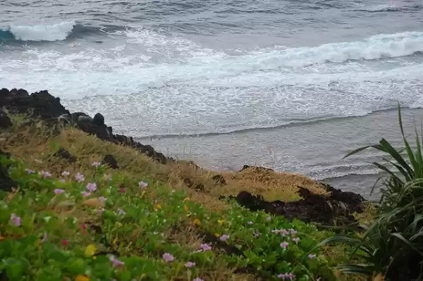
Next, we visited the - Basco Idjang - a rock formation on a hill which serves as natural fortress, since its facing the West Philippine Sea (aka South China Sea). A few miles down the Idjang Hill, is the WWII Japanese Hideout or Tunnel. At foot of mountain, we stopped by the Boulder Beach in Valugan, this side of the island has spectacular view of the Pacific Ocean.
Few meters from canteen is the Sto. Domingo Cathedral, were we had a short stop. It is noticeable that the cathedral is newly renovated, due to the destruction of the typhoon - Habagat on August, 2013. This shows the resiliency of the Ivatans (natives of Batanes), in recovering quickly from calamities.
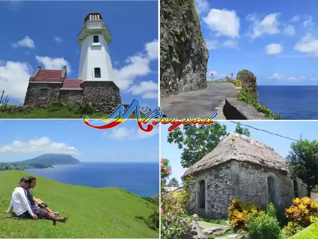
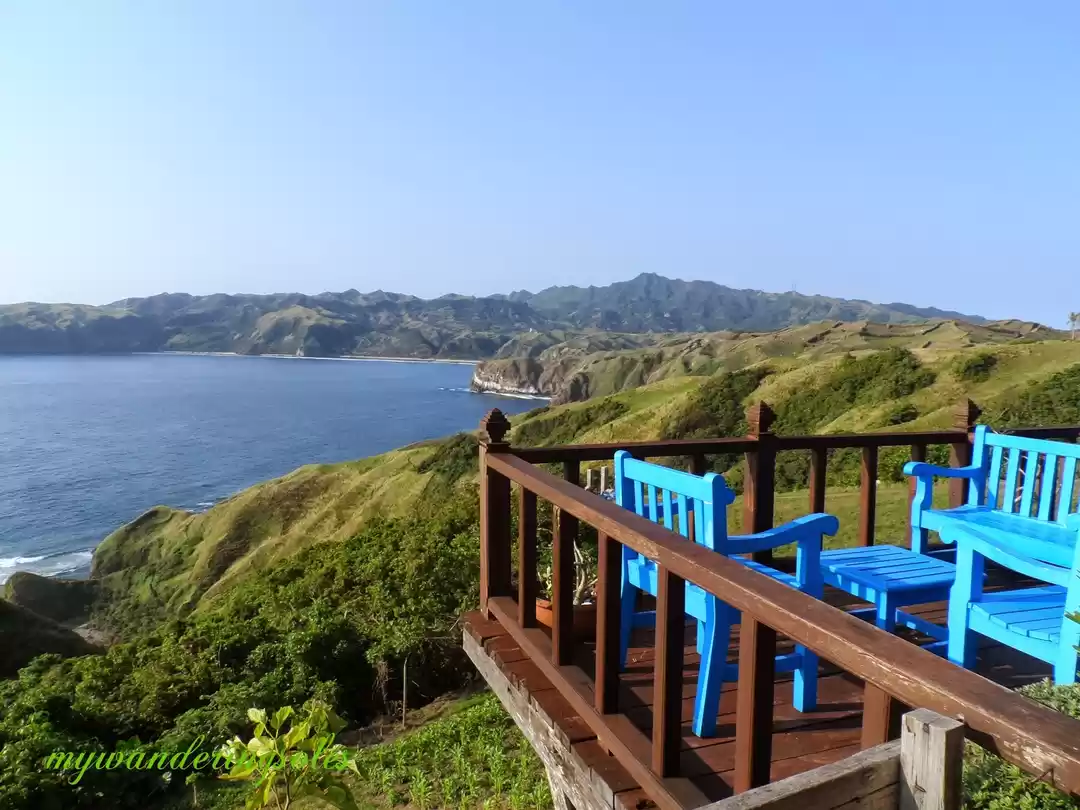
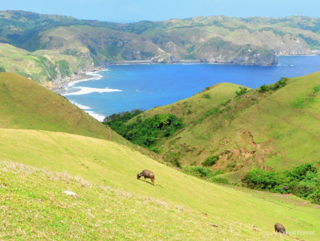
These are seemingly endless waves of rolling hills. It boasts of the perfect combination of landscapes and seascapes. Riding straight pass the Cathedral, we drove up to Vayang Rolling Hills - where the view is simply breathtaking. The site provides the best vantage point where you can see the three islands of Batanes.At the same mountain range, we went to Basco Lighthouse in Naidi Hills. Naidi is an old Sitio derived from the Ivatan words, "Na" meaning Past, "Idi" which settlement or community. Climbing up the lighthouse, it is where we see the view of the whole town proper.
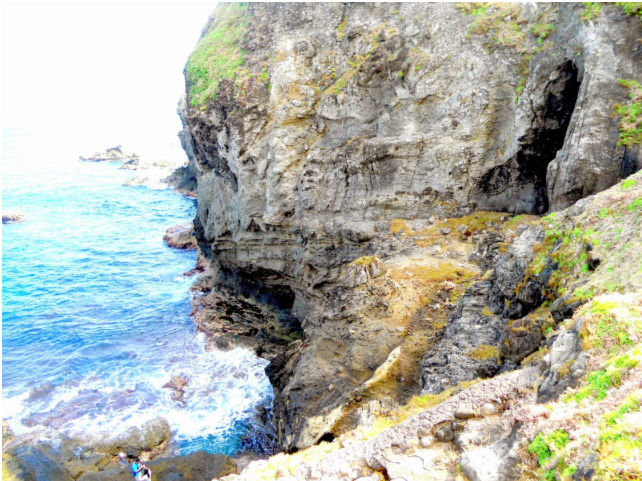
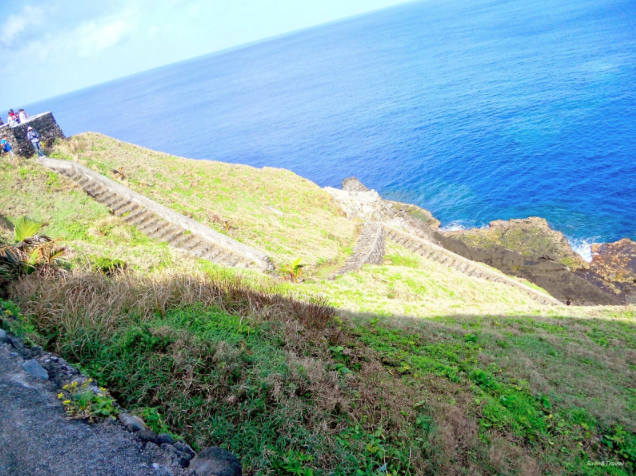
The day started with a short stop at Chawa Point viewing deck - it consists of stairs down to sea coast. Walking down the steep stairs, we saw Chawa Cave, its an enchanted cave with natural salt bed whose mouth opens to the West Philippine Sea.
Next stop is the Mahatao Boat port - this is a natural port made from a small island near the coast, and enclosed by a wall of break water to prevent the strong waves from coming in. Notice the difference with the calmness of the sea within the walls of the port as compared to the waves outside. As an added bonus, we saw this Blue Marlin in the port which was caught by the local fishermen that morning.
According to our driver/guide (which is a Mahatao native) - the locals have cooperated to rebuild the church after the Typhoon Odette last Sept 2013, interior ceiling is made of natural Reed material locally grown. Beside the church has this old Spanish lighthouse. Southern Batan has its own lighthouse as well, the Mahatao Tayid Lighthouse :
After filling our eyes and stomach, we drove down the mountain to the coast line of Alapad hills. This town is named as Uyugan - an Ivatan word meaning: place of flowing water. Visible from the Alapad hills, is the LoRan station - used to house US coastguard detachment for almost two decades. At present it is being developed into a museum.
Ivana Town, is historically famous, because it is where the Katipuneros commanded by Capt. Perea first landed at noon of Sept 18, 1898. Up next, we visited an Ivana Church also known as the San Jose Church built in 1814. It has a crenelated fortress-like bell tower. The church faces the Ivana Seaport, which is the It is the gateway to the island municipality of Sabtang. (Follow the part 3 of this Batanes series to know more about Sabtang).
Our next stop in Ivana is House of Dakay - A Unesco Heritage Building (1887), this is the oldest surviving house in the town of San Jose de Ivana in Batan Island. Constructed from lime and stone, owned by Luisa Estrella who bequeathed it to her favorite nephew - Jose Dakay Estrella. Its windows and floors have never been changed, it is probably most photographed house in Batanes to date. Previous occupant was lola Florestida Estrella, who just passed away last January 2014. The Old Spanish bridge just few meters away from House of Dakay. it was built during the Spanish period and still being used to date.
For dinner we were brought to Pension Ivatan (opposite Basco airport). we ordered their specialty Ivatan Platter - combination of supas (turmeric rice), tamiduk (pako salad), Grilled Beef, Squid, Flying fish, Uved, Luñis, Vunes (dried gabi leaf), Shrimps, and Tatus (Coconut crab); and Dukay salad for dessert. This ends our second day in this cinematic haven of Batanes.
A visit to Batanes is incomplete without seeing Sabtang. Of the three islands, this is the smallest inhabited. On our third day in Batanes, we were picked up at 6 am and was sent to San Vicente Port / Radiwan Port in Ivatan, we took the motorize boat: Falowa to Sabtang Island. There are only 2 boat trips in morning so make sure to reach there on time (before 7:30am).
After 30 minutes Falowa Ride, we arrived at Sabtang Port: Sabtang is at the southernmost island municipality of the Batanes group of islands which is composed primarily of Sabtang Island, as well as two nearby smaller and uninhabited islands: Ivuhos and Dequey. The municipality is known for its lighthouse and the old stone houses of the Ivatan villages in Chavayan and Savidug. Malakdang Lighthouse is prominently seen from the port -
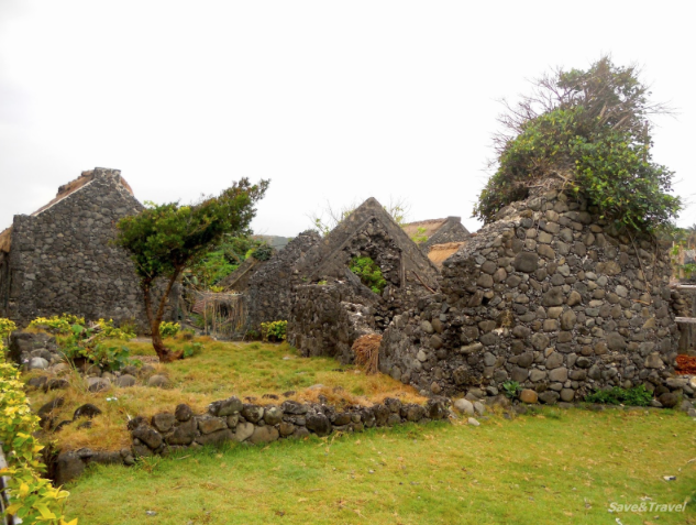
After paying environmental fee (200 php) at the municipal hall, we proceed to our first stop - Brgy. Savidug. Barrio Suvidug is compose of traditional stone houses. Some house ruins can also be seen along the streets. It is a small village with unique traditional style houses. The roofs of the houses are made of cogon grass and the walls are made of lime.At the end of Savidug street, a simple white chapel stands, the Sto Thomas Chapel.
Next stop is Brgy Chavayan Stone houses. The best area to visit if you want to see an authentic vernacular or stone houses is in a small village called Chavayan. Walking through the tiny villages of traditional stone houses and quiet narrow streets of Savidug and Chavayan in Sabtang Island will make you feel like being flown to another country or to a place where time just stood still. The stone houses in Chavayan are currently nominated for the UNESCO World Heritage List. The houses still looks exceptionally stunning with the village nestled between the tall lush mountains and cliffs on one side and a spectacular view of the sea where the churning waters of the South China Sea and the Pacific Ocean meet. Walls are not only compose of rocks but sea shells and corals as well.
We headed to Diura Fishing Village - this is a sitio in the eastern part of Mahatao town where an association of fishermen called Mataw practices the traditional fishing for Arayu (dorado). The fisherman's houses at the foot hill, were mostly unoccupied. Because they only stay here during the fishing season (March to May). The fish ponds serves as storage for the fisherman's catch. They have ritual called kapayvanuvanua signifying the start of the fishing season which usually falls in March. The village offers a good view of the Pacific ocean and Mt. Iraya.
This is one of the most photographed spot in Batanes, famous for its stone / rock arch formation in a private cove. It is our last stop in Sabtang before we head back to the port to take a boat back to Batan island. Afternoon waves are very rough and causes sea sickness to the passengers.