This trip was originally published on www.travelfrreak.blogspot.com
[ Photo alert: Expect loads of photos in this post!]
Banff and Jasper are two of Canada's national parks, located in the Rocky mountains in the west. Frankly, they are not as famous among tourists as you would expect them to be. I had heard about them in 2001 when I had gone on an exchange program to Vancouver in British Columbia. At that time, I did not have enough time or money to visit these parks. But some of my friends did and had shown me their photos. It had looked amazingly breathtaking and since then, these two had been on my travel list.View on morning walk in Field, Yoho national park

And then it happened! We were planning to visit Edmonton in Canada, and since Banff and Jasper are nearby, we planned a short trip to the parks also. And what an experience it was! I would rate them as one of the most spectacular nature based vacations we have ever had.
We were there for a total of about 5 days. We landed in Calgary from London, drove from there to Yoho national park where we stayed for two days and visited Lake Louise etc.. Then we drove on the Icefields Parkway from Banff to Jasper, and stayed in Jasper for two more days before driving on to Edmonton.
Both the parks are amazingly picturesque. They are dotted with lakes, waterfalls, valleys with rivers, snow covered mountain peaks, glaciers and varied wildlife. You can spend your time there trekking, doing water sports in the lakes, visiting waterfalls, glaciers, peaks etc, skiing in the winters or just relaxing with long leisurely walks, soaking in the fresh air.
Banff and Yoho National Parks
We landed on a Saturday night at Calgary airport and stayed the night in a nearby hotel - Clique Calgary. The hotel was very good quality for the price we paid and very conveniently located near the airport. Though at this point itself, we figured out that the GPS maps for this area are not up to date. We had to use Google maps to find the hotel's exact location and so going forward, we always checked before we used the GPS.
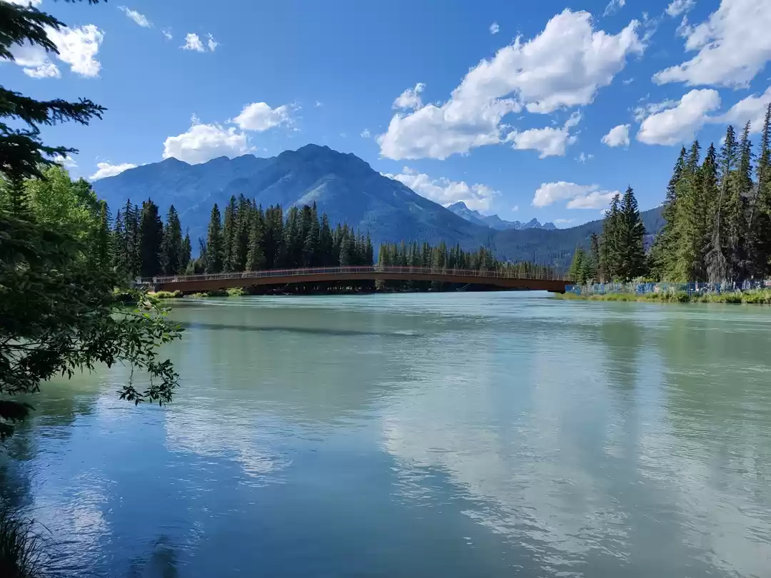
The first day of the trip, we drove towards Banff, which is about 1.5 hours away from Calgary, along Highway 1. This highway runs across Canada from East to West and also crosses the Rockies. We were very impressed with the quality of the roads - multi-lane highways cutting through mountains and forests. We passed through the town of Canmore, crossed Banff and then finally stopped at Lake Louise, which was a total of about 2 hours from Calgary. We also crossed 4 rainbows on the way which was pretty:).
My brother and sister-in-law stayed in Canmore overnight and went for two hikes around. One was the Four Lake trail and the other was the Canmore river trail, both of which were very scenic walks. The Banff Upper Hot springs are also located near the town of Banff which are a major tourist attraction of this area (though we did not get time to stop there).


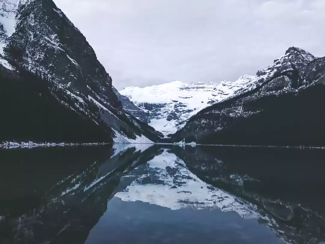
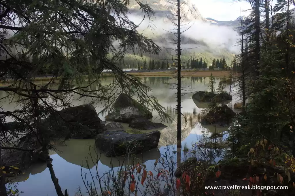
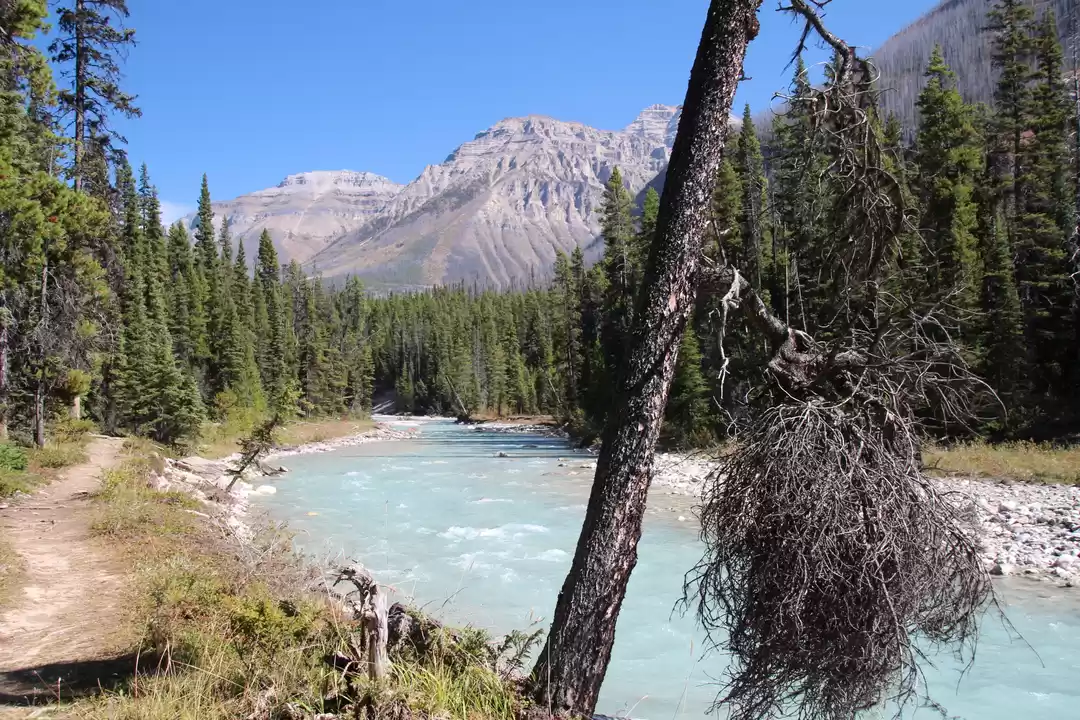
We did not stay in Banff exactly but in Yoho National Park, in the village of Field about 25 kms from Lake Louise. The first and second day we spent exploring the area around. It was raining the first day which was terrible. We did a short 3-4 hour hike up the Lake Agnes trail next to Lake Louise. It starts from the base at the Lake Louise Chateau and is approximately a 7 km round trip trail, going up an elevation of about 400m.
The trek was a quick short trek and we encountered a lot of tourists on the way too. As you go up, you get brilliant views of the turquoise colour of Lake Louise, cross the Mirror Lake (due to the rain, we did not see any mirroring of anything:) ) ending at the teahouse at Lake Agnes. The vegetation all along was alpine, with pine and coniferous trees surrounding us. The mountains had snow covered peaks and small waterfalls coming out here and there. And the teahouse on top was a welcome change - hot food after 2 hours of walking in the rain.
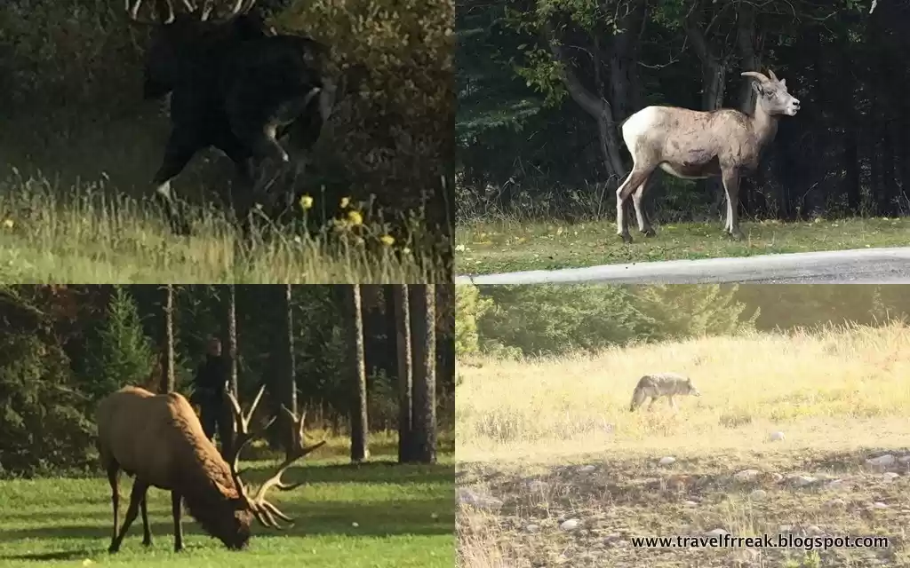
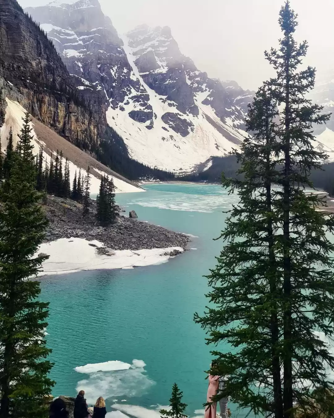
After the trek we made a stop at Morraine Lake which is about 15 mins drive from Lake Louise. To be honest, I was not impressed by it at all and we did not spend much time there. Thereafter, we drove towards our accommodation which was in Field, about half an hour from Lake Louise. We spotted a porcupine on the way, eating away blissfully next to the road - the first of the wildlife we were to see on this trip:).
Yoho National Park is the neighbouring park to Banff and someone had recommended me to stay there rather than Lake Louise which was very touristy. So we stayed in the village of Field which barely had 50 houses. We stayed in a cute little B&B called Canadian Rockies Inn.

The downside of it all though was that there was just one restaurant in the entire village which was already booked by the time we checked-in and went out for dinner! The other two options were to either drive half an hour to the Emerald Lake Lodge or a restaurant near the Takakkaw falls. Thankfully, we asked the owner of Truffles Pigs Bistro if he would be willing to give us takeaway food and he kindly agreed. The food was very very tasty and we loved eating out of even the takeaway bags:).Morning walk view

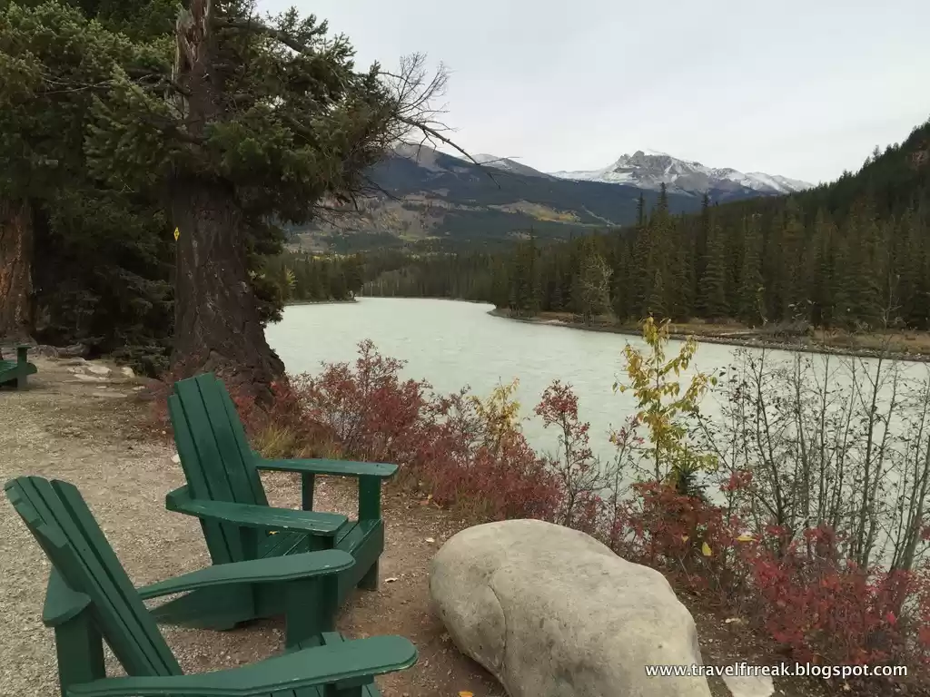
The second day of the trip, we spent mostly in the Yoho National Park area. The village of Field where we stayed was very scenic. It was in a valley next to the Yoho river, overlooked by huge snow covered peaks. We went for a walk in the morning next to the railways track and the river. It was almost a 1.5 hour walk along the river, through the woods, next to the hills and the railway tracks, running past small little lakes on the way and passing through clouds which had come down in the valley. The morning walk refreshed us a lot for the rest of the trip I think:).

We also ran into a local who was taking his dog out for a walk. He told us about the area, how they have to drive 25 kms to get any groceries, how often they get snowed under during the winter months, how their water is of extremely good quality (though expensive) and so on. We had been expecting that people in the area moved out in the winter months but looks like they don't!

The weather was perfect that day: sunny and bright, perfect day to be near nature! We started with having breakfast at the Field Cafe (which btw the next day onwards started its fall timings of opening up at 12 noon!). After that, we visited the Takakkaw falls which were about 30 mins from Field and quite huge. While coming back from there, we saw one of the spiral train tunnels of the park which are listed as a sight to see! By chance when we stopped there, a train was going into the tunnel and a couple of minutes later we saw the other end come out just above. It was definitely an interesting sight but not really a must-do I would say.

We also did a quick 1 hour trek to the Wapta Falls which apparently are the second largest waterfalls in Canada in terms of water volume. We did not find it as impressive though. We also stopped at a location called Natural Bridge, where the Kicking Horse river has created a natural bridge through rocks due to its forceful flow.

After that, we had a quick coffee at the Emerald Lake which was completely out of the world (the lake, not the coffee!). The green sparkling waters reflected the snow covered mountains and were a great place to stop and be close to nature and reflect on your life. The Emerald Lake Lodge was the perfect location to have a cup of hot coffee, looking out at this lake. There were some fall colors in the area, but not much. Only specks of yellow trees in the green all around.

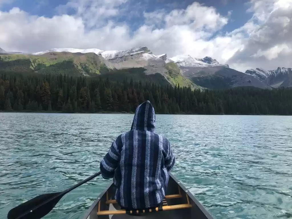
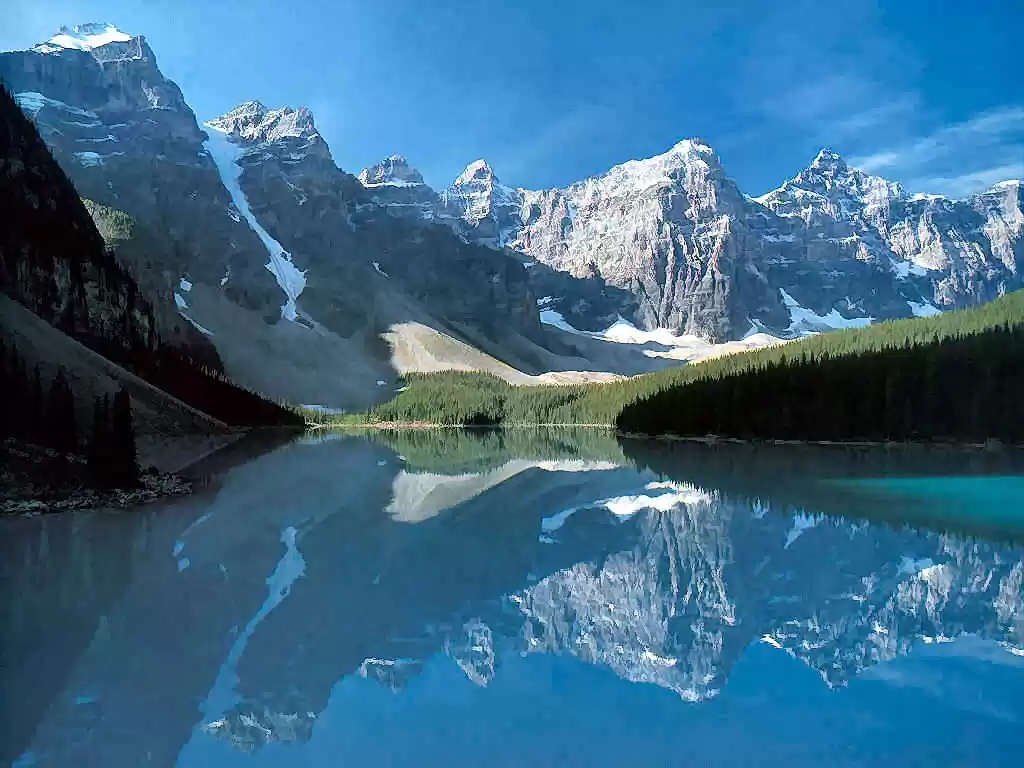
In hindsight, we should have done a longish trek that day rather than the quick touristy stops. All these places were covered quite quickly, so we decided to drive back to Morraine Lake again to get a look at it without the rain. And the view was quite mesmerising. Dark blue of the lake, reflecting the ten snow covered peaks all around. We tried to do canoeing here as well as the Emerald Lake but it was too late at both the places and the canoeing had finished by 4:(.
One benefit of going to Morraine Lake was though that we got a decent dinner:). We stopped at the Lake Louise village just before the lake which has a couple of good eating places. We ate at the Mountain Cafe which was quite cosy and had a good spread.
The day overall was fun though the weather was quite cold. We also met less tourists than the previous day because it was a weekday, which was great. One option in the area which we were unable to do was a trek to O'hara lake. It is apparently a longish walk but definitely worth it.
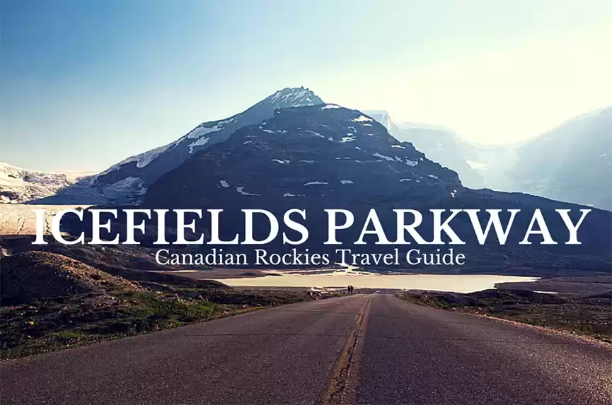
The third day, it had become a lot colder and in the morning the village of Field was full of clouds which had come down in the valley. All the plants and the cars were covered in frost and appeared white. But the day was still sunny and bright, perfect for what was to follow. We started driving towards Jasper, on the route called Icefields Parkway (Highway 93) which is one of the most spectacular routes we have ever driven on.

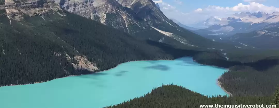
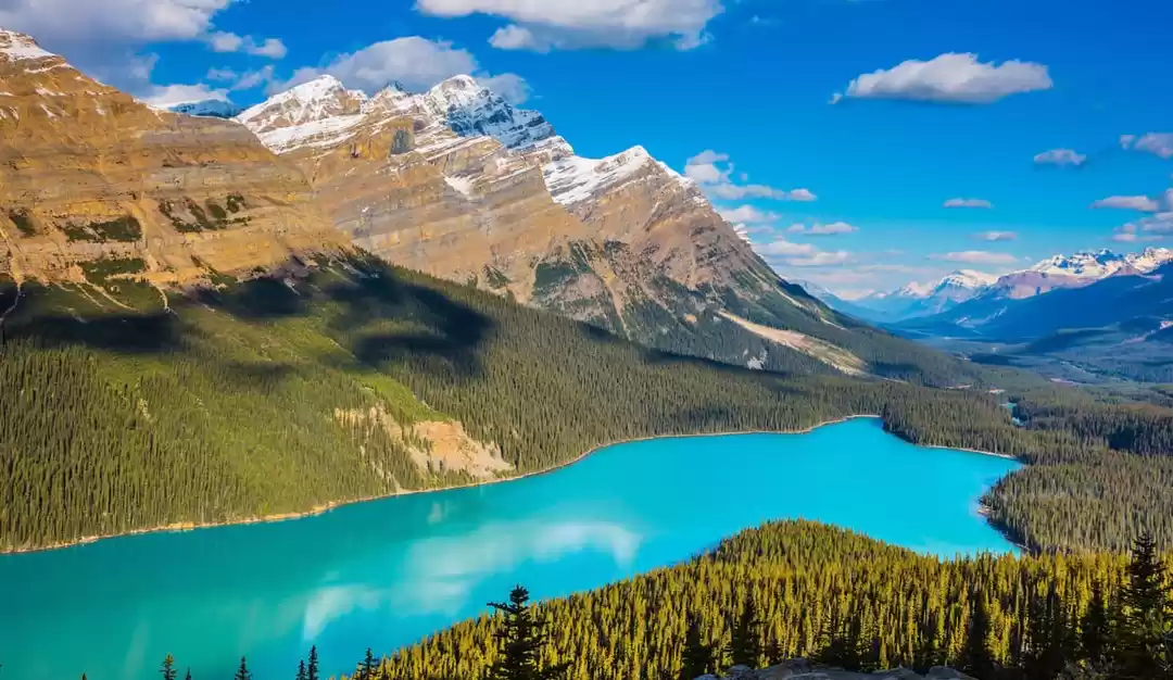
The road goes through high mountains on both sides, snow covered or bare peaks; river valleys, with rivers meandering through; lakes reflecting the colors from all around; yellow leaved trees all along the route showing off their fall colours; lush green evergreen trees up the hill and fresh air all around. It was a 3.5 hour long drive from Field and we did not get bored at all! Also apparently the location of the road is where the continental divide is. I don't know what it means but its something worth reading up on.Peyto lake

On the way, we stopped at a couple of places. The first of which was the Bow Lake just before Lake Peyto. It was so magnificient that we just stopped when we saw it. The clear reflection from the mountains is a scene which is tough to forget. After that, we stopped at Lake Peyto which you can view after a 15 min walk to the Bow Summit through pine snow covered mountains. The lake is quite famous too, and has a similar turquoise colour to Lake Louise but I was definitely more impressed by the Bow Lake we saw just before.


We also stopped at the Saskatchwen river crossing on the way. The view of the river and the valley was quite expansive here. The first humans who had discovered this place would have been so awed by this view!! And there were so many colors all around - bright yellow of fall trees, all shades of green, blue of the water and the sky, the white of the snow and the grays and browns of the hills. Its tough to put into words what our eyes saw!
The crossing was also the only place on the 228 kms of the Parkway that had petrol. We were almost out of petrol and they charged us well for it:), 30 liters for 50 CAD instead of 30 CAD;-). We also stopped for some food at the crossing (in the park, all tourist spots have eating places and souvenir shops!!).

Our last stop on the Parkway was the Columbian Icefields. Its a huge expanse of ice from which the Athabasca glacier can be seen emanating from. The glacier today is much smaller than what it was photographed in the 1840s. It used to come down to the road then and cover what is now the car park. You can take a snocoach onto the glacier and walk on it, take a walk on the skywalk or just enjoy a coffee at the Glacier Inn. We went to the skywalk, which is about 30m away from the cliff, with a 900 feet drop down the valley. You have to buy tickets from the Glacier office, and then a shuttle takes you to the skywalk and gets you back. On the way to the skywalk, we also spotted some wild goats in the area (our second wildlife sighting!), but all we could photograph was their backside!

The skywalk was quite scary actually, and even though logically it should not be, its tougher to walk looking down than otherwise. I even took a jumping photo on the skywalk though it was very tough. The view down the valley, waterfalls and the Glacier was fascinating. You can almost see the Sunwapta river in the bottom flowing through the canyon. We also learnt a lot more about how the valley was created through movements of the glacier, what the wildlife of the area is, what are the types of vegetation and so on, while on the skywalk. But of course, the best part of it was to overcome your fear and walk without twitching while looking down 900 feet under your feet!