Have you ever wondered where the mighty Ganges river begins? Have you ever dreamed of trekking in the Himalayas and witnessing the beauty of nature? Have you ever wanted to experience the spirituality and culture of India's most revered pilgrimage site?
If you answered yes to any of these questions, then you should definitely plan a trip to Gaumukh Glacier, the source of the Ganges.
Gaumukh Glacier is the second-largest glacier in India, after Siachen Glacier, and covers an area of about 56 square kilometers. It is located in the Uttarkashi district of Uttarakhand, at an altitude of about 4,000 meters above sea level. The name Gaumukh means "cow's mouth" in Hindi, as the glacier resembles the shape of a cow's snout.
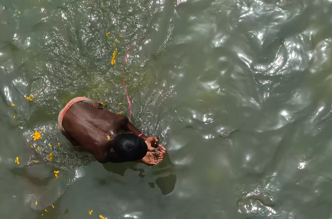
Gaumukh Glacier is also the origin of the Bhagirathi river, which joins the Alaknanda river at Devprayag to form the Ganges. The Ganges is considered to be the most sacred river in Hinduism, as it is believed to be the manifestation of Goddess Ganga. Millions of Hindus visit the Ganges every year to take a dip in its holy waters and wash away their sins.
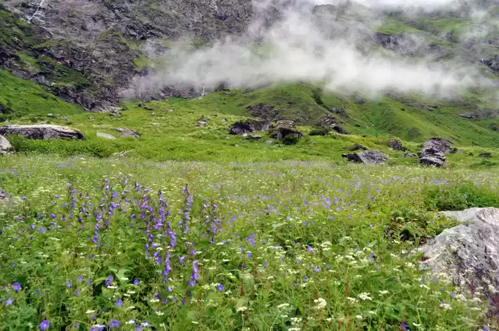
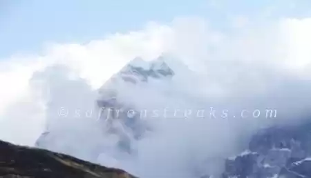
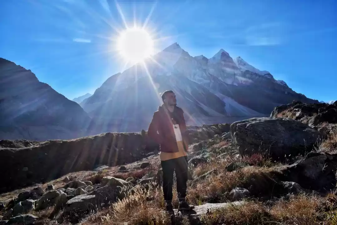
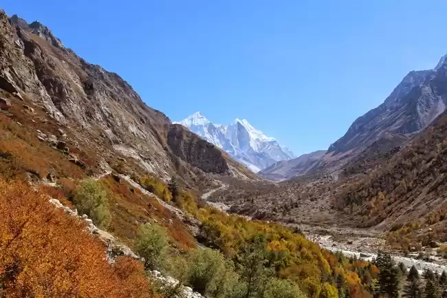
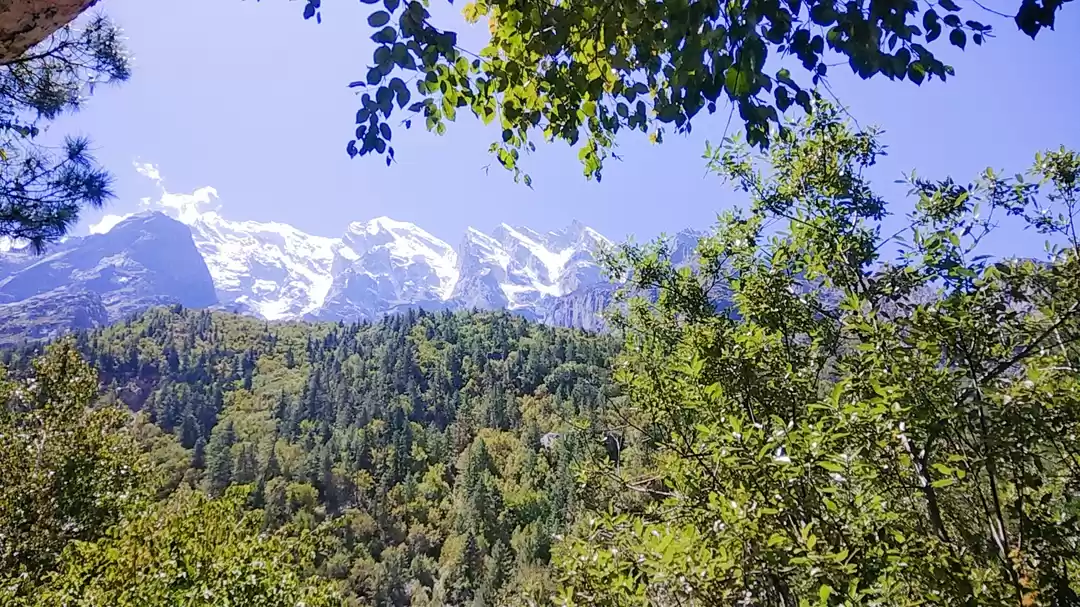
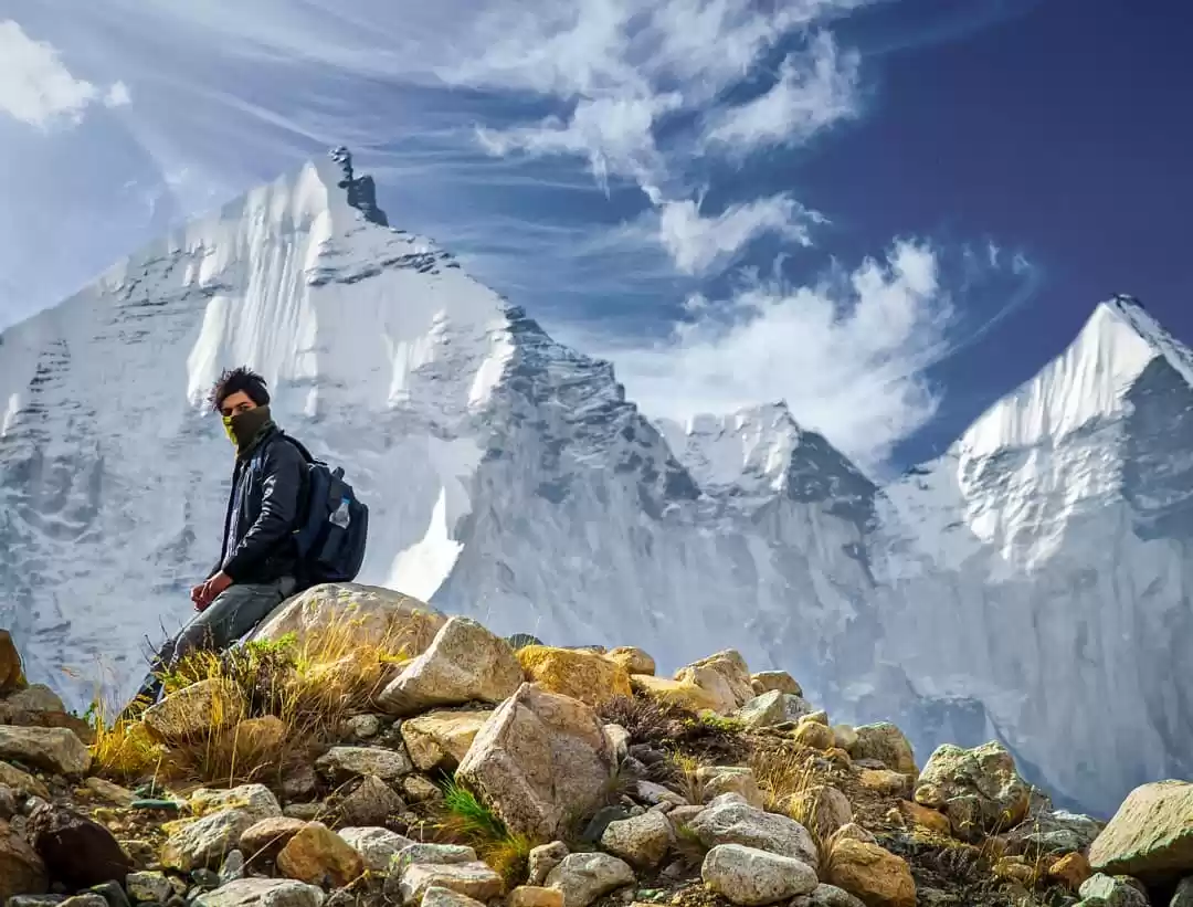
Gaumukh Glacier is not only a religious destination, but also a natural wonder and an adventure lover's paradise. The glacier offers spectacular views of the snow-capped peaks of the Himalayas, such as Shivling, Sudarshan, Meru, and Bhagirathi sisters. The glacier also hosts a variety of flora and fauna, such as birch trees, rhododendrons, junipers, blue sheep, mountain goats, and snow leopards.
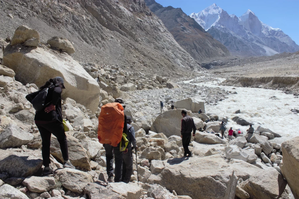
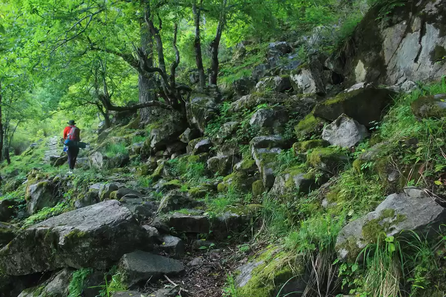
The best way to explore Gaumukh Glacier is by trekking from Gangotri, which is about 18 kilometers away. The trek is one of the most popular and rewarding treks in India, as it passes through scenic landscapes, dense forests, rocky terrains, and gushing streams. The trek also offers a glimpse into the culture and lifestyle of the local people, who live in harmony with nature and worship the river and the mountains.
If you are looking for a unique and unforgettable experience, then you should definitely visit Gaumukh Glacier at least once in your lifetime. In this article, we will provide you with a complete guide to visiting Gaumukh Glacier and its surroundings. We will cover everything you need to know about the trekking route, the best time to visit, the places to explore, and the travel tips.
Gaumukh Trek: The Ultimate Himalayan Adventure
The Gaumukh trek is one of the most sought-after treks in India, as it takes you to the source of the Ganges and offers stunning views of the Himalayan peaks. The trek is suitable for both beginners and experienced trekkers, as it has a moderate difficulty level and requires basic fitness and stamina.
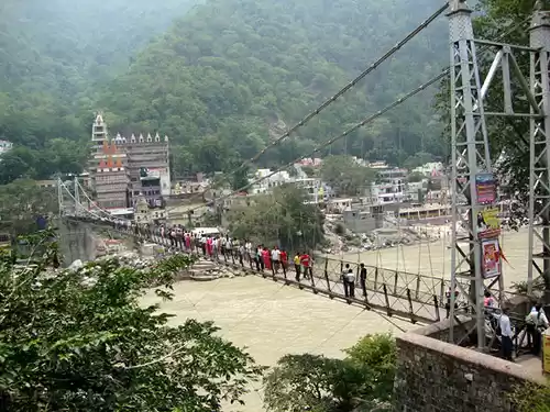
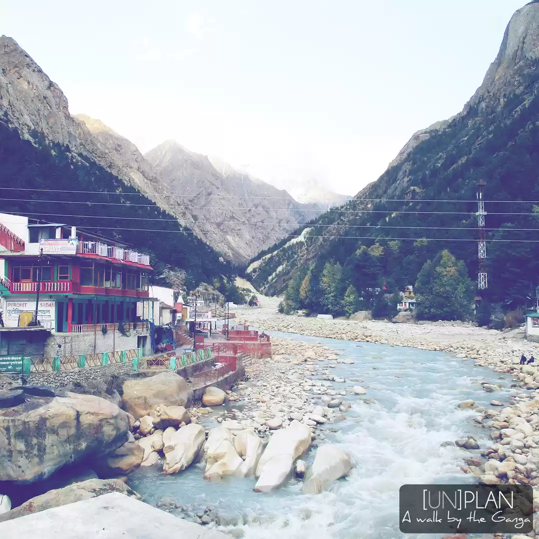
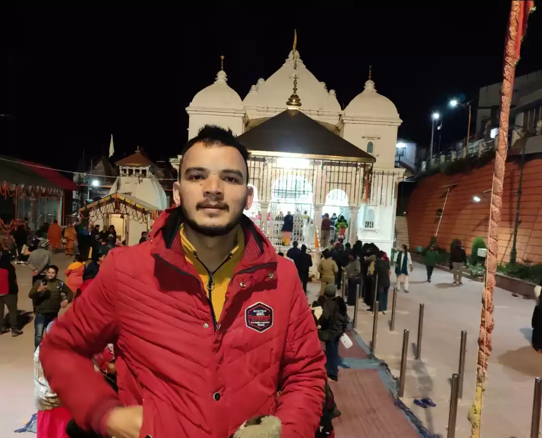
The trek starts from Gangotri, which is about 250 kilometers from Dehradun or Rishikesh. Gangotri is a small town and a pilgrimage site, as it is one of the four sacred places that form the Char Dham circuit in Uttarakhand. Gangotri is also home to the Gangotri temple, which is dedicated to Goddess Ganga and marks her descent from heaven to earth.
From Gangotri, you have to trek for about 18 kilometers to reach Gaumukh Glacier. The trek can be completed in two or three days, depending on your pace and preference. You can either camp along the way or stay at some basic guesthouses or ashrams.

The trek route is as follows:
Day 1: Gangotri to Chirbasa (9 km)
- The first day of the trek is relatively easy and enjoyable, as you walk along the Bhagirathi river and enjoy its soothing sound.
- The trail passes through pine forests, apple orchards, waterfalls, and bridges.
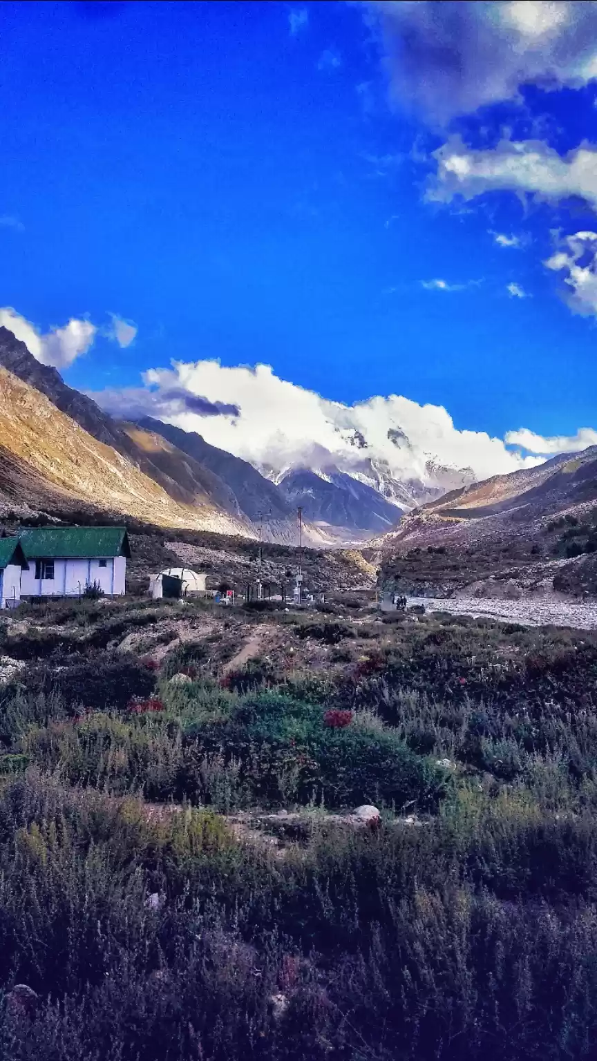
- You will reach Chirbasa after about four hours of trekking. Chirbasa is a small village that derives its name from the chir pine trees that grow there.
- You can either camp at Chirbasa or continue for another 3 kilometers to reach Bhojbasa.
Day 2: Chirbasa/Bhojbasa to Gaumukh (5/8 km) and back
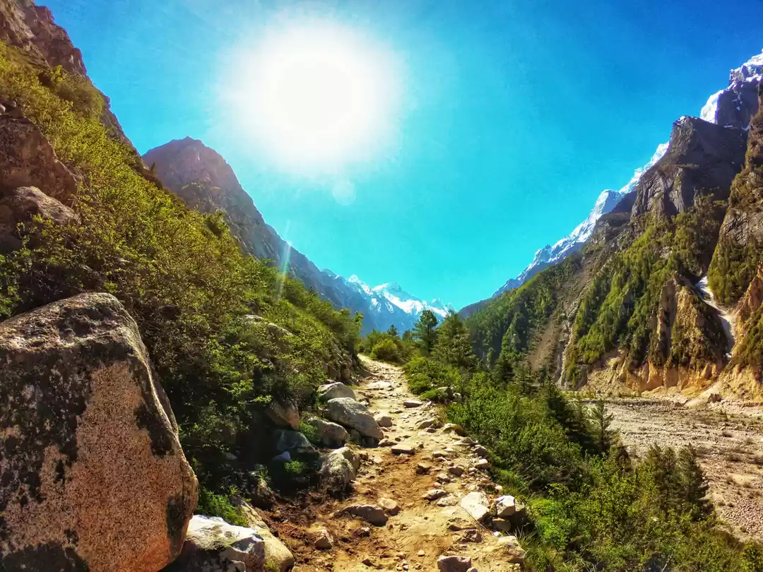
- The second day of the trek is more challenging and rewarding, as you ascend towards Gaumukh Glacier and witness the majestic Himalayan peaks.
- The trail becomes steeper and rockier, and the vegetation becomes sparser. You will also encounter some patches of snow and ice, depending on the season.
- You will reach Gaumukh after about three or four hours of trekking from Bhojbasa. Gaumukh is the end point of the trek, where you can see the glacier and the river emerging from it.
- You can spend some time at Gaumukh, taking pictures, meditating, or performing rituals. You can also trek further for another 4 kilometers to reach Tapovan, which is a high-altitude meadow and a base camp for mountaineers. However, this requires a separate permit and a guide, as the trail is steep and dangerous.
- You have to return to Chirbasa or Bhojbasa by evening, as camping is not allowed at Gaumukh.
Day 3: Chirbasa/Bhojbasa to Gangotri (14/17 km)
- The third day of the trek is mostly downhill and easy, as you retrace your steps back to Gangotri.
- You can enjoy the views of the river and the mountains along the way, and also visit some temples and ashrams.
- You will reach Gangotri by afternoon or evening, where you can rest and relax.
Some tips and tricks to make the Gaumukh trek easier and safer
Get a permit:
You need to get a permit from the forest department at Gangotri to trek to Gaumukh Glacier. The permit costs Rs. 150 per person and is valid for three days. You can also book the permit online in advance. The permit allows you to trek up to Gaumukh only, not beyond it.
Hire a guide or porter:
It is advisable to hire a guide or porter from Gangotri to help you with the trek. They will not only carry your luggage and set up your camps, but also guide you through the trail and share their knowledge and stories. They will also arrange your food and water, and take care of your safety. You can hire a guide or porter for Rs. 500-1000 per day.
Pack light:
You should pack light and carry only the essentials for the trek, such as clothes, shoes, sleeping bag, tent, torch, first aid kit, snacks, water bottle, camera, etc. You should also carry some warm clothes and rain gear, as the weather can change anytime in the mountains. You should avoid carrying any plastic or non-biodegradable items, as they are harmful for the environment.
Stay hydrated:
You should drink plenty of water during the trek, as dehydration can cause headaches, nausea, fatigue, and altitude sickness. You can refill your water bottle from the river or the streams along the way, but make sure to boil or filter it before drinking. You can also carry some oral rehydration salts or glucose tablets to replenish your electrolytes.
Acclimatize well:
You should acclimatize well before starting the trek, as Gaumukh Glacier is at a high altitude and has low oxygen levels. You should spend at least one day at Gangotri or nearby places to adjust to the climate and altitude. You should also avoid smoking, drinking alcohol, or exerting yourself too much during the trek. You should also take frequent breaks and rest whenever you feel tired or breathless.
Best Time to Visit Gaumukh Glacier: When to Plan Your Trip
The best time to visit Gaumukh Glacier depends on your preference and purpose of visiting. However, generally speaking, the best time to visit Gaumukh Glacier is from mid-April to June and from September to November.
These are the months when the weather is pleasant and clear, and the trekking conditions are favorable. The temperature ranges from 10°C to 25°C during the day and from 0°C to 10°C during the night. The snow melts partially during these months, revealing the glacier and its surroundings in their full glory.
You should avoid visiting Gaumukh Glacier during the winter months (December to March) and the monsoon months (July to August).
The winter months are too cold and harsh for trekking, as the temperature drops below zero degrees Celsius and the snow covers everything in sight. The glacier becomes inaccessible due to heavy snowfall and avalanches. The roads and trails also get blocked due to landslides and cloudbursts.
The monsoon months are too risky and unpredictable for trekking, as the rainfall causes landslides, floods, rockfalls, and cloud bursts. The visibility becomes poor due to fog and mist. The river becomes swollen and turbulent due to melting snow and rainwater. The trails become slippery and muddy due to rain.
However, if you are flexible or adventurous enough, you can also visit Gaumukh Glacier during these months, as they offer some unique and offbeat experiences. For instance, you can witness the snow-covered beauty of the glacier and the mountains in winter, or enjoy the greenery and freshness of the valley in monsoon. However, you should be prepared for the challenges and risks involved and take extra precautions and measures.
Places to Visit Near Gaumukh Glacier: Explore More of the Himalayas
Gaumukh Glacier is not the only attraction in the region, as there are many other places that can be visited near Gaumukh Glacier for extended or diversified trips. Some of these places are:

Nandanvan:
Nandanvan is a high-altitude meadow that lies beyond Gaumukh Glacier, at an altitude of about 4,500 meters. It is a paradise for nature lovers and trekkers, as it offers panoramic views of the Himalayan peaks, such as Shivling, Bhagirathi, and Kedar Dome.
It also has a variety of flowers and herbs that bloom in different seasons. Nandanvan can be reached by trekking for another 6 kilometers from Gaumukh Glacier, but it requires a separate permit and a guide.
Tapovan:
Tapovan is another high-altitude meadow that lies beyond Gaumukh Glacier, at an altitude of about 4,400 meters. It is a sacred place for Hindus, as it is believed to be the meditation ground of Lord Shiva. It is also a base camp for mountaineers who attempt to climb Shivling and other peaks. Tapovan can be reached by trekking for another 4 kilometers from Gaumukh Glacier, but it requires a separate permit and a guide.

Vasuki Tal:
Vasuki Tal is a glacial lake that lies beyond Tapovan, at an altitude of about 4,900 meters. It is named after Vasuki, the king of snakes in Hindu mythology, who is said to reside in the lake. The lake is surrounded by snow-clad mountains and glaciers, and has a serene and mystical atmosphere. Vasuki Tal can be reached by trekking for another 3 kilometers from Tapovan, but it requires a separate permit and a guide.
Khatling Glacier:
Khatling Glacier is another glacier that lies in the Bhilangana valley, opposite to Gaumukh Glacier. It is the source of the Bhilangana river, which is a tributary of the Bhagirathi river. The glacier is about 25 kilometers long and 3 kilometers wide, and has several peaks around it, such as Jogin, Thalay Sagar, Barte Kanta, and Kirti Stambh. Khatling Glacier can be reached by trekking from Malla village, which is about 40 kilometers from Uttarkashi.

Kedar Tal:
Kedar Tal is another glacial lake that lies near Khatling Glacier, at an altitude of about 4,750 meters. It is named after Kedar, another name of Lord Shiva, who is believed to have created the lake with his trident. The lake is crystal clear and reflects the image of Thalay Sagar peak. The lake is also home to some rare species of fish and birds. Kedar Tal can be reached by trekking from Gangotri via Bhojkharak and Kedarkharak.
Submerged Shiva Linga:
Submerged Shiva Linga is a natural rock formation that resembles a Shiva Linga, which is a symbol of Lord Shiva. It is located in the Bhagirathi river near Gangotri temple, and is visible only during the winter months when the water level recedes. It is considered to be very auspicious to see the Submerged Shiva Linga and offer prayers to it.
Dayara Bugyal:
Dayara Bugyal is one of the most beautiful meadows in Uttarakhand, located at an altitude of about 3,000 meters. It covers an area of about 28 square kilometers and has lush green grasslands dotted with wildflowers and herbs. It also offers splendid views of Bandarpoonch, Draupadi Ka Danda, Srikanth, and Gangotri peaks. Dayara Bugyal can be reached by trekking from Barsu village or Raithal village, which are about 40 kilometers from Uttarkashi.

Nachiketa Tal:
Nachiketa Tal is a small lake that lies near Uttarkashi town, at an altitude of about 2,400 meters. It is named after Nachiketa, a young boy who attained enlightenment after meeting Lord Yama in Hindu mythology. The lake is surrounded by oak and rhododendron forests and has a temple dedicated to Lord Shiva on its bank. Nachiketa Tal can be reached by trekking for about 3 kilometers from Chaurangi Khal, which is about 30 kilometers from Uttarkashi.
Deoriya Tal:
Deoriya Tal is another small lake that lies near Ukhimath town, at an altitude of about 2,400 meters. It is also known as Indra Sarovar, as it is believed to be the bathing place of Lord Indra, the king of gods in Hindu mythology. The lake offers a magnificent view of Chaukhamba, Kedarnath, and Neelkanth peaks. Deoriya Tal can be reached by trekking for about 2 kilometers from Sari village, which is about 15 kilometers from Ukhimath.
Rudranath:
Rudranath is one of the five temples that form the Panch Kedar circuit in Uttarakhand. It is dedicated to Lord Shiva, who is worshipped here as Rudra, the fierce form of Shiva. The temple is located at an altitude of about 3,600 meters and has a natural rock face as the idol of Shiva.
The temple is surrounded by alpine meadows and forests and has a panoramic view of Nanda Devi, Trishul, and Nanda Ghunti peaks. Rudranath can be reached by trekking from Sagar village or Mandal village, which are about 20 kilometers from Gopeshwar.

Kalpeshwar:
Kalpeshwar is another one of the five temples that form the Panch Kedar circuit in Uttarakhand. It is dedicated to Lord Shiva, who is worshipped here as Kalpeshwar, the lord of meditation. The temple is located at an altitude of about 2,200 meters and has a natural cave as the sanctum sanctorum. The temple also has a Jata tree, which is believed to be the matted hair of Shiva. Kalpeshwar can be reached by trekking for about 2 kilometers from Urgam village, which is about 10 kilometers from Helang.
Dodital Lake:
Dodital Lake is a freshwater lake that lies near Uttarkashi town, at an altitude of about 3,000 meters. It is also known as Dhundital, as it is believed to be the birthplace of Lord Ganesha, the elephant-headed god in Hindu mythology. The lake has crystal clear water and abundant fish and birds. The lake also has a temple dedicated to Lord Ganesha on its bank. Dodital Lake can be reached by trekking from Sangam Chatti or Kalyani, which are about 20 kilometers from Uttarkashi.
These are some of the places that you can visit near Gaumukh Glacier to make your trip more memorable and enjoyable. However, you should keep in mind that these places are also at high altitudes and have remote locations, so you should plan your trip carefully and responsibly.
How to Reach Gaumukh Glacier: Travel Options and Routes
Gaumukh Glacier can be reached by air, rail, or road from different parts of India or abroad. However, you have to trek for the last 18 kilometers from Gangotri to reach Gaumukh Glacier. Here are some of the travel options and routes to reach Gaumukh Glacier:
By air:
The nearest airport to Gaumukh Glacier is Jolly Grant Airport in Dehradun, which is about 250 kilometers from Gangotri. The airport is well connected to major cities in India such as Delhi, Mumbai, Bangalore, Hyderabad, etc. by regular flights. From the airport, you can take a bus or a taxi to reach Gangotri via Rishikesh and Uttarkashi.
By rail:
The nearest railway station to Gaumukh Glacier is Rishikesh Railway Station, which is about 230 kilometers from Gangotri. The railway station is well connected to major cities in India such as Delhi, Mumbai, Chennai, Kolkata, etc. by regular trains. From the railway station, you can take a bus or a taxi to reach Gangotri via Uttarkashi.
By road:
The nearest road head to Gaumukh Glacier is Gangotri, which is well connected to other towns and cities in Uttarakhand by state-run or private buses or taxis. You can also drive your own car or bike to reach Gangotri via Haridwar or Rishikesh and Uttarkashi. The road journey is scenic and enjoyable but also long and tiring.
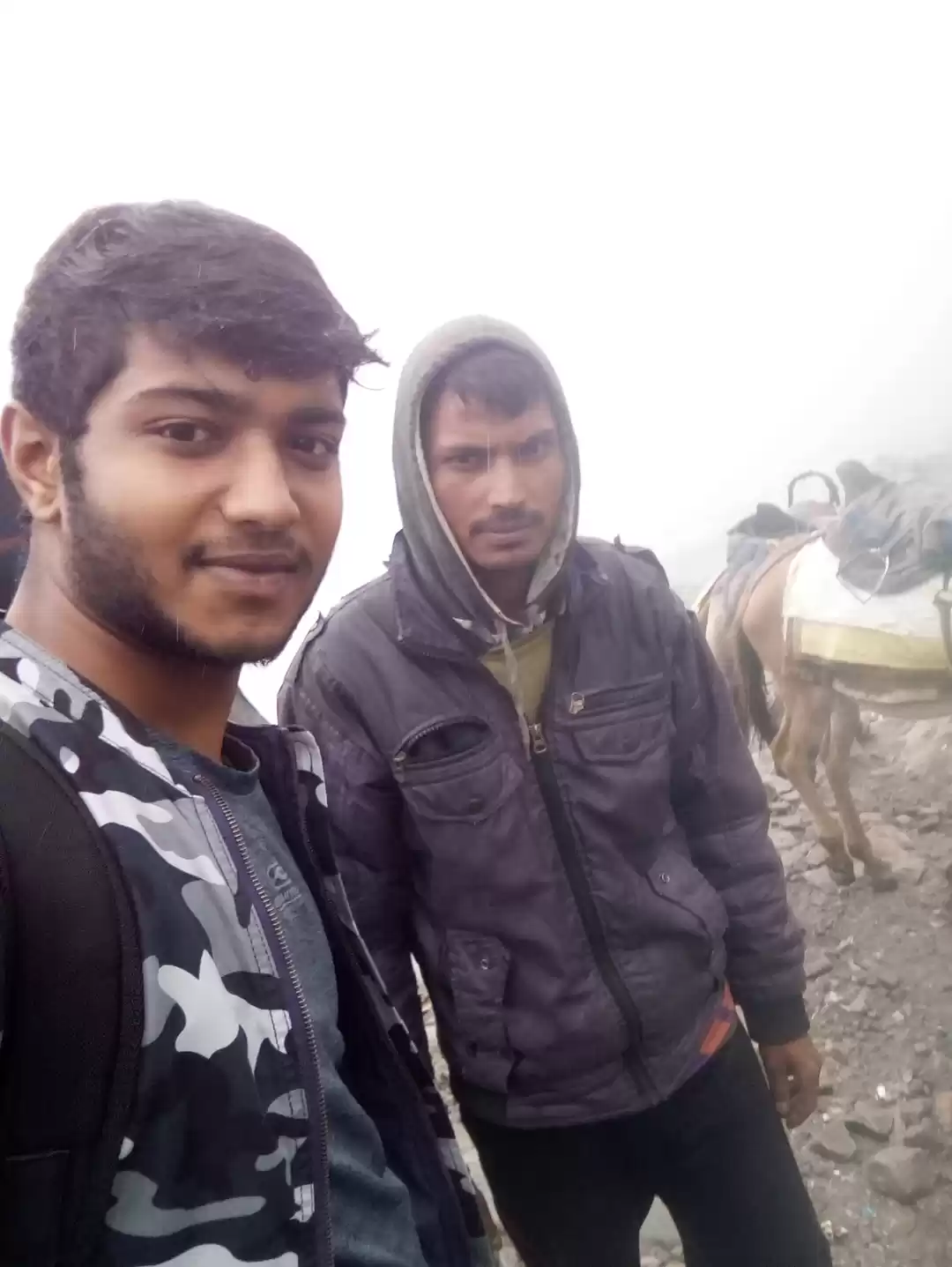
From Gangotri onwards, you have to trek or hire a pony to reach Gaumukh Glacier.
Gaumukh Glacier is a place that will leave you spellbound with its beauty and spirituality. It is a place that will challenge you with its adventure and reward you with its experience. It is a place that will inspire you with its culture and history.
If you are looking for a unique and unforgettable experience, then you should definitely visit Gaumukh Glacier at least once in your lifetime. It is a place that will enrich your mind, body, and soul.
We hope this article helps you with planning your trip to Gaumukh Glacier and its surroundings. If you have any feedback or questions for us, please let us know.