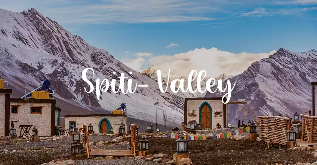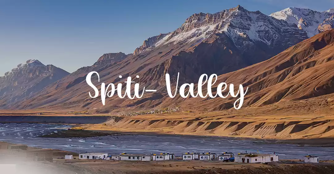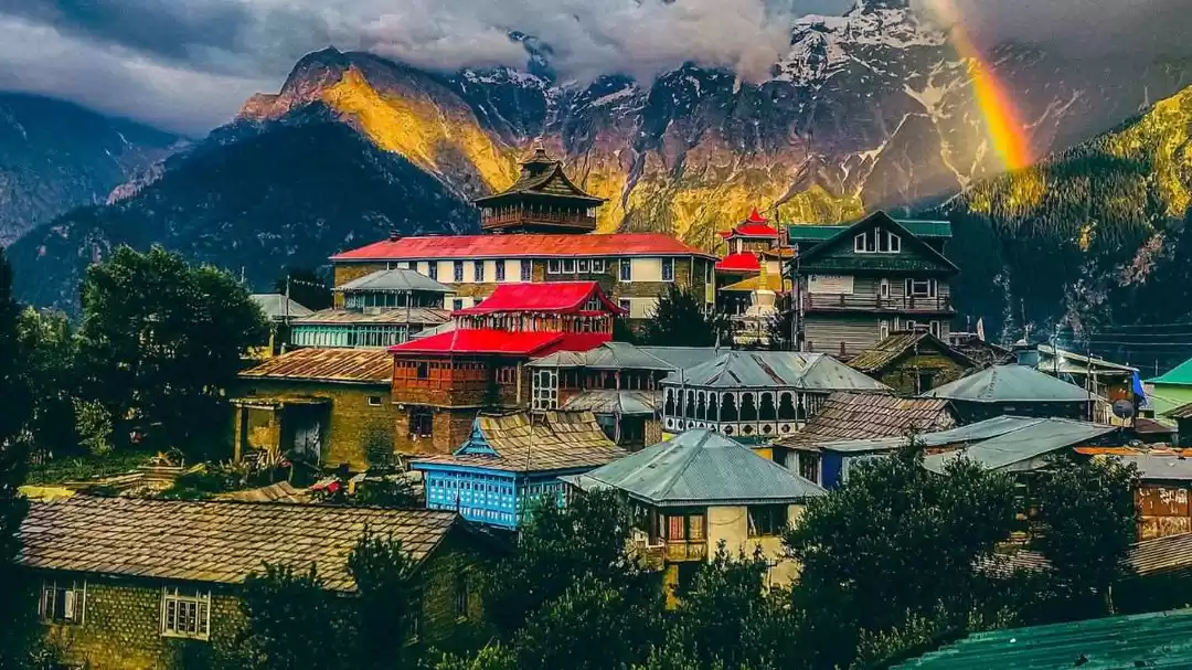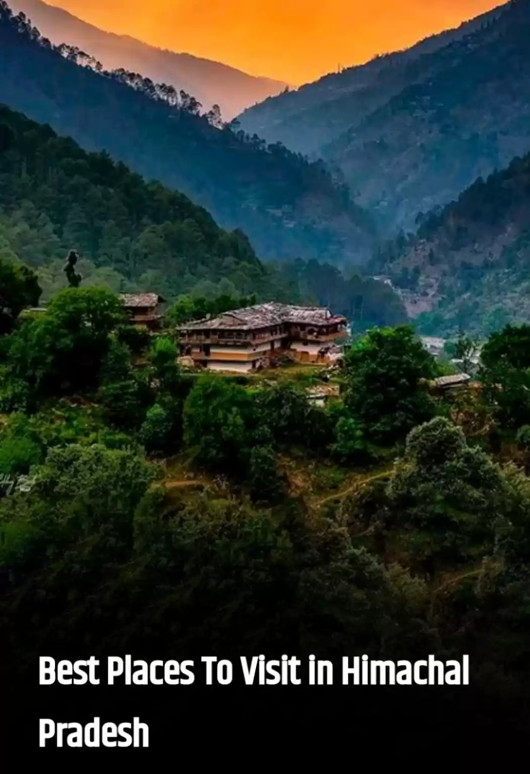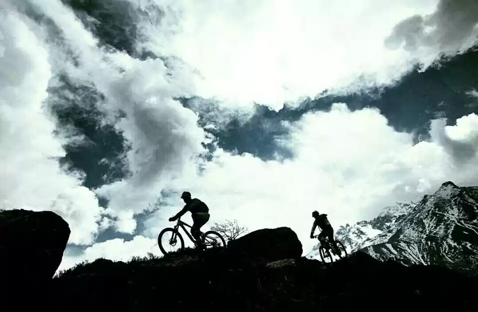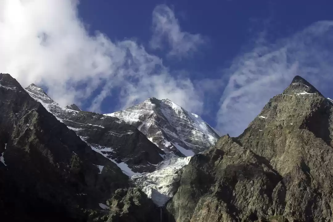

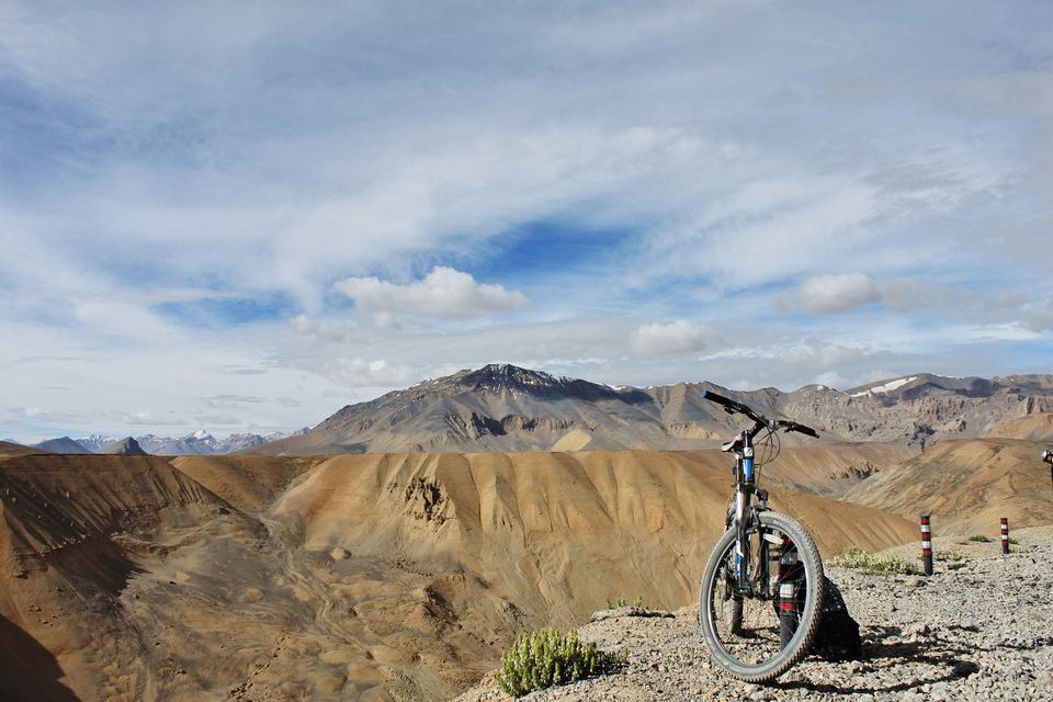


The Adventure Sport of Mountain Cycling can be a thorough test of the mind and body when it comes to cycling over high altitude passes and extreme climatic conditions. But on the other hand, the serene beauty of snow laden valley after valley of the Himalayas, housing exquisite little villages with wizened faces and rosy cheeks of the locals, Ladakh is a land that seldom seizes to surprise a traveller.
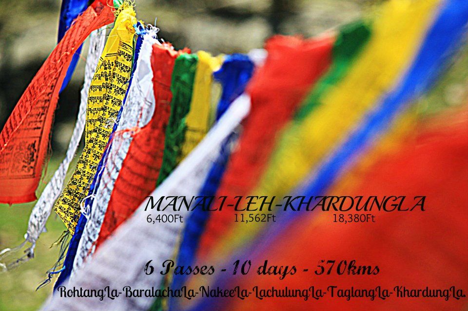
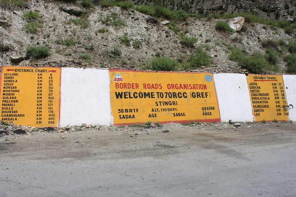
Manali to Leh is a route that is mostly done in a time of 10 days, covering a total of 530kms till Leh. In the process, one crosses over 5 high altitude passes, namely- Rohtang, Baralacha La, Nakee La, Lachulung La and Taglang La. A safety car with a medical kit and an oxygen cylinder is a must for such routes. Tents and camping kits are essential for this trip. The best time for doing it being in the months of June till about mid-September. Cycling provides ample time to absorb nature's beauty and the surroundings.
It isn't the destination that matters, it is the journey that captivates and fascinates the mind of a traveller and their experience of Ladakh.
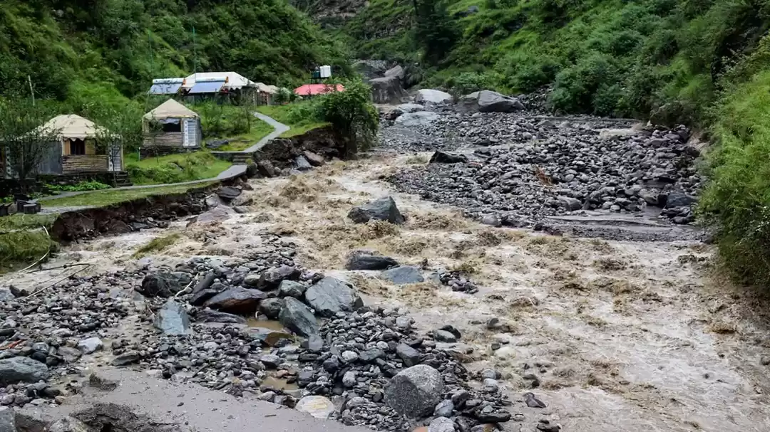
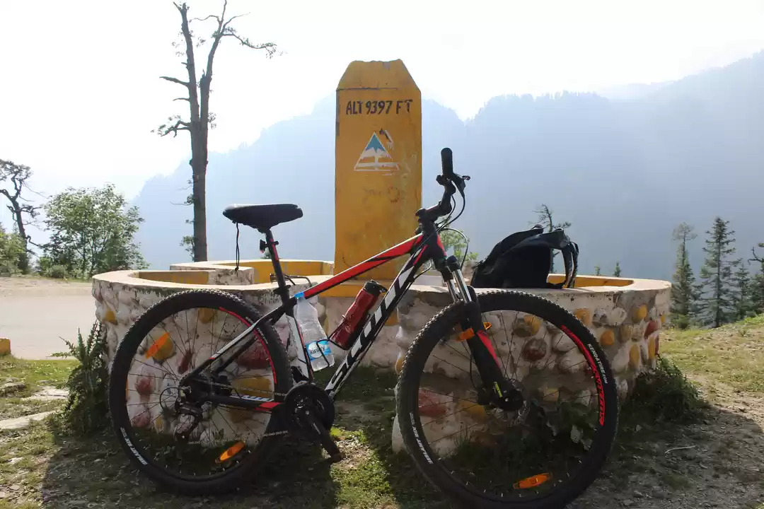
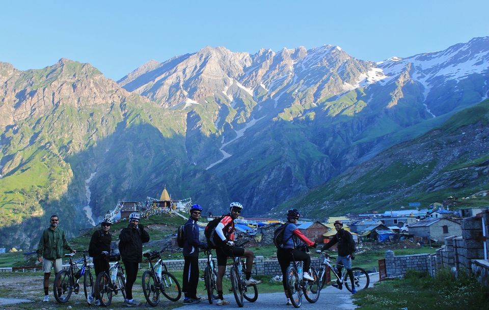
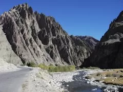
The first day of the trip is most definitely the hardest as the body is not yet acclimatized to the altitude and and the oxygen levels. One requires a lot of preparation mentally and physically because the increase in altitude makes one irritable and if most often there is rain and landslide till Rohtang is not cleared over. The terrain is not lenient either because Marhi is the base camp at the foothills of the first pass to be crossed over- Rohtang Pass (13,000 feet). The route is very scenic and soothing as you slowly start the ascent along side Beas river and end at Marhi which faces the Pir-Panjal Range and Rohtang Pass, which is the second day's objective.The distance till Marhi is about 40kms. Breaks can be taken at Kothi, 15kms away from Manali and at Gulaba, 25kms away. Both these places have Stalls which serve quick fixes like Maggie, Omelettes and hot beverages like Tea.The total climb is about 4200 feet and sleeping height is 11,000 feet at Marhi.

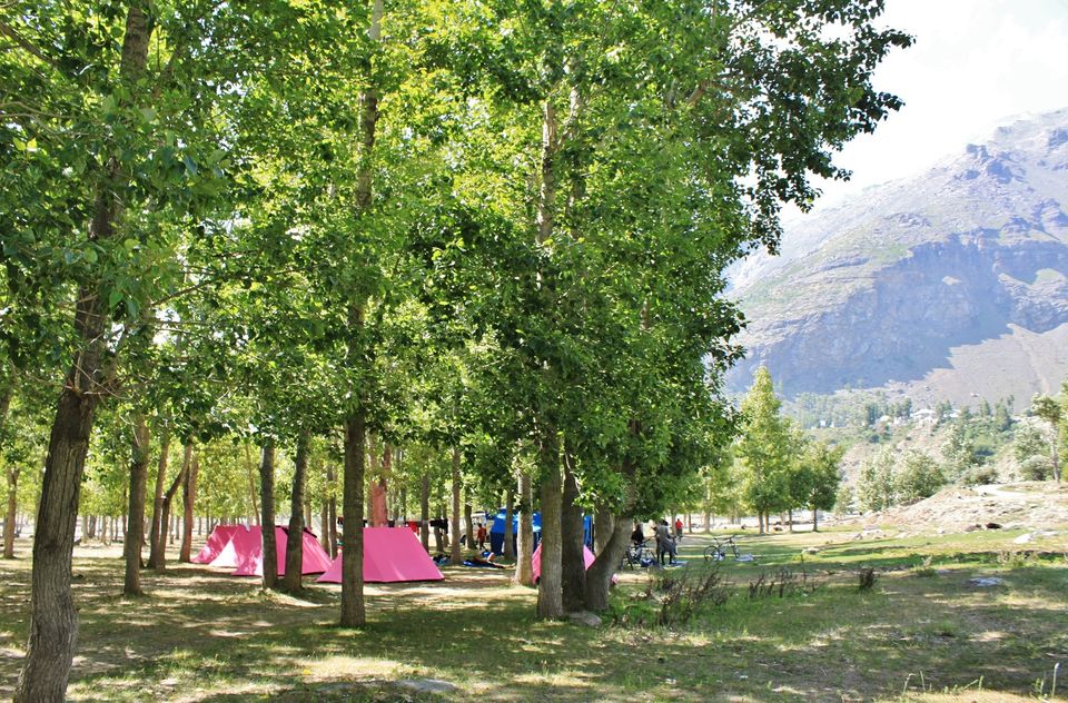
An early morning start from Marhi is essential because as the day progresses, a lot of tourists from Manali come up till Rohtang Pass in search of snow and the road becomes very busy. Major sections of the road till Rohtang top are tarmac void and rutted because of the heavy motor vehicles plying on them while it is raining and the numerous number of tourist cars. Rohtang being at a height of 13,200 feet, windcheaters and gloves are advised for the pass and the descent on the other side. Rohtang onwards, the road is downhill for 20kms and 5kms synchronised slopes, hence there is hardly any effort required. Specially after Khoksar, there is a beautiful tarmac road leading all the way till Sissu.The camp site in Sissu is on the banks of Bagha river and amidst tall green trees.The distance till Rohtang top from Marhi is about 18kms and total climb in height is 2200 feet.A stoppage at Khoksar is advised which has a lot of local dhabas which serve delicious food items.Total distance covered is roughly 45kms.

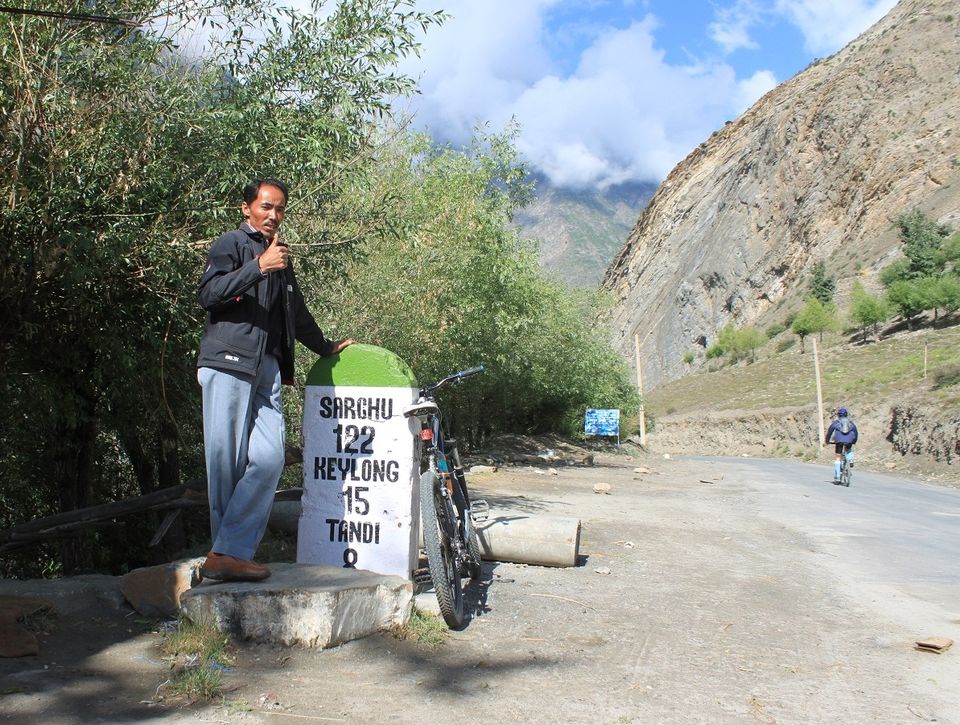
The third day is a mix of climbs and descents throughout the stage. It starts with a decent climb of about 800 feet till a small village called Gondla. From there on, the road is all downhill and not very well maintained till Tandi. All the way till Tandi bridge one can see the river Bagha meandering alongside the road. The climb begins again till a very important location on the Manali-Leh highway called Keylong. A lot of well structured restaurants, mechanics and shops are available here. Till Jispa there is a 800ft climb. The climb continues all the way till the last 10kms before Jispa where there is a very technical downhill of about 400ft on very bad roads.Total distance covered is about 52kms and accommodation in Jispa is available at Padma Lodge and Ibax Hotels which are a welcome relief for those looking for a hot water bath and a blanket to sleep in.
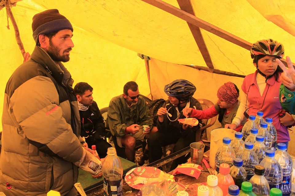
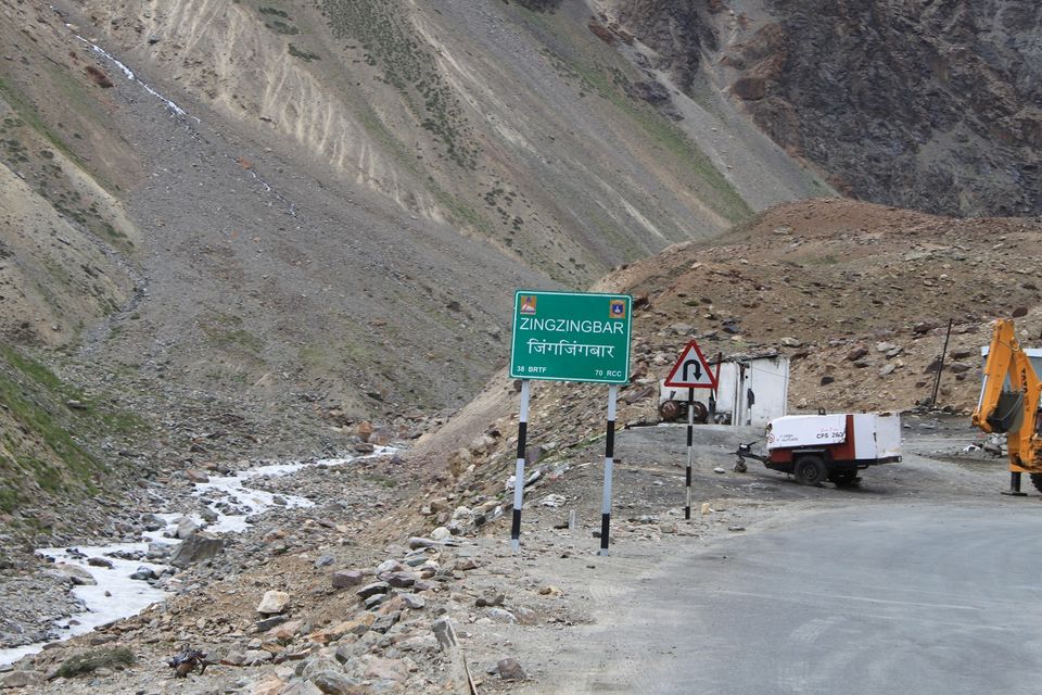
From this day onwards one starts to actually realise the total change in vegetation and climate. Zingzingbar is the base camp for Baralacha La and the climb is steady.Starting early means one can easily reach Patseo which is a minute settlement on the banks of Deepaktal, a small sized lake. Patseo actually being a total army settlement.The small parachute-tent at Patseo is a good spot for a break and a meal with a beautiful surrounding in the form of blue waters of Deepaktal.Beyond Patseo, the terrain drastically changes and one starts to notice the barren land surrounded by dry and arid mountains. In another 9 kilometres, one approaches Zingzingbar and once the last climb is made, the valley opens up for a beautiful and open camp site.Sleeping height at the Zingzingbar camp being 14,100 feet, the total height climbed in the day is roughly 3,300 feet.Total distance covered is about 40kms.

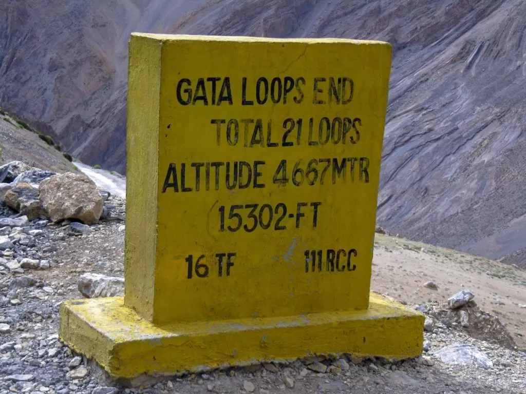
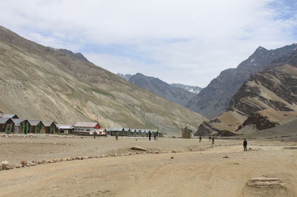
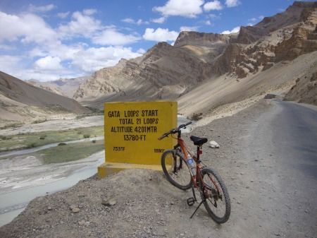
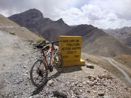
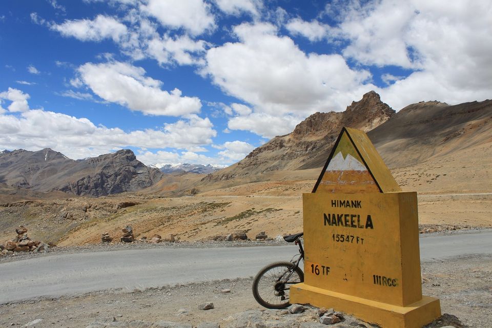
A real challenge in all forms. The sixth day starts with The 21 Gata Loops and goes on to cross over NakeeLa(16,200ft) and yet another ascent of LachulungLa(16,800ft). The reason Gata Loops are so famous is because in under 10kms of travel, there is a height gain of about 1500ft. Once the 21 loops end, there is a final climb up till NakeeLa, from where it is all downhill till the next break point, which is, Whiskey Nallah. Whiskey Nallah has a single very big parachute tent which provides whole meals along with bed and breakfast. A very convenient stop over. Whiskey Nallah marks the climb for LachulungLa which is indeed very excruciating all because of the bad road conditions and the mental trauma of beginning an ascent for the second time after a downhill run. LachulungLa is at 16,800ft and it is marked yet again by a BRO mark-post and numerous prayer flags. The ride from the top till Pang is a technical one with road conditions being on the downside, but once you reach Pang, the cluster of tents is a welcoming sight. Being set-up right next to an army post, one can also use the satellite-phone facility at the army base. Pang serves tourists with ample traditional dance and folklore along with food and accommodation. Total distance covered is at about 57kms and the sleeping height at Pang being 14,800ft.

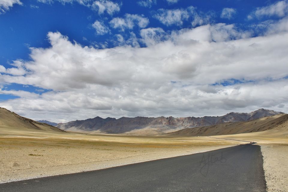
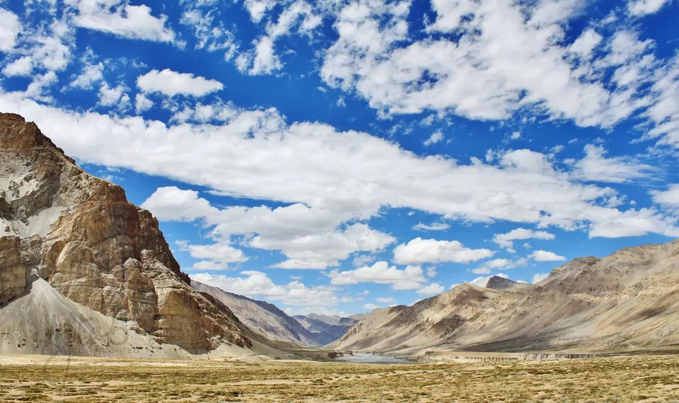
A short 10 km climb ensures one hits the Morey Plains at an altitude of 15,600 feet. In the next 40kms of Morey Plains, which is infamous for its bad surface quality and high head winds, we were pleasantly surprised to find tarmac and excellent quality road and on top of it, there was hardly any headwind. Morey Plains are a visual treat at the top of the draw at like a 40 km long and 50 km wide belt with mountains flanking it from all sides but it still maintains its billiard top levelness all through.The day ends here at Debring, 20kms away from the final pass for the 8th day, TaglangLa. Debring has some stone and tent structures which facilitate very comfortable bedding and meals too because a lot of times, the terrain in this area is too sandy to pitch tents with extremely high speed winds.A total of 50kms covered in the day and a sleeping altitude of about 15,000 feet.
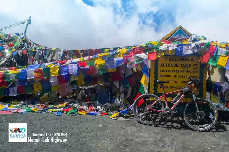
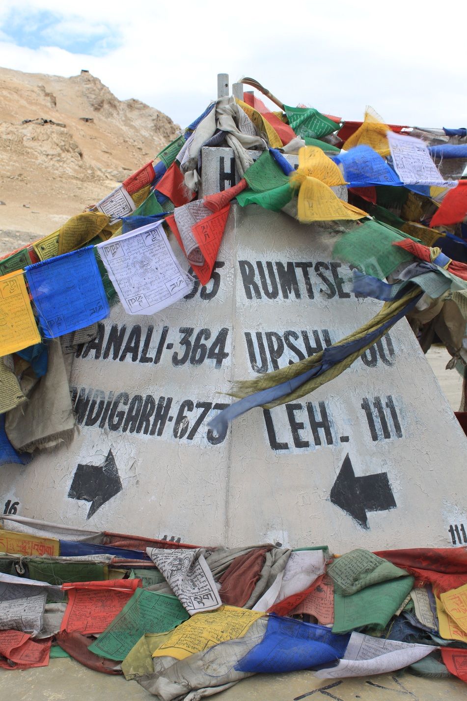
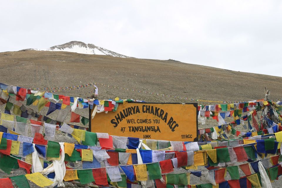
TanglangLa is very unlike any other pass. It does not give you an option to gain altitude in switchbacks but teases you with long-long-long sections of constant gradient climbs that go on forever. One can see the destination at all times and it may fool you with a sense that it is just a touch away, but the reality being- it is a long hard laborious climb from the base. Starting from Debring, the climb is immense and TanglangLa is the 2nd highest motorable road in the world.Once you reach the top at 17,582ft , the downhill from that point beyond has to be the best on the trip till Leh. The scenic beauty is unmistakable and out of this world. From there on, you cross the small villages named Rumtse and Gya, to finally reach Lato. Lato being at an altitude of 13,400ft the total distance covered is about 56kms from Debring.
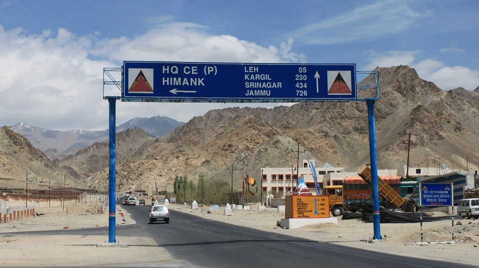
The last day is 15 km downhill to Upshi and then a 50 km undulating terrain to Thiksey and a final 800 feet climb in 5 km to Leh. Upshi is a major army base and a point where one first encounters the mighty Indus River travelling with till Leh. Karu is a nice location to stop for lunch and a break. Karu is the place from where you reach the 3rd highest pass in the world - ChangLa and from where the road continues to Pangong Lake, a huge brackish lake at over 15,000ft. Not far from there is the volatile China border too.The next big town from Karu is Choglamsar, 6 km from Leh and from where the final ascent begins.Covering a total distance of about 70kms, the resting height of Leh is about 11,600ft.
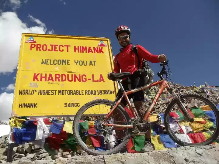
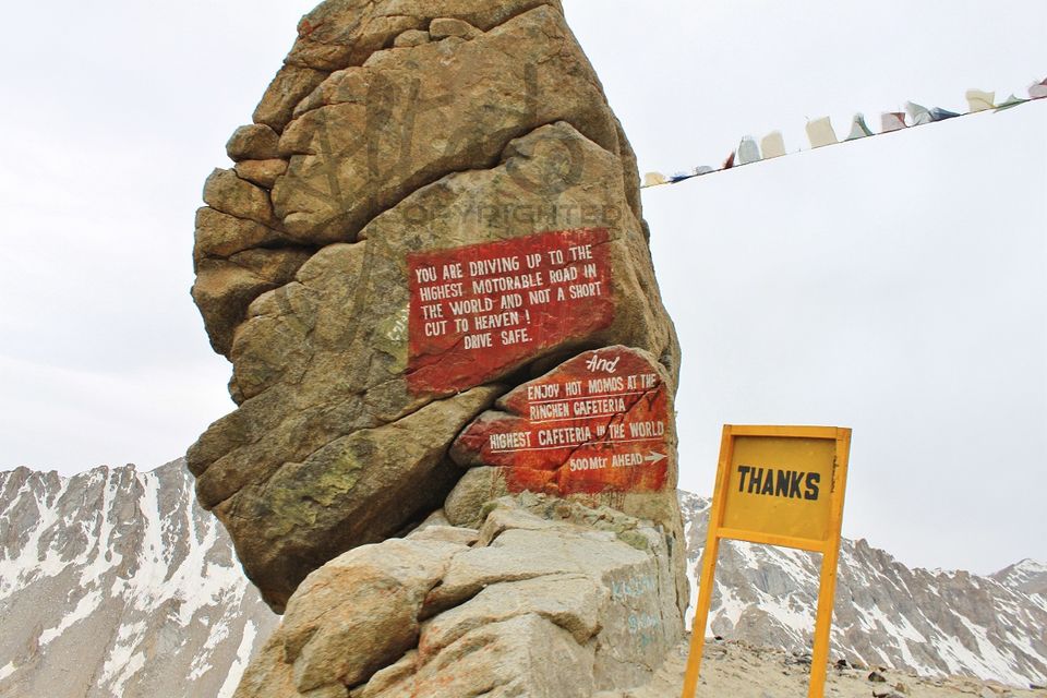
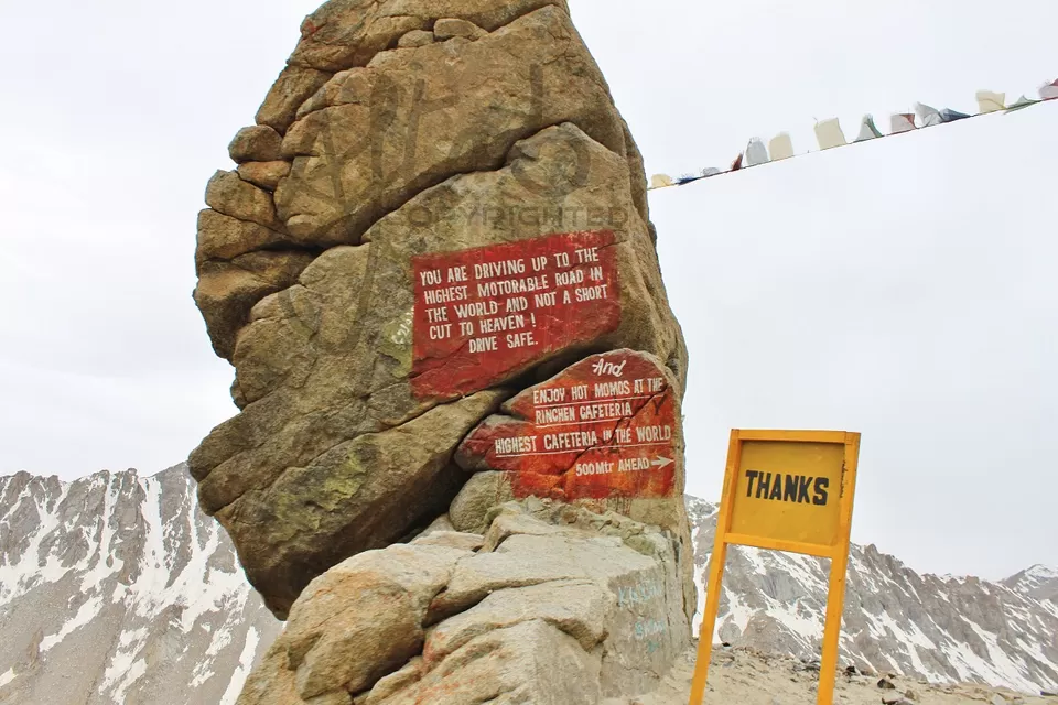
Leh to KhardungLa is a 42 km climb till the top and one has to climb around 6,500 feet or so in 42kms. KhardungLa being the highest motorable road in the world. The road till South Pullu covers 28 km in the best of roads and very conveniently too. The remaining 14 km till the summit and a climb of 2500 feet is on a slightly less well maintained road and can get pretty rough at patches. It takes a heavenly effort to convince the body and mind to keep going forward at such high altitude and treacherous conditions. One might notice that 17,800 feet is the actual altitude measure with a GPS and Altimeter, full 530 feet shy of the boards that scream 18,380 feet. The reason being that the actual Khardung Pass which nomads used was 500 feet higher. When the road was constructed it was given the same altitude measurement for historical reasons rather than anything else.So in all, the total climb for the day is about 6,500ft.
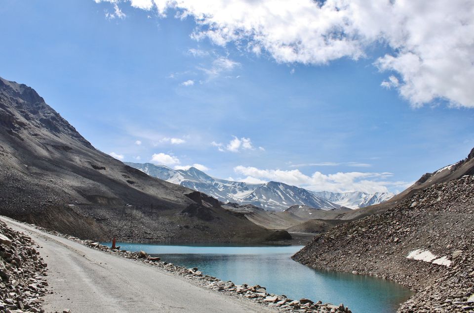
The main highlight of this day is the 17km climb to the top of Baralacha La, the first pass at over 16,000 feet. Before Baralacha La, there are beautiful valleys all around. 14kms into the climb, you come to Surajtal, which is a magnificent blue lake right before the pass. Baralacha La is situated at a height of 16,500 feet and is marked by several prayer flags and a lone shrine at the top.Once you cross over Baralacha La, the descent continues till Bharatpur where a stop can be made if needed. Other than that, if one keeps moving, the Sarchu plateau is a treat to bike on because of it's well maintained roads and epitome of scenic beauty with Bagah flowing alongside once again. Sarchu is advisable for a lunch or meal break.Brandy Nallah is at the base of the infamous Gata Loops. Camping at Brandy Nallah is often a better choice as it leaves only so much for the next day for the cyclists to cover the Gata Loops before the next two passes are crossed over.Day 5 being longest in terms of distance covered as almost 60kms are covered trying to align ourselves for the Gata Loops, NakeeLa and LachulungLa pass the next day.
Frequent Searches Leading To This Page:-
leh ladakh tour packages, places to visit in ladakh, things to do in ladakh, hotels in ladakh, ladakh tourism

' fill='%23359391'%3e %3cpath d='M46.1538462%2c43.5714286 L41.5%2c50 L36.8461538%2c43.5714286 L36.8670256%2c43.5714286 C36.3173077%2c42.7142857 36%2c41.6851429 36%2c40.5714286 C36%2c37.4854286 38.4535641%2c35 41.5%2c35 C44.5464359%2c35 47%2c37.4854286 47%2c40.5714286 C47%2c41.6851429 46.6826923%2c42.7142857 46.1329744%2c43.5714286 L46.1538462%2c43.5714286 Z M41.4294872%2c39 C40.6150641%2c39 39.9487179%2c39.675 39.9487179%2c40.5 C39.9487179%2c41.325 40.6150641%2c42 41.4294872%2c42 C42.2439103%2c42 42.9102564%2c41.325 42.9102564%2c40.5 C42.9102564%2c39.675 42.2439103%2c39 41.4294872%2c39 L41.4294872%2c39 Z' id='Location-white'%3e%3c/path%3e %3c/g%3e %3c/svg%3e)