
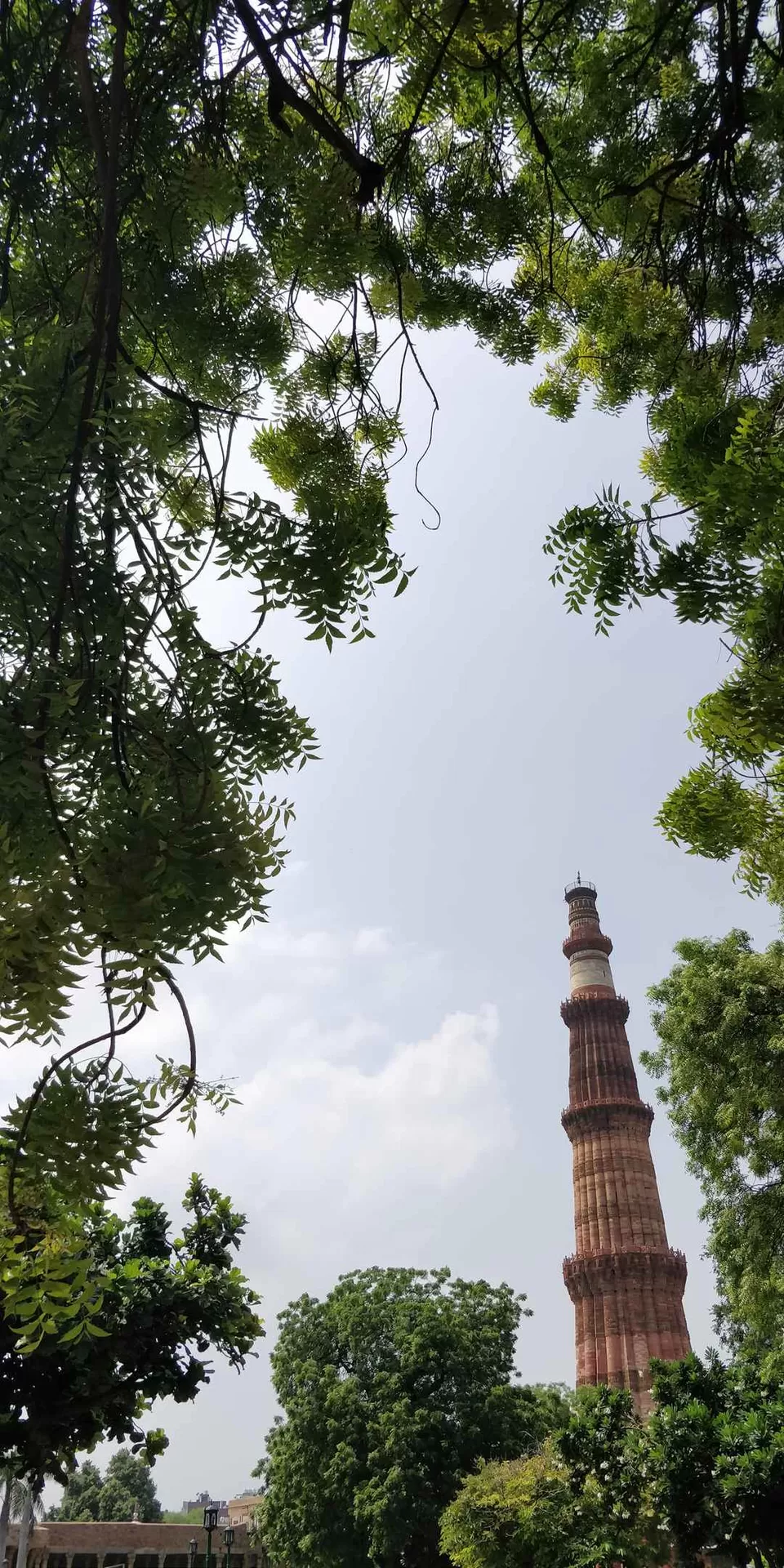
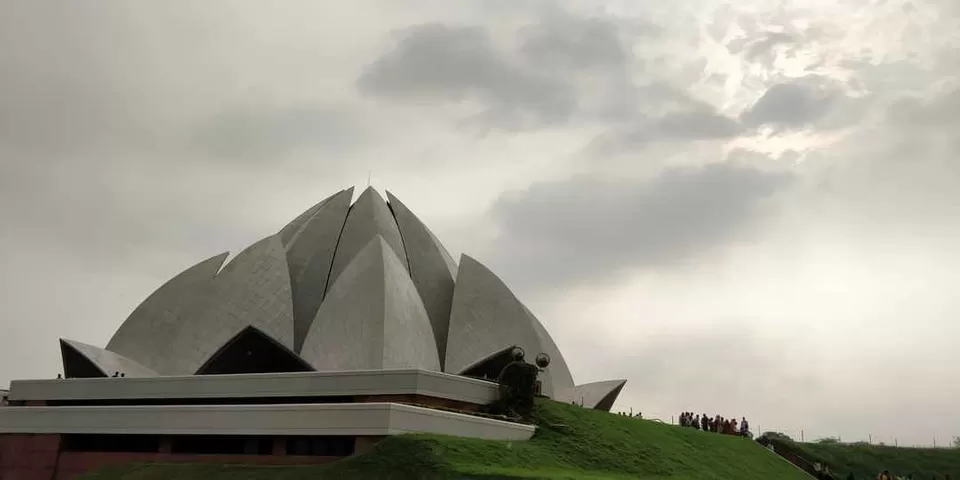
Today I am coming with a brand new blog about Pin baba pass trek and my days at Himachal during that time.So I had an early morning flight to Delhi from Bangalore.I spend the entire day in Delhi, there my first destination was Kareem’s Hotel near to Jamamasjid, I love the mutton items there especially the mutton sheek kabab, So whenever I go to Delhi this one is in my first priority. After that I visited Kutabminar, it is a UNESCO World Heritage Site in the Mehrauli area of Delhi, India. Qutubuddin Aibak,founder of the Delhi Sultanate, started construction of the Qutb Minar's first storey in 1199. This level has inscriptions praising Muhammad of Ghor. The architecture and inscriptions of this tower is magnificent. My last stop was Lotus Temple, personally I don’t like rush tourist spots But I don’t have any other option. This one was near to the Bus station from where I have to catch the bus for Shimla at night. After that I had to take an overnight bus journey to reach Shimla,I was there by early morning.
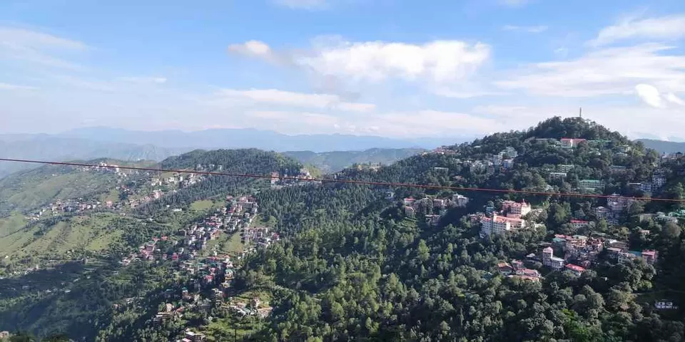
Did my check-in first, when I reached my room first thing I noticed was the view from my window. What a beautiful city it is!!! But it was just a start of my journey in Himachal. I didn’t have any clue about what all I am going to experience in the coming days.
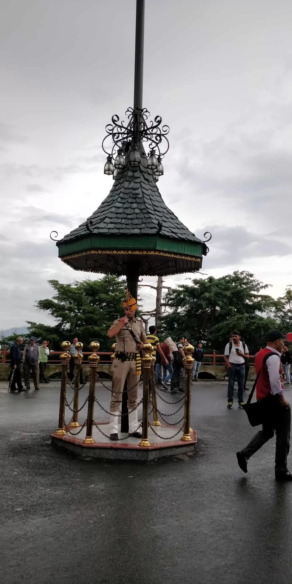
I spend a full day and night at Shimla. There I went to Mall road first for some small shopping, Can’t take too many items in my backpack as I am heading for my trek.
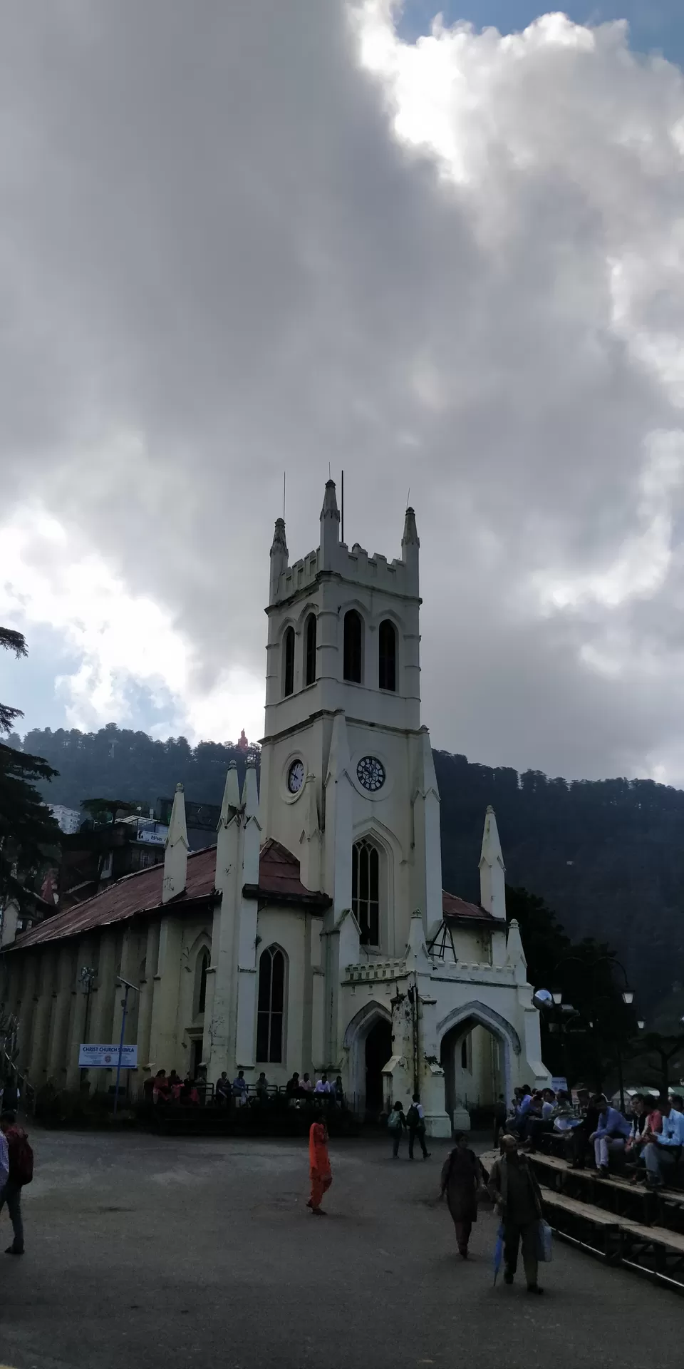
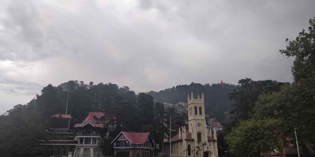
Mall Road is the main street in Shimla, Constructed during British colonial rule, the Mall road is located a level below the ridge road. The offices of municipal corporation, fire service, and police headquarters are located here. The Ridge Road is a large open space, located in the center of Shimla. It is the hub of all cultural activities of Shimla. Underneath the Ridge, large water tanks are placed from which water is supplied to the British era tourist town. The Ridge houses the city's lifeline in terms of the water reservoir, with a capacity of 1000000 gallons of water, beneath it. Because of the fact that these tanks are significantly large in size, they have been used as the main water supply for Shimla. Another highlight here is Christ Church which is Situated on the Ridge, It is the second oldest church in Northern India. In the backdrops of the church you can see the Jakhu Hills and the big stautue of Lord Hanuman.Next day I started from Shimla to kafnu.
My trek organisers have arranged a 4*4 Jeep for this long travel. In between we had breakfast from a place called Kufri. The view from there was really beautiful you can see the snow-covered mountains right there in the horizon.
NOW I WANT TO SHARE WITH YOU SOME INTERESTING FACTS ABOUT THE ROAD THROUGH WHICH WE ARE TRAVELLING, THERE IS A RICH HISTORY BEHIND THIS ROAD THIS IS KNOW AS ONE OF THE OLDEST ROAD IN INDIA.
Road where history speaks
The Hindustan-Tibet Road, also known to us as the National Highway 22, leads to Kinnaur and presents an idyllic picture of life above 12,000 feet. This one conjures up images of a rich past, a valley flanked by the Trans Himalayas and The Kinner Kailash range, a road along the river Sutlej which is flowing in from Mansarovar Lake in Tibet through the narrow gorge. In this altitude the life and the People here are as rugged as the land, and here Buddhism prevails alongside Hinduism, a place dotted with Monasteries and Temples.


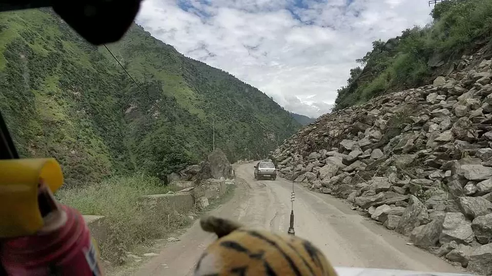
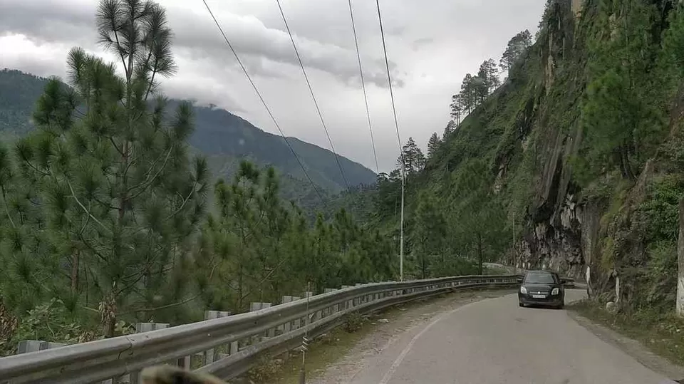
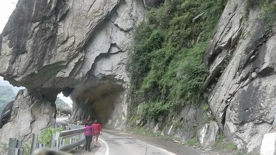
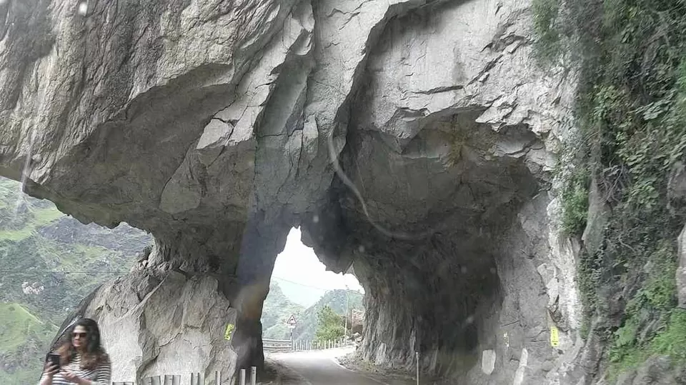
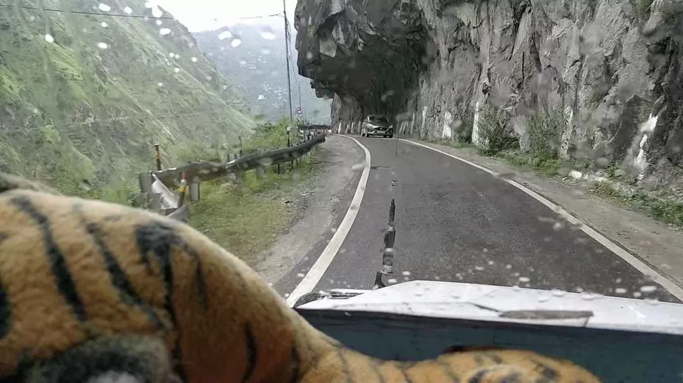
As it is one of the most dangerous and scariest road in the world, it possess the most beautiful terrain too, due to that Bollywood movie shootings happen very often here. Now as we entered the Kinnaur District you will be noticing the differences in the surroundings, the mountains are becoming taller, cliffs are deeper and the entire drive looks a bit scary. There is an adrenalin rush we get while going through this road due to the deadly turns everywhere and deep cliffs at either side of the road. At certain places the Rocky Mountains are carved inwards and the road is constructed, which make it look even more scarier.
The Kinnaur District
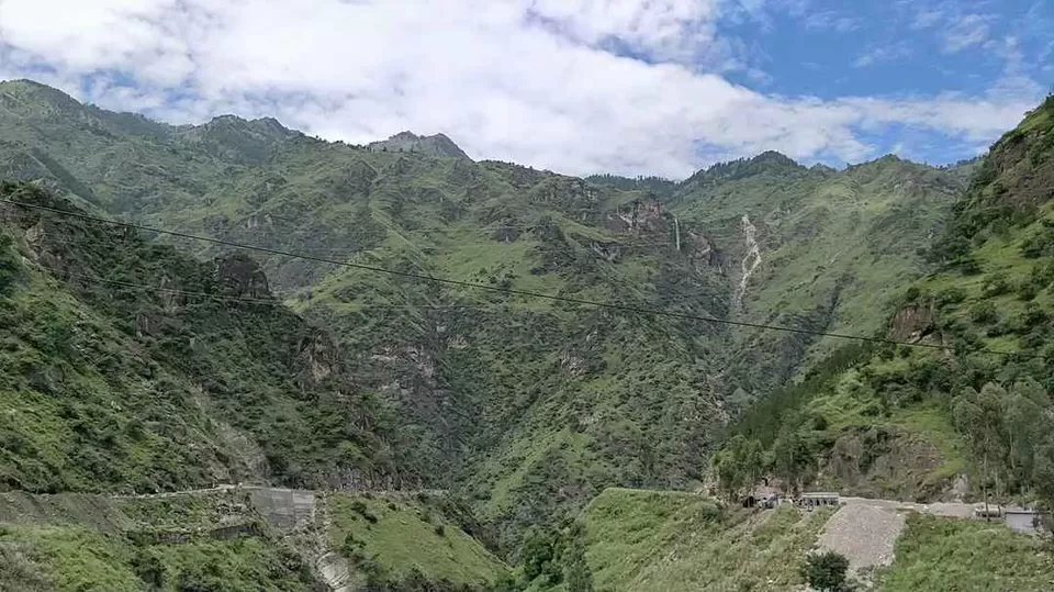
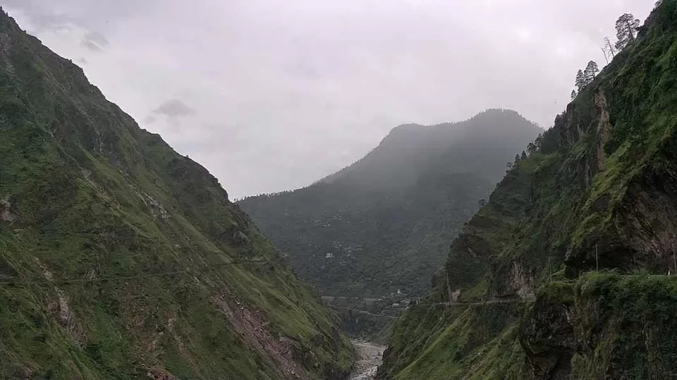
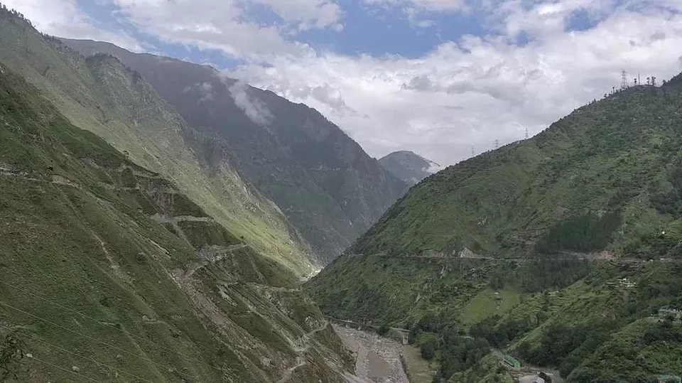
The major part of the Hindustan Tibet Road passes through Kinnaur valley. It goes along the bank of river Satluj and finally enters Tibet at Shipki La pass. The headquarter of Kinnaur district is about 235 km from the state capital Shimla. It is surrounded by Tibet in the east and is the northeast corner of Himachal Pradesh, The valleys of the Satluj, Spiti and Baspa rivers along with their tributaries are enclosed in Kinnaur by three high mountains ranges in Kinnaur, namely, the Zanskar, the Himalayas and the Dhauladhar, The district was opened for the outside world in 1989.
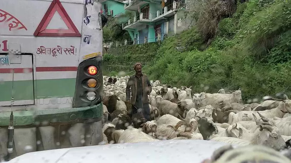
It’s slightly raining here and there is small traffic block due to the herd of sheep passing by. One of the main revenues for the villagers here are sheeps. They use it for milk,wool and meat.
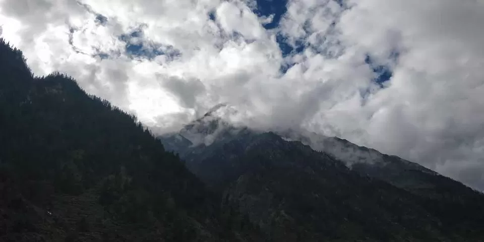
You can clearly notice the difference in the terrain as we are in kinnaur, see the beauty of majestic mountains infront of the road. As we are gaining the altitude I can feel the less density of oxygen in air now.We just crossed Wangtoo and now we are going straight up to the kafnu village.Now we have taken the cut road for the kafnu village from the main road. The Hindustan Tibet Road will go towards the Indo tibetian border from here.These deadly turns in this road are looking even more scarier due to the height, you can see the other mountain roads deep down below. Even though this road looks really scary and dangerous for an outsider, These local drivers here are really used to this roads, they ride through this road with absolute ease. It’s only because of the experience they have, they might be riding through this roads from years. I was getting a bit nervous when he was in his mobile and driving our vehicle with just one hand and at times even with out touching the steering also.
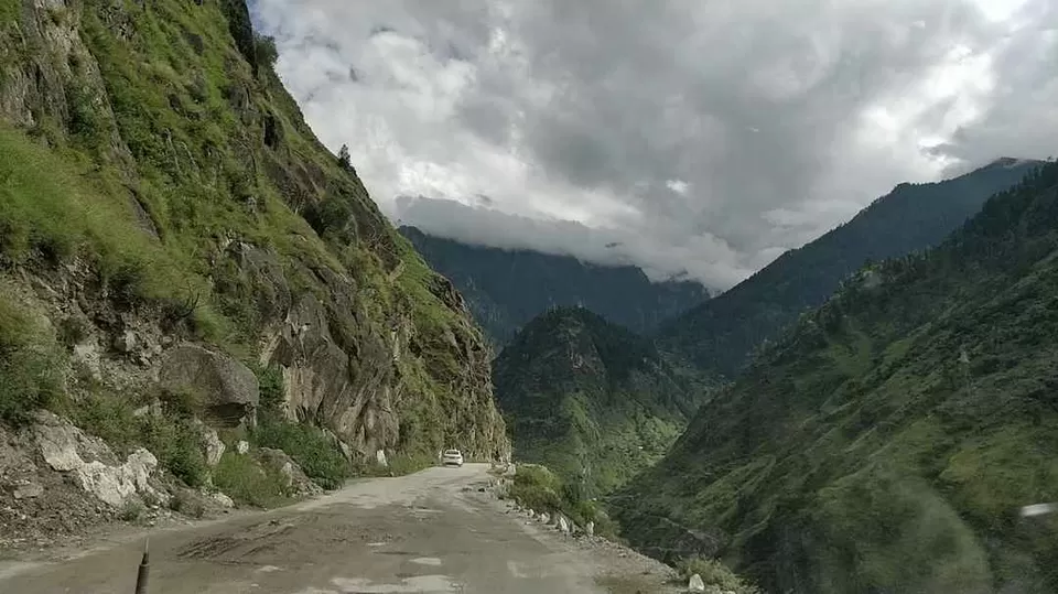
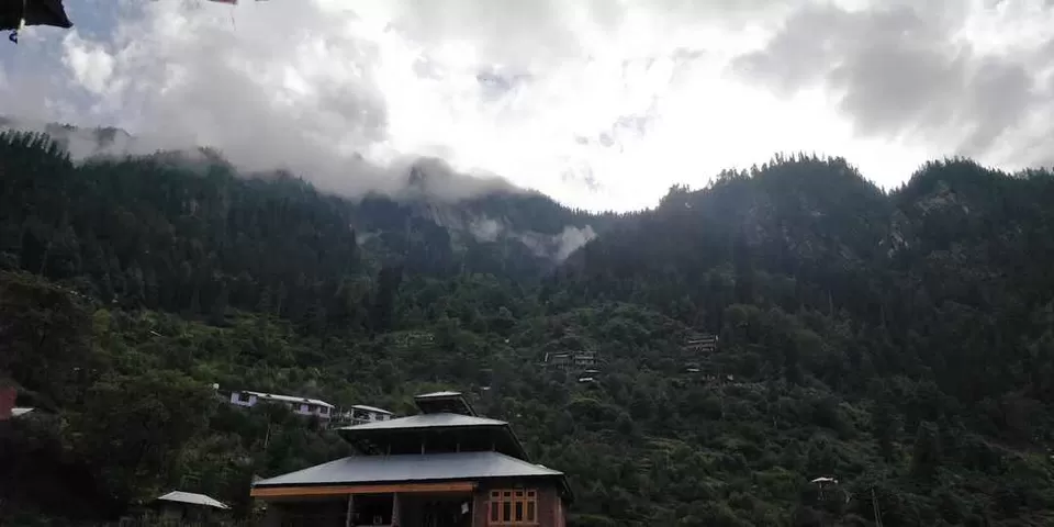
The road to Kafnu climbs fast over the hydel power project at Wangtoo which can be nerve wracking when the jeep swings left to right on the narrow dirt road hanging over precipitous cliffs. We are just reaching the Kafnu village where my trek organiser has arranged a stay in one of the local lodges It’s important to use the day to rest in preparation for the trek to Mulling tomorrow. So here we are at this beautiful village named Kafnu, it is located at an altitude of 8200 FEET in Bhaba Valley, I instantly fall in love with this place, you can see Apple trees ever where, it’s very common here. I will come back to you soon with more exciting stories about kafnu and my trek in my next blog, till then stay safe and stay tuned. I will stay at Kafnu for the night, at one of the local lodges.
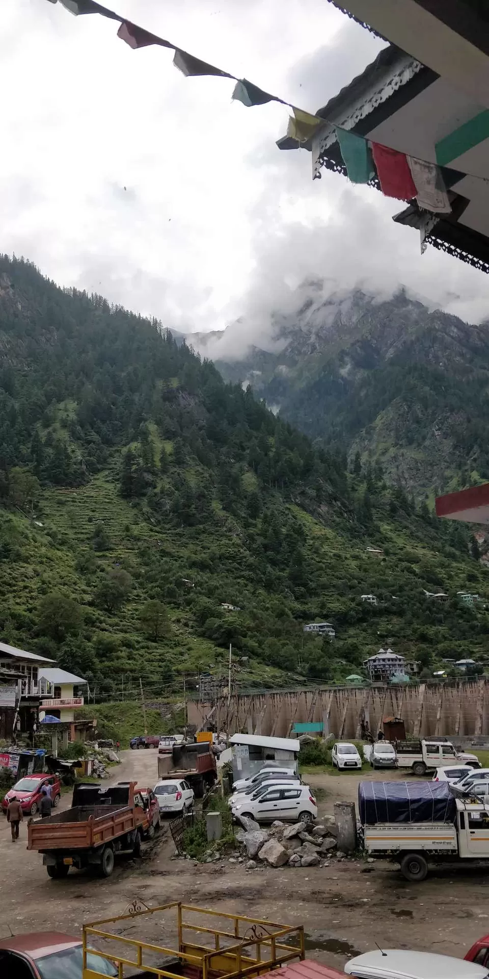
As I told the entire route to Kafnu is really beautiful covered with big mountains rivers and waterfalls.Getting to Kafnu is not as difficult even though it is a really remote village in the deep reaches of southern Himachal. It is a serene village, remotely situated, almost 200km away from Shimla. The ride will be 7 hours long but the road comes with beauty and joyride of turns and twists. Kafnu is a known village of Kinnaur due to the Hydroelectric project. This hydroelectric power project is on the Bhaba river which is a tributary of River Sutlej. Kafnu is well connected by bus to most of the nearest cities due to this reason. We took pee breaks in between, it also helps to manage with motion sickness and also handle the tiredness in this exhausting journey.


Now you can see the River Sutlej down there parallel to the road , it is one of the main water source for the surrounding cities.


Historic background of Old Hindustan Tibet Road
The British Governor General of India, Lord Dalhousie (1848-1856) ordered to commission the work of constructing Hindustan Tibet Road in June 1850. He wanted to create trade ties with Tibet and this is felt to be the real reason for initiating the road other than his monitoring access to far off regions under British control. Then Commander-in-chief Sir Charles Napier has designed the map of road and he started the constuction. Beyond Shimla, to the Shipki La pass on the border, the route included a length of 228 miles through Shipki-la till Shipki village in Tibet.


While the Dalhousie brought the route into focus, the area had long been on one of the peripheral trade circuits of the legendary Silk Route. The path that passed the tract carried goods like musk, borax, wool, livestock, dry fruits, precious and semiprecious stones to and from Tibet, Kashmir, Ladakh and Yarkand. It was basically a mule track constructed and maintained by British. We reached Rampur and there we stopped for some time to have our Lunch.
The Route of the Hindustan Tibet Road
This road has been featured in the History Channel as one of the most “Deadliest Road” in the world. Built in 19th century, the Hindustan-Tibet road, also known as the Silk route or the National Highway No. 22, begins from Ambala in Haryana, as an offshoot of NH.1.It runs 40 Km through Punjab and is known as Ambala Chandigarh Expressway. From Chandigarh, it runs north towards Zirakpur and meets NH.64. Thereafter it goes to Panchkula- Pinjore- Kalka and then enters Himachal Pradesh at Parwanoo.With the change in the terrain it becomes a mountainous road, full of hairpin bends and continues north-east up to Solan and then goes northwards to Shimla. It joins the NH 88, where it repeatedly criss-crosses and goes along the Kalka Shimla Rail track, which is an “UNESCO World Heritage Site”.Then it heads north-east towards the Tibetan frontier from Shimla. Chitkul in Kinnaur district of Himachal Pradesh is the last inhabited village on this road on the Indo-Tibet border.And right now we have crossed the district of Shimla and now we are in Kinnaur district.
The kind of roads we have in this stretch just imagine how much effort was there to create such a road in this terrain. As I told before the last village on this road is Chitkul and after that this road reaches the border town Khab and then runs for a short distance through Namgial up to the Shipkila pass, and ultimately enters Tibet. Here the Indian side of the road ends at the Line of Actual Control. Actually, the road does not lead to the actual border. It closes about 90 km before the border and then rest of the road is under the control of ITBP, the Indian Paramilitary force guarding the frontiers.
Mythology rules
Kinnaur is a land seeped in mythology, nurtured and contained, no doubt, due to the inaccessibility of the region. Ancient Indian texts considered the people of Kinnaur as mystical Kinners () that is like supernatural beings, halfway between humans and gods. The Kinner Kailash range is purportedly the mythical winter abode of Lord Shiva. According to Mahabhartha The Pandavas, too, chose Kinnaur to spend their last year of exile in. Visible from across Jangi, on the old Hindustan-Tibet Road, is a hamlet called Moorang, the name indicating a place where three water channels meet. Remarkable for the strikingly beautiful mountains surrounding the village, as much for a distinct mud structure crowning a rocky hilltop in the foreground. Silhouetted against the sky and the snowy peaks, it is an antediluvian structure of indeterminate architectural style and age. The Pandava Fort is supposed to have been built by them during their stay here; it presently houses Ormig Devta, the reigning deity of the village.


' fill='%23359391'%3e %3cpath d='M46.1538462%2c43.5714286 L41.5%2c50 L36.8461538%2c43.5714286 L36.8670256%2c43.5714286 C36.3173077%2c42.7142857 36%2c41.6851429 36%2c40.5714286 C36%2c37.4854286 38.4535641%2c35 41.5%2c35 C44.5464359%2c35 47%2c37.4854286 47%2c40.5714286 C47%2c41.6851429 46.6826923%2c42.7142857 46.1329744%2c43.5714286 L46.1538462%2c43.5714286 Z M41.4294872%2c39 C40.6150641%2c39 39.9487179%2c39.675 39.9487179%2c40.5 C39.9487179%2c41.325 40.6150641%2c42 41.4294872%2c42 C42.2439103%2c42 42.9102564%2c41.325 42.9102564%2c40.5 C42.9102564%2c39.675 42.2439103%2c39 41.4294872%2c39 L41.4294872%2c39 Z' id='Location-white'%3e%3c/path%3e %3c/g%3e %3c/svg%3e)