Overview
Region :- Uttarakhand Duration :- 5 Days Grade :- Easy To Moderate Max Altitude :- 13,100 Ft. Approx Trekking Km :- 30 Kms.
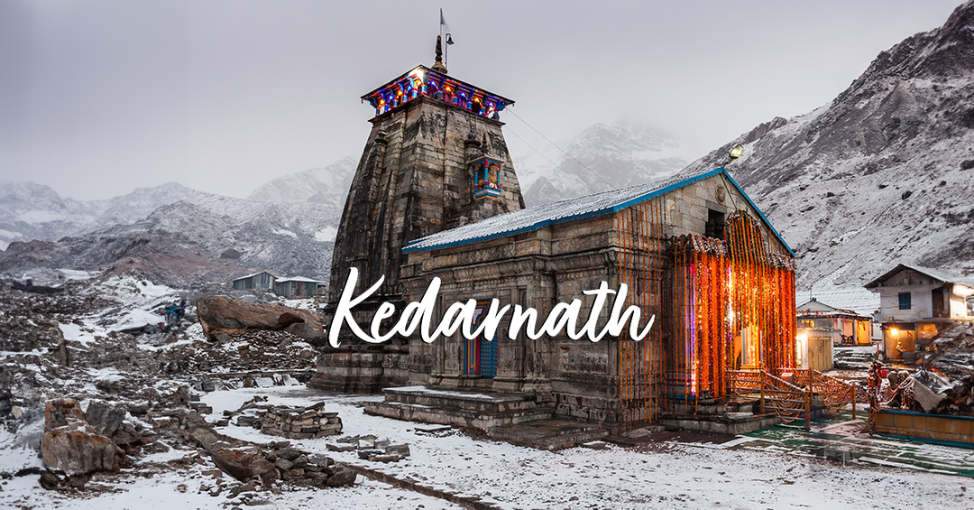
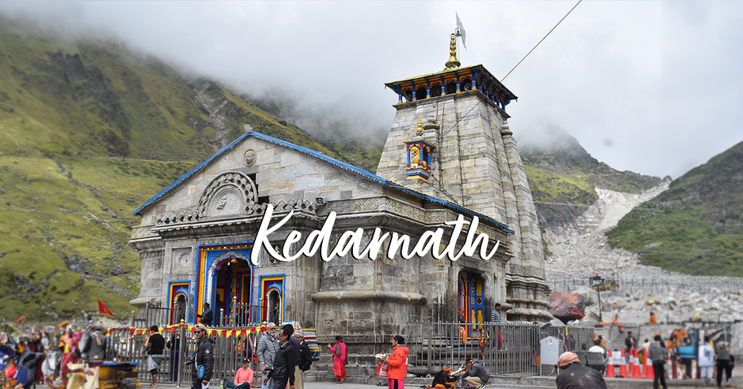
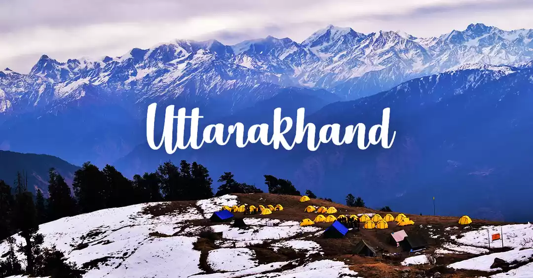
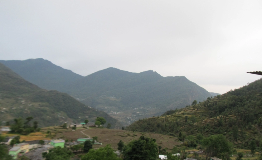
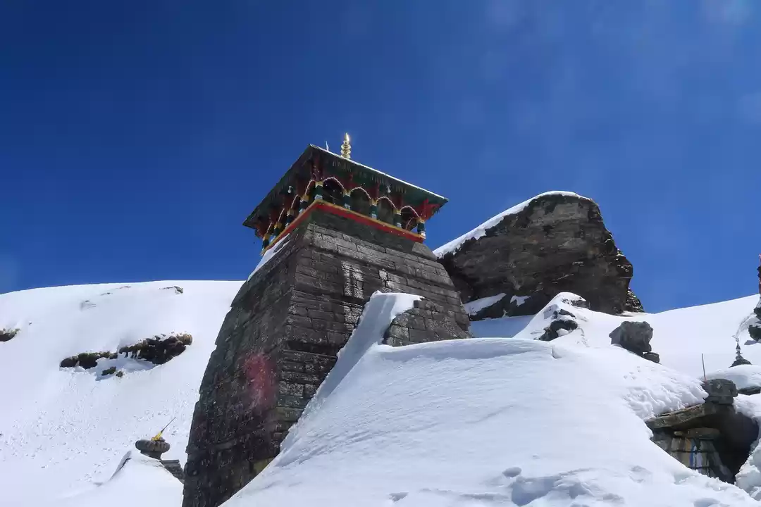
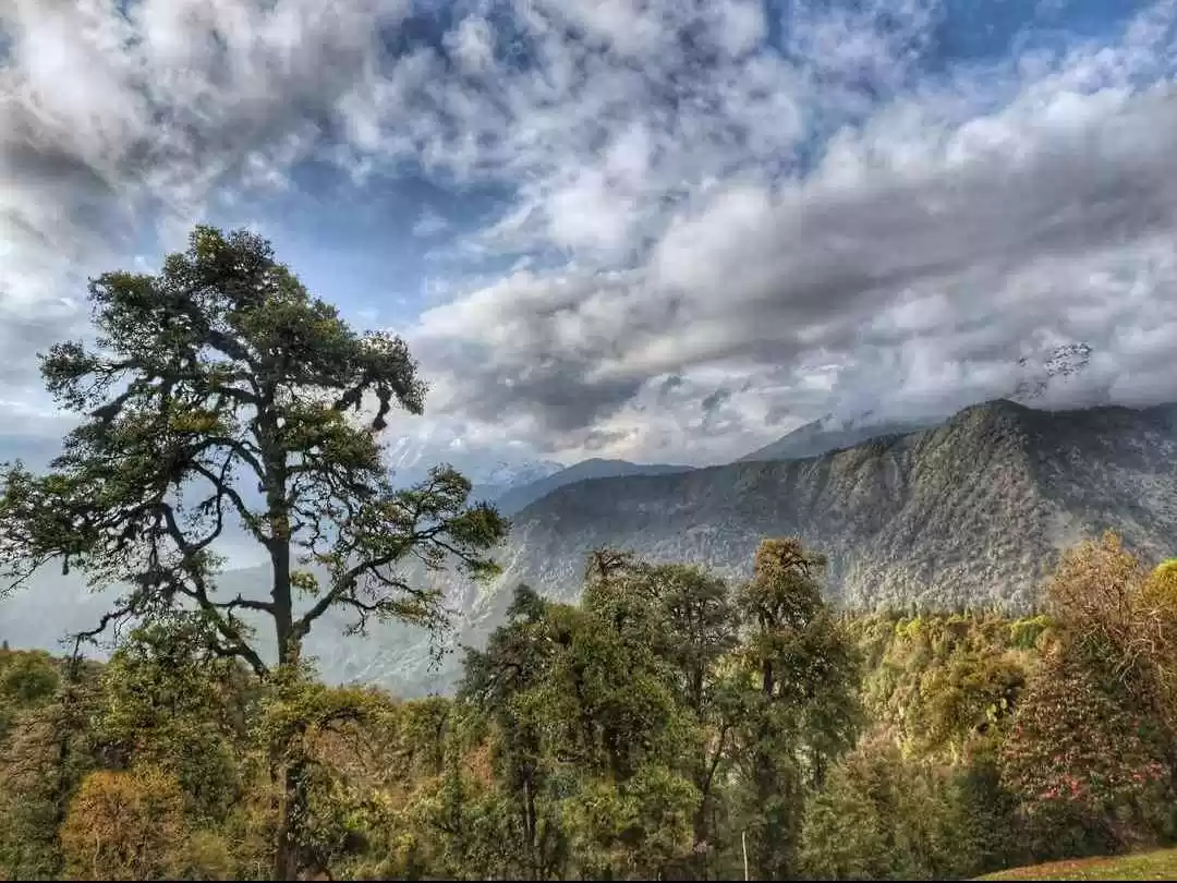
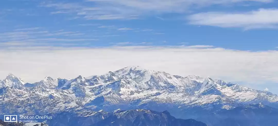
Chopta Chandrashila Deoriatal is a window into Himalaya's spring color vibrancy. A well-loved trek for mountain goers of all kinds, this trek flourishes with blossoms, especially rhododendrons red and pink, in summer time while winters are a hazy shade with enough scopes to have a ball in spilling snow. The whole tour covers a swoop to the Chandrashila Peak, passing by the enchanting Deoriatal lake side, and opens up a gallery of stunning snow peaks all the way. This 5-day plan is unmatched in nature's beauty, exhilarating challenges, time-efficiency and convenience. The highlights of the trek range from awe-inspiring summit views to warmth of the forest greens, piquing up interests in all sorts of mountain lovers. You could be a nature treasurer, bird watching amateur, or a shutterbug with a dream of capturing the drama in the highlands, Chopt-Chandrashila-Deorital is a trek for all and fails none. The first big stop on thetrek comes with Deoriatal. Situated at a good height of 7, 800 feet, the lake is gripped with forests all around. At a short distance ahead, the Chaukhamba massif glistens and the reflection of it is caught in the crystal-like waters of the lake. The effect is striking. The site is steeped in myths. As goes the story, the five pandava brothers from the Mahabharata, once thirsty, had come to the waters of Deoriatal and faced a test of wisdom. Camping here the first night under a stardusted sky makes the mellowest of memories on a trek. Next up on the line of visual ecstasies are the extensive meadows that turn to snow fields along the way to Chopta. As one furthers up the trail, great peaks jump to view-Bandarppoonch, Kedar, and Chaukhamba to name a few. These stellar features of Garhwal Himalayas promise to get more elucidated from the zenith of Chandrashila, so the motivation is never lost and one goes on until the end of the summit stretch at the Tunganath temple.
Brief Itinerary
Brief Itinerary
Day 1: Drive Haridwar-Sari
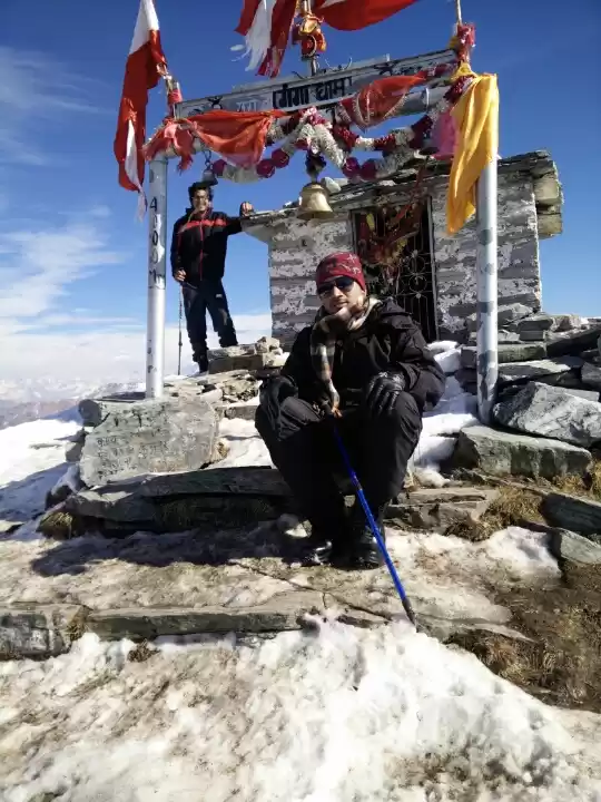
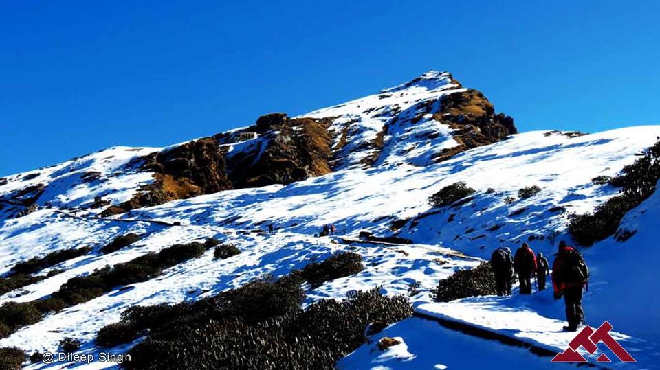
Pick Up Point- Haridwar Railway Station Pick Up Time- 6:00 am Distance- 190 km Driving Time- 7 hour Altitude- 6,600 ft Network Availability- Available till SariDay 2: Trek to Deoriatal Distance- 3 km Trekking Time- 1 hour Altitude- 7,800 ft. Water source-None. Day 3: Deoriatal to Baniyakund through Rohini Bugyal Distance- 16 km Trekking Time- 7-8 hours Altitude at Chopta-8,700 ft Water source- A ground water source before entering Rohini Bugyal. Waterfalls on the second half of the trail.Day 4: Baniyakund to Tungnath, Chandrashilla Summit and back to BaniyakundBuniyakund to Chopta (Drive 3km) Chopta to Tungnath, Chandrashilla Summit and back (Trek 8km) Trekking Time- 7-8 hour Altitude- 13,100 ft. Water Source- None View: Mountains of Garhwal and Kumaon- Nanda Devi, Trishul, Nandaghunti, Kamet, Dronagiri, Chaukhamba, Kedar dome, Thalaysagar, Gangotri ranges, Jahanukut etc.
Day 5: Baniyakund to Haridwar (Drive 7 hours)
Drop Off Point-Haridwar Railway station Distance- 210 km Time- 7 hour; destination to be reached around 6:30 pm
Who Can Go:-
First timer can apply, should have some interest in Trekking and mountaineering. The climber must be fit and have sufficient stamina to cover 5 km of distance in 45 minutes without a stress. The climber should be able to carry a 10 kg backpack. Heart problem, high blood pressure, asthma, and epilepsy cannot be reconciled on this mission. The climber must not have the conditions mentioned above.
Detailed Itinerary
Detailed Itinerary
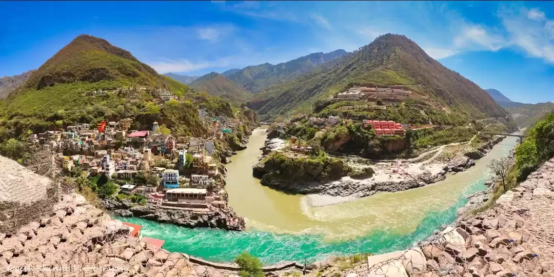
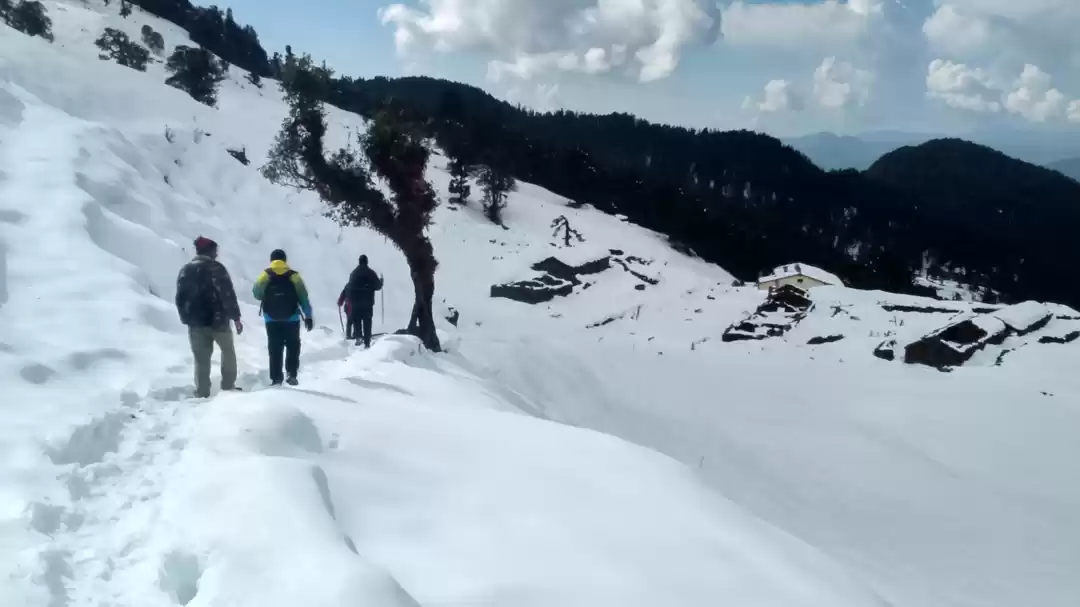
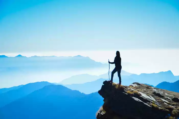
Day 1: Drive Haridwar-Sari Our tour guides will expect you at Haridwar railway station at 6:30 in the morning today. You can arrange an overnight bus journey from Delhi, reaching Haridwar in the morning or reach a couple of days earlier to the starting day of the trek. Haridwar-Rishikesh by the Ganges is a famous site on the pilgrim trail of Uttarakhand. You can spend your time in Rishikesh immersing in cultural activities and adventure sports in the choppy waters of Ganga. We can pick you up alternatively from Rishikesh as well. From this point to Sari village is a journey of 7-8 hours. Take in the beautiful vista of lower Garhwal Himalayas as the drive turns uphill. The most picturesquely notable stop on the way will be at Devaprayag- a town marking the gorgeous confluence of Alakananda and Bhagirathi. The river will keep you company throughout, reaching you at Sari by 6:00 in the evening. The village is a pretty picture composed of little houses sketched across a mountain backdrop and lined with green patches of agricultural fields. If you are missing any minor requisite for the journey ahead, visit the market area in Sari, just might find something useful!Day 2: Trek to Deoriatal The trek on the first day is easy with mixed ascent and descent. A well-defined rocky trail will show you to the end, from where the Chandrashila summit is clearly visible and the Tunganath temple is a speck of color. After this point, it's a steep uphill bend on the ridge back of the mountain. Get ready for an acutely laborious climb, giving you the first taste of challenge. Soon, you will reach the Forest Department built resting stop. Clocked timely by your Trek Leader, you can afford a 20 minutes break here. An excellent view the way of the mountain fall waits here. Post-rest, the trail will bend through a forest of rhododendrons. Spring treks here in the crimson shadow rhododendron blossoms make it memorable more than ever. We go steadily up. At 7, 434 ft. village localities vanish from sight. Nearly 20 minutes from this point, we will be standing with the waters of Deoriatal glistening down a lurching gentle slope. A grand vista of Chaukhamba massifs is unveiled in the background of the lake. It will be mid-noon by the time you reach the spot. Wait for the morning when the cloud cover lifts and a diamond-crushed sunlight elucidate the outlines of Chaukhamba, making for the ultimate striking frame. Having the entire day to yourself, explore the deep nooks of the forests lying out around, a paradise for bird-watcher's and nature lovers. Hot lunch on this day will be served on reaching our lakeside camp in Deorital.Day 3: Deoriatal to Baniyakund through Rohini Bugyal Today's trail will familiarize you more with the Chaukhamba massif and Mount Kedar summit, rising closely as you process. Rhododendron and maples eclipse the forest path, spreading a cool and rejuvenating vibe. In these thickets you will find two prominent varieties of rhododendrons-red and pink, the concentration of them thickens as you move pass the first forest stretch. The trail is sprinkled with little shrines that stand out in the greenness by the red and yellow flags tied on them. After crossing a clearing in the forest lined with scarlet blossoms, we are directly ushered up an ascending path towards Rohgini Bugyal and Chopta. The ascending trail gives way to a level land and some leeway in the rigorous uphill hike. A resplendent view of the Chandrashila awaits on the other side of the forest margin. After the level-land, you will have to re-enter the forest now characterized with old oaks and maple besides the rhododendrons. This forms part of the Kedarnath Sanctuary, and with some luck, trekkers can spot red fox and other small wild things. More 25 minutes of trekking in the Kedarnath Sanctuary trail and you will reach the Bhagdwal temple. This is a junction point for three trek routes. One connects to Sari village, another towards Ukhimath, and the central one descending to the meadows of Rohini Bugyal. Along this line, Chandrashila and flanked by the adjoining Kala Parvat Peak gain prominence. You can find the way bending from here to Bisuri Tal lake and a small tarn named Nandikund, situated at the base of Kala Parvat. Further down as you progress, a silvery rivulet coming from Chandrashila meets your way. Here, you can fill your water supplies and move on taking a small wooden bridge on the stream. A little way up, the meadows start. Here, you will find a cluster of huts. Shepards from local villages come here to graze their livestock. Not far from here, you will find a road head at the margin of a jungle trail. In this area in the vicinity of Chopta village, we have our campsite at a clearing in the forests.Day 4: Baniyakund to Tungnath, Chandrashilla Top and back to Baniyakund We commence the hike today early morning. Starting in the wee hours of dark will let us have a beautiful sunrise experience from Tunganath top. The trek runs on a well-defined concrete-bound trail from Chopta to the temple. Today,the hike will be fraught with steep climbing challenges with sharp turns to cross by. There will be other shrines on the way, of which a particular temple with a flagpole is notable. This one comes after the 10th bend of the road and marks the opening of a splendid view of Chandrashila up ahead. From here, you will also get a clear vision of a connecting peak to Chandrashila. This one is named Ravanshila. In the winters, you will find snow from here. The 11th bend marks the entryway to Tunganath above which the splendid Chandrashila peak towers at 12, 083 ft. The route to the peak bends from behind the temple complex. Beware of thick snow on this summit stretch after December till the end of April. Crampons and gaiters are highly recommended for the snow climb and your trek lead is expected top make the path through the cover of snow sludge with the help of an ice axe. At the end of a steep and arduous climb, the summit will be reached with a 360 degree view of the Garhwal and Kumaon mountains welcomingly lying ahead. Notable peaks in this panorama of grandeur are-Nanda Devi, Trishul, Nandaghunti, Dronagiri, Chaukhamba, and Kedar. Glimpses of the Thalaysagar and Gangotri ranges too could be made out at the edges. The downhill journey is relatively less time consuming and smoother. It will take you about 3 hours to climb down to the Baniyakund campsite.Day 5: Baniyakund to Haridwar A ride back from the Chopta road head to Haridwar is scheduled for day 5. After this 7 hour journey full of mellow reminisces of the hills, you will be reaching Haridwar in the evening. An overnight journey to Delhi will hopefully work out best.
How to Reach
How to Reach
By Air :- Jolly Grant Airport is the airport serving Dehradun, located about 48 km from the Haridwar. There is a daily flight from Delhi for Dehradun, reach Haridwar one day early if coming by flight.
By Train:- An excellent rail network connects Haridwar to other important cities like Delhi, Mussoorie, Mumbai, Varanasi, Lucknow, and Kolkata. From Delhi -DDN NZM AC EXPRESS (2205) From Kolkata- Doon Express (13009) From Mumbai- Dehradun Express (19019) From Chennai- Dehradun express (12687)
By Bus:- There is regular bus service from Delhi to Haridwar, from Delhi ISBT Kashmere Gate. We would suggest you to take only government buses from ISBT Kashmere Gate. Private buses ply from outside ISBT and they are not trust worthiness. Usually buses drop you at Haridwar bus station. From there you have to come to Haridwar Railway Station TTH's Tata Sumo or similar vehicles will pick-up you from Haridwar Railway Station at 6:00am. Pick-up is included in the cost of the trek You will reach Sari village by 3:00 pm
Cost Terms
Inclusions :- 1. Accommodation. (Guest house, Home stay, Camping) 2. Meals while on trek (Veg.+ Egg) 3. Trek equipments: Sleeping bag, mattress, tent (twin sharing), kitchen & dinning tent, toilet tent, utensils and crampon (if required) 4. All necessary permits and entry fees 5. First aid medical kits and oxygen cylinder 6. Mountaineering qualified & professional trek Leader, guide, cook and Support staff 7. Porters/mules to carry central equipment 8. Transport Haridwar to Sari and Chopta to Haridwar
Exclusions 1. Any kind of personal expenses 2. Food during the transit 3. Insurance 4. Any kind of emergency evacuation charges 5. Mules or porter to carry personal backpack 6. Anything not specifically mentioned under the head
Note : Normally TTH expect to carry your personal luggage on your own, if you wish to offload your backpack, you can give it to Mule. Charges of offloading backpack:- INR 700/- if you make an online payment, 10 days in advance INR 900/- if you inform us after reaching Sari village The backpack cannot weigh more than 11 kgs. Backpack should have waterproof cover. Suitcases/strolleys/ bags will not be allowed.Paying the Trek/ Adventure activity fee: The fee can be paid by online transfer/check deposit/ demand draft. Instruction for payment will be forwarded along with your confirmation email. When your transfer is done, please e-mail us a confirmation mail with your transfer details, so that we can follow up your reservation efficiently.
When to book: It is wise to make your booking at least two months in advance. However, if you want a good deal on your domestic/international flight, we recommend organising your trip at least five months in advance. (Please contact us if you require a late booking)
In the event of cancellation of trek/adventure activity services due to any avoidable / unavoidable reasons we must be notified of the same in writing. Cancellation charges will be effective from the date we receive advice in writing, and cancellation charges would be as follows: -
Cancellations prior to 24 days from the start of the trek Book any other trek till one year or get 95% refund (Note: If the trek charges are more, the balance needs to be paid by the trekker)
Cancellation between 24 days and 14 days to the start of the trek Choose to go for the same trek, with any other batch, till year or get 70% refund
Cancellation between 14 days and 10 days to the start of the trek Choose to go on the same trek, in the same season, with any other batch or get 50% refund.
Cancellation less than 10 days to the start of the trek Transfer your trek (same trek, same batch) to your friend. No cash refund.
Note:- 1)- Change of trek batch is dependent on the availability of seats in the batch. 2)- In case of transferring a trek to a friend, he/she should satisfy all the mandatory requirements put forward by TTH. 3)- TTH holds the right to change/cancel the policies, without prior notice.
Trek Essential
Trek Essential

Fitness
Fitness regime for:
Calculate Your BMI
If your BMI is normal, you can plan your fitness regime as mentioned. If your BMI is not normal, consult your trusted physician before you plan your fitness regime. If you're suffering from any chronic illnesses consult a medical practitioner.
Risk & Respond
Risk & Respond
High Altitude Treks: Risk and Response A high altitude trek calls for an adventurous attitude, but embarking on an adventurous trip without calculating the risks is utter stupidity. That's why we have listed a few risks and the response planned by TTH to minimise or address the risks in the best possible way.
Risk: Altitude Before you start the trek, it is important to understand the implications of high altitude on your body. Be aware of symptoms of AMS (Acute Mountain Sickness) like mild headache, nausea and general discomfort.
Response: If you feel any of these symptoms, inform the trek leader on priority and follow his instructions. Every campsite has as stretcher, fully equipped first aid kit, oxygen cylinders to address the situation.
Risk: Weather Weather is unpredictable in the Himalayas. Though we are always observant about the changing weather, no one can guarantee a snowfall, rain or Sun. Do understand that your security is of utmost importance to us and we will not proceed any further from the campsite if the weather is not favourable.
Response: The decision of the Trek Leaders and Guides to proceed or wait for the weather to get better will be final.
Risk: Injuries Often, while trekking over difficult terrains, you might have minor injuries like leg sprain, bruises etc. Serious injuries like fractures or major cuts are very rare.
Response: All our Trek Leaders are Certified Wilderness First Aid responders. They are trained to handle emergencies and can tackle minor injuries with a well-equipped first aid kit. In case of serious injuries, the patient is carried on a stretcher to the nearest road-head and is led to nearest medical centre.
Risk: Lack of communication devices In the remote areas of the Himalayas, mobile networks do not reach. On a trek, one is cut off from the world of calls, SMSs or watsapps.
Response: We rely on walkie-talkies and runners to communicate between the campsites and the base camps.
Similer Treks
Similer Treks
Let our experts suggest a trek for you. Click here
' fill='%23359391'%3e %3cpath d='M46.1538462%2c43.5714286 L41.5%2c50 L36.8461538%2c43.5714286 L36.8670256%2c43.5714286 C36.3173077%2c42.7142857 36%2c41.6851429 36%2c40.5714286 C36%2c37.4854286 38.4535641%2c35 41.5%2c35 C44.5464359%2c35 47%2c37.4854286 47%2c40.5714286 C47%2c41.6851429 46.6826923%2c42.7142857 46.1329744%2c43.5714286 L46.1538462%2c43.5714286 Z M41.4294872%2c39 C40.6150641%2c39 39.9487179%2c39.675 39.9487179%2c40.5 C39.9487179%2c41.325 40.6150641%2c42 41.4294872%2c42 C42.2439103%2c42 42.9102564%2c41.325 42.9102564%2c40.5 C42.9102564%2c39.675 42.2439103%2c39 41.4294872%2c39 L41.4294872%2c39 Z' id='Location-white'%3e%3c/path%3e %3c/g%3e %3c/svg%3e)