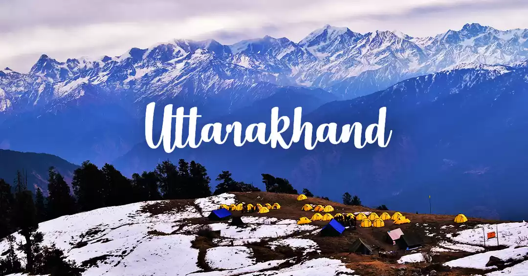
Overview
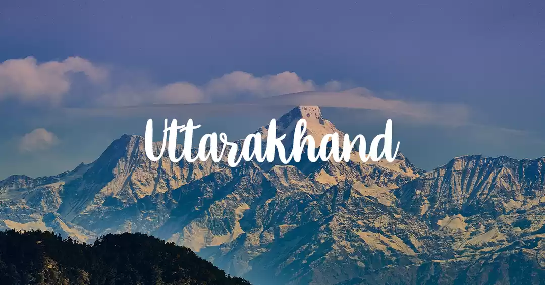
Region :- Uttarakhand Duration :- 6 Days Grade :- Easy To Moderate Max Altitude :- 12,100 Ft. Approx Trekking Km :- 22 Kms.
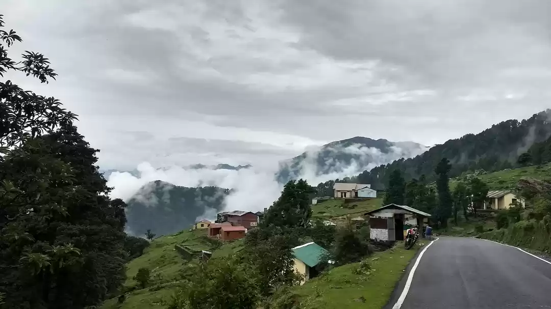
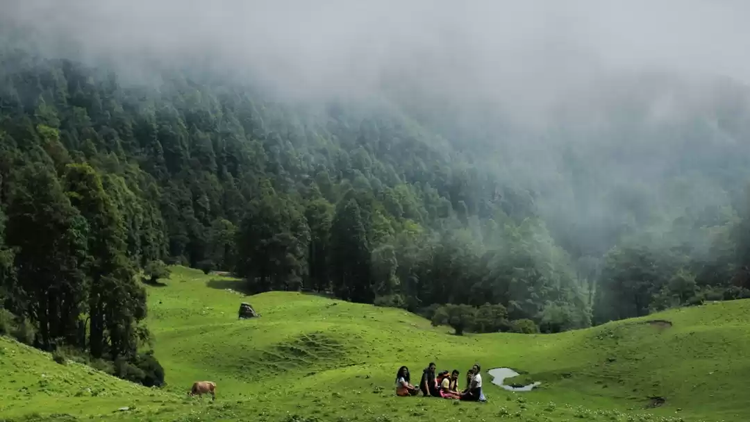
The pasture uplands of Uttarakhand's alpine heights are focal points for many of our splendid treks in the region. These are the Bugyals-fecund grassy uplands secreted away in mountain laps where shepherds take their herds in summer days before the winter snow renders them fallow. Dayara is a relatively lesser known Bugyal, accessible from Uttarkashi by just a short, crisp trek but it is one that pays off magnificent rewards.
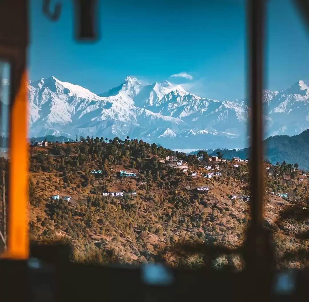
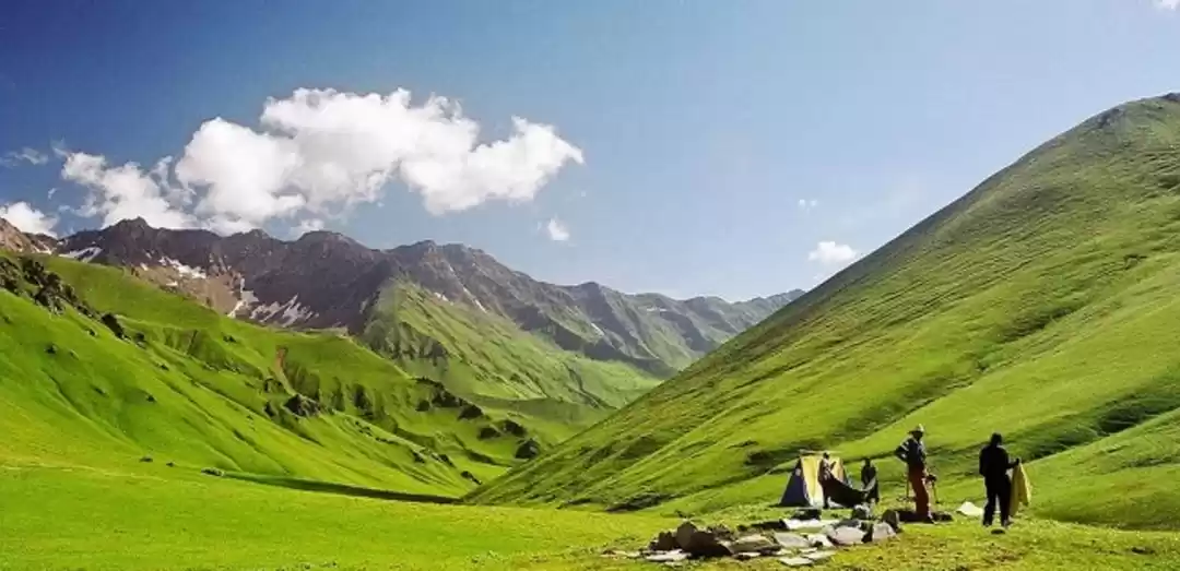
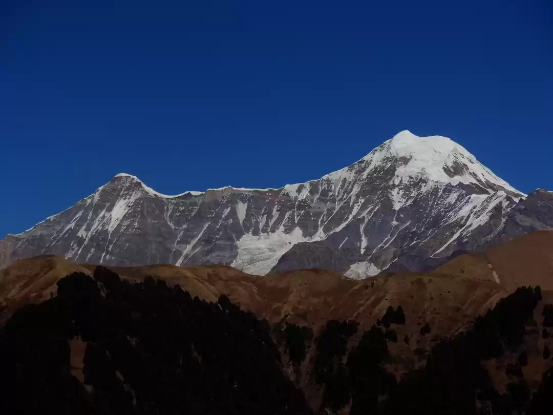
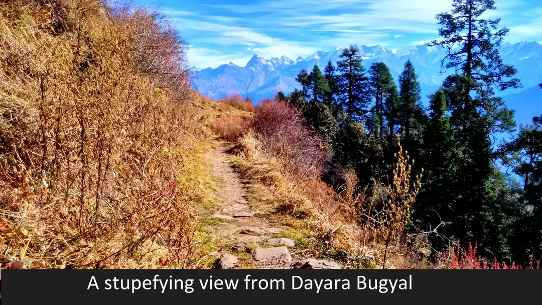
Dayara in the local tongue refers to a circular plot of land, reflecting the hoop shaped grassy turf of this Bugyal, margined by dark oak and maple woods and beyond the green reaches, a glowing snowline of the Bandarpoonch and other ranges. A rambling walk through the undulated pastures of Dayara will bring you out of the world frames of its green ecosystem, the whispering wilderness of the oak woods, and somewhere far away, a breathless peak view panorama gradually unveiling. Along the entire stretch, at different junctures, you can catch glimpses of the Gangotri set of peaks, Srikanth peak, Bandarpoonch, and Black Peak.
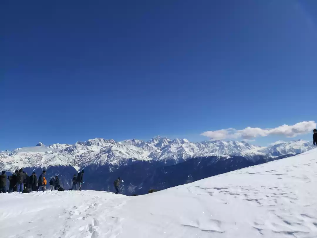
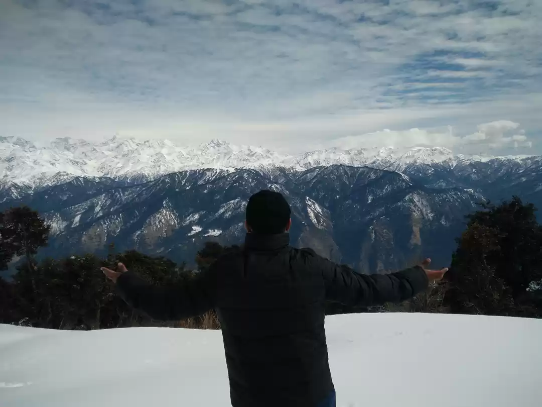
Another high point of the journey comes on the fourth day when we are ascending to 12, 100 ft. from our Dayara campsite to Dayara Top. A ridge walk takes you to convergences of many adjoining meadows including the Giddara Bugyal. You will also find a descent trail to Dodital- a fresh water lake which is the origin of Assi Ganga. The summer meadows are infused on this stretch with a spray of wildflowers, all yellow. On all of this paradisiacal effervescence, the snow thatched Bandarpoonch will cast an iridescent impression. The walk ambles down from here to Barsu, a pretty settlement memorable for its silkenly flowing buckwheat fields and poppy beds and a warm shelter at the end of the
First timer can apply, should have some interest in trek and mountaineering.. Before reaching the village, we make a last stop at Barnala, a small crystal waterhole flanked by a temple of the Nag Devata.
Brief Itinerary
Brief Itinerary
Day 1- Dehradun to Natin Village
Altitude:7,400 ft Stay in Guest house/homestay Drive 180km (6-7 hours) Main market at Uttarkashi, another market at Bhatwari Network is available (Airtel, Idea, BSNL) View of Gangotrirange from Moryana top Front view of Shrikanth peak and massif view Gangotri range from Natin Pick up time 06:00 am at the parking of Dehradun railway station Route:- Dehradun- Suwakholi-Moryana Top -Uttarkashi - Bhatwari-Raithal - Natin Village Day 2- Natin to Gui
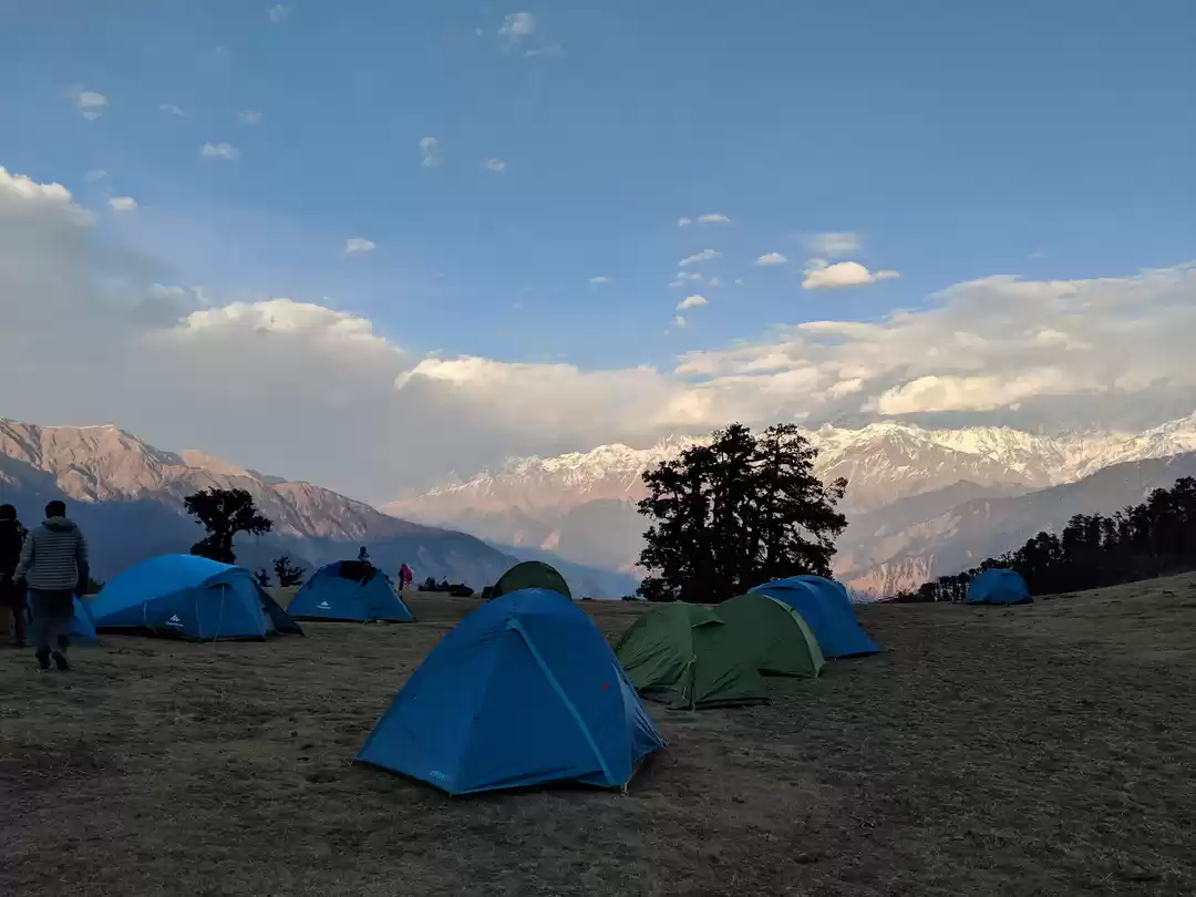
Altitude: 7,400 to 9,500 ft Stay on meadows in tents Distance is 3.5km will take 4-5 hours Easy trail. Gradual ascend throughout No water sources, carry 2 liters of water bottles Same view as Natin, village huts around, campsite surrounded by forests of silver, gold oak trees, bloomed with rhododendrons. Day 3- Gui to Chilapada
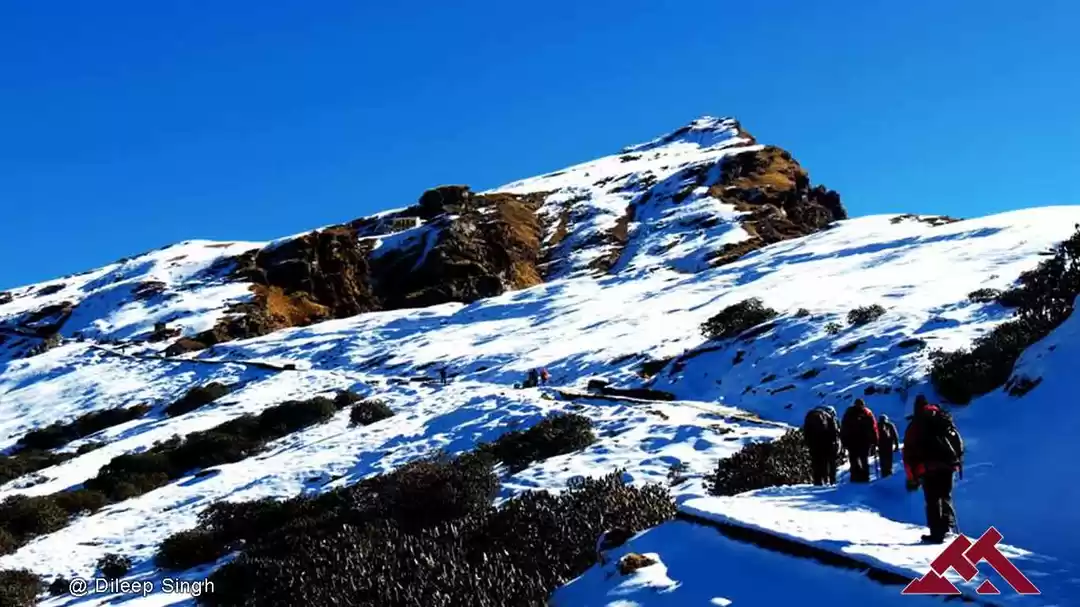
Altitude: 9,500 to 9,800ft Distance is 3km, 2hours Stay in tents Easy trail, Gradual walk Hot lunch in the camp site One liter of water is enough Day 4 - Chilapada to Dayara top and back to Gui
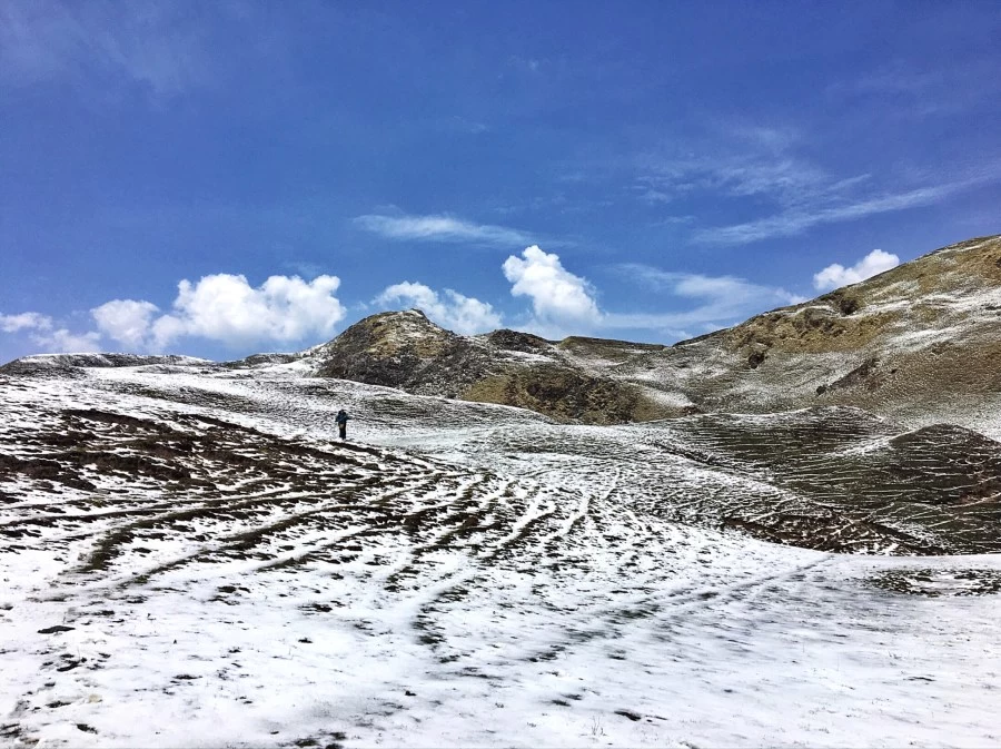
Altitude: 9,800ft to 12,100ft Distance is 6 km (each way), 6-7 hours Easy to Moderate trail Packed lunch on the way Carry enough water, only one water source near the top Massive views of many peaks and Dodital range from top Day 5- Gui to Natin
Altitude: 9,900 to 7,400ft Distance: 3.5 km 2 hours Easy descend all the way Hot lunch at Raithal Stay in guest house Day 6- Natin to Dehradun
Time taken: 6-7 hours drive to Dehradun Leave Raithal by 6:30 am You'll reach Dehradun between 3-4 pm. You can book your travel any time after 6 pm.
Who Can Go:-
First timer can apply, should have some interest in trekking and mountaineering. The climber must be fit and have sufficient stamina to cover 5 km of distance in 45 minutes without a stress. The climber should be able to carry a 10 kg backpack. Heart problem, high blood pressure, asthma, and epilepsy cannot be reconciled on this mission. The climber must not have the conditions mentioned above.
Detailed Itinerary
Detailed Itinerary
Day 1- Dehradun to Natin Village
Natin, is a pleasant village famous as base camp of Dayara Bugyal trek. It is around 38 km away from Uttarkashi. The village is flourished with lush greenery. Bhagirathi River flows throughout the way to the village. The route to Raithal is like a pathway between the mountains. You will get first glimpse of Gangotri range, Shrikanth peak from Moryana top. Here you will halt for a small break if you wish to capture the splendid peaks.
As you approach closer to Natin the views of mountain peaks get bigger, Shrikanth peak is one of the prominent peaks from here. You
will spend the night in guest house or get authentic home stay.
Day 2- Natin to Gui
Start early morning with energized spirit to embark on the actual trek. The trail on this is a walk through the jungle. It is filled with silver, gold oak trees. The route to campsite is well marked and the campsite at Gui always remains in line of sight. The trail is ascending gradually hence it will take around 4-5 hours to reach to the next resting point.
The camping site is unique in a way that is surrounded by alpine trees unlike mountains. You will spot quaint village huts near the campsite. The view from Gui is almost same as from Raithal, with clear views of Gangotri range and Shrikanth peak. Under the beautiful night sky you can relax and re-energize yourself.
Day 3- Gui to Chelapada
Today is a smaller day, just like hiking in mountains. The trail rises slowly as the forest clears and the next camping site of Chelapada will come. It will be a small hike. You can find a flowing stream next to the camping site. You might get some snow traces on the path.
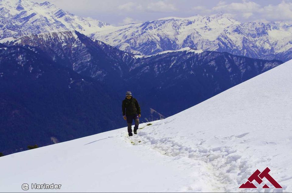
Bandarpoonch is highly associated with Dayara Bugyal trek, but you will also encounter many other splendid peaks. After lunch or evening tea you must stroll around and explore the area.
Day 4 - Chelapada to Dayara top and back Gui
Summit day finally arrived. Today you will go to the highest point and return back to the campsite. With the first few steps under forest, the trail gradually opens up, leading to vast meadows. Hereafter, you will find yourself trudging on the green meadows blossomed with colorful flowers.
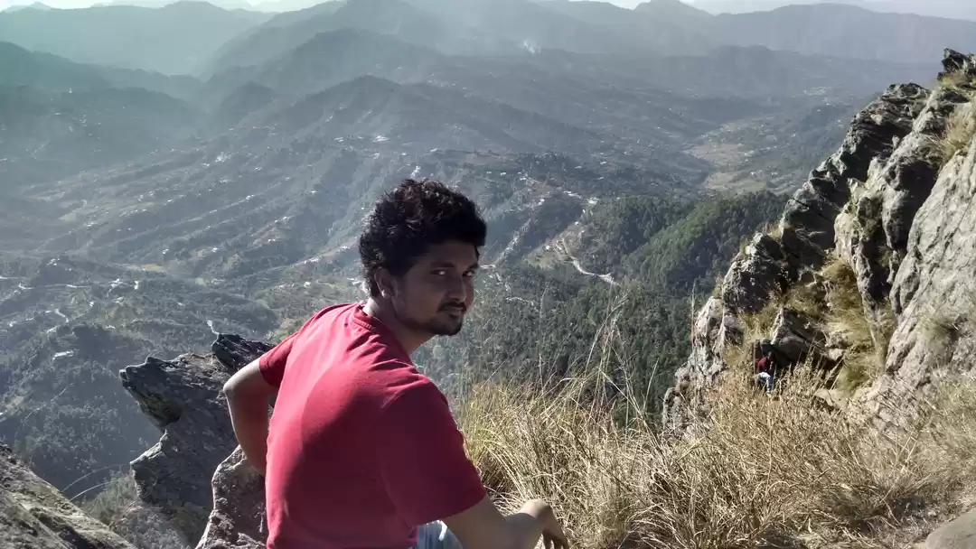
Walking on such beautiful terrain with stunning views of Bandarpoonch and other peaks, you will fail to notice that you have finally reached closer to the top. You might also spot a sparsely filled water stream. The final climb is steep but it is worth the physical strain because you will end up standing in front of the Dodital range. Bandarpoonch seems a touching distance away. The trail then takes you to the Gidara pass. Pass distinguishes ways to Pichkiya and Gidara Bugyal. Give yourself some time to inculcate the serenity of the landscape and take back your steps to return to the campsite. This day might seem hectic, as we try to reach campsite till the lunch time.
Day 5 - Gui to Natin
The small journey in the mountains comes to an end today. Wake up early and get all packed up to store the trek memories in permanent storage.
The trail as you might have guessed is easy descent till Raithal. Throughout the trail, you can relive the past fond moments by just looking behind. It seems as if the mountain peaks are calling you back. Raithal is a lively village where children and villagers will be seen meandering around. Your overnight stay will be in Natin.
Day 6 - Natin to Dehradun
Have a final cup of morning tea in Natin. Say final good bye to your fellow trekkers, exchange numbers, and lots of memories. Take a wonderful group picture and get into the cab that will ride you back to Dehradun. This will an 7 hours ride, between the mountains, valleys and Bhagirathi river. The river which guided us throughout the trek.
You will reach Dehradun by 3 to 4 PM, from here you can lead your return journey as you have planned. Make sure to take back loads of adventure filled memories and take a pledge to come back to the mountains.
How to Reach
How to Reach
By Air :- Jolly Grant Airport is the airport serving Dehradun, located about 25 km from the city. There is a daily flight from Delhi to Dehradun
By Train :- Take the overnight train to Dehradun from Delhi
Nandadevi Express - Train no: 12205 (Departure 11:50pm; Arrival - 5:40am) Dehradun Express - Train no: 12687 (Departure - 9:10pm; Arrival - 5:00am)
By Bus:- There is regular bus service from Delhi to Dehradun, from Delhi's ISBT Kashmere Gate. We would suggest you to take only government buses from ISBT Kashmere Gate. Private buses ply from outside ISBT and they are not trust worthiness. Usually buses drop you at Dehradun ISBT. From there you have to come to Dehradun Railway Station
TTH's Tata Sumo or similar vehicles will pick-up you from Dehradun Railway Station at 6:00am. Pick-up is included in the cost of the trek You will reach Natin by 2:00 pm
Cost Terms
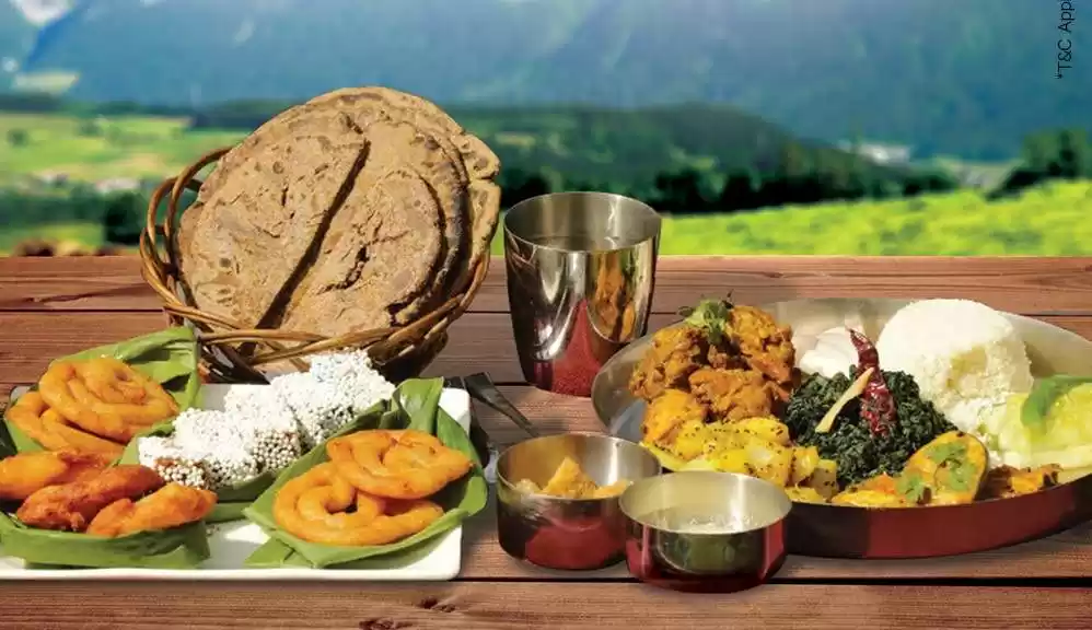
Inclusions :- 1. Accommodation. (Guest house, Home stay, Camping) 2. Meals while on trek (Veg.+ Egg) 3. Trek equipments: Sleeping bag, mattress, tent (twin sharing), kitchen & dinning tent, toilet tent, utensils and crampon (if required) 4. All necessary permits and entry fees 5. First aid medical kits, stretcher & oxygen cylinder 6. Mountaineering qualified & professional trek Leader, guide, cook and Support staff 7. Transport from Dehradun to Raithal and return as per the itinerary 8. Mules to carry group equipment.
Exclusions 1. Any kind of personal expenses. 2. Food during the transit. 3. Insurance. 4. Anything not specifically mentioned under the head 5. Any kind of emergency evacuation charges
Note : Normally TTH expect to carry your personal luggage on your own, if you wish to offload your backpack, you can give it to Mule. Charges of offloading backpack:- INR 1200/- if you make an online payment, 10 days in advance INR 1500/- if you inform us after reaching Base camp The backpack cannot weigh more than 11 kgs. Backpack should have waterproof cover. Suitcases/strolleys/ bags will not be allowed.
Paying the Trek/ Adventure activity fee: The fee can be paid by online transfer/check deposit/ demand draft. Instruction for payment will be forwarded along with your confirmation email. When your transfer is done, please e-mail us a confirmation mail with your transfer details, so that we can follow up your reservation efficiently.
When to book: It is wise to make your booking at least two months in advance. However, if you want a good deal on your domestic/international flight, we recommend organising your trip at least five months in advance. (Please contact us if you require a late booking)
In the event of cancellation of trek/adventure activity services due to any avoidable / unavoidable reasons we must be notified of the same in writing. Cancellation charges will be effective from the date we receive advice in writing, and cancellation charges would be as follows: -
Cancellations prior to 24 days from the start of the trek
Book any other trek till one year or get 95% refund (Note: If the trek charges are more, the balance needs to be paid by the trekker)
Cancellation between 24 days and 14 days to the start of the trek Choose to go for the same trek, with any other batch, till year or get 70% refund
Cancellation between 14 days and 10 days to the start of the trek Choose to go on the same trek, in the same season, with any other batch or get 50% refund.
Cancellation less than 10 days to the start of the trek Transfer your trek (same trek, same batch) to your friend. No cash refund.
Note:- 1)- Change of trek batch is dependent on the availability of seats in the batch. 2)- In case of transferring a trek to a friend, he/she should satisfy all the mandatory requirements put forward by TTH. 3)- TTH holds the right to change/cancel the policies, without prior notice.
Trek Essential
Trek Essential

Fitness
Fitness regime for:
Calculate Your BMI
If your BMI is normal, you can plan your fitness regime as mentioned. If your BMI is not normal, consult your trusted physician before you plan your fitness regime. If you're suffering from any chronic illnesses consult a medical practitioner.
Risk & Respond
Risk & Respond
High Altitude Treks: Risk and Response A high altitude trek calls for an adventurous attitude, but embarking on an adventurous trip without calculating the risks is utter stupidity. That's why we have listed a few risks and the response planned by TTH to minimise or address the risks in the best possible way.
Risk: Altitude Before you start the trek, it is important to understand the implications of high altitude on your body. Be aware of symptoms of AMS (Acute Mountain Sickness) like mild headache, nausea and general discomfort.
Response: If you feel any of these symptoms, inform the trek leader on priority and follow his instructions. Every campsite has as stretcher, fully equipped first aid kit, oxygen cylinders to address the situation.
Risk: Weather Weather is unpredictable in the Himalayas. Though we are always observant about the changing weather, no one can guarantee a snowfall, rain or Sun. Do understand that your security is of utmost importance to us and we will not proceed any further from the campsite if the weather is not favourable.
Response: The decision of the Trek Leaders and Guides to proceed or wait for the weather to get better will be final.
Risk: Injuries Often, while trekking over difficult terrains, you might have minor injuries like leg sprain, bruises etc. Serious injuries like fractures or major cuts are very rare.
Response: All our Trek Leaders are Certified Wilderness First Aid responders. They are trained to handle emergencies and can tackle minor injuries with a well-equipped first aid kit. In case of serious injuries, the patient is carried on a stretcher to the nearest road-head and is led to nearest medical centre.
Risk: Lack of communication devices In the remote areas of the Himalayas, mobile networks do not reach. On a trek, one is cut off from the world of calls, SMSs or watsapps.
Response: We rely on walkie-talkies and runners to communicate between the campsites and the base camps.
Similer Treks
Similer Treks
Let our experts suggest a trek for you. Click here
' fill='%23359391'%3e %3cpath d='M46.1538462%2c43.5714286 L41.5%2c50 L36.8461538%2c43.5714286 L36.8670256%2c43.5714286 C36.3173077%2c42.7142857 36%2c41.6851429 36%2c40.5714286 C36%2c37.4854286 38.4535641%2c35 41.5%2c35 C44.5464359%2c35 47%2c37.4854286 47%2c40.5714286 C47%2c41.6851429 46.6826923%2c42.7142857 46.1329744%2c43.5714286 L46.1538462%2c43.5714286 Z M41.4294872%2c39 C40.6150641%2c39 39.9487179%2c39.675 39.9487179%2c40.5 C39.9487179%2c41.325 40.6150641%2c42 41.4294872%2c42 C42.2439103%2c42 42.9102564%2c41.325 42.9102564%2c40.5 C42.9102564%2c39.675 42.2439103%2c39 41.4294872%2c39 L41.4294872%2c39 Z' id='Location-white'%3e%3c/path%3e %3c/g%3e %3c/svg%3e)