15.06.2023 : From Noida to Katra - Driving distance covered 662 km in around 11 hours with breaks for breakfast and lunch of 45 minutes each.
16.06.2023 : Trek to Vaishno Devi shrine - 13 km trekking to shrine, helicopter ride to Katra on way back.
17.06.2023: Katra to Srinagar - Driving distance covered 230 km in around 9 hours with breaks for breakfast for 30 minutes (many halts for passing of army convoy) and 20 km in Srinagar.
18.06.2023: Srinagar - Around 30 km for local sight seeing.
We planned to start early and Irfan prepared a breakfast of baked roti and omlette for us. That really helped us as we did not have anything much to eat that day before lunch. We took leave from Irfan at 6:30 am and left a sleepy Srinagar to reach the Srinagar - Kargil - Leh highway (NH 1D) near Ganderbal. Following the historic trade route along the Indus River, the highway passes through extremely treacherous terrain involving many mountain passes. The existing road was constructed in 1962 after the Sino-Indian war. Indian Army started building the road from Sringar in 1962, reaching Kargil in two years. Building the road was hazardous task, given the challenging geographical location, and maintaining the road is still an unenviable task. Heavy snowfall on the highest passes, especially historic Zoji La pass, blocks traffic, cutting Leh from Srinagar for some six months each year. During springtime, the Border Roads Organisation (BRO) plows snow and repairs damages caused by landslides. This year road was opened for regular traffic in June.Initially the road is smooth winding through green meadows and snowclad mountains with river Indus keeping company. We enjoyed the visual treat passing through Sonamarg (meadows of gold), one of the most beautiful places on this route. Then the snowclad mountains started closing in as we approached Zoji La. It was around 9 am and we stopped at a roadside tea stall. Over a cup of Kahwah we talked with the owner and his two sons. The elder one generously offered to take our "selfie" and we happily posed for him.


The road condition deteriorated as the climb to Zoji La began. Zoji La, located at an altitude of 11649 ft (3528 m) above the sea level, is a very important pass connecting Srinagar Valley with the Suru and Drass Valley. It remains disconnected from the rest of the world for almost six months in a year thereby cutting Ladakh from Kashmir. The road at Zoji La is sliced through glacial snow by hundreds of labourers who dig through the white wall for nearly a month at the end of winter season. Apart from the extreme cold climate, there is danger of avalanches, landslides, snow blindness, frost bites and chill blains. A tunnel is under construction to weather-proof the connectivity between Kashmir and Ladakh. At present it is a narrow dirt trail with vertical fall. Traffic consists of trucks, army and tourist vehicles and lots of bikers. A bike trip to Ladakh, roof of the world, is ultimate dream for bikers. The traffic crawled at snail's pace and giving way to traffic from opposite direction was tricky. The mountain pass and the road on its sides are etched with histories of wars. During the First Kashmir War, Zoji La was seized by Gilgit rebels in 1948 in their campaign to capture Ladakh. The pass was recaptured by Indian forces on 1st November in an assault codenamed Operation Bison, which achieved its objective primarily due to the surprising use of tanks by Indian forces. At the time, this was the highest altitude at which tanks had operated in a combat situation in the world. There are more army posts than villages on the route. We stopped at Gumri post near Zero Point - central point of the mountain pass. There is no natural habitation at Zero Point the freezing weather making it almost impossible for any form of life to survive. However, Zero Point is emerging as the new tourism spot and a daily stopover for hundreds of travelers with provision for tea, maggi, snacks, joyrides on hand-driven sledges, snow bikes by enterprising people.


After Gumri the road became metalled and smooth again. As we moved on, the lush green mountains changed to barren mountains introducing us to the landscape of a cold desert. At places herds of sheep caused different kind of traffic jam. Near Drass, the landscape changed again as the road crossed through green fields.


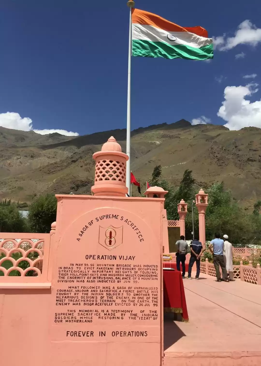
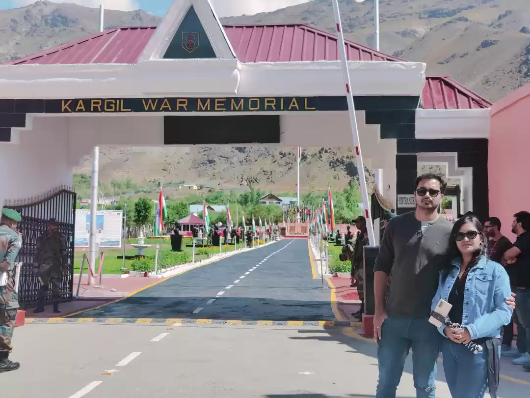
A few kilometres after Drass at around 12 noon we reached Kargil War Memorial.

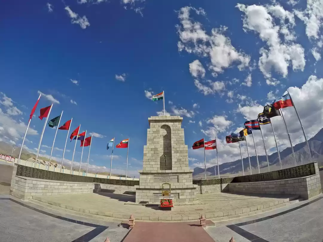
The Kargil War Memorial, also known as Drass War Memorial, was built in 2004 by the Indian Army in the town of Drass near Kargil city commemorating the 1999 Kargil War fought under the codename Operation Vijay between India and Pakistan. The memorial was constructed here as some of the fiercest battles were fought in Drass sector and some of the peaks like Tololing and Tiger Hill intruded by Pakistani Army are visible from the memorial.


We could see pictorial descriptions of all the major events of the war as we started the tour of the museum.
Vijay path : The road from entrance to cenotaph lined with national flags and bust of posthumous Param Vir Chakra and Maha Vir Chakra awardees on either side.


Cenotaph and Wall of fame : The Cenotaph is carved out of pink sandstone with the eternal flame "Amar Jawan Jyoti at its base. An extract of the poem - Pushp Ki Abhilasha by Makhanlal Chaturvedi is inscribed on it.Wall of Fame is a brass wall in the background of the cenotaph engraved with the names of all 559 martyrs who laid down their lives with the inscription "Beneath this earth young warriors sleep" on the top and an extract of the poem "Shaheedo ke chitao par" by Jagadamba Prasad Mishra at the centre of the wall.The army personnel narrated the history of the Kargil war and the proud moment when the regions were captured back from the enemies near the Cenotaph. The narration and the sight of the huge national flag behind the cenotaph gave me goosebumps.

Hut of Remembrance or Capt Manoj Pandey Gallery: It houses pictures from the battle zone, war heroes and write ups on participating units and soldiers. I felt proud to see the picture of a martyr from my home state Assam, Captain Jintu Gogoi, adorning the hall of fame! The last letter from Capt Vijayant Thapar to his family is heart rending. The museum features models of Himalayan ranges where battle took place. Captured Pakistani flag, documents and weapons are on display too.

Veerbhumi : It contains the epitaphs for each of the Bravehearts who made the supreme sacrifice in this sector in all operations other than Operation Vijay since 1947.

Zoji La War memorial : Built next to Veerbhumi, it has details of "Operation Bison" and pays tribute to participating units.


Besides, there is a souvenir shop and a restaurant in the premises.It took us nearly one and half hours to visit the memorial and it made us our heart swell with pride and sadness at the same time.Despite Drass being the second coldest inhabited place in the world, we felt quite hot touring the museum on the sunny day. Quenching our thirst with a fruit juice from a stall near the parking lot we resumed our journey towards Kargil. After half an hour we stopped for lunch seeing a restaurant at a nice location. The restaurant was pretty with a beautiful view of Indus River. But the food was disappointing and felt stale.

We reached Kargil at around 3 pm. It is a beautiful place surrounded by brown mountains and a grey coloured Indus river winding through it.

Crossing past the bustling market place we took a road going upward and checked into Hotel Brownhills. The hotel has a beautiful view and good amenities. We could see the mountains and the Indus from our room. The hotel has an open-air restaurant at the terrace which offers terrific views.

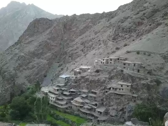
After a while we went to Hunderman LOC view point going back on the same road from Drass. Hunderman or Hundarmaan or Hundurmaan is situated on the banks of the Suru River at a distance of 10 km from Kargil and said to be the last village in India lying close to the border. At the end of the Indo-Pakistani War of 1947, Hunderman came under the control of Pakistan. The Indian Army captured Hunderman after the Indo-Pakistani War of 1971. The village is now abandoned as the villagers moved to a new settlement on the upper parts of the valley. Many of them found employment as porters in the Indian army. Travelling on a winding road up the hill we reached Hunderman LOC view point at around 5 pm. There are two binoculars installed in the view point that can be used for a fee Rs 50 per person for viewing the points. We could see a green patch and a masque in a Pakistani village across the LOC. Pakistani and Indian army posts were visible on two mountain peaks. We could also see the houses of the abandoned village Hunderman. There is a memorial museum in Hunderman village opened few years back on personal initiative of a resident of the village and I wanted to visit it. However, no one could confirm till when it was open and we dropped the idea.

Coming back to Kargil, we got our car washed which was caked with dirt at a car washing centre. While the car was being cleaned we had nice chit chat with the owner and staff and few other residents present there. I also entertained myself by observing the owner's young daughter immersed in play all by herself. Afterwards we went to the market. Managing to find a parking slot, we roamed about for some time in the market and had a cup of Kahwah in an eatery.

Back in the hotel we went to the terrace restaurant. It felt nice in pleasant evening breeze gazing at the star lit sky. After dinner we returned to our room and called it a day in excited anticipation for our next day's journey to Leh!
Tit bits from Google map19.06.2023: Srinagar to Kargil - Driving distance covered 190 km in around 6.5 hours (tea break - 10 minutes, Kargil War Memorial 1.5 hours, lunch break 30 minutes, other stops at various places), another 20 km (to and fro) to Hunderman LOC view point.


