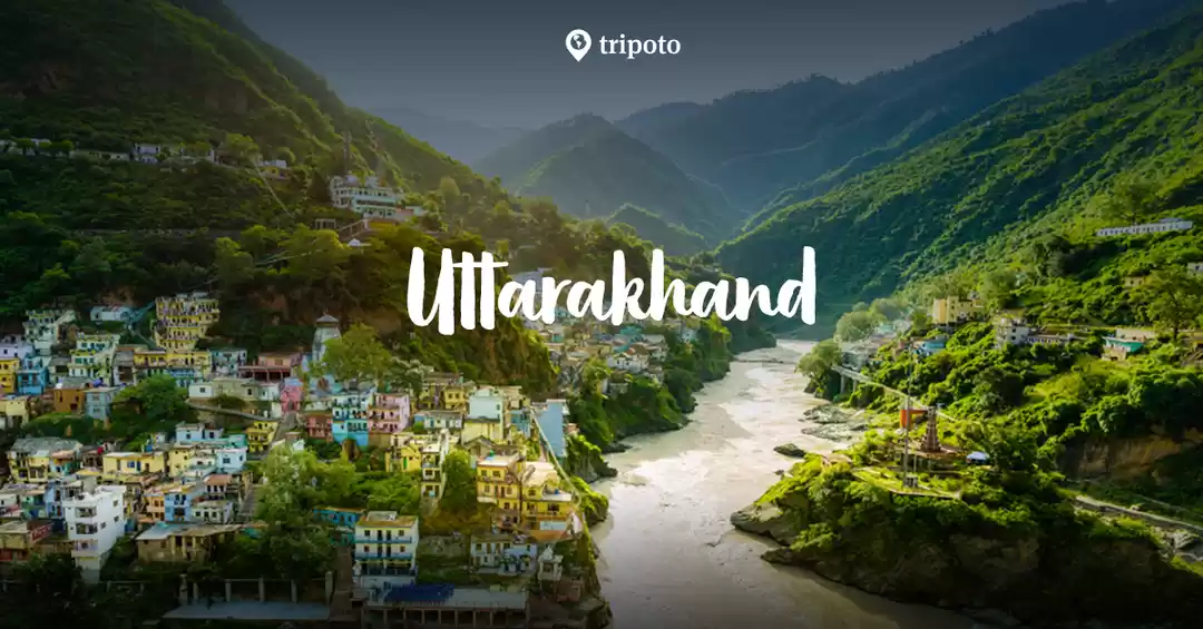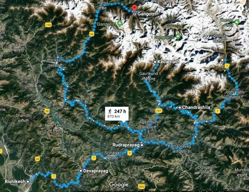
A perfect family getaway into the four pilgrimage sites of Hindus. To visit these sites we took a package tour of 4 from GMVNL (Garhwal Mandal Vikas Nigam Ltd.). The transport was in a 2x2 27 seater coach (non AC). The travelling was during the day time and the stay was on a twin sharing basis in their guest houses/resorts which were in prime location with a scenic background. The package cost was 18000 per pax which did not include lunch.
Day 0
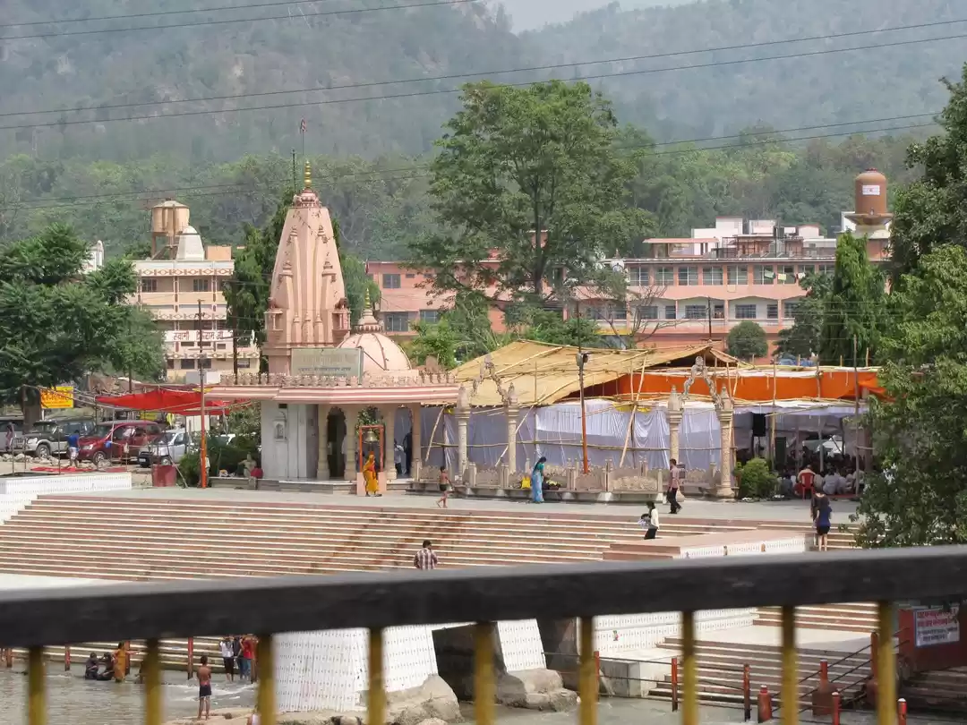
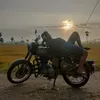
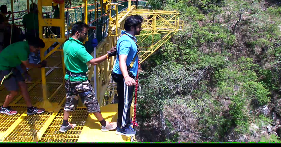
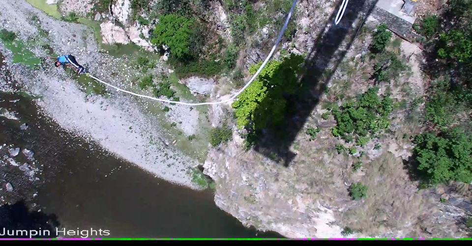
Arrival in Rishikesh and stay in TRH Bharat Bhoomi Tourist Complex. The reporting date was a day before the tour start date. Rishikesh offers some great adventurous activities like white water rafting, bungee jumping, giant swing, flying fox, etc. Rafting in Rishikesh, on the rapids of Ganges will surely get your pulse racing. We did the Shivpuri rafting stretch, which is a 16km long stretch with grade III rapids. Rafting is done under trained professional and can be enjoyed by all, irrespective of age. Unlike rafting, bungee jumping has an age limitation of 45 (not very strict). Jumpin Heights offers India's highest jump (83 Mts) for INR 3500. A must do activity if you're looking for thrill and if you're not acrophobic (obviously).
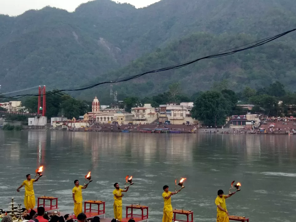
As the dusk descends it's time for the Ganga Aarti, performed on the Ghats of Ganga beneath the Laxman Jhula, which is surely an awe-inspiring spectacle and an uplifting spiritual ritual not to be missed.
Day 1 - 260km drive to Phool chatti
First day was a 260km drive from Rishikesh to Phoolchatti via Mussoorie, Kempty Falls (view from above). We drove along the banks of river Yamuna (NH 709B). The highway is very exciting with lush green mountains cut along the meandering course of the river. Also the view of sadhus walking along the road with minimal belongings would fill your heart with devotional charm. A number of tributaries joining the main river can be observed along the way. We reached our TRH (tourist rest house) in Phoolchatti late evening, had dinner (arranged by GMVN) - home cooked North Indian meal. The location of TRH is in a calm and quiet place away from the town and has an awesome backdrop.


Day 2 - 8km drive to Yamunotri (parking area)
Yamunotri, where Yamuna landed on earth, is a symbolic source of river Yamuna. Actual source, a frozen lake of glacial ice, is located around 3/4 km further up on Kalind Parvat. It's a 6.5km trek from parking to Yamunotri. The trail is over two meters wide concrete path with river flowing on the right. The services of ponies and pitthus are available as the religious shrine gets thousands of pilgrims every year. Also carrying a rain coat is advisable as the weather is quite unpredictable in the mountains. There are hot water springs (garam kund) in the shrine so carry towels if you're in for a dip!! The changing rooms are available. The journey to Yamunotri isn’t complete without preparing potato and rice in the hot spring of Surya Kund near the holy shrine. Devotees offer this in the temple and take the cooked rice home in the form of Prasad.

Day 3 - 200km Drive to Harsil
Next on the pilgrim trail was Gangotri which is one of the most visited holy places in India. Route to Gangotri bifurcates from a place called Dharasu which is 100kms (south) approx. from Yamunotri. We drove along NH34 from here onwards, along the river Bhagirathi (known as Ganga after Devaprayag) to Harsil where we stayed the night in GMVN TRH. The rest house is situated right beside the river Bhagirathi offering a calm and serene atmosphere. The whole evening was passed taking some memorable pictures and sinking in the atmosphere with the sweet sound of the holy river flowing beside us.


Day 4 - 25km drive to Gangotri & 100km drive to Uttarkashi (stay)
The temple stands at an altitude of 3048m, on the banks of Bhagirathi river and emits a pious aura. The Gangotri temple opens on the auspicious day of Akshay Tritiya which falls in the month of May and closes down on Yama Dwitiya or Bhai Duj which falls in the month of November. Gangotri is immensely famous as the base of several treks in the Garhwal Himalayas. Treks to Gaumukh Glacier, Tapovan, Mt Shivling are amongst the most popular things to do near Gangotri.


Day 5 - 275km drive to Guptkashi via Tehri Dam
The next destination was Kedarnath. Fifth day was a drive from Uttarkashi to Guptkashi. On the way we visited Tehri Dam which is a slight detour but was worth it. The rock and earth fill dam on the Bhagirathi river is the highest dam in India.


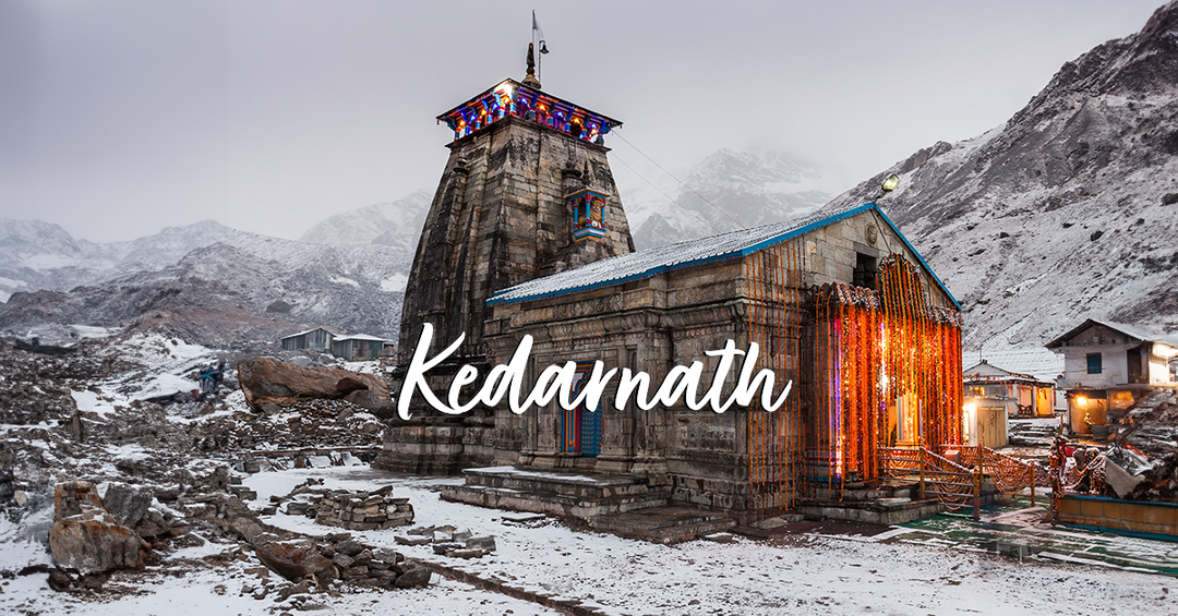
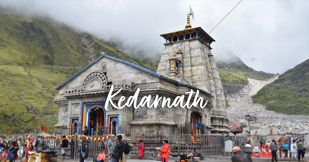
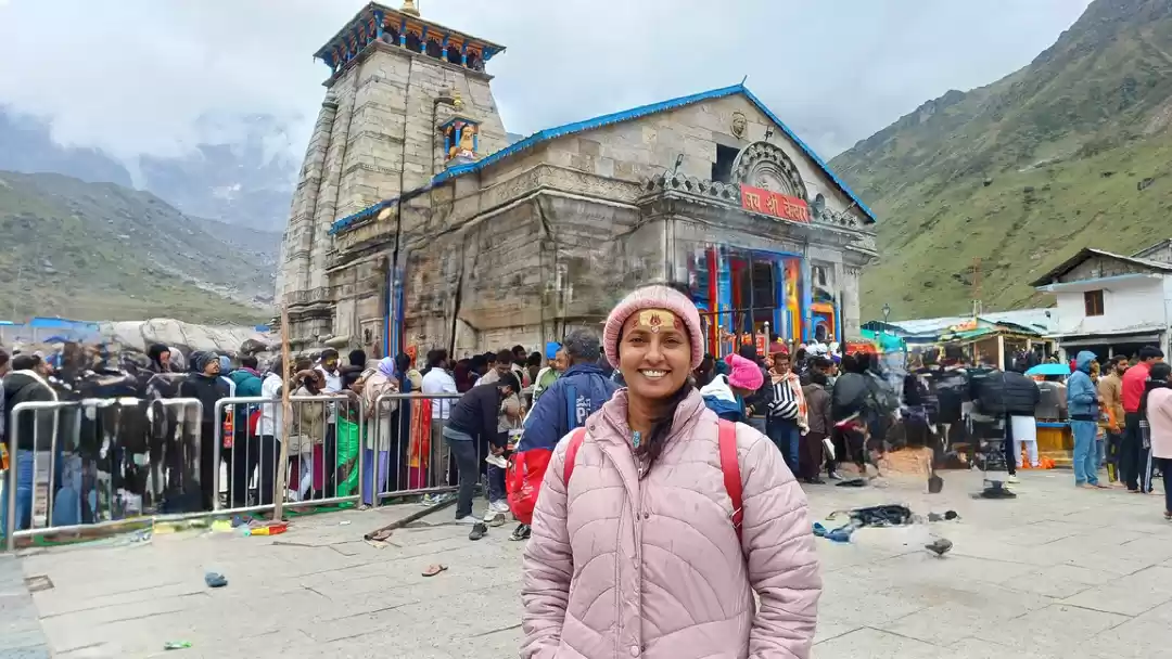
Day 6 - 33km drive and 17km uptrek to Kedarnath
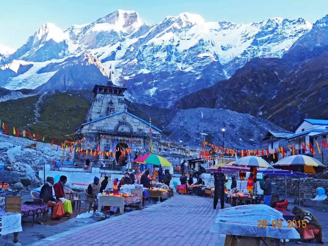
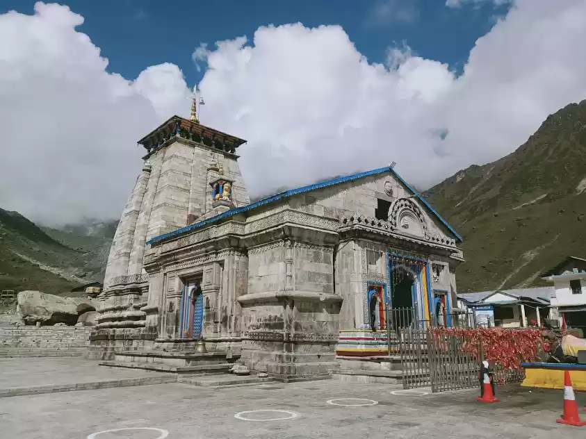
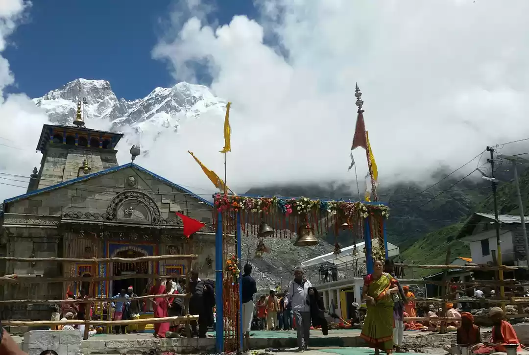
Kedarnath lies at an altitude of 3584 m and is significantly popular for the presence of the temple of Lord Kedarnath (Lord Shiv). The Kedarnath Trek is a 17km medium to steep trek which requires a good level of physical fitness. The helicopter service (largely depends on weather conditions) also plies from different helipads located between Guptkashi and Sonmarg at a cost of around INR7000. The Kedarnath Trek facilitates the services of Palki/Dandi, Kandi & Mule/Ponies. Timings of Kedarnath Trek from Gaurikund commences from 04:00AM in the morning till 01:30PM. No pilgrim is allowed to leave after this specific time. In the midst of the trek there are proper facilities of drinking water, toilets, medical centres and small shops/restaurants. There are proper resting shades available at every 01 km on this trek. Carry raincoat as weather is very unpredictable. We encountered rain many times during the trek. The path gets quite slippery when it rains, so wear boots (preferrably water resistant) having good grip. The disastrous effect of the floods of 2013 can be seen along the way. The ascent flattens out about a KM before Kedarnath. The view is fantastic while walking towards the temple but the smell of dung of mules can make you a little uncomfortable. Along the 1 km stretch you'll see many sadhus, merely having a single layer of cloth over them, while you're having 2-3 layers, sitting in their tents and smoking chillam. The temple is closed from 3 PM to 5 PM. After 5 PM, no one can touch the idol but can get Darshan from a distance. GMVN camps are set up at the base camp having multiple bunk beds and are warm enough for a good night's sleep.


Day 7 - Kedarnath to Gaurikund 17km trek down
The trek down had all the adventures waiting for us from heavy rains to dense clouds rising up from the valley. Many people were stranded at the top as the helicopter service was down. We marched on no matter the weather conditions and completed the descend in 5hours. The night stay was in GMVN guest house Tilwara.
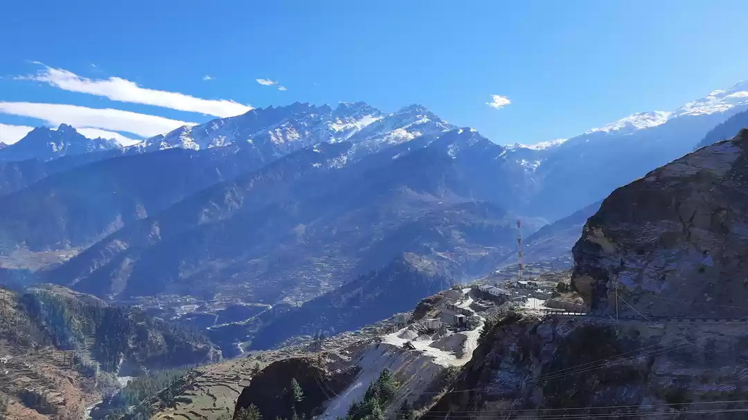
Day 8 - 170 km drive to Badrinath via Rudraprayag - Karnaprayag - Nandaprayag & Vishnuprayag
The drive to the last and the holiest of the holy Dham of Chota Char Dham Yatra (also a site of Char Dham Yatra) is filled with four sangam along the way. Alaknanda river meets Mandakini river, Pindar river, Nandakini river and Dhauliganga river at Rudraprayag, Karnaprayag, Nandaprayag and Vishnuprayag respectively. Badrinath Dham is easily accessible by motorable roads and the Badrinath temple can be reached by walking along an easy trek. The snowy mountain peaks, gracefully flowing Alaknanda River and incredible landscapes create the perfect background to facilitate a spiritual connection. Neelkanth peak in the background is a breathtaking sight during early morning. Pilgrims can also take a dip in the Tapt Kund (hot water springs) near the temple.


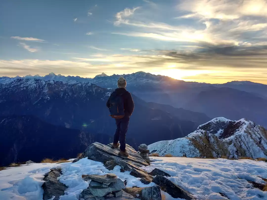
Day 9 - 50km drive to Joshimath via Auli
Vyas Gufa (cave) situated in Mana village, the last Indian village towards Tibet, around 5 km from Badrinath is not to be missed. If you are looking for some trekking adventure, some history lessons and some peace, this is perfect location for you. It is believed that Ved Vyas narrated the epic Mahabharata in this cave to Lord Ganesha. On the way to Joshimath TRH is Auli, which is also known as Switzerland of east. The summer season is not the best time to visit Auli as all the snow had melted. Visit Auli in January to March to sink in its pristine natural beauty and alpine atmosphere or to try hands on skiing. Cable car connects Joshimath to Auli, which is 3km long and takes about 15 minutes and charges INR700 (return journey). Stayed the night in Joshimath at GMVN guest house.

Day 10 - 256km drive to Rishikesh via Devaprayag
Devaprayag is a place on the confluence of river Alaknanda and Bhagirathi and here onwards it is named Ganga.

' fill='%23359391'%3e %3cpath d='M46.1538462%2c43.5714286 L41.5%2c50 L36.8461538%2c43.5714286 L36.8670256%2c43.5714286 C36.3173077%2c42.7142857 36%2c41.6851429 36%2c40.5714286 C36%2c37.4854286 38.4535641%2c35 41.5%2c35 C44.5464359%2c35 47%2c37.4854286 47%2c40.5714286 C47%2c41.6851429 46.6826923%2c42.7142857 46.1329744%2c43.5714286 L46.1538462%2c43.5714286 Z M41.4294872%2c39 C40.6150641%2c39 39.9487179%2c39.675 39.9487179%2c40.5 C39.9487179%2c41.325 40.6150641%2c42 41.4294872%2c42 C42.2439103%2c42 42.9102564%2c41.325 42.9102564%2c40.5 C42.9102564%2c39.675 42.2439103%2c39 41.4294872%2c39 L41.4294872%2c39 Z' id='Location-white'%3e%3c/path%3e %3c/g%3e %3c/svg%3e)