Pithoragarh District, Uttarakhand, India
Munsiyari is located in the far northeast end of Uttarakhand, 595 kilometers from Delhi. The people of the Munsiyari region are known as Joharis (or Shaukas) and are also called Bhotias, the original inhabitants of the Himalayan highlands. The town Munsiyari, with it’s rich history acts as a base town for many glacier treks, such as Milam, Rilam, and Nanda Devi east base camp. The local in and around town treks are also quite enchanting.

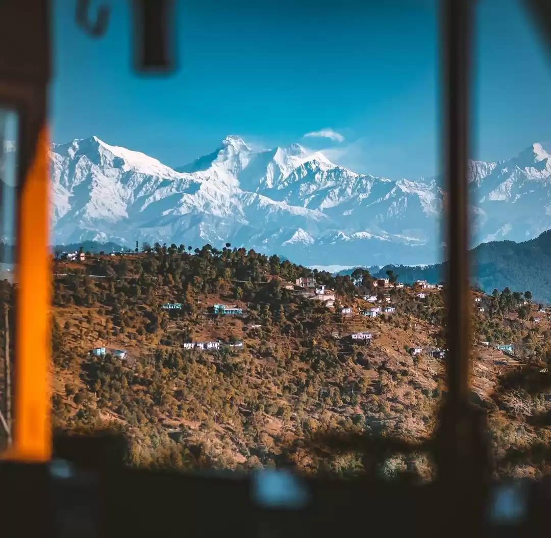
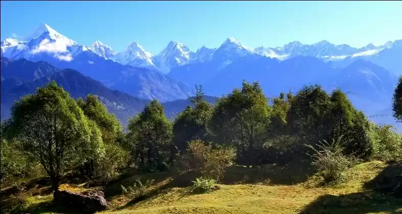
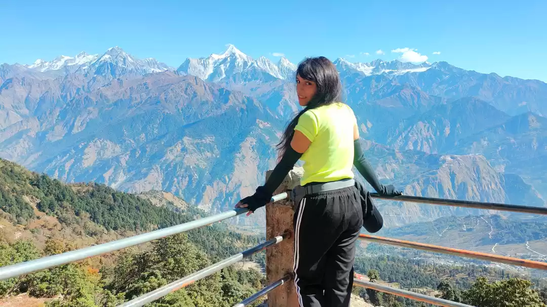
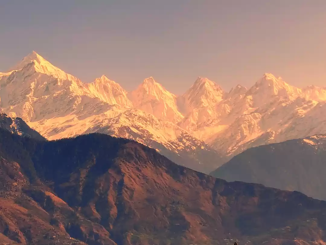
Panchachuli Peaks – View from Munsiyari Town
In the past people of Munsiyari depended mainly on trade with Tibet until 1962 when borders were closed. The Chinese had invaded Tibet. Mainly salt was traded at the time and it took people crossing the great white peak barriers and passing through various passes into Tibet best part of a month to reach. Subsequently after trade stopped, people shifted to lower plain areas for work especially in the winters.
Munsiyari is a Heavenly town offering spectacular views of the stunning Himalayas, multi treks to do locally and glacial treks to do in case of long duration trekking. It is a beautiful valley town with multi coloured forest cover.The Oak, Walnut forest with the green Bugiyals and the carpet like white Pangor flowers , accentuated by the colour rich Rhododendrons make it a formidable package and one of the most scenic and breathtaking hill towns of Uttarakhand. Munsiyari’s animal kingdom includes many different types of birds and animals such as the whistling thrush, wagtail and hawk cuckoo, leopard, bear and the musk deer.

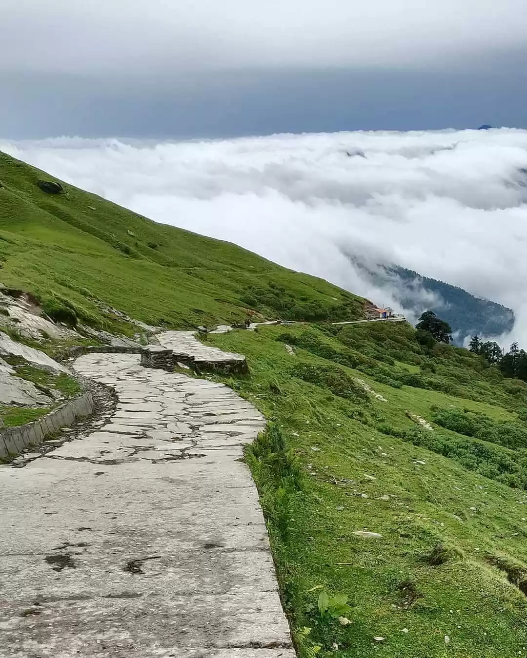
Munsiyari Town
The name Munsiyari itself means “place of snow” and has an equally interesting history too. It’s believed that the Pandavas had started their heavenly journey from this picturesque and serene town of Munsiyari.

Another glimpse of the town – Munsiyari
If you cannot travel long distances and have no penchant for moderate treks come to Munsiyari to develop the taste for it and get hooked on and if you like treks,nature trails and high peak gazing then what are you waiting for , hit Munsiyari without a thought if you already have not.
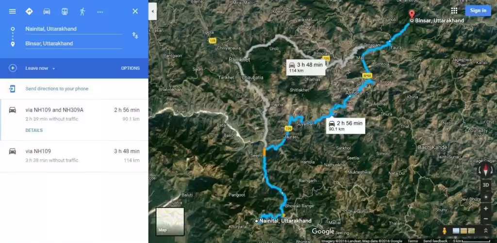
Munsiyari Distance from Delhi
The Route to Munsiyari from Delhi is via Hapur-Moradabad bypass-Rampur-Haldwani (Mountain road starts)-Bhowali-Kainchi Dham-Khairna-Almora-Chitai Temple- BareChinna- DhaulChinna-Sheraghat- Udiyari bend- Thal – Girgaon- Birthi- Kalamuni – Munsiyari. Munsiyari is about 590 kilometres away from Delhi. Roads all through are fairly decent except parts of the Thal-Munsiyari stretch which should be covered in the daylight itself.
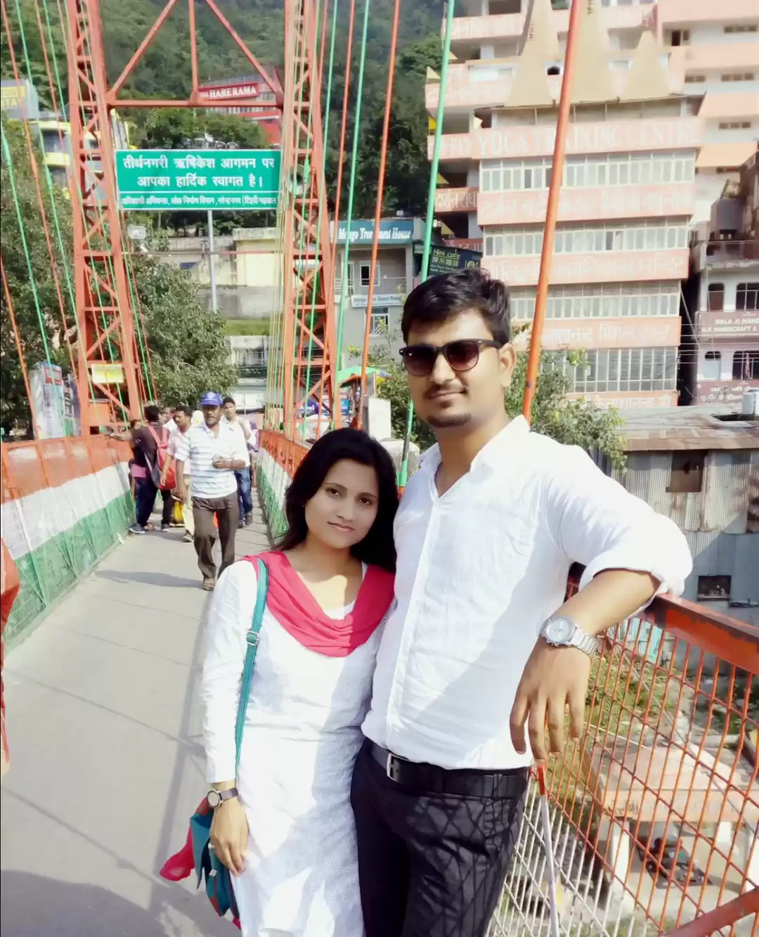
My Husband and I drove to Munsiyari from Delhi, treating it just like any other weekend drive cum trek trip. Reaching Haldwani overnight from Delhi, we rested and started early morning from Haldwani for Munsiyari which is a 292 kms mountain drive. We did it i n 12 long hours, passing through all the towns almost with a single-minded desire to reach Munsiyari as soon as possible and view the night sky with the peaks. The day had been cloudy and so was the night. The strenuous 80 kms incline after Thal and passing the majestic Birthi falls in the dark with it’s crippling chatter was the most difficult part of the journey to Munsiyari.

The Birthi Falls
The Birthi mountain is a muddy one with large chunks taken away by erosion and landslides and on the dangerous side are scary and deep gorges waiting to gobble up erring drivers and their payload on the wink of an eye. Many an unlucky people have lost their lives here in this section due to fatal car, bus and jeep accidents. Their memory stones sprung sporadically during the whole stretch, demanding zero error and alert brand of driving out of us.
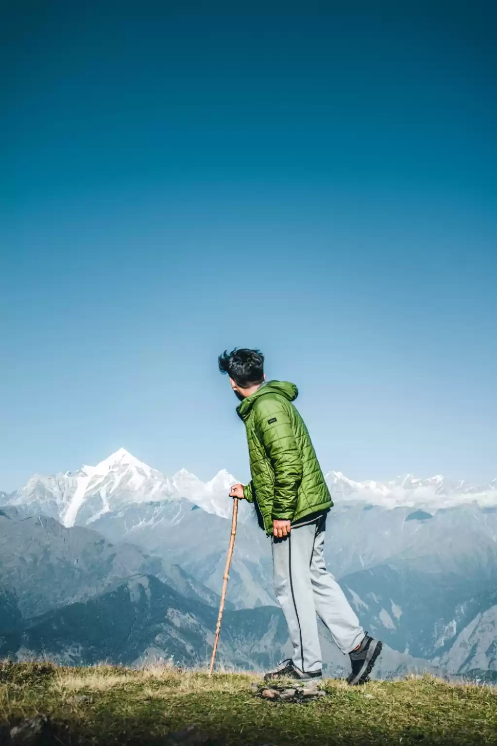
We did the famous Khulia top trek the next day without a guide, which if required can be arranged at Rs. 400-Rs.500 . I never prefer guides aqs I perceive them to be as encroachments, slightly dampening the adventure element. Who doesn’t want to get lost in these fairytale woods forever. The Khulia top trek starts from a place called Balati bend which is 8 kms from Munsiyari town. The trek takes a minimum of two hours and is five kilometres long one way. Although uniform in gradient which is all the way uphill, it is a still categorised as a moderate trek,cushioned by a fairly decent gravel pathway. Trekking shoes with rubber soles suggested for trekkers equipped fully with eats and drinks. Before the Khulia top there are camping sites for trekkers to camp for the night just as the forest on the top gives way to open meadows. Viewing the peaks at sunrise is a special site to savour.

Trek To Khulia Top
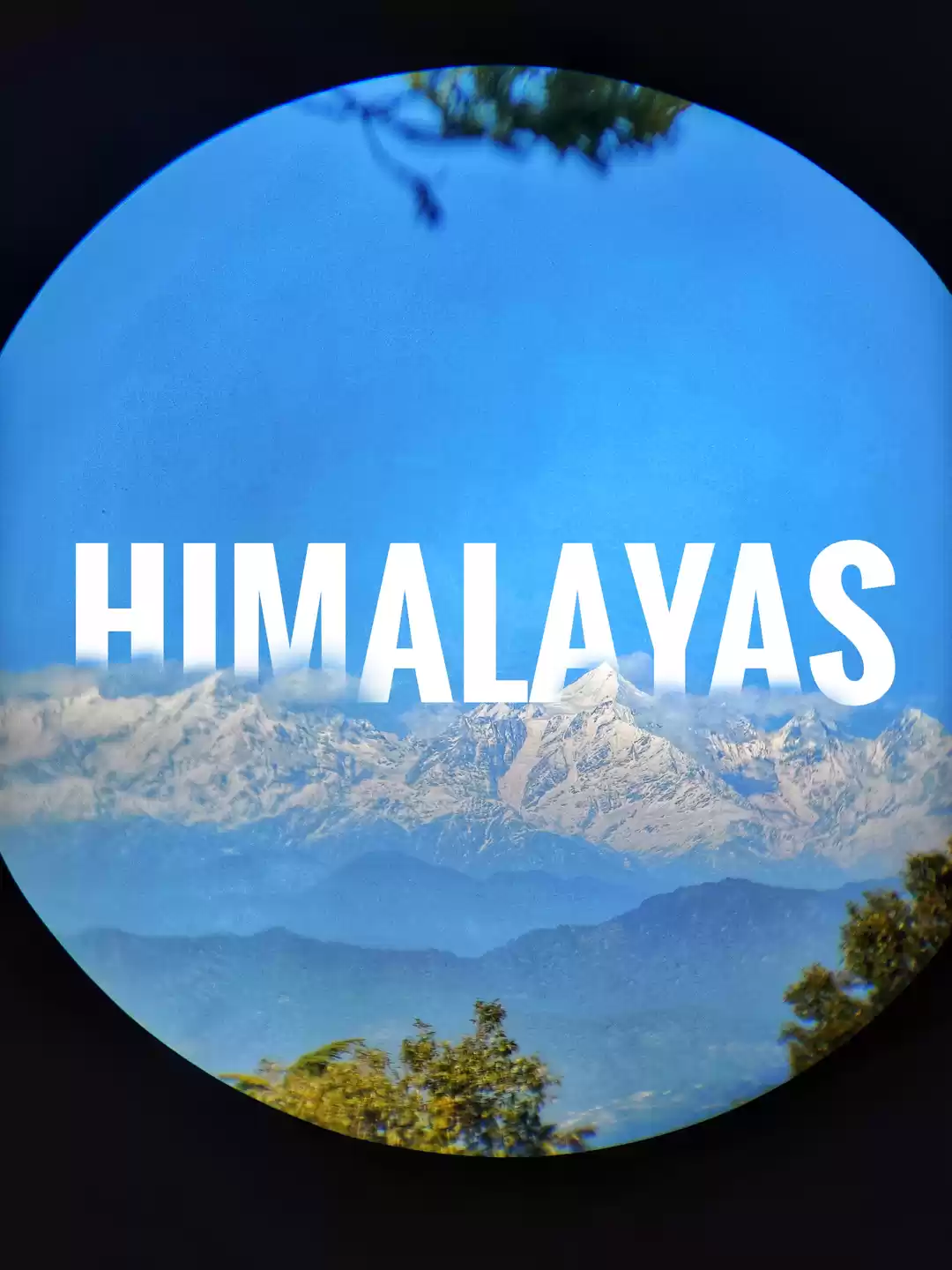
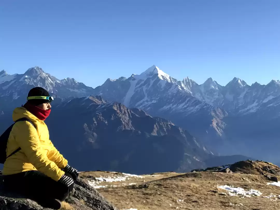
Initially the way winds up through beautiful and in parts dense oak forest, intermingling with Rhododendron trees which I see as the colour factories of the upper regions. The trek continues, crossing two ridges and walking us through the next kilometre long clear meadows of Khuliya over a connecting ridge, running all the way to its top. During the trek one gets intermittent views of the beautiful Panchachuli and Rajrambha peaks and after reaching the Khulia top the trek proves it’s worth by offering a 360 degree view of the Himalayas, including the mighty and daunting Nanda Kot and Nanda Devi peaks, the Hardeol cluster, with the Sunderdhunga and Milam valleys spread like carpets under the feet of the mighty peaks.

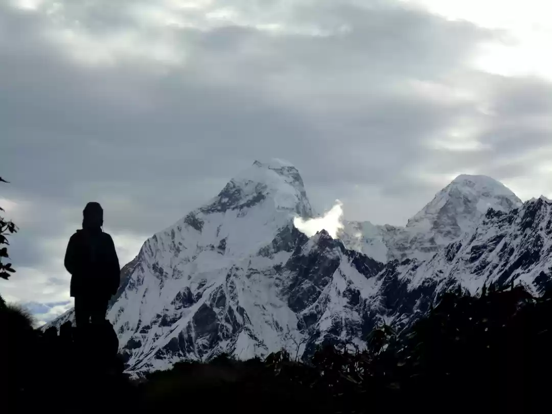
As close as it gets
On the way downhill and back to balati bend we had to tread carefully, tendering our knee joints and ankles as surely on the way up they had taken a beating. The next day we did the Tambri kund trek which is a nature trail starting 9 kilometres from the main town, just one kilometre away from Balati bend. Compared to Khulia this trail is gentler and less harsh on the knees. It also passes through thick forest cover and the multi colour vegetation strikes the eyes. It is amazing to view the Panchachuli peaks from the trail and one can gather one’s breath back sitting and gazing at the peaks for as long as possible.

The third day morning we drove to Madkot, following a winding, undulating and weather beaten road. The 22 kilometers drive is just plain beautiful with the Gauriganga river in company, from a tiny speck down below to kissing the town Madkot. The route further trails to Dharchula which is almost 96 kilometres afar. The Gauriganga continues ahead to join the Kali river. Here we spent good two hours soothing our limbs in hot water springs which are said to be good for arthritis and joint pains, rejoicing in the sheer mountain-ness of the area. These are serious mountain terrains.

Gauriganga
The latter half of the day we returned and trekked to the famous Nanda Devi temple which is 3 kilometres from Munsiyari and offers a great view of the Nanda Devi peak.

Whatever time I could steal out of our short stay and with the clouds clearing I spent on peak gazing. Watching the Himalayan peaks is a different experience for everyone. For me it absorbtion to the limit of being able to see them when not in view. While watching them for long hours and closely I have been a part of their barren topography and atmosphere, no matter how rarified or thin. I have witnessed many snow clusters tumbling down the deep ridges of the peaks, the great white plumes rising from the majestic tops making spectacular viewings and most of all sensing the quietness up there and the relentlessness of the terrain and the weather. A cloud suddenly disrupting the view is like an anticlimax. The beauty of the peaks itself is multifaceted, on the one hand seemingly welcoming you to appreciate their grandeur just like nicely dressed up highland lasses and the next disappearing into the clouds with changing moods, reminding you of the hostility factor as much as their beauty, emerging again with changed clothing of silken white gowns and reminding me of the eternal cycle of life. The peaks change their colour playing like little children with the morning or evening sun and even appear to grow taller at times and back to original shape and size. These are no hallucinations but manifestations of the special visions.

In the words of King Crimson, “ I talk to the wind, my words are all carried away, I talk to the wind, the wind does not hear….”
Munsiyari is the base town for Milam and Rilam glacier treks. The trek to Milam glacier starts from a small village called Bog Udyar near Munsiyari. Milam glacier is a collective blend of many other glaciers formed by all peaks in the region including the eastern slope of the Trishul, southern one of Kohli, Hardeol 7151 m tall, the 6568 m tall Mangraon, the even taller Deo Damla at 6637 m, the 6254 m tall sakram and the Nanda Gond at 6315 meters. The trek takes 15 days and includes mindboggling views of the mighty peaks, passing though virgin forest cover, lush green alpine meadows laden with umbrellas of flower bushes and thick forest patches as well. The explorers have vouched for the forests whispering at them. Milam is the biggest source for the Goriganga river. Acclimitization for high altitudes is an essential part of this trek. Places covered during the trek are the Railkot village at 3130 meters, Panchu and Milam village at 3420 meters. It further winds up a glacial trail through Nitwal Thaur to Suraj Kund which offers a breathtaking view of the Trishul massif, just an arm’s length away.

The second major trek near Munsiyari is the Nanda Devi East Base Camp. This is a trail to the base of the Nanda Devi peak at an altitude of 7816 meters. Tennzing Norgay had rated the Nanda Devi east climb to the massif as one of the most difficult he had attempted in search of two French climbers who had not returned. Taking about 18 days, the trek is magnificient in it’s views and includes the Rishi Parvat at 6,692 meters, Hardeol at 7,151 meters and Trishul I at 7,074 meters.
My experience from doing difficult glacier treks compels me to mention the extreme serenity of high altitude climbs and the almost whispering vegetation which suddenly changes in texture,shape, colour and personality. Nature becomes overwhelming and leaves one speechless and spellbound. The mind just swells up to the visions in awe of them with an unbelievable whisper to the peaks almost as if asking,”are you really there, so perfectly defining beauty and grandeur as you seem to do eternally and forever?”
All good things must come to an end and the fourth day we started back for Delhi from Munsiyari with an overnight stay planned in Kathgodam.

On our way back we halted at Chaukori, which is a small very scenic town with a clear view of the Himalayan ranges. It is approx 200 kilometers from Haldwani with fair amount of tea gardens which is it’s exclusive feature and despite the many hotels and resorts which have sprung up it still conveys a non commercial hideout impression which is a trait of many places of Uttaranchal Kumaon but is fast vanishing. Chaukori is a neat family vacation place, motorable and comfortable with a reasonable KMVN establishment to hook up for the night as well. To me Chaukori gives an impression of being a British town with it’s salubrious lush green cover. It has many temples to visit such as the Kamakshi devi, Dhauninag, Feninag, Kalinag,Bashukinag,pingalnag and Ghunsera devi and Kedar Temples. Chaukori is perched at 2010 meters and offers breathtaking sunset and sunrise treat to the eyes with dense pine forest and rhododendron foliage, intermittent with neat packs of tea plantations.Chaukori is also centrally located with reach to many other Kumaon destinations such as the Patal Bhuvaneshwar temple and caves, only 35 kilometers away. These are marvels of stalagmite and stalactite caves with mythical folklore abundant. It is 113 kilometers from Almora.

Chaukori - KMVN
We as always descended the roads with the cool memory of the peaks and Munsiyari’s lush meadows and surroundings. Our muscles remembered Khulia top and the eyes had been given a refreshing treat for three full days, recharged to take on the Delhi ring road traffic head on.
Have you ever visited Munsiyari? Share your experience at Munsiyari in the comments below!
' fill='%23359391'%3e %3cpath d='M46.1538462%2c43.5714286 L41.5%2c50 L36.8461538%2c43.5714286 L36.8670256%2c43.5714286 C36.3173077%2c42.7142857 36%2c41.6851429 36%2c40.5714286 C36%2c37.4854286 38.4535641%2c35 41.5%2c35 C44.5464359%2c35 47%2c37.4854286 47%2c40.5714286 C47%2c41.6851429 46.6826923%2c42.7142857 46.1329744%2c43.5714286 L46.1538462%2c43.5714286 Z M41.4294872%2c39 C40.6150641%2c39 39.9487179%2c39.675 39.9487179%2c40.5 C39.9487179%2c41.325 40.6150641%2c42 41.4294872%2c42 C42.2439103%2c42 42.9102564%2c41.325 42.9102564%2c40.5 C42.9102564%2c39.675 42.2439103%2c39 41.4294872%2c39 L41.4294872%2c39 Z' id='Location-white'%3e%3c/path%3e %3c/g%3e %3c/svg%3e)