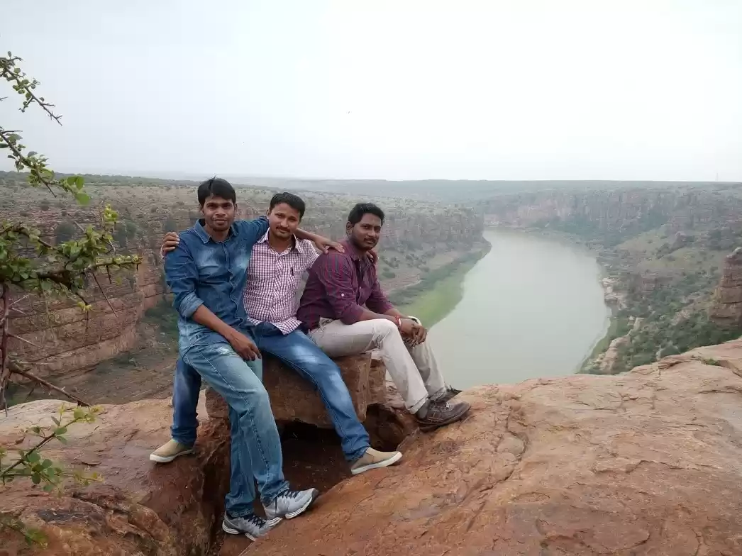
Rayalaseema is the southern part of Andhra Pradesh comprising four districts: Anantpur, Kurnool, Kadappah, and Chittoor. This region hosts some spectacular historical sites, such as Lepakshi, Penukonda, Gooty fort, Tadipatri temples, Yaganti, Belum caves, and Gandikota. After moving to Bangalore, I was contemplating on visiting these places someday. The long weekend of Ganesh Chaturthi was coming close and I thought why not visit some of these places? I had three days in hand and decided to visit Penukonda, Gooty fort, and Yaganti. The places were quite far from each other and using public transport would have wasted a lot of time. Not being much confident with driving a car, I finally decided to take my own bike for this journey. Having a hundred-and-ten-cc bike and this being the rainy season, I was a bit worried whether I will be able to make it without any trouble. But if there is no risk, where’s the fun? I packed my bag and started my journey early in the morning.
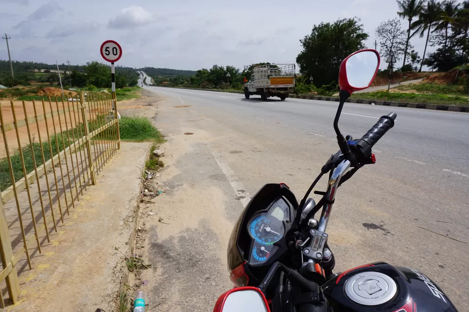
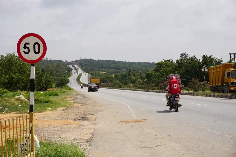
The weather was cloudy and the wind felt chilly. Being early hours of a Saturday morning, Bangalore roads were relatively free. I soon crossed the busiest streets and started riding on the long-ass Bangalore–Hyderabad highway. As I left behind the highlands of Bangalore, the weather slowly became warmer and the landscape turned arid. The thick blanket of clouds that had engulfed Bangalore skies was now dismantled into tiny furball-like pieces. These tiny clouds played hide and seek with the sun and created a mesmerizing light-and-shadow effect on the vast farmlands. The weather looked perfect for a long ride. The only issue was the uncomfortable saddle of my bike. This bike was not meant for long rides. Staying in an uncomfortable posture for a long time was very tiring. I decided to take rest stops every 50 km and keep going. To my surprise, the highway was in a very good condition.
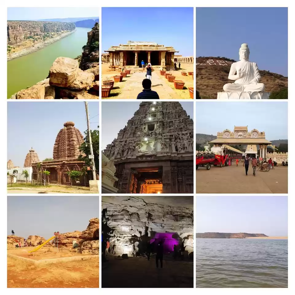
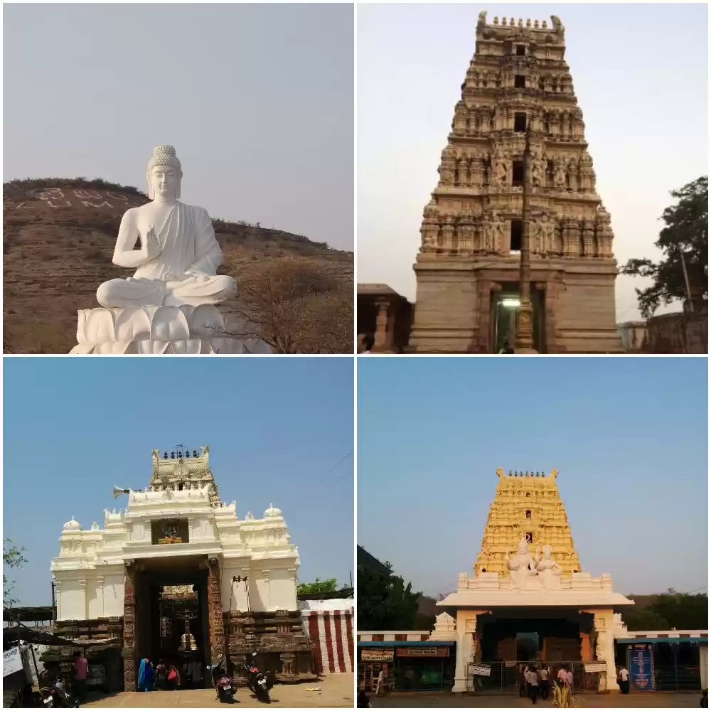
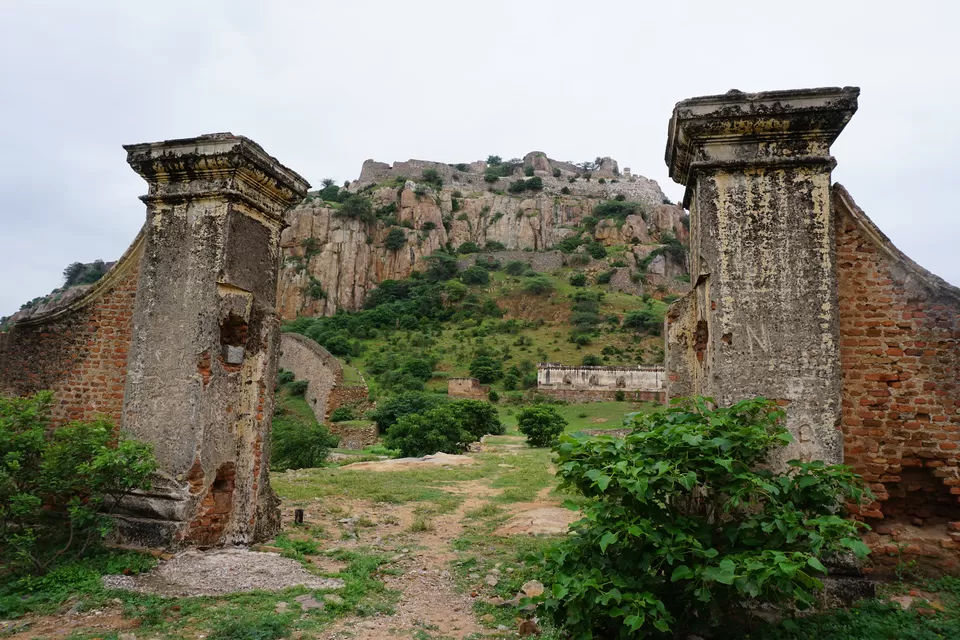
My first stop was Penukonda. This place was the summer capital of the Vijaynagar empire of Hampi. The emperor Venkatapathi Rayalu, the successor of Krishnadevray, made Koneti Nayadu the governor of Penukonda. Koneti Nayadu and his successors ruled this region for several centuries. After the battle of Talikota in which Vijaynagar fell, Penukonda became the capital of the remaining empire. Today it is a small town with historical monuments scattered here and there. One can easily spot the road leading to Penukonda from the highway; it hosts a huge arch with Penukonda fort written on it. Right next to the arch, stands a statue of Krishnadevray. I entered the town, and the typical hustle-bustle of a typical Indian town flashed in front of me. I started looking for the monuments. Suddenly, an ancient fort gate popped out of the chaotic cityscape. This was the gate of the Penukonda fort. The adjoining wall is now collapsed. One can see some traces of the wall here and there in the town. The fortification of the gate, however, was pretty much in a good condition.
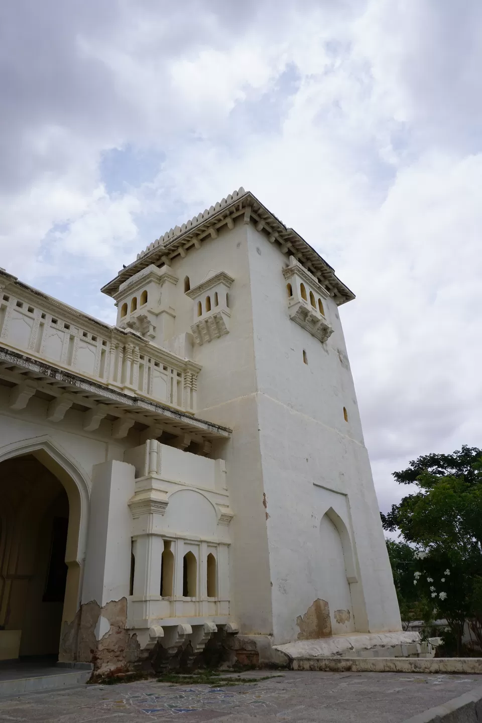
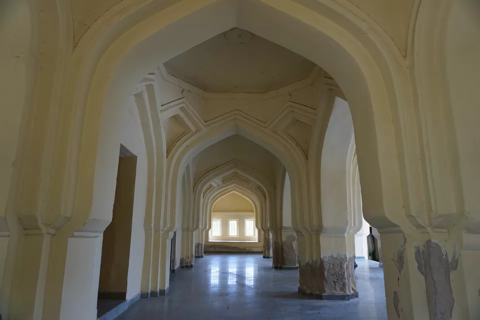
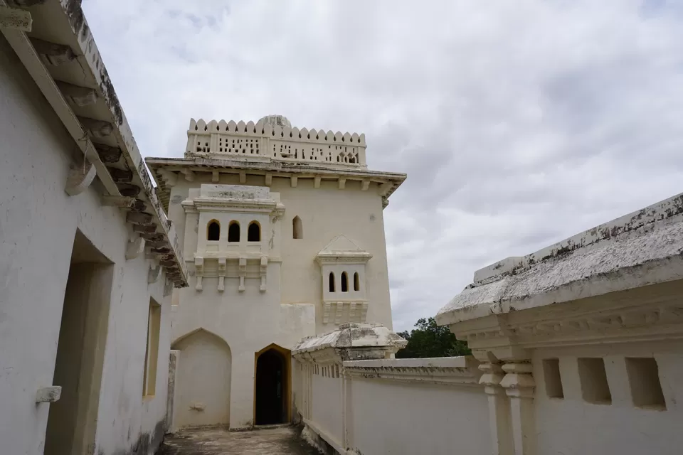
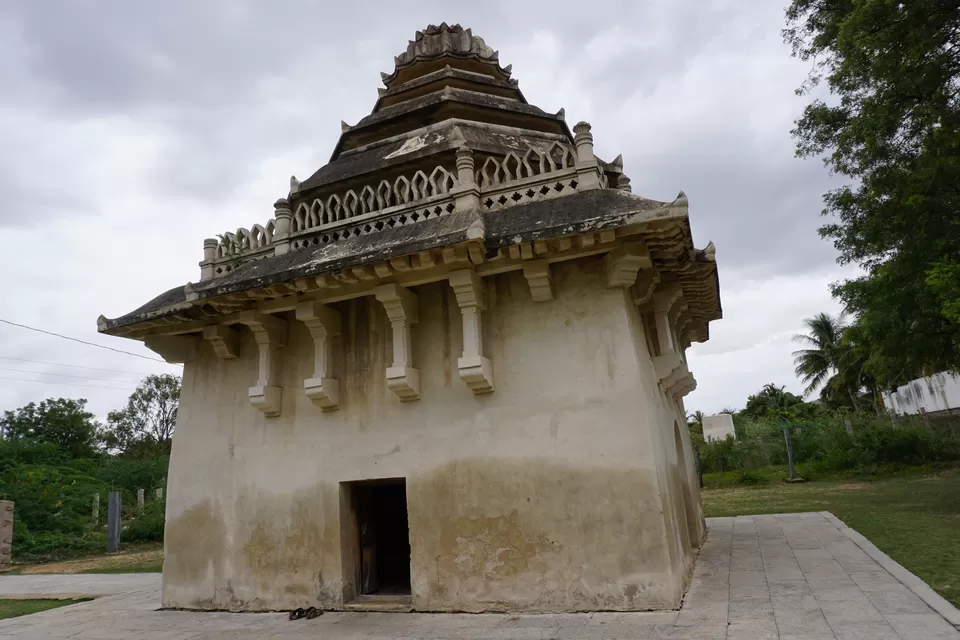
Right next to the gate stood a signboard of Gagan Mahal. I followed the directions and reached the palace. This used to be a palace for king’s harem. It is a two-story building and consists of foliated arches on the ground floor. The architecture style is borrowed from Lodi architecture of New Delhi. To me, the palace looked similar to the Lotus palace of Hampi, which was built for the same purpose. Gagan Mahal was renovated by ASI ten years ago. I could already see some graffiti by tourists on the walls. Except for the arches and decorated ceilings, there wasn’t anything much impressive. I took some pictures and came out.
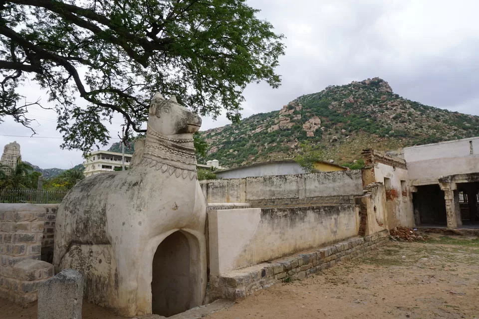
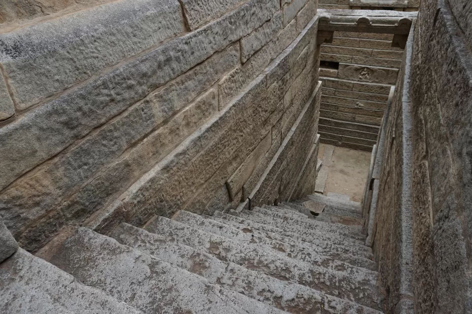
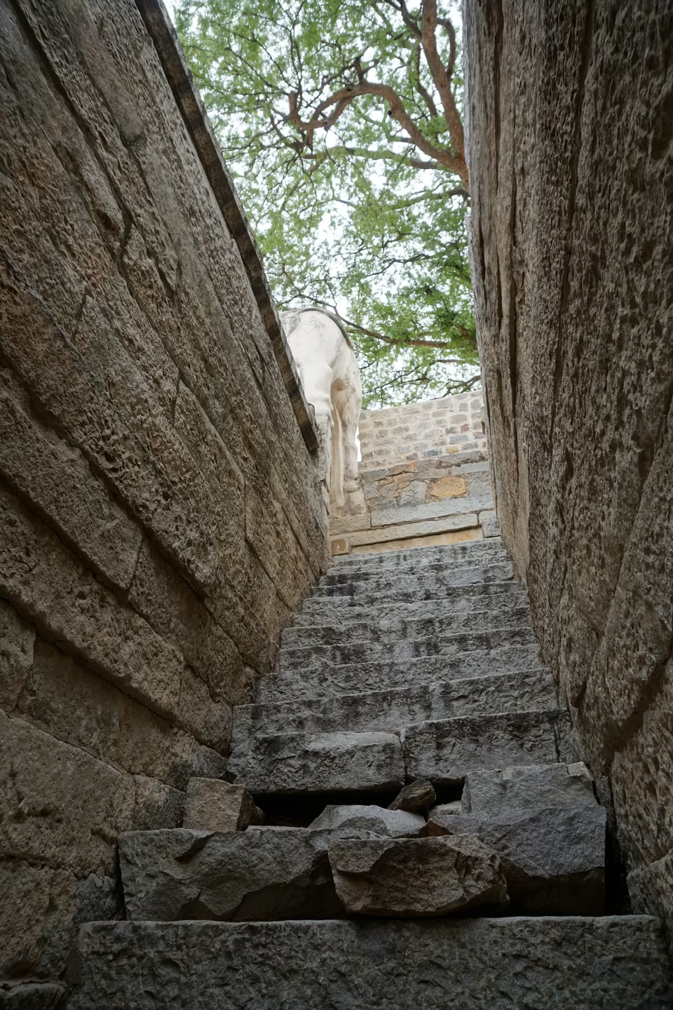
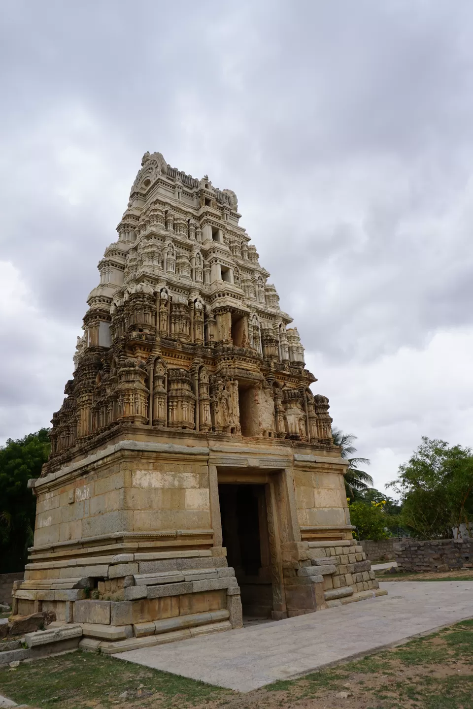
Right next to the palace were two temples: Ramaswamy temple and Eshwar temple. Both temples were unfortunately closed. I took a quick glance and came out of the temple complex. Right in front of these temples was a small gate, and a signboard stating “Timmarusu jail” stood next to it. I walked in. Over there was a small, square-shaped building with slanting roofs. On the first look, it appeared like a temple. However, it was a jail! Timmarusu was a general of Krishnadevray. He was very loyal to his master. However, the king accused him of poisoning his son and jailed him in this very building. After Timmarusu’s death, the king realized that he was innocent. Quite a tragic story! I clicked some pictures and moved to the next monument. A few steps further from the jail stood a giant Gopuram. The adjoining temple was no more in sight; only foundation could be seen. The Gopuram was tall and magnificent. I kept thinking how magnificent and beautiful the temple could have been! On another side of the narrow road was a step well. The entrance of the well was in the shape of Nandi. The well was around 10 meter deep. Most of the steps were still intact. There wasn’t any water inside. However, I could feel a minor drop in temperature. When I touched the stone walls of the well, they appeared considerably cold. Probably the spring was still active. With some restoration, the well might become full of water again! So be it. It was already 1 pm and I was hungry. The town did not seem to have a decent restaurant to have lunch. I decided to visit Penukonda fort and then look for some restaurant on the way to Anantpur.
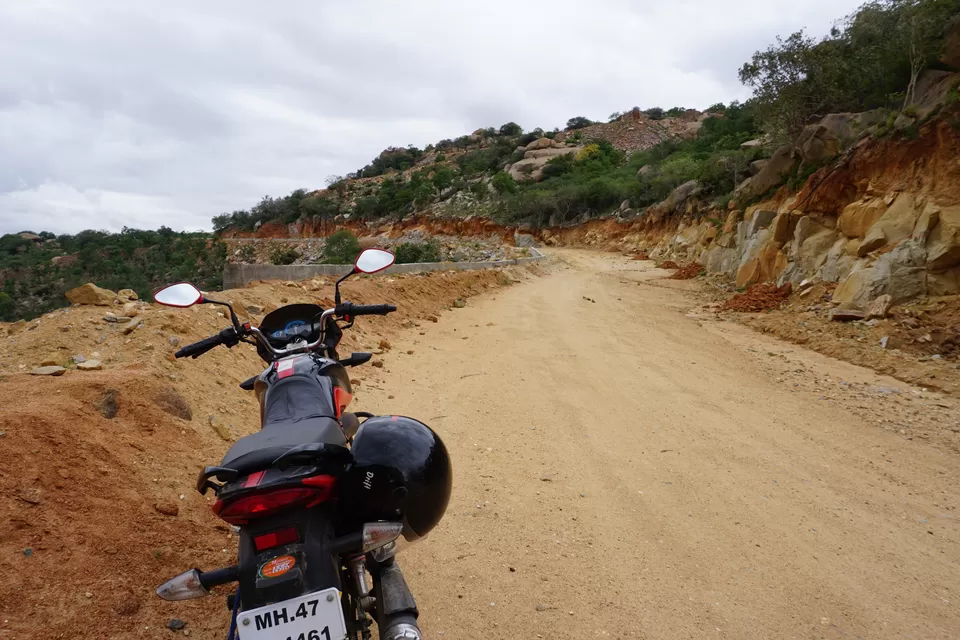
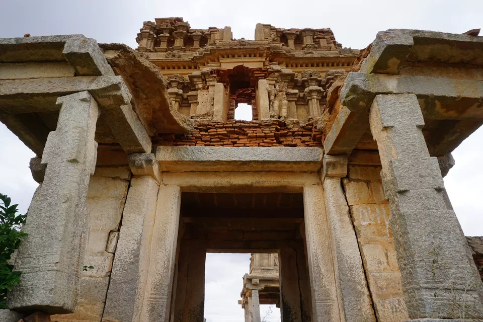
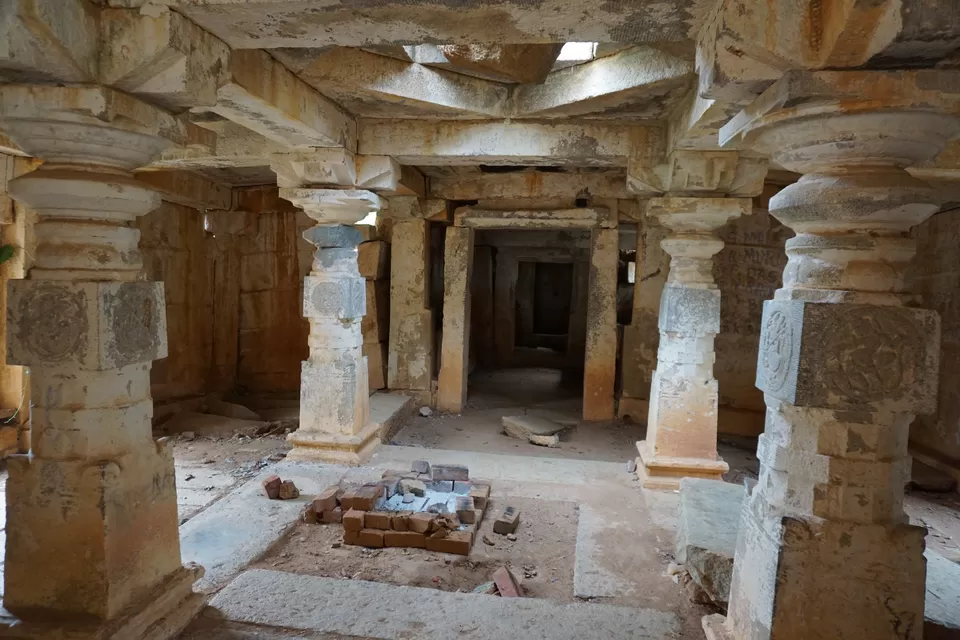
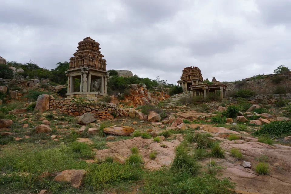
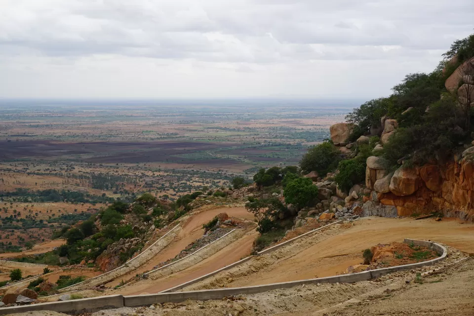
The road to Penukonda fort was from outside the town. As I crossed the farmlands, the road started going uphill. It took a few turns and abruptly ended in a dirt track. It seemed like an under-construction road. I stopped there for a while contemplating whether to go ahead. Then I saw two guys on a scooter coming from the opposite direction. If a scooter could make it, my bike certainly can. I ignited the engine and moved further. The road wasn’t as bad as I had imagined. As the road gained altitude, it became steeper and rougher. This was my first ever venture into off-roading. I was a bit scared yet enjoying the adrenaline rush. In around 30 minutes, I reached the top of the hill. The air was much cooler here. On my left stood the ruins of the Lakshmi-Narasimha temple. I climbed the steep stairs of the Gopuram and entered the temple premises. Although the temple was in ruins, its overall structure was quite intact. The Gopuram, the Mandapam, the Garbha-griha, everything could be located. A small Hanuman statue was kept at the entrance. The air was filled with mystic silence. Slow wind blowing through the broken walls and pillars was disrupting the mystic silence. It was quite an another-world-like moment. After clicking some pictures inside the temple, I climbed down and started exploring around.

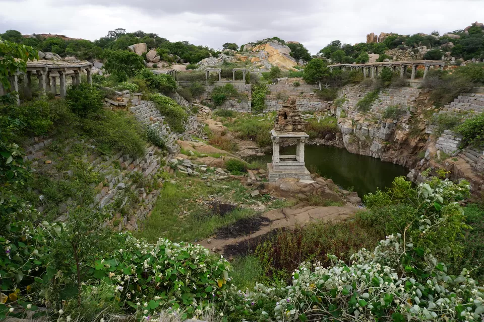

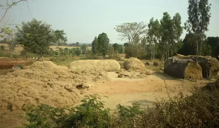
Right in front of the temple was a Pushkarani. Pushkarani is a water tank with steps from all sides. The whole tank was infested with weeds and shrubs. Little rainwater was accumulated at the center of the tank. A few sparrows were having their pool party in the water. Most importantly, there was not a single human being around. I was enjoying the solitude. I was busy clicking pictures and suddenly felt some raindrops falling. It looked like a heavy downpour was minutes away. I was in no mood of riding the dirt track when it is raining. I wrapped up my camera and rushed to the bike. While riding through the hills, I could see humongous black clouds raging from a distance. I raised my speed and soon reached the Bangalore–Hyderabad highway. Over there, the weather appeared clear and I felt happy that I escaped the showers. I stopped at restaurant on the way to grab lunch and continued my journey toward Anantpur. I had decided to stay the night at Anantpur. By the time I checked into a hotel, I was completely exhausted. I had covered almost 300 km in one day. For a 100-cc bike, this was quite an achievement. I finished my dinner early and went to bed.
The next day, I woke up around 7 am. I could still feel some body ache. And today’s ride was going to be even more strenuous. In the excitement of visiting new places, I totally ignored the body ache and started my trip. The weather was cloudy. As I started riding on the highway, I could feel tiny raindrops hitting the helmet. I just hoped that the rain does not become more intense than this and continued riding. My first stop was Gooty fort. It was round 60 km from Anantpur. The highway was cutting through scrub forests and grasslands interspersed with green paddy fields. In little more than half an hour, a few rocky hills emerged at the horizon. I was close to my destination. As I moved further, I could observe fortification on one of those hills. My guess was right; it was the Gooty fort. I took a left turn and entered the Gooty town. After the peaceful, undisturbed ride on the highway, the humdrum of the town seemed annoying. Gooty was somewhere between a village and small-sized town. A town that is mostly dirty, chaotic, and completely oblivious to its own glorious past. Wading through the traffic of humans, vehicles, and animals, I finally ended up at the base of the fort. I parked my bike, made an entry at the check post, and started my hike to the fort.
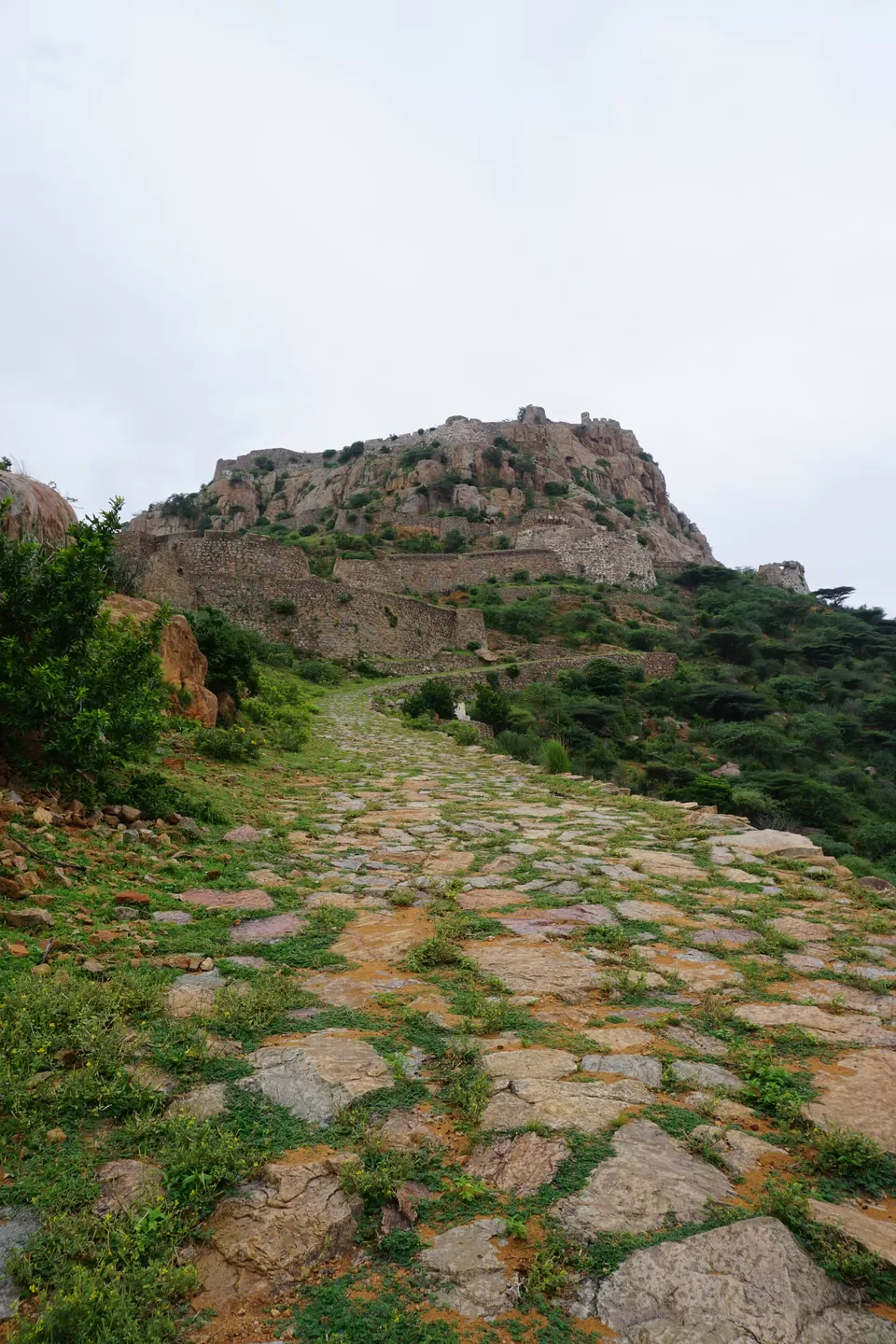
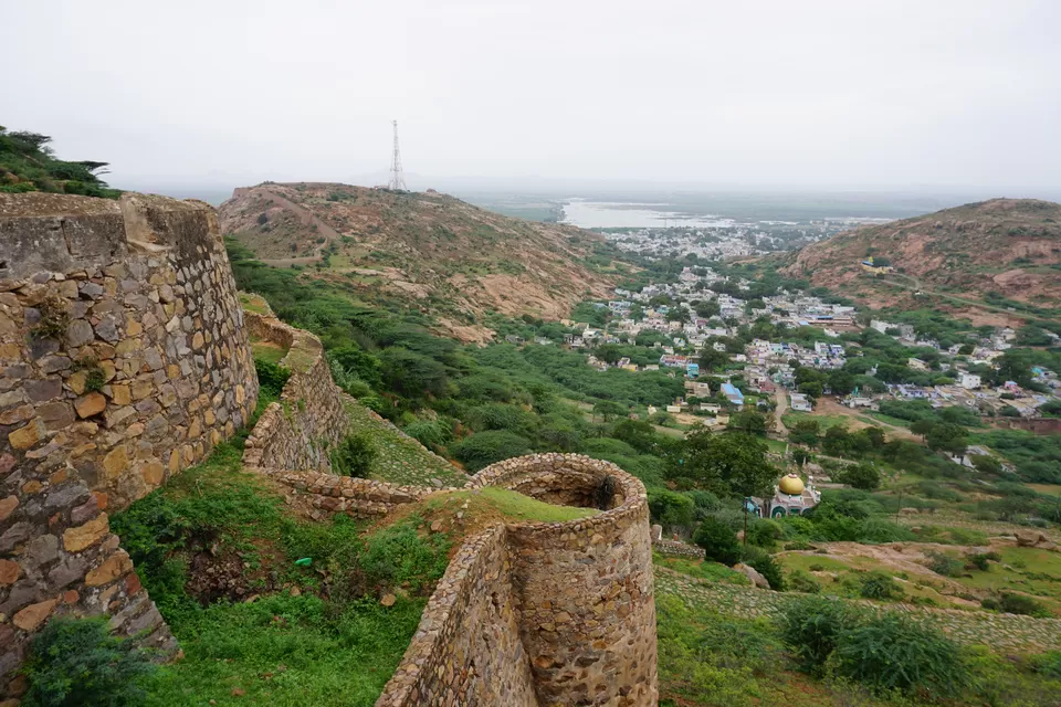
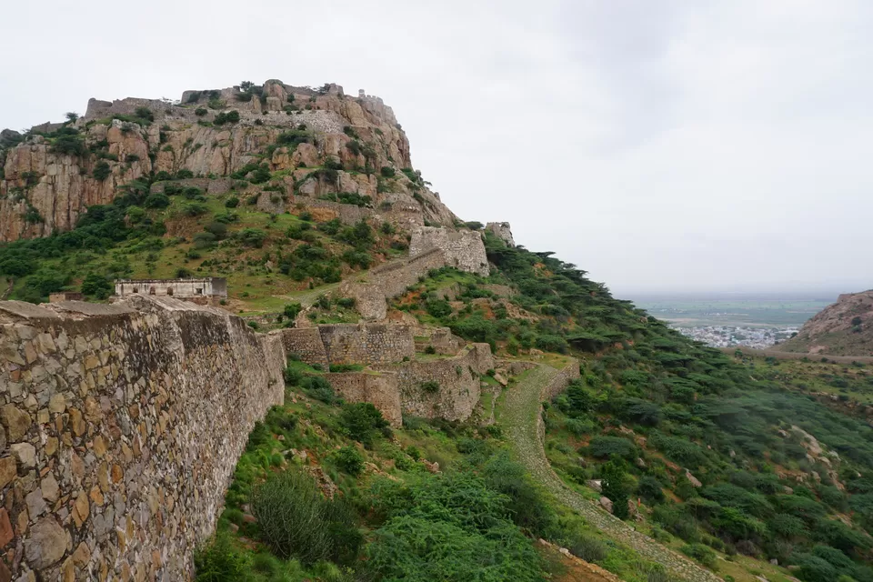

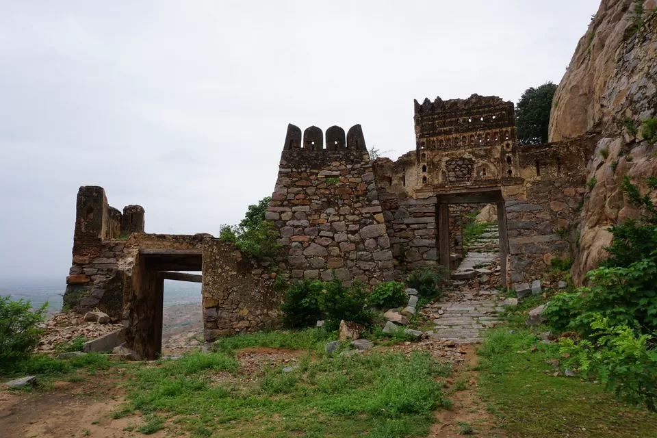
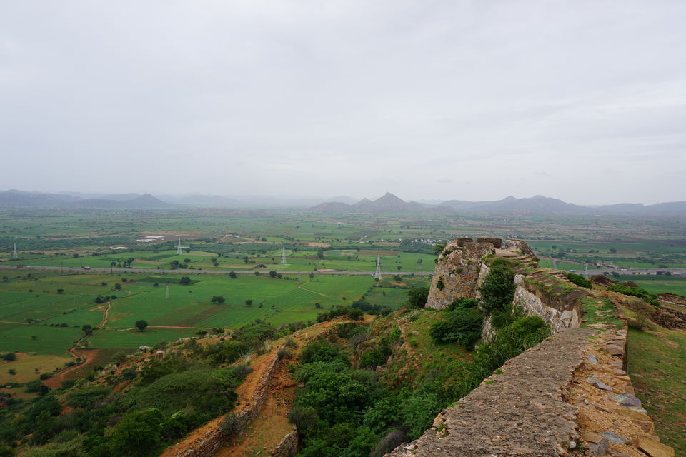
The fort, also known as Rayadurg, sits on a range of hills connected by spurs. The highest point rises 680 m above mean sea level. Its boundary wall stretches across miles. Right at the base of the hill was European Cemetery. After the defeat of Tipu Sultan, the East India Company sought to consolidate all principalities in South India. Gooty was one of them. This resulted in a fierce battle and several English soldiers lost their lives. Finally, the Company succeeded in annexing this fort and the dead soldiers were buried at the base of the fort. Thus, the cemetery was called European Cemetery. The Cemetery was closed. I took a glimpse from outside and moved uphill to explore the fort. This fort was originally built in the 11th century by a Western Chalukya king, Vikramaditya VI. Later it came under the control of Vijaynagar Empire, followed by Qutub Shahi, Mughals, Marathas, East India Company, British India, and finally the state of Andhra Pradesh in the Republic of India. Each ruler added something to the existing fortification and left an impression of their existence. The independent Republic of India has left its impression in the form of carved out lovers’ names and failed attempts of restoration. So be it.
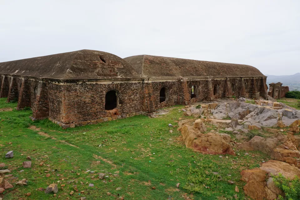
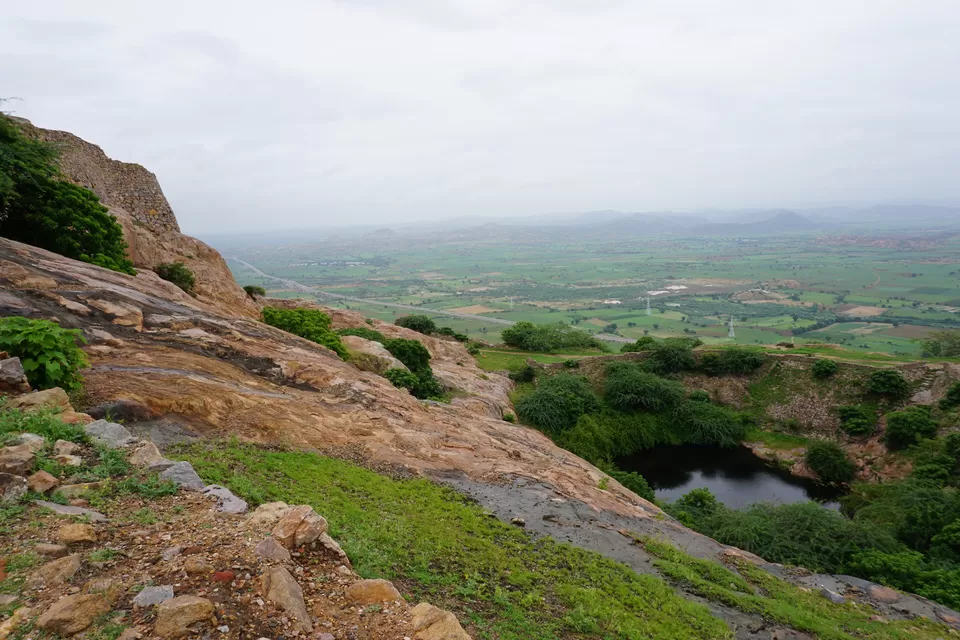
Soon I reached on a small plateau. It had a small water tank in the center. Some ruined buildings were scattered around. One of them looked like a granary. Another looked like a horse stable. The plateau was guarded with strong walls and watch towers in all directions. I explored the area along the outer wall. From here, the summit of the hill looked majestic. From the watch towers, I could see the fort wall stretching over adjoining hills and cutting through the town. After clicking some pictures, I continued my hike. After a few steps, the path became steep. Huge gates were laid on the path. The style of fortification reminded me of forts in Maharashtra. Each bend and curve of the path offered a different view of the surrounding landscape. Most importantly, there was not a single human being around! I was enjoying my solitude. As I gained altitude, the weather became misty and the wind became cooler. At the summit, there were several ruined buildings. One of these was Murari Rao’s seat. Murari Rao was a Maratha general who made this fort his permanent residence. It is said that Murari Rao used to play chess and swing at the highest point of the fort. I loitered around exploring the ruins and clicking some pictures. It was 10 minutes to 11 and I realized that I had spent a whooping two hours on the fort. I rushed down and started my journey ahead.
The next stop was Yaganti. As I rode on the highway, huge dark clouds started gathering in the sky. My worst nightmare of getting caught in a heavy downpour was about to realize. The highway passed through a deserted area and finding a shelter was close to impossible. I decided to reach the nearest town and if it starts raining, wait there until the downpour recedes. I reached the town of Peapully from where I had to take a right turn. Still no signs of rain. But the road looked wet. Probably, there was already a spell of rain in this area. If it rained recently, it probably won’t rain again very soon, the weatherman in my hopeful mind spoke. I raised the accelerator and moved ahead. The road, however, was in mayhem. Repair work was going on at most places on the way. The recent shower had messed up things further. Wading through the lunar-like craters, I finally reached the Yaganti temple.
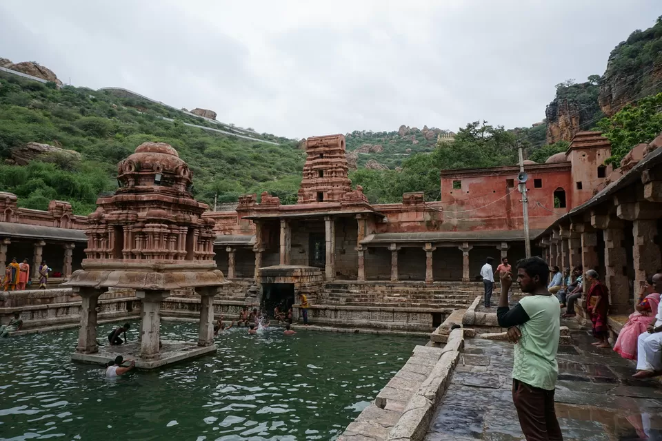
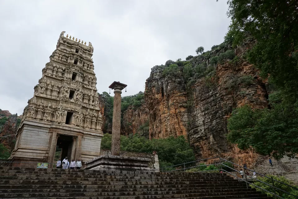
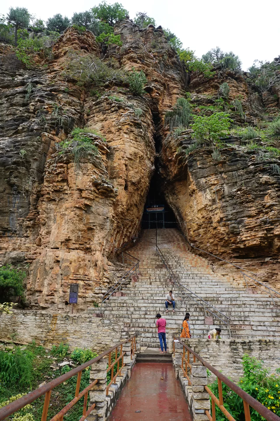
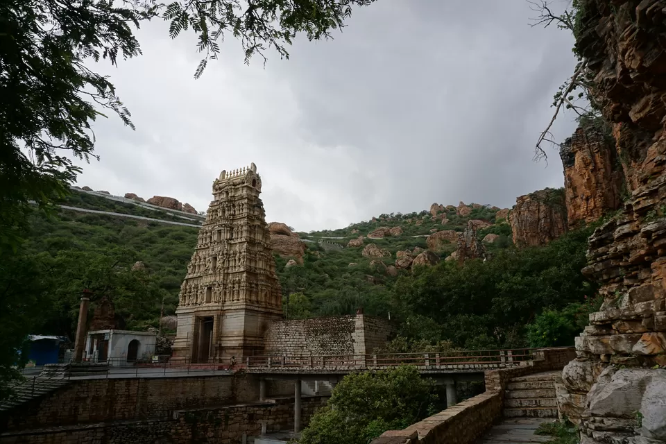
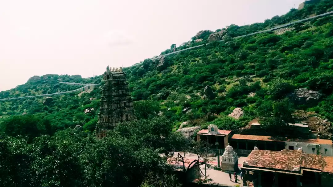
Yaganti is a Shiva temple located in Kurnool district of Andhra Pradesh. It was built in the 15th century by the Vijaynagara king Harihara. The legend behind the temple is quite interesting. Sage Agastya wanted to build a Venkateshwara temple at this site. However, the idol could not be installed as its toenail was broken. The sage got upset over this and performed penance for Shiva. Then, lord Shiva appeared and said that the place is more suitable for himself as it resembles Kailash. The sage requested Shiva to appear along with Parvati as lord Uma Maheshwara in a single stone. And the idol was established at this temple. The temple is surrounded by karst hills from three sides. In the hills, there are three caves: Agastya cave, Venkateshwara cave, and Veera Brahmam cave. The temple showcases the typical Dravidian style of architecture. The biggest attraction of the temple is Pushkarani. It is a small water tank which is full of fresh water coming from the hills. Devotees generally take bath in Pushkarani and then visit the temple.
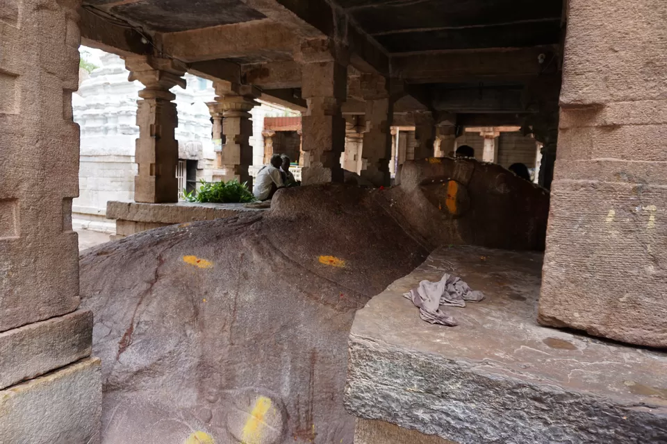
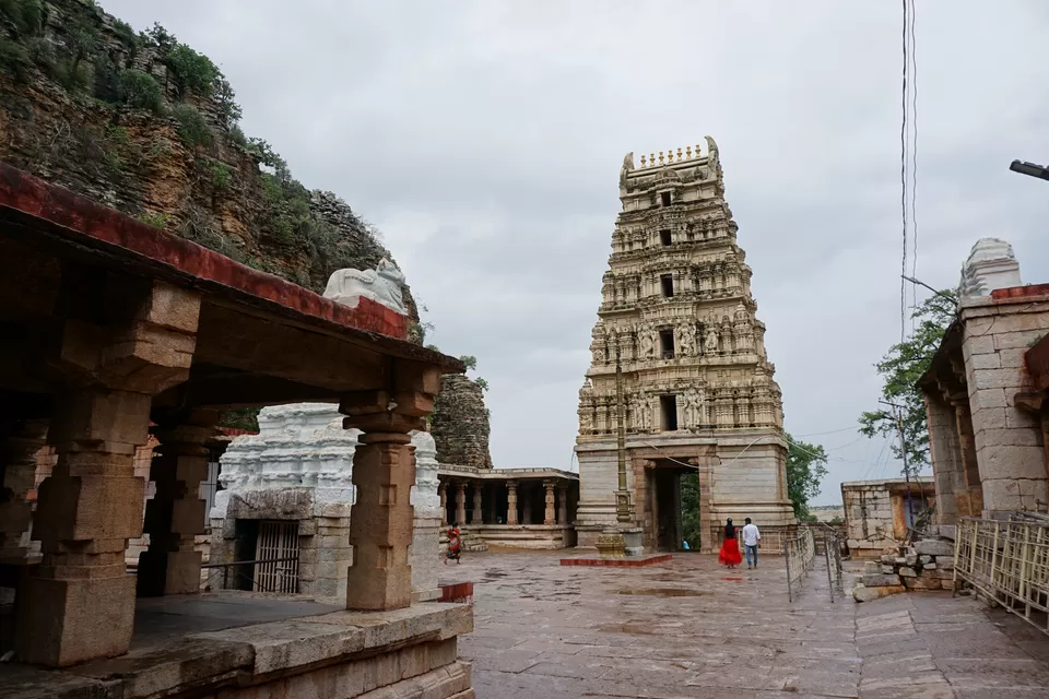
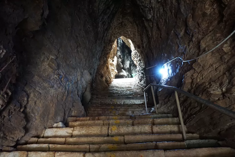
I parked my bike outside the temple and started walking toward the Pushkarani. The tank was much smaller than what I had thought. However, the steps, doors, and pavilions were beautifully constructed. The water looked deep bluish green; surprisingly it was clean and fresh. Some men were jumping and playing in the water. Their noise was a bit irritating. I once thought of taking a bath; however, with all the ruckus around, I did not feel like stepping in. I clicked some pictures and moved toward the temple. The Gopuram was tall and beautiful. It blended well with the surrounding hills. The temple was unfortunately closed. I walked inside the temple courtyard. The famous growing Nandi was right in front of me. It is said that the stone of which Nandi is made has unique properties and it grows 1 inch every 20 years. It is said that once upon a time people could comfortably walk around the Nandi. Today, however, the Nandi is touching the temple pillars on all sides. When I looked closely, it appeared to be out of shape. Probably the Nandi rock was indeed expanding. It would be interesting to investigate this further and find out what is causing expansion of the rock. I could not see the single-stone statue of Uma Maheshwara. I felt a bit disappointed, but then I decided to explore the entire temple complex. The three caves were in the hill located on the right side of the temple. I climbed to all of them and had a look. The view of the temple and surrounding hills was mesmerizing from the Veera Brahmam cave. The Gopuram looked majestic at the background of the karst limestone. I clicked some pictures and came out.
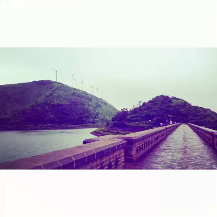
Suddenly the sky became grey and within a moment, it started pouring. I had escaped the mighty monsoon showers until now. But now, the rains had finally caught me. Fortunately, I was still at the temple and could take a refuge at a nearby tea shop. I sat there sipping hot chai, waiting for the showers to recede. In around fifteen minutes the rain stopped. I wore my raincoat and started the bike to ride back to Anantpur. I decided to take a little longer route via Banaganapalli and Tadipatri. The shorter route leading to the Bangalore–Hyderabad highway was in shambles and the recent showers must have made the situation worse. I was in no mood of having a Motocross Madness experience. As I crossed Banaganapalli, the weather became clear. In fact, the roads were hardly wet! I realized that the showers were a result of just a passing cloud. Whatever! I was happy that I had escaped the rain. This road was in overall good shape. The landscape was dotted with lush paddy fields. Suddenly, the road took a sharp uphill turn and ended up next to a huge reservoir. I was pleasantly surprised at the scenery in front of me. I stopped for a moment, took some pictures, and moved on. Within two more hours, I reached Anantpur. Next day being Ganesh Chaturthi, the markets in the city were flooded with people. I reached the hotel, finished dinner, and retired for the day. The next day, I returned to Bangalore.
With secluded hill tops, hide and seek with the rain, and mesmerizing landscapes, this road trip was quite enjoyable. It was my first ever long-distance trip on a 100-cc bike and the experience was memorable.