Exotic and Captivating, the Big Island is Home to Some of the Most Beautiful Places Off-the-Beaten Path
Hawaii Island, otherwise known as the Big Island, has it all.
Pristine white sand with crystal clear waters, lush tropical valleys and geological anomalies are all just a drive away on this small yet diverse volcanic island sitting in the middle of the pacific ocean. The youngest of its siblings, Hawaii is still vastly undeveloped and untouched so it’s great for seeking out seclusion in even the most pristine places.
I honestly had no idea I was going to such a special place when I bought my ticket to Hawaii, I simple wanted to pick mangoes and experience life as a WWOOFer. For a first time backpacker it seemed exotic, yet familiar. Slowly, day-by-day I started realizing the complex secrets this island has to offer. One day you’re watching hot lava pour into the ocean beside the remnants of an old village now obsolete, covered in volcanic rock while the next you’re trekking through the jungle, chasing waterfalls, hacking away at the dense vegetation acting as a wall between you and bliss.
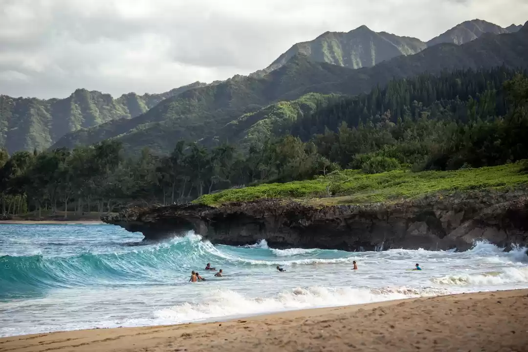
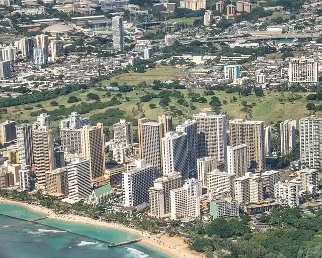
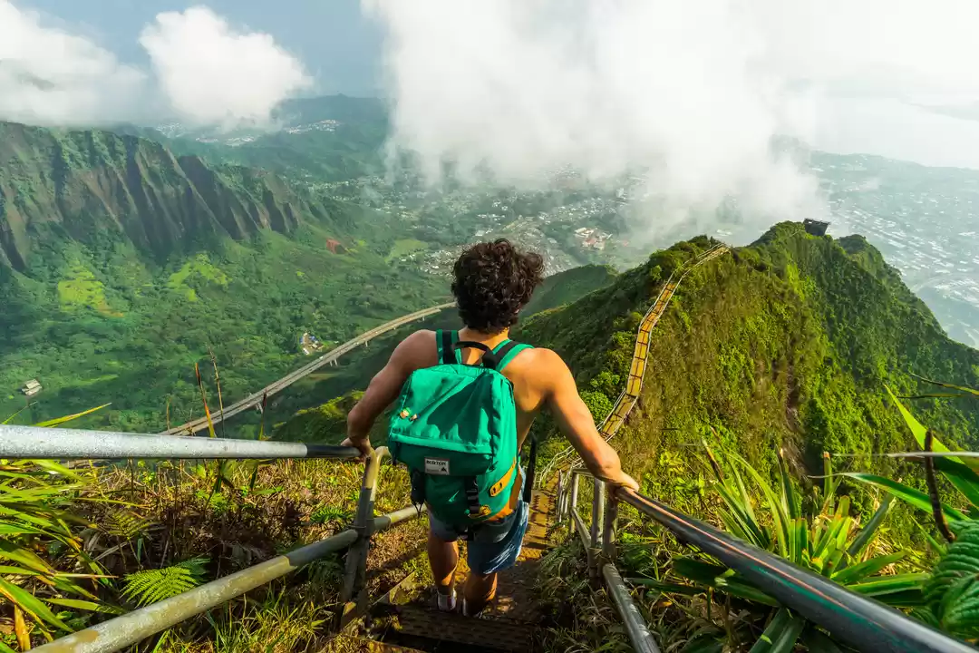
If you’re looking for adventure, this is the place for you. Although the Big Island is abundant in plush resorts with man-made beaches, I suggest putting on your hiking shoes and checking out a few or all of these secluded beaches, most accessible only by foot.
Hike time: 20 mins.
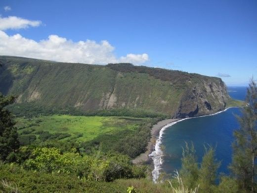
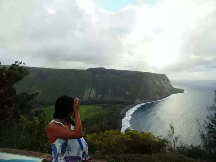
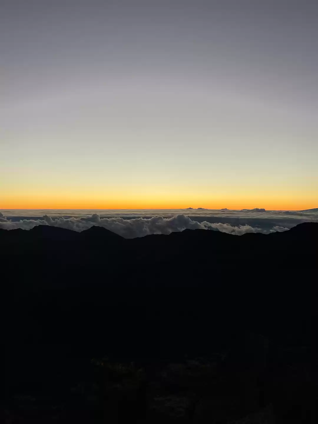
Not the kind of beach you go to for basking and bathing the day away, but a tranquil place of contemplation in a wild, lush, untamed and unpopulated valley at the north end of Hawaii’ Island. Most tourists opt to visit Waipi’o Valley so this is a great place for seclusion, I didn’t see anyone else when I was there but noticed that some campsites had been setup at some point so it might be a great option for an overnight stay. To get there drive north on Highway 270 until you get to a the end and you will be rewarded with a gorgeous view over Pololu valley and the rugged Kohala Coast. From there I highly suggest taking the hike down to the beach. The trail is a rough switchback, dropping 400 feet rather quickly so you should be moderately fit or the way up will be a challenge.
The valley is privately owned so you should stay close to the beach. You can cross the stream 80-120 feet inland and can usually find a stone ford in that area to cross easily. It’s not recommended that you swim here as the beach lies at the channel connecting Hawaii and Maui, bringing strong currents and rip tides, even the strongest swimmers can easily be caught and swept away.
Hike time: 30 mins.
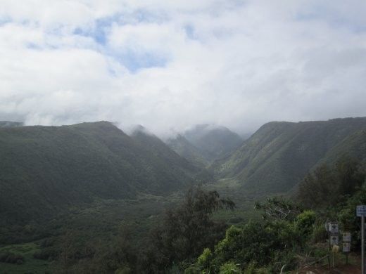
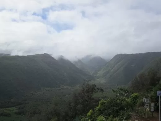
Waipi’o Valley used to be home to ancient Hawaiian royalty, but is now mainly taro farmers.
Sheltered by high cliffs on either side, Waipi’o valley is only about 1 mile long with a stream flowing into the ocean from the privately owned Hiilawe Falls towering 1,400 ft above, making it the highest waterfall on the island. To get there from Hilo, take Route 19 north and turn right onto Route 240 to Waipi’o Valley. There is a car park at the top with a lookout and although there is a paved road allowing access to the valley, it is very steep with a 25% grade and only accessible by 4-wheel-drive. A walk down is usually your only option to access the valley, but well worth the trek.
Though many locals use this beach as a surf spot, the current can still be quite strong and it’s best to swim only when the water is calm. It is especially dangerous in the winter months, though still worth the trip because this is the best time for whale watching. You have to be wary of the waves crashing in, I went from knee-deep to waist deep in a matter of seconds and damaged my camera that was (stupidly) in my pocket, another silly mistake of mine.
For another excellent view of the valley, cross the river and cross all the way to the opposite side of the beach and head up the steep Muliwai switchback trail leading to Waimanu Valley (an excellent but long hike for the more adventurous). The third switchback is the best photo opportunity with little to no tourists getting in your way, it only takes about half an hour to get this far.
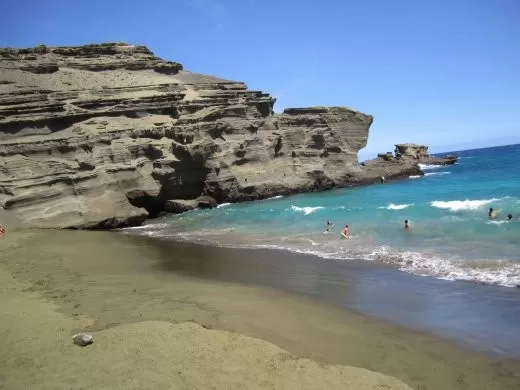
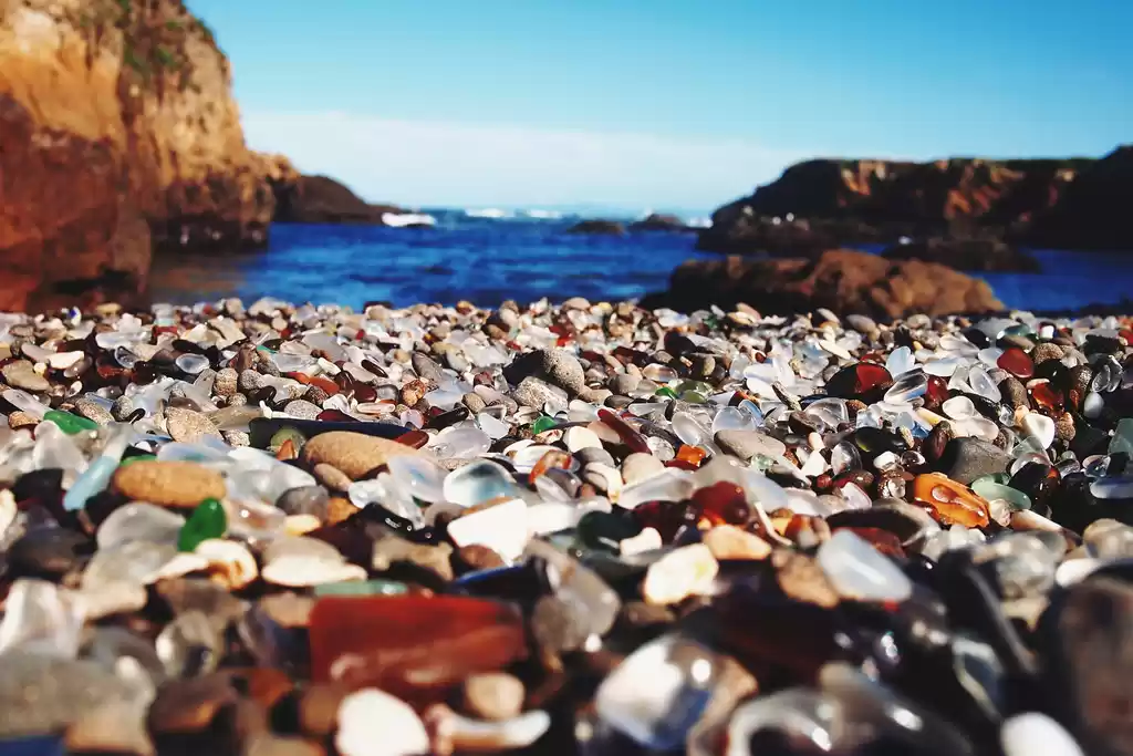
Hike time: 1 – 1.5 hrs Green Sand Beach is an absolute must-do activity for anyone traveling to the Big Island. Don’t be scared off by the tales of a windy, long hike, just be prepared. Yes, it’s extremely windy, and dusty, and rocky, but once you get there you’ll know it was well worth it. I saw a couple doing this hike with an infant on their back, so it’s definitely more than doable. Green Sand Beach There is very little shade on the beach so bring plenty of water, a hat and sunscreen – it’s hot out there. Often there will be locals with their 4-wheel-drives selling cold beer and sandwiches. You can also pay them to give you a lift back ($10-15) if you’re not feeling the treacherous journey, though don’t count on it because they’re not always there. I ran out of water with not a local in sight and the hike back was not fun. From Ka Lae (South Point), find the Kaulana Boat Ramp and follow the rough trail for about 4 km (2.5 mi). It’s hard to get lost, just follow the coastline, you’ll know when you’re there. It’s pretty steep getting down onto the beach so make sure you follow the trail and watch your step, it can be quite slippery. The beach sits in a volcanic crater and the olivine deposits actually cause the sand to be green. You may notice a green shimmer in the rocks as you get closer to the beach. It’s forbidden to take any of the sand as a souvenir to preserve one of the only two natural phenomenons of its kind in the world (the other being in the Galapagos), so be sure to respect that and take pictures only.
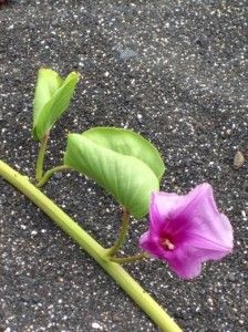
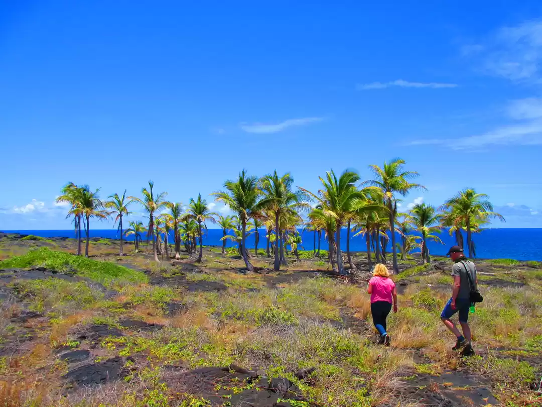
Hike time: 20 mins. Honomalino Honomalino beach is accessible from Mioli’i which is one of the few remaining traditional Hawaiian fishing villages lying at the end of a long winding road along the southern Kona Coast. Don’t be offended if you’re not welcomed with a warm Aloha by local villagers, they are a tight-knit community and enjoy their privacy. I wouldn’t suggest pointing your cameras at them either. From the Mioli’i Beach Park, between the restrooms and a yellow church, you will find a clearly marked sign posting the beginning of the trail. Follow it for about 20 minutes through the trees and lava rocks, staying to the right whenever it forks to avoid trespassing on private property. The trail is quite easy though be sure to wear shoes and watch out for big thorns. Honomalino is actually a gray, or salt-and-pepper beach because it has a mixture of black lava sand and white sand. It lined with palm trees and kiawe trees, with morning glories crawling along the sand. Be sure to bring some snorkeling gear because this bay has some great coral and good swimming as long as the water is calm.
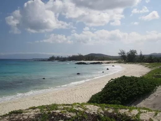
Hike time: 25 mins. O-M-G. Makalawena There should be a picture of Makalawena Beach under “paradise” in the dictionary. By far the most beautiful beach on the island, “Maks”, as it’s called by the locals, is almost always empty with powder white sand, crystal clear azure water, a series of coves, big sand dunes, fresh water ponds, ample shaded areas and wildlife lingering around undisturbed by your presence. It offers great swimming and snorkeling as well as boogie boarding in the surf. The center beach is the best snorkeling spot with abundant coral, caves, and sea arches. To get there take Queen Ka’ahumanu Hwy. (Route 19) to Kona Coast State Park, also called Kekaha Kai State Park, between Mile Markers 89 and 90. It’s not the most obvious turn off so keep your eyes peeled, I missed it and had to turn back. The road off the highway leads all the way down to a parking lot near the water but has a gate that is only open Thursday through Tuesday 9am-7pm, so be sure to make it out on time or you’ll be locked in! The hike begins by taking you on an old carriage road, past the abandoned Magoon Mansion on Mahaiula Beach. Keep on trekking through some kaewe trees, past a couple of springs and over the dry a’a lava field until you reach the sand dunes. From here you’ll want to get out your camera because the view is spectacular. Stop for a moment to take it all in because it might not last forever, the land is surely set for development of condos and resorts unless the locals manage to put them off with their protests.