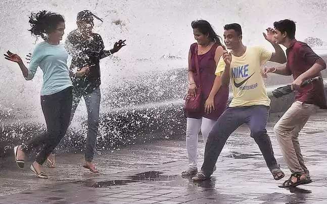
The place with highest rainfall in India, has the highest rainfall in the world also Amazing right? India is a land of diversity From cultural, to linguistic, to even geographical diversity! Due to the latter, one can experience varied temperatures and climates in different parts of the subcontinent. So you have places as dry as the Thar desert in the West and places as wet as Mawsynram in the East which happens to be the wettest place in India. You have places as cold as Leh in the North and as humid as Chennai in the South. It is a superb amalgam of all of this. India is incredible indeed! Among the highest rainfall places in India, feature Arunachal Pradesh, Sikkim, West Bengal, Odisha, Uttarakhand, Karnataka and Kerala.
Here are the top 12 Wettest Places in India
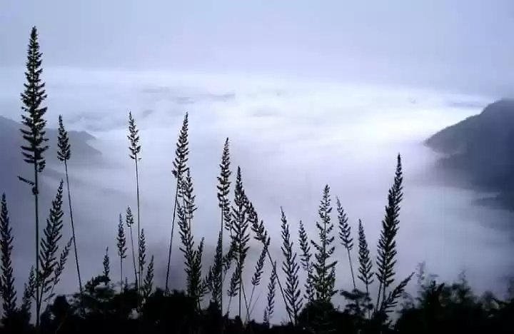
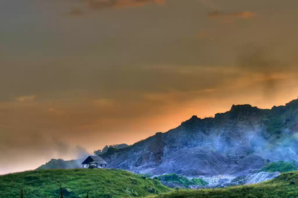
1. Mawsynram: The Wettest Place on Earth
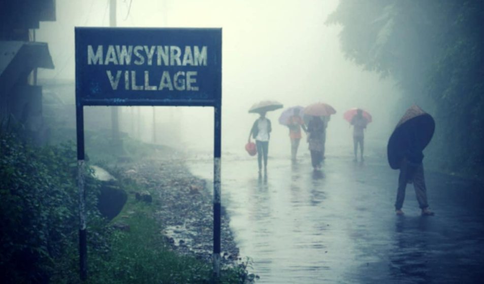
Mawsynram of Khasi Hills in Meghalaya, North East India, has the title of being the wettest place in India and of the world. It is located on the top of a hill in the middle of a valley. It has a recorded 11, 872 mm. of rainfall during peak monsoons in India.
The modest hamlet of huts, where often the rain bearing clouds enter inside, has very simple localites residing who consider it to be a great thing that their village features in the Guinness Book Of World Records for being the wettest place of the world. It is amazing to see how women from every household make "knups," using bamboo slivers, plastic sheets and broom grass to create a rain shield.
Popular Attractions in Mawsynram: Mawjymbuin Cave, Dwarksuid Pool, Mawsmai Falls, Khreng Khreng Viewpoint.
How to Reach Mawsynram: Mawsynram is about 60 km from Shillong, the capital of Meghalaya. One can take a taxi or a bus from Shillong to reach Mawsynram. The nearest airport is Umroi Airport, about 40 km from Shillong. The nearest railway station is Guwahati, about 140 km from Shillong.
Must Read : Top 5 Destinations for Monsoon in India
2. Cherrapunji: The Land of Living Root Bridges

Cherrapunji lies in the slopes of Khasi Hills and experiences rain levels very close to Mawsynram. Its located at the confluence of two gorges in the hills and has recorded 11,619 mm as the highest rainfall in Cherrapunji. It is located 4500 feet above sea level. Tourists flock to witness the magnificent monsoons, apparently the only weather of Cherrapunji because it literally rains all year long here. Still it has maintained its beauty as it is. Another interesting fact is that it usually rains here at night so that the day's work is not disrupted.
There are some picturesque sites in Cherrapunji. 1,035-ft-high Mawsmai Falls-the fourth highest in India lies just a few kilometres beyond Cherrapunji. Apart from this, there are Cherrapunji monoliths and underground passes beneath age old caves which are fascinating.
Popular Attractions in Cherrapunji: Nohkalikai Falls, Living Root Bridges, Mawsmai Cave, Seven Sisters Falls.
How to Reach Cherrapunji: Cherrapunji is about 50 km from Shillong, and can be reached by taxi or bus. The nearest airport is Umroi Airport, and the nearest railway station is Guwahati. One can also take a helicopter service from Guwahati to Shillong.
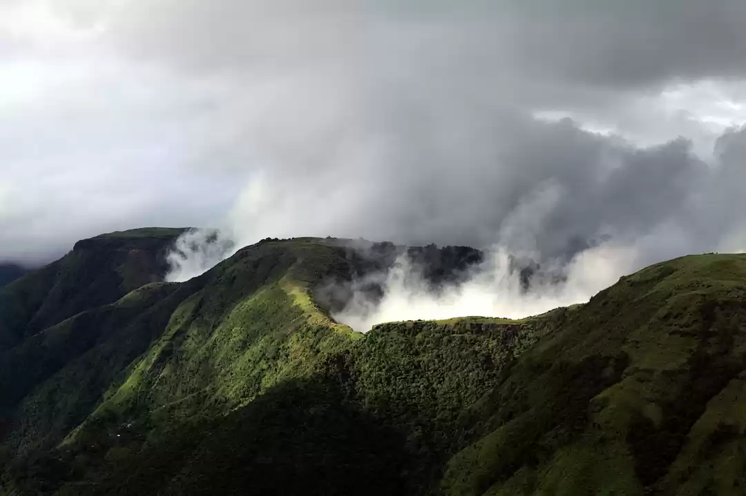
3. Agumbe: The Cherrapunji of the South

Agumbe is a small town in Shimoga district of Karnataka with an average rainfall of 7,691 mm. It is one of the most scenic places in Western Ghats of India with lush green views all around and has an important rainforest station for research. It is known for its high rainfall and dense forests full of reptiles and other plants and animals. The rainforests surrounding Agumbe are part of the Someshwara Wildlife Sanctuary It is called the Cherrapunji of South.
The busy streets of Sringeri’s main market, 27 km from Agumbe, lead to one of Karnataka’s most popular pilgrimage spots. The Sringeri Sharada Peetham is a complex of temples and monasteries constructed in the eighth century by Adi Shankaracharya, the pioneer of the advaita philosophy.
Popular Attractions in Agumbe: Jogigundi Falls, Barkana Falls, Sunset Point, Agumbe Rainforest Research Station.
How to Reach Agumbe: Agumbe is about 380 km from Bangalore, the capital of Karnataka. One can take a train to Shimoga or Udupi, and then take a bus or taxi to Agumbe. The nearest airport is Mangalore, about 100 km from Agumbe.
Must Read: Waterfalls in Monsoon in India You Cannot Miss
4. Mahabaleshwar: The Strawberry Capital of India

Mahabaleshwar in Maharashtra comes next in terms of amount of rainfall it receives annually. 5,618 mm. is the recorded level. It is also located close to Western Ghats and receives continuous rainfall in mild quantity throughout the year. Heavy rains occur during monsoons. It is a perfect summer weekend getaway. Apart from the rich foliage which turns even more beautiful during monsoon, you have various mythological temples to visit in Mahabaleshwar. Then there is the Venna lake, a popular tourist attraction and Arthur Point, named after British officer Sir Arthur Malet, who sat here and gazed at the Savitri River, where he lost his wife and children in a tragic ferry mishap.
Popular Attractions in Mahabaleshwar: Venna Lake, Pratapgad Fort, Elephant’s Head Point, Mapro Garden.
How to Reach Mahabaleshwar: Mahabaleshwar is about 120 km from Pune, the nearest major city. One can take a bus, taxi, or self-drive car from Pune to Mahabaleshwar. The nearest airport is Pune Airport, and the nearest railway station is Wathar, about 60 km from Mahabaleshwar.
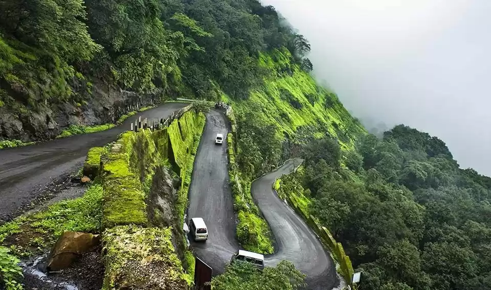
5. Amboli: The Misty Hill Station of the Sahyadris

Amboli is another hill station in Maharashtra, close to Panjim, famous for tourism especially in rainy season. Its called the 'MIST PARADISE' and encompasses beautiful gorges and waterfalls during monsoons. It is also home to a rare variety of flora and fauna. . It witness around 7,500 mm. of rain every year.
It is even called the queen of Maharashtra. Amboli is located on the ridge of the Western Ghats. Amboli is situated at an altitude of 690 meters above the sea level and its amazing topography comprises dense forest area with a large number of waterfalls which increase in number during the rainsAmboli waterfall and Nangarta waterfall are a must visit.
Popular Attractions in Amboli: Amboli Waterfall, Hiranyakeshi Temple, Nangartas Waterfall, Sunset Point.
How to Reach Amboli: Amboli is about 500 km from Mumbai, the capital of Maharashtra. One can take a train to Sawantwadi, and then take a bus or taxi to Amboli. The nearest airport is Goa, about 120 km from Amboli.
6. Pasighat: The Gateway to the Land of the Rising Sun

Pasighat witnesses an annual rainfall of 4,388 mm. every year. Full of beautiful tea gardens, Pasighat feels more like Assam than Arunachal Pradesh but it is located in Arunachal Pradesh itself and is one of the oldest villages of the state.
It is located alongside Siang river. Otherwise, its a quiet village with not much activity. Tourists usually stop here to take a taxi or ferry to other destinations in Assam or Arunachal.
Popular Attractions in Pasighat: Daying Ering Wildlife Sanctuary, Sirki Waterfall, Dangoria Baba Temple, Raneghat Bridge.
How to Reach Pasighat: Pasighat is about 270 km from Itanagar, the capital of Arunachal Pradesh. One can take a bus or taxi from Itanagar to Pasighat. The nearest airport is Pasighat Airport, which has flights from Guwahati and Kolkata. The nearest railway station is Murkongselek, about 40 km from Pasighat.
Must Read: Planning for an adventurous bike trip in monsoon?
7. Gangtok: The Jewel of the Himalayas
Gangtok, capital of Sikkim comes next in line and experiences 3,737 mm. of annual rainfall. It has now converted into a modern capital with concrete buildings having come up here. Rumtek and Tsomgo Lake are certain places for excursion. Khangchendzonga national park is another tourist favourite. One can stay here and enjoy the unique culture of the place Monsoon is definitely the best time to enjoy the lovely climate here.
Popular Attractions in Gangtok: MG Marg, Rumtek Monastery, Tsomgo Lake, Nathula Pass.
How to Reach Gangtok: Gangtok is about 120 km from Siliguri, the nearest major city. One can take a bus, taxi, or shared jeep from Siliguri to Gangtok. The nearest airport is Bagdogra, about 125 km from Gangtok. The nearest railway station is New Jalpaiguri, about 120 km from Gangtok.
8. Neriamangalam: The Rainforest Paradise of Kerala

Neriamangalam is a village in Ernakulam district of Kerala, situated on the banks of the Periyar river. It is also known as the gateway to the high ranges, as it is on the way to the hill stations of Idukki district. Neriamangalam is the third wettest place in India, after Mawsynram and Cherrapunji, receiving an average annual rainfall of about 6,000 mm1 The village is surrounded by dense rainforests, which are home to a variety of flora and fauna. Some of the attractions in and around Neriamangalam are the Neriamangalam bridge, the Mawsmai caves, the Nohkalikai falls, the Mawlyngbna village, the Lum Symper peak, and the Jakrem hot water spring. The best time to visit Neriamangalam is from October to March, when the weather is pleasant and the rainforest is in full bloom.
Popular Attractions in Neriamangalam: Neriamangalam Bridge, Ranikallu, Baur Sarra Nadi, St Joseph’s Church.
How to Reach Neriamangalam: Neriamangalam is about 60 km from Kochi, the nearest major city. One can take a bus or taxi from Kochi to Neriamangalam. The nearest airport is Kochi Airport, about 40 km from Neriamangalam. The nearest railway station is Aluva, about 35 km from Neriamangalam.
9. Sitarganj: The Oasis of the Terai Region
Sitarganj is a town and a municipal board in Udham Singh Nagar district of Uttarakhand, located in the Terai region of the Himalayan foothills. It is a historical and cultural hub, as it was the site of many battles and movements during the freedom struggle of India. Sitarganj is also the second wettest place in Uttarakhand, after Munsiyari, receiving an average annual rainfall of about 2,000 mm. The town is blessed with scenic beauty and natural resources, such as the Baigul fish reservoir, the Dhora reservoir, and the Nanak Sagar reservoir, which are used for irrigation and fisheries The best time to visit Sitarganj is from October to March, when the climate is mild and the landscape is green.
Popular Attractions in Sitarganj: Sitarganj Fort, Bhitaura Lake, Nakaha River, Dohra Temple.
How to Reach Sitarganj: Sitarganj is about 250 km from Dehradun, the capital of Uttarakhand. One can take a bus or taxi from Dehradun to Sitarganj. The nearest airport is Pantnagar, about 40 km from Sitarganj. The nearest railway station is Khatima, about 20 km from Sitarganj.
Must Read: Monsson in Karnataka which You cannot Miss
10. Chinnakallar: The Green Route of the Western Ghats
Chinnakallar is a hamlet in the Valparai taluk of Coimbatore district of Tamil Nadu, nestled in the Western Ghats mountain range. It is the wettest place in Tamil Nadu and the third wettest place in South India, after Agumbe and Mahabaleshwar, receiving an average annual rainfall of about 5,000 mm3 The hamlet is famous for its Chinnakallar falls, which is a spectacular waterfall surrounded by thick forests and misty hills. The falls are also known as the “Cherrapunji of South India”, as they are the one of the highest rainfall places in India. Some of the other attractions in and around Chinnakallar are the Nallamudi viewpoint, the Koolangal river, the Aliyar dam, the Sholayar dam, and the Valparai town. The best time to visit Chinnakallar is from June to September, when the monsoon season is in full swing and the waterfall is at its best.
Popular Attractions in Chinnakallar: Chinnakallar Falls, Koolangal River, Aliyar Dam, Nallamudi Viewpoint.
How to Reach Chinnakallar: Chinnakallar is about 80 km from Coimbatore, the nearest major city. One can take a bus or taxi from Coimbatore to Valparai, and then take another bus or taxi to Chinnakallar. The nearest airport is Coimbatore Airport, and the nearest railway station is Coimbatore Junction.
11. Matheran: The Eco-Friendly Hill Station of India

Matheran is a hill station situated on the Sahyadri range of the Western Ghats. It is one of the smallest hill stations in India, but also one of the most popular and unique ones, as it is an eco-sensitive zone and an automobile-free hill station. Matheran is the fourth wettest place in Maharashtra, after Mahabaleshwar, Amboli, and Chikhaldara, receiving an average annual rainfall of about 6,500 mm. The hill station is known for its 36 viewpoints, which offer stunning views of the mountains, the sunrise, sunset, and the valleys. Some of the famous viewpoints are the Monkey point, the Panorama point, the One tree hill point, the Charlotte lake, and the Shivaji’s ladder. The best time to visit Matheran is from October to May, when the weather is pleasant and the hill station is less crowded.
Popular Attractions in Matheran: Venna Lake, Pratapgad Fort, Elephant’s Head Point, Mapro Garden.
How to Reach Matheran: Matheran is about 120 km from Pune, the nearest major city. One can take a bus, taxi, or self-drive car from Pune to Matheran. The nearest airport is Pune Airport, and the nearest railway station is Wathar, about 60 km from Matheran. One can also take the famous Matheran toy trai.
12. Harnai: The Coastal Retreat of the Konkan Belt

Harnai is a small town and a fishing village in the Dapoli taluka of Ratnagiri district of Maharashtra, located on the Konkan coast of the Arabian Sea. It is an ancient port and a historical place, as it has a group of three forts, namely, the Kanakadurga, the Fateh Gadh, and the Goa Fort, which were built to protect and support the main Suvarnadurg fort, which is a sea fort on a small island near Harnai. Harnai is the fifth wettest place in Maharashtra, after Mahabaleshwar, Amboli, Chikhaldara, and Matheran, receiving an average annual rainfall of about 3,000 mm. The town is a perfect destination for a quiet and peaceful getaway, with its clear waters, delicious seafood, beautiful seascape, and rocky coasts. The best time to visit Harnai is from October to February, when the climate is cool and the sea is calm.
Popular Attractions in Harnai Maharashtra: Harnai Beach, Suvarnadurg Fort, Anjarle Beach, Murud Beach.
How to Reach Harnai Maharashtra: Harnai is about 500 km from Mumbai, the capital of Maharashtra. One can take a train to Khed, and then take a bus or taxi to Harnai. The nearest airport is Goa, about 120 km from Harnai.
Experiencing monsoon in India is one of the best way to explore this land of diversity. So, why delay any longer?


' fill='%23359391'%3e %3cpath d='M46.1538462%2c43.5714286 L41.5%2c50 L36.8461538%2c43.5714286 L36.8670256%2c43.5714286 C36.3173077%2c42.7142857 36%2c41.6851429 36%2c40.5714286 C36%2c37.4854286 38.4535641%2c35 41.5%2c35 C44.5464359%2c35 47%2c37.4854286 47%2c40.5714286 C47%2c41.6851429 46.6826923%2c42.7142857 46.1329744%2c43.5714286 L46.1538462%2c43.5714286 Z M41.4294872%2c39 C40.6150641%2c39 39.9487179%2c39.675 39.9487179%2c40.5 C39.9487179%2c41.325 40.6150641%2c42 41.4294872%2c42 C42.2439103%2c42 42.9102564%2c41.325 42.9102564%2c40.5 C42.9102564%2c39.675 42.2439103%2c39 41.4294872%2c39 L41.4294872%2c39 Z' id='Location-white'%3e%3c/path%3e %3c/g%3e %3c/svg%3e)