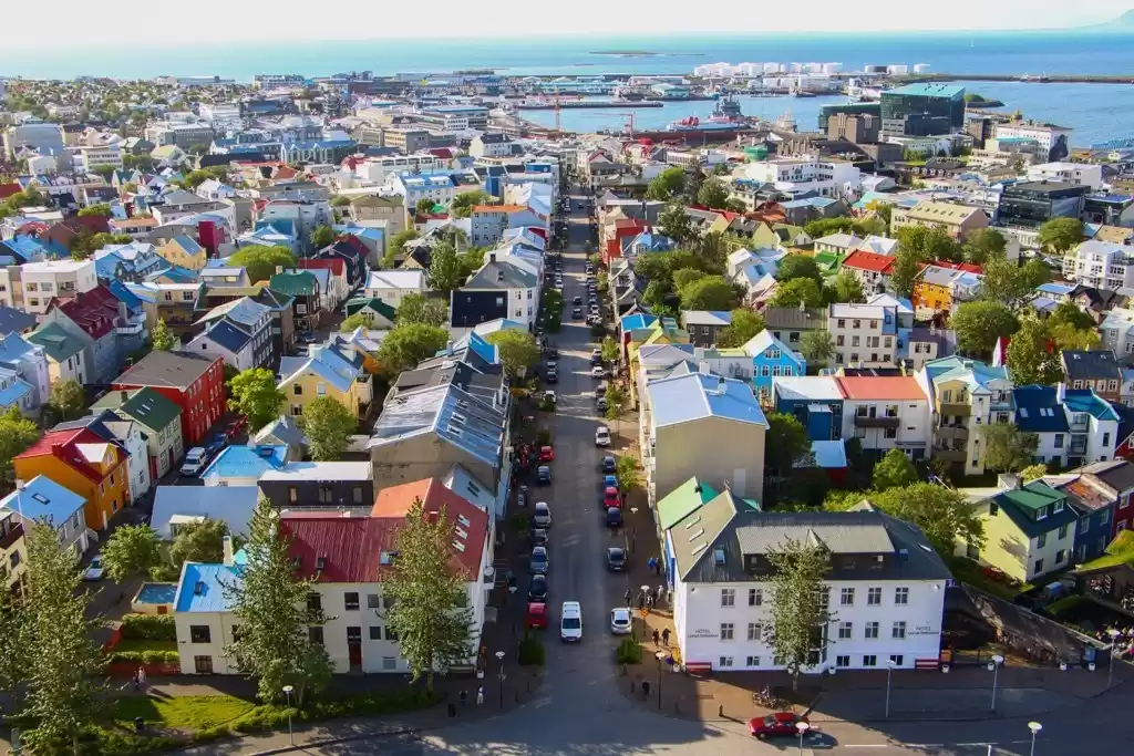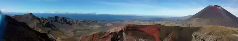
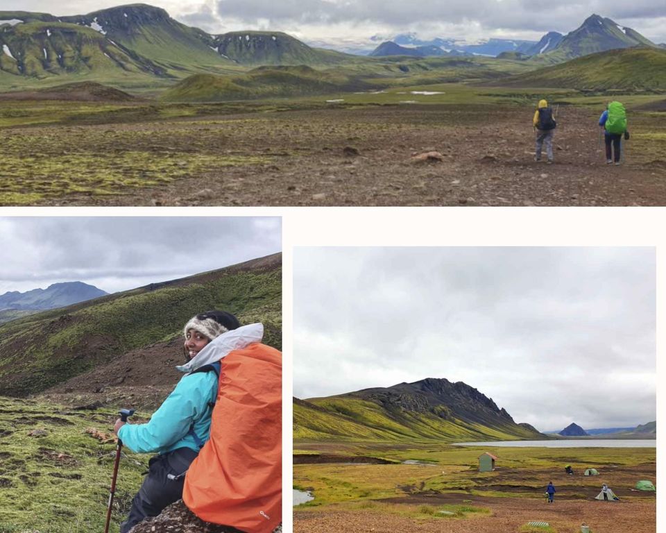
The Laugavegur trail is one of the most scenic trails in Iceland. With simulating visuals and unique landscapes, no wonder the trail is top 20 lists of national Geographic. From the rainbow-colored mountains of the Landmannalaugar to the green terrains of Þórsmörk (Pronounced Thorsmork), the hike should be on your bucket list. It is the most surreal hiking experience you’ll ever encounter. Sometimes the scenery seems impossible to be belonging to planet earth. This trail holds a special place in my heart and it will in yours too.

The one-way trail stretches to about 55 Km from Landmannalaugar to Thorsmork, which can be completed in 2-4 days depending on your speed. You can continue further on the Fimmvörðuháls trek adding 25 km and 1-2 days more to your hike and end on Skogar.
The Icelandic Tourism Association provides detailed information for both the Laugavegur and Fimmvorduhals trails. The highlands are snowed in the entire year except for the months of June to September i.e., summer.

After going on the hike by myself, I have noted down all the details that one needs for this hike. All you need to do now is plan for the hike. Here is everything you need to know:

What Is the Difficulty Level of the Trek?
The hike is a solid moderate on the scale of difficulty level and the elevation is not extremely high. The gains and the descends are not too dramatic, though there are some steep parts. Anyone with a moderate level of fitness should be able to do the trek.
The biggest factor of the hike is the weather. These are the ICELANDIC HIGHLANDS, where the weather changes every 5 minutes and can get extremely bad! All you need to do is be prepared and follow the packing list that I’ve curated for you and it should be OK.
Where Can You Start the Trek?
The trek can be completed either from the Landmannalaugar to Thorsmork/Skogar going on the Northern trailhead or come the other way, from Skogar/ Thorsmork to Landmannalaugar on the southern trailhead. The trail is usually traversed North to the south but there is no particular advantage of choosing one direction on the other. The elevation gain between the North and the south ends is approximately 350 meters.
P.S In the peak season, you can book the huts only from North to South so if you decide to go the other way round, you’ll have to camp.
How to Get There?
The easiest way to get to Landmannalaugar is by the highland bus. It starts in Reykjavik and drops you at your destination depending on where you begin.
The highland pass can be purchase here. You could drive up to Land or Thorsmork/ Skogar but since it’s a one-way trail, your return would be difficult.

Where Should You Stay?
The huts on the trail are expensive, around 60 euros a night with just “sleeping bag style” accommodation. The question is are they worth it? My answer is yes. Camping in the Icelandic highlands comes with its unique set of challenges and I can assure you, your normal tent won’t be dry throughout the trek. You need MSR quality tents to bare the winds of wrath!
There are dedicated camping sites at every location and it is illegal to camp anywhere else on the trail.

There are 6 huts on the trail
-Landmannalaugar to Hrafntinnusker: 12 km, 4-5 hrs
-Hrafntinnusker to Álftavatn: 12 km, 4-5 hrs
-Álftavatn to Hvanngil: 2 km, 1 hrs
-Hvanngil to Emstrur: 14 km, 5-6 hrs
-Emstrur to Thorsmörk: 15 km, 6-7 hrs
-Thorsmork to Baldvinsskáli hut on Fimmvörðuháls trail- to skogar- 25 Km

All of these six places have huts that get booked one year in advance. They are handled by the frumhusan huts and to book them you have to email them directly. All the huts have running water, flushing toilets, and paid showers except the Hrafntinnusker hut. There is a kitchen in all the huts with a basic set of utensils
What Should You Pack?
Food:
You can find water in streams and at the huts. There is a restaurant at Álftavatn and Thorsmörk huts where you can find hot food. Apart from these two places, there is no other place that you could find food. I carried Dehydrated meals, cereal bars, coffee (it was worth it), some trail mix, and snicker bars for instant energy on the trail. Although the huts have kitchens, dehydrated food is the easiest to carry and cook. All you need to do is add hot water

Clothes
I had one pair of clothes for hiking and one for sleeping in. The trick to getting through the harsh weather is layering. Also, it can rain on the trail, and being wet is the worst feeling while hiking. Make sure you have waterproof gloves, beanie, and a balaclava. They are extremely important to face the harsh winds of the highlands.
How should you layer?
1. Inner-wear
2. Thermal wear
3. T-shirt
4. A puffy jacket or fleece jacket/ Leggings
5. Waterproof jacket and pants
Gear
• Backpack: The most important part of the hike is your backpack. Make sure you have a lightweight backpack with great back support.
• Hiking poles: They can be a lifesaver when you are crossing the river and on steep slopes.
• River crossing shoes: An extra pair of shoes for river crossing is an absolute must. You cannot cross the river bare feet and you cannot cross it in your hiking shoes and have them wet for the rest of your hike.
• Power back up: There is no electricity on the trail so you cannot charge any of your electronics. Sometimes you can charge your phones with the warden for 500 ISK. Always better to have your supply
• Sleeping bag: The huts provide you with a mattress and that’s all. The huts are warm and you don’t need anything for sub-zero temperatures. A sleeping mask is a bonus as the sun never sets and they can help.
• Medical first aid kit
• Waterproof maps, compass, offline GPS although the trail is fairly marked
• Headlamp, towel, toiletries, toilet paper
All of the gear recommendations are in the case where you stay in the hut. If camping an MSR grade lightweight tent is a must-have. A sub-zero temperature sleeping bag should be your second investment. Along with that, you would need a sleeping mat, cooking stove, and utensils.

Day to Day Itinerary of the Trek
Day 1 Landmannalaugar to Hrafntinnusker
12 Km, 1541 ft Elevation, 4-5 hours.
The highland bus arrives at the Landmannalaugar around Mid-day and you can either start the same day or stay at Landmannalaugar the night. I chose to start the hike on the same day and try to arrive at the hut before 5 pm.

Day 1 starts with looking over shades of orange, green, and red. There is an elevation of 1541 feet passing through multiple hot fumaroles (The name for the tubes popping out smoke along the trail). The uphill is almost gradual except for 2-3 slopes where the hiking poles were my lifesavers.

There was quite a lot of snow at the higher altitude but crampons are not needed.
You will find markings all over the trails, so it is relatively easy to follow.
Two kilometers before the hut you come across the memorial of Ido Keinan from Israel. Ten years later Ido Keinan is still not forgotten on the Laugavegur hiking trail. His memorial near Hrafntinnusker still reminds hikers of the hidden dangers concealed in the Icelandic highlands.

I made it to the hut before 5 pm and I was content with my timing and pace for the day. Five minutes after I enter the hut, the weather outside gets foggy and it starts raining. The hut was warm and cozy where I met more hikers from Iceland and Christein from the Netherlands, another solo female traveller.
Day 2 Hrafntinnusker to Álftavatn
12 Km, 1607 ft Elevation decrease, 4-5 hours.
The weather outside looked crazy and the visibility was low. This was also the day of the first river crossing and I was a little anxious about how the day was turning into. That’s when I decided to ask Christein if she wanted to do the day together as it would be much safer, best decision ever. The visibility was low until our descent. The day is fairly flat with some steep climbs. We did most of it in almost no visibility and hence missed out on some of the most beautiful views.

Right at the beginning of our descent, the clouds cleared and the view opened up. The final steep downhill path leading to the greenery can be a bit tricky. The hiking poles come in extremely handy in this stretch of the trail.
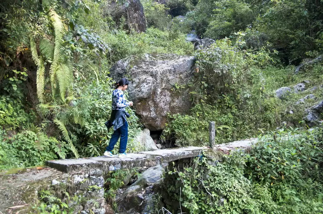
Once you enter the greenery below you have your first river crossing. This river is mild compared to the ones that we crossed in the next few days.

The trick to crossing the river is to choose the widest section as the flow is mildest there. Also, cross the river facing the current on your side and sliding one foot after the other. Remember that these are glacial rivers and the water is icy cold. The river crossing shoes and the poles are lifesaving. Make sure to unclip your backpack for safety.

Day 3 Álftavatn to Emstrur (Botnar)
16 km, Elevation decrease -131 ft, 5-6 hours
Day 3 is a bit longer than the first two days but it is also quite flat and without much elevation gain or loss. The day starts with a few uphill climbs and the descents. Right at the beginning, you will come across the second river. This river is bigger than the first one and the water can get knee-high.
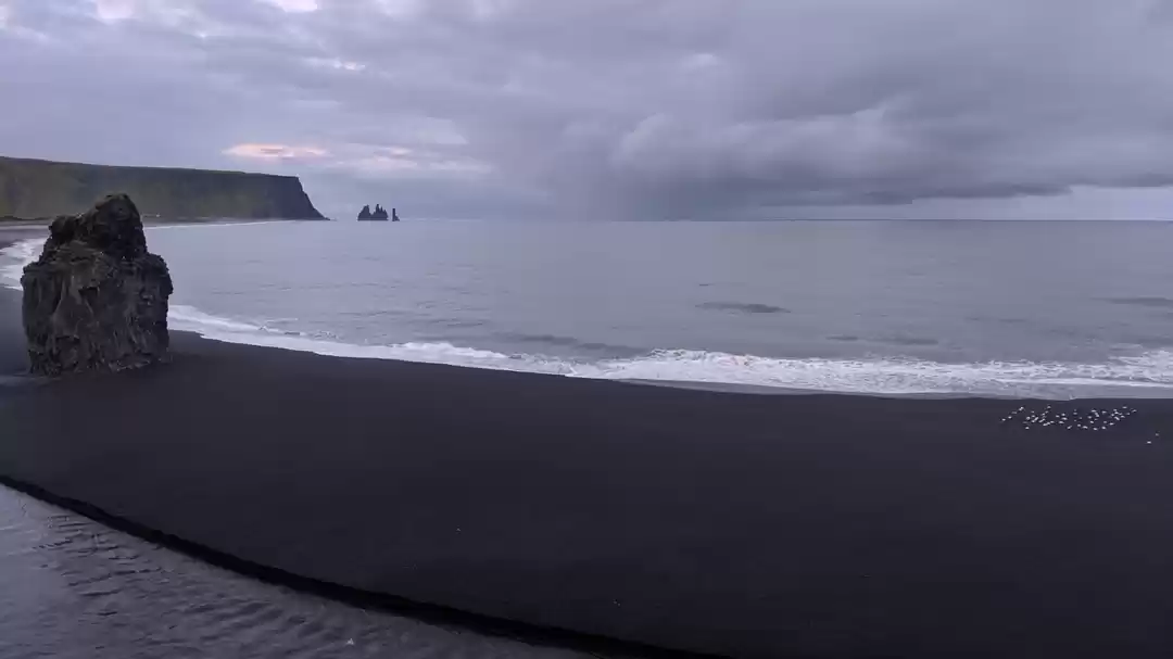
You will then come across the Hvanngil hut right before crossing the third river, the most challenging one. This is the indication of leaving the green lands and entering the black zone of volcanic fields. The floor is literally lava.
It is recommended to ask the warden at Hvanngil about the conditions of the third river. On the third day, another solo woman from the Czech Republic had joined us and then another man from Germany.
So, now the four of us arrived at the river of doom. Pants off, river shoes on, and mentally preparing ourselves for the crossing, we watched others cross before us. We locked hands with each other and faced the wrath of the river. This was the coldest and the harshest river crossing. The water felt like 1000 little needles on my legs.
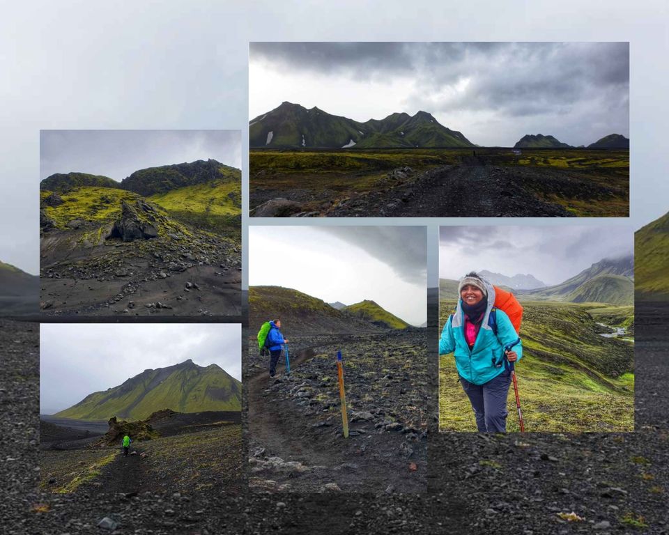
The rest of the day is spent walking on black ground that does not seem to end! So the first view of the hut is a sight to sore eyes.

In this hut, there was me, Christein, Rene and Floor, Francesco, and his son from Italy. By then all of us had bonded with each other and felt I’d know them all my life. I was the last one to enter and as soon as I came in Francesco offered me a cup of hot tea. This man had carried tea from Reykjavik and was offering it to me. I was touched by how much I was learning from humans of the world.

The Markarfljótsgljúfur Canyon is 1 km from the huts and it is worth a visit. So, all of us decided to visit the canyons together and I had the time of my life.

I know for sure I am not the first Indian to hike the trail but nonetheless it felt incredible to be the first in this book. Writing the name India definitely gave me goosebumps.

Day 4 Emstrur to Thorsmörk
15 km, elevation decrease- 984 ft
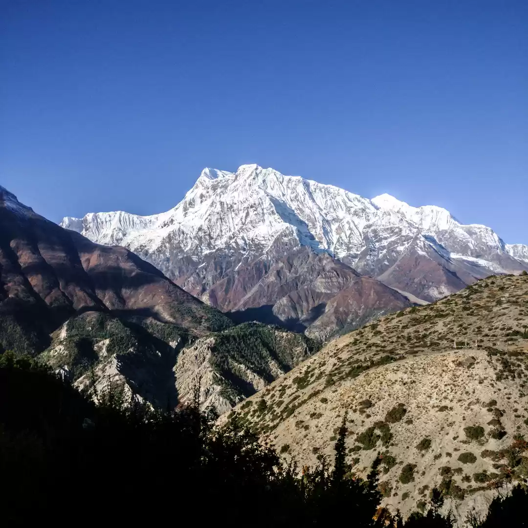
The length of day 4 is similar to day 3 but has many uphill and downhill slopes. You will go downhill and cross the canyon. There is a bridge to help you cross the river and then a walk through green and black landscapes. There is a big uphill climb from where on a clear day you will have the most gorgeous view of the glacier.

On the fourth day, we decided to take it slow and make the most of the sunny day that we were having. The fourth river crossing is towards the end of the day. This is the biggest river to cross but not as deep as the third river. The river was knee-deep high but the flow was not forceful. I recommend you wait for someone to cross the river before you in case you are alone.

The arrival at the Thorsmork was emotional. I did not realise what a huge impact these four days were going to have on my life. There are two huts at Thorsmörk, one that is run by the Ferðafélag Ísland and the second with the volcano huts. If you plan on continuing on the Fimmvorduhals trail, I recommend the first one as it's on the way. If not, I recommend the volcano huts.
They have a hot shower in the room, electricity, and an average restaurant that serves beer. What better place to celebrate the end of your hike?
.
.
.
For more travel info, follow me on Instagram
Ready to travel for free? Earn credits and redeem them on Tripoto’s weekend getaways, hotel stays and vacation packages!
Explore the best of travel inspiration on Tripoto Instagram!