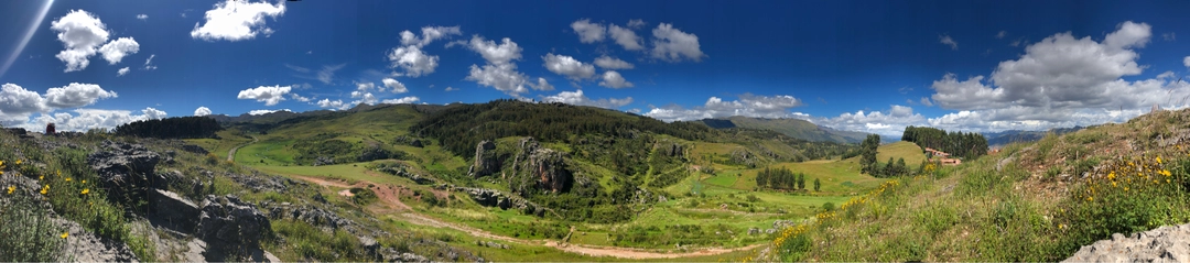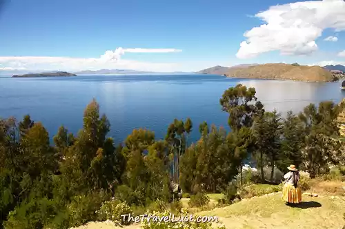


The Sacred Valley of the Incas is a valley in the Andes. It is also known as Urubamba Valley as it is formed by the Urubamba River. The valley mutely flows through numerous archaeological remains and villages. It encompasses the heartland of the Inca Empire. The Sacred Valley is commendably picturesque and mesmerizing. The beauty of this quaint part of Peru snuggled high in mountains is comparatively unvoiced.

Abra Malaga, also referred to as Malaga, high pass is located in the Vilcanota mountain range. It is a habitat of endangered species like Royal Cinclodes which live in Andean forest and many other bird species. This high pass has forests with extensive zones of bamboo and straw Andean meadow.

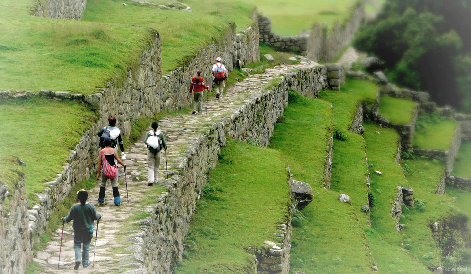
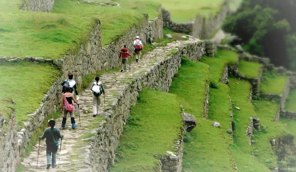
The Inca trail is in the Andes mountain range and passes through several cloud forest and alpine tundra. The trail will help you discover various settlements, tunnels, and many Incan ruins. This will be one of your most remarkable journeys. Many trekkers opt for four or five days to complete the "Classic Inca Trail" to discover the paths fully. The Peruvian government has placed a limit on the number of hikers on this trail per season and guides after concerns of erosion were raised.
Santa Teresa is situated 6.5 km northwest of Machu Picchu and is at the axis of several important routes leading to this archaeological center. The people of Santa Teresa have completed the bridge that reconnects Cusco with Machu Picchu, which was completely destroyed in the landslide in 1998 and thereby revived their community. It’s a point where a lot of backpackers head to seek an access to Machu Picchu that is budget friendly.

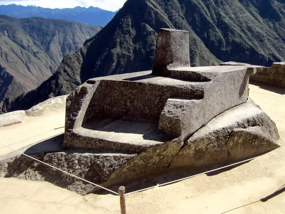
It is located 3,300–3,400 meters above sea level, near the town of Písac in the Urubamba Valley. The Intihuatana was so-called because the Incas are believed to have “tied” the sun to a hitching post during sunrise on the solstice to stop it from going any further away. It is said to be important in telling Inca when to harvest their crops. Archaeologists believe that it was used for making astronomical observations and calculating the passing of time.
It is a small town at the bottom of the valley next to Machu Picchu and the principal access point to the site. It is an area cut off for the main roads. You won’t see many tourists visiting this area to only see this town. They arrive here only to visit Machu Picchu, which is about a 1.5 hours walk. This place is simple and coy, serene and quiet.

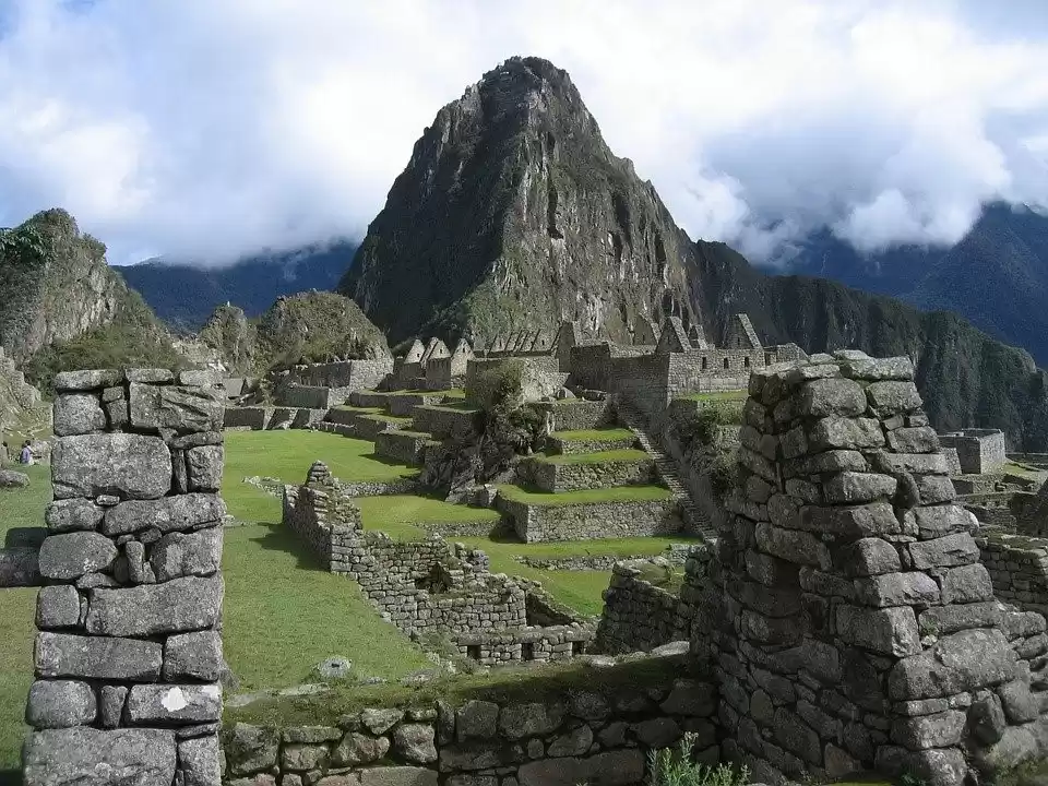
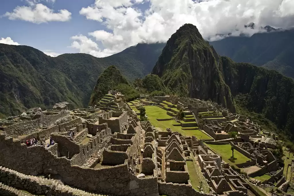
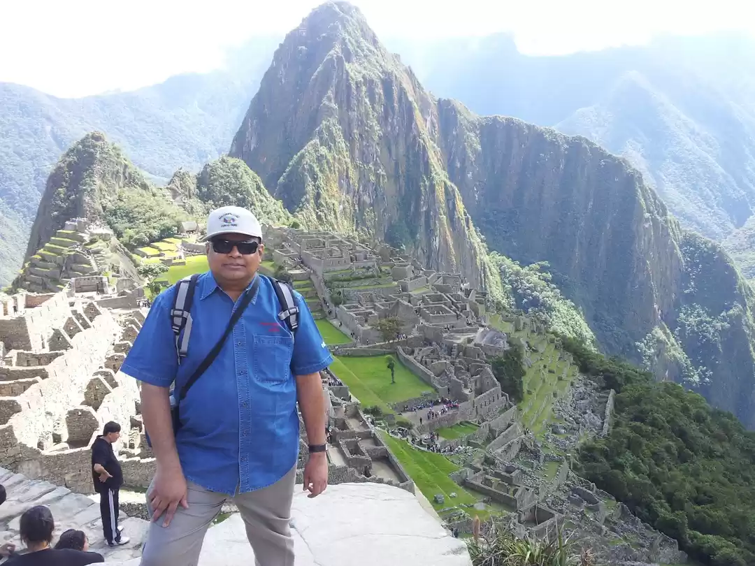
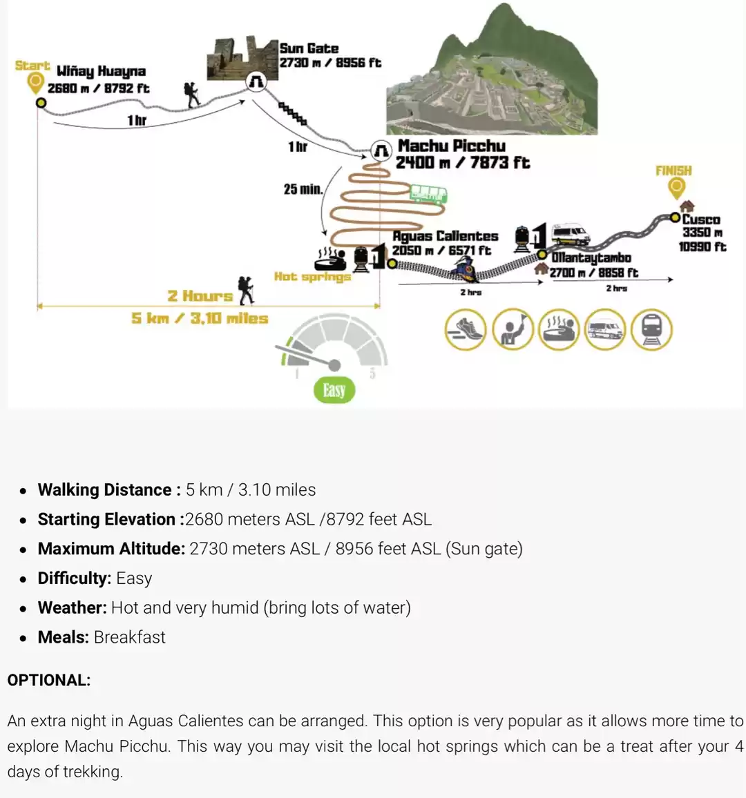
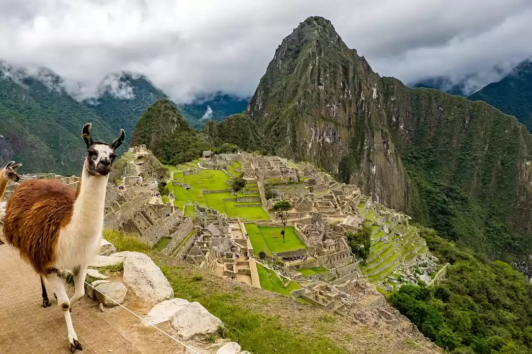
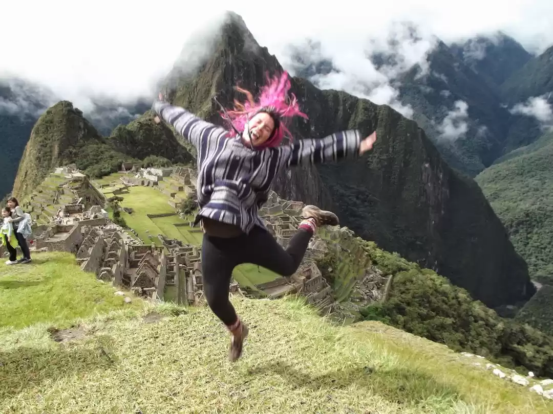
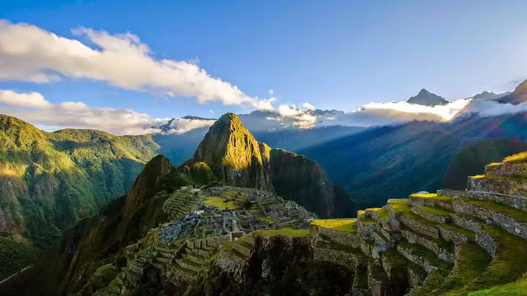
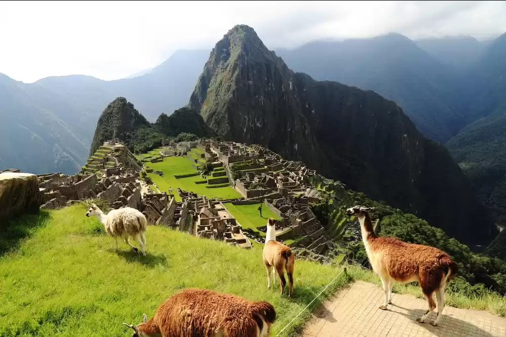
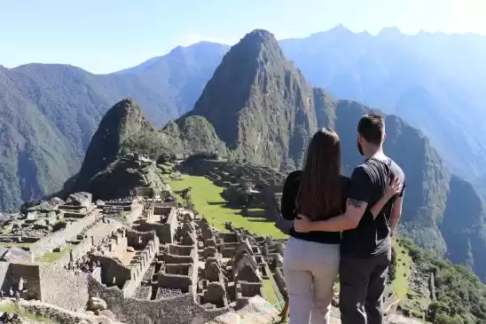
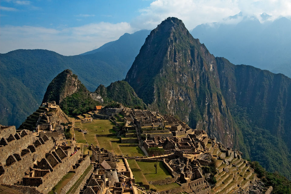
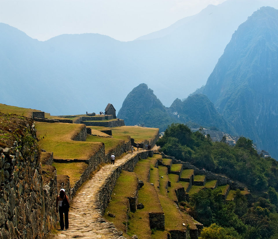
Machu Picchu is the perfect combination of nature and architecture. It is like nothing you've ever seen. The sheer majesty of the ruins on such a great height, balancing on the mountain is inspirational. Machu Picchu was built around 1450 and can be reached by two walking ways. The ruins show existence of a remarkable civilization infused with culture and religion till before the Spanish invaded. This place is said have remained a secret for the outside world till 1911 when American historian Hiram Bingham came here. Numerous stone stairways set in the walls allowed access to the different levels across the site. The view of this historical site is out of this world.

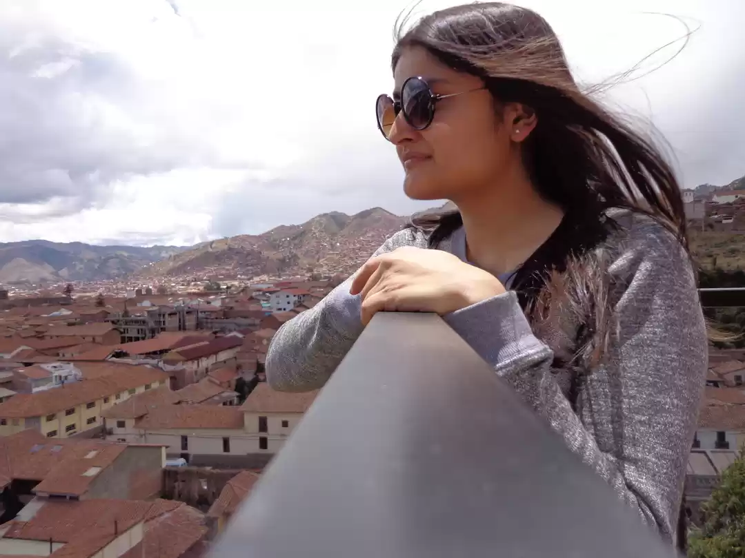
A journey in any part of Peru is an extraordinary experience inundated with splendid nature, impressive archaeology and adventure. This is a place to discover culture and history. Peru is not just unique, but it is a land of contrasts. The timid coastal towns, tropical latitudes and highest mountain ranges furnish Peru with a large multiplicity of climates. And the diversity doesn’t stop there. The ethnic diversity here is intriguing enough for you to want to interact with the locals.
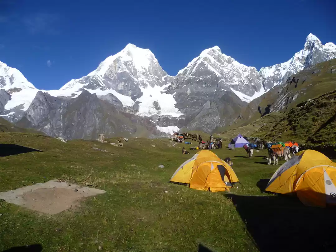
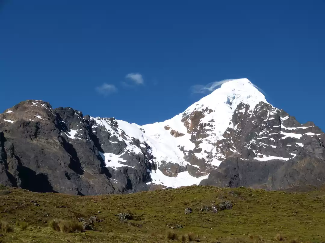
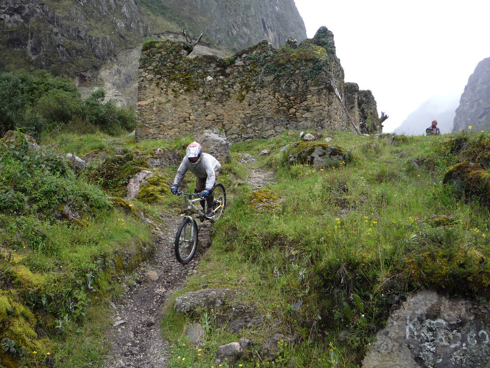
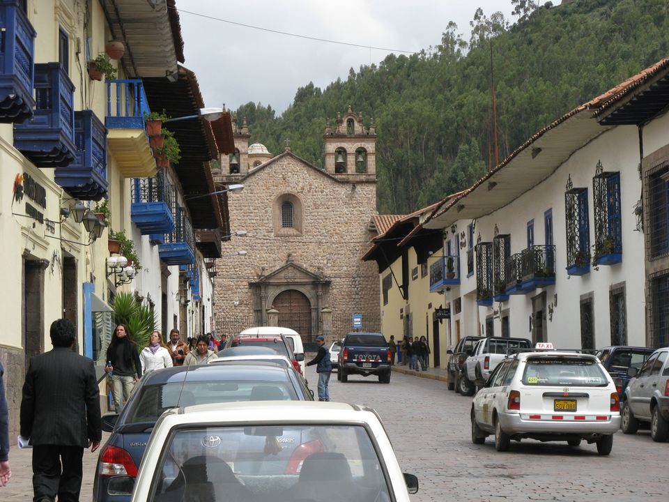
Instead of walking over the dozen footprints, I decided to combine downhill biking with hiking on old Inca trails. I started my journey by moving from Cusco, the capital of the Inca Empire. I then headed to the Sacred Valley of the Incas, which hosts many beautiful Inca remains. Moving up into the mountains towards the glacier, I reveled in this place’s scenic beauty. On the way I visited Abra Malaga, which is a habitat of endangered species of birds which live in Andean forest. This high pass has forests with extensive zones of bamboo and straw Andean meadow. This is where I started my downhill biking. The unspoiled jungles imbue you to take your time to immerse in its crude existence. I pedaled further to town of Santa Maria. I took some time to explore this quaint town, and ended the night with a lovely dinner and stay in a small hostel.
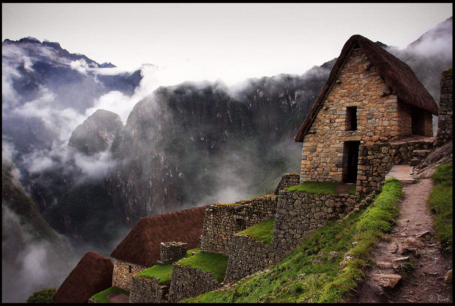
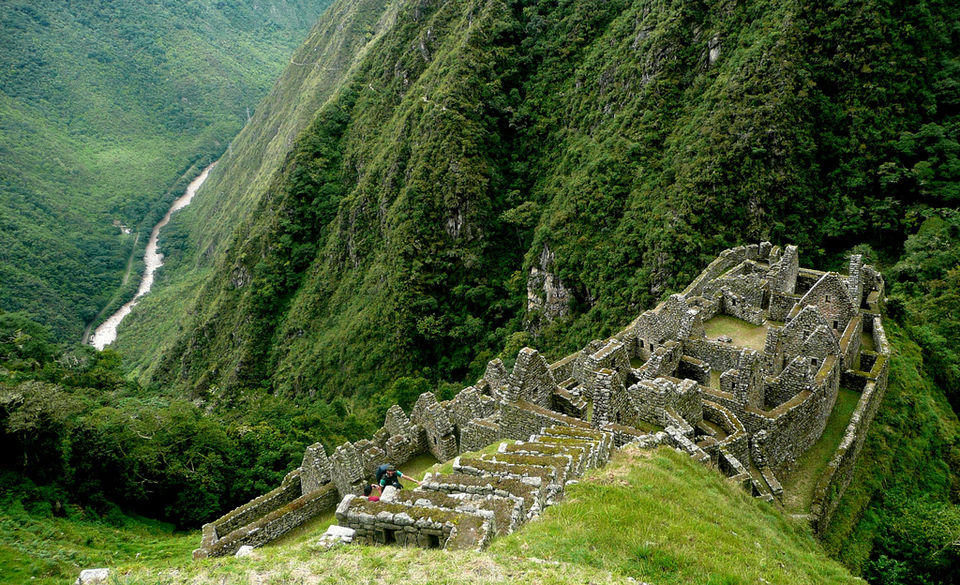
The next day after breakfast, I hiked to Santa Teresa. This hike took me around six to seven hours. This is not a demanding hike. I moved along various settlements and Incan ruins that are located en route the Inca trail. The soothing overview of coffee and cocoa plantations was the highlight of this day. Beautiful birds and butterflies were the finishing strokes to the awe-inspiring canvas that I was in. I arrived at Santa Teresa in the afternoon. Here I set up a camp for dinner.
Following breakfast on the third day, I hiked by crossing the Vilcanota River by hanging in a basket or ‘Oroya’. The river is a segment of the Urubamba River. My next stop was the hydroelectric station village. I spent some time exploring the archaeological ruins of Intihuatana. It is a ritual stone associated with the astronomic clock or calendar of the Inca. After travelling for two more hours I arrived in Aguas Calientes, which is also known as Machupicchu Pueblo. It is the closest access point to the historical site of Machu Picchu. This place is enclosed by stone cliffs, cloud forest and rivers.
On the last day of the trip I started rather early to enjoy the sunrise over the much spoken about citadel of Machu Picchu. This magnificent UNESCO World Heritage Site is a 15th-century Inca site located 2,430 meters above sea level. It is often referred to as "Lost City of the Incas” but still somehow manages to be one of the most well recognized icons of Inca civilization.