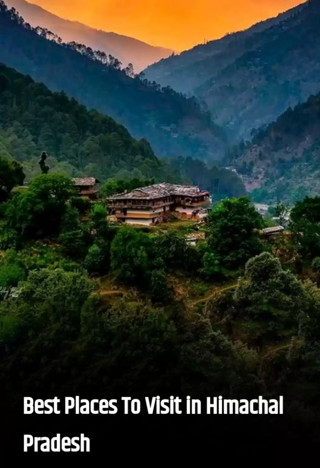
It is always better to have a plan B.
Plan was to trek Pin Parvatri Pass, while preparing I met a traveler on tripoto, and was hoping to travel with his group, but finally I ended up exploring Lahul Spiti alone for 10 days, that’s the beauty of being handy with plan B. After overnight comfortable journey in HRTC bus, I reached Manali late morning (about 11 am) on 1st Sep 2016. Though there are always options for shared taxis, but I opted for HRTC bus to Keylong which was scheduled at 2.30 pm.
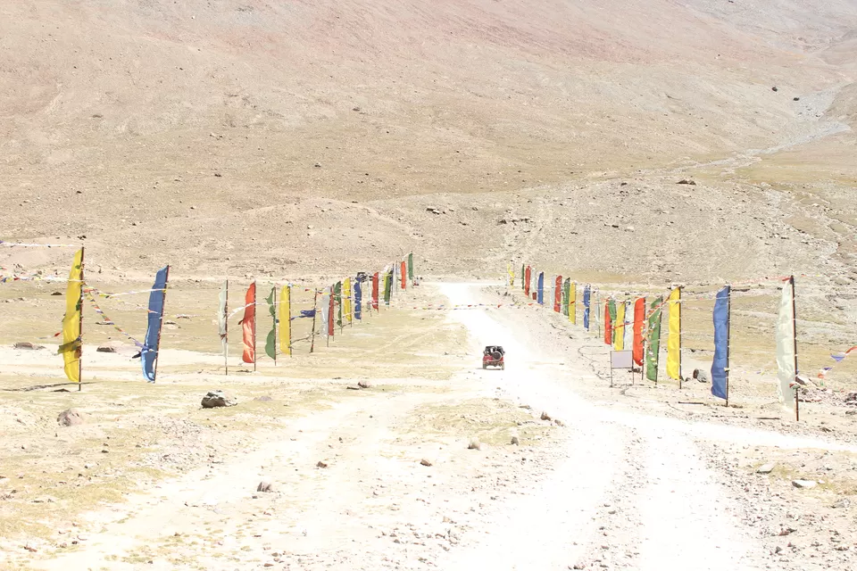
Rohtang Pass
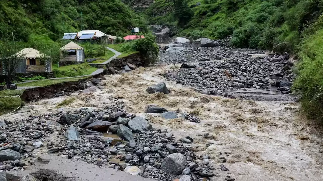
Rohtang Pass (about 52 km from Manali), separates Kullu from Lahaul valley. In Tibetan Rohtang means "heap of dead bodies", that stands true to its notorious name. In days gone by it must have taken toll of life and property. This is because sudden blizzards and snow storms are usual here; pass becomes more hazardous to negotiate due to frequent avalanches. Directly opposite and only a few km away is the well-known Sonapani glacier. Tea and snacks are available at Rohtang Top, however for food one has to halt at Marhi which is about 10 km before Top. At Rohtang top our bus had to stop for almost 20-25 min at one place just to give pass to an army convoy coming from Leh Leddakh. Waving hand towards them and getting response in same way from soldiers on truck was like re-living childhood memories (like every other child I also used to greet army by hand waving).
Khoksar, Tandi and Keylong
After crossing Rohtang we reached Khoksar, and stopped there for Tea break. Avalanches can be seen piled up even near the river bed. Though it was about 05.30 pm, but was cold / windy enough, I had to put on my fleece jacket. This may be of interest to the reader that Khoksar was on the old trade route from Indian plains to the West Asia. In 6 hr. journey from Manali to Keylong, apart from Koksar, I crossed villages like Sissu, Gondhla and Tandi.
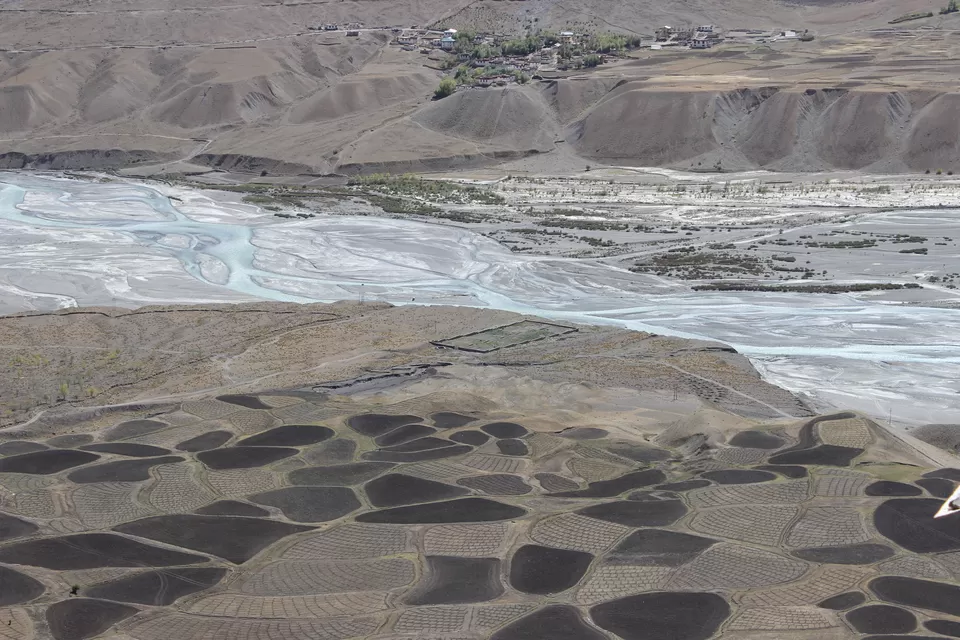
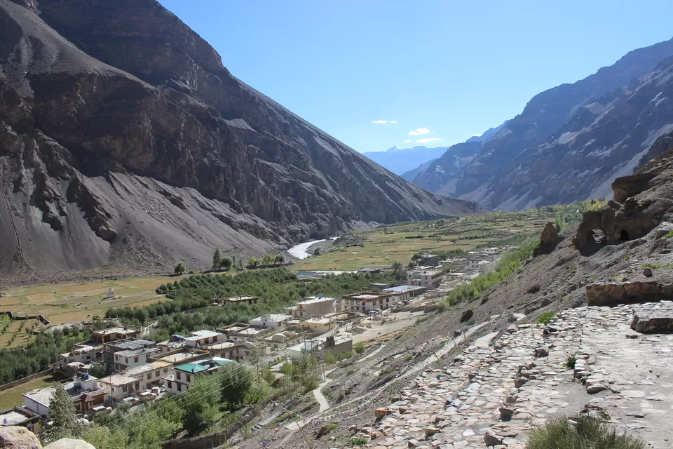
After Koksar it was getting dark, but enthusiasm of locals traveling in bus kept the journey alive. They were talkative and valuable info about area, people, culture, and wildlife kept pouring on me. It was great to know that there is a swampy patch on the river side where the Siberian wild duck and geese halt when on their way back from the Indian plains. Snow trout is also available in the villages nearby. Village Gondhla is situated at a distance of 18 kms before and Tandi is about 6-7 km just before Keylong. It is situated above the confluence of the rivers Chandra and Bhaga. There are three mythological stories connected with Tandi. First, Tandi is believed to means Tan Dehi, i.e., giving up of the body. This is associated with Draupadi, the wife of Pandavas, who left her body at this place. Second, this is believed that Rishi Vashishtha who meditated near the hot water springs of Manali was cremated at this confluence; hence named Tandi, i.e. body consumed. According to the third, Chandra the Son of Moon and Bhaga the daughter of Sun god were in love. To perform their celestial marriage they decided to climb the Baralacha-la and from there run in opposite directions encircling a vast tract of Lahaul. Thus flowing south-east and south-west both met at Tandi. Another village above the confluence is Gushal which looks extremely beautiful. The confluence itself is best seen from Ghushal.
Surajtaal :(
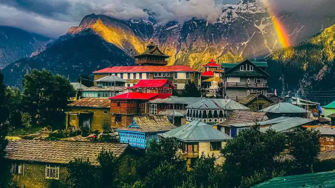
I reached Keylong (district headquarters of Lahaul and Spifi, 3156 m above msl) about at 8 PM. Plan was to go to Surajtaal in morning which is about 80 KM from Keylong on the way to Leh. After arranging a room for night I again went to Bus stand to confirm option for Surajtaal but got disappointed, because next day’s bus to Leh was cancelled because of very few passengers available (interestingly HRTC bus from Keylong to Leh depends on pre-booking at bus stand). I was left with an option to hire cab till Surajtaal (a costly affair for a solo traveler) so I dropped the idea for Surajtaal (will cover it when I will go to Leh) and decided to explore Keylong. Next day I visited nearby monasteries, attended a local marriage in nearby village as the guest house owner invited me see the culture. Keylong is refreshingly striking against a backdrop of brown hills and snow clad peaks.
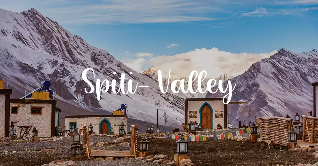
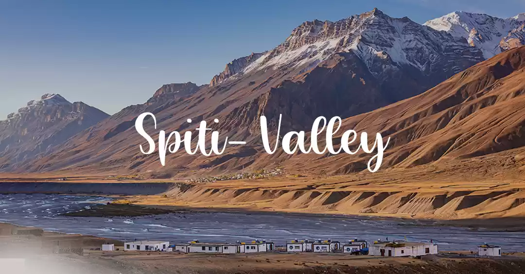
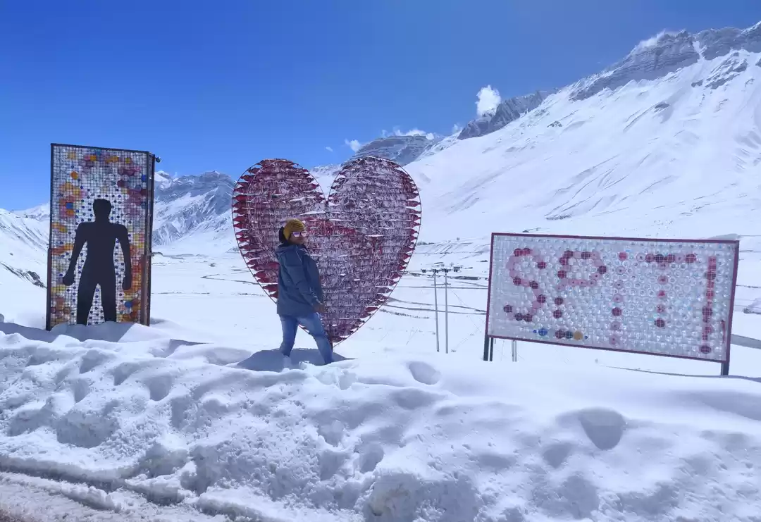
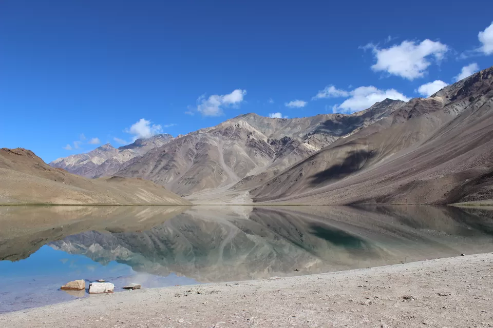
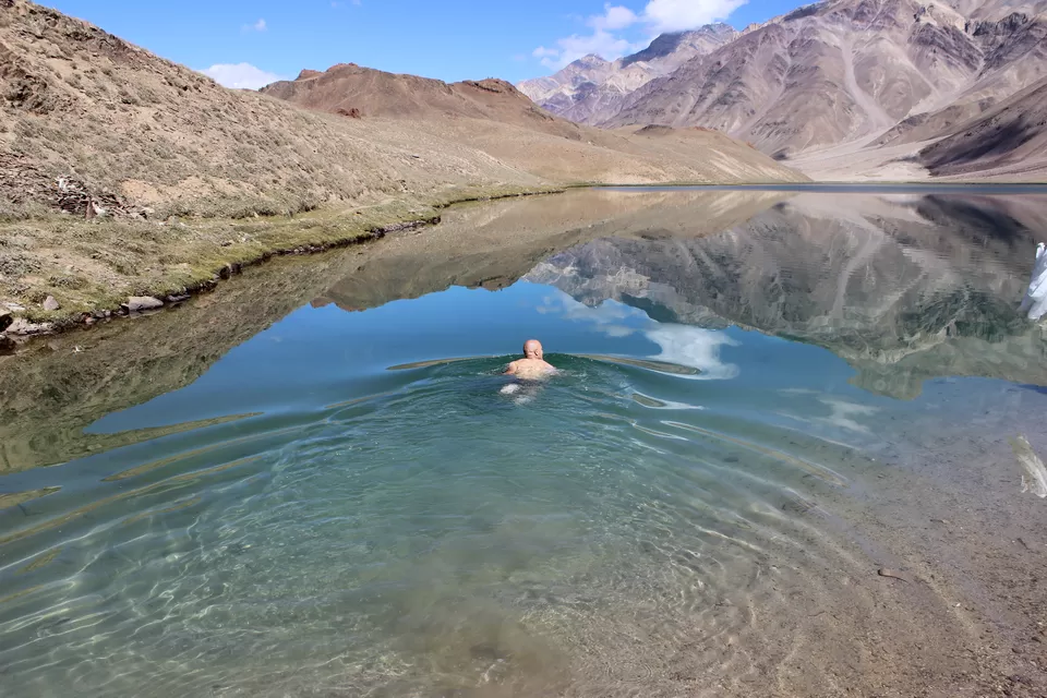
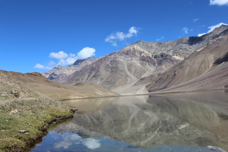
Chandertaal :)
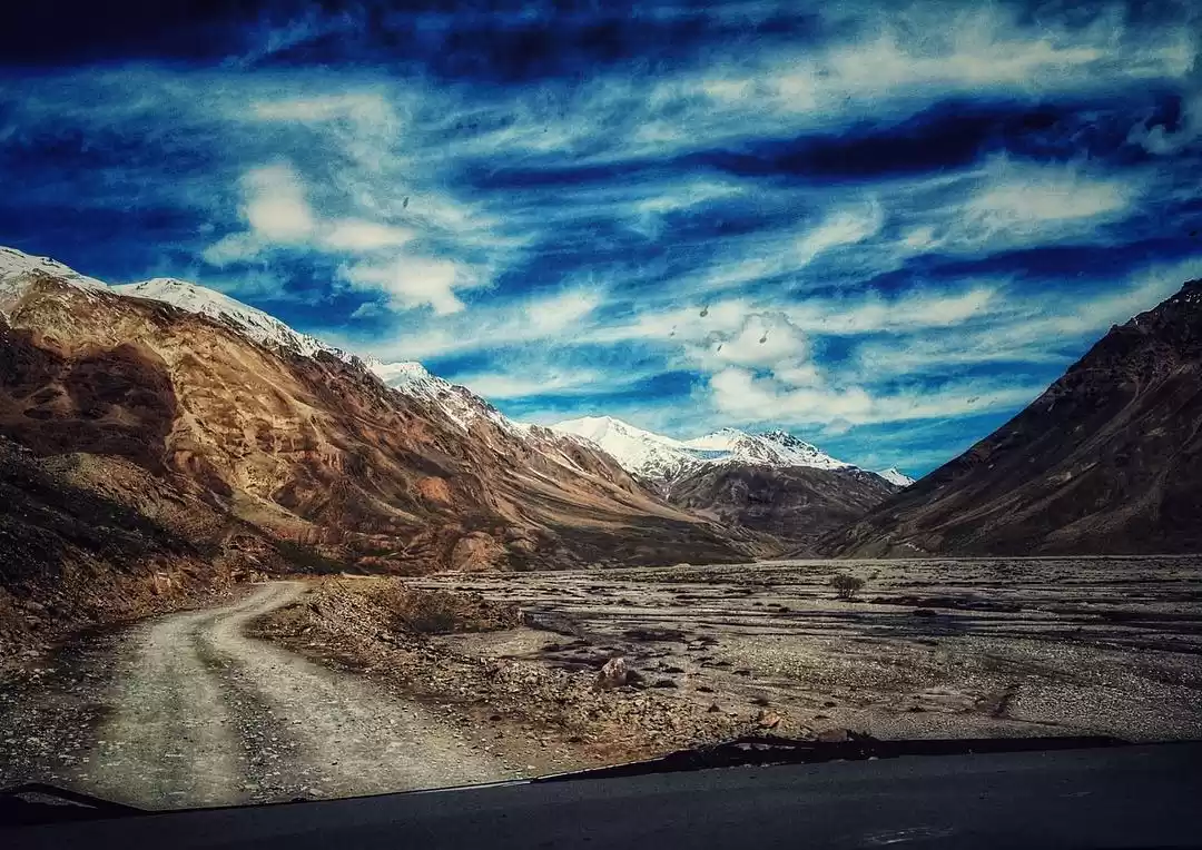
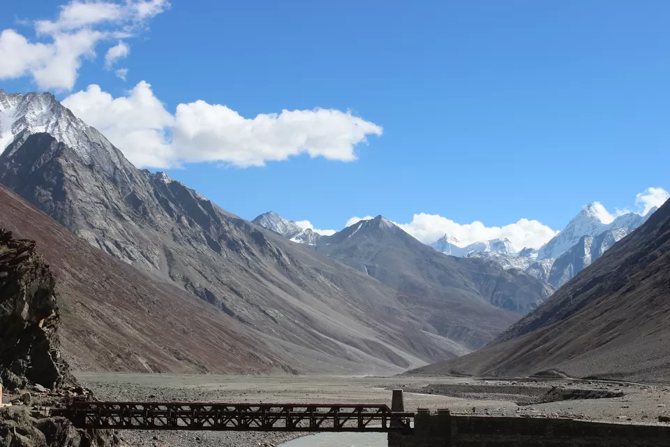
There is no direct bus from Keylong to Kaza, so next day early morning (6.30 am) I boarded the bus to Manali and about at 10am I got down Gramphu which is on Manali Leh highway about 65 km from Manali. After waiting here for 30min I got a bus (only bus on this route) which was coming from Manali to Kaza. My destination was Batal, about 48 km from Gramphu. It took about two and half hour to cover this 48 km, (you imagine the road conditions). I reached at Batal about 1.30pm. Here I found a small shop known as "chacha chachi ka dhaba". Couple running the place I mean chacha and chachi (uncle and aunty) are always there to attend you with smile on their face, amazing people.
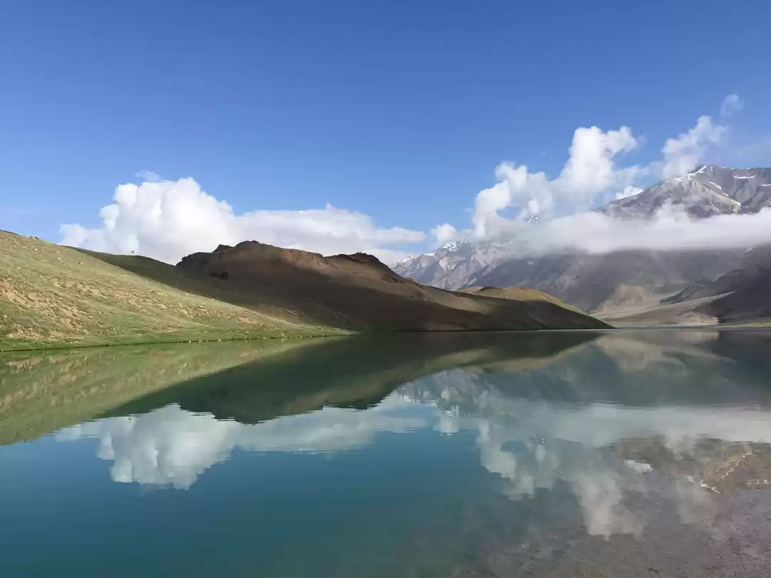
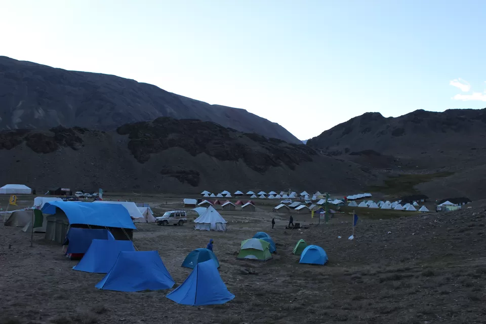
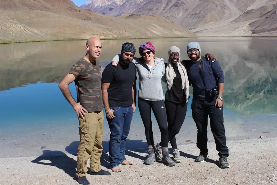
My plan was well in place, after lunch I was prepared for 14 km trek from Batal to Chandrataal. While having lunch I met with Kate (German), Dado (French), Aman and Shubham, all solo travelers. I think they were waiting for someone to say; let’s walk these 14 km, because as soon as they got to know that I’m trekking to Chandertaal, instead of hiring a taxi, or joining any shared cab, they readily got in the plan. To cover 14 km it took us about 4 hrs. I realized that I am in love with the landscape here; I am running short of words to explain it. We reached at the last camp about at 7 pm; Lake is 2 km ahead of this. I managed to negotiate for one big tent for five of us at very reasonable price that included dinner and morning breakfast.
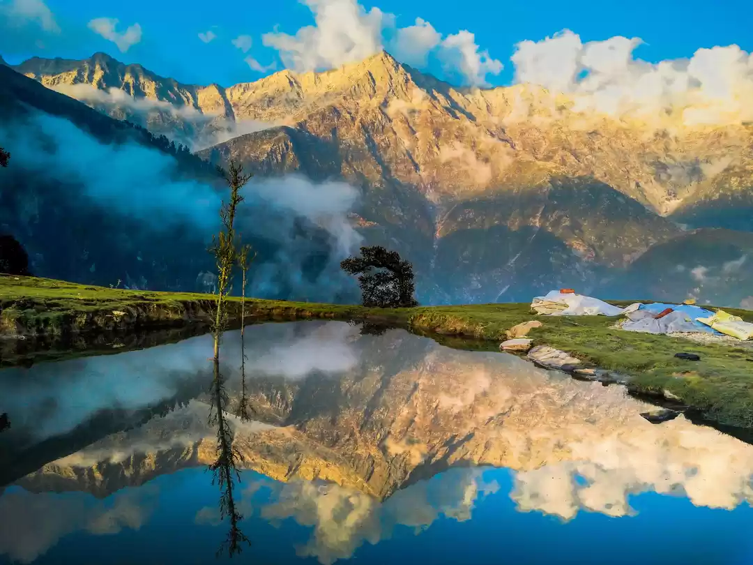
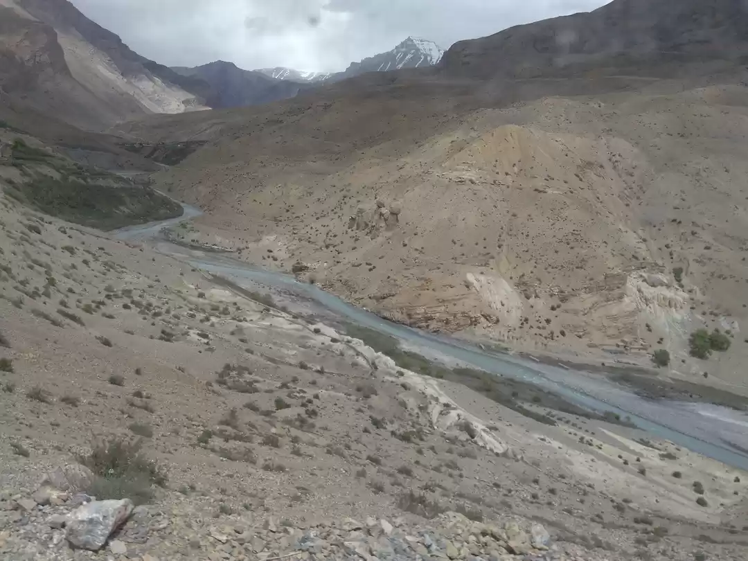
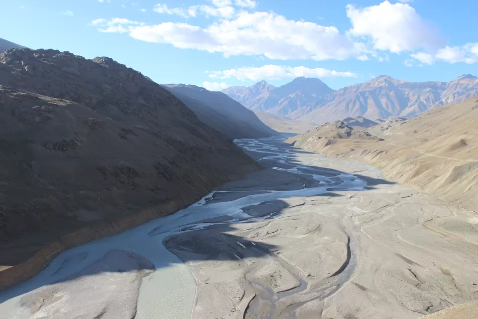
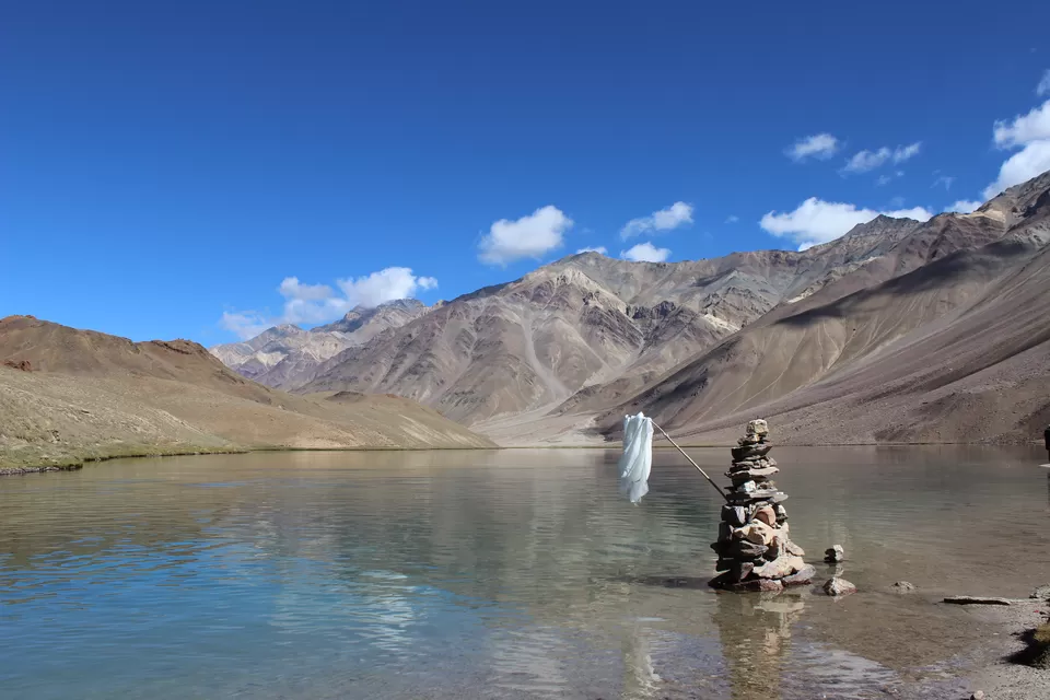
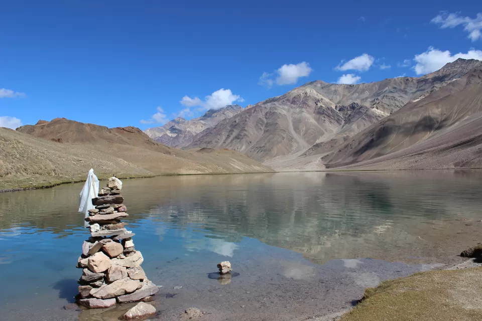
This was the first time in my life that I saw Milky Way with naked eyes. I think they say it right that "clearest sky in Asia is at Lahul Spiti". A “session and connection” while sitting with Dedo outside the tent till late night under billions of stars was informative. Being as a traveler she was full of stories/experiences to share. Early morning we headed to lake. This natural lake is situated at about 14,000 ft. above msl. The Lake about a KM long and about half KM in breadth is located in a broad grassy plain which in ancient times was a glacier. There is a story of a mermaid living in the glacial lake. Chandrataal is a favorite halting place for the shepherds because of rich growth of grass. Pollution free water of the lake is so clear that stones at its bottom are easily visible. It freezes during the winter. As soon as I reached the lake, I couldn’t stop myself of taking a dip in these sacred waters. After spending good amount of time here we decided to go to Kaza, (about 100 km from Chandrataal). Lucky we were, we all got lift in a cab from lake to kaza. On the way Kaza we crossed, Kunjum pass, Lossar, Hansi, Kaito etc. At places we had to stop as our fellow travelers were asked to show their passports.
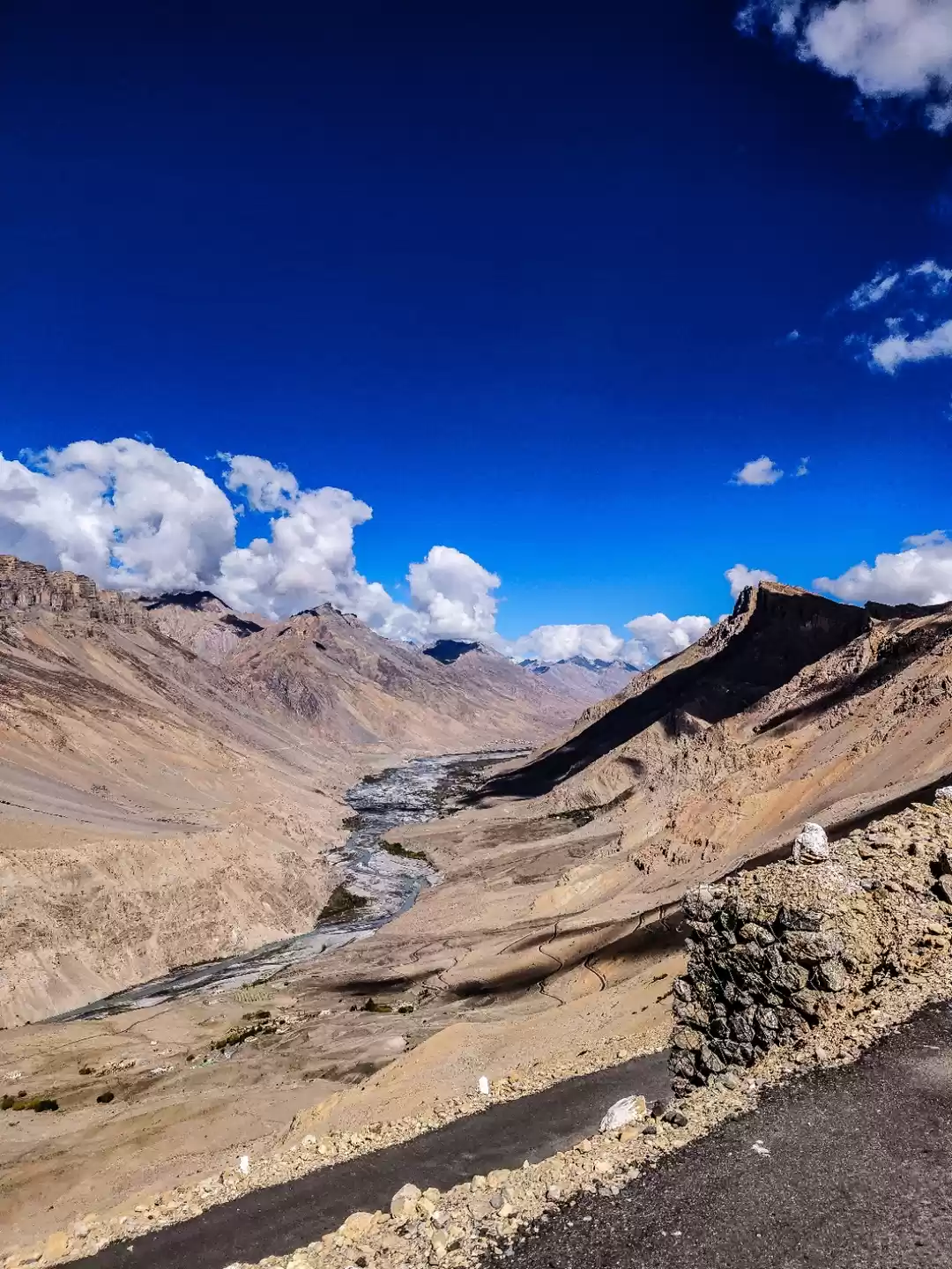
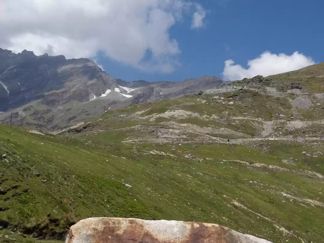
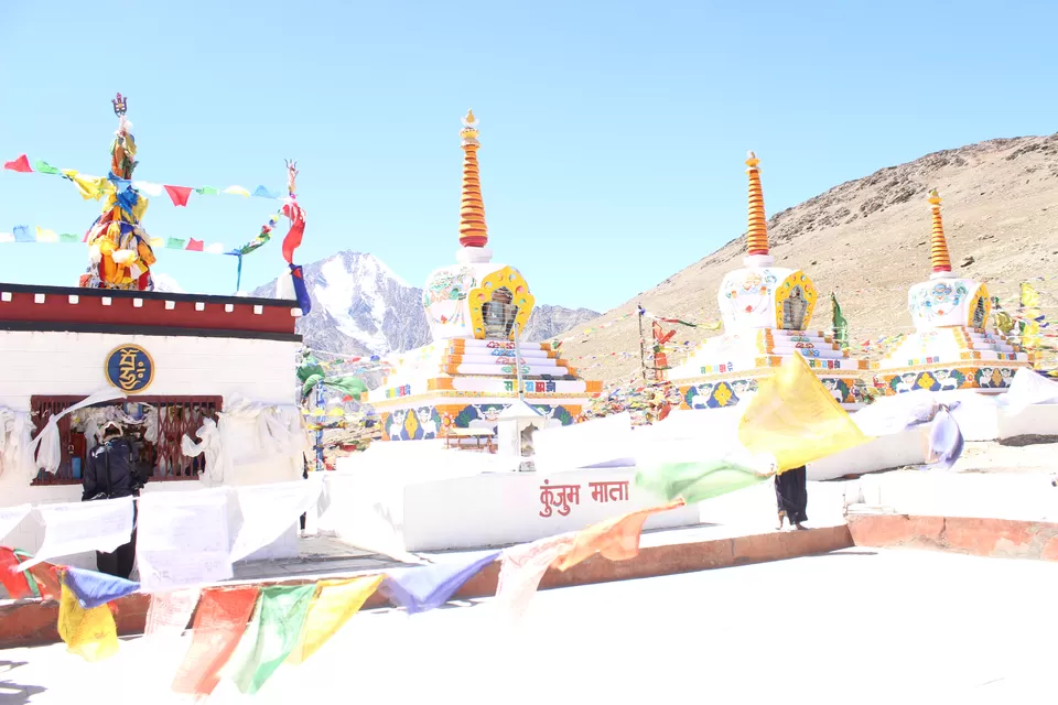
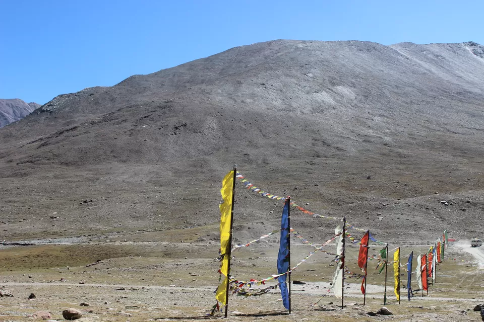
Kunzum Pass
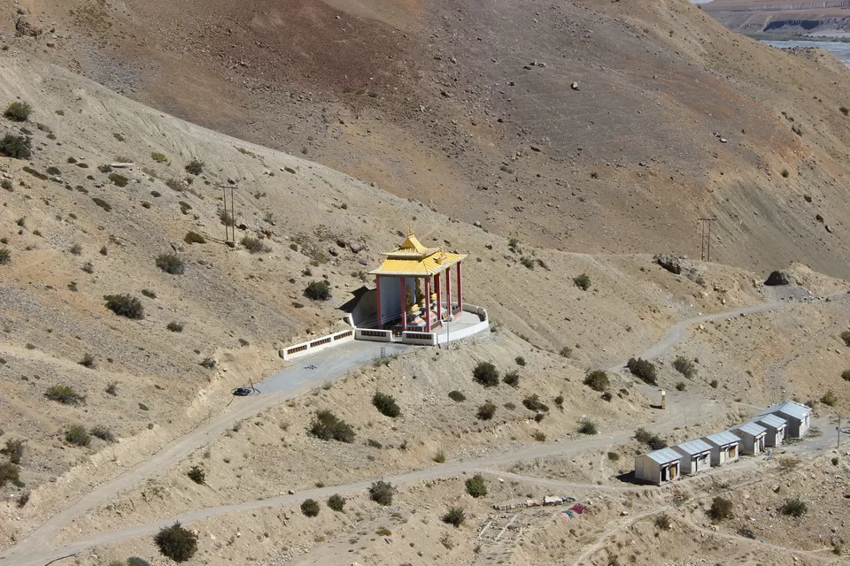
Kunzum Pass provides access to the Spiti-valley from Lahaul-valley. This is the place where Chief River of the area (Spiti river) takes its source. Though higher than the Rohtang Pass, Kunzom is safer and provides easier ascent and descent. The altitude is about 4590 m. The panorama as viewed from the top is breathtaking. The lofty Bara Shigri Parbat can be seen right in front in all its grandeur. A temple dedicated to Durga, the fierce female deity, was built by some (shepherds) gaddies, but it could not withstand avalanches and today is in ruins. People believe that the deity has refused to live in the temple. She prefers to stay in the open. Her foot impressions are worshiped by gaddies and local people. There is a small hut about 200 m. away from the temple where travelers can find shelter during foul weather. From Kunzom one trek leads to Chandrataal, the Moon lake.
Lossar
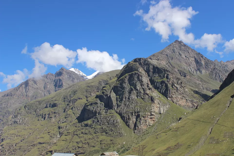
After spending some time at Kunzum top we reached at Lossar, which is the first inhabited village on the Spiti. Sight of Lossar to a trekker coming down from Kunzom brings instant relief. There is a small gompa in the village. I heard that Ibex, blue sheep, etc. can be seen in the higher reaches around the village, though we did not see any. Most important input that we got is snow leopard sighting is not un-common in this area.
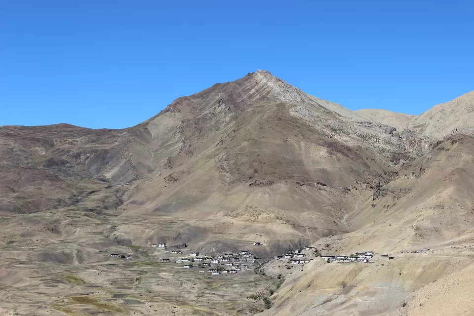
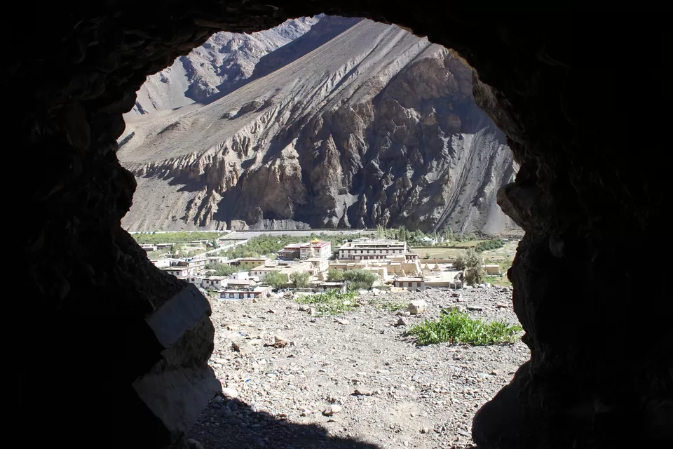
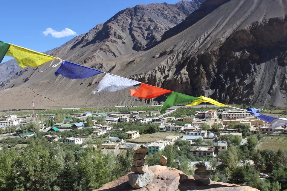
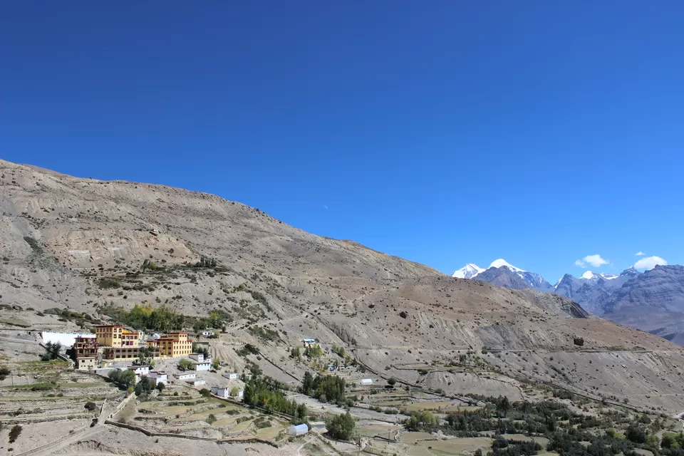
Kaza
In evening we reached at Kaza, sub-divisional headquarters of Spiti. After getting a decent arrangement in a home stay I went for a walk in the town. This town is center of tourist activities in this valley as they converge here for permits, currency exchange, information, accommodation, and fuel etc. In night at the time of dinner I got to meet a lot of travelers from different countries in small restaurant managed by the owner, whose choice of music was great. After dinner a friendly heat of argument and discussions on a wide range of topics continued till late night.
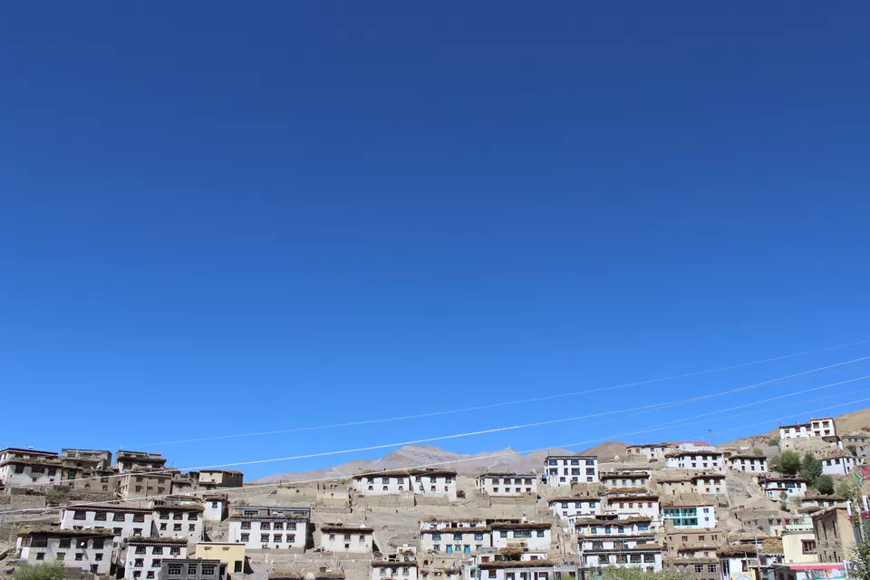
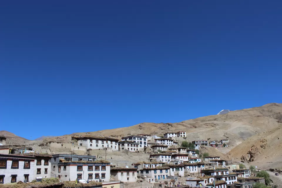
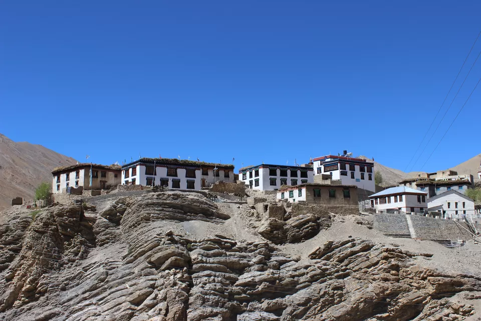
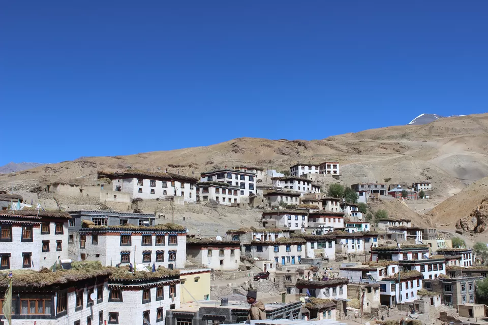
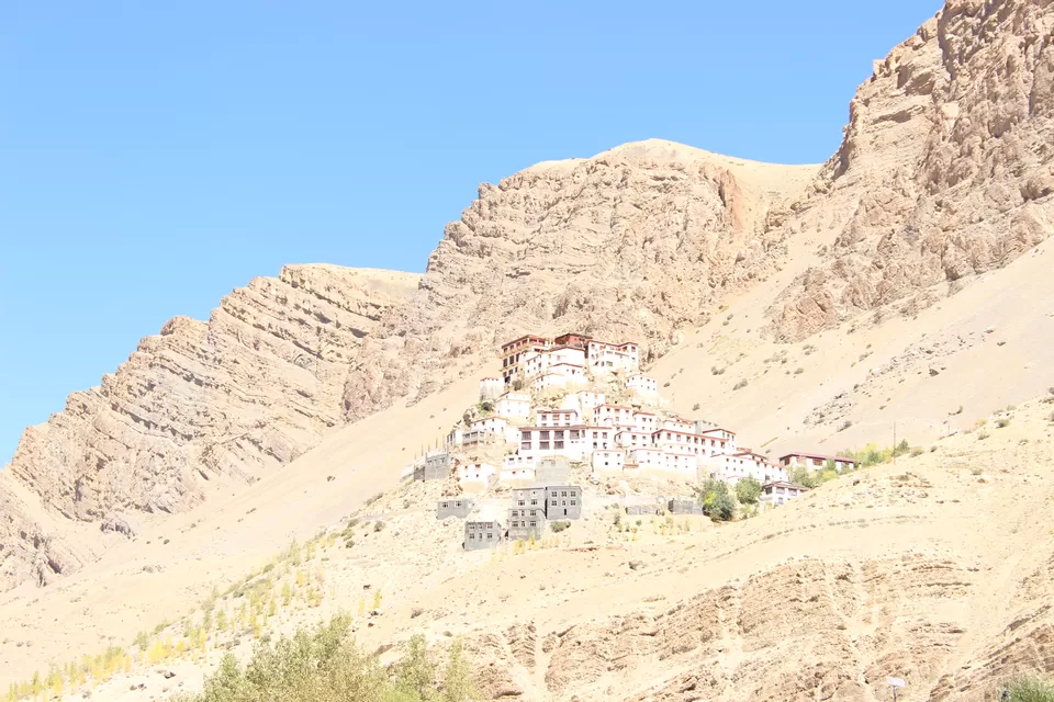
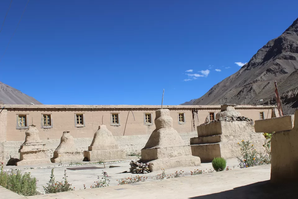
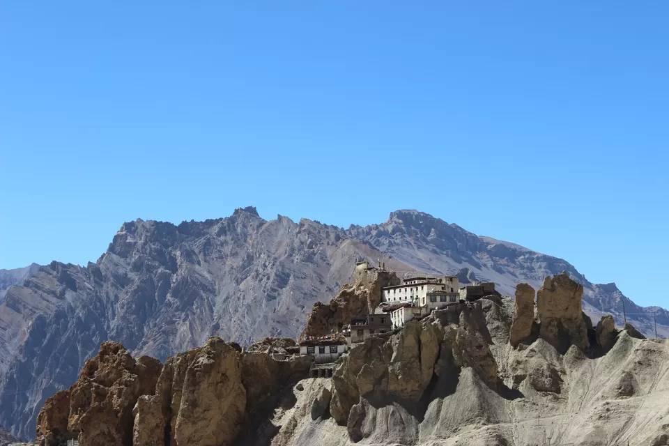
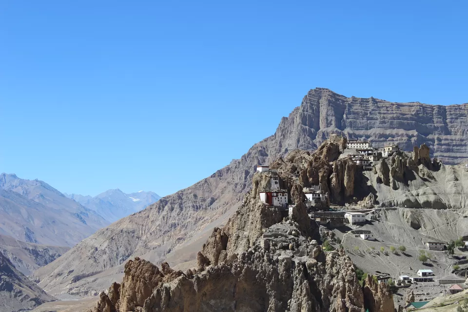
Kibber village & Key Monastery
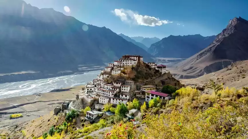
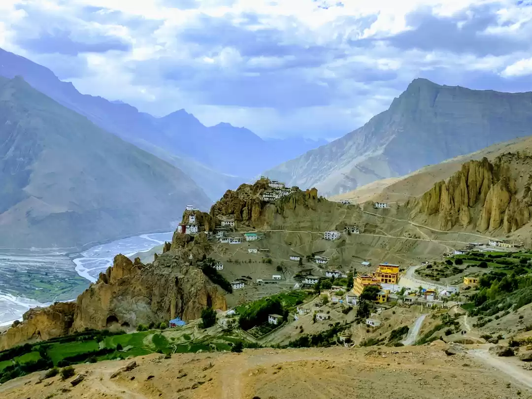
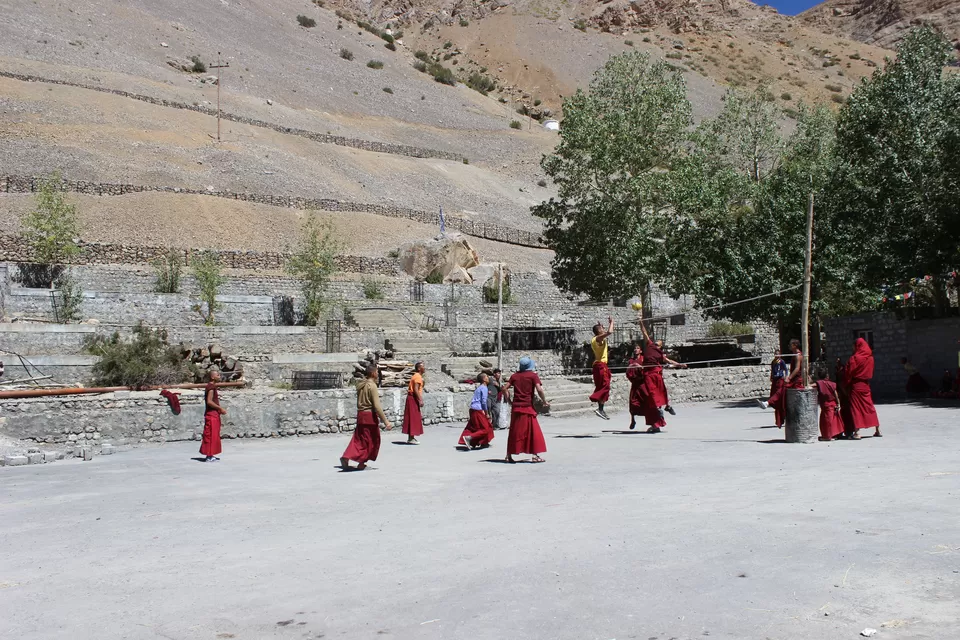
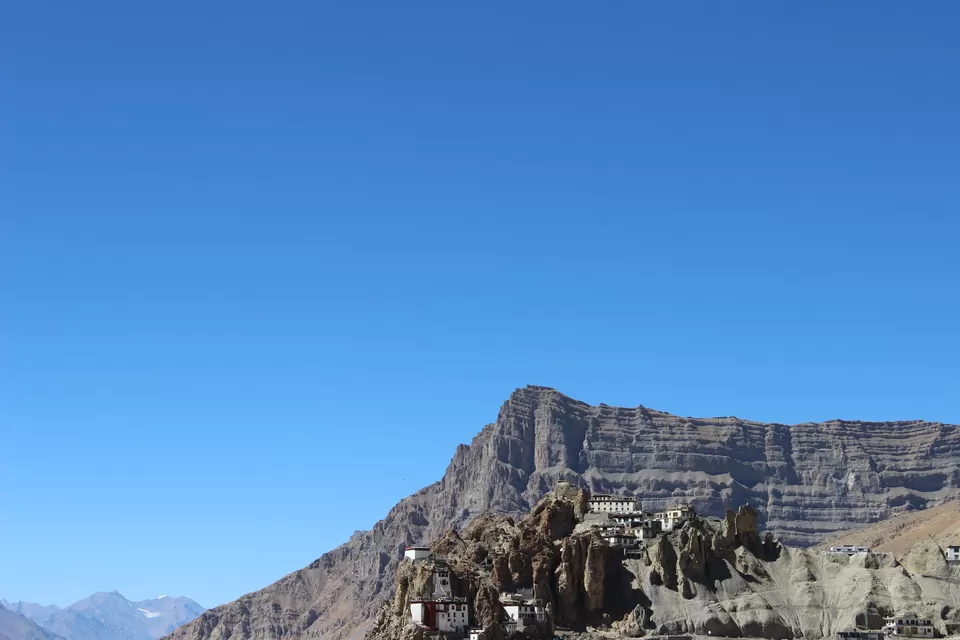
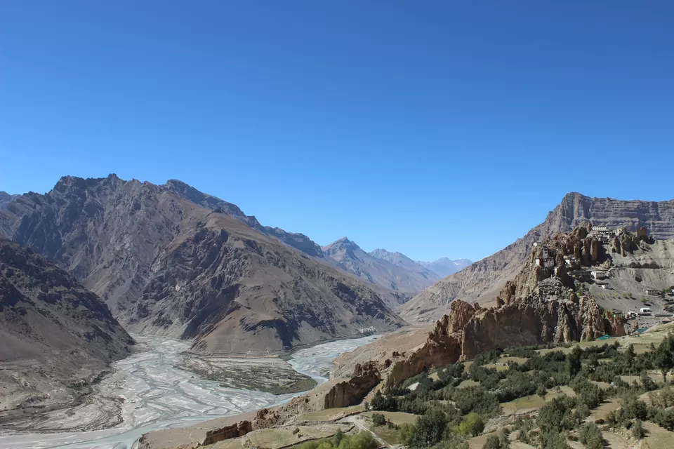
Next day early morning after breakfast we hired a cab for Kibber which is located at a height of about 14,200 ft. and is about 18 km from Kaza. Used to known as highest motor-able village in the world, now tag is with another nearby village Komik. There are only 80-90 houses in Kibber. The remarkable feature about the architecture is the use of stone instead of mud or adobe brick used extensively in the valley. Almost all the houses in this village have same architecture, and outlook. They look like replica of each other. We kept on walking in village streets for a long; people are talkative and greet you with Julley (means greeting in Tibetan language). There is a civil dispensary, a school and a post office in this village. The Spitians use a traditional trade route from Kibber to Ladakh through Parang La; and go there to barter their horses for yaks or to sell for cash. The treks to Ladakh take minimum 3 night halts and require permission. While on the way back we went to Key Monastery, overlooking Kaza from a height of about 13,500ft, the Kye monastery is the largest in the valley and holds a powerful sway over the most populous part of the valley around Kaza. The monastery is an irregular heap of low rooms and narrow corridors. The irregular prayer chambers are interconnected by dark passages, staircases and small doors. Hundreds of lamas receive their religious training in the monastery. It is also known for its beautiful murals, rare manuscripts, and stucco images. Thousands of devotees from all over the world attended the Kalachakra ceremony which was performed in August, 2000 by His Holiness Dalai Lama. It is not just an elaborate puja or a religious congregation. It is a workshop in a grand scale to make an earnest effort by both the teacher and disciples to awaken their Buddha nature by the combined forces of teaching, prayer, blessing, devotion, mantra, yoga and meditation. It is an effort by every participant to try to discover the true and permanent peace for the sake of all others. Buddhists believe mere presence during this elaborate initiation ceremony stretching over a few days liberates the participant from suffering and bestows on him the bliss of Enlightenment. The gompa is only 12 km by road from Kaza.
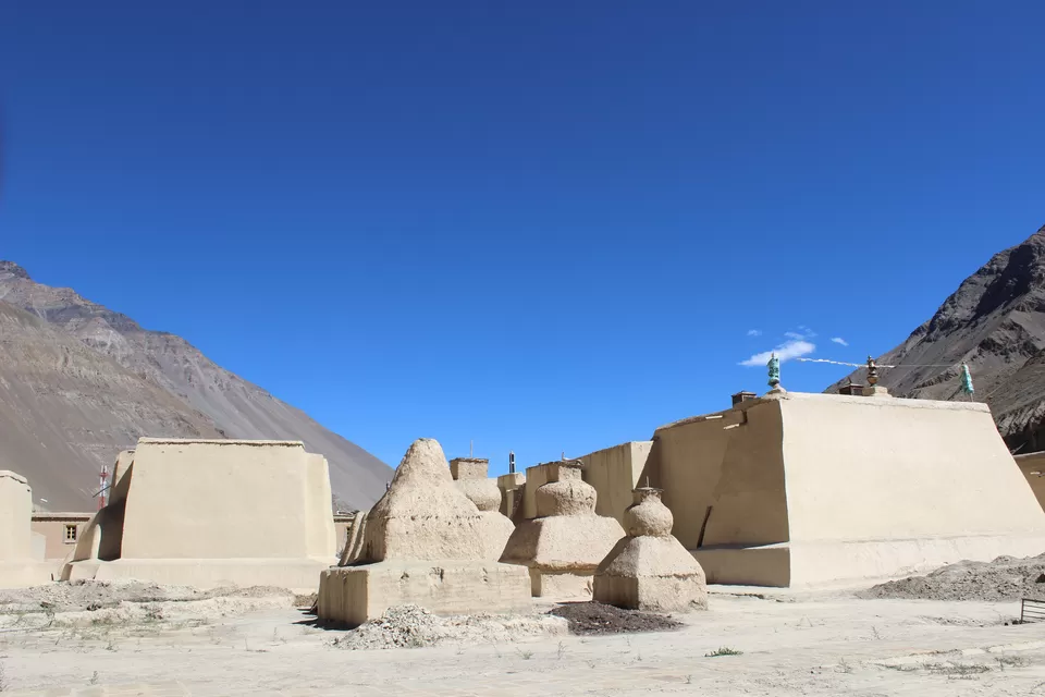
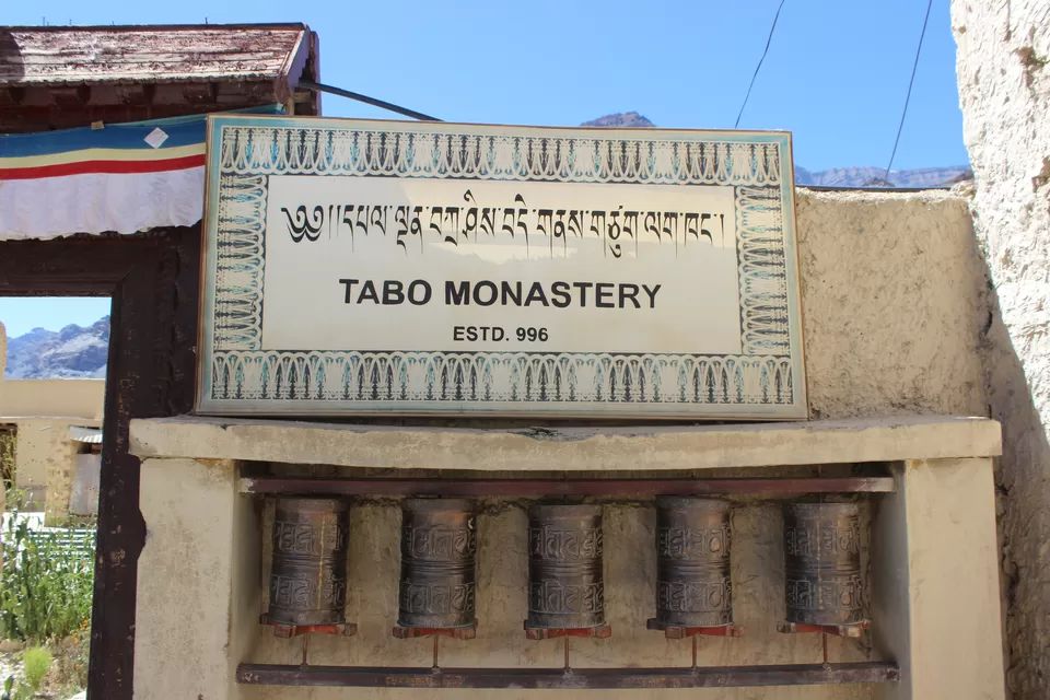
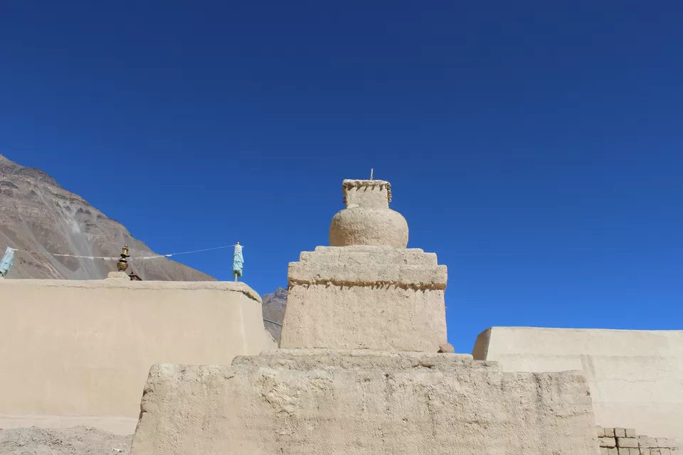
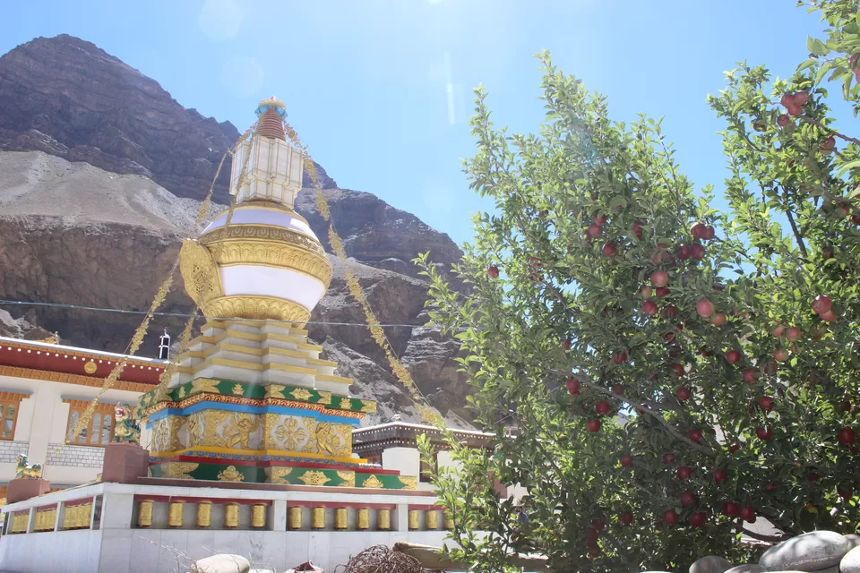
Tabo
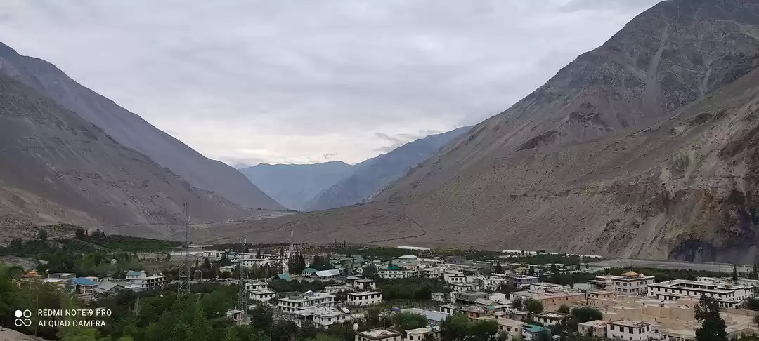
After we came back, Kate, Dedo and me had a great "session of connections" from early evening to late night. It was total trance. Next day early morning (6.30 am) we boarded a bus to Tabo, and reached there about at 10 am. After getting settle down in a home stay (amazing family) for a while, we went out to explore the town. It is a small but very important human settlement. This town is famous for Tabo Monastery, built around a thousand years ago. (In 996 A.D by Buddhist king Yeshe O'd)
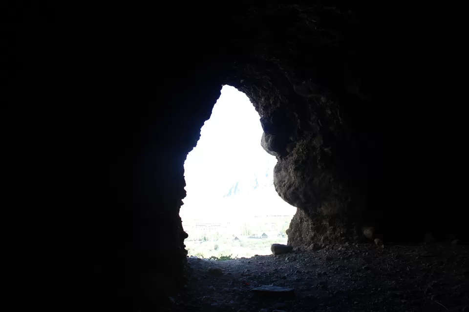
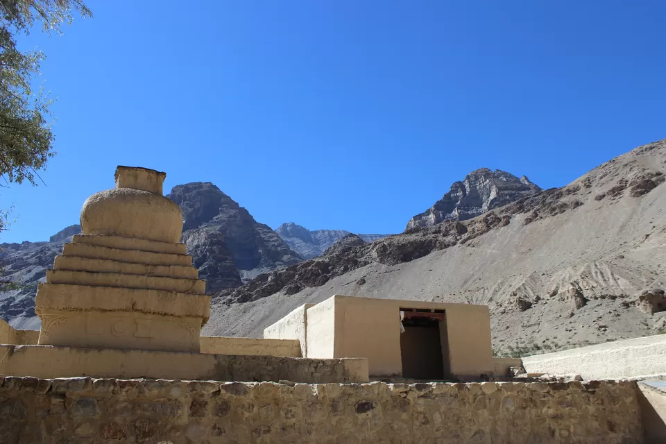
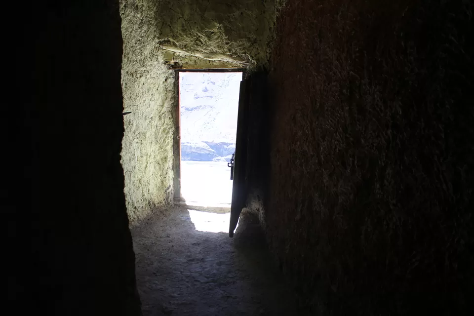
Tabo has a lot of home stays and cafe's providing a wide range on their menu card (that includes continental, Israelis, Chines, and local dishes). After lunch in a cafe, we visited monastery. It is made up of mud and mud bricks. Roof tops of all the stupas are supported by wooden pillars. There are a lot of temples (stupas). As soon as we enter in any of the stupa, we enter in a different world all together. Walls have paintings showing the life events of Buddha, only few of these are renovated, otherwise maximum are untouched since centuries. In main chamber (the prayer hall) there is rare collection of manuscripts and Thankas (scroll paintings). We spent there about 3 hrs. But I lived the history, I lived the time gone by long ago. Culturally these were the richest moments that I have ever lived till date. Just next to this, a new gompa is in making. In evening we headed to famous caves, which are at 15 minutes of easy walk from the monastery, on slop of a nearby mountain. In the middle of nowhere there are about 5- 6 caves, and very small monastery. These caves are not too deep, not even well maintained these days. But it looks like in days gone by; these must have served as the resting place/shelter for travelers in hostile weathers. However a small monastery near the caves has ancient wall paintings.


Dhankar
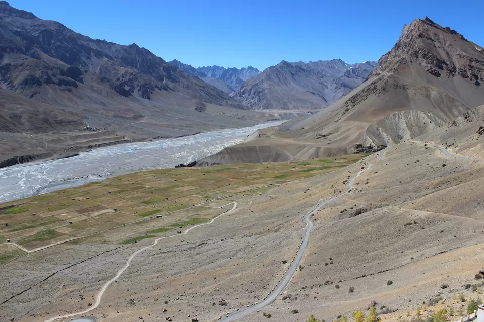
On dinner table I realized that our cultural diversity is a reason that people from all over the world flocks to India. This was the last time that we were having dinner together as we all had our planes. Next day morning Kate, Dado, Shubham and Aman, decided for Kalpa and then to Shimla, and I took a lift in an army truck to Dhankar, another monastery in valley. I got down at Shichling, nestles the citadel of Dhankar. From Schichiling it is 8 km trek to Dhankar, while on the way I met with a group of bikers, and got lift. The fort of Dhankar now lies in ruins, but still is a place worthy of visit. From the remnants of the fort one can see vast expanses of the Spiti valley. Unexpectedly I found that its main monastery is made up at a cliff high up on a mountain top. From here we get a beautiful view if confluence of river Spiti and river Pin, The monastery consists of a number of multi storied buildings perched together, giving a fortress like impression. I heard that there is a fresh water lake about 2.5 km. Set amidst lush green pastures, the lake offers a perfect idyllic camping site. Because of time constrain, I missed it. Interestingly Dhankar is not as famous as Tabo, however it is older.
Old Manali
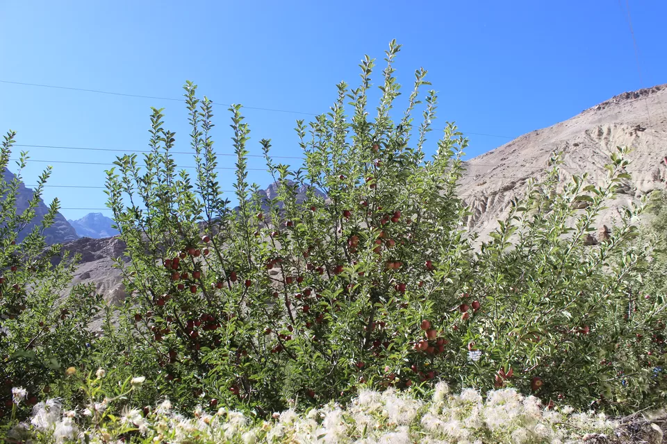
By late evening I came back to Kaza, same homestay, same cafe, same music, but different crowd. Next two days were reserved for Old Manali. Though I have been to Manali many a times, but never visited old Manali. About 3 km from overcrowded mall road of Manali, old Manali is located at the bank of Manalsu rivulet, which is a tributary of bias. There are lot cafes and home stays along this rivulet, this is a place for trekkers, backpackers, hippies and people who want to get rid of overcrowded cities. As soon I got down here, I was approached by owner a decent home stay called "river beats" located right at the bank of this rivlet. Owner was impressed by my solo travel, and was interested in my 10 days travel experience. Just outside of my room was a small apple garden, (season was on bloom) and next to garden was the river bank. Interestingly this was the first time I met a traveler from China, she was travelling alone. Apple garden, River bank, billion stars, session with her till late night was full of information and learning. In coming days she was heading to Spiti and to Laddakh, so was equally interested in my experience of Spiti, and was opened to my inputs for her travel itinerary. That’s how we travel.
Next morning it looked like I am alone on the way back to home, but I was not. Because a traveler may start solo, but never comes back, alone!

' fill='%23359391'%3e %3cpath d='M46.1538462%2c43.5714286 L41.5%2c50 L36.8461538%2c43.5714286 L36.8670256%2c43.5714286 C36.3173077%2c42.7142857 36%2c41.6851429 36%2c40.5714286 C36%2c37.4854286 38.4535641%2c35 41.5%2c35 C44.5464359%2c35 47%2c37.4854286 47%2c40.5714286 C47%2c41.6851429 46.6826923%2c42.7142857 46.1329744%2c43.5714286 L46.1538462%2c43.5714286 Z M41.4294872%2c39 C40.6150641%2c39 39.9487179%2c39.675 39.9487179%2c40.5 C39.9487179%2c41.325 40.6150641%2c42 41.4294872%2c42 C42.2439103%2c42 42.9102564%2c41.325 42.9102564%2c40.5 C42.9102564%2c39.675 42.2439103%2c39 41.4294872%2c39 L41.4294872%2c39 Z' id='Location-white'%3e%3c/path%3e %3c/g%3e %3c/svg%3e)