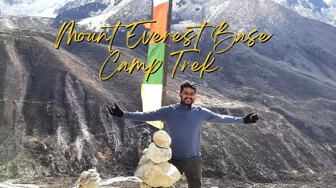
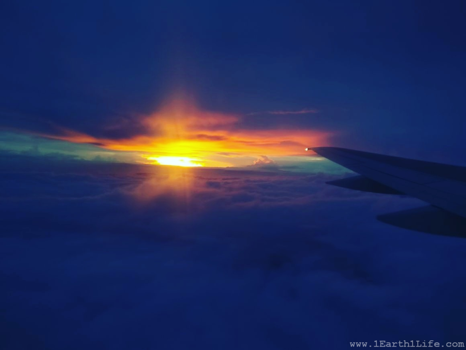
Every year go to a place that you have never been before. Every year do something that you have never done before.
Accept the fact that everything that makes up your world is there because you attracted it with your own thoughts and emotions. There is no big secret, just listen to your emotions and choose to feel good. You can decide to have better feeling thoughts and choose to be in a place of attraction and abundance.
What does it feel like to be present ? To be here and now and fully experiencing the moment. Free from any weight of the past or any anticipation of the future. Just free for you to realize that you can control how you feel about anything and everything. Free to really see things what they really are. Free to give your time and energy to what really matters.
What do you want to do in your life ? What makes you tick ? What makes you feel off ? What makes you happy ? What makes you smile ? What makes you feel alive ? Finding answers to these questions is of utmost importance. Do not be under the impression that you are supposed to do anything. You are supposed to do what you choose to do. Follow your bliss! Stop looking for reasons why you can't and start looking for reasons why you can and when you realize that you can, you should.
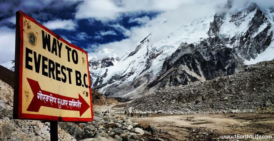
Yes, I had been on multiple treks earlier. But, all of them were to the Western Ghats. Easy-to-moderate level with a trek time of 7-8 hours, both ways included. The trek to EBC [Everest Base Camp] is something at a completely different level altogether. Walking for ~140 kms over a period of 13 days with a 10 kg backpack at high altitude has to be a challenge. It demands for some good level of physical fitness and mental toughness. Even if you possess it, there is no guarantee of you making it. There are a few factors that are not in your control, altitude sickness being the main one. It is something that all high altitude hikers/mountaineers need to be wary off. It can hit anybody, no matter how strong you are physically and mentally. Human body is not designed to work at high altitudes where the oxygen level is low. At the Base Camp of Everest, the oxygen level drops down to 50% than what you find at the sea level. The only thing in my control was to put in the hard work during training and leave the rest to as it comes, being fully aware of the consequences. Trekking at high altitude is more like a marathon than a sprint. It is all about endurance and longevity. The mantra was to train hard and trek slow.
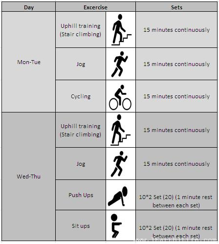
Training :
It started a little more than two months before landing in Nepal. I did not want to wake up every morning during the trek with a sore body. I had to sweat it out during training in order to return with a great experience and make this expedition a huge success. Agreed that I was not climbing the summit of Everest, but reaching its Base Camp is not a cake-walk and definitely not an easy feat to accomplish. I had to take my training seriously.
The training schedule was spread over 4 days per week for 2 months, more focus being on building stamina and strengthening my core body. The ones mentioned in the image were for the evenings. During mornings, I had included long walking hours in Lalbagh with a backpack and my new pair of hiking boots. The idea behind wearing a backpack and hiking boots during my morning walks was to replicate the trek as much as possible. As mentioned earlier, the only thing in my control was to work hard during training and leave the rest to as it comes. Two months into training and towards the end of it, I was feeling good and ready to undertake this adventure of a lifetime. At the same time, I did not want to get complacent as I was fully aware of the things that were not in my control.
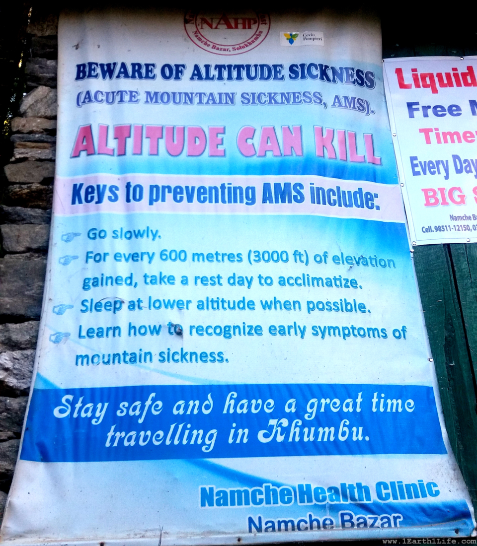
High Altitude Sickness [AMS, HAPE and HACE] :
It becomes very important to be aware of altitude related illness - its symptoms, prevention and treatment. Knowledge of this would be very essential in making wise decisions during the trek. This section includes a brief explanation of the same. High altitude sickness includes:
AMS - Acute Mountain Sickness.
HAPE - High Altitude Pulmonary Edema.
HACE - High Altitude Cerebral Edema.
HAPE and HACE are a more severe version of AMS where fluid gets accumulated in lungs and brain. If not treated on time it could potentially lead to death.
AMS symptoms :
● Headache
● Tiredness
● Lack of appetite
● Difficulty staying asleep (waking frequently)
● Nausea, sometimes with vomiting
AMS prevention :
This can hit anybody irrespective of their fitness levels. However, it can be prevented. The two most important preventive measures are to ascend slow and to keep your body well hydrated by drinking plenty of water. Human body is not designed to work at high altitudes where the oxygen level is low. The initial itinerary included multiple acclimatization days to give my body enough time to get used to the height. The idea was to climb high and sleep low. The plan was to hike to a higher altitude during the day and return to a lower elevation to sleep at night.
AMS treatment :
AMS treatment includes rest, descent, and medicines to relieve symptoms. I had taken Dispirin and Diamox along. Dispirin takes care of mild headaches due to dehydration and if it did not reduce after say maybe even an hour, I would be popping in Diamox as it helps in acclimatizing faster. It takes all the bi carbonates out of the body through urine and acidifies your blood. That means your body will start to hyperventilate and you will inhale more oxygen. Basically, it makes you breathe better and helps your body get more oxygen. The best treatment of them all is to stop climbing higher until the symptoms have resolved. If hit by any of these symptoms and if they did not improve or worsen even after medication, I knew that the trek would be called off and I had to descend to a lower altitude as soon as possible.
Equipment :
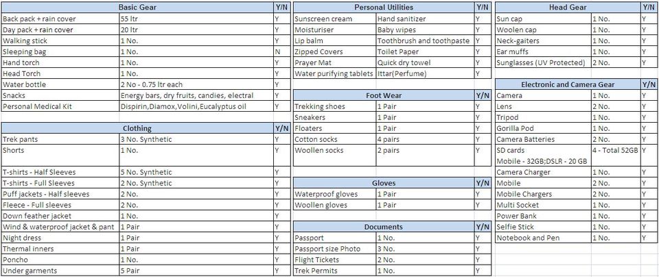
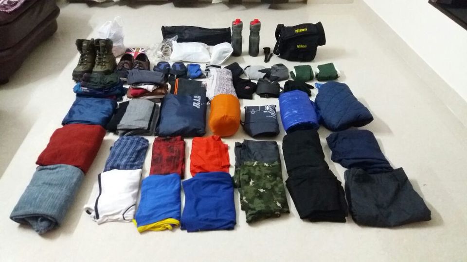
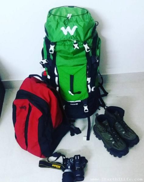
The most important aspect while packing my backpack was to realize that I am the one who would be carrying all the stuff during the 13 day long hike. Hence, lesser the weight, lesser would be the strain on my body and easier would be the hike. I had to take things that were absolutely essential for this epic adventure, things that were really required and useful. My backpack with all the things inside weighed a little over 10 kgs. The following image has a check list of all the things that I carried. I ended up using them all.
The Check-list :
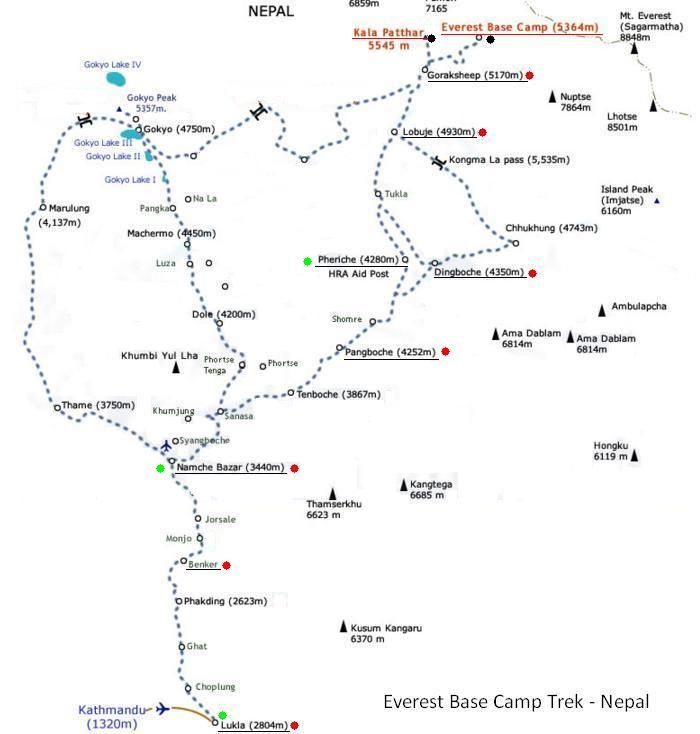
Map :
The ones marked in red were the places where we halted at night during the forward trek and the green dots were during the retreat trek.
FAQs :
I have compiled the most frequently asked questions about this trek. Click here to view.
Initial Itinerary :
Sep 30 - Day 0 : Flight -> Bengaluru-Kathmandu.
Oct 01 - Day 1 : Explore Kathmandu. Last minute equipment-shopping in Kathmandu.
Oct 02 - Day 2 : Fly to Lukla (2804 m) from Kathmandu, trek to Phakding (2610 m).
Oct 03 - Day 3 : Trek from Phakding (2610 m) to Namche Bazar (3441 m).
Oct 04 - Day 4 : Acclimatization day in Namche Bazar which includes a short hike.
Oct 05 - Day 5 : Trek from Namche Bazar (3441 m) to Tengboche (3860 m).
Oct 06 - Day 6 : Trek from Tengboche (3860m) to Dingboche (4410 m).
Oct 07 - Day 7 : Acclimatization day at Dingboche (4410 m) which includes a short hike.
Oct 08 - Day 8 : Trek from Dingboche (4410 m) to Lobuche (4910 m).
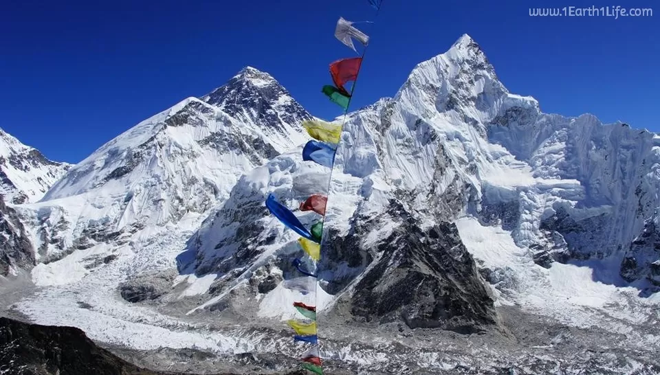
Oct 09 - Day 9 : Trek from Lobuche (4910 m) to Gorakshep (5153 m) to Everest Base Camp (5364 m) and back to Gorakshep (5153 m).
Oct 10 - Day 10 : Hike up to Kalapatthar (5545 m) and retreat trek to Lobuche (4940 m).
Oct 11 - Day 11 : Retreat trek from Lobuche (4940 m) to Tengboche (3860 m).
Oct 12 - Day 12 : Tengboche (3860 m) to Monjo (2835 m).
Oct 13 - Day 13 : Monjo (2835 m) to Lukla (2800 m).
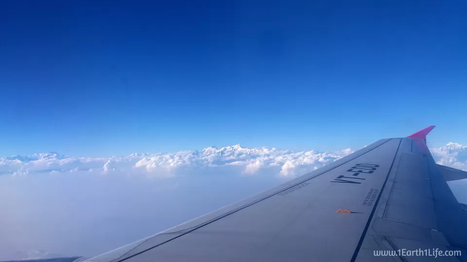
Oct 14 - Day 14 : Fly from Lukla to Kathmandu. Explore Kathmandu.
Oct 15 - Day 15 : Flight -> Kathmandu-New Delhi-Bengaluru.
Sep 30 - Day 0 : Flight -> Bengaluru-Kathmandu.
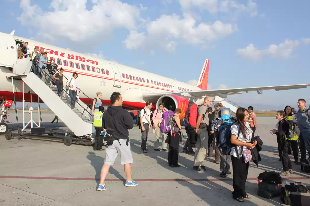
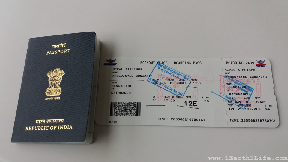
An uneventful Nepal Airlines flight took me from Bengaluru to Thribuvan International airport, Kathmandu in 3 hours. Cleared immigration without a visa as Indian nationals do not need it to enter Nepal. A hotel representative picked me up from the airport and dropped me at The Lemon Tree Hotel, Thamel.
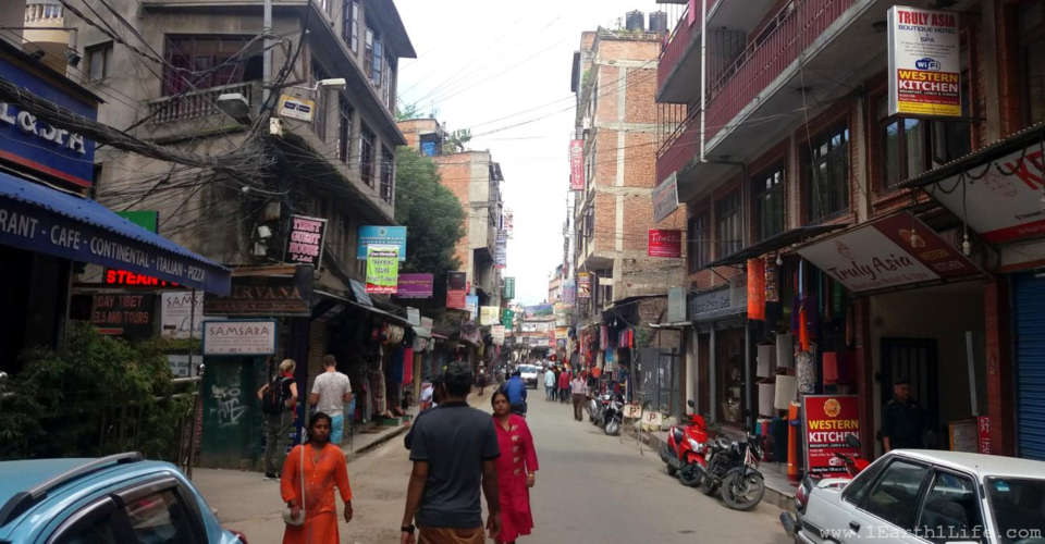
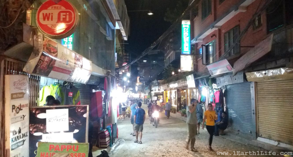
Oct 01 - Day 1 : Explore Kathmandu. Last minute equipment-shopping in Kathmandu.
Thamel, Kathmandu : The Thamel region of Kathmandu is a bustling area with shops and eateries of various kinds. You name it and they'll have it. It is a shoppers paradise and friendly for pockets of all sizes. You will find hundreds of trekking companies, trek gear outlets, restaurants, spas, massage parlors, super markets, foreign exchange outlets, road side eateries etc. This place truly comes to life after sunset. I remember dining with my fellow trekkers in one of the open-air candle lit Italian restaurants with live music in the middle of a bustling market place. Post dinner, I had been on a last minute shopping spree, purchasing a pair of water proof gloves, walking stick, water purifying tablets, EBC trek map and everyone in our team bought a 'Everest Base Camp' printed T-shirt for wearing it at EBC.
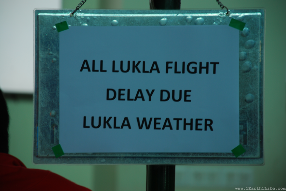
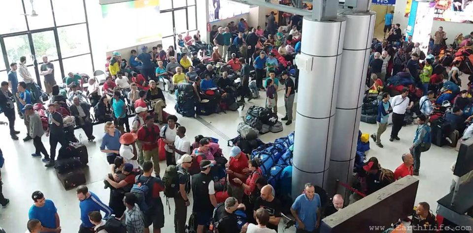
Oct 02 - Oct 03 ; Day 2 and Day 3 : Stranded in Kathmandu domestic airport due to bad weather in Lukla.
Can you imagine the feeling of going to the airport for two straight days with an expectation of flying to Lukla and all that you get in return is the board in the below image. Frustration and absolute chaos. It had become a routine, wake up early in the morning, reach the airport by 7 am, wait till 4 pm and return back dejected to the hotel with fresh hopes for the next day.
Recalling the excerpts from my diary:
"Very bad and another frustrating day at the airport. All flights to Lukla were cancelled due to bad weather. Multiple options for tomorrow:
1. Take a chopper to Lukla - Ruled-out as it was just too expensive. 450-500 USD.
2. Continue waiting for the flight with a hope of weather clearing in Lukla.
3. Take a 12 hour off road jeep ride to a place called Phaphlu and then trek for 3 days to reach Lukla.
4. Cancel the trip and return back to India.
Money and time are two big concerns. Lots of things going on in my mind. Should I return back home leaving behind this dream or just stick around and keep trying? But for how many days ?? Will I be able to take a 12 hour off-road jeep ride to Phaphlu, trek for 3 days to Lukla and then trek to EBC ? I don't know. Hope something good is in store for tomorrow. All fingers crossed."
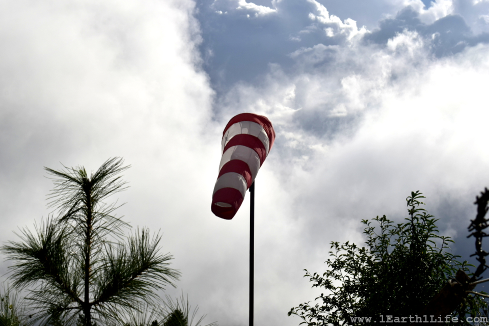
If everything goes fine, you will have no issues. But, when things don't go right, you will start to complain with exaggeration like how I'm going to do now. Kathmandu domestic airport is nothing less than a fish market. Chaotic with no sense of direction. You will find trekkers everywhere - lying on the floor, staircase, restrooms, entry, exit, just everywhere. You will find them sleeping, snoring, walking, talking, eating, drinking - in frustration and hopelessness. Each one of them share a common goal with you - reaching Lukla. This place will surely test your patience. Adding up to the misery, they have a single runway for both international and domestic flights which leads to further delays and eventual cancellations. The flights to Lukla operate only during mornings. Your best bet to reach there is by taking an early morning flight, from 6am-8am. Anything after that gets dicey as the clouds close in on the notorious mountain runway.
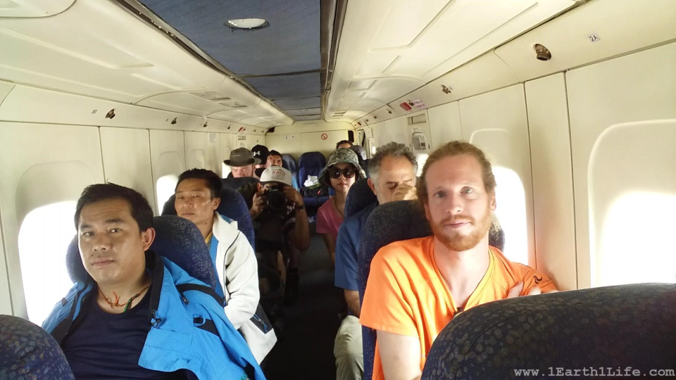
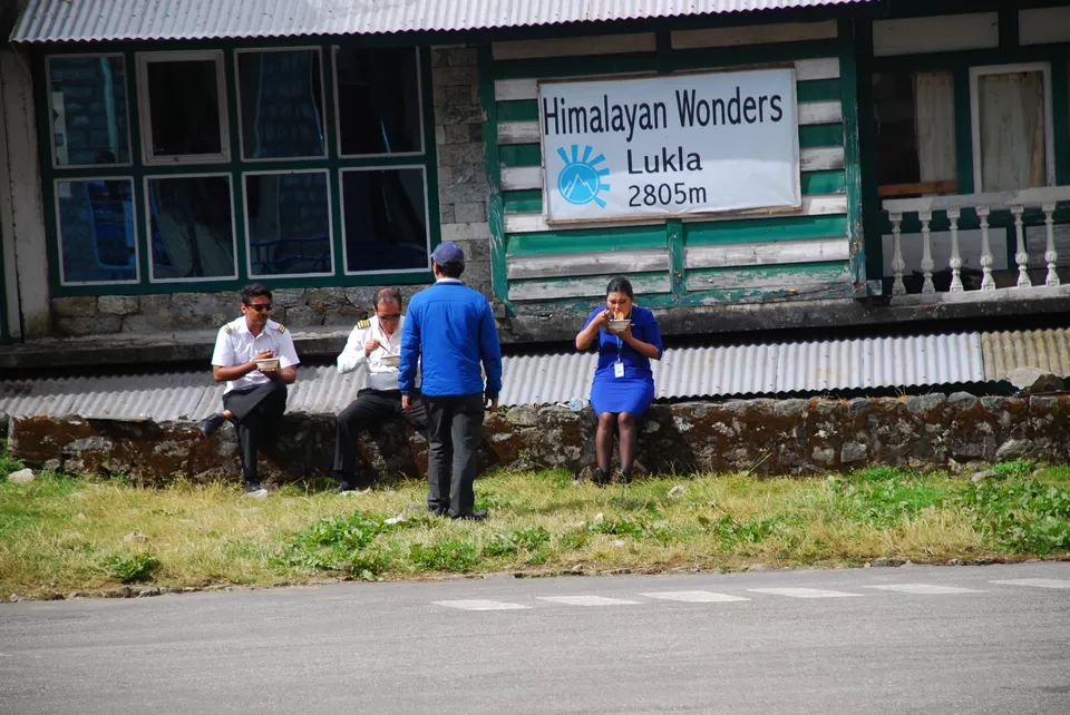
Oct 04 - Day 4 : Flight -> Kathmandu - Lukla.
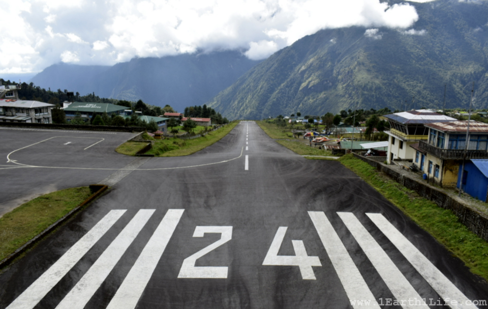
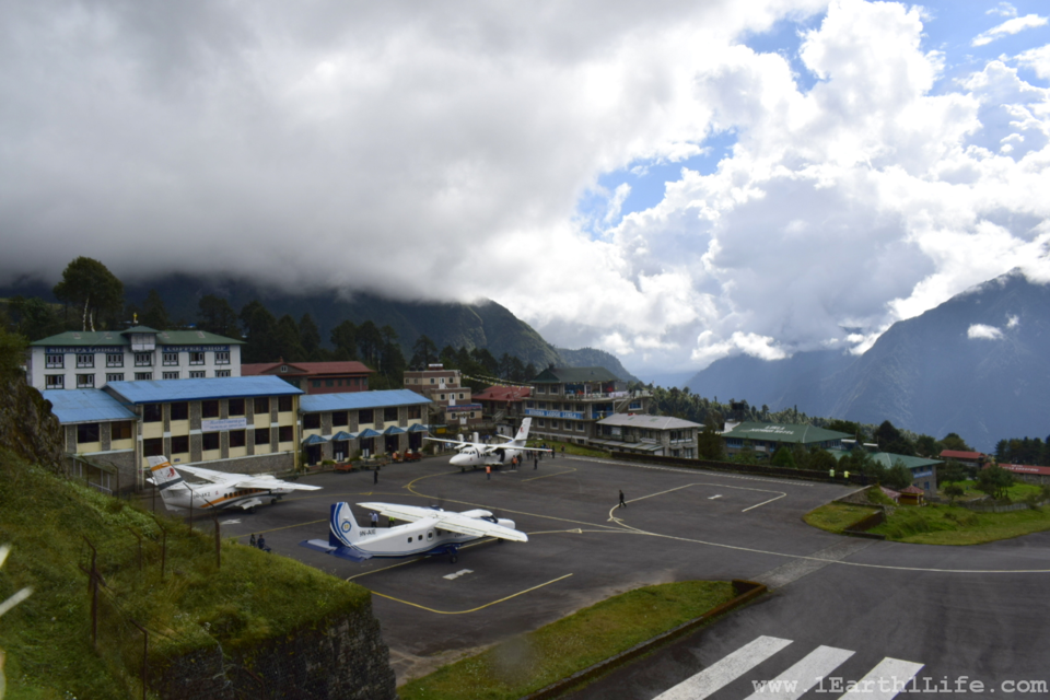
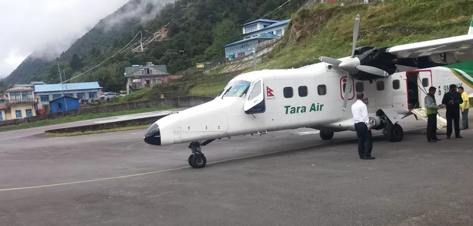
Flight to Lukla - Worlds most dangerous airport :
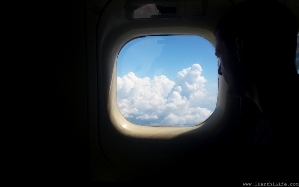
Third day at the airport and I finally boarded the flight to Lukla. One of the longest flights I have ever been on. It was a Havilland Canada DHC-6 Twin Otter 14 seat aircraft. It had 2 columns with single seats on each side. The front 2 seats belonged to the pilots, of-course. You can see them in action right in front of your eyes. Though the flight lasted for a mere 35 minutes, every minute seemed like an hour. This plane was exactly similar to the one that I had boarded during my recent skydiving stint in Dubai. The only difference being me not jumping out this time. Sigh of relief...!!!
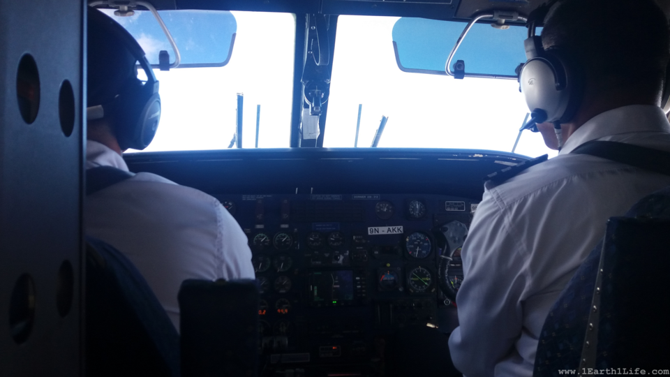
Tenzing–Hillary Airport, Lukla is a gateway to the Everest region. No wonder it is tagged as the worlds most dangerous airport. The runway is a little over 500 m in length and hangs over a mountain cliff. The cliff end of the runway is ~50 m lower than the opposite end. This is to slow down the aircraft upon landing and to speed it up during take off. At one point just before landing, the pilots switch off the throttle and begin to descend like a helicopter. Trust me, you will have your heart, lungs, kidneys and everything else in your mouth.
The airport has recorded multiple crashes over the years. The worst one being -"On 8 October 2008, Yeti Airlines Flight 103, a DHC-6 Twin Otter 300 (registration 9N-AFE) crashed on final approach and caught fire, killing eighteen passengers and crew. The aircraft's captain was the only survivor. Video of the incident showed inclement weather at the time of the incident." - Source : Wikipedia.
Due to its rich accidental history, the authorities take extra precaution during inclement weather. The pilots completely rely on visibility to land and take off. Any hindrance results in delays and cancellations. After all safety and human life is of utmost importance.
Revised Itinerary : Loss of days due to weather related flight delay compelled us to revise our itinerary.The 13 day trek reduced to 9 days. This meant more walking hours and skipping acclimatization days. Yes, not a good decision.
Sep 30 - Day 0 : Flight -> Bengaluru - Kathmandu.
Oct 01 - Day 1 : Explore Kathmandu. Last minute equipment-shopping in Kathmandu.
Oct 02 - Day 2 : Stranded in Kathmandu domestic airport due to bad weather in Lukla.
Oct 03 - Day 3 : Stranded in Kathmandu domestic airport due to bad weather in Lukla.
Oct 04 - Day 4 : Flight -> Kathmandu - Lukla.
Oct 05 - Day 5 : Trek from Lukla (2840 m) to Benkar (2630 m)
Oct 06 - Day 6 : Trek from Benkar (2630 m) to Namche Bazaar (3440 m)
Oct 07 - Day 7 : Trek from Namche Bazaar (3440 m) to Pangboche (3930 m)
Oct 08 - Day 8 : Trek from Pangboche (3930 m) to Dingboche (4410 m)
Oct 09 - Day 9 : Trek from Dingboche (4410 m) to Lobuche (4910 m)
Oct 10 - Day 10 : Trek from Lobuche (4910 m) - Gorakshep (5140 m) - Everest Base Camp (5356 m) - Gorakshep (5140 m)
Oct 11 - Day 11 : Hike to Kala Patthar (5550 m) - Gorakshep (5140 m) - Pheriche (4270 m)
Oct 12 - Day 12 : Retreat trek from Pheriche (4270 m) to Namche Bazaar (3440 m)
Oct 13 - Day 13 : Final trek from Namche Bazaar (3440 m) to Lukla (2840 m)
Oct 14 - Day 14 : Flight cancelled due to bad weather at Lukla airport - This was not a planned part of the itinerary :D
Oct 15 - Day 15 : Flight -> Lukla-Kathmandu-New Delhi-Bengaluru.
Trek days :
Oct 05 - Day 5 : Lukla (2840 m) to Benkar (2630 m)
Duration : 7 hours
Difficulty Level : Easy
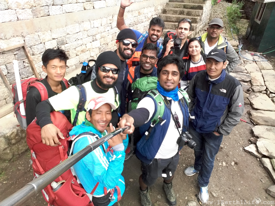
Today was the most easy section of the entire expedition. Though it lasted for 7 hours (including lunch and refreshing breaks - 1 hour), it was an easy down hill climb reducing us by ~200 m in altitude. This long duration hike gave us all a glimpse of what is to come in the days ahead.
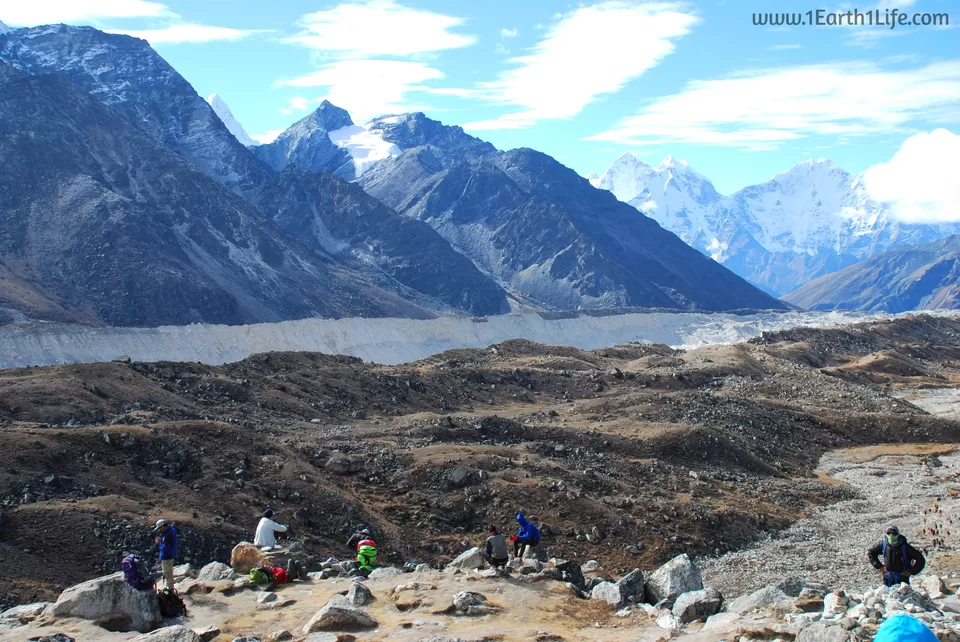
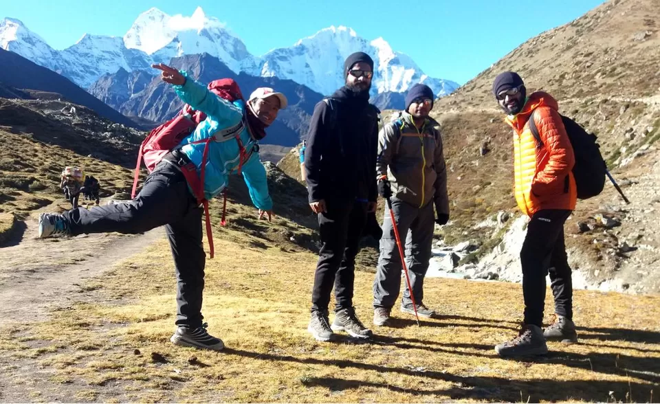
Below picture was our first morning 'groupie' before beginning the hike. The person in light blue jacket is our Sherpa. Brilliant guy! He had made an attempt to climb Everest in 2015 but had to return from camp-2 due to the deadly earthquake. It had triggered an avalanche on Mount Everest, killing 21, making April 25, 2015 the deadliest day on the mountain in history. He was one of the lucky survivors. Two years on, he still holds on to his dream of reaching the summit. Inspiration!
Oct 06 - Day 6 : Benkar (2630 m) to Namche Bazaar (3440 m)
Duration : 6 hours
Difficulty Level : Difficult
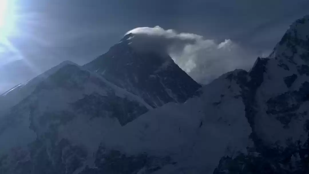
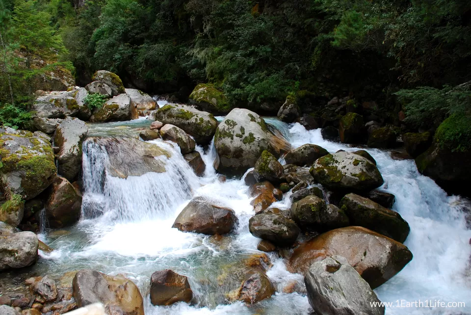
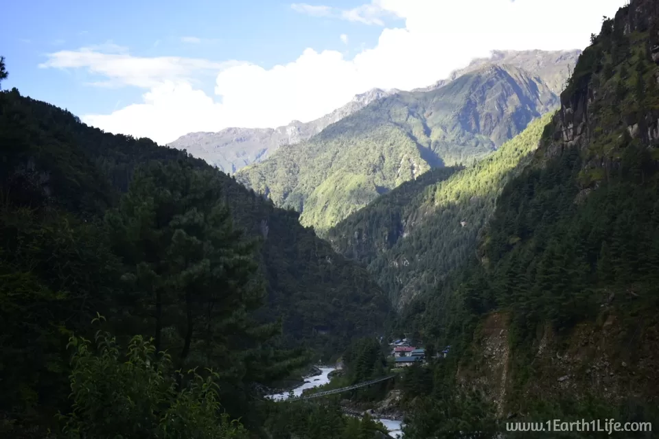
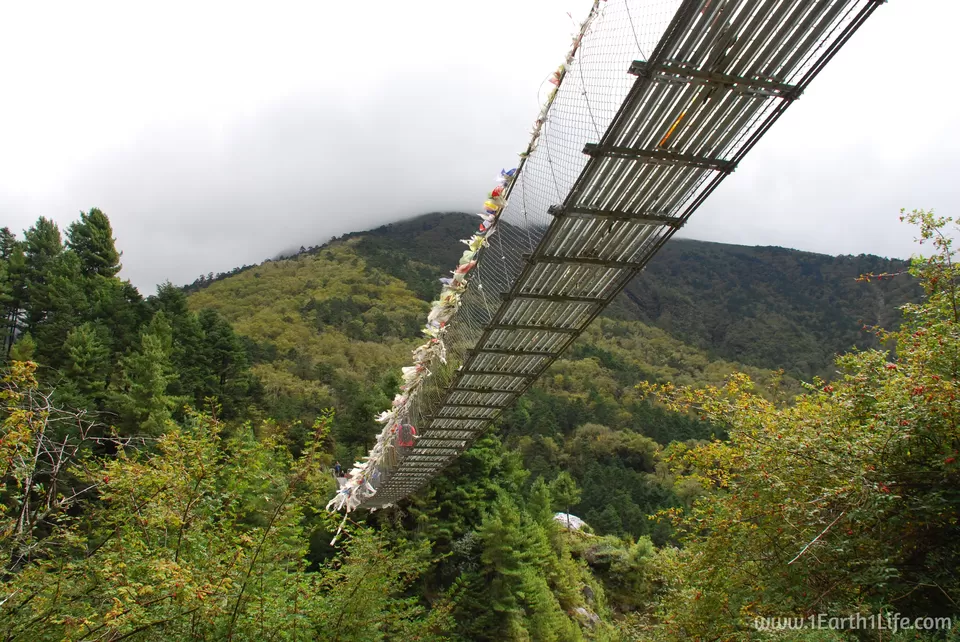
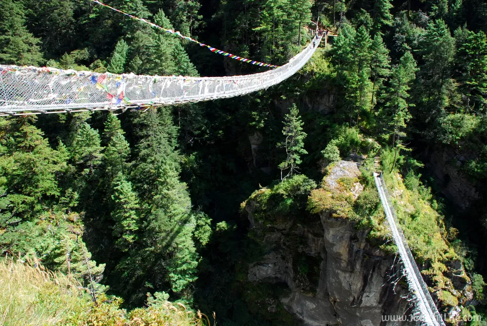
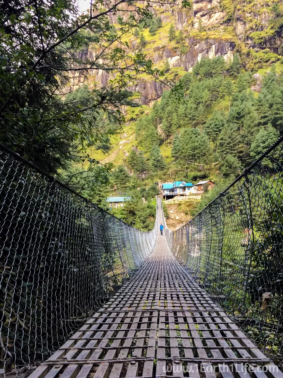
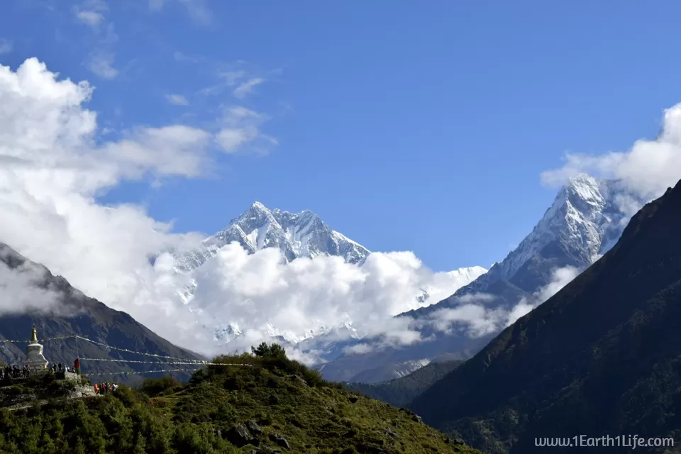
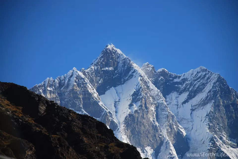
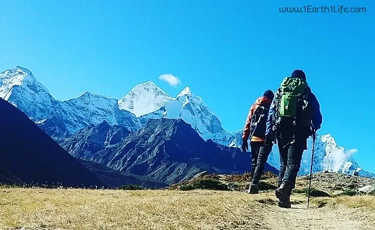
Today's trail will take you along River Dudh Koshi crossing it multiple times over hanging bridges. If my memory is right, there are a total of 8 such bridges - 6 on the way to Namche and 2 higher up. You will get your first glimpse of the mighty Everest, weather permitting. It was playing peek-a-boo with us behind the clouds. The final 3 hour uphill push towards Namche gets very tough where you will be gasping for breath. Recall the mantra of keeping yourself well hydrated and taking it slow even if you have the energy to push hard. Remember, you had trained hard to trek slow.

Oct 07 - Day 7 : Trek from Namche Bazaar (3440 m) to Pangboche (3930 m)
Duration : 10 hours
Difficulty Level : Moderate
The initial 2 hour hike was on an easy-parallel-walk-way with some stunning views of the snow capped peaks. We then started descending to Phunki Tenga (3250 m) all the way down to the river side in the valley below. Post lunch we resumed our tiring upward climb towards Tengboche (3860 m). As per the initial itinerary we had to halt at Tengboche for a night. But, due to loss of days on the way to Lukla, we had to push ourselves all the way up to Pangboche (3930 m) in order to cover up for the lost days. An extra walk of 2 hours took the toll on us. 4 of our 8 member team were down with headache, possibly mountain sickness.
Excerpts from my diary :
"Reached the tea house at 6 pm. Crazy hike from 8 in the morning to 6 in the evening. Second part of the hike post lunch was very exhausting with no views due to cloud cover. Very tiring and I have a mild headache. Sherpa to decide on a one day extension looking at our teams health condition tomorrow. Bitter cold here. Good night."


Oct 08 - Day 8 : Trek from Pangboche (3930 m) to Dingboche (4410 m)
Duration : 5 hours
Difficulty Level : Moderate
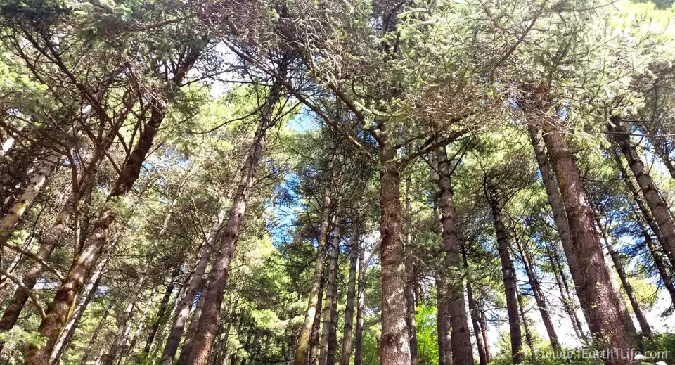
Starting today everything that you do will seem like you have done it before - Deja vu. You will wake up early in the morning to some stunning views outside your room window, freshen up, pack your bag, put on your layers, have your breakfast, take your walking stick and start walking away to glory. You will be very well aware that the task you have for today is, to walk. You will start to thank for all the extra hours you had put in the gym while training. You will want to walk faster or maybe even run, out of excitement. But then, reality sinks in. You will start gasping for breath for every harsh physical move you make, due lack of oxygen. This can be further witnessed by observing the vegetation around. On the first 2 days, you had walked through thick green forests, you will now start seeing shrubs and dry grass all around. Courtesy : lack of oxygen. The terrain will get drier as you gain more elevation. Difficult days ahead.

Oct 09 - Day 9 : Dingboche (4410 m) to Lobuche (4910 m)
Duration : 5 hours
Difficulty Level : Moderate
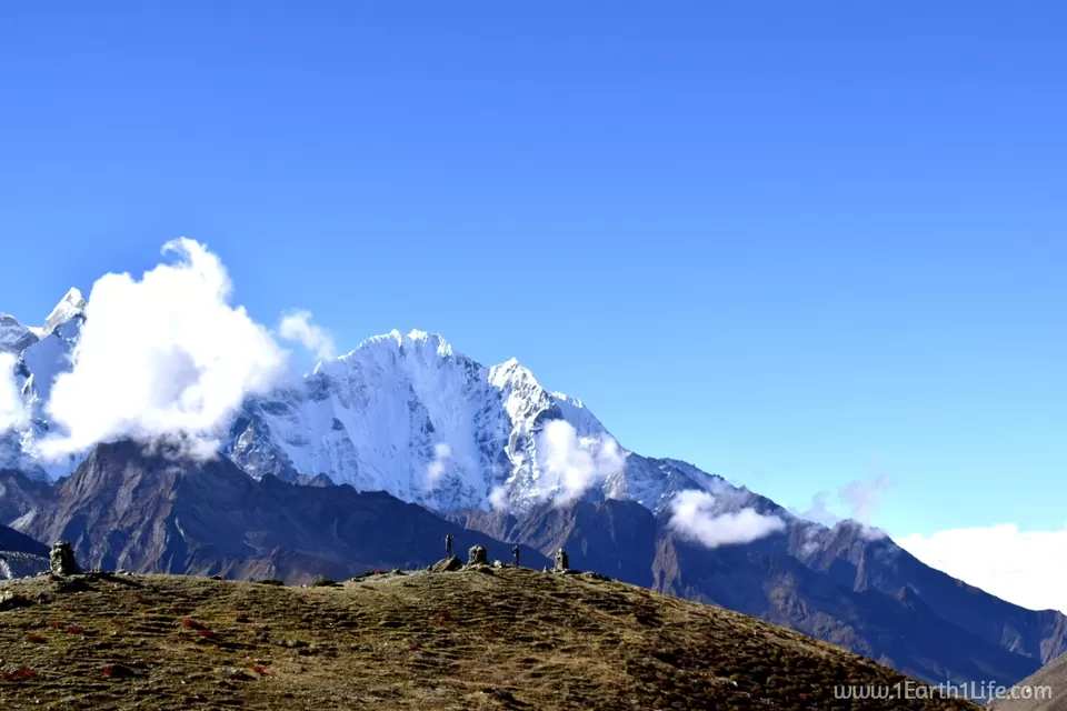
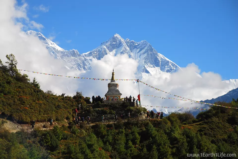
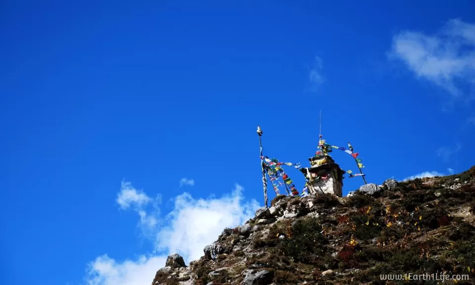
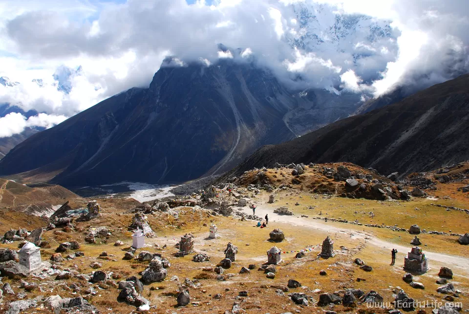
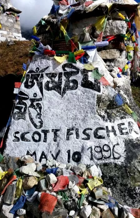
It had to be by far one of the most scenic and beautiful days with clear blue skies and warm sunshine. The initial 2 hour walk was on an easy mountain plain. Slowing down for clicking pictures and capturing some video stills definitely helps to relax your legs. 3 hours into the walk and immediately after a tiring 1 hour uphill climb post lunch, we came across The Everest memorial. It is an area that has been maintained in the memory of all those who have lost their lives up there. This place has hundreds of prayer-flag-engulfed-stones, each designated to a lost life on Everest. A very calm and a serene place.
Excerpts from my diary :
"Another day in the mountains and high altitude. 2 team members are struggling. They are considering for a helicopter evacuation through insurance if their health deteriorates further. For me, so far so good, touch wood. Not able to contact family due to lack of network. They must be worried. Will connect with them as soon as I get to a place that has network. Sleeping now :)"


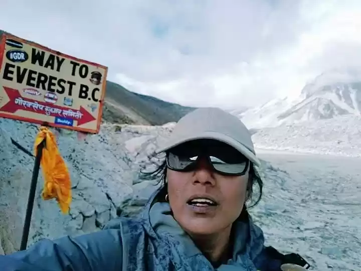
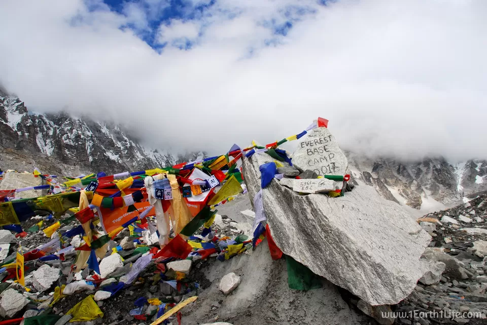
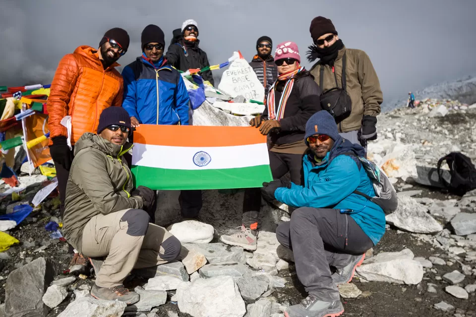
Oct 10 - Day 10 : Lobuche (4910 m) - Gorakshep (5140 m) - Everest Base Camp (5356 m) - Gorakshep (5140 m)
Duration : 10 hours
Difficulty Level : Difficult
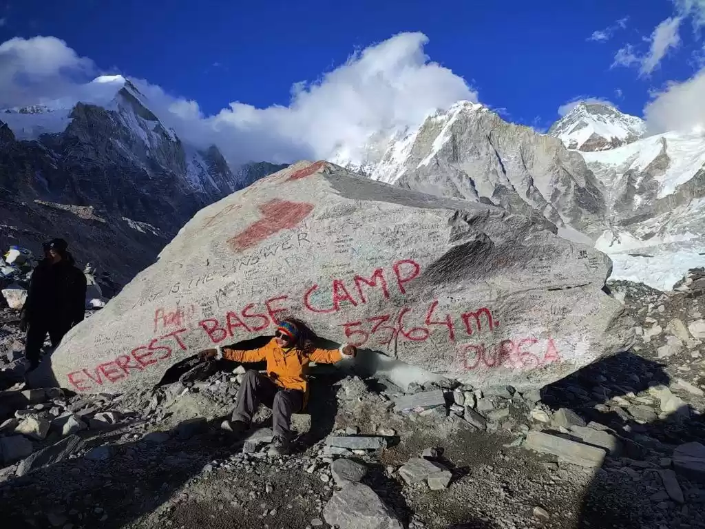
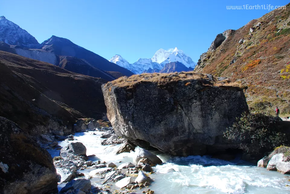
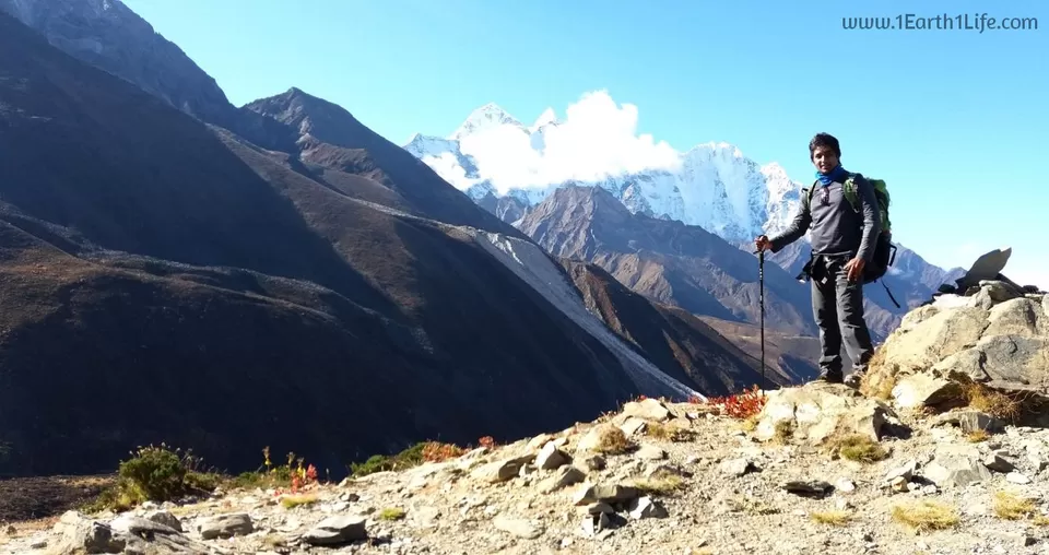
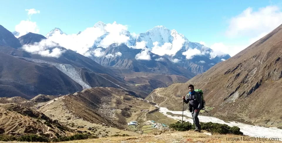
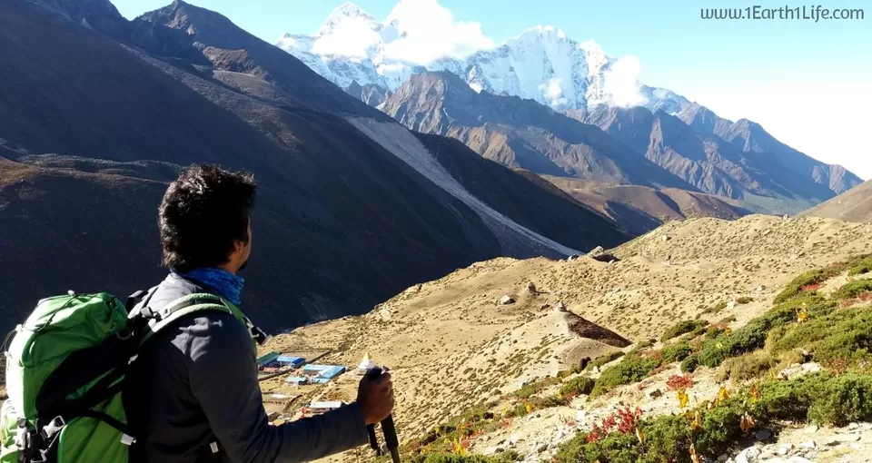
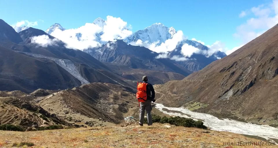
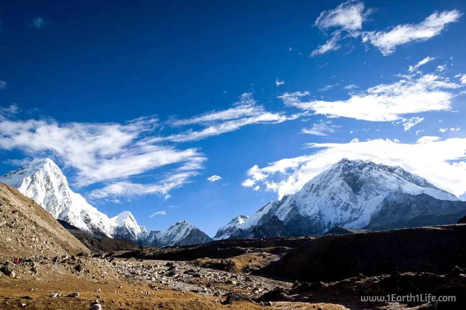
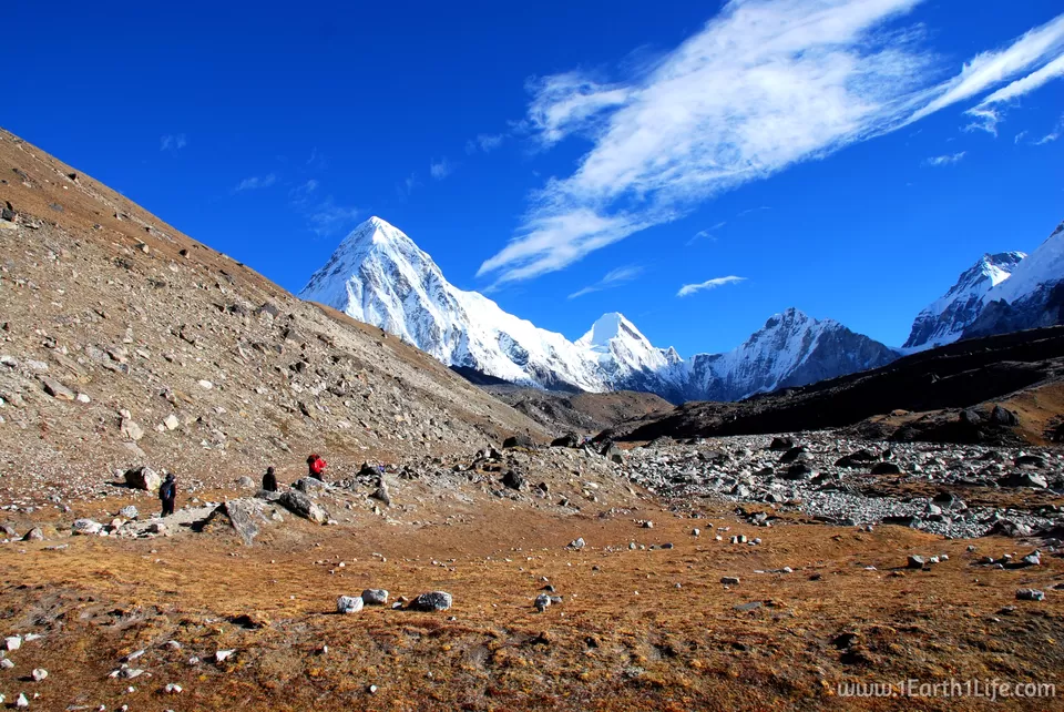
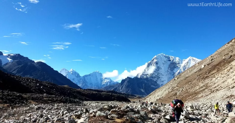
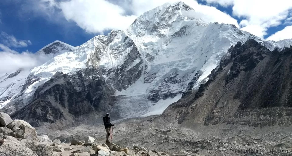
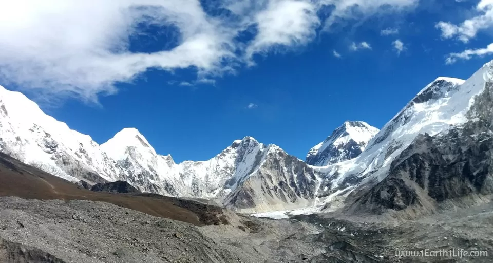
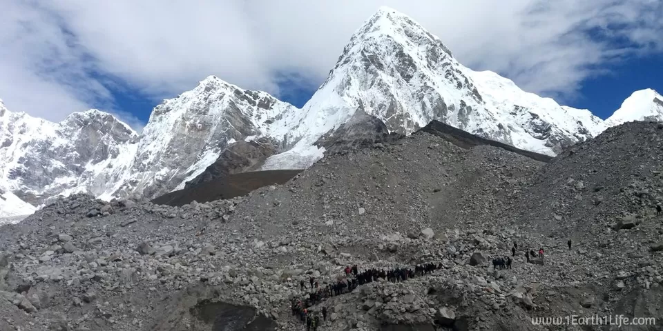
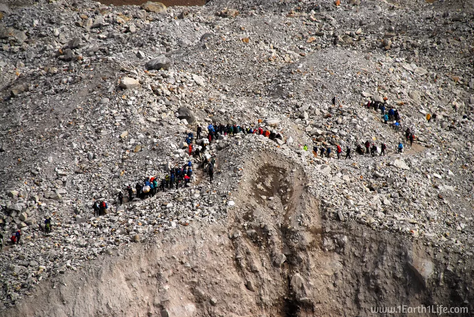
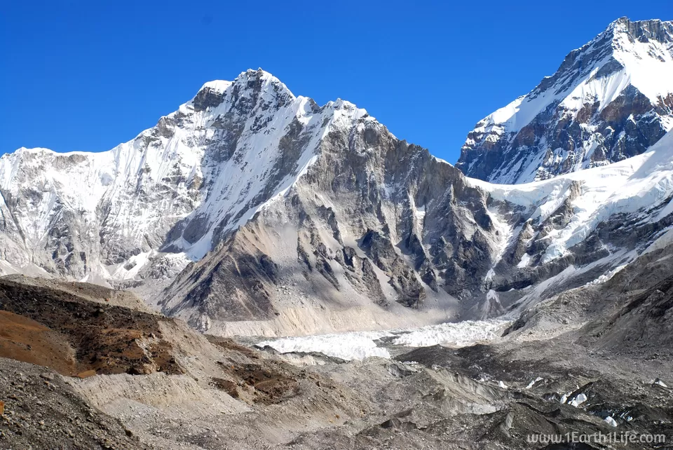
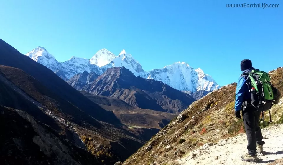
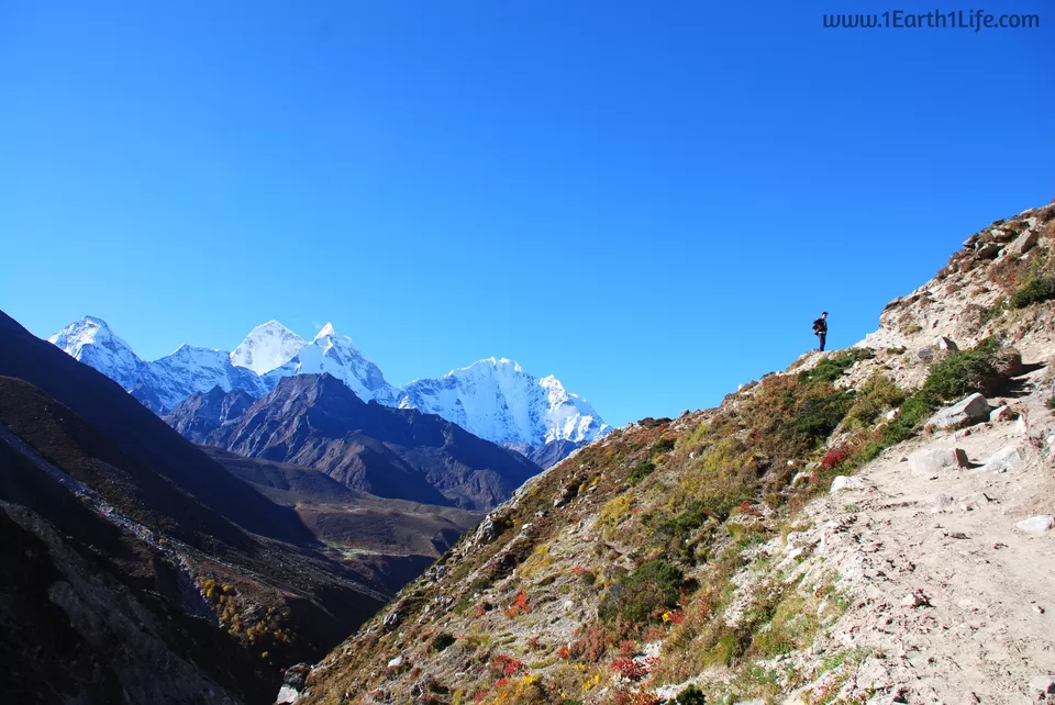
Big day today. We would be finally reaching our destination - The Base Camp of Mt Everest. But, it was still 7.5 long grueling hours away. We started our hike from Lobuche at 730 in the morning and reached Gorakshep by noon (1230). For the first time today we crossed the 5000 m mark. It was a stunning walk with clear views of Mount Pumori (7161 m), Mount Nuptse (7861 m), Mount Cholatse (6440 m) and Mount Thamserku (6623 m) amongst others. After having our lunch at Gorakshep (5140 m) we began our final push towards EBC, a 3 hour one side walk along the Khumbu Glacier. Definitely one of the hardest terrain I had ever walked on with big boulders on all sides and of all sizes. As you get closer and closer to the Base Camp, Mt Everest begins to seem farther and farther away. It's like she's saying, "Not so easily". As you go higher and higher, the dangers of landslides get bigger and bigger. The Khumbu Glacier begins to look like a Beast and Mt Everest begins to play tricks with your head. If Mother Earth shook here, you would be crushed underneath with no trace.
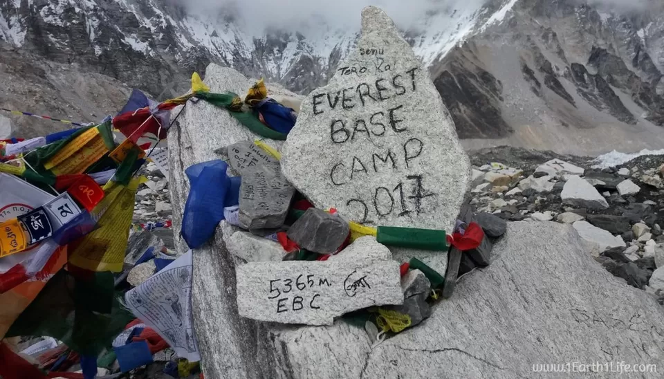
We walked at a constant non-stop pace. 2 hours into the walk, we were seeing the end of the Khumbu Glacier which marks the beginning of the ascend to Everest. Slowly and steadily we finally reached the place where we had once dreamed to be - Everest Base Camp. If you thought that this place would be remote with no signs of human movement, you would be in for a surprise. There was lots of activity with scores of trekkers congratulating each other for having made it so far. Some were even down with tears, including me. As expected, there were no climbers at the Base Camp. You will find them during the months of March, April and May where the weather is expected to be clear with calm winds on the summit. We were lucky to have witnessed a live avalanche with a thud in the far distance; a creepy feeling. After having spent an hour admiring the landscape and clicking pictures, it was time to return. For most of us , EBC was the destination point. But, for all those daring mountaineers, this would just be the beginning. They would be spending weeks acclimatizing here to bid for a summit push - a 2 month long expedition.
When you are trekking to the Base Camp of Everest, it is challenging, it is tough, it is scary, it is daunting and it is exhausting. But then, when you look up to witness the stunning landscape around you, you get to know that whilst it is all of the above, more than anything, it is rewarding and completely worth it. One has to definitely go out in the mountains. They will make you modest. They will make you humble. They will make you feel that the world is a much bigger place than where you live. Looking at them you will realize such a tiny place you occupy in this world.


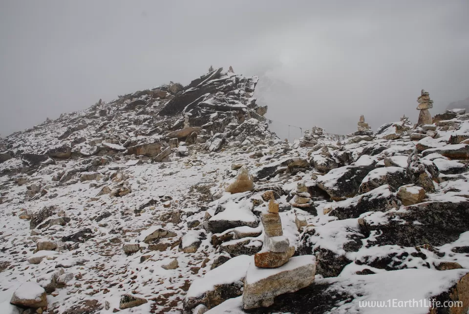
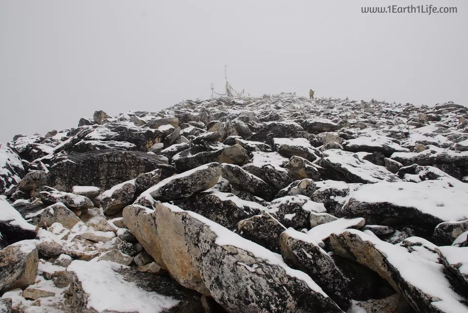
Oct 11 - Day 11 : Gorakshep (5140 m) - Hike to Kala Patthar (5550 m) - Gorakshep (5140 m) - Pheriche (4270 m)
Duration : 12 hours
Difficulty Level : Very Difficult
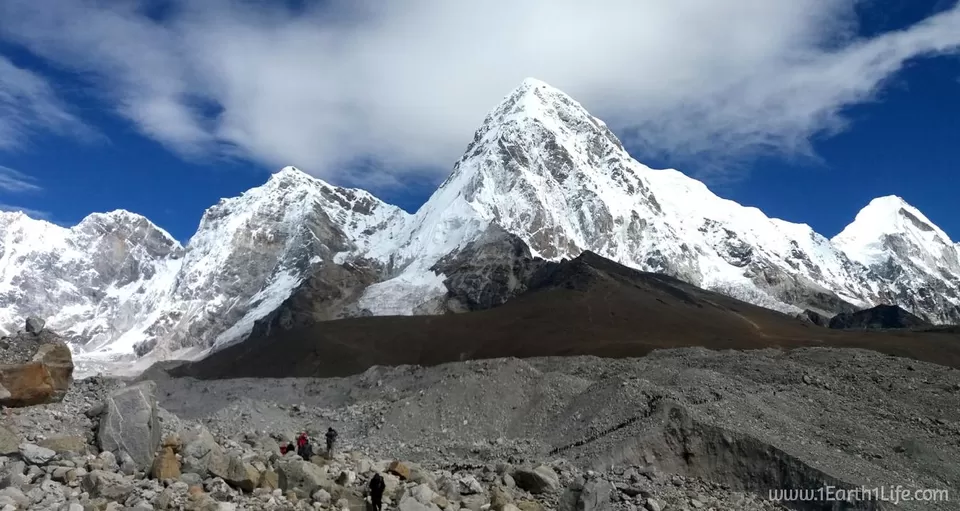
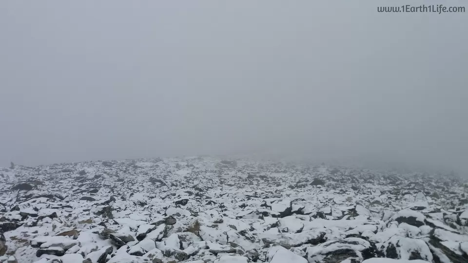
Woke up to a bitter cold morning and experienced my first snowfall ever. The temperature was definitely in the negatives and I wouldn't be surprised if it had touched double digits below zero. At those temperatures, everything that you thought does not freeze, will freeze. Your gloves, camera batteries, shoe lace, sunscreen cream, hands, nose, everything. I remember having put on 6 layers to stay warm. It is so strange how the weather changes so quickly in the mountains. The previous day was clear with sunshine and it snows heavily the next day. Today was the highest point that I had ever been to - The peak of Kala Patthar at 5550 m. I know, the number in meters is not very impressive. It is a whopping 18,208.66 ft above sea level. It was a very difficult climb with a constant inclined hike of ~60 degrees for three hours in freezing temperatures. We had started at 6 am and reached the peak at 9 am. The descend was equally strenuous on the knees but less exhausting. It took us an hour to climb down to Gorakshep.
At this point, the journey was just half done. Remember, you will have to walk all they way back from where it had all started - Lukla. It is at a daunting distance of 65 kms which had to be covered in 3 days. You know that you have accomplished your dream of reaching EBC, but the job was still half left. All the energy, excitement and enthusiasm was towards reaching your destination point and that definitely takes a beating during your retreat hike because you know that you are returning back to normalcy.

Oct 12 - Day 12 : Retreat trek from Pheriche (4270 m) to Namche Bazaar (3440 m)
Duration : 10 hours
Difficulty Level : Difficult
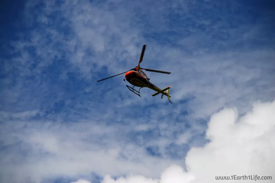
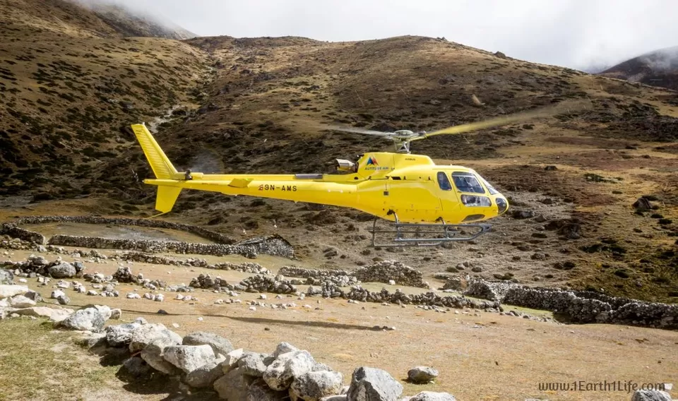
Woke up in the morning to a news that one of our team members would be evacuated by a chopper due to altitude sickness. He was clearly struggling for the last couple of days. But, hats off to this guy for his determination and grit for making it to EBC in-spite of his health issues. It took one email and a follow up phone call to the insurance company for arranging an evacuation chopper. He was flown straight to a hospital in Kathmandu and one of our team members accompanied him as a guardian. I soon realized the importance of being covered by an insurance, especially on high risk journeys of this stature and magnitude. When you know that help is not far away, you can go ahead and take risks. I realized my mistake of not having myself covered by an insurance and at the same time thanked God for my good health through out the trek.
Excerpts from my diary :
"Another long day of walking. This was a different route than what we had taken during our upward hike. Different route means, different peaks and different views. Mind boggling. The pictures clicked do not do any justice to this place. No picture can. I am really lucky to be here and witness the stunning beauty of the Himalayas."
We finally reached Namche Bazaar after 10 long hours of walking. It was 6 pm and it had turned dark. The retreat hikes are easier and at the same time challenging. Easy because you do not have to worry about altitude related issues as you are always reducing in elevation and difficult because of the distance that you have to cover per day. On an average we covered 10-12 kms during our upward hike and 20-22 kms during our retreat trek. There was no single day which was not challenging. Each day had its own ups and downs. Some days we tackled with altitude and some with distance.

Oct 13 - Day 13 : Final trek from Namche Bazaar (3440 m) to Lukla (2840 m)
Duration : 10 hours
Difficulty Level : Difficult
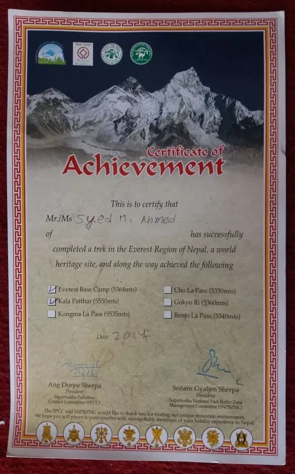
Last day of the expedition. By now, I had fallen in love with walking. I had never walked so much in my life before. Today's walk felt like it was just another day in the office. Another day where we covered 20 kms in 10 hours. We started at 7 am and while exiting the border of Namche, at the check post, we purchased our certificates. It was a paid one. It is no proof that you had been to EBC and other points of the Sagarmatha National Park. It can be bought even by people who only make it till Namche and back. Nevertheless, we got ours and proceeded towards Lukla.
Oct 14 - Day 14 : Flight cancelled due to bad weather at Lukla airport
Nothing surprising here after having experienced Lukla weather, a fortnight ago. We were waiting with a boarding pass in hand only to be informed about our flight cancellation due to bad weather. It was a run against time. I had my international flight from Kathmandu the following day. With the help of some locals, I was lucky to get a ticket and board a flight to Kathmandu the following day.
Oct 15 - Day 15 : Flight -> Lukla-Kathmandu-New Delhi-Bengaluru.
It is such a wonderful feeling when you accomplish a goal that you set for yourself. The memories and experiences gathered during this trip will definitely be cherished for a very long time.
FAQs:
I have compiled the most frequently asked questions about this trek.Click here to find them! Cheers!
Frequent Searches Leading To This Page:-
Everest base camp trek in Nepal, everest base camp trek cost from india, everest base camp trek cost for indian, everest base camp trek best time

' fill='%23359391'%3e %3cpath d='M46.1538462%2c43.5714286 L41.5%2c50 L36.8461538%2c43.5714286 L36.8670256%2c43.5714286 C36.3173077%2c42.7142857 36%2c41.6851429 36%2c40.5714286 C36%2c37.4854286 38.4535641%2c35 41.5%2c35 C44.5464359%2c35 47%2c37.4854286 47%2c40.5714286 C47%2c41.6851429 46.6826923%2c42.7142857 46.1329744%2c43.5714286 L46.1538462%2c43.5714286 Z M41.4294872%2c39 C40.6150641%2c39 39.9487179%2c39.675 39.9487179%2c40.5 C39.9487179%2c41.325 40.6150641%2c42 41.4294872%2c42 C42.2439103%2c42 42.9102564%2c41.325 42.9102564%2c40.5 C42.9102564%2c39.675 42.2439103%2c39 41.4294872%2c39 L41.4294872%2c39 Z' id='Location-white'%3e%3c/path%3e %3c/g%3e %3c/svg%3e)