
Continued.....
From this day forward we witnessed a new unexplored landscape.
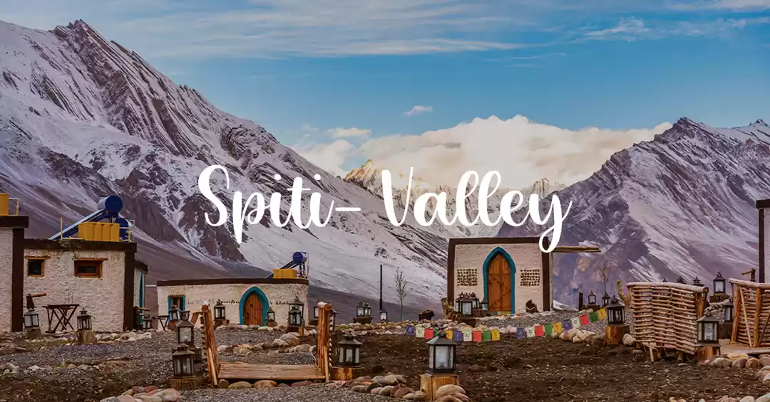
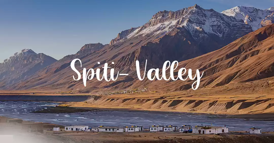
We were to explore " Spiti" - ‘a world within a world' as described by Rudyard Kipling (of ‘Kim' fame) - is a relatively unknown world, tucked away in the Trans-Himalayan belt of Himachal Pradesh. Spiti Valley is a desert mountain valley located high in the Himalaya mountains in the north-eastern part of the Indian state of Himachal Pradesh. The name "Spiti" means "The Middle Land", i.e. the land between Tibet and India
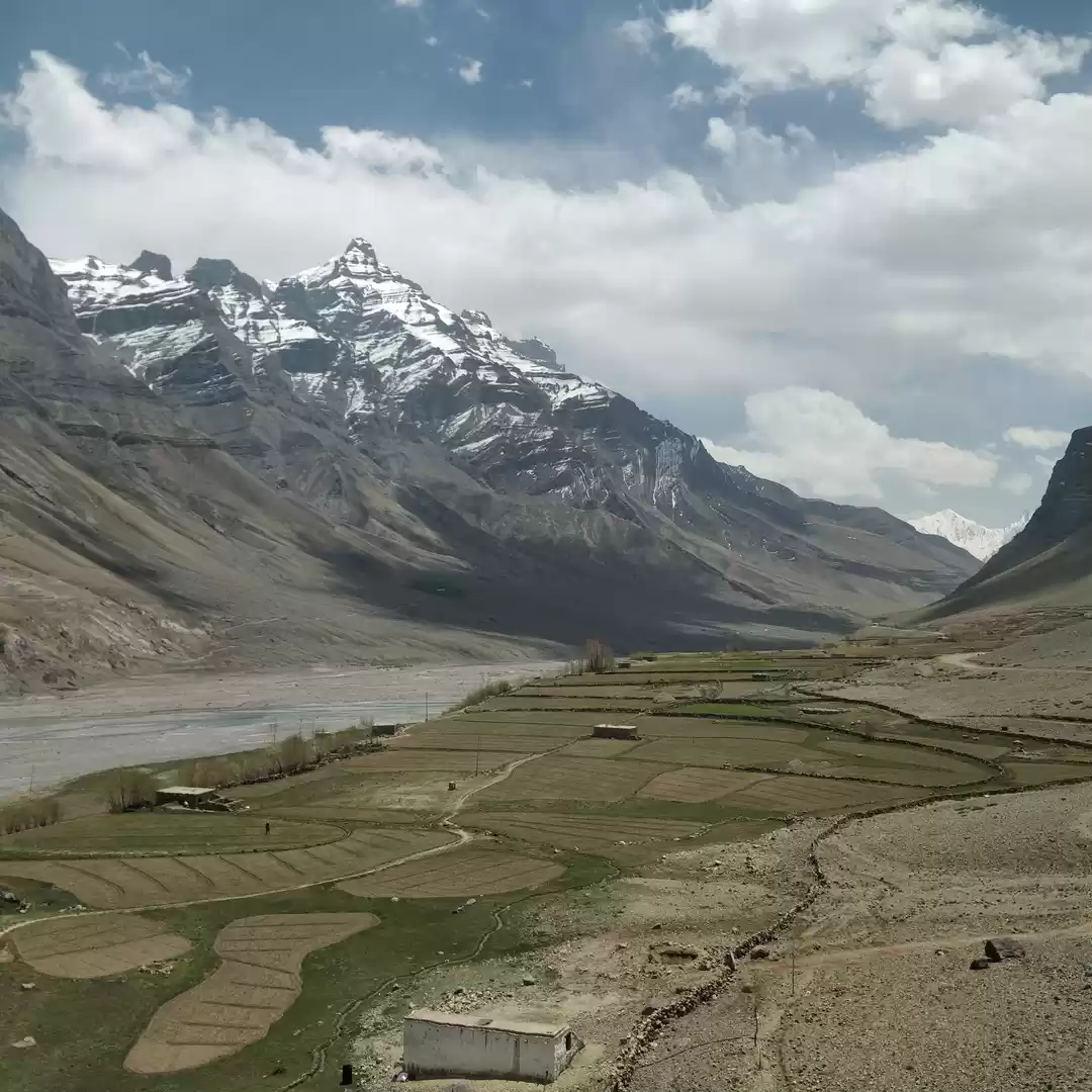
The lowest point in the valley is 11,000ft and many villages lie as high as 14,000ft. The average elevation of the mountain ranges is over 18,000ft. Spiti is poor in cultivatable land. Over the centuries, man and yak have endeavored to scratch out less than one thousand hectares in isolated patches on the flats above the silver Spiti River.
There is plenty of water in the rivers below and the glaciers above, but the searing flats are as dry as the valleys of the moon. Spiti receive some heavy showers fall but the rainfall is invariably insufficient to have any beneficial effect on the growth of crops or grass. The winter snow soon evaporates once the summer sun begins to scorch the valley.
With almost no rain but abundant snow-fall, Spiti is a land of fascinating contrasts – shocks of green alternating in a barren expanse of russet. The dry harsh climate, high altitude, lack of communications and the poverty of the land, all cumulatively, make life hard in the extreme. The searing heat in the sun, the extreme cold in the shade and the freezing temperature during the night turn sand particles into micro fine dust of countless hues whirling and floating in air on the slightest agitation.
The Journey of this valley has taken us through the surrealism, an adventure worth every penny or even more..
Continuing the travel from Kinnaur Valley further days went in exploring Lahual & Spiti Valley.
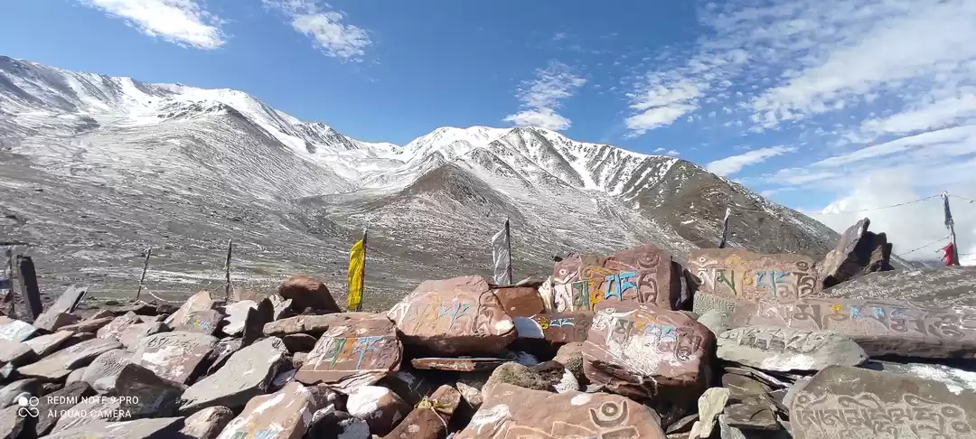
Day 4: Kalpa-Pooh-Khab-Nako-Chango
Distance: 120 Kms
Travel time:9 hrs
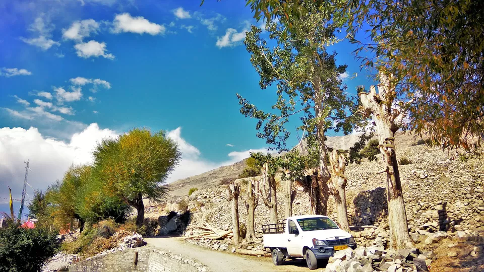
We started our journey early in the morning. Reached Karcham and from there we took right on highways towards pooh Traversed the most dangerous rugged ruble path through mountains
We cross the Sutlej again to now drive along the left bank and come upon the ‘Most treacherous road in the world’ signboard.
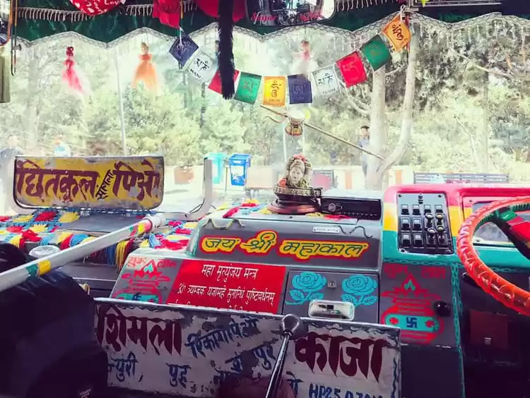
The roads are often very narrow with many stretches as narrow as the distance between the width of tyres. The soil is loose and unstable and falls or slides without any warning. The landslides in this regions are too common for entire year. And i can bet you for sure that one or the other day of your travel you'll be stuck for minutes to hours or even day on this or further journey. Lucky if you escape this. It is amazing to observe roads on such mountains and all kudus to the BRO and the way they manged to cast road through such unpredictable mountains and they work throughout the year to maintain the vehicular flow.


At powari the sutlej was along the right bank and with few stops for photography we continued our journey further. On the way we crossed Pooh and Khab
KHAB: Khab is a small village in the state of Himachal Pradesh, India. It is located in the Sutlej river valley near the India-Tibet border. National Highway 22 connects Khab with state capital Shimla. And it is here at Khab sangam(near namgia) :the confluence of Spiti river and Sutlej river. The Spiti river flowing through the spiti valley here meets the Sutlej, which originates from Mansarovar Lake in Tibet.

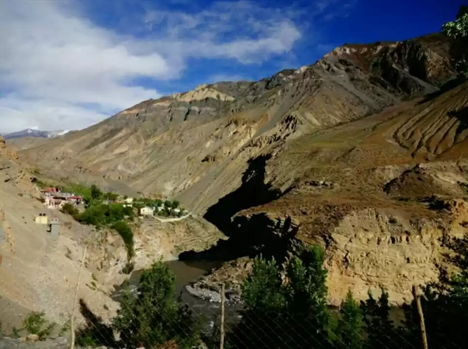
From the confluence now the Spiti River was running on our left bank. After crossing a zig-zag valley upwards. We made our 1 hr halt at Ka/Kaah to cool down our vehicle. We took this as an opportunity to capture few moments through our lenses.


From Kaah it took 1hr to reach Nako Village
NAKO: Nako is a village in the Himalayas of northern India, located near the Indo-China border in the Trans-Himalayan region of Kinnaur district in Himachal Pradesh. Nako Lake is a prominent feature here where it borders the village
Nako Lake is a small and beautiful holy lake. Early in the morning is the most scenic — if the water is still you get a beautiful reflection of the village and mountains in the lake. Follow the path around the left side of the hotel.
Walk around the small village absorbing the traditional atmosphere and architecture — it looks like it hasn't changed in hundreds of years.
There are some nice day walks around the mountains if you're reasonably fit. Behind the lake you can head up the mountain towards the visible chortens which is a nice viewpoint.
Nako Monastery is located in the middle of the village. Allegedly founded by Ringchen Zangpo in 996 AD. A complex of small old temples with fine old sculptures and frescoes.
We were surprised by the look of this village and lake and to the very fact of life away from commercialization and their happiness in it.
The barren land still was cultivated with trees ,greener than anything and everything. We had thupka and our lunch and started for lake. Lake was located on the rear of the village on east side of it. The lake was surrounded by boulders and a walkway is created all around.
After sitting and enjoying the view for 2 hrs we left for tabo. Our driver was quite unhappy for us spending so much time on one location, But we were contend.
We crossed Liti and chango in between. By 4:30 towards sumdo we observed few vehicles coming on opposite side . This seemed unusual and thus we enquired with one of the cab driver. and he said that the road is closed till morning because of landslide. We took turn and made our stop at the first village backwards ie. CHANGO. The place had less than 100 people living there. As the place was small and traveller were more we were fortunate to arrive first and book our sub standard rooms. Not happy with the rooms we went ahead to find few more places and found Himachal tourism guest house. They said tey were full but if we wait till 10:30 if other guest doent turn up tey may offer us theor rooms. We were not sure on this idea. And fortunately the owner of the Guest House arrived. After talking to him he arranged our stay at one bunglow near chango highway.
We were happy and happily gave our earlier booked stay to other travellers in need. After checkin it was already 7:30 pm and it was dark with no lights due to power cut in the area.We brought few candles before the market was closing.after few hours the power was restored and we received our dinner from the staff.
This trip was turning more adventurous day by day and we had no plans to sleep early. We were carrying few extra blankets. We spread the sheets near the sides of highway and arranged our tripod stand for capturing the most soothing Milky way with star lit sky. The view cannot be described in words as its been a long time that we have seen such magnificent sight. After keeping tripod on the reuired mode we sat on the highway beneath the sky full of stars and went on discussing from school life, college life, adventures to para nominal activities. Had food and slept around 4:30 am.
Day 5: Chango-Tabo-Dhankar-Kaza
Distance: 90Kms
Travel Time:12 hrs
Woke up by 6:00 am went for a walk on the highway to watch Spiti River flowing just beside the house on left bank. We started our journey by 9:00 am and reached Sumdo at around 09:15 am to register our vehicle for entry into Lahual & Spiti Valley (arranged by Tours and travellers). Reached Tabo at 10:30 am and started exploring the village and its ancient roots.
Tabo: The village is situated at an altitude of 10,760 ft/ 3,280 metres. Tabo is a small town in the Lahaul and Spiti district on the banks of the Spiti River in Himachal Pradesh, India. The town surrounds a Buddhist monastery which, according to legend, is said to be over a thousand years old. The Dalai Lama has expressed his desire to retire to Tabo, since he maintains that the Tabo Monastery is one of the holiest. In 1996, HH the Dalai Lama conducted the Kalachakra initiation ceremony in Tabo, which coincided with the millennium anniversary celebrations of the Tabo monastery. The ceremony was attended by thousands of Buddhists from across the world. Tabo Monastery's spiritual head is Tsenshap Serkong Rinpoche.
The temples within the monastery complex in Tabo have a plethora of wall paintings and mud statues. The Archaeological Survey of India (ASI) attempted to restore some paintings that were ravaged by time, but were not very successful. Photography, however, is not permitted inside the monastery.
This was the first monastery visit for me and i was awed by the look of it. The art in terms of wall painting, murals and stucco sculptures carved on the wall, mud painting, wooden architecture etc were primitive and colouful. The people maintaining this were humble and happy. Women from village every morning gather here for prayers and monastery works. We visited each 9 temples inside the monastery. It was very peaceful environment.It is dark inside and to prevent complete darkness, there are small windows in the walls, from where sunlight approaches Left the monastery by 12:30 and arrived at the hotel arranged for earlier night stay. Had lunch there and started for Dhankar at 2:30 pm.
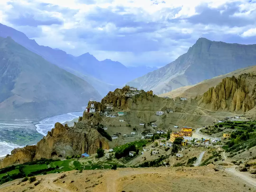
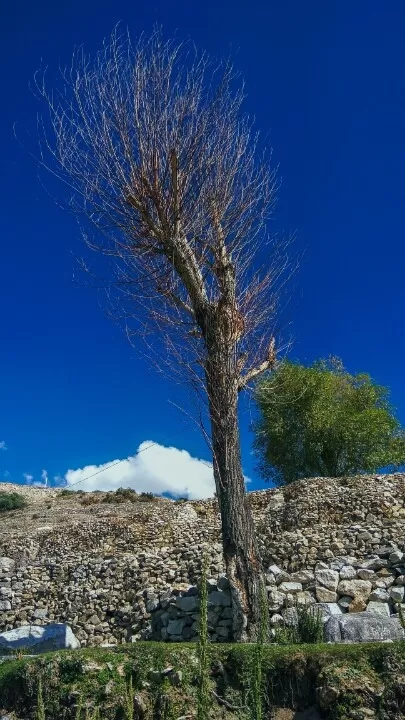
Dhankar is just like another small village in the cold desert of Spiti Valley. Untouched and away from tourists exploitation , the population of this village is not more than 100. When we arrived there around 2:30 pm. In front of us near the Dhankar Entry gate lies the Dhankar Monastery
Dhankar Monastery:It is situated at an elevation of 3,894 metres (12,774 feet) in the Spiti Valley above Dhankar Village, between the towns of Kaza and Tabo. The complex is built on a 1000-foot (300-metre) high spur overlooking the confluence of the Spiti and Pin Rivers - one of the world's most spectacular settings for a gompa. Dhang or dang means cliff, and kar or khar means fort. Hence Dhangkar means fort on a cliff.

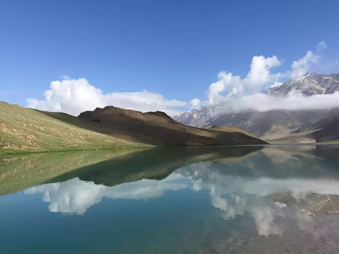
We reached by 3:30 pm .We immediately started our trek to Dhankar Lake as people said it required 2 hrs to trek one side. We started fast with only water and cameras, tripod in our hand bags. The trek was on a steep trailing cold dessert mountains. We were exhausted and had no clue how further we need to travel to see the dhankar lake. The air at such heights were scarce and trek made it more suffocating. Had many stops to reach the lake. It took us 45 minutes to reach the lake. We the tired souls were elevated by the view. The lake is a beautiful site. There is a good amount of crystal clear water in the lake and it spreads over a large area. It is surrounded by the barren hills from the sides,but still there is a plenty space left on the bank of it giving an impression of a perfect camping site. Beyond the river valley, snow-capped peaks of Himalayas are clearly visible and their reflections in the lake water frame the perfect pictures for a photographer. Ran for few meters and sat by the lake side. The air was too cold. We immersed our foot in the lake and came out right away. The water was chilled and our feet became insensitive. Walked around the lake . Started our trek back to the monastery. Reached by 6:00 pm. There is a small temple being build by the local people on a side of the lake. There is a pole with lot of prayer flags on the other side of the lake.

Started for Kaza late evening and reached by 8:30 pm.
KAZA:The town of Kaza, Kaze or Kaja is the subdivisional headquarters of the remote Spiti Valley in the Lahaul and Spiti district of the state of Himachal Pradesh in the Western Himalayas of India. Spiti, which is a part of the Lahaul and Spiti district of Himachal, is a high altitude or cold desert having close similarities to the neighbouring Tibet and Ladakh regions in terms of terrain, climate and the Buddhist culture. Kaza, situated along the Spiti River at an elevation of 3,650 metres (11,980 ft) above mean sea level, is the largest township and commercial center of the valley .
The place of our stay was located on the outskirts on highway to losar. Th hotel was " The Cliff Palace" a standard stay. We moved our luggage and got settled by 9:00 am. Requested the owner to open the terrcae for us and to cook the maggi what we were carrying.They fulfilled both our request. We again did the same setup as Chango and sat on terrace with drinks and maggi. Th dinner was kept in our room for late night snacking. We were lucky in every respect as the sky was clear with milkyway and stars more brighter with great setup behind it. With music playing in background and some old stories in hand we celebrated birthday of my brother in law with magi cake and drinks.
Sat there till 2:30 pm and slept off on site of bed. We knew while going for sleep that morning will definitely bring more cheer to our adventure.
Day 6: Kaza- Langza-Komic-Kibber-Kaza
Distance: 86 Kms
Travel Time:10 hrs

We woke up early at 7:30 am and went for local sight seeing. We reached Seven Stupas. Offered our prayers and again walked for few meters for Sakya Tengyud Monastery. This newly built monastery has maintained all the sanctity and holiness of Buddhism and makes every effort to keep its vicinity clean and fresh. The moment you enter, you breathe-in spiritualism. we arrived at 7:45 am and the gates were closed. We sat on the long stairs just enjoyin the view when one of the monk passing by informed that te monastery will open in 5 more minutes . The gate opened at dot 8:00am and all the monks started arriving from there in campus stay. The hustling one were the younger monks followed by aged disciplined older monks.s They all sat on the seatings provided for offering prayers on left and right hand side in line. In the center was the statue of Buddha with many wall paintings, statue, and colourful flags. We sat on the rearest line and enjoyed the prayer and the interior of Monastery till 8:30 am. They served us hot tea which was to be consumed after the prayer. The red and yellow attire was amazing. And it was amazing to know that they have all the modern accessories to prevent cold but that too in red or yellow colour :-)
We had our breakfast at 9:00 am and started by 9:30 am.. We reached Langza by 10:30 am.
LANGZA: known as "the fossil village". Fossils of marine creatures and plants are found in plenty under the sedimentary rocks. These fossils are around millions of years old. Although possession and collection of fossils are illegal in India, the locals in the village sell these collectibles to the travellers visiting their village.. Langza is also famous for its huge Golden coloured Buddha statue which is believed to be around 1000 years old. Langza is also considered to be one of the highest villages in the world with a motorable road. Owing to its proximity to Tibet in China, the population of the village is predominantly Buddhist and belongs to the Sakyapa sect of Tibetian Buddhism. The village has a population of about 137 people living in 33 houses.

The sight was amazing. We can see snow clad mountains on north west of us and valley of kaza on eastern side. After being there for an hour. we started for komic.
KOMIC: Komic ('Ko'- snow cock, 'Mic'-eye), situated at an elevation of 4513 meters is one of the highest villages in Asia and literally means the eye of a snow cock. This quaint little farming village houses a population of 84 in 13 households. One of the world's highest monasteries (4513 meters), called "Komic Lundup Chhemo" is situated in this village and belongs to the Sakyapa sect of Tibetan Buddhism.. This monastery is also famous for being highest motorable Buddhist monastery in the world.
The Tangyud Monastery (also written bTang-rGyud, Tangyuth) or Sa-skya-gong-mig Gompa at the village of Komic, two km southeast of Hikkim in the Spiti Valley of Himachal Pradesh, India, is built like a fortified castle on the edge of a deep canyon, with massive slanted mud walls and battlements with vertical red ochre and white vertical stripes which make them look much taller than they really are. It is one of the highest altitude gompas (monasteries) in India, at an altitude of 4,520 metres (14,830 ft), on the edge of a deep canyon and overlooking the town of Kaza, Spiti 4 km to the west. It is located on the periphery of the Kibber Wildlife Sanctuary.
We visited the monasteries and chatted with one of the tailor of cloth painting. He described us about the tibbetian flags and the history of the monastery. Taking photograph was allowed here. We toured around and had few personal crazy group pics inside the fortified walls.
From there we went ahead for Hikkim
HIKKIM: popularly known for the Highest Post office in the world. The hikkim is located at a towering altitude of around 14400 feet above sea level. Hikkim also has the highest polling booth in India.
Hikkim much like the other two villages in the velt iss rich in fossil life since it was also a part of the mighty indian ocean before the Himalayan fold mountains were formed.
We walked downward searching for the post office and found it. I thought that since this was the only known tourist destination for the town , it will be heavily decorated with lot of ads etc. But to our surprise it had nothing but a regular post office board situated inside one simple house. That's the simplicity of the place.
We sat there writing postcard for our family and us. The moment will remain in our memory. Writing a postcard pouring love, memory into it and that experience of reaching some place unknown and that only charged us 25 rs each postcard.
Reached the hotel back for lunch at around 1:30 pm and ordered food. For the one sleeping in morning when three of us walked down in morning to the monasteries we took them to monastery again. We took some photograph. Had food and left for Key Monastery.
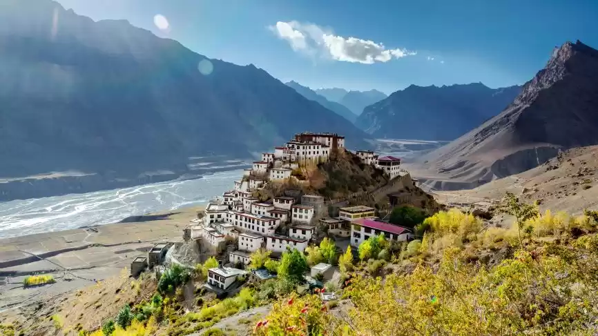
KEY MONASTERY: Kye Gompa (also spelled Ki, Key or Kee - pronounced like English key) is a Tibetan Buddhist monastery located on top of a hill at an altitude of 4,166 metres (13,668 ft) above sea level, close to the Spiti River, in the Spiti Valley. It is the biggest monastery of Spiti Valley and a religious training centre for Lamas.
Kye Gompa is said to have been founded by Dromtön (Brom-ston, 1008-1064 CE), a pupil of the famous teacher, Atisha, in the 11th century. This may however, refer to a now destroyed Kadampa monastery at the nearby village of Rangrik, which was probably destroyed in the 14th century when the Sakya sect rose to power with Mongol assistance.
Kye was attacked again by the Mongols during the 17th century, during the reign of the Fifth Dalai Lama, and became a Gelugpa establishment. In 1820 it was sacked again during the wars between Ladakh and Kulu. In 1841 it was severely damaged by the Dogra army under Ghulam Khan and Rahim Khan. Later that same year suffered more damage from a Sikh army. In the 1840s it was ravaged by fire and, in 1975, a violent earthquake caused further damage which was repaired with the help of the Archaeological Survey of India and the State Public Works Department
The walls of the monastery are covered with paintings and murals, an example of the 14th century monastic architecture, which developed as the result of Chinese influence.Kye monastery has a collection of ancient murals and books, including Buddha images.
There are three floors, the first one is mainly underground and used for storage. One room, called the Tangyur is richly painted with murals. The ground floor has the beautifully decorated Assembly Hall and cells for many monks.
Kye Gompa now belongs to the Gelugpa sect, along with Tabo Monastery and Dhankar Gompa, one of three in Spiti.
The monastery of Kee, for instance, accommodates nearly 350 monks, who reside within the sacred walls in winter, and stay during the summer with their parents or brothers, working in the fields, or employed in carrying travellers' goods. These monasteries have their regular heads, or abbots, and the higher ecclesiastical titles can only be obtained by the candidates proceeding in person to either Shigatzee (Shigatse) or Lhassa (Lhasa).
After walking around few us wanted to capture the postcard few of the Gompa and started trekking. Three of us wanted to travel to kibber and started leaving three at Key to pick them up on our way back.

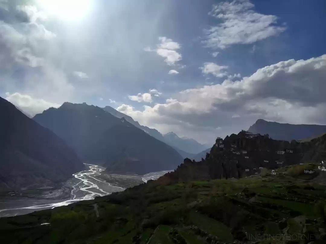
KIBBER: The route to Kibber was scenic and we reached in Twenty Minutes. The village was once famous for being the highest inhabitated and motor-able village till komic came in picture. The village had views ti die for. The houses here are closely located , painted in white and the roof of all the house are stacked with stacks of dried for preventing snow to enter through terrace. and also for burning in winter. The area is known for Snow Leapord and
We were there for one hour watching the place glory and left for Key Gompa. We wanted to capture key gompa from down the hill and asked our driver to pick two of us on our way down. We trekked down from narrow stretches and reached the road below. Took few pictures and were waiting and walking on road. It was turning dark and being unaware of the village nearby we waited and finally our cab arrived and we left for the Hotel. We observed light showers in evening and it was all cloudy. and we were tired. Shared our images from both the places. reached by 8:30 pm and after having our dinner slept by 1030 pm to start early next morning.
Day 7: Kaza- Losar- Kunzum La-Chandratal Lake
Distance: 90 Kms
Travel Time: 9 hrs
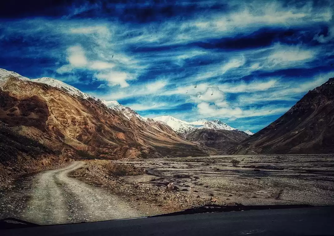
Today we left hotel after having breakfast early by 9:00 am . Reached losar village for tea by 10:30 am. The route was mind boggling. The mountains were taller. The valley was flat. The bank of river were creating beautiful structures due to erosion. The terrain was becoming drier and drier when heading upwards. Now the roads were more zig zag, narrow, rugged ruble path with No road above losar village. The sky was much clearer and their was hint of all colour ranging from red, blue green, white silver, shades of brown etc. This was indeed a paradise away from civilization in the laps of nature with its vividness so rare and magnifique.
We reached Kunzum la at around 12:00 pm. i was getting speechless in describing the view day by day. Their was a passage made to reach the Kunzum mata Stupas. This was decored by numurous thread of Tibetian flags. Flowing heavily and fully with the chilled winds hustling through. On the north was snow clad mountains so near that we can feel the snow fall in that mountain on this peak too.This peak has its own glory. The air was so chilled that we were not able to unmask our noses. We visited the temple and went walking towards the mountain side. Sat their creating timelapses and photo memories.
Started at 1:30 pm towards chandratal. Now we had Chenab river on left side of us. The roads are dangerous with waterfalls becoming nallah on places making the soil more collapsable. You have to be very attentive while driving on this route. Even one blink of eye will lead to fall in the gorge with only rocks and a narrow river chenab flowing below. The zig zagness, the uneven rubbled surface and the road width were dangerous to drive. We just had some faith in our driver as he was driving in such location for past 20 years. We reached Chandratal Base camp by 3:00 pm.
We were hungry as we had no option of food on the way and went to the camp Kitchen. They were closed as it was 3:15 pm . We requested them to give us anything and cooked us maggi. We had maggi as our lunch and were ready by 3:30 pm for trekking to lake 3 kms away. Trekking takes 1 hr 50 minutes. Three of us were in no mood to trek as we already had trek for last three days. I requested driver to drive three of us to the nearest location one km apart from the lake. Three guyz started trekking with just water in their bags. We went in vehicle wit all the luggage. We have fixed our spot and timings and we were supposed to wait for other to as we were supposed to land up early. The cab slowly and steadily climbed up on again very narrow zig zag lane. We were running fine and then suddenly felt the jerk and saw our vehicle stranding down on hill side. Three of us hurriedly shifted our-self out. Put some stones on the tilted side of cab and asked our driver to come out. We were only able to fetch few bags in our hand . The cab was hanging on hill side with only rocks and river below.
We realized just then that we escaped death. We asked our driver to calm himself and started flagging to far away vehicles for help. One cab arrived and took our driver to the base camp for getting some help as one vehicle was not sufficient for pull the vehicle out. Our driver asked us to complete our trek and meet him at the base camp below. We told him to be careful of himself while trying to pull the cab out and leave the vehicle and luggage there only if unable to. We were forced to trek as their were no signals for cellphone and we will not be able to contact other three who were trekking. We had only camera bag, tripod, lense bag and a purse with some water at our disposal. Everything else was hanging there with the cab.
We reached the site by 5:00pm but couldnt trace our other members. I wanted to stand on the highest peak to search for them but were not able too.. Then we deccided to sit near the chandratal lake. and wait for them.
The sight and everythin was great but i was in great tension of finding the other three. I started zooming my camera and taking photographs of farthest location. In one of the pic i can find three prople climbing down through other side. I was relieved. And i was ready to capture and feel the landscape . The very own chandratal Lake. There were no major travellers at sight and it was serene torquise water upfront and deep blue water at the latter part amidst dark brown mountains.
Chndra Tal / Chandra Taal / Moon lake is situated at a height of 4300 m and 7 kms away from the Kunzum Pass in Spiti and Lahaul district of Himachal Pradesh India. Boasting of a circumference of about 2.5 kms, the deep blue-water of Chandra Tal Lake is the source of the Chandra river. According to legend, this lake is the location from where god Indra’s chariot picked up Yudhishthira, the eldest of the Pandava brothers. As a result, this lake is a revered one and draws a large number of devotees.
We soaked our legs ad sat their relaxed. We thought we arrived in heaven after that death escape.
Finally the other three arrived. We told them entire story . They took some phot and we left the place by 5:45 pm. We trekked up first and then down through great lanscape. Saw glacier melting into a lake and walked further Down. Our reference was one mountain which was towards the camp side. Prople were getting lost here and you have no one to ask for help. We trusted our guts and kept running down and saw the base camp from top.
We hit the bottom of base camp and saw our driver & cab coming from the road away from Chandratal lake. He was shaking with fear. He considered this day as his rebirth and wanted to celebrate in his own way :-)
We were given our camps and it was getting chillier minute by minute. We asked him not to untie the luggage and keep it as is. But only took our pursse and camera inside camp. It was so clod that no one was ready to explore the camp and its surrounding and were deep inside the blankets given in three layers.
We were called for dinner. We were in no mood to step out but ad to as we hardly had something for lunch. The food tasted great. The Camp owner told us that this week was their last week for camp setup and they will move by the weekend and come here again in next summer. Scarcity of things will be only witnessed at such places.
We went again into our tents. I had seen the sky and made my mind to click few pictures of milky way as i was aware that this was my last day for a while to witness a sky so clear and of course te milky way. With determination i came out of tent with camera. I had no intention of setting up tripod and used one of my shoe as base for camera setting and stability. I git the perfect clip and went inside the tent with satisfaction and slept peacefully. The temperature was -9 degree that night.
Day8: Chandratal- Batal-Gramphu-Rohtang-Manali
Distance: 130kms
Travel Time: 12 hrs
We woke up expecting it to be much chillier but to our surprise it was bearable. We had no mind of having an bath. Just had our freshening up and breakfast and left by 8:30 am. Reached Batal at 10:00 am. On chacha Chachi ka dhaaba we had our parathas most amazinly prepared and left by 11:00 to chattru.
We reached Chattru by 1:00pm Had some maggi and again left for Rohtang pass.
The terrain from chandratal was again changing visually with many waterfalls amidst rocky grassland to cultivated mountain trees to thick forest till we reached rohtang. We also witnessed the heard of horses with perfect view. From batal to Rohtang Chenab River was flowing parallelly along on left side till Chattru from where it was flowing on right till rohtang pass. Gramphu was the last village in Lahual & SPiti Valley.
Rotang Pass:Rohtang Pass means pile of corpses, due to people dying in bad weather trying to cross the pass (elevation 3,978 m (13,050 ft)) is a high mountain pass on the eastern Pir Panjal Range of the Himalayas around 51 km (32 mi) from Manali. It connects the Kullu Valley with the Lahaul and Spiti Valleys of Himachal Pradesh, India.
On the lower side towards manali lies the temple of Beas. The place from where beas river originates.
We halted for half and hour there and left for marhi. Had lunch and drive further down towards solang valley. We went on to visit the Rohtang Longest Tunnel project as our friend was working there and had an amazing experience on witnessing the construction of world longest tunnel of 8.9 km. We felt proud for our friend. Met the staff and started for Manali : our last destination. We reached manali by 6:00pm .
With some freshening up we went to mall road for dinner.This was our last night of this adventurous journey and wanted to celebrate . We wanted in our life more of such journey with like minded travellers. Had amazing apple cider at local restaurant with amazing food and slept off after reaching back.
Day 9: Manali- Kullu- Mandi-Chandigarh-Delhi
Distance: 557
Travel Time:12 hrs
This day was only about reaching Delhi airport on time
This was an end to the amazing journey of Nine days. We experienced different life, place, culture & heritage. We felt in love with this place and will always be willing to explore this land further.
COSTING OF TRIP:
Cost for 10 days transportation, lodging , Breakfast & dinner,: 13000/ head
Cost of flight to and fro Bangalore: 6000/ head
Cost of lunch +Hotel tip(generous)1+ One day extra stay+Drinks and snacks: Depends
Therfore Total Cost: Rs 19000/head
DO's & DONT's:
Dont take excessive luggage than required
Take cloths in layer (Two set of thermal+ full Sleeves T shirt+ Jacket)
Take required medicinal kit (if possible try to equally distribute among team so that it consumes less space)
Take abundance of sun screen lotion
Goggles+Gloves+Head Gear+Muffler/Scarf+ Socks+Trekking shoes
Camera + Lenses+ Tripod + Filter + Batteries/ Charger + SD cards
Mobile phone + charger+ power bank
Trekking bags+ water bottles
A lot of songs on your phone
I ll end up this story by one line close to me:
"Two roads diverged in a wood and I- I took the one less travelled by" by Robert frost.
Keep exploring the new lands!!! Keep travelling!!!
Cheers!!!
Sudha
Frequent Searches Leading To This Page:-
9 nights 10 days himachal package, himachal tour package for couple with price, himachal pradesh tour package for family, himachal tour packages for couple, himachal tour package 5 days, spiti valley trek the himalayas

' fill='%23359391'%3e %3cpath d='M46.1538462%2c43.5714286 L41.5%2c50 L36.8461538%2c43.5714286 L36.8670256%2c43.5714286 C36.3173077%2c42.7142857 36%2c41.6851429 36%2c40.5714286 C36%2c37.4854286 38.4535641%2c35 41.5%2c35 C44.5464359%2c35 47%2c37.4854286 47%2c40.5714286 C47%2c41.6851429 46.6826923%2c42.7142857 46.1329744%2c43.5714286 L46.1538462%2c43.5714286 Z M41.4294872%2c39 C40.6150641%2c39 39.9487179%2c39.675 39.9487179%2c40.5 C39.9487179%2c41.325 40.6150641%2c42 41.4294872%2c42 C42.2439103%2c42 42.9102564%2c41.325 42.9102564%2c40.5 C42.9102564%2c39.675 42.2439103%2c39 41.4294872%2c39 L41.4294872%2c39 Z' id='Location-white'%3e%3c/path%3e %3c/g%3e %3c/svg%3e)