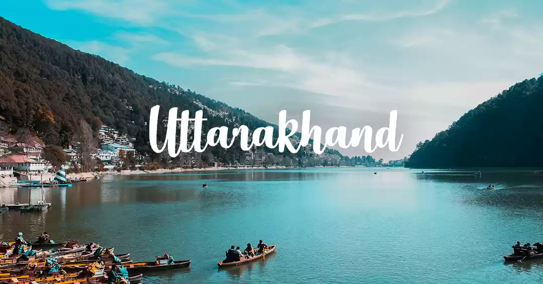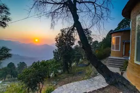


Roopkund, also known as Mystery lake or Skeletal Lake, nestled in western Himalayas on the lap of Mt Trishul...It is arguably the quintessential Himalayan trek for every trekker who loves the Himalayas. The surreal beautiful landscape with a pinch of mystery and myth makes it very adventurous. It's got everything going for it. Deep alpine forests, gurgling rivulet, incredible campsites, miles of green meadows, snow capped mountains, taste of Himalayan village life... a perfect fusion of mystery, myth and adventure as you hike up from around 8000 ft to 16000 ft in just 5 days.
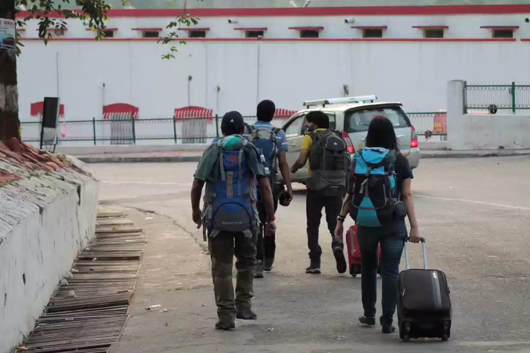
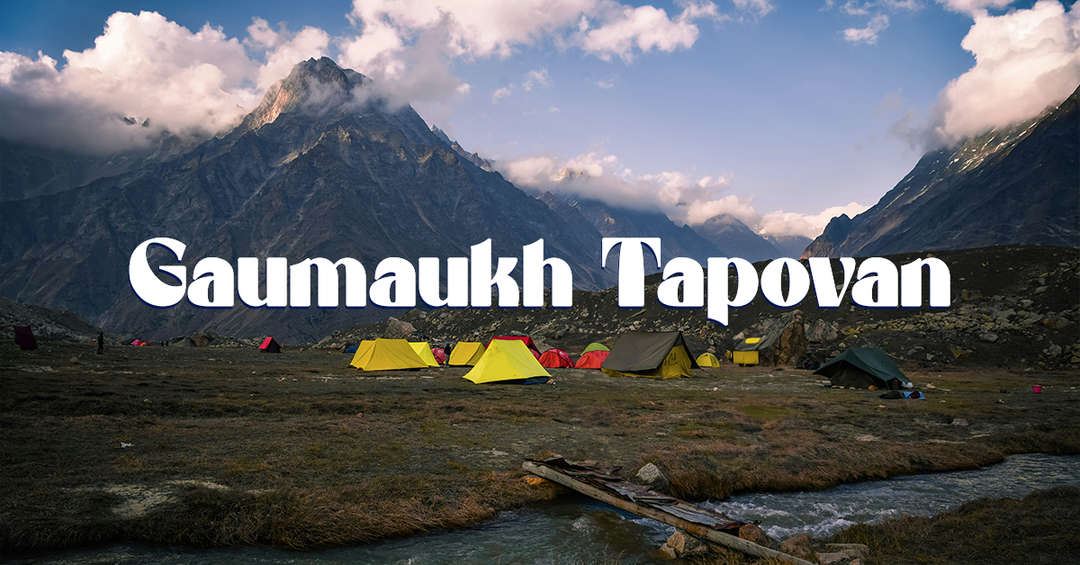
It is glacial lake situated in Chamoli district of Uttarakhand, India. What really pushed me for this trek was those stories about the human bones that are lies in the bed of the lake for centuries..but this should not be the only reason for taking up Roopkund trek. There are lot many thing to witness in this trek as you progress in the trek you get to notice gradual change in the surroundings. Our starting point of the trek was a small town called Lohajung, it is around 8 hrs drive from the nearest rail head i.e Kathgodam.
Starting from Lohajung the first day's trek is bit hectic one as it don't offers you anything special in its course. Its a simple jungle trek in its initial path then an uphill hike to the village of Didna. You pass through deep forest with well laid out path, with some villages here and there, you'll cross some streams of water in the way to Didna. Didna is a small village with some handfull of homestays, this village still don't have any electric connectivity yet.
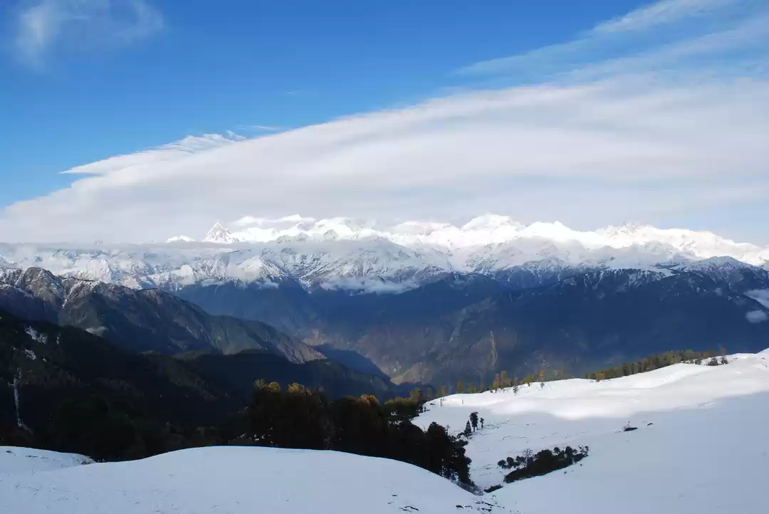
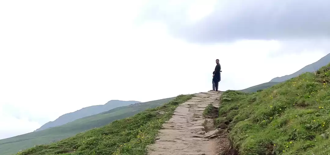
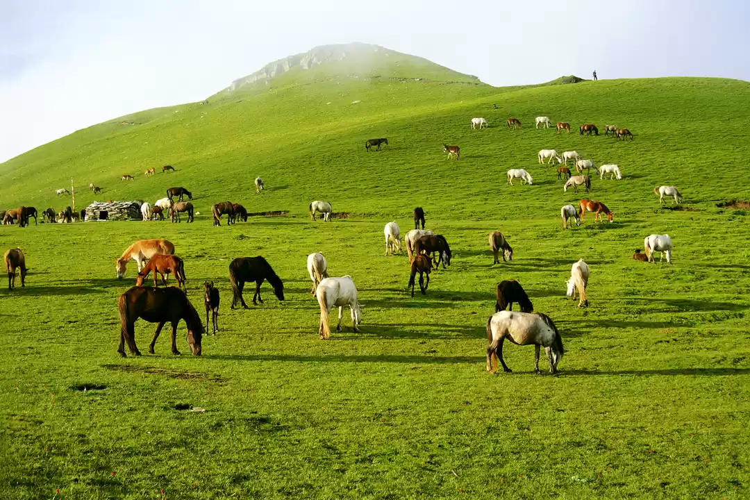
Roopkund trek really opens up from the second day...it is the day when trekkers hike up from Didna village to the most beautiful meadows of India, Ali Bugyal. It is a tough day as the hike from Didna to the start of the meadow, where the tree line ceases is a knee breaking climb, but it is equally rewarding as after a hard climb you suddenly visualizes an ocean of green meadow in front of you, the feeling is incomparable indeed. The next part is just a serene stroll in the meadow to your next campsite, which gives you a great view of Himalayan range on a clear day.
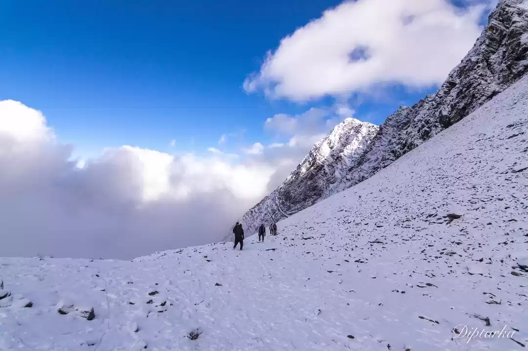
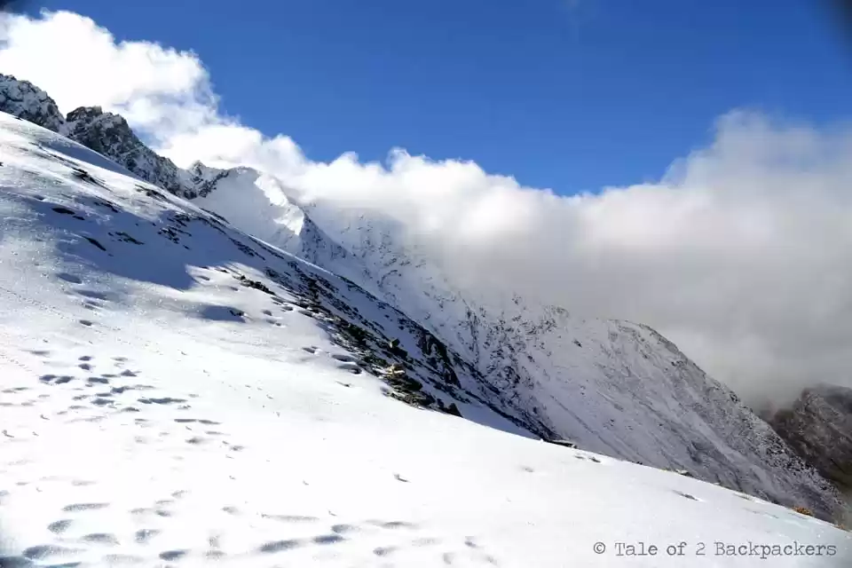
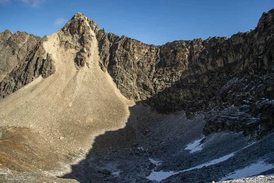
As trekkers leave behind treeline and enters the meadows , the next day it turns out to be a rugged landscape as the trail towards the Holy lake takes you from the green meadows to the higher ridges of Pathar Nachauni. The third day trek from the meadows of Ali Bugyal to Pathar Nachauni is the easiest day in the entire trek, it is a gentle uphill trek along the rocky path. From Pathar Nachauni the glamorous part of the trek ends and serious things comes in. You are now in the higher ridges of the mountain well above 11000 ft almost devoid of any greenery around and the night can be real chilly. There are some very scenic camping ground here. As it is a short trek, trekkers can spend some more time here and can relax their body before the toughest day of the trek, which is the fourth day trek from Pathar Nachauni to Baghwabasa vis Kalu Vinayak. The day's hike is tough and painful as it is a straight uphill steep climb from Pathar Nachauni to Kalu Vinayak but from Kalu Vinayak to Bagwabasa is mere saunter on an evenly laid out path. From Kalu Vinayak, majestic views of Himalayan ranges opens up and if you are doing this trek in the month of September and October, then you are bless to witness the holy Brahma Kamal flowers in full bloom in between the trail to Bagwabasa camp site from kalu vinayak shrine.
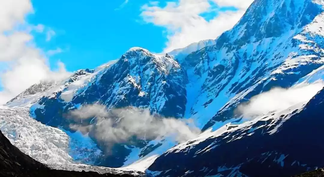
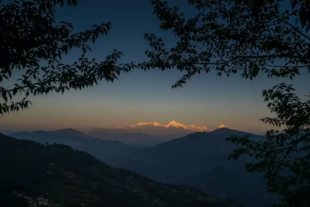
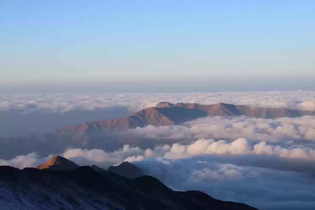
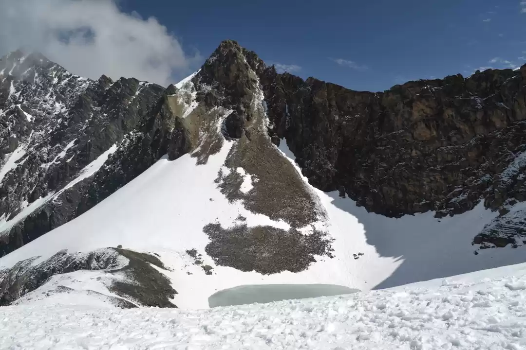
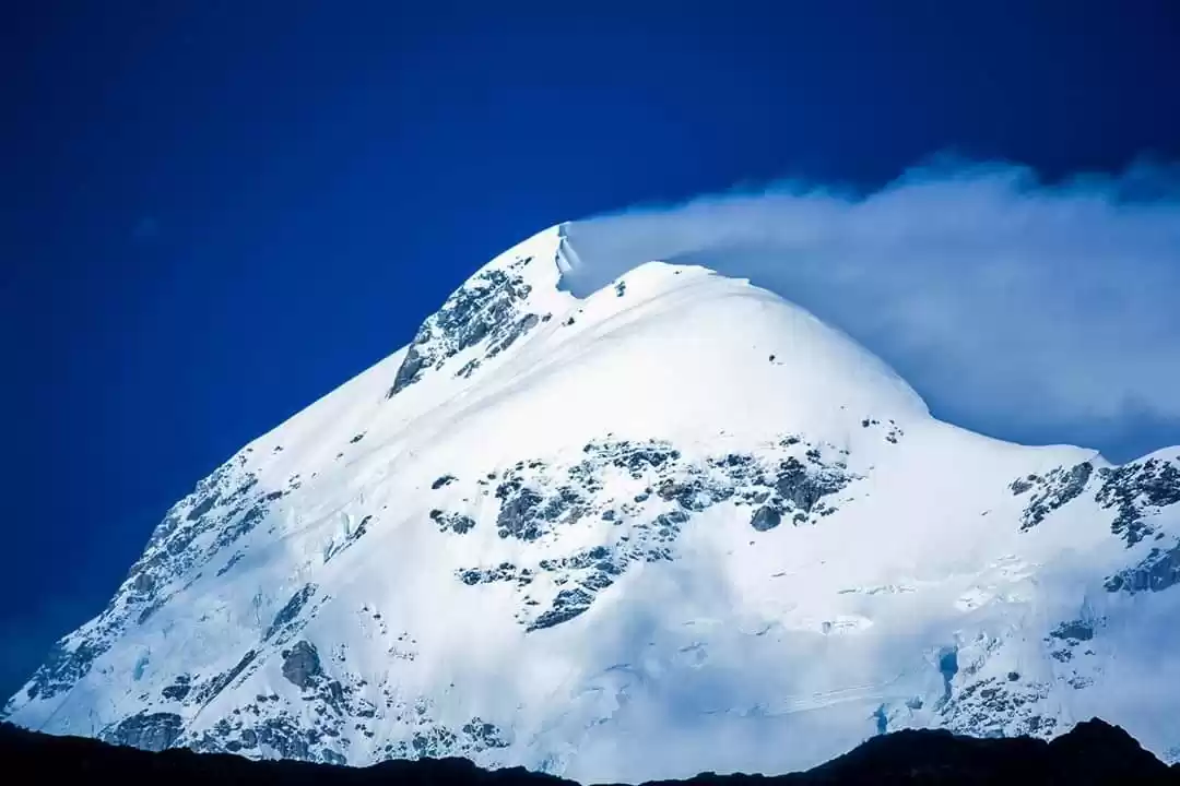
Bagwabasa is the last point of the trek where trekkers spend the night before they make their final push for Roopkund and Junargali. The weather of Bagwabasa is very uncertain, situated at an altitude of above 14,200 ft, it faces some serious wraths of climatic anomalies. Sometimes tekkers also tend to face some kind of health issues at these heights. Spending a night at Bagwabasa can be very difficult at times because of the sheer cold and very early start to the final trek to Roopkund. A 3kms trek from Bagwabasa takes you to the Holy lake, but the last 1 kms is a knee breaking climb and can be very difficult when it is covered with snow. The final day in any trek becomes very exciting,same goes for roopkund also, as the first rays of the sun hits the mountains in the horizon you are already a kilometer away bagwabasa camp, golden rays lit up the summits of Chowkhamba, neelkanth and many other peaks...the topography around becomes rocky and rugged.One more speciality of Roopkund trek is , until and unless you actually reach roopkund you can never see the lake from a distance, one can only see the ridge beyond which the mysterious lake resides.
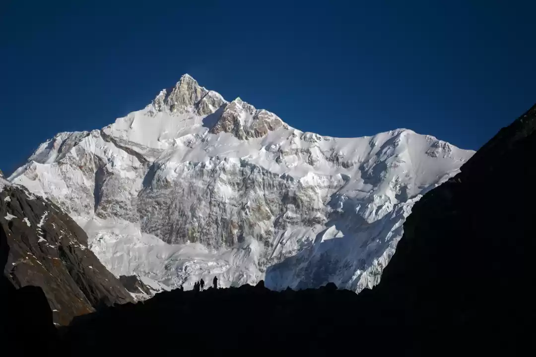
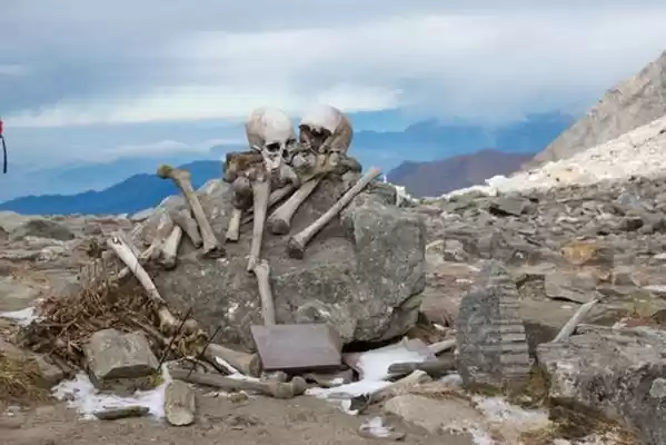
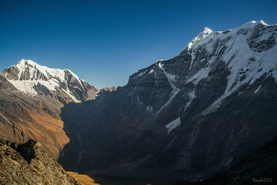
Reaching the top of the ridge, suddenly the mysterious skeletal lake stands in front of you. One can go further upto the top of the mountain and reach Junargali to get a hand stretch distance view of Mt Trishul and Mt Nanda Ghunti.
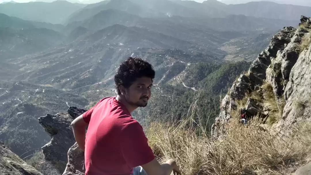
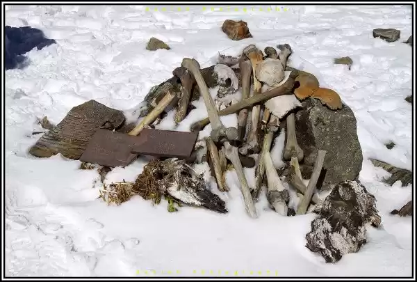
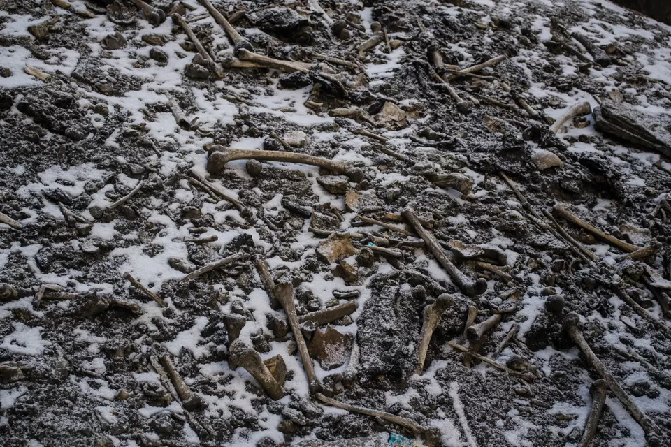
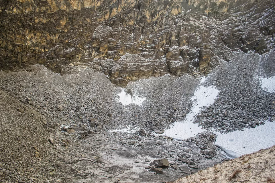
I reached Roopkund on 13th October 2015, 9:21 a.m, was blessed with clear weather considering previous night's blizzard at Baguabasa camp, To be very honest, I was bit disappointed when i had the first sight of this holy lake after a hard climb, was expecting the "cliched" imagery of roopkund that we all gets to see in the internet, a small turquoise blue water body amidst milky-white snow everywhere...alas!!! I wasn't that lucky to get that view,it was fully dry devoid of any water..but when you miss something you certainly get something, we got the opportunity of exploring the dried up bed of the lake full of scattered bones and skulls of the human.
Getting down from Roopkund is not very difficult as the sense of achievement works as a self booster, but it is a long day as you ends your trek way down to Pathar Nschauni only to have a small halt at Bagwabasa for lunch.
The last day of the trek is another long day from pathar nachauni to Wan village via Bedni Bugyal , arguably the largest meadow in Asia.It is comparatively an easy day as the trail go past the meadows of Bedni bugyal and enters the treeline again, the enchanting forest leads the trail down to neelganga from it takes you to the village of Wan, where road is connected to lohajung and even Kathgodam.
Highlights:
- Lohajung is the last place where electricity will be available.So do charge up camera batteries to the fullest.
- Explore the village of Didna as you will get a perfect taste of the lifestyle of Garhwal Himalaya
- Enjoy the walk on the twin meadows of Ali Bugyal and Bedni Bugyal to the fullest. Do not take a quick walk just to reach the camp site, take ample amount of time on the meadow, enjoy the surrounding views of snow capped peaks,wild horse grazing, relax a bit.
- Do not miss out on the different folklore that are prevalent among the locals about roopkund from the guides and porters.
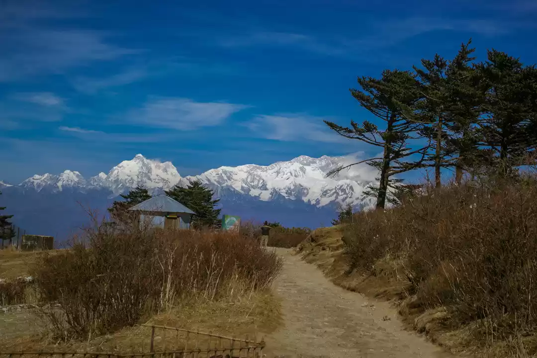
- On the way to Roopkund on the final day, do lookout for the peaks on your left. A plethora of western Himalayan peaks opens up in the far left.Ask you guide about those peaks.
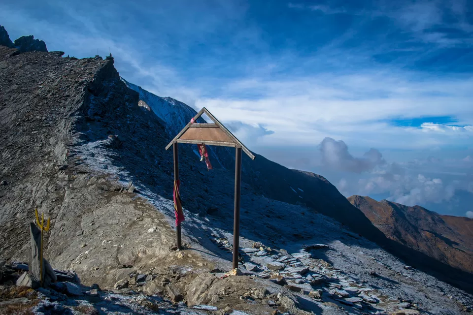
- Do not miss out on Junargali top until and unless you are really not well to make it or the weather turns out to do the spoilsport.
- If you are undertaking the trek in the month of September and October, do lookout for BrahmaKamal flowers and if you are lucky you may even spot elusive Fenkamal and Hemkamal.
- While approaching Wan village, do lookout for huge Cyprus trees along the track, the stems of these trees are so thick that it takes 3-4 persons to encircle it.
- The best time to do the trek is either May and June or September and October
Itinerary:
Lohajung to Didna
Didna to Ali Bugyal
Ali Bugyal to Pathar Nachauni
Pathar Nachauni to Bagwabasa
Bagwabasa to Roopkund to Pathar Nachauni
Pathar Nachauni to Wan
The starting point of the trek, a few guest housem eateries are available, a place from where you can pick up the last minute items required for the trek

First day of the trek ends in this village, a picturesque himalayan village with some basic homestay accommodation available for the trekkers.


One of the best day of the trek, huge meadow walk with wild flowers every where. Snow capped peak looms large in the horizon. An experience never to be missed.


An high altitude campsite before making it further higher up to the trail. Camping grounds are available here.

A hostile camping ground before making it to the Roopkund. Weather here at baguabasa can be really uncertain due to its high altitude.


Frequent Searches Leading To This Page:-
Roopkund trek in uttarakhand tours, roopkund trek difficulty level, best time for roopkund trek, uttarakhand high peaks is situated at, rudraprayag to roopkund, 10 best places to visit in mussoorie uttarakhand, hotel in shivpuri uttarakhand, uttarakhand tourism today
' fill='%23359391'%3e %3cpath d='M46.1538462%2c43.5714286 L41.5%2c50 L36.8461538%2c43.5714286 L36.8670256%2c43.5714286 C36.3173077%2c42.7142857 36%2c41.6851429 36%2c40.5714286 C36%2c37.4854286 38.4535641%2c35 41.5%2c35 C44.5464359%2c35 47%2c37.4854286 47%2c40.5714286 C47%2c41.6851429 46.6826923%2c42.7142857 46.1329744%2c43.5714286 L46.1538462%2c43.5714286 Z M41.4294872%2c39 C40.6150641%2c39 39.9487179%2c39.675 39.9487179%2c40.5 C39.9487179%2c41.325 40.6150641%2c42 41.4294872%2c42 C42.2439103%2c42 42.9102564%2c41.325 42.9102564%2c40.5 C42.9102564%2c39.675 42.2439103%2c39 41.4294872%2c39 L41.4294872%2c39 Z' id='Location-white'%3e%3c/path%3e %3c/g%3e %3c/svg%3e)