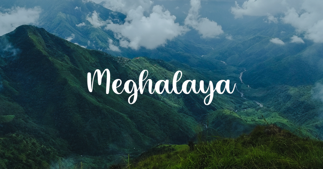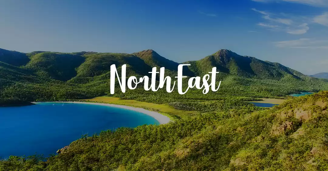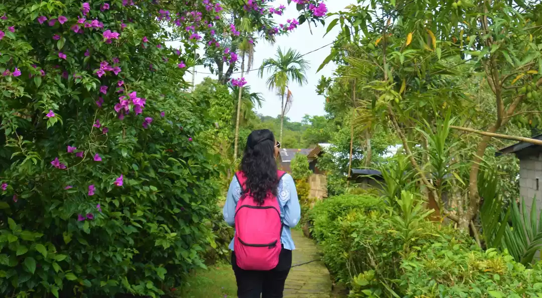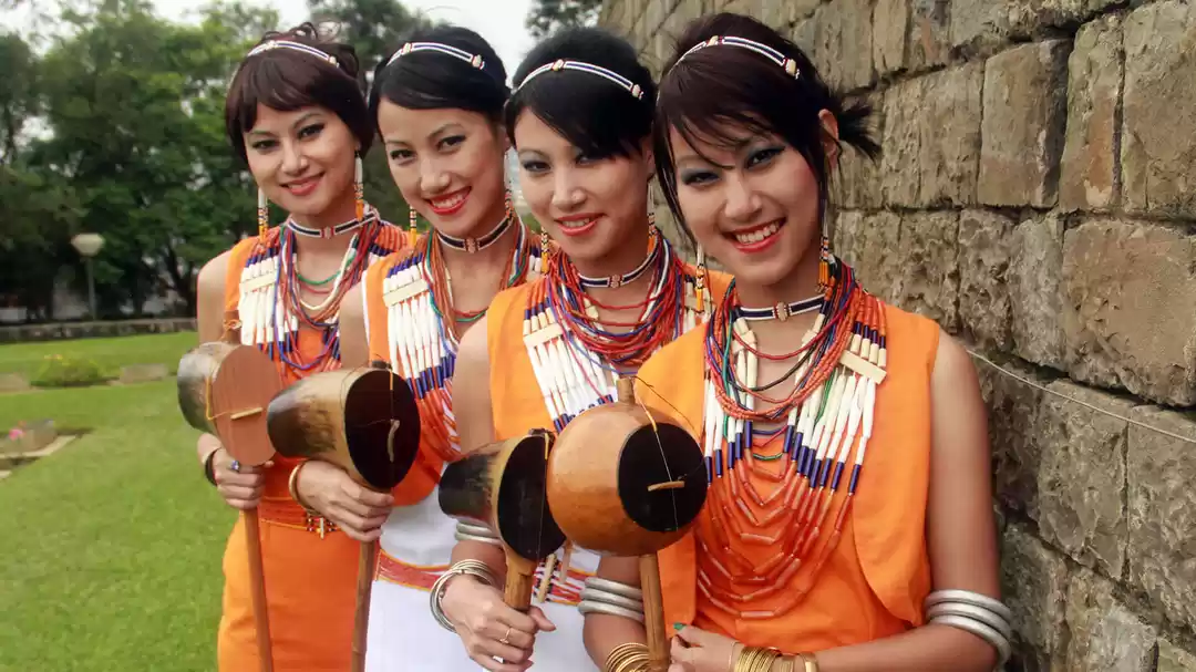
Travelling to the North-East is something that always generates lots of oohs and aahs from whoever you tell about your journey there, or your plans. These exclamations come not from ready available knowledge of the area but more from the lack of it. Leave the ability of people to tell you where to go, the majority cannot even name the states in this corner of the country. Even people who have been here sometimes never find out about many places that if they had visited, would have made their eyes pop. The case of my travels remains no different. Though I spent a considerable time here when compared to the weekend getaways that have become more popular, I leave the place with a feeling of incompleteness.
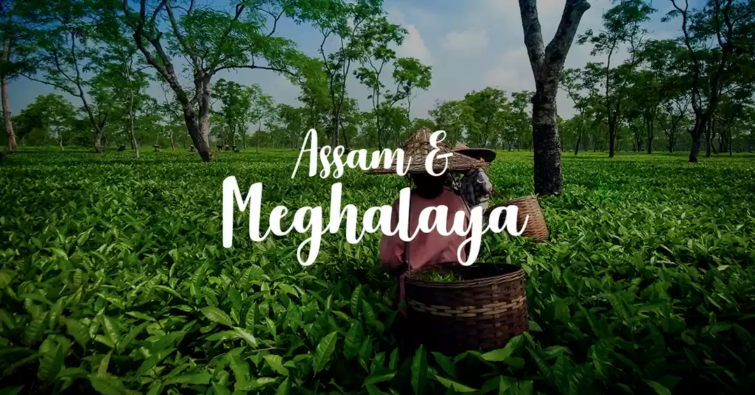
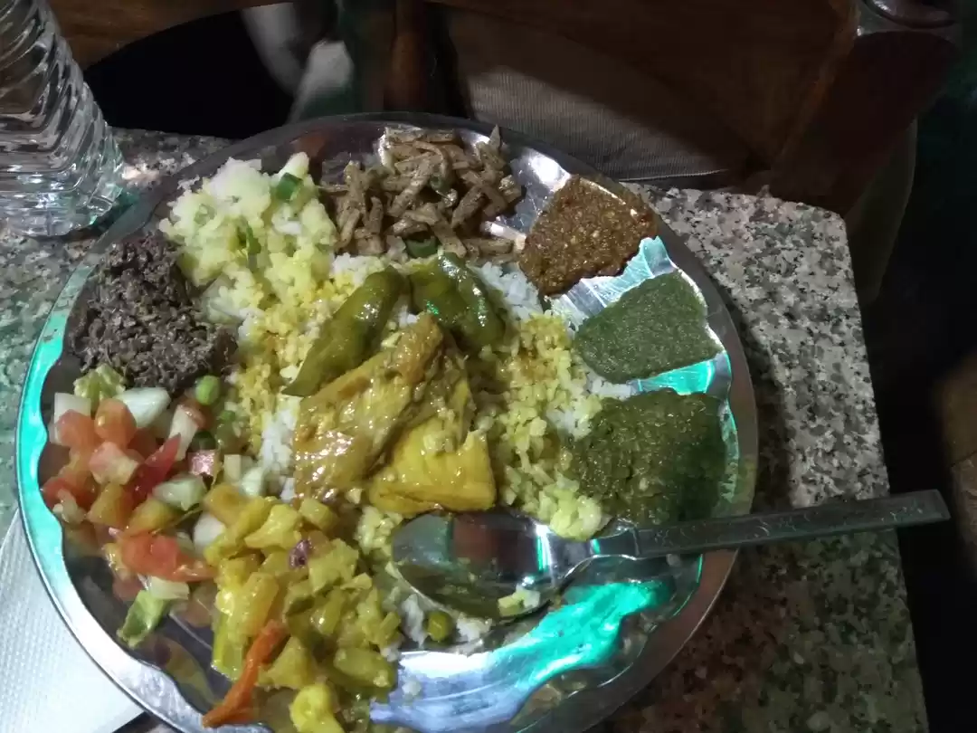
Travelling by train, buses and jeeps, all served to amplify the separation of time and space, and the lack of knowledge about where we were going, increased the trepidation and excitement that comes from visiting somewhere new. But, on reaching here, one understands the truth of all travels, the only thing new here is you. So from the start, while we exclaimed at what we saw and sang praises for the Assam and the Meghalayan Tea, relished Beef and Bamboo aachaar, we were reminded of it.
The entire trip, now that I look at it seems to be a journey through waterbodies! My trip seemed to revolve around waterfalls, rivers, streams and lakes. It reminds me of something I had read about oceans once. It spoke about how when faces the sea, the horizon towards it, one is assailed by an unending expanse, that in all oceans, are so depressingly alike. Its only when one looks back towards the land that the ocean changes. Though, those who love the oceans would understandably declare this to be patently wrong, it strikes a chord somewhere in this travel.
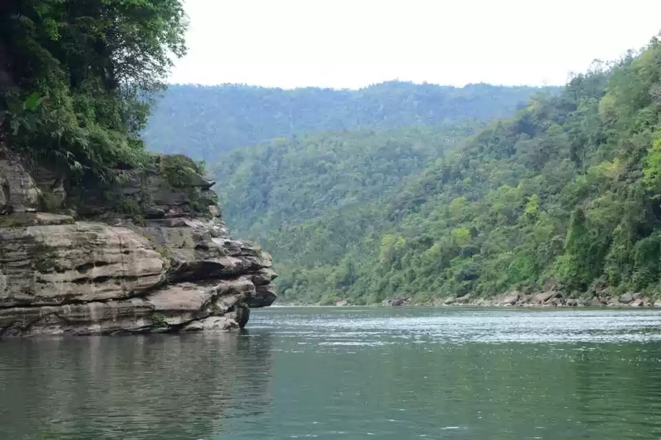
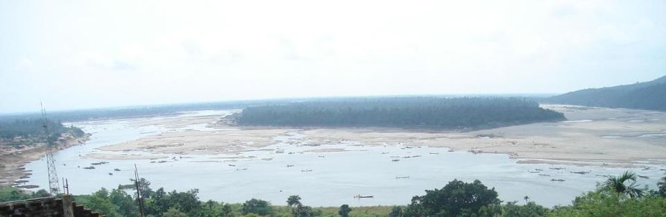
Guwahati is the gateway to the North-East and even called as such, so it is no wonder that our journey to Meghalaya would begin from here. Guwahati, in the first glance, seems like any other urban sprawl, with its fair share of concrete and cement. But the low-lying hills that one catches glimpses of from the occasional clearings and of course the rooftops, along with the massive Brahmaputra, on the banks of which Guwahati lies, make all the difference. If you are fascinated by rivers as I am, the Brahmaputra is the piece de la resistance for those going to Guwahati.
Depending on the time one lands up in Guwahati, the Brahmaputra will not fail to enchant you, whether it be as a lazy ambling beast during the drier months or the all-consuming monster it becomes when it rains. During my trip here it had the former mask on, letting me take a ferry ride across the wide river, something everybody should do if they are visiting here. And if you are one of those lucky ones with all the time in the world, and a good part of its money too, you could also take a cruise down the river. I say this because a description of 10 day river cruise had left me drooling.
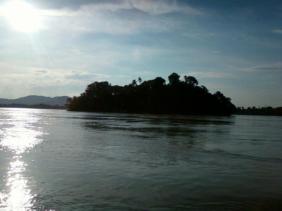
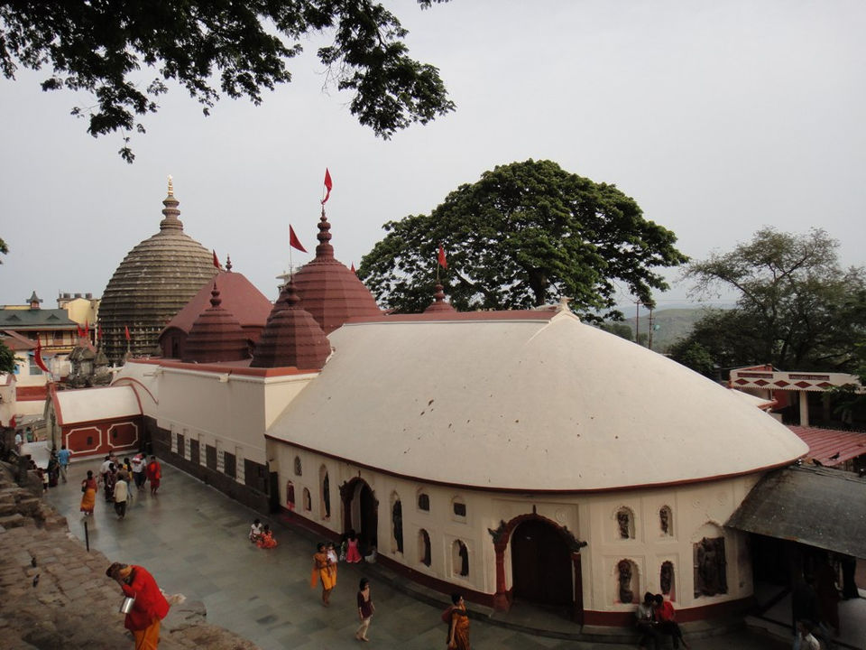
To not seem as fixated by the River as I am, let me mention that Guwahati has other places and things too. They too have something to do with the Brahmaputra, but as far as Guwahati is concerned, the River is inescapable. The Kamakhya Temple, situated on the Kamakhya Hills on the banks of the Brahmaputra is one such place. Even if you are not interested in temples, one should visit the place for the commanding view of Guwahati, the hills and the River from its height. The same sentiment stands for the Umananda Temple, situated on an Island in the middle of the Brahmaputra. Just reaching the temple by a boat, where the river is but a few feet from you is an experience that makes the trip worthwhile.

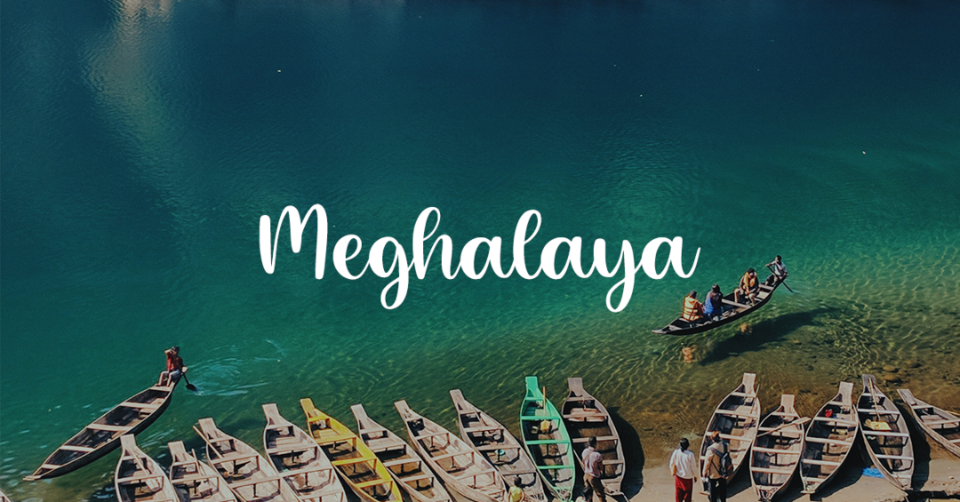
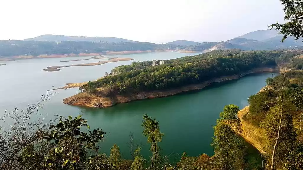
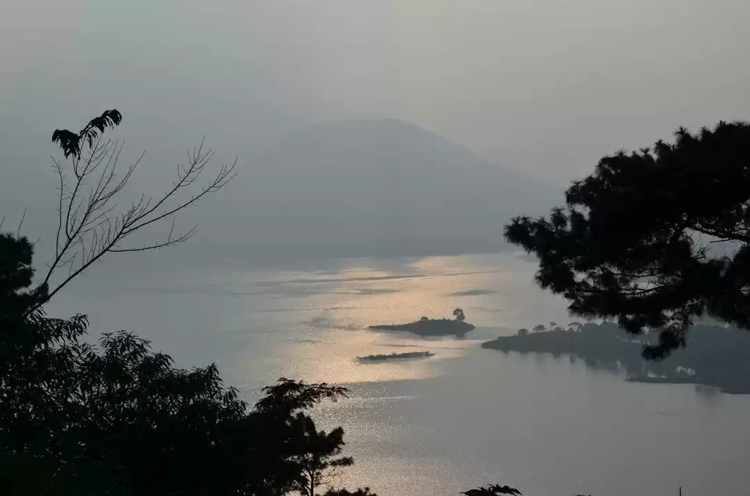
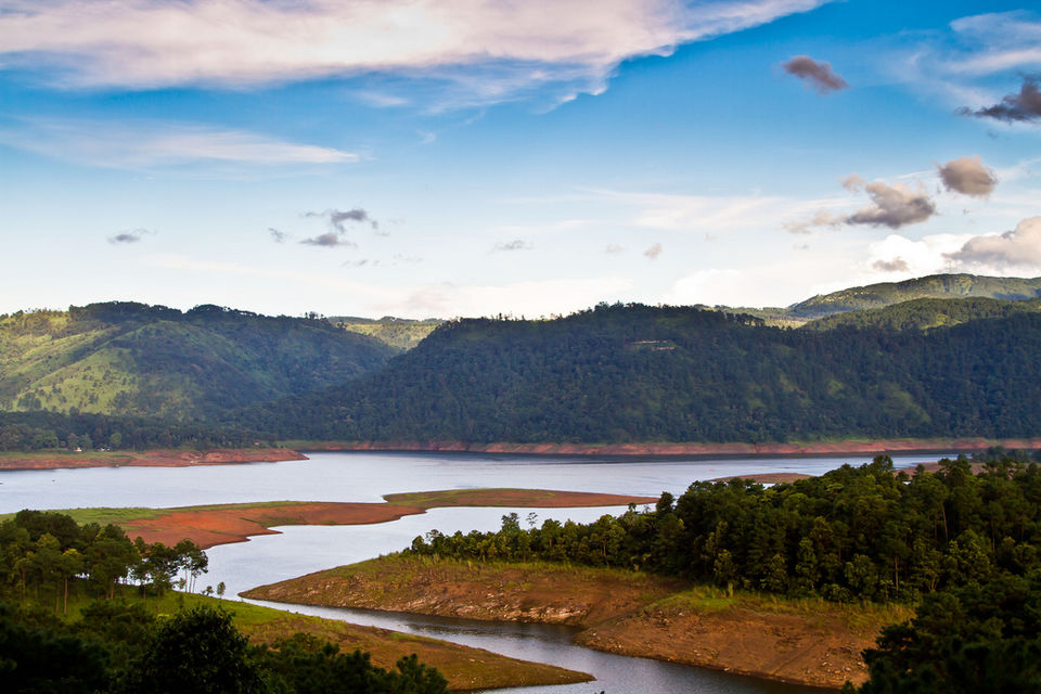
On the way to Shillong, just 20 odd kilometers short of it, is a place called Barapani. Barapani or Umiam Lake as it is officially called is a destination that one really shouldn’t miss out on, one for the fact that it is right on the way and second because it is really quite beautiful. A large blue lake, dotted with small islands in the middle, framed by pine covered hillocks on its banks, with numerous walks and points from which to admire the calm lake. The place is an idyllic picnic spot, and that’s just what we did there. Being a tourist attraction, there are numerous resorts from where we got a meal packed and then headed out to the bank of the lake, where we sat and enjoyed our meal in the cool breeze.
Though there were options to take a boat ride on the lake, my friends were a bit chary of getting on to a boat post our feast. So we instead headed out into the Nehru Park for a stroll through one of its trails, seeing glimpses of the lake, as it peaked at us here and there between the leaves. Though the best view of the lake was from atop the United Christian College hill.

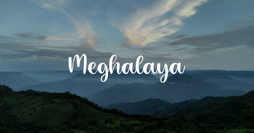
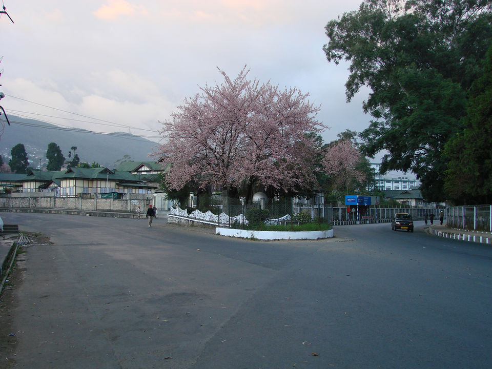
A short cab drive from Barapani and we finally arrived in the ‘Scotland of the East’. Before the trip started, we had all looked at pictures of Shillong, and all of them unerringly depicted the place as a cloudy and rainfall-prone area and we weren’t disappointed. Although we had left Barapani after an early lunch, we reached Shillong by 4.30ish, meaning evening had set in, made even darker by the clouds.
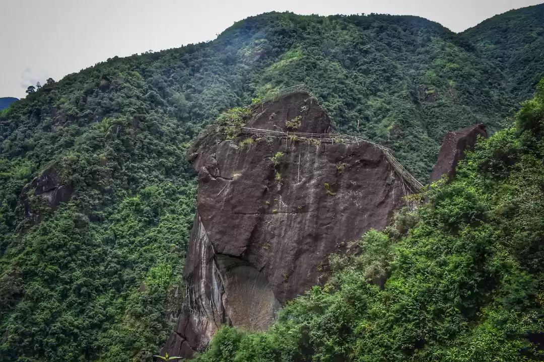
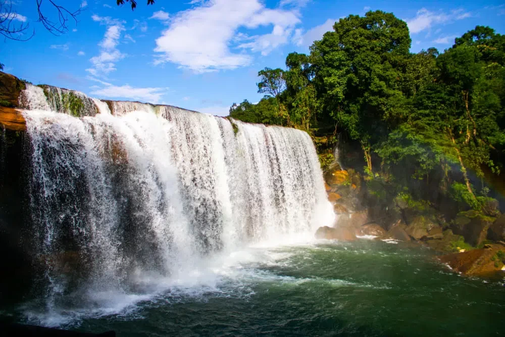
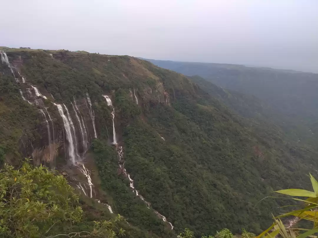
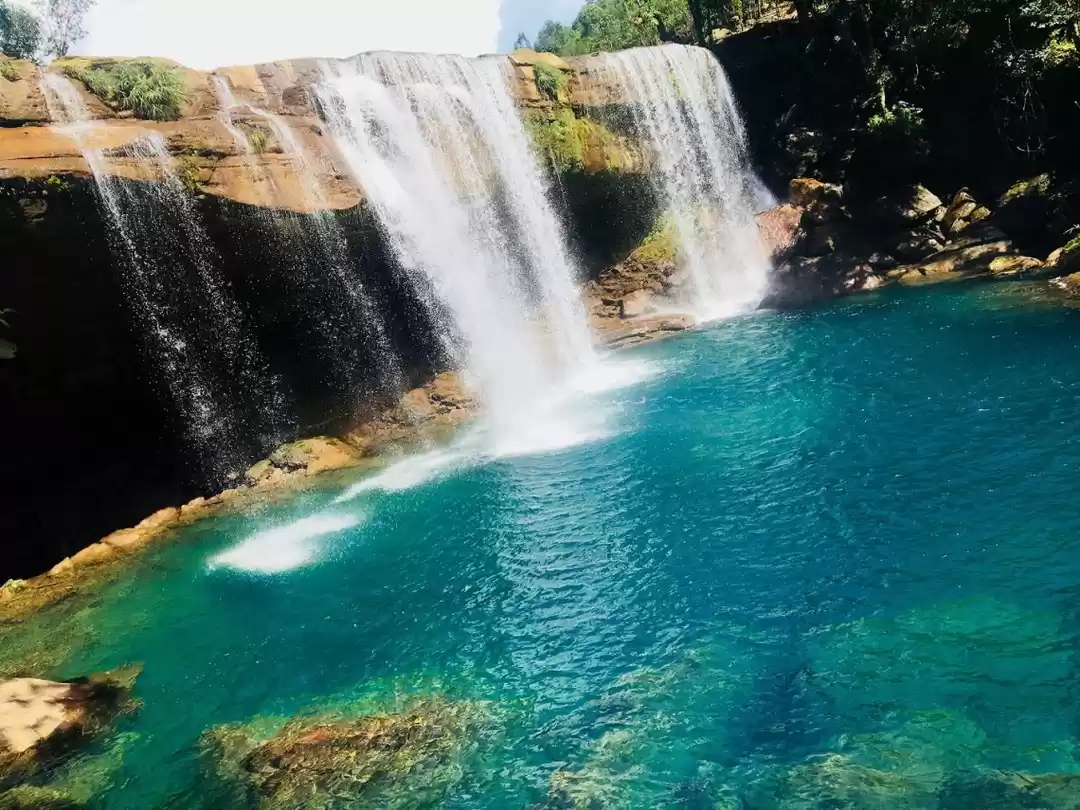
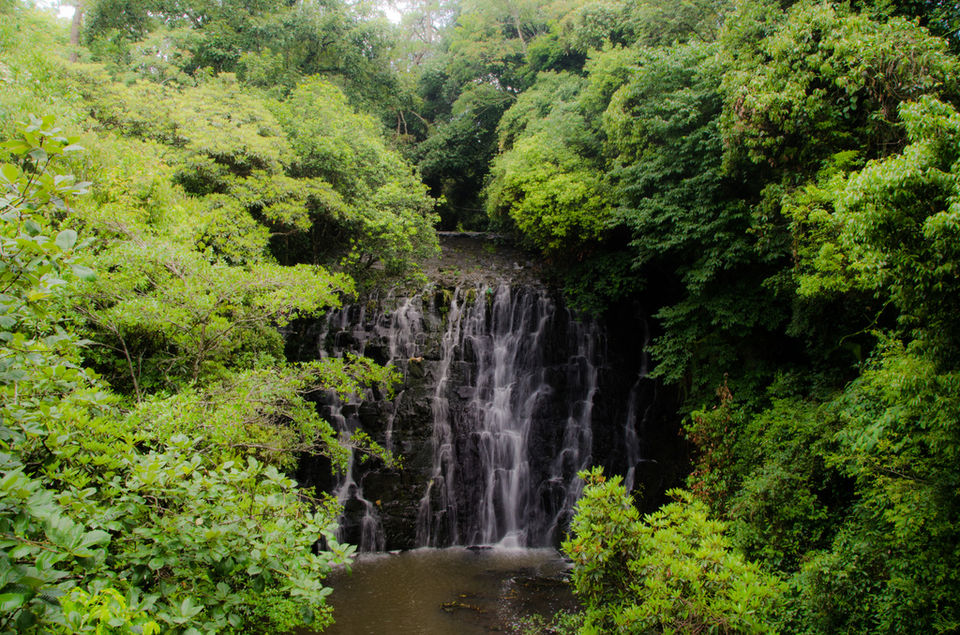
Shillong is full of waterfalls and water-bodies. From the Wards lake, to the Sweet Falls and the Bishop-Beacon Falls, these water bodies make up a large part of Shillong’s tourist attraction. Since, our trip was more about journeying rather than nestling into one place, we had to make a choice as to the place we would visit, so we decided to go to Elephant Falls. The name might suggest a water-body of elephantine proportions, but that really isn’t the case. The name came up due to a rock that shared a likeness with the animal, a rock that incidentally isn’t there anymore. Elephant Falls is more a collection of numerous falls that finally flow into a small lake, a series that you can walk along as you trace the flow of the water. Aided and abetted by the greenery of the Khasi Hills, where it is located, the Falls make for a lovely walk while being serenaded by the sound of the gushing and falling water.

After Shillong, we were on the road again and we headed towards Cherrapunji. A name familiar to all of us from our textbooks from our school days, Cherrapunji is widely known as being the wettest place on Earth. A fact that seemed acutely fitting, as even though we were here during a time when rainfall is scant, it seemed liked the middle of the monsoons. But, we found out from people here that the monsoons were brutal here, not a time to rejoice, but a time when the people were cut-off from the rest of the world, as well as from each other in the village.
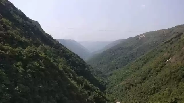
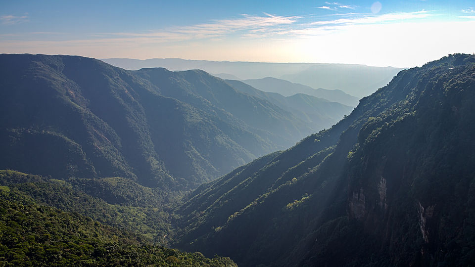
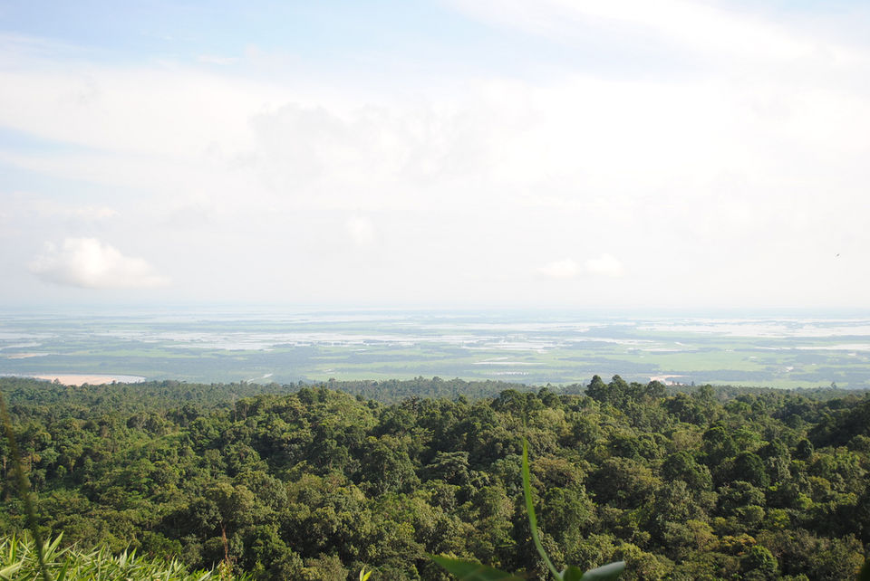
So no matter, how adventurous, the monsoon is not a time to visit this place. Being a place where one could get accommodation, we made Cherrapunji our basecamp for exploring Meghalaya. But first we set out to see Cherrapunji itself, a beautiful lush green place, a green like no other, constantly washed anew there isn’t a speck of dust and the entire landscape. It feels like it has been recently laundried! We headed first towards the Bangladesh viewpoint, a high cliff on the mountains from where the plains of Bangladesh are visible, as and when the rolling clouds leave you and you can see into the distance.

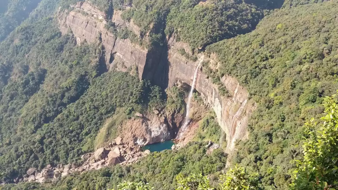
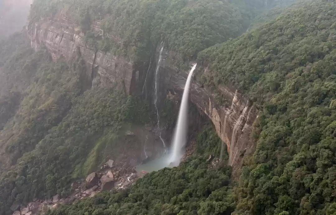
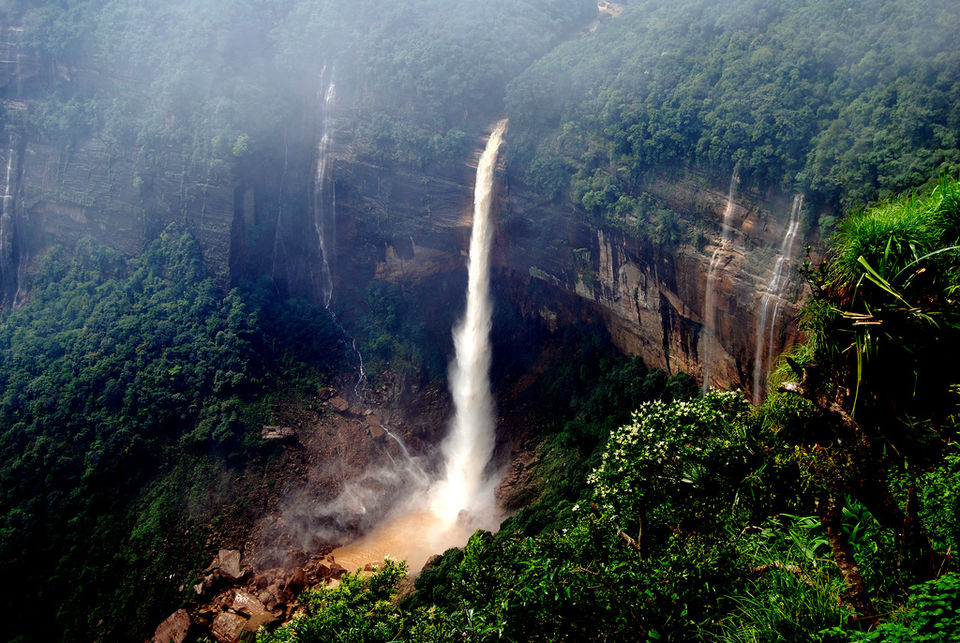
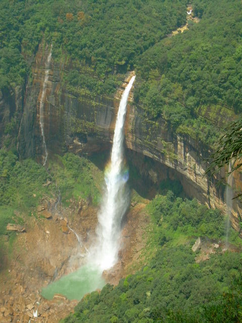
We head out again to a waterfall. Perhaps while reading this, it struck me that for a trip to a culturally diverse and virtually unrepresented area, my trip would be centered around people, after all how many waterfalls can one see? But while you are there, the repetition of visiting waterfalls and water-bodies doesn’t strike you as much. Instead, it’s what you want to do, not what you have to. The water-bodies and falls themselves tell you a little something about the people, about their stories. The same holds true for the NohkaLikai falls, the name itself comes from the name of a mother, whose new husband, jealous of the wife’s child from before their marriage, kills the daughter and feeds her to the mother. The mother maddened by grief jumps from the precipice of the fall. Thus, the name of the deepest plunge waterfall in India, Nohkalikai or from where fell Ka Likai. The story tinges the beauty of the place with a grimness and melancholy perhaps, but doesn’t in anyway reduce it.

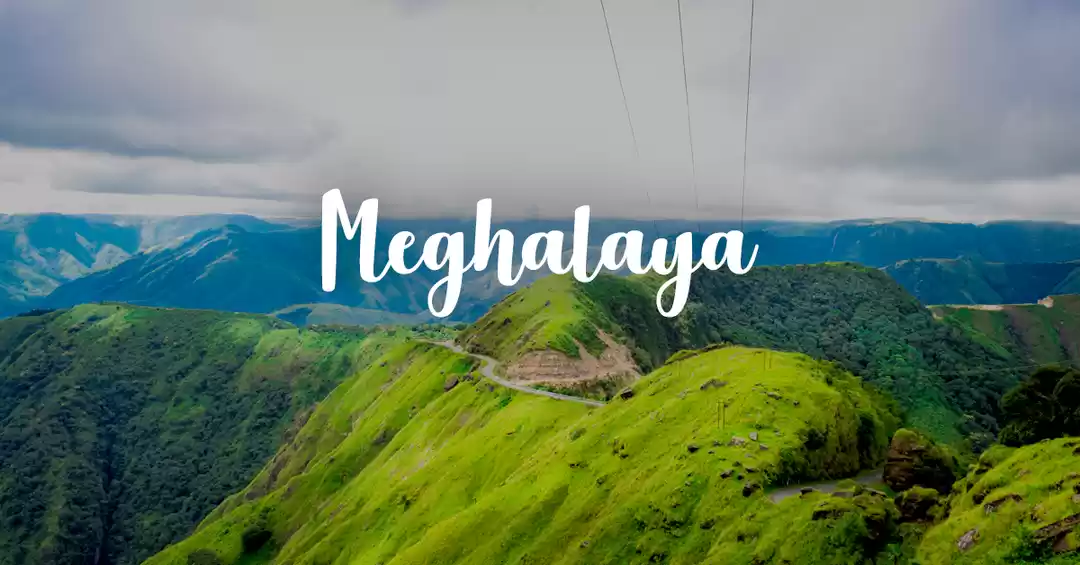
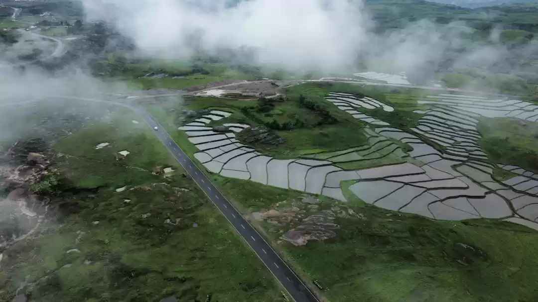
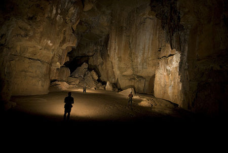
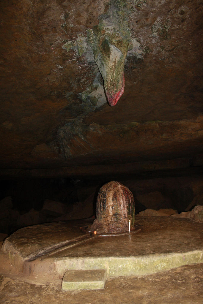
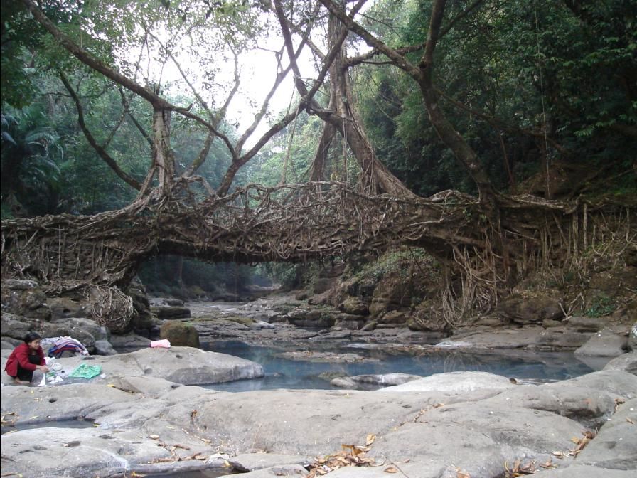
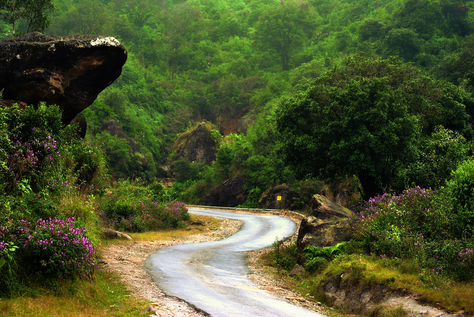
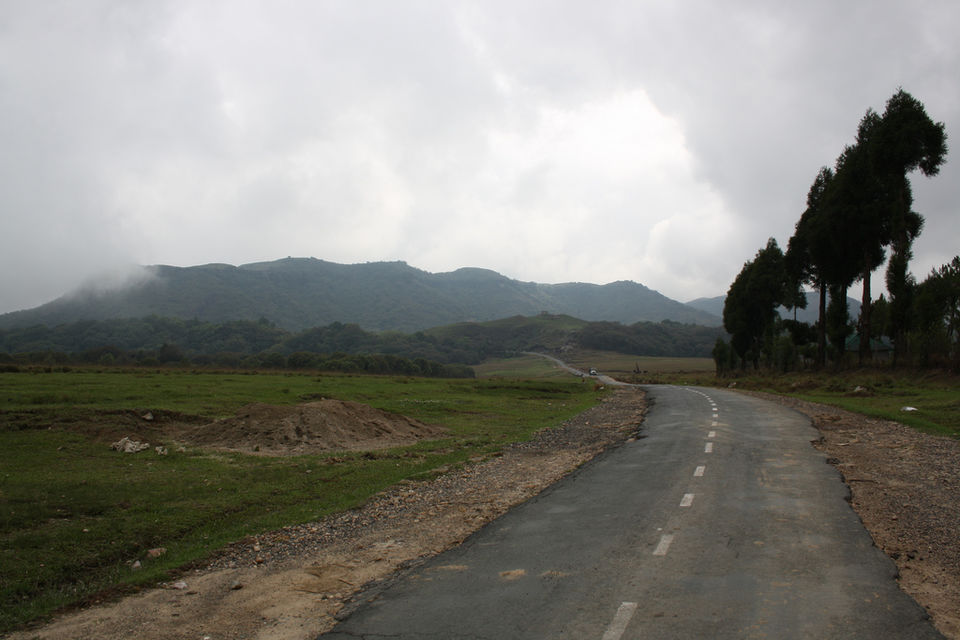
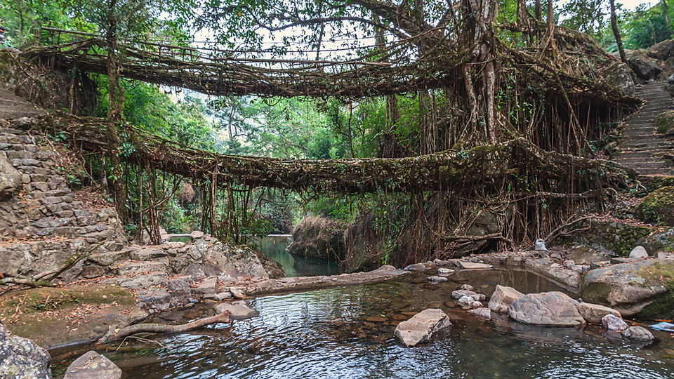
Cherrapunji and Mawsynram are in a competition of sorts, both the places vie for the title of the ‘wettest place on earth’ and it’s a fierce competition. Though Mawsynram is just 16 KM away from Cherrapunji, if one travelled in a straight line, but by road it’s a good 2 hour journey. There are no regular busses as such here, shared jeeps are the way to go, otherwise one can use the tour buses of the Meghalaya Tourism but they have conducted tours, so if you want your independence, it's best to head out on one of the jeeps. The drive is scintillating, the road weaving in and around the mountains. Mawsynram is considerably lower in altitude than Cherrapunji making the verdant extent of the landscape more visible than it was in Cherrapunji. It’s also far smaller, removed and secluded. That’s why one of the first things that struck our eyes were large shells, almost turtle like, being made and displayed in some areas. We later found out that these shells, made out of bamboo and grass were called knups, and were used as rain shields by the people. Cherrapunji had almost stopped using them, relying more on umbrellas and raincoats. We then headed towards the Mawjymbuin Cave, a holy site for Hindus now, as the stalactite formations are in the shape of a Shiv-lingam. However, religious import aside, the wide cave, with multiple entrances and streams gushing in and out is really quite picturesque. On our way there, we came across upon another practice of the people, begotten by the persistent rains in the area. A living bridge or a jingkieng deingjri, is a bridge that is grown out of the roots of the rubber tree to cross streams. The root is guided of the ground to continue on to the other side of the stream, a process that takes years. Something we had seen in Cherrapunji too, but hadn’t given much attention. Surprisingly, a cursory search told us about how these bridges were great tourist pullers, and we added one to visit from Cherrapunji.

In the village of Nongriat, some KMs ahead of Cherrapunji is where one can see perhaps the most remarkable living root bridge. The bridge here is a double Decker bridge, over large boulders and a stream that at the time we were there had been lulled into a stupor, given that the rains were still some time away. Amidst massive boulders, the streams had made cerulean pools that you could cross over with the help of this living bridge, if anything this was truly an architectural marvel!

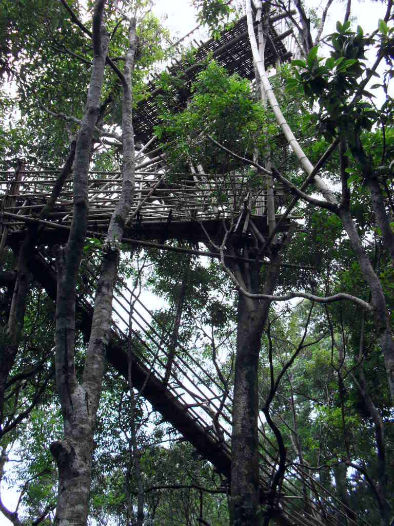
From Cherrapunji, we started off towards a small remote village this had famously earned itself the achievement of being the cleanest village in the country. With just around 90 families, Mawlynnong is a small village that feeds of tourism, and as if the natural sylvan landscape was not enough, the people have gone ahead and created structures to boost tourism that set it apart from almost anything that one would expect to see. From tree houses to machans, the village seemed to be perched up on trees. Accommodation for the traveler comes as homestays which are available at a comfortable price. The village being small and forested has only walks to offer, but this is something that we never tired of and were always willing to simply stroll about the place overflowing with flowers, plants, trees, butterflies and birds. You can even walk up to the two churches of this Christian Village, structures that are rendered more serene because of their surroundings. One particular walk takes you to a nearby place called Riwai, where there is another living bridge. By now, utterly enchanted with the concept, we obviously set out for it.Another thing that is purely remarkable is the Sky View, a machan of sorts built right on top of the tallest trees, that gives you panoramic views of the entire area. As you alight on the platform after making your way up the slightly precarious steps, it is a slightly Jack and the Giant Beanstalk –ish moment, entering into a place that gives you an entirely different view of the area. Buffeted by winds and slightly unsteady on my feet because I could feel all too much, the give of the bamboo beneath my feet, I sat down in the centre and enjoyed the wind and the mound like treetops that extended in front of me all the way up to the plains of Bangladesh.

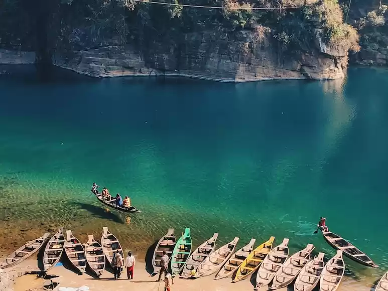
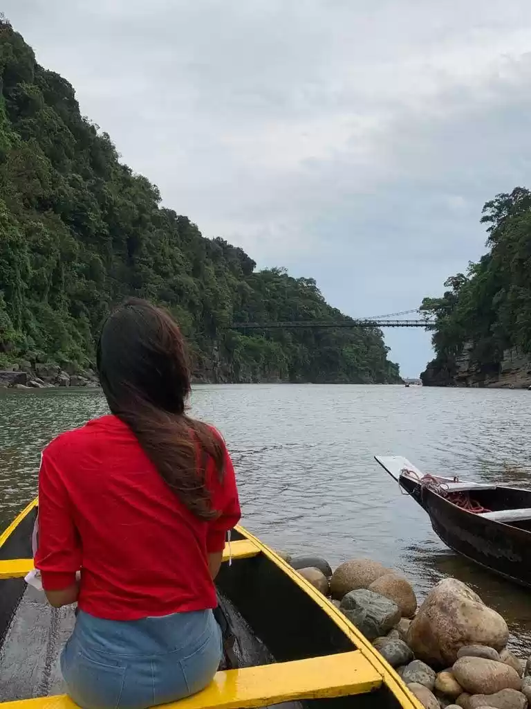
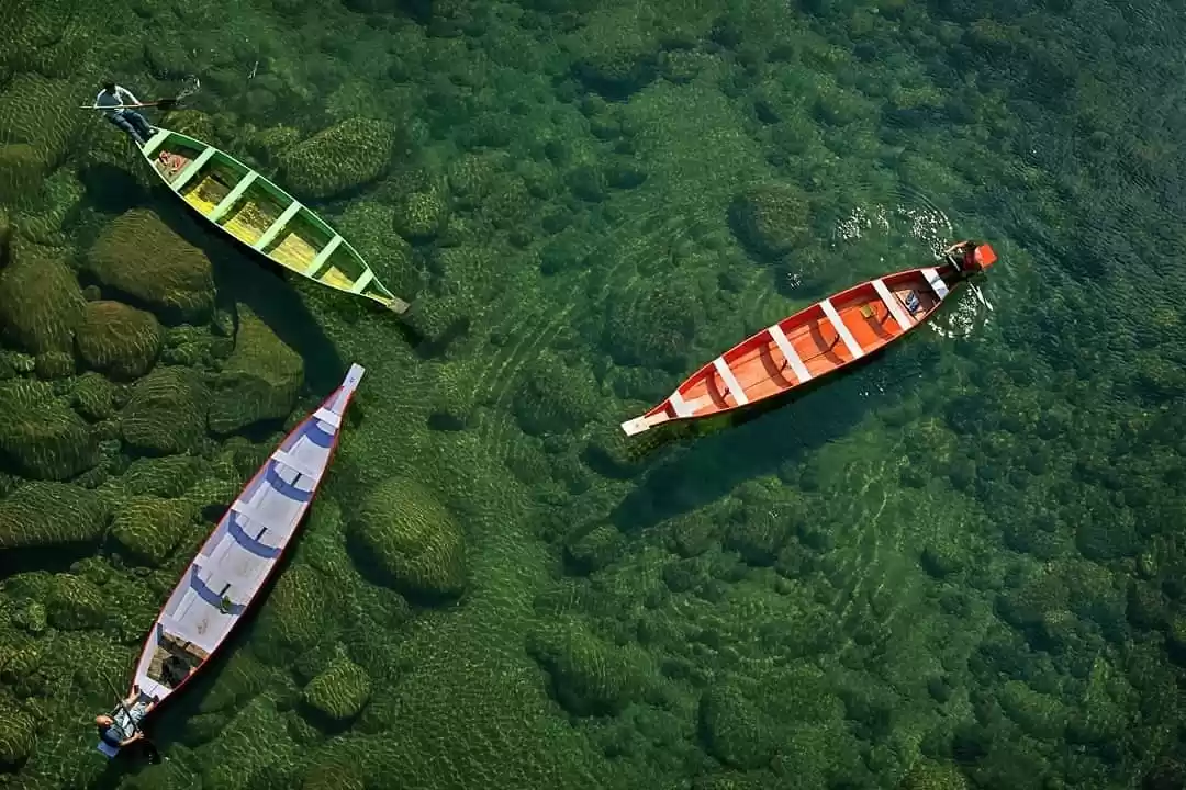
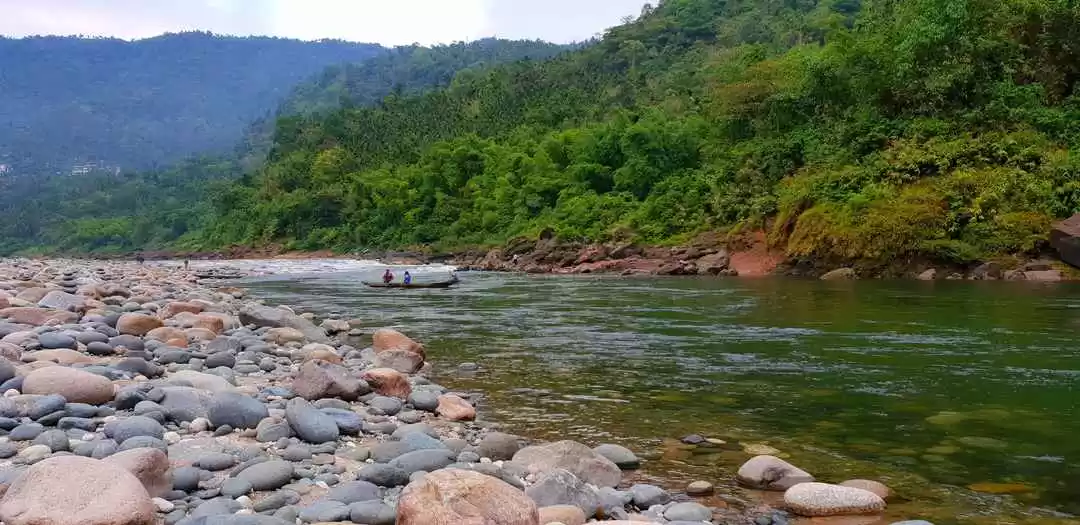
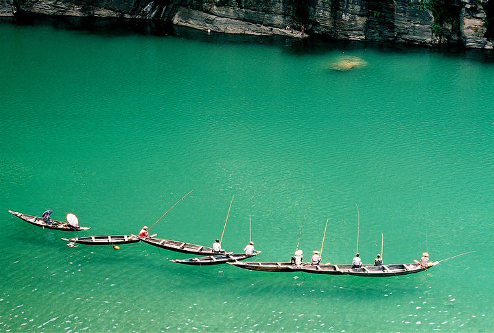
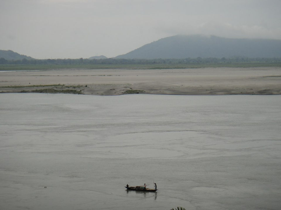
A day’s excursion from Mawlynnong, Dawki lies but 2 Kms from Bangladesh. Despite the fact that the area is located in a place that has been for years demanding development, one is amazed by the quality of the roads, and the road to Dawki perhaps epitomizes the idyllic hill drive. At first I thought this was the result of tourism, but later learned that this had more to do with the area’s strategic importance as well as the limestone and coal mines. Anyway, the black metalled road, offset by the rich, wet green and dark red-brown patches offered a smooth contrast that technology can scarcely capture. The cool, wet air brushes over your face and refreshes and revitalizes you as it enters your body. Dawki is a small village and its main attraction is the Umngot River that marks the natural separation between the Khasi and the Jaintia Hills. The river can be forded by a suspension bridge that connects India to Bangladesh and facilitates trade between the two nations. The Umngot is the site for a boat race that is held in March-April, but even otherwise, seeing this large emerald-green serpent threading its way through the hills, with fishermen’s boats dotting its surface, right into the plains of Bangladesh, is a sight whose majesty echoes long after you leave it.

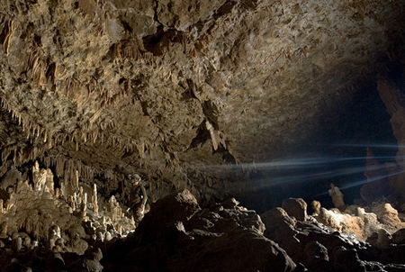
After Dawki, we went back to Shillong. As we left the area, and reached Shillong again, compared to what we had left behind, even Shillong seemed a tad bit too crowded! We had initially planned to spend another couple of days just lounging around Shillong, but we still had our radars out to perhaps make one last small trek before we returned. We had no idea that just a cursory visit to one of the adventure tour operators would introduce us to something as novel as caving. Though we had read about Meghalaya’s caves, numbering well over 750, the tours we had heard about were all long, adventure oriented tours, all around the caves, and since we had wanted our independence, we had instead decided to just schlep our way across Meghalaya, pretty much wandering from one place to another. However, the Mawjymbuin Cave in Mawsynram had made us more receptive of caves, as being more than just dark, clammy, claustrophobic holes. So when, a small 3 Day Caving Tour in the Shnongrim came before us, we decided we had the time, and would somehow wrangle the money and manage to see Krem Liat Prah, the longest cave in Meghalaya. So again we found ourselves in a jeep, travelling through a vividly intoxicating landscape, making our way to the Shnongrim Ridge in Jaintia Hills. The two nights we were here we roughed it out in tents that the tour operator provided and during the day, mainly explored two caves, spending a good day in each. The first was the Krem Liat Prah, measuring over 23 Kms in length, though we scarcely went into a fraction of that, the sheer Brobdingnagian proportions of that cave’s entrance, often called the Airport-Hangar, leave you speechless at the prospect of what seems like a subterranean world. The initial reaction is to be spellbound by the play of light, reflections and shadows, the distorted, amplified sound, but then as you begin to step away from simply admiring the largeness of this constricted space, the finer details explode around you.

For a city boy, accustomed to the square, matchbox like architecture of apartments and flats in the cities, Shillong was a treat. With slanting roofs and large windows, the structures here were more akin to the likeness of houses we drew as children, rather than the ones we now lived in, so no wonder that I was taking in Shillong with an almost childlike glee, as we walked around Shillong looking for accommodation– umbrella in hand and a smile on my face. Shillong has lots of places to visit, and surprise, surprise a lot of them have to do with water!
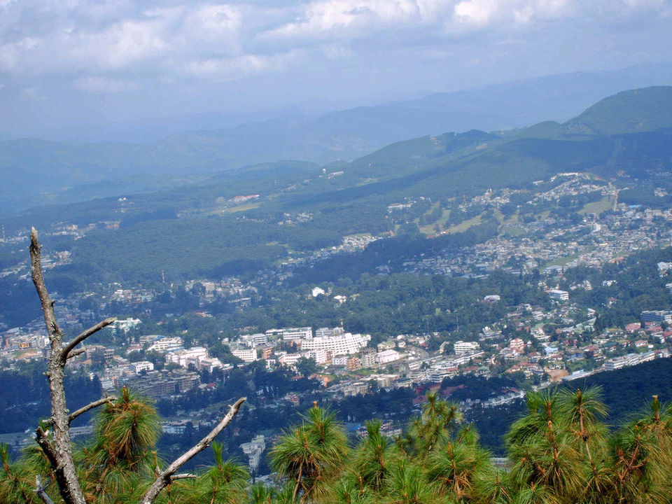
Barapani is one such destination, but we had already covered that. Before we headed out to more water, on our first full day in Shillong, we headed to the Shillong Peak after a leisurely morning. We stuck around on the peak well past sunset, to see the town lit up. We couldn’t take any pictures, as having heard that the peak was also an Air Force Radar Centre, there were certain restrictions on photography, so we left the camera altogether, fearing a confiscation. But that didn’t really matter, none of us are really such snap-happy creatures, and the place was lovely!

You may also like to read:

' fill='%23359391'%3e %3cpath d='M46.1538462%2c43.5714286 L41.5%2c50 L36.8461538%2c43.5714286 L36.8670256%2c43.5714286 C36.3173077%2c42.7142857 36%2c41.6851429 36%2c40.5714286 C36%2c37.4854286 38.4535641%2c35 41.5%2c35 C44.5464359%2c35 47%2c37.4854286 47%2c40.5714286 C47%2c41.6851429 46.6826923%2c42.7142857 46.1329744%2c43.5714286 L46.1538462%2c43.5714286 Z M41.4294872%2c39 C40.6150641%2c39 39.9487179%2c39.675 39.9487179%2c40.5 C39.9487179%2c41.325 40.6150641%2c42 41.4294872%2c42 C42.2439103%2c42 42.9102564%2c41.325 42.9102564%2c40.5 C42.9102564%2c39.675 42.2439103%2c39 41.4294872%2c39 L41.4294872%2c39 Z' id='Location-white'%3e%3c/path%3e %3c/g%3e %3c/svg%3e)